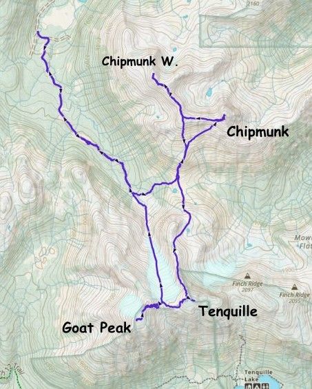
Chipmunk Mountain, Tenquille Mountain and Goat Peak
June 28, 2026
2473m
Pemberton, BC
These peaks are well documented objectives in Matt Gunn’s Scrambles in SW British Columbia. Chipmunk Mtn. is usually accessed from the end of Hope Creek FSR which is off the Hurley whereas Goat Peak and Tenquille Mtn. are often approached from Tenquille Lake, but can also be done from the north (Hope Creek FSR). I actually think the northern approach is more efficient but not many folks are aware of that, probably because of the lack of “beta” or the required glacier travel. Goat Peak is the highest of these peaks and boasts over 600 m prominence but Chipmunk Mtn. also boasts over 500 m prominence. There are two peaks on Chipmunk Mtn. with the east peak being the iconic and higher one. The west peak doesn’t look attractive but still boasts over 100 m prominence to qualify as an independent summit, so the plan was to tag them all even just for the completion purposes.
The original plan was only the two peaks on Chipmunk Mtn. with Holly but upon seeing the other peaks I made the in situ decision to tag them as well. I actually had no “beta” about the northern approach of Tenquille Mtn. and Goat Peak but the route seemed obvious and could naturally make a loop by descending the glacier between those two peaks. Holly and I left Vancouver at around 5:30 am and made quick work up to Pemberton. We decided to take Holly’s Ford Explorer this time as I had some recent updates about the road conditions. Despite the length of travel on gravel roads the rough section was only the final few kilometers. Indeed, the Hurley was actually in an excellent shape and so was Hope Creek FSR to around 8 km. There’s an deactivated bridge with a sign of “road closed” but we drove across nevertheless. The last few kilometers were indeed challenging for Holly’s vehicle but I got us to the “trail-head” with no mishap. The access would be no brainer for the Subaru, in retrospect.
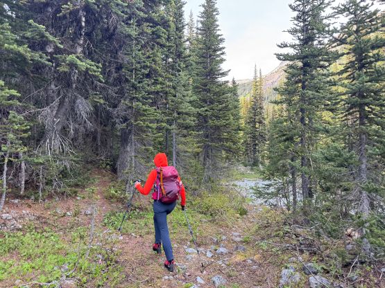
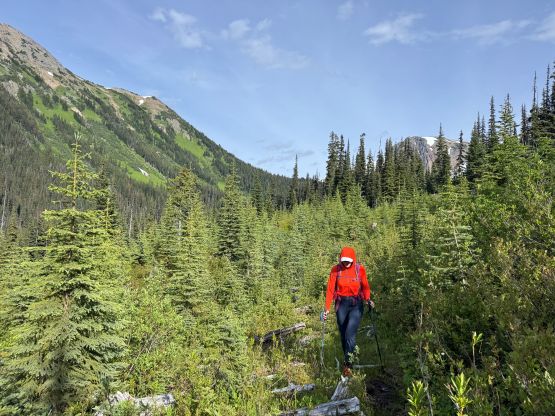
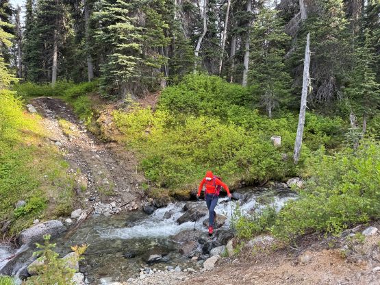
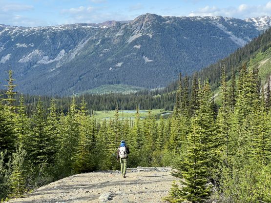
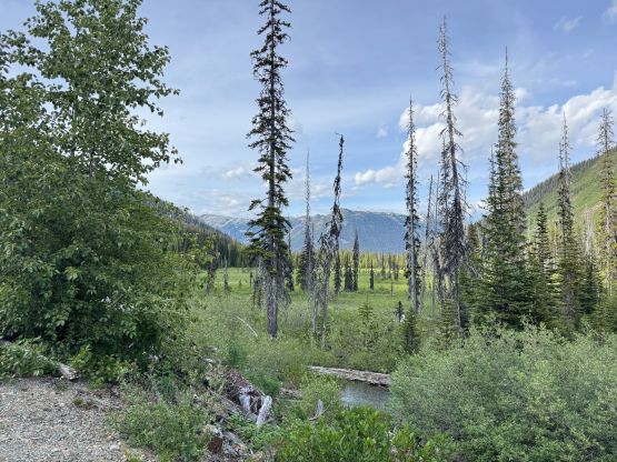
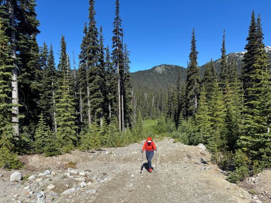
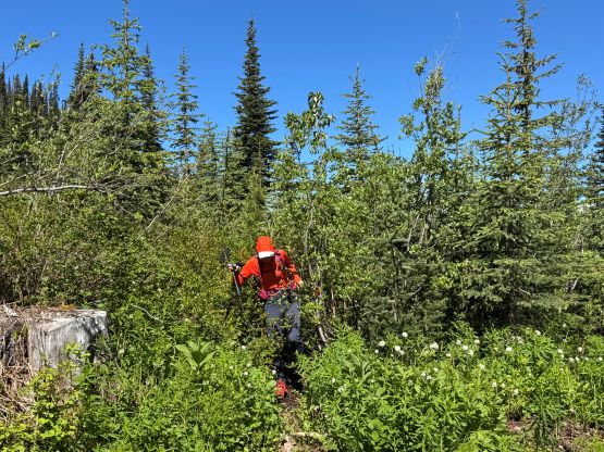
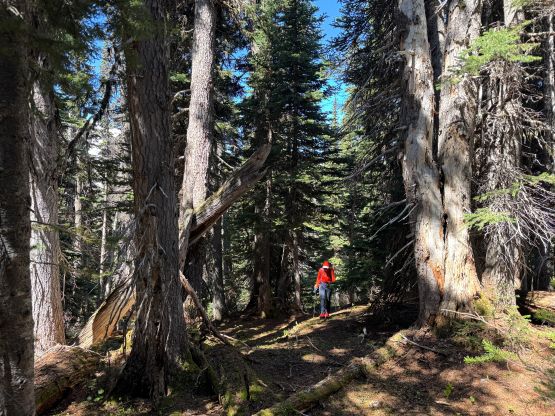
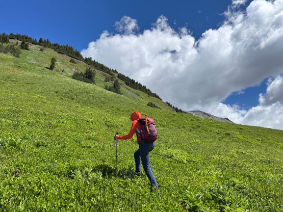
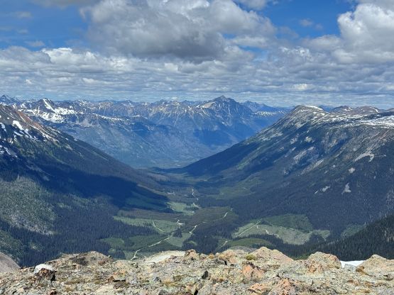
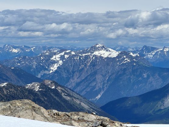
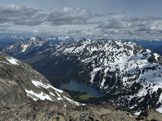
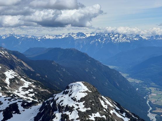
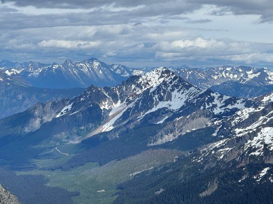
The weather forecast was originally looking grim but improved towards the last minute but only for areas north of Pemberton. Indeed, those who went for Garibaldi area all reported clouds and white-out conditions. It was bright and sunny up north and wasn’t too hot. An ATV or a very aggressive Jeep could get another kilometer or two farther but there’s hardly any point in doing that. The remaining FSR was an easy plod anyways with some nice views. The FSR gradually gave way to an overgrown trail and the trail was surprisingly difficult to follow at places despite the abundance of flagging. We even lost the trail at some point but I quickly corrected the mistake as I had been constantly consulting with the GPS app. The trail eventually entered the forest and it was mostly a cruise sail to the basin underneath the pocket glacier coming down from Goat/Tenquille saddle. There was only flagging beyond this point so we did do some light bushwhacking, but nothing annoying by the Coast Range’s standard.
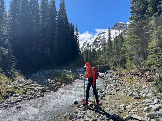
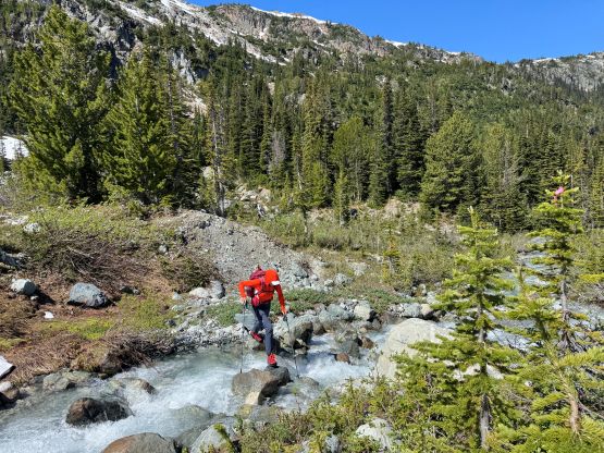
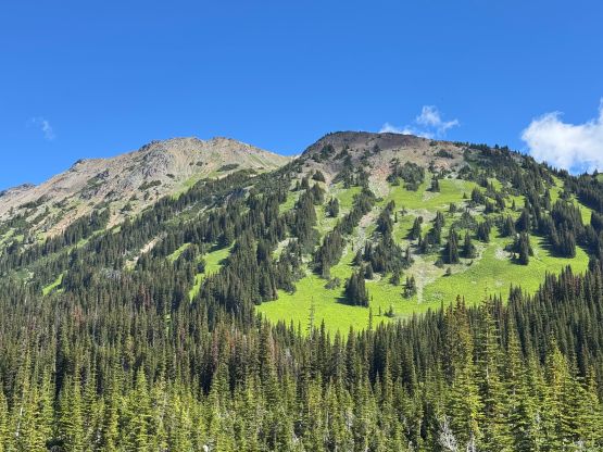
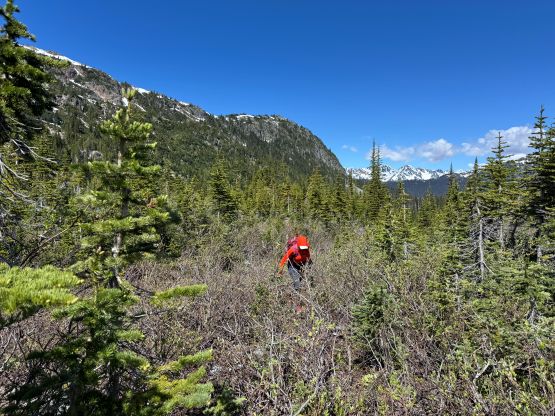
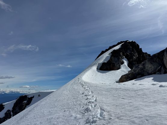
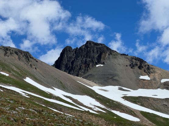
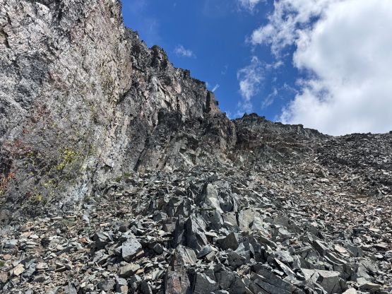
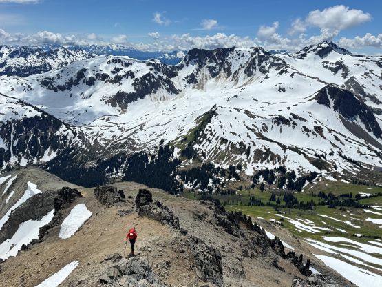
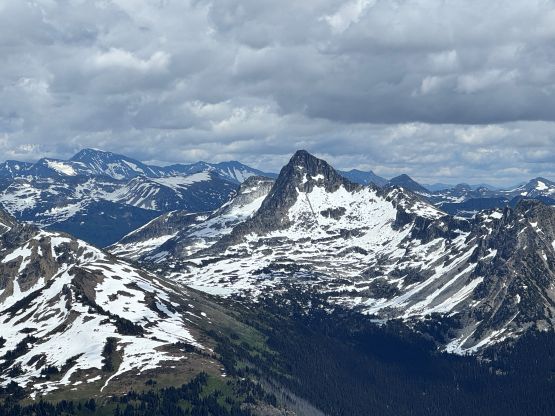
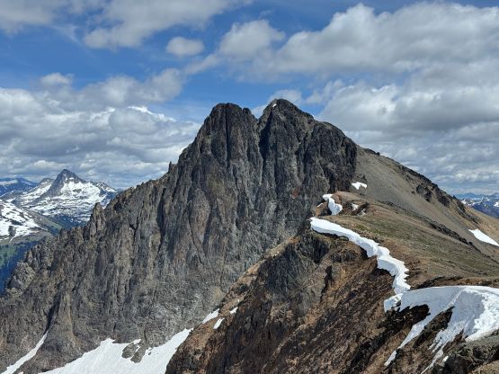
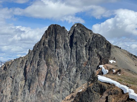
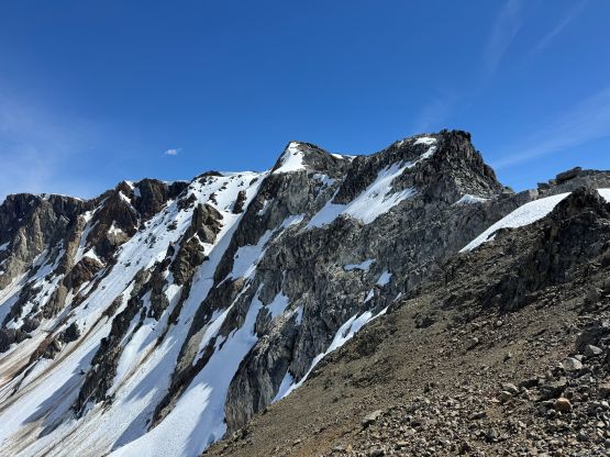
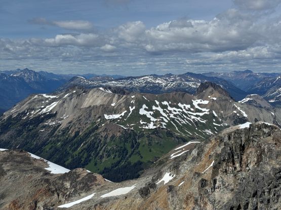
We stayed left of the drainage coming down from Opal Lake so didn’t actually go visit that tiny lake. Instead, we grunted straight up the grassy south slopes coming down from the saddle between the two peaks on Chipmunk Mountain. There were multiple ways of doing this stretch and I opted to follow the most recent GPX track posted on peakbagger.com, straight the hell up the slopes for simplicity. The terrain did become ridiculously steep but the bushy stretch was nicely flagged. We then took a rising traverse aiming directly towards the notch/saddle west of the east peak of Chipmunk Mtn. Holly didn’t quite like the look of this traverse so took a more undulating way by plodding onto the ridge. A few snow slopes helped the traverse as otherwise there would involve a lot of side-hilling on scree. For the scramble to the summit I opted to do my own (more direct) route which was definitely quicker but involved a lot of loose rubble. Holly went around following the scramble route but I always prefer the shorter and more direct variation, if possible. Higher up there were a few scrambling moves but nothing worse than “class 2” and in exactly 3.5 hours we both stood on the summit of Chipmunk Mountain. Regarding the confusion of the name of these peaks, BC Basemap puts the name of “Chipmunk Mtn.” on the higher east peak whereas Canada Toporama puts the official name on the west peak. That’s another reason why I insisted on doing both, to be 150% sure of being able to claim the summit of Chipmunk Mountain no matter what map one opts to use. The site bivouac.com refers the west peak as “Tamias Peak” but I don’t like that name.
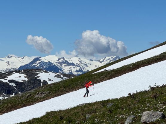
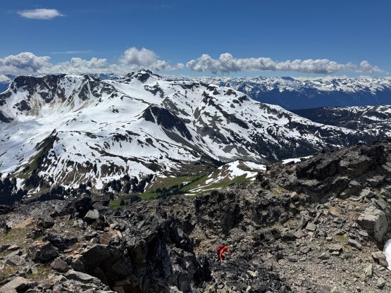
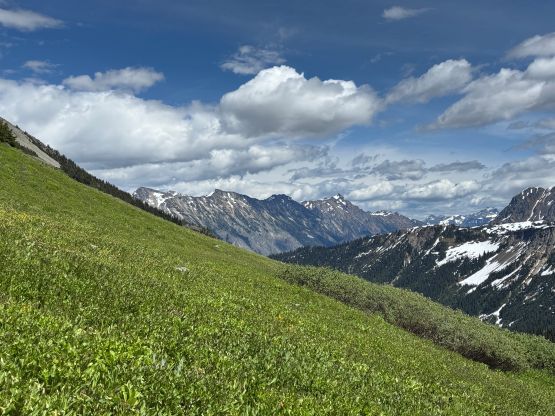
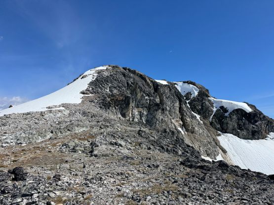
After making the decision to extend the trip by including the two taller peaks to the south I had to start moving rather quickly. Holly wouldn’t be joining me on those two but still preferred to explore towards the west peak, but on her own pace. I assured her that the three extra peaks combined wouldn’t take me more than 3 or 4 hours and we should meet somewhere in the vicinity of the trail’s end. I was correct in the end, as we only separated for exactly 3.5 hours. After quickly reversing my own scramble route down the summit block of Chipmunk East I started jogging across the connecting ridge. The ridge was longer than appeared with lots of micro-terrain including one major elevation loss that must be regained on the return. That stretch also had a few scrambling moves. The true summit of Chipmunk West was tucked behind several false summits and that’s also quite annoying. I took me about 40 minutes traversing between the two peaks running most of the downhills and the flats.

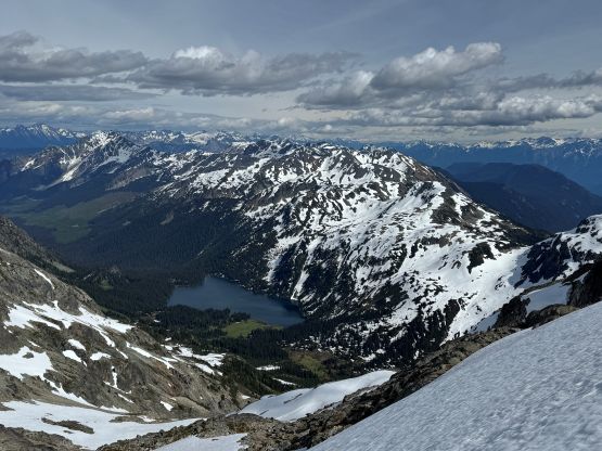
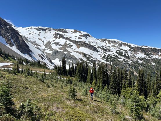
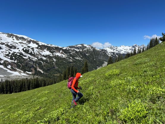
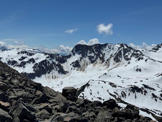
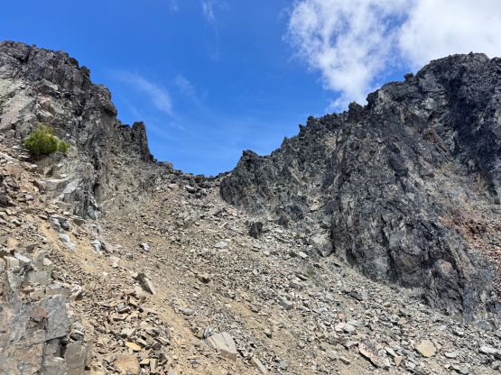
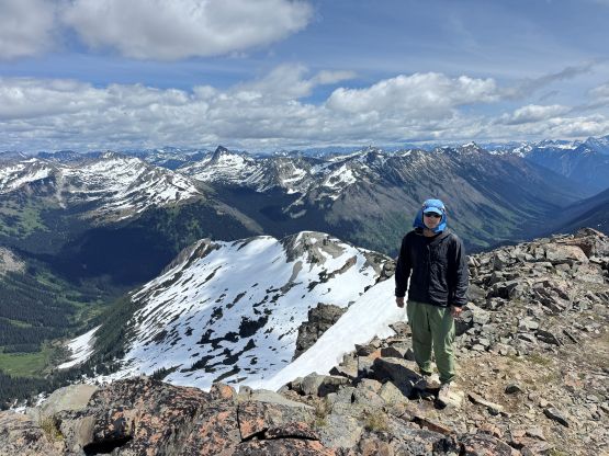
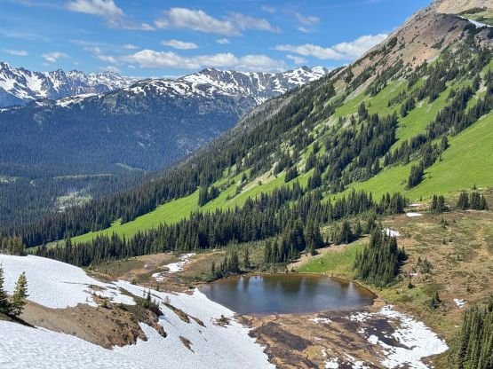
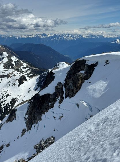
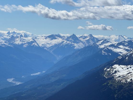
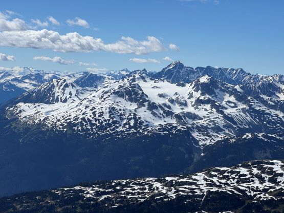
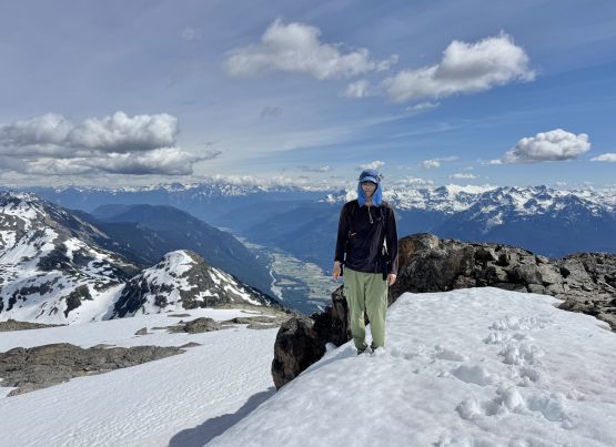
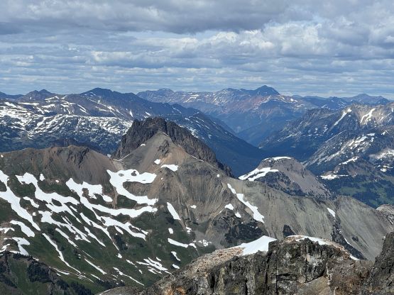
I then jogged back to the bump in the middle of the ridge and dashed down the south slopes towards Opal Lake. I utilized snow to facilitate the descent for as much as I could, but the dirt and the scree was a bit annoying in the way that I needed to sit down and clean my shoes multiple times. The steep grassy slopes at the bottom of the slope also required some care, but overall the descent didn’t take me too long. Before realizing I was already starting up the north spur route on Tenquille Mtn. Most of the route was still covered in snow and there was more post-holing than expected, such that my progress in this stretch wasn’t as fast as I was hoping for. I nevertheless got to the summit of Tenquille Mtn. in just over an hour from Opal Lake and there’s one unexpected stretch of class 2/3 scrambling. Most of the route was plodding. I wasn’t too sure where’s exactly the true summit of this peak so I tagged two contenders. The western (closer) one was the highest but I didn’t regret visiting the east summit as the views were excellent.
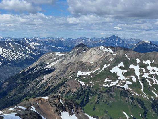
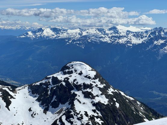
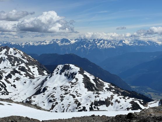
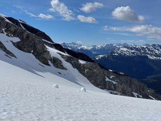
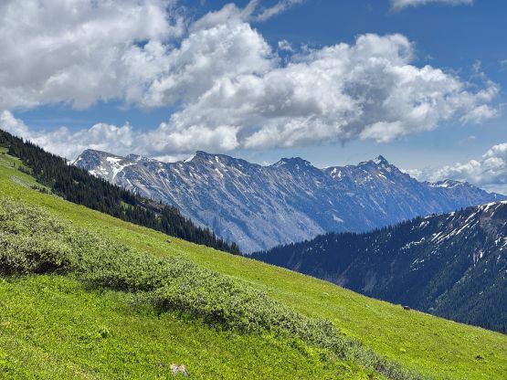
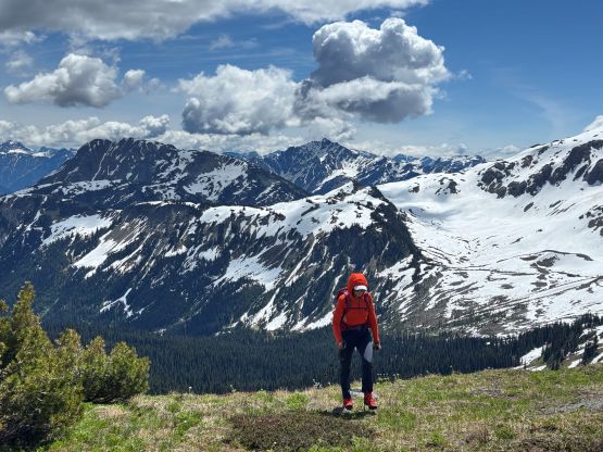
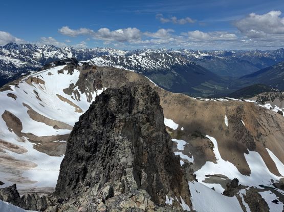
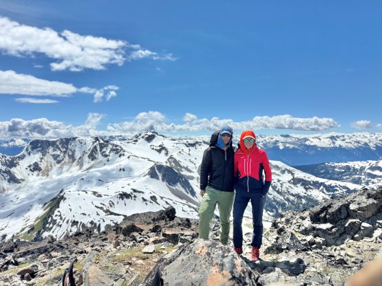
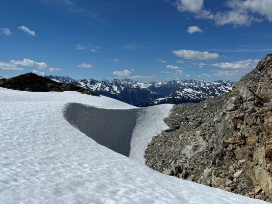
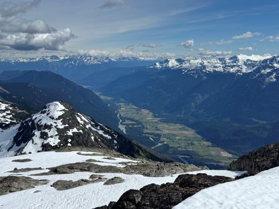
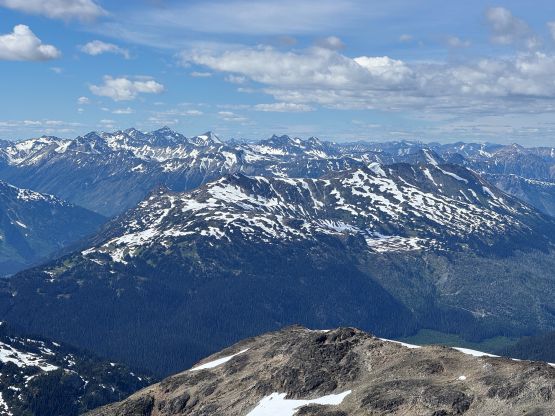
I was running low on energy so did the only food/water stop before descending towards Tenquille/Goat saddle. There’s again, some micro-terrain to deal with. I down-climbed one exposed class 3/4 step which could likely be avoided, and also descended some steep-ish snow slopes. The steepest drop was right before the saddle. The NE Ridge of Goat Peak appeared a bit complicated but I caught some reception and double-checked with the beta source. Most scramblers stayed reasonably close to the ridge so that’s what I would do. There was indeed nothing challenging but the route was a bit annoying and foreshortened. There were again, two contenders with roughly equal heights so I had to tag them both. I ended up traversing up and over the first contender and the elevation loss (and regain) between the two summits was a bit frustrating. Fortunately the view from Goat Peak was the best of the day and I actually spent a few minutes to soak in the experience as I knew I was doing fine on time.
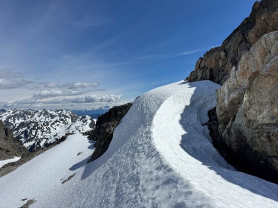
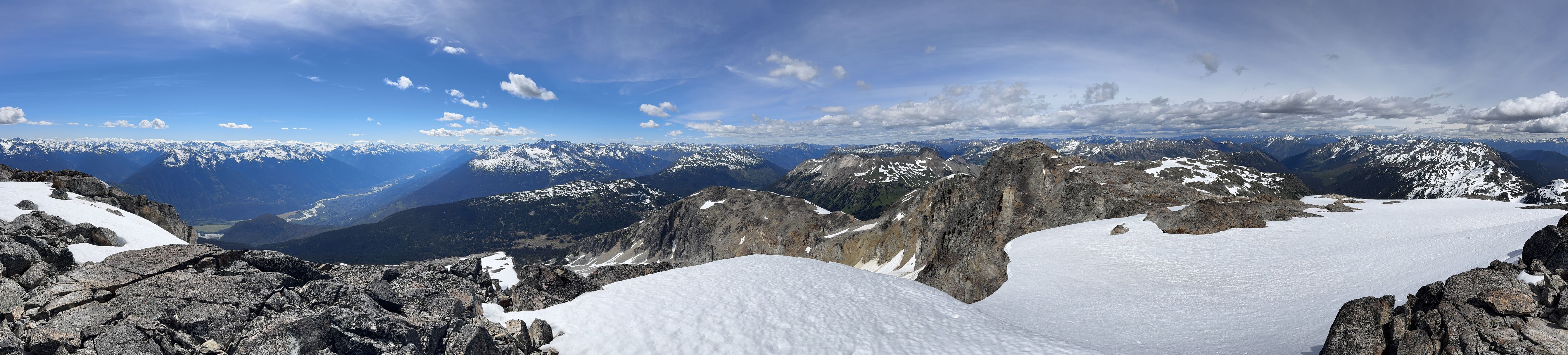
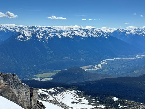
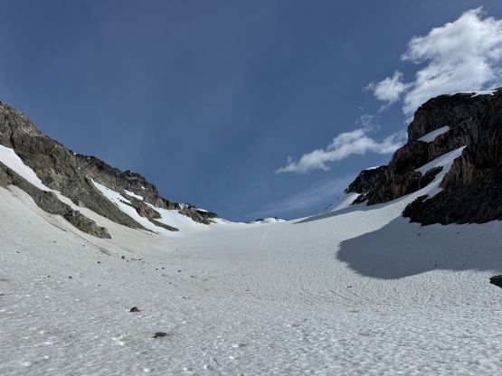
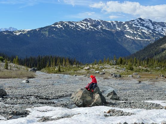
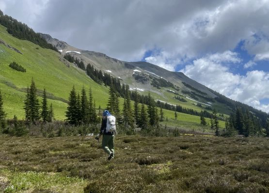
I carefully descended the NE Ridge mostly following my own steps but with a few variations on the scrambling sections. I then mostly jogged down the glacier from Tenquille/Goat saddle losing elevation in no time. This valley was foreshortened so the descent still took a while. I eventually spotted Holly waiting for me on a boulder and it turned out that she had only been there for at most 20 minutes. I then mostly followed Holly’s lead plodding back down the trail and our round trip time was exactly 8.5 hours. Holly wanted to practice on driving sketchy roads so she got us back to Pemberton. We then took turn driving back to Vancouver. The hike itself might not be a “full day” outing but the trip turned out to be a long day home-to-home.