Mount Clairvaux (Traverse)
August 23, 2015
2705m
Mt. Robson Provincial Park, BC
Among the half-dozen peaks by Fizwilliam Basin on the eastern edge of Mt. Robson Provincial Park, Mt. Clairvaux is the southernmost and perhaps the most technical one. It appears like a jagged slabby ridge with a glacier in front when looking from Fitzwilliam Basin and there’s some confusion as which is actually the true summit. Apart from that, there’s also a distinct higher peak about 1 km to the NE that’s essentially unnamed, but has been referred as “Mt. Wentworth” by Eric Coulthard on summitsearch.org. Not knowing which end is the actual apex Maury and I did the full traverse of Mt. Clairvaux, as the 4th objective after successfully ascending Mt. Fitzwilliam, Bucephalus Peak and then Frontier Peak earlier in the day. We didn’t know at this point yet that this was gonna be the real adventure of our day.
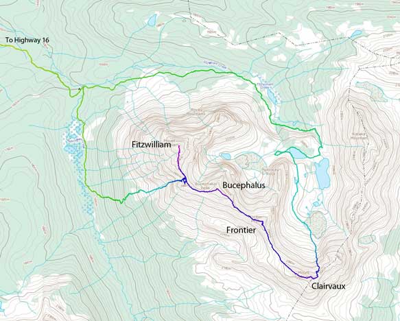
The Fitzwilliam to Clairvaux Traverse route. GPX DL
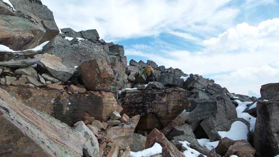
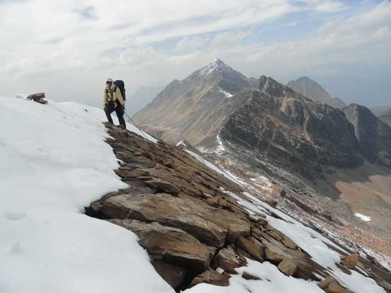
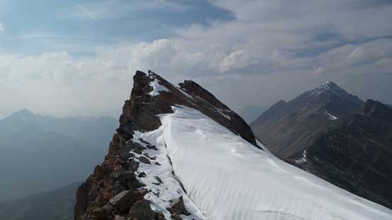
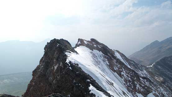
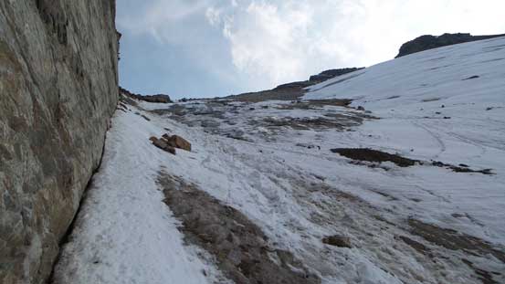
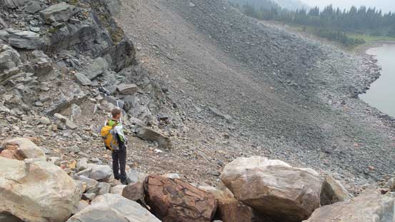
The ascent of Mt. Clairvaux from Frontier/Clairvaux col went easy initially on easy boulder field but soon enough the boulders started to get really big and unstable. There’s quite some hands-on scrambling just to negotiate those boulders but more “fun” stuffs were yet to come. Just when we thought we were close to the first high point the terrain suddenly became slabby and exposed. With fresh snow the slabs were wet making some tricky route-fining. But nothing super hard at this point yet and we soon made to the first high point. The far end appeared at the same height and checking my GPS it did say the official summit was on the far end so we had to traverse over.
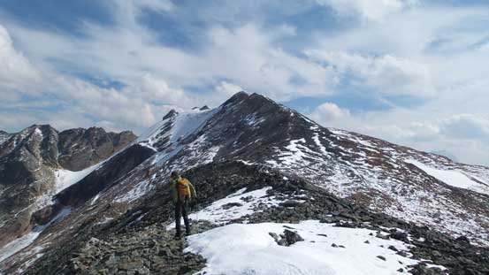
At Frontier/Clairvaux col, looking ahead
Upwards on Mt. Clairvaux
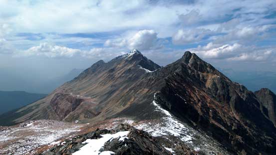
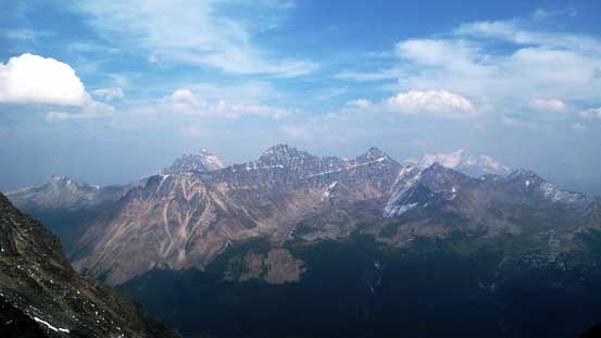
Looking back towards Frontier Peak (R) and Bucephalus Peak (L)
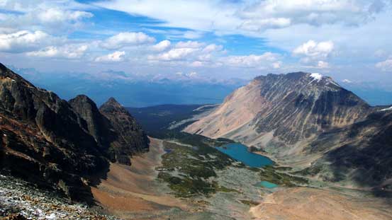
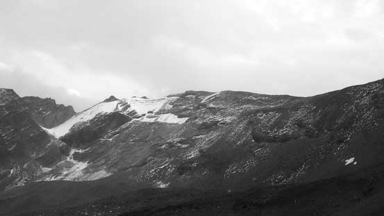
Kataka Mountain and Fitzwilliam Basin
You gotta love boulders if you go in here…
Now the terrain started to get interesting
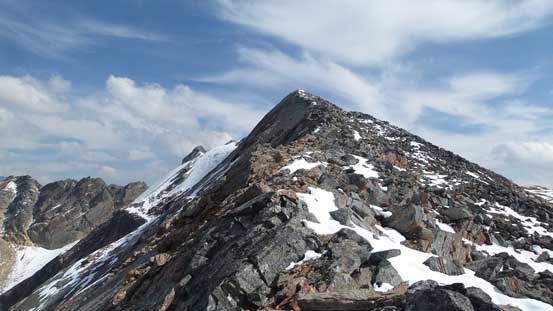
From the first summit looking ahead to the traverse
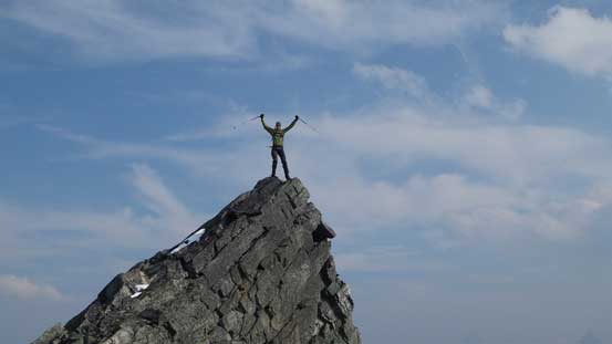
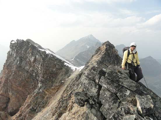
Me on the first highpoint, likely the true summit. Photo by Maury
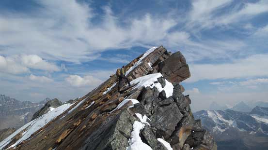
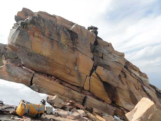
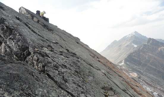
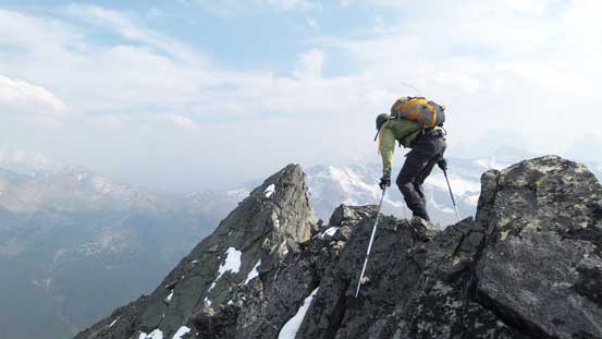
After negotiating another piece of exposed slabs we came to a down-climb. I could see a possible line down skier’s left but given the fresh snow that was not possible on this day, so we had to do that down-climb. It’s loose and fairly exposed and took Maury a good 10 minutes or so to figure out the sequence. Then it’s my turn and once I lowered myself down the first few moves I had no idea how Maury did it. It appeared overhanging and the foot holds were down-sloping and not obvious. Of course I made it down somehow but that’s by removing my backpack and then getting instructed one move followed by another. Maury gave it a 5.6 rating and it surely felt like that. The technical terrain would never end and again, given the snow we couldn’t stay directly on the ridge crest nor down on the slabs. Some au-chevalling and some “crab walking” I was on the second crux – an exposed long-reach that I was instructed to overcome with a side-pull swinging move. It worked and we continued onwards. Some more awkward slab climbing later we arrived at a low saddle on this jagged ridge.

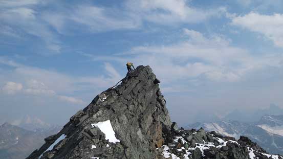
Maury inspecting the crux down-climb
Me starting the crux down-climb. Photo by Maury
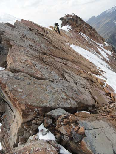
Me negotiating the very typical slabs. Exposed and wet…
Up a short, but easy step
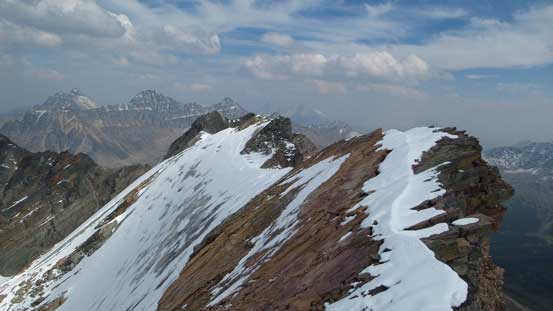
Looking back from about halfway down the traverse

Maury leading through the next slab…
Me on one more slab piece. Photo by Maury
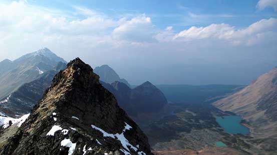
The E. End is ahead, but we had to get down to the saddle first
Looking back we could see Mt. Fitzwilliam where we were hours ago.
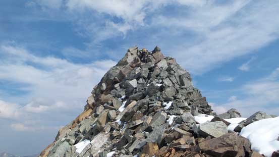
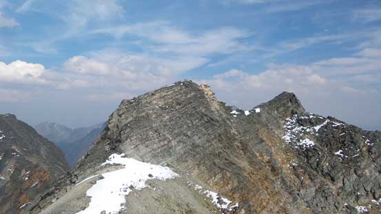
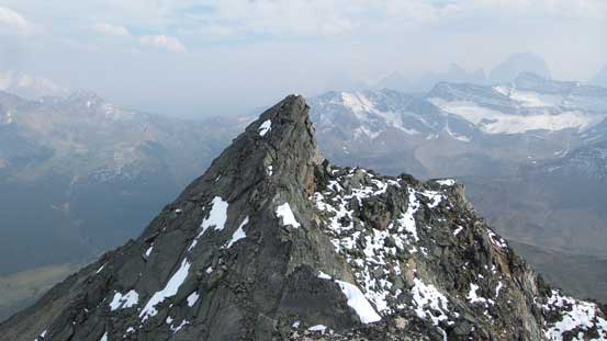
Up the far side the terrain was easier, but still mostly 4th class and fairly exposed. The E. end of Mt. Clairvaux actually had two summits close to each other and we again, couldn’t tell which was higher, so went up both. Getting down to the saddle was loose but not overly tricky, but getting up the second summit involved again, some exposed slab climbing. Looking back I’d say the first peak we ascended about 1 hour earlier was probably the true summit of Mt. Clairvaux, by my GPS did indicate the one we were standing on being the “official summit”. In the end no matter what I could safely claim this peak now so that’s good. But now the question was how to get down this thing…
Up towards the far end, looking back along the ridge
Maury on the first summit of the E. End.
Getting down the first summit was loose
The second summit (the far end) ahead

Another picture of Fitzwilliam Basin
Looking towards Basillica Mountain et al.
Maury climbing the last few moves to the far east end
Maury on the far east end

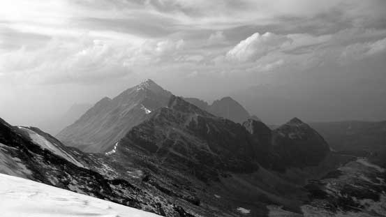
Looking towards Vista Peak it was super smoky already
Looking back from the far east end (where my GPS showed the summit is)
Me on the far east end of Mt. Clairvaux
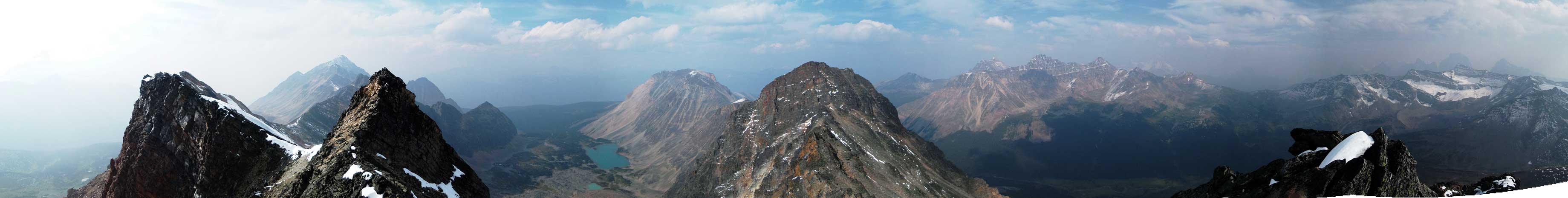
Summit Panorama. Click to view large size.
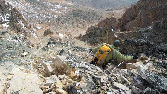
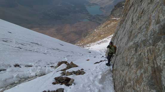
I didn’t feel like traversing all the way back across this jagged ridge unless I had to, so we looked around for some other routes. We did spot a line that if we continued down this ridge to the next saddle we could possibly get off the mountain by an icy gully to the skier’s left. That would dump us into Fitzwilliam Basin and knowing there’s a trail somewhere in the Basin we could then hike all the way out. We did bring crampons but no ice axe, but having the experience on Sir Douglas I knew I could handle some low-angled ice without an axe. So down we went. Some tricky maneuvering we made to the saddle. Crampons on and Maury went down first, and soon paused struggling to find a good hand hold on the wall. The words I got from his was “this’s super dangerous, make sure you really take your time”… Oh well, considering Maury is a WI6 ice climber that did not help my confidence… But again, the terrain looked awfully similar to the dirty glacier I down-climbed on Sir Douglas, just a bit steeper and with a bit more dirt at the start. The first 5 meters or so felt indeed very insecure, but once hitting the “real ice” I got the flow and managed to front-point down fairly quickly. Once off the snow/ice we still had a field of glacier debris and boulders to descend and that felt super tedious at this point.
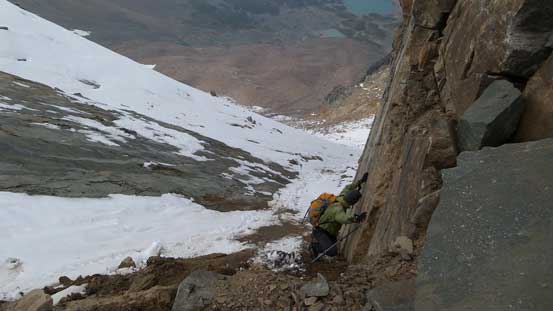
In order to hit the ice/snow we had to get down this dirt covered ice…
Down the sketchy stuffs now, still a bit of ice to down-climb
Looking back from halfway down the ice couloir

Oh the painful boulders again… And covered by snow again…
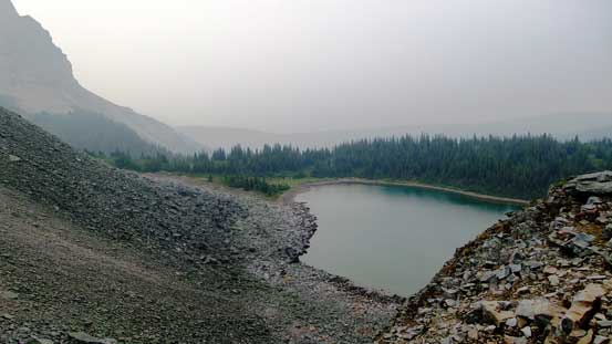
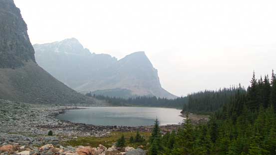
Down into the basin we had more boulders to overcome, but our real problem was not knowing where exactly that trail went. We weren’t planning on this loop traverse so I did not do any research of Fitzwilliam Basin other than knowing there’s a trail (apparently not in the best shape) somewhere. We ended up going too far skier’s left (West) but eventually I called the mistake and we took a shape turn to the right, traversed around a tarn and found cairns and paths which eventually led us to the main trail. This trail was in a rough shape with lots of indistinct sections on boulder fields or alongside creeks. Down into the wood the majority of the travelling was on boggy ground. Thankfully the mosquitoes were mostly dead at this time of a year otherwise it could be horrendous. I did not enjoy this trail at all, neither did Maury, but with good perseverance we made back to the campground, just before it’s too dark to see.
Looking back towards Mt. Clairvaux from Fitzwilliam Basin
Hiking across this meadows by the Basin
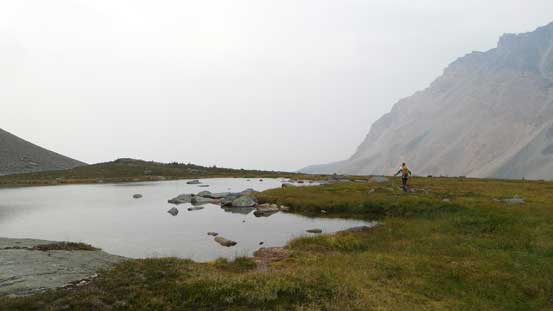
Looking down at one of the tarns
Another boulder/scree slopes to descent. We totally didn’t know where the trail was…

Searching around for the path
Looking at another tarn
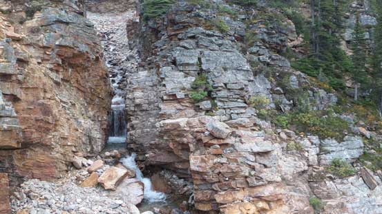
We eventually found the trail. This is one of the small waterfalls along the trail
Headlamps out we started cruising down the final 7 km. I had brought my runners for the hiking sections and that came super handy. My feet were sore wearing the rigid mountaineering boots for the whole day and that’s a good relief. With the help of the better footwear we semi-jogged all the way down, and our round trip time was 17.5 hours on pretty much full force.
Overall this was a very successful first trip with Maury bagging 4 remote peaks in one very long day. The terrain was not pleasant for the most part with bush, boulders, glacial debris and bogs, but it’s a fun adventure. Checking the weather forecast it still looked good for the next few days so we had to take advantage of that…
