Marmot Mountain
January 26, 2013
2612m
Jasper, AB
About a couple weeks ago Ben and I started talking about ascending Indian Ridge from its “backside” on snowshoes and the last weekend of this January seemed to be the perfect time. The trip would start at Marmot Basin ski resort and follow Whistler Creek ski trail up its backside so we increased our ambition to bag the nearby Marmot Mountain first. The front-side of this mountain is owned by the ski resort so technically one can easily tag the summit by taking the chairlift to the top. For obvious reason that’s considered unacceptable for me. The Marmot Basin was gated (closed) in non-operating hours we had to park at Portal Creek trail-head, which was the closest place we could park… This meant we had an extra 5 km distance one way with near 300 m more elevation gain.. It was obviously frustrating but to solve the problem we just had to wake up a bit early (4:30 am).

Marmot Mountain, Muhigan Mountain and Indian Ridge winter ascent route
We woke up under a full moon. Excellent! That means we didn’t need headlamp at all. So we had a quick breakfast (one sandwich for me) and got ready pretty soon, and we started the day a few minutes passing 5. Having the entire day ahead of us, we tried to walk as fast as we could up the Marmot Basin Road. The only way to walk faster was to jog. We made to the gate in just 30 min and hopped over it, then another 20 min brought us to the upper parking lot. Nobody was working there at this time of a day. The Whistler Creek trail was well maintained so it was easy-going in the dark, but painfully long. Under full moon, it was quite a peaceful environment though.

We ascended the entire way in dark
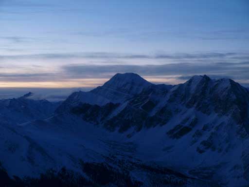
Too bad I don’t have those fancy camera gears so I can’t show you any photo (the moonlight was too weak). All the nearby peaks were clearly visible and we knew exactly where we were going. I think doing 4AM start under full moon will become my favourite in the future. We tried to slow down on the upper slope as we started to realize we were too fast. We would miss the sunrise photos if we kept going up under this pace. But even so it didn’t take us long to arrive at Marmot Mountain summit. The sky was slowly getting brighter, but we were still way ahead of schedule. We waited there for about 20 min until the coldness forced us to descend. It must be below -15 degree, and under this temperature, we must keep moving. Ben’s camera was better than mine and he could take a couple of photos without blurring, but that’s it for this summit. I really like the awesome looking Peveril Peak.
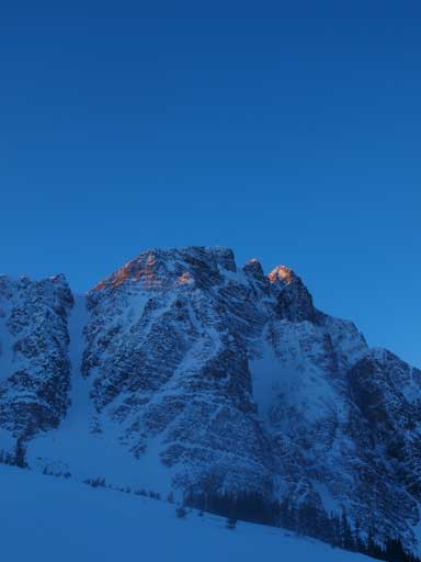
Mount Edith Cavell
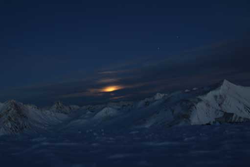
Moonset from the summit. Photo by Ben
Impressive peaks in Tonquin Valley. Peveril Peak in foreground. Photo by Ben

Mt. Edith Cavell rises behind Lectern Peak. Photo by Ben

Me on the summit of Marmot Mountain. Photo by Ben
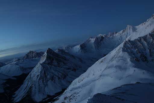
In order to get better photos, we took a slightly less direct line down the ‘backside’. Instead of dropping down straight towards Whistler Creek, we decided to descend the ridge towards Marmot Pass. On the slope we were treated by the ever-changing colours. I especially like the reddish view over Mount Kerkeslin. The snow was excellent (rock hard) for going uphill, which also meant, it was terrible to go down. Every step was on the knees. Of course, even though there wasn’t enough snow, we could still find lines to glissade. But given the fact we wanted to slow down, we didn’t bother with that. And of course, the impressive Terminal Mountain and Manx Peak was always eye-catching, and I finally could get a photo of them without blurring…

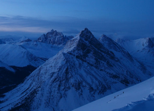
Panorama from just below the summit of Marmot Mountain
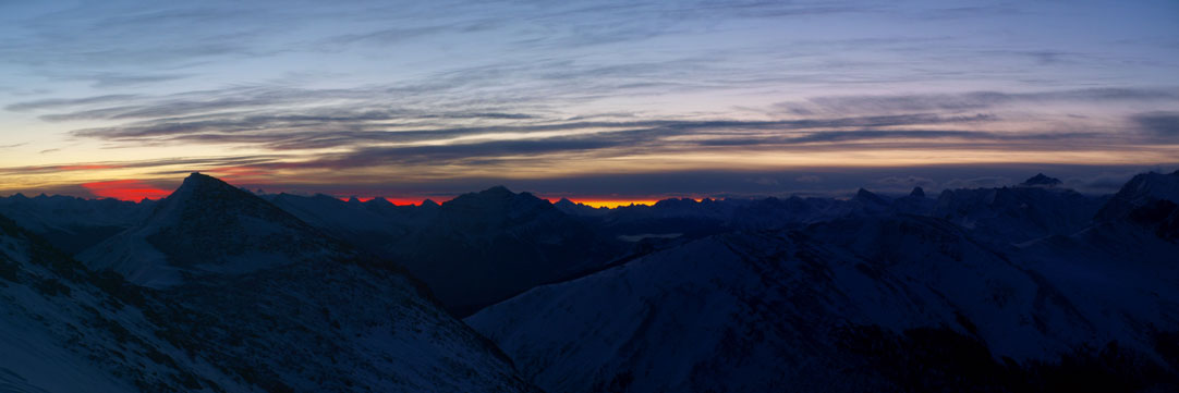
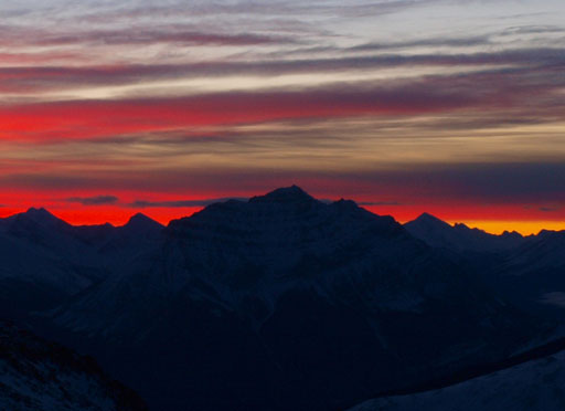
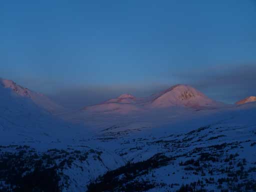
Morning colours showing up over the horizon

Me checking out the views. Photo by Ben Nearingburg
Peveril Peak
Mount Kerkeslin
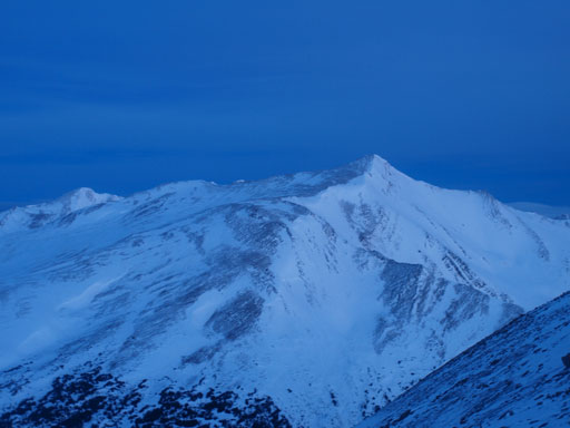
The back side of Indian Ridge is as simple as it looks

Morning colours over Mount Kerkeslin
We didn’t drop all the way down to Marmot Pass, instead we cut straight down the slope to save some distance. More interesting colours started to show up, and we quickly got down to treeline. Some post-holing was waiting for us, but it was brief. We soon crossed the Whistler Creek and started up the other side. By now, we had done the most significant elevation loss in this traverse. We were treated with some alpenglow views.

Manx Peak
Terminal Mountain
Whistlers Pass on left; Indian Pass on right.

This rounded bump is The Whistlers
The day continues with an ascent of Muhigan Mountain and Indian Ridge.
