San Jacinto Peak
March 23, 2017
3302m
Palm Springs, CA
Rising 3000 vertical meters above the desert floor of Palm Springs east of Los Angeles the mighty San Jacinto Peak is the second highest peak in southern California and boasts one of the most impressive north face relieves of the “lower 48”. For the simple reason of its geological significance this is one of the most sought-after objectives and attracts hikers, climbers and peak-baggers from all over the nation. While adventurous climbers may choose to climb the north face as an “Alpine II” snow/ice climb, the gentle east and west slopes offer easy access for those lacking the technical experience. The most popular route is via the trails in Round Valley from the east accessed by the Palm Springs Aerial Tramway which dispatches 2000 m of elevation gain right off the bat.
The same route can be ascended at any time of a year as long as the conditions are favourable. It’s nothing fancier than a gentle plod whether on foot, on skis or on snowshoes. This was the 15th day of this spring break vacation and my plan was to tag the main summit along with a couple other sub-peaks to make a peak-bagging combo. At that time I did not do much research and it turned out that the ascent of Cornell Peak was the major challenge, but we’ll get to that point later. In this trip report I’m only focusing on the ascent of San Jacinto Peak.

Ascent route of San Jacinto, Jean, Miller and Cornell Peaks. GPX DL
The earliest ride of the tramway is 10 am which meant I could sleep in till whenever I wanted. It turned out that I woke up at 8 am nonetheless and then killed some time in a nearby McDonalds. While lining up for the tramway ride people were looking at me weirdly. It was so damn hot at the valley floor and “why would this guy bring snowshoes”… The ride was certainly the longest I’ve ever taken and was quite scenic to be honest and brought me from desert to a winter wonderland. From the upper station I joined the “highway” of footpath westwards into the woods.
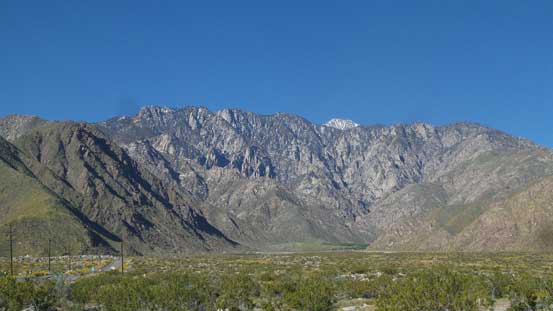
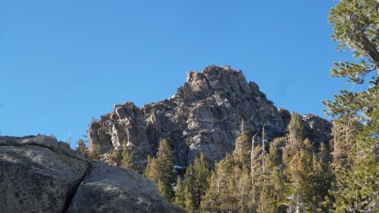
Mt. San Jacinto massif from Palm Springs
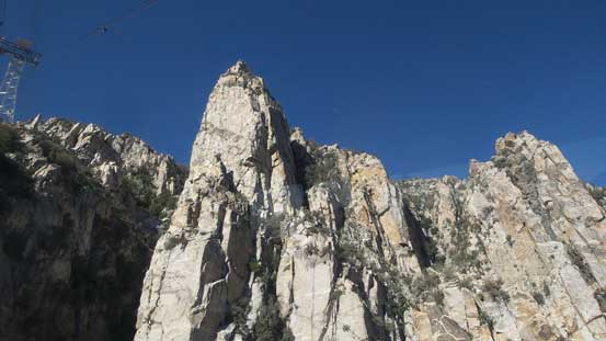
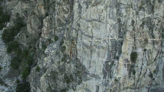
Impressive rock towers on the NE Face from the ride up
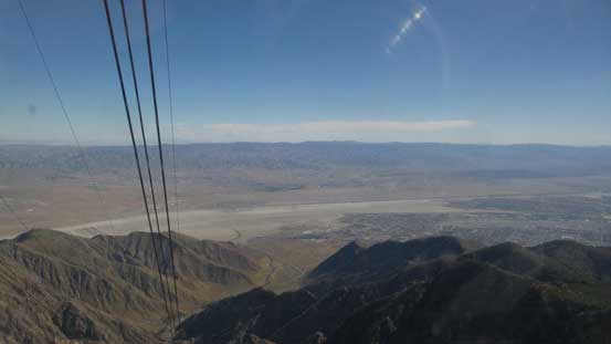
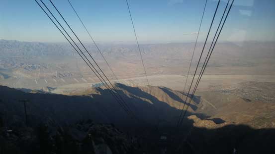
Looking back down towards the desert floor from the tramway
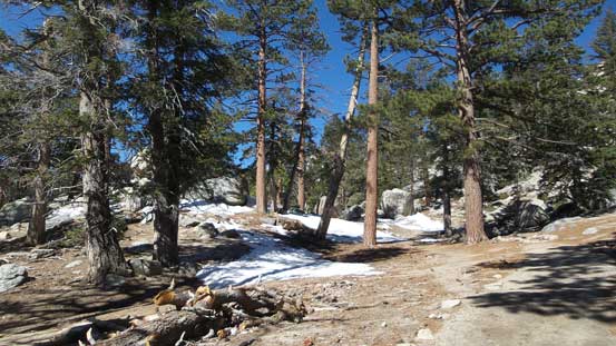
Picking up a set of trail into the woods.
After about a mile or so the snow became continuous and I strapped the snowshoes on. There were lots of paths leading everywhere and not loading a California topo into my GPS meant I had to do some guess work. The terrain was undulating and confusing but the general bearing was trending SW into Round Valley and I did this section OK. Later on I completely lost the trail so just went with my own route-finding which worked pretty well. From Wellman Divide which is the high shoulder SE of Jean Peak I gained the broad south ridge of Jean Peak via some semi-open forest. The slope angle maxed out about 30-35 degrees which was easily manageable with my Lightning Ascents.
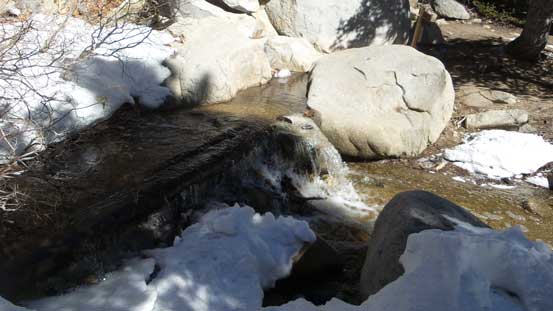
One of the few creek crossings
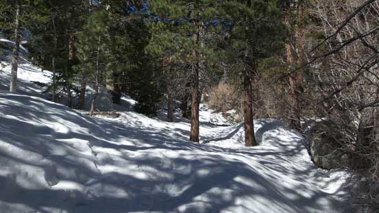
The snow became continuous and time to strap the ‘shoes on
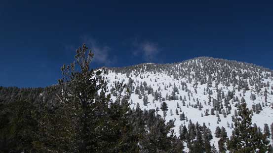
Looking ahead towards Jean Peak
Great views from Wellman Divide
Snowshoeing up the steep slopes to intersect the S. Ridge of Jean Peak
Looking back from where I started from.
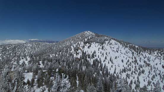
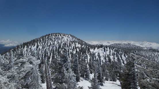
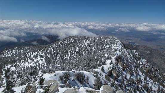
The plod up the south ridge of Jean Peak wasn’t as straightforward as appeared on map. There were a few dips and some short detours required but soon enough I was pushing towards the first summit of this day. Jean Peak is the second highest peak on Mt. San Jacinto massif but the highpoint is actually quite wooded.
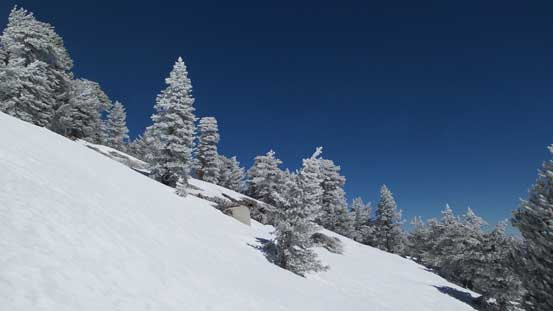
Fresh frost on the trees made some alpine feeling

One of the rock bands that I had to detour around
High up on Jean Peak now, looking back towards Marion Mountain
Not doing much lingering I soon descended into Jean/San Jacinto saddle which itself was easy peasy. The plod up the south ridge of San Jacinto Peak was similar to the south ridge of Jean Peak although seemed shorter. Before realizing I was already gazing at the final push towards the summit where a perfect panoramic view was waiting for me. I descended the NW Ridge for about 50 m aiming at Folly Peak but eventually decided against it as I simply couldn’t gain enough motivation for that. Had I gone down to bag Folly Peak I would have to slog all the way back up. I figured might as well just take a lengthy break and save some energy for Miller Peak and Cornell Peak later.
San Jacinto Peak ahead

Descending the north ridge of Jean Peak
Up the south ridge of San Jacinto, looking back towards Jean Peak
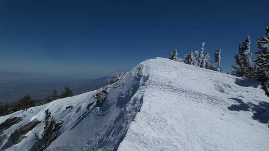
Trees on San Jacinto Peak

Almost there!
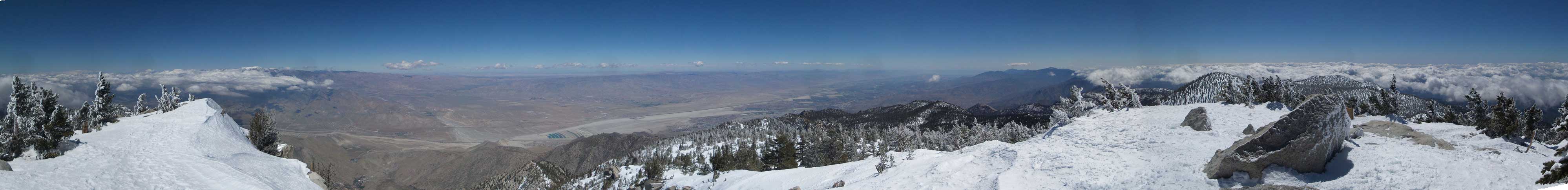
Partial Summit Panorama from San Jacinto Peak. Click to view large size.

Partial Summit Panorama from San Jacinto Peak. Click to view large size.
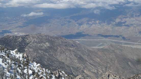
Looking steeply down into San Gorgonio Pass and where I-10 travels through

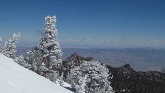
San Gorgonio Mountain on the horizon – highest peak in southern California
Folly Peak in the foreground
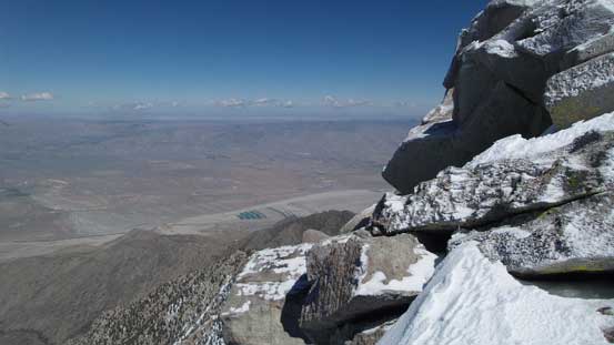
Looking sideways down into the desert floor
This is the steep N. Face
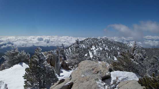
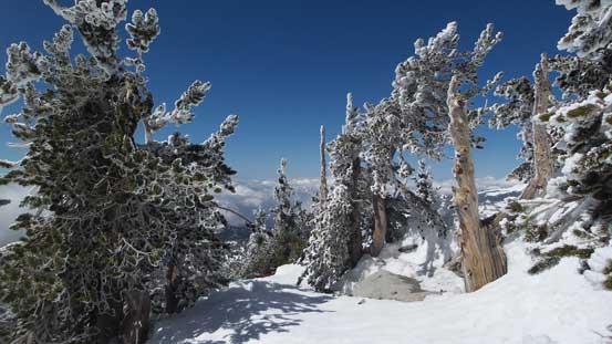
Wondering around the summit
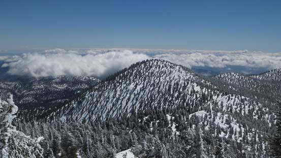
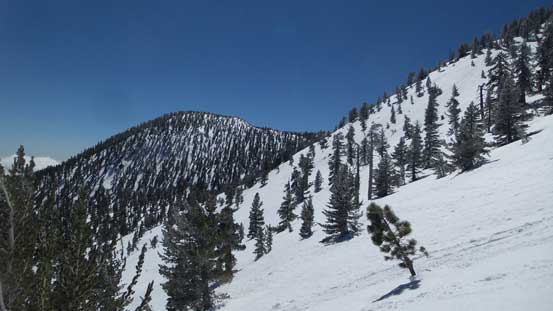
Jean Peak
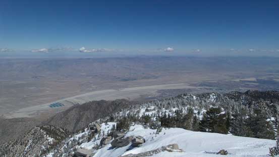
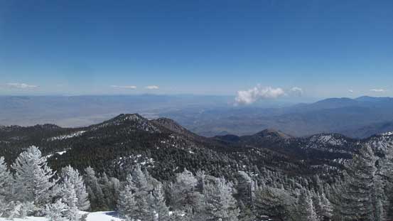
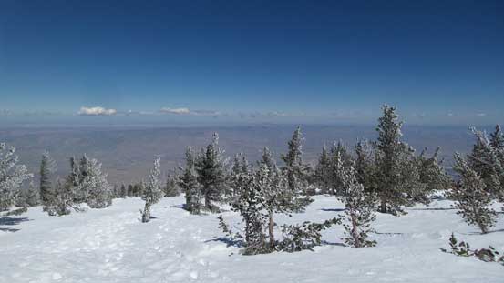
More about the desert floor looking east
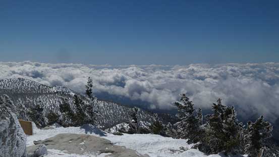
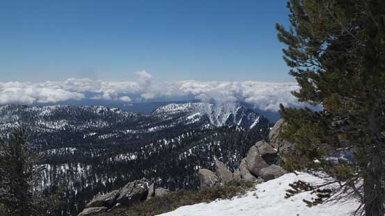
A sea of clouds looking south. Couldn’t see the ocean this day

Me on the summit of San Jacinto Peak
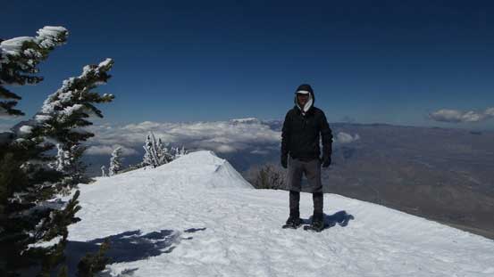
Another picture of me on the summit of San Jacinto Peak
Descending the broad east ridge I had to keep my eyes sharp as where Miller Peak actually was. From reports I knew people “passed by without actually noticing” and they sure did. Miller Peak is just a small rock pimple on the shoulder. There were a couple scrambling moves required to get on top though. Back down to Miller/San Jacinto saddle I removed the snowshoes and plunged into the bowl while keeping my bearing more towards skier’s left. Eventually I would descend into another bowl below Cornell Peak. The ascent of Cornell Peak goes at 4th class and is written is a separate trip report. It was a challenging and somewhat airy fair and I’m super glad I pushed on to finish the combo.
Time to head down…

Descending the upper east ridge. Easy peasy..
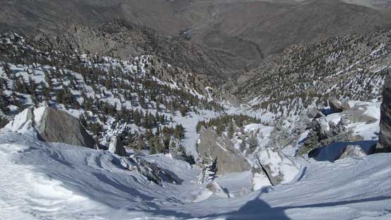
Plunging into the two bowls in a sequence. It’s bit steep here and there.

Toro Peak looming on the horizon
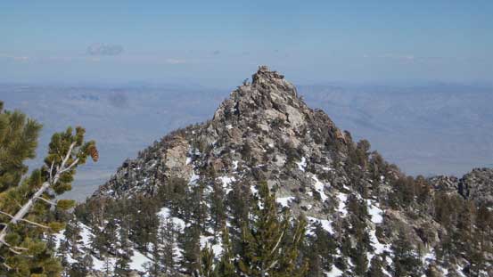
This is Cornell Peak – my 4th objective also the hardest.
Picking a “highway” of tracks down into Tamarack Valley I had no problem re-joining the main trail near a creek. The elevation regain back at the upper tramway station was a drag and I missed the ride down by just a fraction of a second. On the other hand this earned me about 15 minutes to kill and I went to check the second floor of this building. There’s a good viewpoint down towards the desert floor. And once time was up I joined the hordes down the scenic ride, and then drove back to Palm Springs for food and stuffs.

Descended into Tamarack Valley now
Looking back towards Cornell Peak. As you can see there is no easy route up
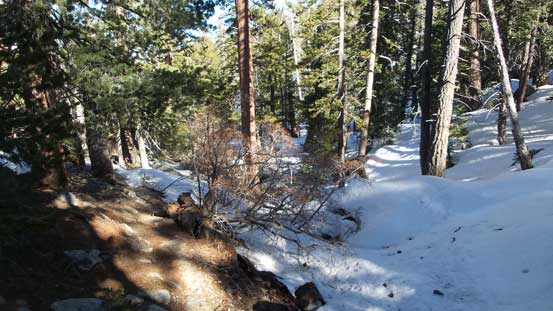
The typical condition on the trail

The final uphill plod back to the tramway station

The tramway station offers some unobstructed views down to the desert floor
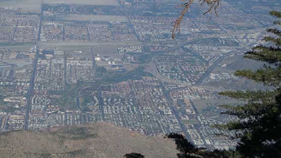
The city of Palm Springs
Down…
Shear cliffs on the faces.
Later in the evening I resumed the westwards drive down I-10 towards Los Angeles. About an hour later I exited into the town of Upland and slept randomly in my car for the following day’s ascent of Mt. San Antonio.
