Sloan Peak
August 15, 2017
2388m
Mountain Loop Highway, WA
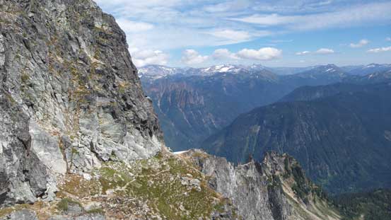
Behind the small town of Darrington the “Matterhorn of the Cascades” may not be the tallest in the state of Washington and in fact, it isn’t even on the famed Bulgers list (WA Top 100), but the distinct profile has made Sloan Peak one of the most recognizable objectives, visible across much of the west slopes of the North/Central Cascades. A simple glimpse at this peak one would hardly believe there actually exists a non-technical route. The 3rd class Corkscrew Route spirals its way up to the summit rounding much of the E/SE/SW and W sides of the pyramid but getting to the base of this route requires crossing a somewhat troublesome glacier as well as a tiresome forested approach.
The inspiration of making an ascent of Sloan Peak mostly came from a recent condition post on the Facebook group “Washington Hikers and Climbers”. With the glacier reported to be still passable and then some good weather in the forecast I figured this would be a golden opportunity to get it done even though I had never “planned” this objective in the past. These days I do nearly all of the planning on Facebook and that includes finding trip partner(s), and sure enough Lena Tian was game for the challenge. Regarding the approach we’d take a “newly published” Bedal Creek option for one reason that it avoids that unpredictable river crossing. The bonus is that with a decent 4×4 like my Toyota Tacoma one can get to the trail-head high up on Road 4096, shaving at least a couple hundred meters off the elevation gain. I honestly don’t think there’s any reason to take the traditional Cougar Creek approach anymore.
After a tiring 4 am wake-up call and then a familiar drive down south I picked up Lena from the city of Arlington, and then eastwards down SR 530 later we turned onto Mountain Loop Highway. Finding the start of that Road 4096 wasn’t super obvious but I had previous plotted a line on my GPS map so there’s no excuse to screw it up. This forestry road was quite a steep haul but did not impose much of a problem to my trusty Tacoma.

Sloan Peak via Bedal Creek. GPX DL
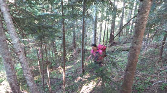
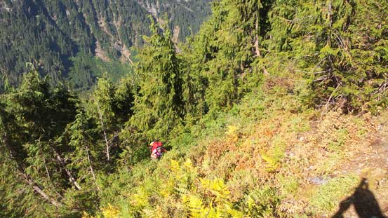
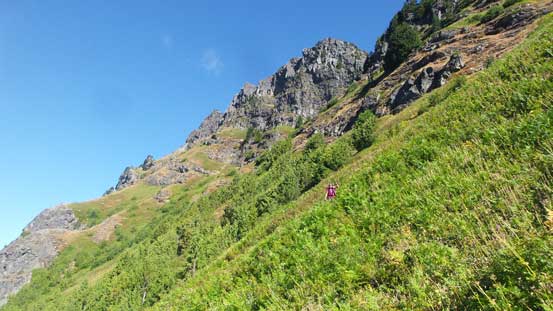
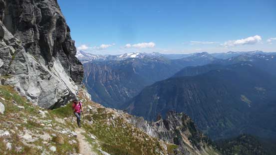
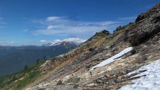
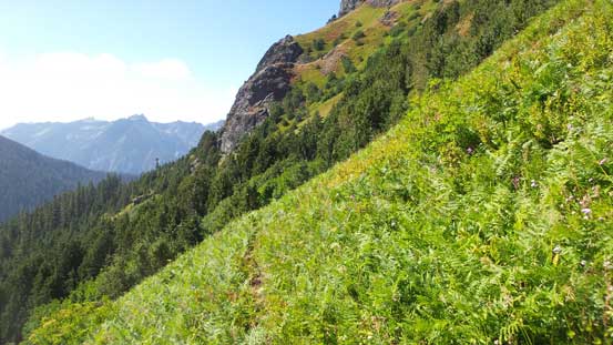
The first stage was following Bedal Creek Trail for about 1.2 miles. Much of this trail did see some maintenance work but a couple avalanche paths were heavily overgrown just like the nearby Glacier Peak’s approach, except for being much worse. Following the path was easy but then we had to push through the 2-meter tall, sometimes prickly brushes and adding the heavy morning dew this was downright miserable. By the time we reached the point where we had to leave this trail (marked by a flag) both of us were all soaked to the bone. Thankfully I was wearing a pair of pretty new Trango Ice Cubes that kept my feet dry. There’s supposed to have a flagged path heading up to Bedal/Sloan col but following this path was not an easy job even with a previous party’s GPS track handy. The general direction was trending climber’s right but speaking the micro-terrain there’s still lots of guess work to be made.
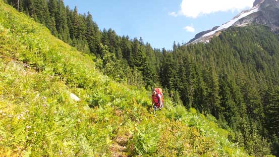
The typical forested travel below Bedal/Sloan col
Even with GPS navigation we still got off-route a couple times. I managed to correct most of the mistakes but for one stretch we had to deal with a long haul of bushwhacking. But the good thing we were not far from the open drainage mentioned in some other trip reports. Once reaching the open terrain the route-finding became much easier although the trail was still not very obvious at places. Traversing towards Bedal/Sloan col looked like an enjoyable grassy walk but actually not. It’s pretty crucial to not lose the trail on that part as trust me, we learnt the hard way.
Finally emerging out of the woods…
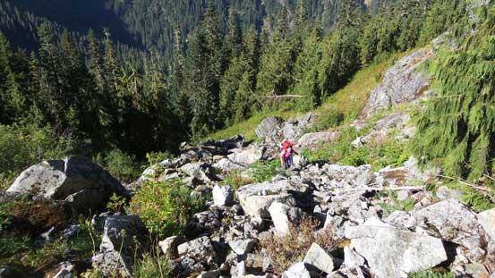
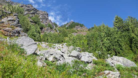
Grunting up this dry rocky drainage for a while
Unfortunately we lost the trail again
Bushwhacking to get back on track

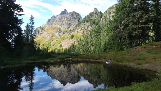
There’s a lovely tarn right by Bedal/Sloan col
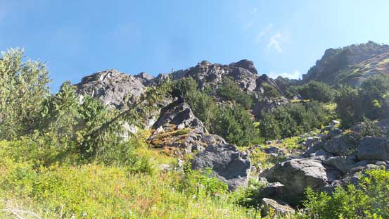
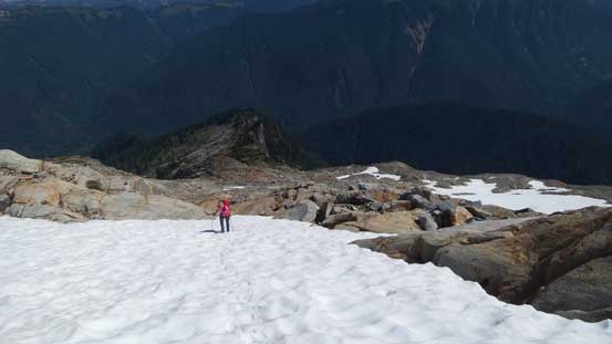
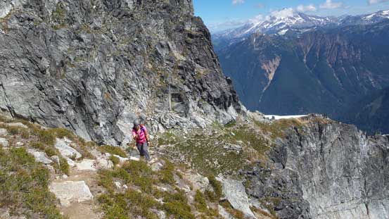
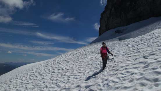
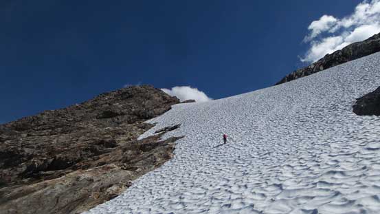
Upwards from Bedal/Sloan col the next section was a long diagonal traverse across this wide low-angled triangular face towards a saddle on the far left skyline, just under 6000 feet in elevation. There are many ways to do this traverse depends on the amount of snow coverage. The route we took was pretty much a straight beeline towards the saddle. About 1/3 of the way over we found a pretty damn good flat grassy platform with running water so dropped all of the overnight gears. At this point it seemed like those were just dead weight for exercise as the approach had been much shorter than anticipated. After about half an hour we resumed the traverse mode. There’s one rocky/slabby stretch followed by a steep snow slope but otherwise it’s an easy plod to the aforementioned saddle.

Getting out of the col, now looking back at Bedal Peak
There are quite a few creeks for running water

Another look at the south side of Bedal Peak
Working our way across some slabs

Arriving at the saddle. Now we had to ascend parallel to the glacier
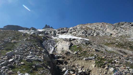
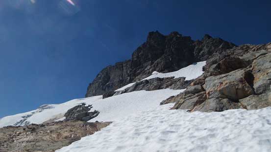
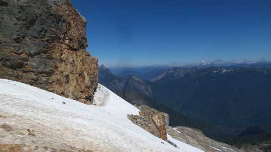
From the saddle we turned right and worked our way up the broad NE flanks paralleling the edge of that glacier. In early season it’s probably easier to merge onto snow. In mid August it’s more obvious to stay on rock on climber’s right side. We just had to find a way zig-zagging up some wide ledges and the scrambling never exceeds “class 2”. We did not merge onto the glacier until very high up and then did a long diagonal traverse to gain the glacier proper. This is not a large glacier but the holes are deep and bottomless. That piece of snow bridge came towards the upper end and after checking it out briefly we opted to belay across. The bridge was about a feet wide, less than two feet thick and about two meters long. A fall into that crevasse would definitely end up calling for a rescue if not straight to death so better safe than sorry. Two dead man anchors solved the problem and then we were back on easier ground, albeit still a no-fall zone as there’s another house-eating crevasse down the slope waiting to eat any careless climber.

Bedal Peak now looking pretty small. Pugh and Which Chuck behind
Getting closer
Finally merging onto snow

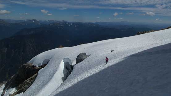
This is the broken glacier. We had to traverse a long ways to get onto it

Moving through this stage for as fast as we could for obvious reasons…
Then around a corner, looking back

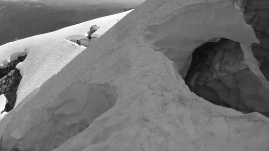
Lots of big holes on this small glacier
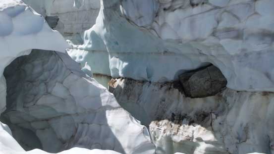
Looking into the big crevasse that we had to cross

We belayed across. You’d need balls of steel to solo this one.
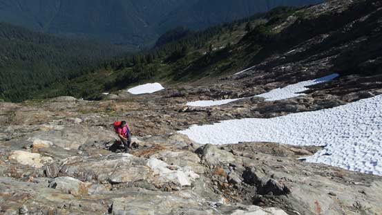
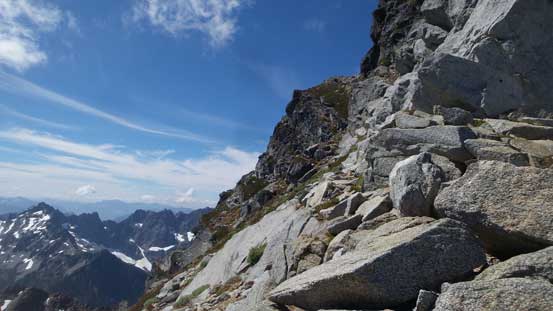
The exit of this glacier marks the start of the Corkscrew Route. We took another lengthy break and ditched all of the unnecessary snow equipment. There’s already a pretty well-defined trail working it way around the south corner traversing across several bowls. This is very much unlike the peaks in SW BC where any sign of human traffic is a scarce thing. The trail and cairns had eliminated any route-finding challenge plus we also had a GPS track for backup so this final scramble was more about soaking in the experience other than “mountaineering”. There might have a couple 3rd class moves but overall I’d say it’s more “class 2” than “class 3” and the exposure is pretty tame.
Rounding the first corner on the upper Corkscrew
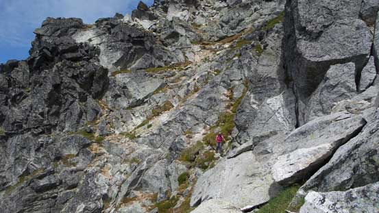
Lena working her way up one of the few traversing bowls

We had to ascend the ramp ahead. Again there’s a trail
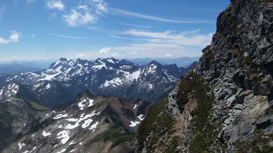
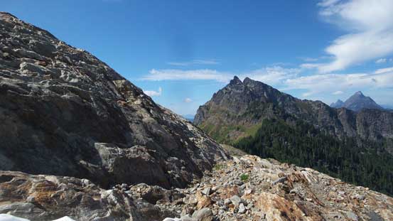
Looking sideways across towards the distant Monte Cristo Group

The south buttress of Sloan Peak. Thankfully this isn’t the way up
Traversing across another bowl on the south side

Now what? Another bowl traverse. This time on the SW side
We had pushed this guy up the mountain for quite a long ways
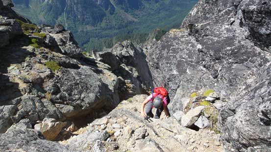
Lena scrambling up one of the few 3rd class moves

Slowly but steadily
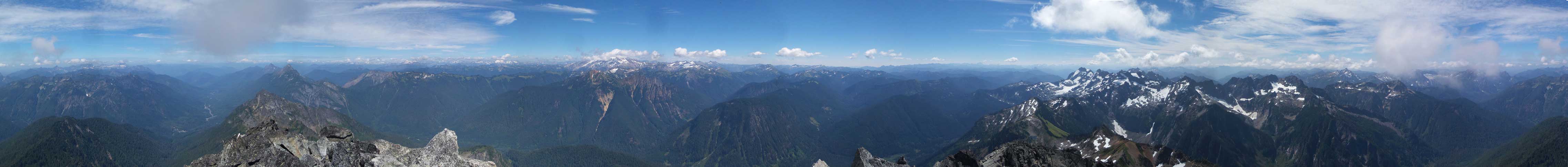
Summit Panorama from Sloan Peak. Click to view large size.

The South Fork Sauk River Valley way down below
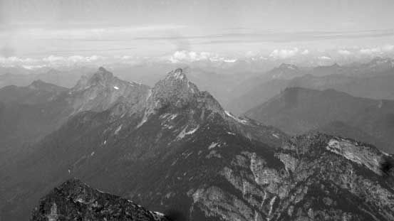
Mt. Pugh and Which Chuck Mountain now looking tiny
Del Campo Peak and Morning Star Peak

Glacier Peak now engulfed in clouds
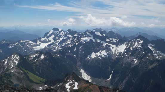
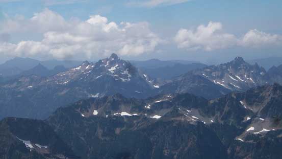
Monte Cristo Group looking south

The new summit register
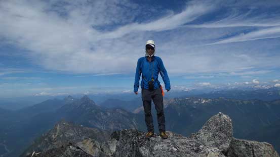
Me on the summit of Sloan Peak
There are a couple familiar names in the newly-placed register that I recognized from the Facebook group. We stayed for about half an hour before starting the descent. There’s literally not much worth noting other than we simply reversed our route off the upper mountain. On the glacier we belayed each other back across that snow bridge and then unroped for the rest of the plod. Plunging downhill on the soft snow was such a fast and fun process and in no time we were off the glacier. Down from the saddle we descended a steep roll of snow and then traversed a lower ledge then we used on the ascent. This actually got us rid off some slabby scrambling terrain.
Leaving the summit behind
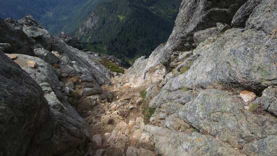
Descending this gully. You should remember this spot from the ascent
Now working around the south side traverses
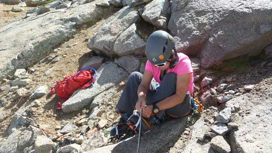
Gearing up for the glacier
The first section of the glacial traverse
Back across this dicey snow bridge…
The day was as good as it gets
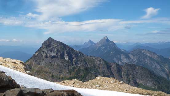
Bedal Peak, Mt. Pugh and White Chuck Mountain

Glacier Peak
Plunging down towards the saddle
Down-climbing a steep roll of snow.
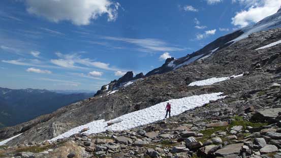
This traversing stage is incredibly scenic
Bedal Peak ahead. We took a lower ledge on the return
Back to where we ditched overnight gears we took no time to repack everything. It seemed like a dumb decision to have hauled so much unnecessary weight up as it’s very obvious we’d finish in under 10 hours. Traversing back across that meadows zone under Bedal/Sloan col we paid very close attention to not miss that trail and we almost screwed up for a second time. The descent through lower forest was mostly about GPS navigation. It’s either checking your GPS for every two minutes or risking getting off-route into some nasty bushwhacking. We opted for the former and the rest of the way back to the parking lot was uneventful. Thankfully the brushes had dried off.
I have to say this is a great camp site, if we had extra time to kill.
Back to that tarn. Just had to take another picture
Where’s the trail again?!
On path now
Down that rocky drainage. Almost time to drop into the forest
Believe or not the Bedal Creek Trail travels through here…
Our round trip time ended up being exactly 8.5 hours and that meant I could even get back to Vancouver before dinner time. Not a bad timing for an objective that most parties spend 2 days. Other than this somewhat sketchy glacier crossing I’d say getting to the summit of Sloan Peak is an easy fair, but that piece of snow bridge does make it into a beginner/intermediate mountaineering category. Earlier in the season (July) is probably a better timing.
