“Sasamat Hill”
March 14, 2023
190m
Port Moody, BC
“Sasamat Hill” is one of the forested pimples recently added to peakbagger.com and the sole reason I accepted this unofficial name and did this “peak” was the 100-m prominence. Thank to the lack of a spot height on BC Basemap and the 20-m contour lines the “100 m prominence” shown on peakbagger.com is rather the lowest possible value, which is defined as “clean prominence” by the webmaster Greg Slayden. The actual prominence of this peak can be anywhere between 100 m and 140 m. A few trip reports had popped up in the recent days and it seemed like a no brainer kind of ascent with some bushwhacking.
Nikita and I made the spontaneous decision to tag this objective in the midnight under the cover of darkness since there are better things to do in daylight time. The summit is entirely forested so the “view” would technically be the same regardless the weather and the time of the day. I finished work at 9 pm and subsequently showed up in Nikita’s home in Richmond at 9:45 pm. We then drove eastwards to Port Moody and then westwards down the winding roads towards Sasamat Lake. It’s unfortunate that the park was closed at night. The previous groups had approached from White Pine Beach on the shore of Sasamat Lake but a closed gate and some aggressive “no parking” signs forced us to go elsewhere. Finding a legal spot to park was actually the crux of this ascent. After searching back and forth for at least 15 minutes I opted to park in front of some residential houses on the west side of the hill. I figured that the chance of getting towed in the middle of a night would be low, if not zero.
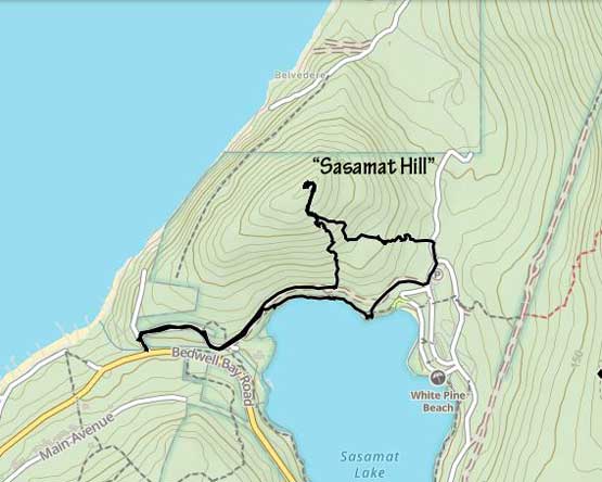
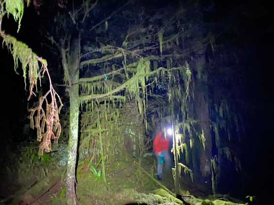
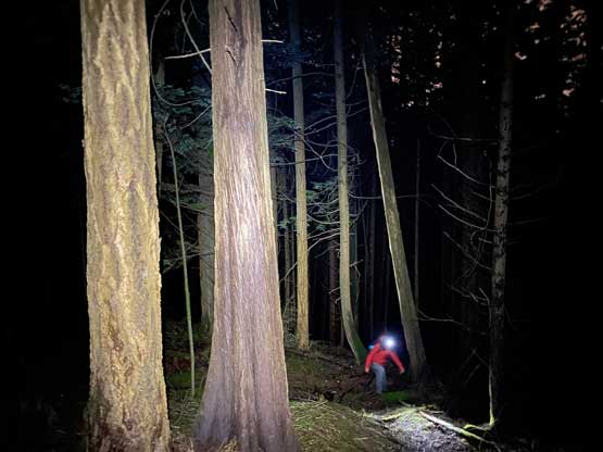
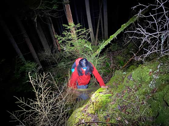
Nikita and I then quietly got out of the car and started the hike. I didn’t do much research so we just walked on a gated gravel road eastwards and then picked up another gated road contouring around the north side of Sasamat Lake. Once “making sense” I made the call to ascend the south slopes aiming more or less straight for the summit. The bushwhacking was not bad, but there were some bluffs and micro-terrain to content with higher up. We crossed path with an excellent biking trail about halfway up and came across another, lesser-defined trail near the summit. We opted to take the narrower trail near the summit and it did lead us to the summit cairn. I have to say that the ascent was actually more involved than anticipated.
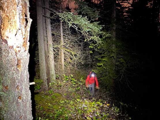

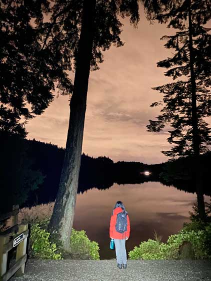
After taking in enough of the “views” of the trees and cairn we decided to descend. We opted to take that lesser-defined trail further down but it started to descend towards some random directions. I then made the call to leave the trail, but the bushwhacking on the SE side of this hill was considerably worse that our progress was actually quite slow. It was also very disorienting in the micro-terrain so I had to constantly consult with the GPS to make sure we weren’t doing circles. A while later I opted to just dash down in one direction and we popped out onto the gravel road. While contouring back we made another spontaneous decision to check out the shore of Sasamat Lake which was not disappointing. We finished the hike at 1 am or something and immediately started the drive. I was getting particularly hungry so we stopped in an A&W for a chicken burger. That gave me enough energy to drop Nikita off in Richmond. I eventually got back to White Rock exhausted but satisfied to have another dumpster in the bag.