Mount Anderson (Vancouver Island)
February 19, 2023
1258m
Vancouver Island, BC
“Anderson” is a very common name in English-speaking countries. This is already my 3rd “Anderson” bagged. The first one was in Waterton Lakes of Alberta and the second one was near Bellingham in Washington. This one locates not far from Port Alberni on Vancouver Island. By coincidence all three Andersons that I have bagged boast over 600 m prominence. I noticed this peak simply by mapsturbating over the years and I noted this as a straightforward snowshoe ascent. There wasn’t any winter “beta” on the internet but the route is obvious for those who are capable reading the maps. The same route I planned actually has a flagged trail that we learnt later.
The plan for this Sunday changed a few times due to the questionable weather forecast. Getting some views would be difficult, if not impossible in any area with 4-5 hours of driving but Vancouver Island was the place with the least amount of precipitation. My trusty Meteoblue forecasts predicted 100% clouds but less than 20% chance of precipitation and to me that was good enough. Raphael agreed to pay a visit to the island and I suggested Mt. Anderson as I wanted a no-brainer kind of objective to grant our chance of success. Raphael and I made the decision on Saturday afternoon and spontaneously booked the outbound ferry. Samir and Mackenzie joined at the last minute and the plan was to pick up all three of them from North Vancouver at 5:15 am in my truck. The drive would involve some logging roads to 400 m elevation, possibly with some snow and we wanted my Tacoma to be absolutely certain.
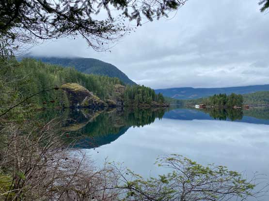
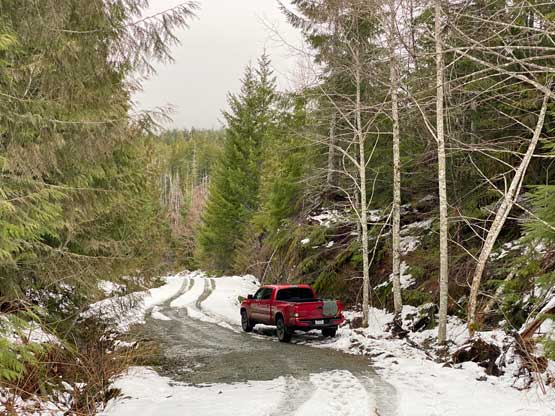
As usual a day-trip to Vancouver Island would involve two times more logistics than hiking and this trip wasn’t an exception. I woke up at 4 am from White Rock, firstly went to swap vehicle with my parents in North Surrey and then picked the three of them up in North Vancouver. We then lined up at the ferry terminal and took the sub-2-hour ride to Nanaimo. The drive on the other side was about 2 hours so we didn’t start hiking until 10 am, 6 hours after I woke my tired self up. The FSR (Gracie Main) had some snow at Gracie Lake (400 m) whereas the spur road on the west slopes of Mt. Anderson was completely covered. We were able to drive a short ways up the spur road following a set of tire tracks, but turned around and parked as soon as the tire tracks disappeared. That was at 450 m elevation.

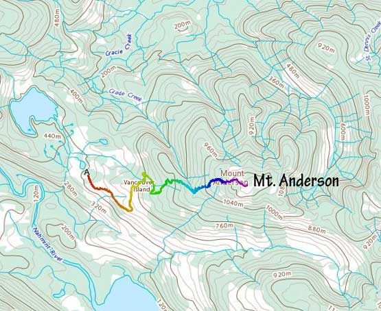
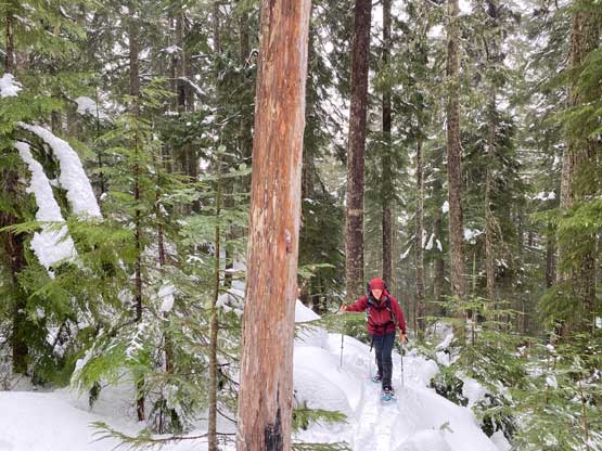
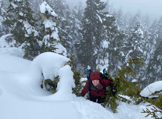
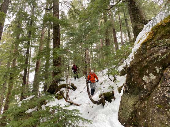
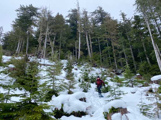
The first stage was as simple as plodding the snow-covered spur roads to the very end. Raphael as usual, led a blistering pace right from the start and a kilometer or two later we had to don snowshoes. Another short while later Samir decided to turn around to have a leisure day whereas Raphael, Mackenzie and I continued. The trail-breaking started to become heavy. From the end of the spur roads I led us ascending a not-so-pleasant cut-block into the mature forest. There was some bushwhacking but nothing worth noting. We ascended a NW-facing rib and towards the end of this micro-section we encountered flagging and what seemed like a snow-covered trail. I recalled that Nikita had sent me an AllTrails page about this peak. At the time I didn’t even bother to read because I’m not a fan of AllTrails and I already had my own route planned. Little did I know that my way was pretty much the same as that trail. For the next while we basically just followed the flags upwards, breaking our own trail on top of the summer trail.


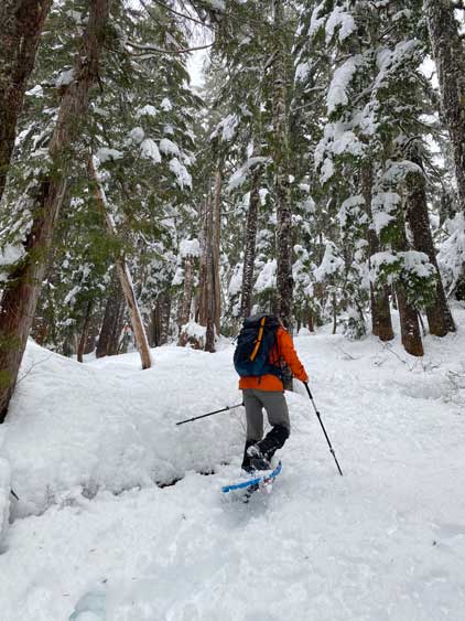
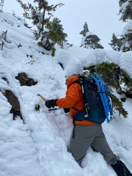
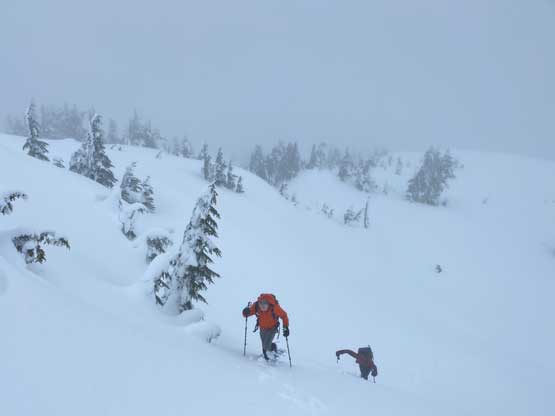
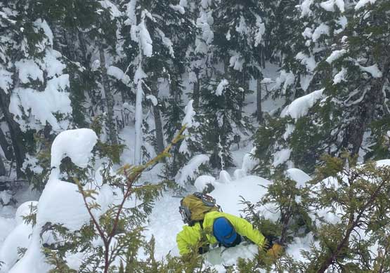
Near 1100 m elevation the trees started to thin and the snow depth increased drastically. We were post-holing in the classic west coast cement but we still made steady progress. There’s a bluff with no obvious bypass from where we were standing. I’m sure by contouring to the south we could find an easier way but I wanted us to practice snow climbing. I spotted a line that should work so we swapped the snowshoes for ice axes. I didn’t bring an ice axe so I would just use my fists and fingers to hold onto the snow. There was more wallowing than climbing, unfortunately. The steep snow passage gave way to a short 3rd class step with some vege belays. Raphael volunteered to lead the rock crux, cleaning off the loose snow with the adze of the ice tool like a real alpinist. After this bits of excitement we strapped the snowshoes back on and plodded across the rolling terrain to the true summit, now completely in flat light inside a ping pong ball. There was no view to speak of whatsoever and the visibility was down to 10 meters. The saturated white-outs reminded me the Hawaiian jungle a few days earlier.


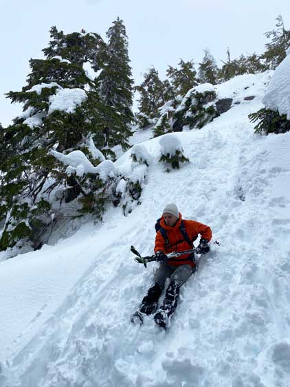
All we did on the summit was to eat some snacks and take an obligatory victory shot. I thought about to find an easier route down the crux but decided to just embrace the down-climb. I assured them that the down-climb should always be simpler than on the way up on non-technical terrain and it sure turned out to be easier. Raphael even went for a short glissade and down-climbed the entire pitch facing outwards. Mackenzie and I opted for the slower but more sure way of down-climbing, facing into the slope. We then followed our own snowshoe tracks out and leisurely descended the boring FSR. Samir had been doing laps near the truck to kill time and our round trip time was 5 hours.


I didn’t think we could catch the 5:45 pm ride given that all reservation spots were sold out so we would be aiming for the 8:45 pm ride. The reservation spots were also sold out but Samir somehow managed to find a spot by constantly refreshing the page for about half an hour. This meant we earned ourselves over 2 hours of extra time. A spontaneous decision was then made to bag “Notch Hill/Nanoose Hill” in the vicinity of Parksville. The name of this dumpster peak is unofficial so I’m not going to write a separate trip report for that. Mackenzie did the quick research and gave me a GPS coordinate to drive to. The dash to the summit took about 10 minutes and that’s it. After this quick grab we drove into the city of Nanaimo and Raphael found us a Greek restaurant. The food wasn’t cheap but the service quality was excellent. It was then the ferry routine and I eventually got back home at midnight.