Stoyoma Mountain
June 18, 2020
2267m
Merritt / Spius Creek, BC
The North Cascades are more well-known in Washington state but a branch of it sticks pretty far north into British Columbia. This section is usually called the “BC Cascades” and though not as rugged as the Washington Cascades, still boasts some interesting peaks such as the spires near Coquihalla Pass. The area around Stoyoma Mountain is about halfway between Merritt on Coquihalla Highway and Boston Bar in Fraser Canyon on this very far reach of the “BC Cascades”. Stoyoma Mountain is the highest in its vicinity with the closest higher peak in the Cascades being Snass Mountain almost 100 km to the south. The ascent is however, rather just a lame walk-up and with a 4×4, high clearance vehicle the summit can be reached in under 1.5 hours from truck. The standard access is via a complicated logging road system from Merritt. One needs to drive more than 30 km south-west from Highway 8 linking up several branches. The driveable end is Cabin Lake but the last several kilometers are known to be very rough.
Vlad and I made this spontaneous decision taking advantage of the single day of weather window in this week. The weather wasn’t stable enough to attempt bigger objectives. Stoyoma Mountain is an easy objective on a local peak-bagging list that we both were working on, albeit half-hearted so the trigger was pretty easily pulled. But as always we wouldn’t drive that far just to hike one peak. There is Mt. Hewitt Bostock as well as the unofficially named “Stoyoma’s Widow” nearby so the plan was to grab all three in one bag. To make that happen we agreed to drive out on Wednesday evening after work at 10pm. It was an exhausting show but by 2:30 am I did park my truck halfway up the Cabin Lake spur road. The remaining 2 km or so looked too rough and muddy to attempt and I knew for sure there would have snow patches too. The section up Spius Creek from Prospect Valley was already rough enough and so was the first part of Cabin Lake spur. I was glad we made it here but the crawling was quite slow.
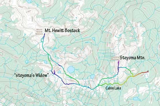
Stoyoma Mtn. and Mt. Hewitt Bostock traverse. GPX DL
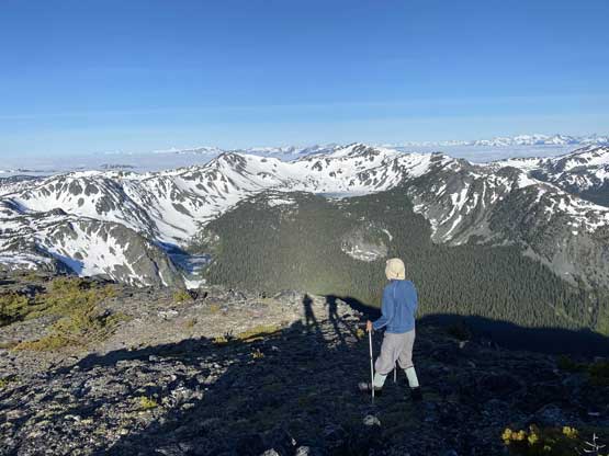
The night was clear and cold that by 5 am we were both awake. I wasn’t very stoked about getting out of the sleeping bag but since the sun’s already up there’s no more reason to go back to sleep. I stuffed in some breakfast that I bought from T&T supermarket the day before while Vlad did his sandwich art as usual. Vlad mentioned that standard route for this peak as per “103 Hikes in SW British Columbia” starts from Cabin Lake but looking at the topographic maps we made the decision to short-cut on the east-facing open forest and slopes, not to mention that I did not even have the 103 Hikes book. The bushwhack was pretty lame for BC standard that in no time we were at treeline. The snow was not as firm as I was hoping for as this is in the interior zone and the snow was more “Rockies” than “coastal”. In general the snow was supportive but not on thin spots. Our aim was a high col on the south ridge of the peak and we got there in about 1 hours after leaving the truck.
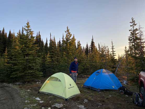
Our tents in the morning.
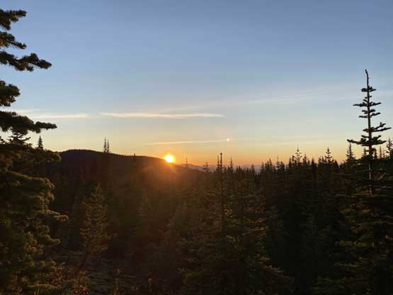
The sun woke us up at 5 am…
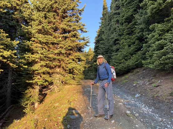
Vlad walking up Cabin Lake spur road
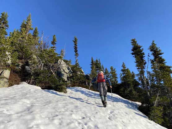
After some brief bushwhack we hit snow in no time.

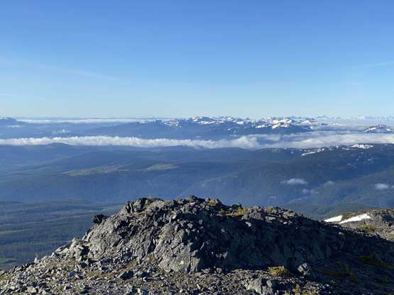
Looking back at the rolling hills of Merritt area

Vlad aiming for the low point on the ridge ahead. Cruising now
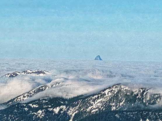
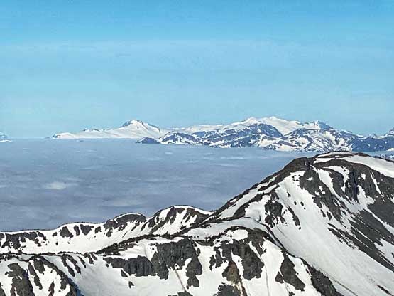
Mt. Urquhart pokes above the low cloud ceiling

The Old Settler in the distance, also poking above the low clouds
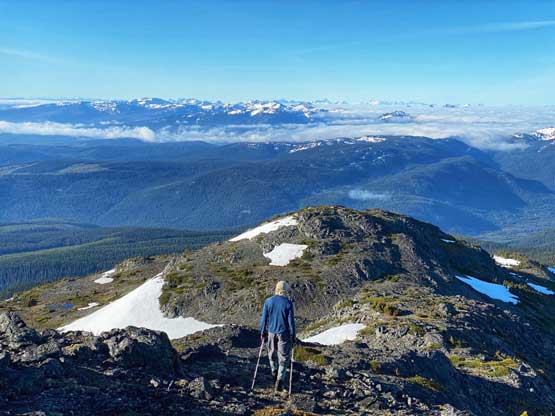
The view opened up once reaching this col so we spent several minutes taking photos. But we also knew the view would be even better from the summit so we stopped taking photos and started the ascent. We ditched the backpacks. The scramble via south ridge was nice and open with scenic views the whole way, and took us about 20 minutes.
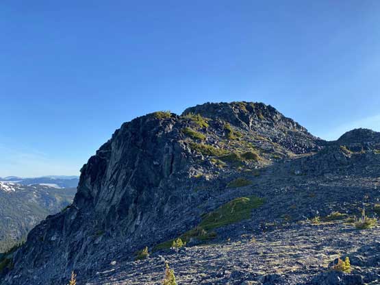
The south ridge of Stoyoma Mountain
“Gilda Peak” to the north
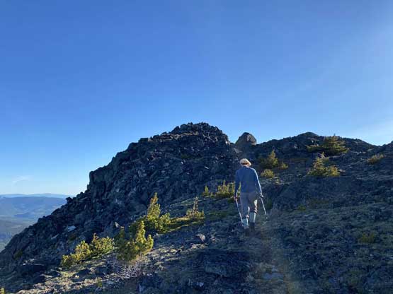
Vlad rambling up the south ridge towards the summit

Me coming up the south ridge. Photo by Vlad M.

Partial Summit Panorama from Stoyoma Mountain. Click to view large size.

Partial Summit Panorama from Stoyoma Mountain. Click to view large size.
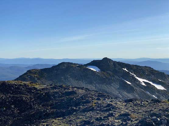
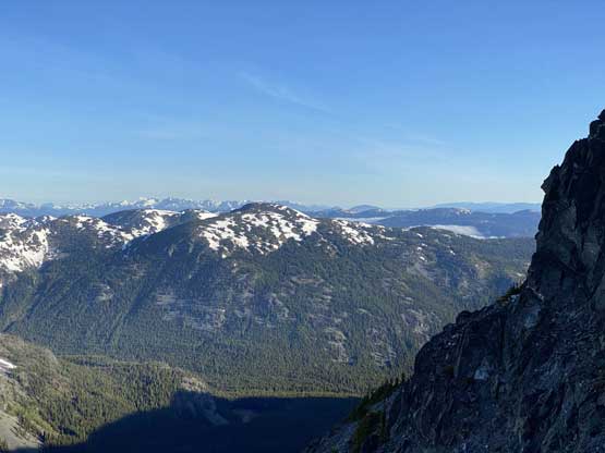
The north summit of Stoyoma Mtn. is only a little bit shorter
Mt. Hewitt Bostock in the foreground. Looks like a long way away…
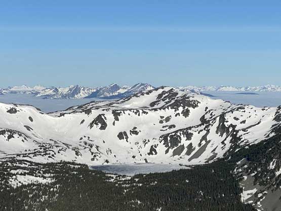
“Stoyoma’s Widow” and Widow Lake in the foreground
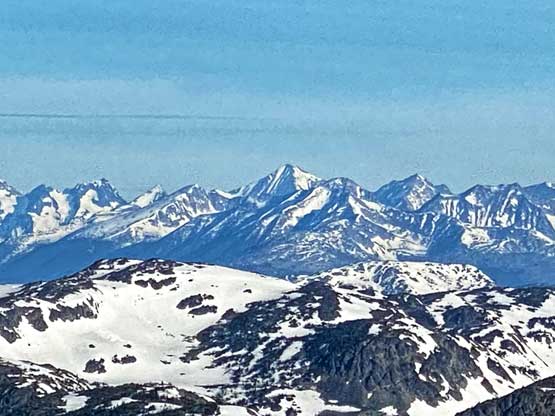
This is looking south into the peaks by Coquihalla Pass

Mt. Baker on the skyline to the south
A closer look at “Stoyoma’s Widow” with The Nipple and Mt. Laughlan behind
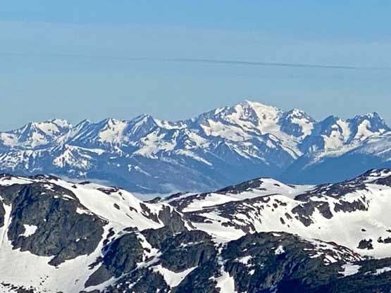
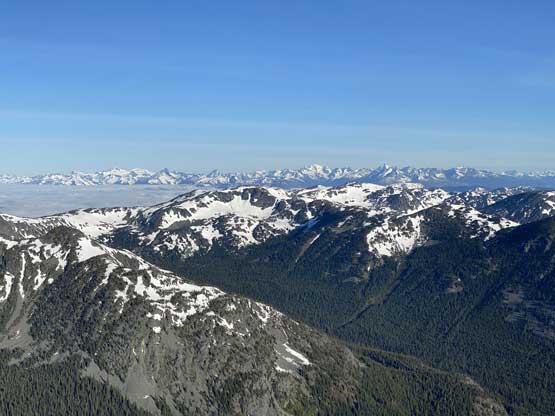
The mighty Skihist Mountain dominates every direction

Silvertip Mtn. on the skyline with the Anderson River Group poking on right

The Chehalis Group and Mt. Judge Howay poking above the low clouds
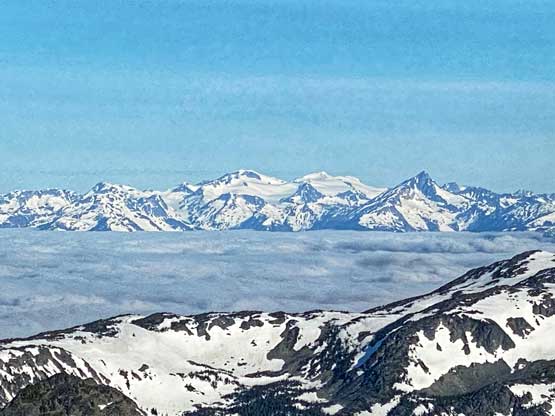
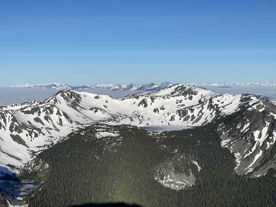
The remote peaks by Kwoiek Glacier area

Another photo of Mt. Urquhart
Petlushkwohap Mtn. is the second highest in SW BC

Mt. Outram on the skyline
Mt. Breakenridge and Traverse Peak on the skyline
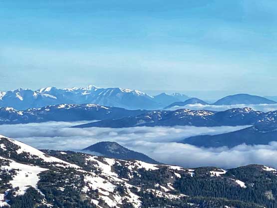
Mt. Brew on the skyline, looking north towards Lillooet

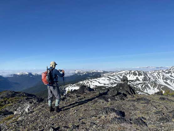
Me on the summit of Stoyoma Mountain
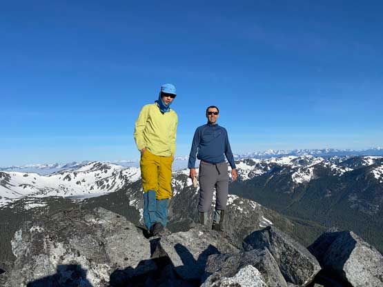
Vlad and I on the summit of Stoyoma Mountain
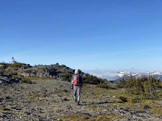
We took as many photos as could but the summit was a bit too windy and cold to linger without having the jacket so we made a leisure retreat back to where we ditched the backpacks. We picked up the packs without lingering and ascended up and over several intermittent bumps working south and then south-west towards the low points directly above Cabin Lake. The going was rougher than expected with some route-finding, a bit of bushwhacking, a lot of post-holing and of course, many frustrating up-and-downs…
Vlad starting the descent
Partway down the south ridge. Nice and easy…
On top of the next bump taking in the views

The ridge system here has a lot of small pools like this
Rambling ahead.

Me posing in front of a bigger melt tarn.
The ridge rambling between Stoyoma Mountain and “Stoyoma’s Widow” wasn’t as easy as the topo maps made it seem, but we did manage to keep a steady pace. Our next focus would be “Stoyoma’s Widow” and then Mt. Hewitt Bostock.
