Goat Ridge (Squamish)
December 23, 2020
1762m
Squamish, BC
This peak in the close proximity to Squamish offers some really nice views but needs a better name, despite the official status of this name. Goat Ridge just simply does not sound sexy enough. The most common route is from Murrin Park via Petgill Lake trail and the undulating west ridge. An unofficially maintained trail goes beyond Petgill Lake to the alpine although complicated route-finding in micro-terrain is still required. There’s another option that goes up the east ridge from Goat/Copilot col but that route reportedly requires 4th class climbing and doesn’t have a lot of information. The west ridge route from Petgill Lake can also be done in winter conditions on snowshoes as the terrain’s gentle enough that avalanche hazard is minimal (but not non-existent).
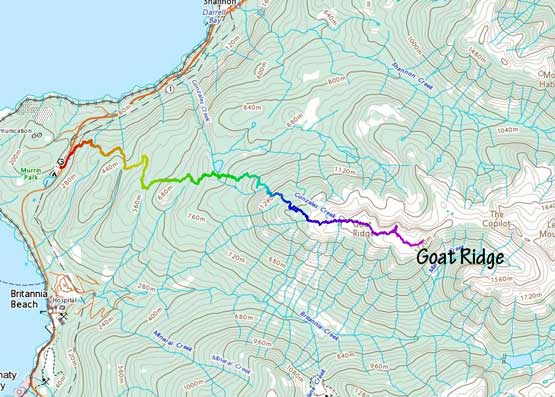
Goat Ridge via Petgill Lake Trail. GPX DL
I had been wanting to snowshoe this route for a couple years and finally made the spontaneous plan with Mel and Winnie on the second day of this Christmas break weather window. On the first day I just did some dumpster-diving on Galiano Island. There wasn’t a lot of walking, but fair amount of waiting and driving making a decently tiring day. The three of us agreed to meet at Murrin Park at 7:30 am. The drive was short enough that we decided to not carpool thank to the stupid Covid. We started the plod with head-lamps on for about 20 minutes. The trail-head is on the east side of the highway so we had to run across the road at the start. We then followed the Gaia map to correctly locate the trail-head. The first stretch of the trail had a few rocky and slippery steps. A few hundred vertical meters of gain later we merged out of the mature forest onto what seemed like an old logging road and followed this road for a few kilometers up. At about 550 m elevation the trail left the road into the forest again and the snow soon became continuous, but the snowshoes stayed on our packs until 900 m elevation, past Petgill Lake junction.

Just merging onto the logging road section

One of the handful creek crossings
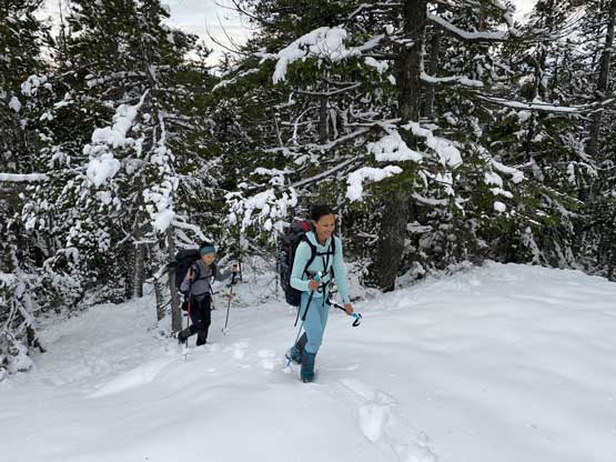
The snow finally became continuous but very shallow

We paid very close attention to not lose the trail.
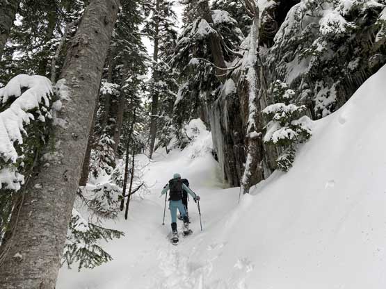
The trail was confusing and difficult to follow but there were enough orange markers and flagging that we were able to stay mostly on track. The trail was also difficult to hike on as the snow was deep enough to warrant the use of snowshoes, but not quite deep enough to comfortably snowshoe on, and the terrain was steep. The steepest stretch was around 1200 m where we had to ascend some 40 degree forest through bluffs. The snowpack was finally deep enough but the grade was almost too steep for our snowshoes. There’s only about 15 cm of fresh powder on top of a very firm base layer, which made some dedicated “technical snowshoeing” moves with some exposure. Beyond this technical stretch the slope grade eased but the trail-breaking took over. For about an hour we sank past knee deep on the uphill side making some tedious and slow progress. We did power it through and at around treeline we transitioned onto some wind-affected terrain and the trail-breaking finally eased.

The snowshoes were finally strapped on but the terrain was still thin

Tackling one of the “technical snowshoeing” steps

As you can see, the forest was very steep here
Past the steep shit. Winnie and Mel leading the way
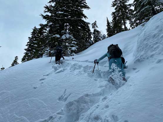
Horrendous trail-breaking on steep terrain for a while

Into the treeline zone.
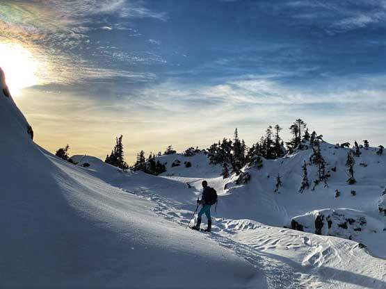
The route-finding through this treeline was frustrating as we were stopped by a few steep bluffs and were forced to backtrack with elevation loss. The theme of this trip seemed like up-and-downs. Some were avoidable with more careful route-finding but most weren’t. Upon seeing the upper route we decided to not follow the GPS track on Gaia and instead, picked a steeper but more direct line to gain the upper ridge. This stretch had some steep terrain but the condition felt good enough on this particular day. Once onto the upper ridge/plateau the views finally opened up. Unfortunately there’s a layer of high clouds blocking the sun but it also seemed like the clouds were slowly moving away. We plodded up-and-over and/or down-and-around several more subsidiary bumps to finally reach the true summit. We also decided to check out a bump/viewpoint that overlooked the steep north face.

Mel charging up on the steep zone above treeline

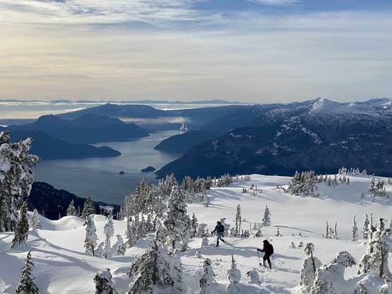
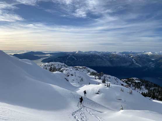
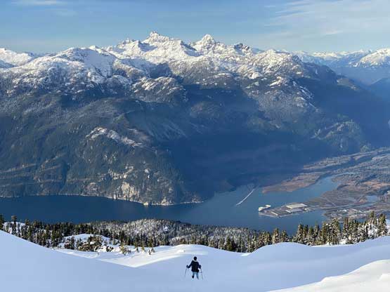
Our first unobstructed view down to Squamish and Howe Sound

The lower Howe Sound and the islands
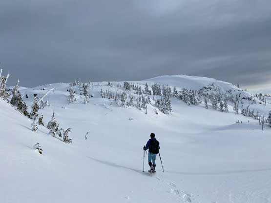
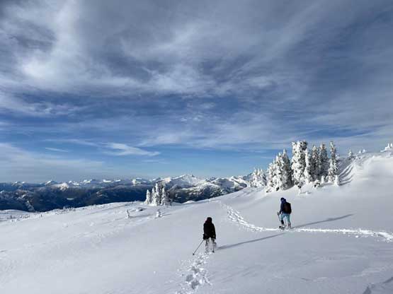
Mel leading the way on the broad and undulating west ridge

Mel and the December Sun

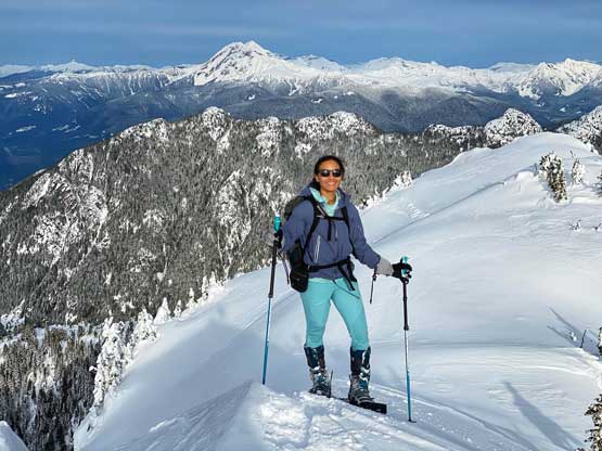
Winnie and I with Howe Sound behind. Photo by Mel O.
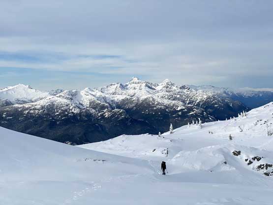
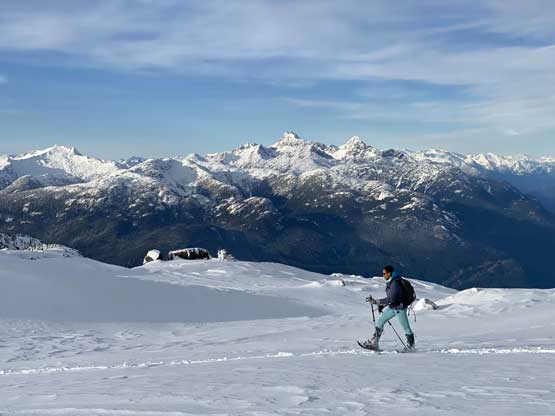
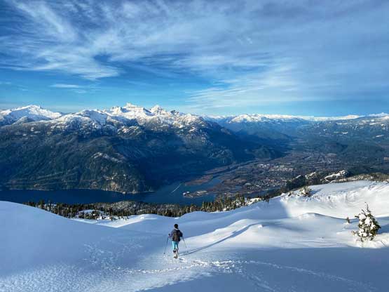
Winnie coming up gentle but never ending terrain with Tantalus Range behind

Mel charging up the last rise

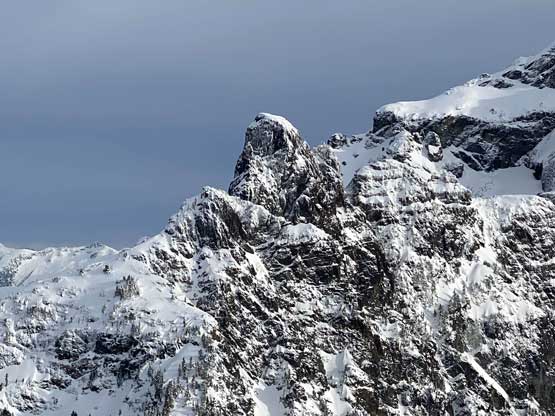
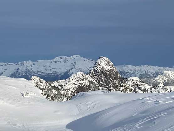
Sky Pilot Mountain and The Copilot

Partial Summit Panorama from Goat Ridge. Click to view large size.

Partial Summit Panorama from Goat Ridge. Click to view large size.
Mel on the summit of Goat Ridge with Mt. Garibaldi behind
A lower sub-summit in foreground with Squamish Valley behind

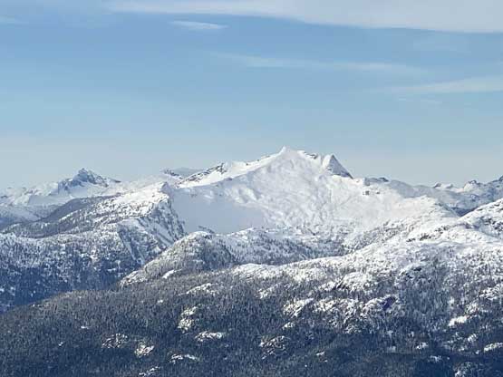
Mamquam Mountain looms behind Mt. Habrich
A zoomed-in shot of The Copilot
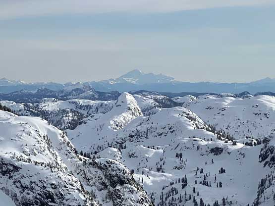
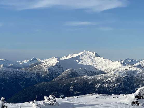
Mt. Baker dominates the horizon behind Ben Lomond

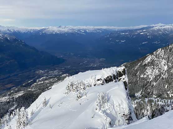
The north face of Cathedral Mountain in the Greater Vancouver Watershed
The Lions and Brunswick Mountain on Howe Sound Crest Trail
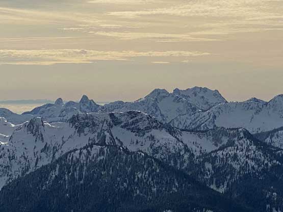
The SE Face of Mt. Sedgwick
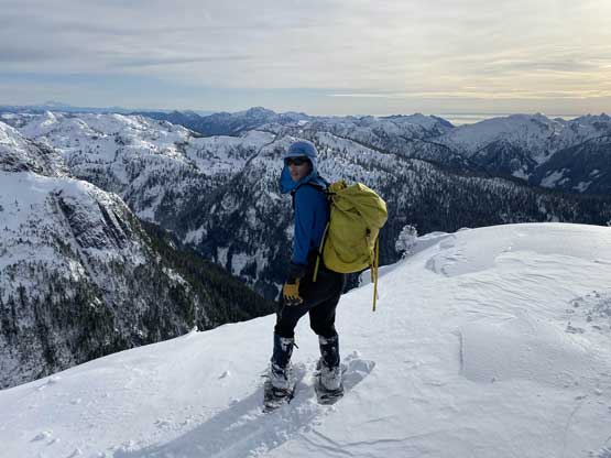
Me on the summit of Goat Ridge
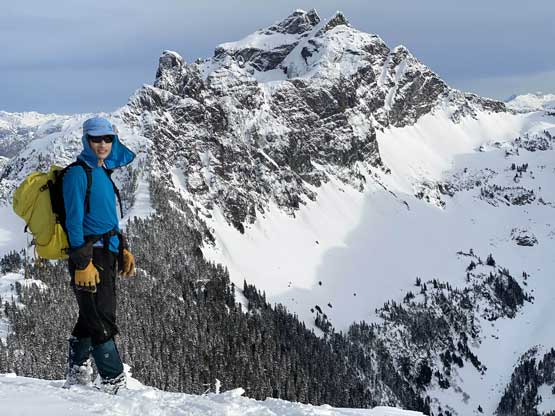
Me on the summit in front of Sky Pilot Mountain

Our group shot on the summit of Goat Ridge
The summit was a bit windy and cold so we didn’t linger too long. While descending the upper ridge the high clouds finally moved away giving some superb views. Mel and Winnie had set a blistering pace to descend so whenever I snapped a few photos I had to run to keep up. I still managed to take a shit ton of photos since the view was the reason why I came up here. There was no break once we descended back into the forest. The deep powder in treeline zone was uber fun to plunge and glide down but soon we came to that steep and icy stretch near 1200 m. Mel and Winnie did a few butt slide to clean the zone out in style. For the sketchiest section I did not feel comfortable glissading with snowshoes on and without an ice axe, so gingerly took the snowshoes off and down-climbed facing into the slope. We then raced down the next 500 or so vertical meters. I was struggling to keep up the pace probably because of my cumbersome 30′ snowshoes. Both Mel and Winnie had 22′ shoes. Once the snowshoes were off I took over the lead racing down the snow-covered-trail back to the logging road stretch. At this point Mel set our goal to finish the descent without having to use head-lamps. I was not keen but reluctantly agreed.

Time to start the long ass descent
Winnie plodding across virgin snow while Mel following the tracks

Mel and Winnie zooming down on a mad pace.
Mel plodding in front of Tantalus Range

Another photo of Mel plodding
Descending another roll with Howe Sound down below
The late afternoon sun had made some great lighting

A closer look at Mt. Garibaldi/Atwell Peak massif
Another view of Mt. Habrich in front of Mamquam Mountain

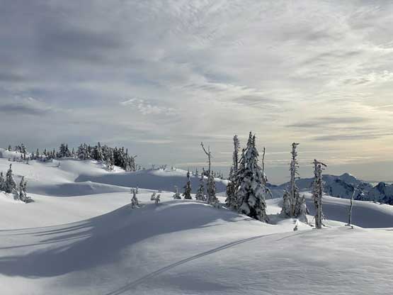
Looking back at the alpine terrain on the west ridge of Goat Ridge
Mt. Sedgwick now completely in sunlight

The Red Tusk, Mt. Dione/Mt. Tantalus and Alpha Mountain

The low-angled sun. It wasn’t even 3 pm yet…
Mel finally stopped for a photo here…
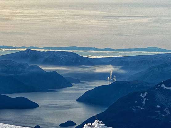
Port Mellon on Sunshine Coast emitting industrial smog

As you can see, we dealt with lots of micro-terrain and up-and-downs
I had to run to keep up with Mel and Winnie on the descent…
Mel plodding down with Squamish below
Another photo of Mel plodding with Mt. Tantalus behind
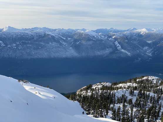
More about the Howe Sound and peaks on Sunshine Coast

Back to one of the tarns under treeline zone

Winnie plodding back across the same tarn

Mel taking a glissade despite the icy conditions

This stretch was very steep and needed careful work
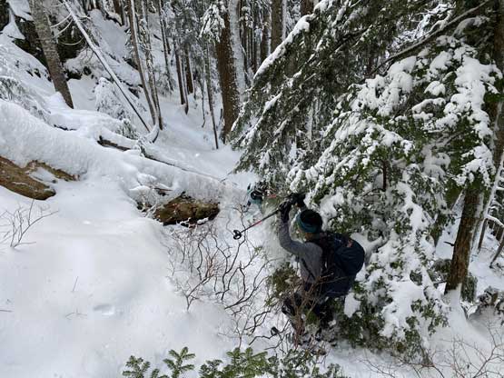
Winnie bushwhacking, her favourate sport…
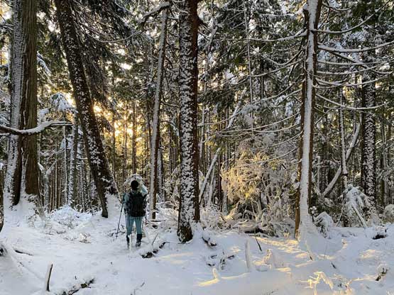
The evening light shone through the woods

As this point we sped things further up to beat head-lamp time…
We did manage to beat head-lamp time but barely. Our round trip time was 9 hours 10 minutes so a tad faster than anticipated. We were anticipating something like 13 hours given the recent dump of snow and others’ trip reports but I guess we did a pretty good job moving fast on this day.
