Sunwapta Peak
June 19, 2014
3315m
Icefield Parkway (North), AB
Although merely an off-trail hike, Sunwapta Peak is the 2nd highest in Alan Kane’s Scrambles in the Canadian Rockies. Most of the folks describe it as a true slog, especially the upper mountain, 1000 m of scree. Obviously that doesn’t sound very inviting to me, but objective wise, it’s a near-11,000er that guarantees to have a fine view in good weather. To make things more interesting I figured the best time to do it is spring or early summer when there’s still enough snow on the upper mountain. This past Thursday seemed like the right day when Doug Lutz asked me if I could take the day off. Being a hardcore scrambler Doug has done peaks like Mt. Vaux. We’d been talking to each other for a while via Facebook and finally got a chance to do a scramble together. He’s also the first scrambler I know from Red Deer, so on Wednesday evening we met near Highway 2/Highway 11 junction and carpooled from there.
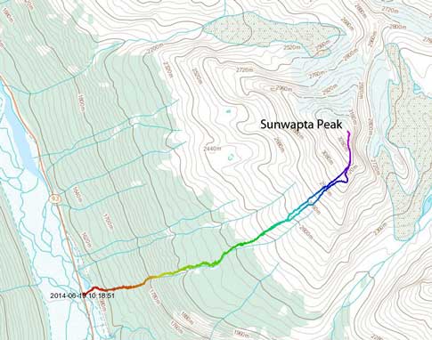
Sunwapta Peak standard scramble route. GPX DL
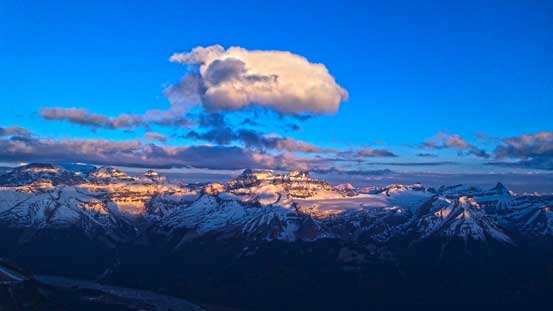
We arrived at the trail-head just before dark and had a good view of our objective. Apparently there was less snow but more mosquitoes than expected and we wouldn’t need to haul the snowshoes up. We spent some time finding the trail described in Kane’s book. It’s not very easy to find but pretty easy to follow, so we set the alarm at 2 am hoping to ascend most of the way up in dark. The prize for doing an alpine start is the gorgeous alpenglow view (in this case, alpenglow on Sir Winston Churchill Range and Columbia Icefield).
The ascent was more or less simply putting one foot in front of another. One big theme was foreshortening which we were mentally prepared. There’s more than 700 m vertical to gain in the forest even though the treeline appeared to be “right there”. I think it took us 1.5 hours or so. It was still pretty dark by the time we reached treeline. Higher up we started to encounter snow. Apparently there was some freeze overnight but not a full-depth freeze. The crust couldn’t support our weight and we post-holed knee deep. This kind of post-holing was even more tiring than in isothermal snow and our progress was slow. At the mean time we didn’t see a full-on alpenglow thank to the few pieces of clouds… But with the summit in mind we kept trudging up, keeping as positive as possible.
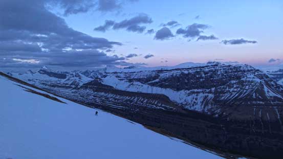
It was still pretty dark at this point. Can you spot Doug coming up the snow?

Me ascending the typical slope. Photo by Doug Lutz
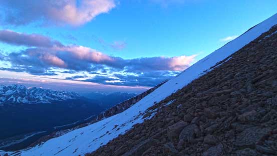
Typical, typical…
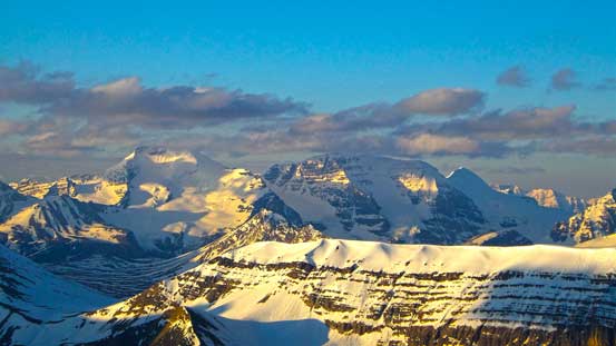
Alpenglow on Woolley and Diadem
A neat piece of cloud just above Woolley and Diadem

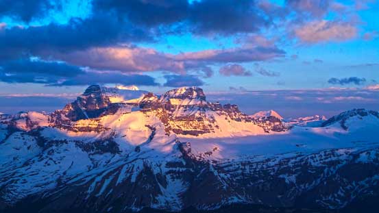
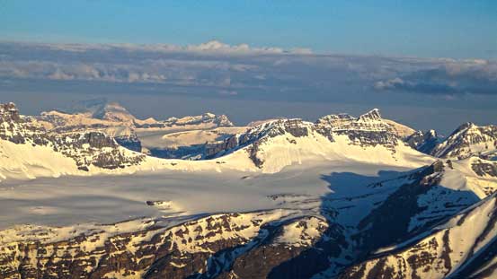
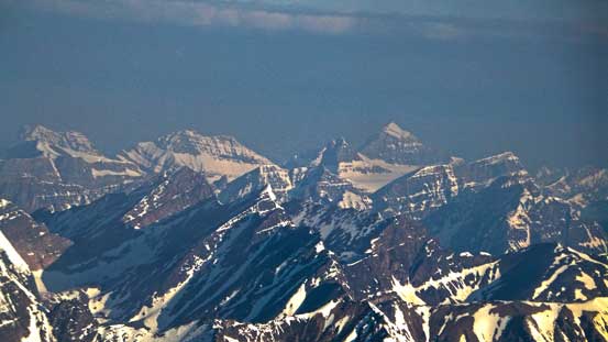
Stutfield, Cromwell and Englehard at golden glow
Thankfully the crust started gaining strength further up. At this point I aimed more or less directly up while Doug took a longer route to avoid snow for as much as he could. The upper snow field was just as good as I could expect, but that part was long. Eventually I reached the summit ridge. Looking over the other side I could see more clouds rolling in. At this point I was still quite a ways from the summit but I thought I could beat the clouds (thank to the foreshortened view). So I went up as fast as I could. The clouds and I arrived at the same time on the summit. The views were partially obscured but still pretty good. I waited for a while before Doug showed up on the summit.
Arriving at the summit ridge. Still a long way to go.
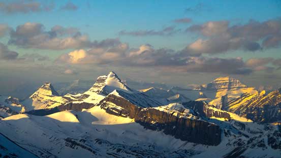
The northern end of Sir Winston Churchill Range
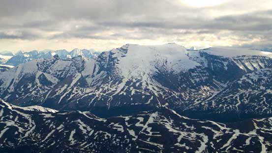
Neat, but typical rock pattern in the front range. Most of these peaks are unnamed.
I have great memories from Athabasca and Andromeda’s ascents.
Nigel Peak looks neat. Behind on right skyline is Mt. Saskatchewan. Both are on my to-do list.
Gorgeous morning sun light

Mt. Columbia poking behind Stutfield Glacier
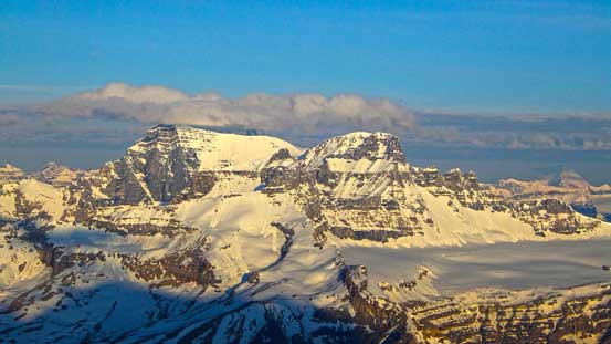
Woolley and Diadem are two of the easy 11,000ers that I’d wish to do this year.
Mt. GEC and Gong Glacier on Sir Winston Churchill Range

Gong Peak with Mt. McGuire in front, and Catacombs Mountain behind

Impressive Mt. Smythe
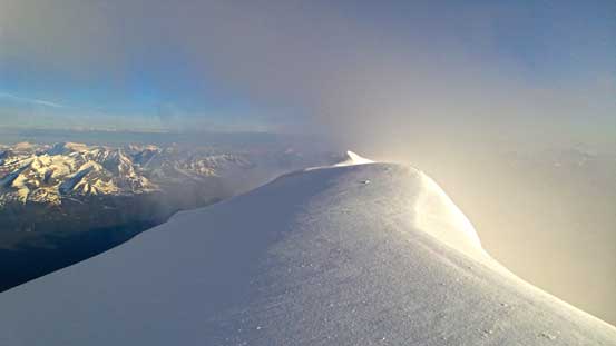
The last push to the summit

Summit Panorama looking west towards Sir Winston Churchill Range. Click to view large size.

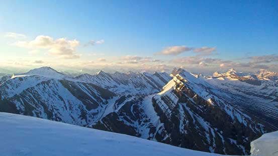
Summit Panorama looking east into the front country. Click to view large size.

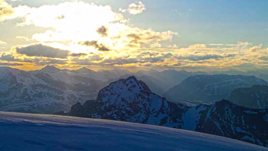
You can see the clouds were moving in.
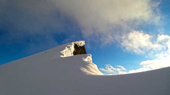
The summit snow hump.
Mt. Clemenceau is the 4th highest in Canadian Rockies. Ben and Liam bagged it this spring.

Catacombs Mountain is one of my favourite ascents.
Mt. Fryatt in the distance

Mt. Warren, Mt. Brazeau and Brazeau Icefield
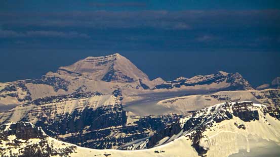
Poboktan Mountain. It looks very similar to Sunwapta.
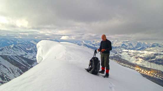
Doug on the summit
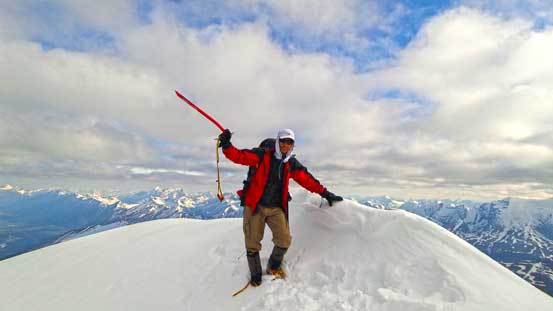
Me on the summit
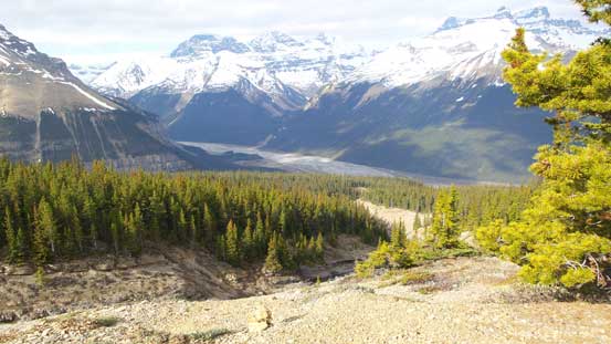
On the descent we tried to glissade the lower crusty snow. It was still faster than walking down but wasn’t very fun neither. Into the woods, we took our time investigating the nearby canyon/waterfall that we missed on the ascent. Our round trip time was 7 hours 40 minutes and it was only 10 am when we arrived back at the car.

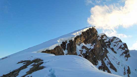
Me checking out a cornice on the descent. Photo by Doug Lutz
Into the woods. It was very hot at this stage
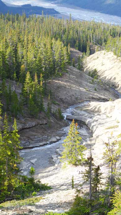
A nearby creek and canyon

Looking back towards the summit
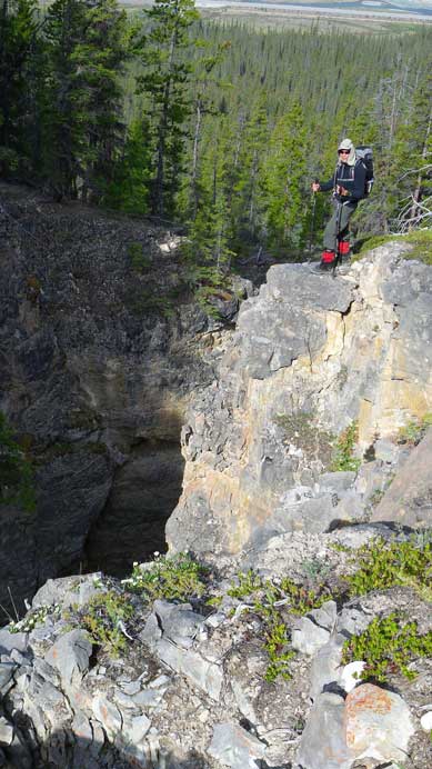
Doug checking out the canyon
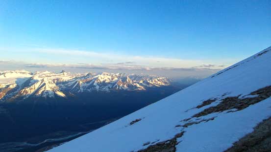
Looking back from highway. The view is very foreshortening
Doug suggested ascending Coral Ridge in the afternoon. I certainly had the strength to do that but considering the potential big trip 2 days later, I shouldn’t exhausted myself. So we went up Hoodoo Creek for some hands-on scrambling before driving back home. All in all, a great trip in the Rockies again.

We hiked up Hoodoo Creek for some fun stuff in the afternoon
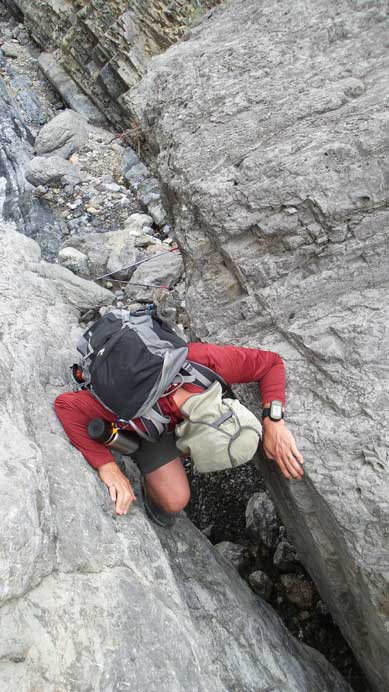
Doug trying to down climb this crack

Me playing around a boulder. Photo by Doug Lutz
