Gideon Peak and St. Jacobs Mountain
October 29, 2023
2560m
Pemberton / Van Horlick Creek, BC
“Gideon Peak” and “St. Jacobs Mountain” are two of the highest peaks in the remote “Bible Group”, accessed from logging road systems in the headwaters of Van Horlick Creek. These peaks are not often ascended. There are a few reports on bivouac.com and ClubTread documenting several routes from the north-east but those reports are well over 10 years old, so who knows the status of the access roads. Luckily about a year ago Matt J. had noticed some new logging activities on the west side through browsing the up-to-date satellite images (Sentinel Hub playground). Matt subsequently went out to test the theory and made a smooth ascent via his experimental route. This route does require substantial amount of bushwhacking, but the shortness and the lack of technical difficulties means it’ll become the new-standard route as long as the road stays in a drivable shape. The area is incredibly scenic and it took us only 3 hours to make the ascent of “Gideon Peak” on a not-so-rushing pace. Matt only did “Gideon Peak” because that’s the higher of the two, but I wanted to make a traverse to the nearby “St. Jacobs Mountain” to make a loop. The traverse is rarely done but I was confident to make it work as I had a few route options in my mind.
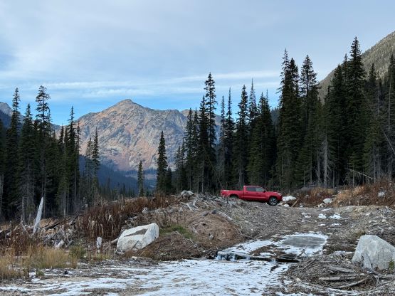
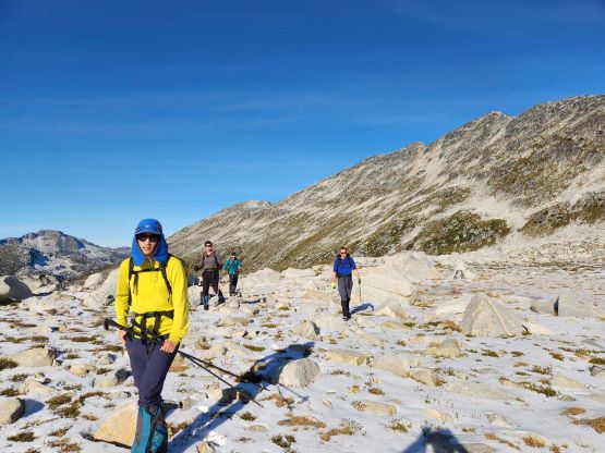
About a week ago Chris G. and I were planning this outing to take advantage of another high pressure system in this autumn. The area had received some new snow but I had been closely watching the webcams and the weather forecast. There’s even an update in the Sentinel Hub playground showing the current satellite images after the recent precipitation, that the access roads were still free of snow. The fresh snow would surely make the scrambling more challenging, but this is barely a 3rd class route anyhow. Rex, Vlad and Sean P. joined the team at the last minute and the decision was to take my Tacoma as this was the only vehicle capable of off-roading and transporting five people. I decided for us to meet at the church at 5 am in order to be hiking right after sunrise. The drive was longer than I thought as we encountered water bars right from the beginning of Van Horlick FSR. The second half of the road wasn’t even shown on the Gaia topo nor the satellite layer, but was obvious enough to navigate. After turning onto the last spur we encountered numerous enormous ditches in addition to one substantial wash-out. A few of the obstacles necessitated me to get out to inspect, but I managed to drive us all the way to the road’s end at the start of Matt’s GPX track nevertheless.
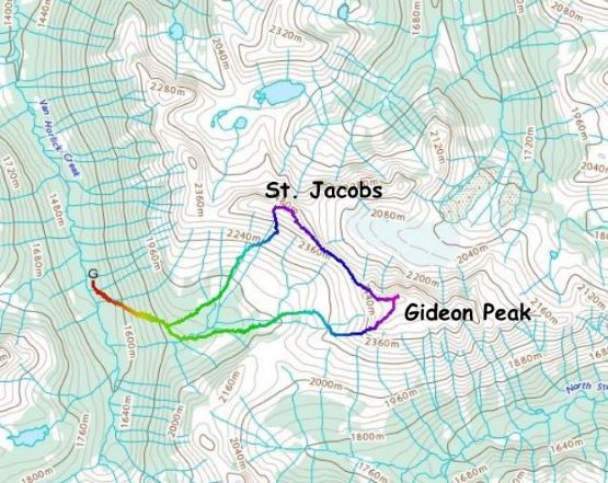
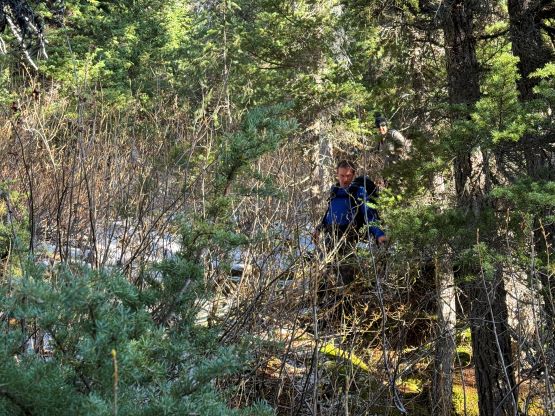
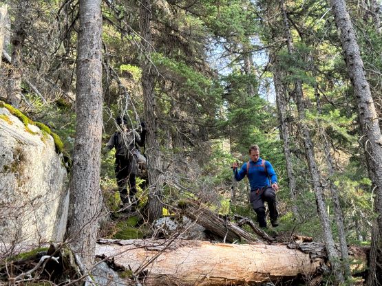
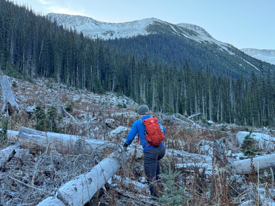
There’s about 400 vertical meters of bushwhacking and I too was surprised by the thickness given that the area hasn’t been logged in the past so this isn’t a secondary growth forest. There wasn’t anything thorny nor abundant amount of alders, but we had to fight the underbrush for pretty much every single step upward. Usually the worst of the brush was in the initial cut-block but the forest was not any better on this approach. The fact we must maintain a rightwards diagonal bearing did not help neither. Rex F. does not have a lot of experience in bushwhacking so I stayed back with him, and we regrouped not far from the treeline. The bushes finally gave way to a semi-open hanging valley. Matt had commented about the bogs and marshes in the middle of this valley and as a result he opted to hop on boulders on the far climber’s right side. The condition for us was the exact opposite. The boulders were covered in a thin layer of snow, whereas the wetlands were mostly frozen. We made the in situ decision to plod up the middle of this valley to as high as we could, and only to hop onto the SW Ridge for the scrambling sections.


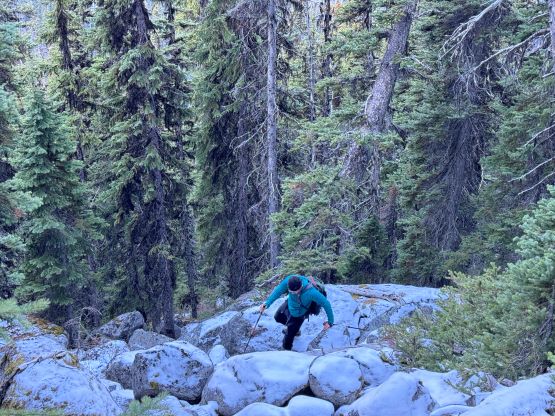

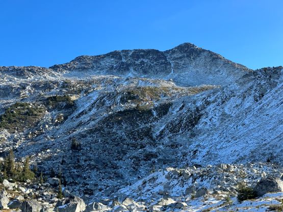


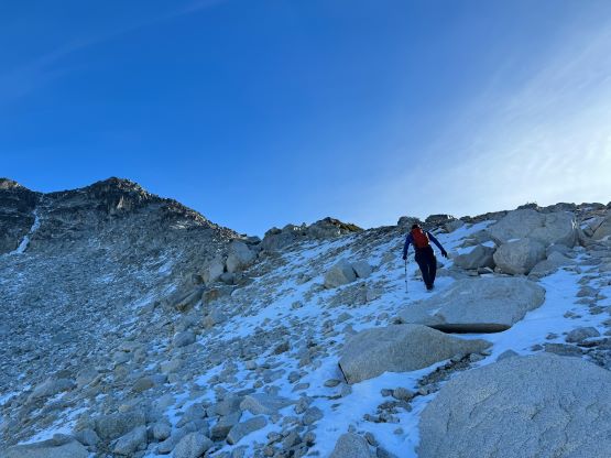
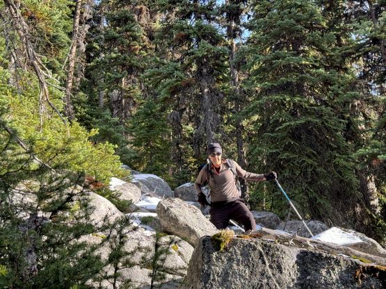
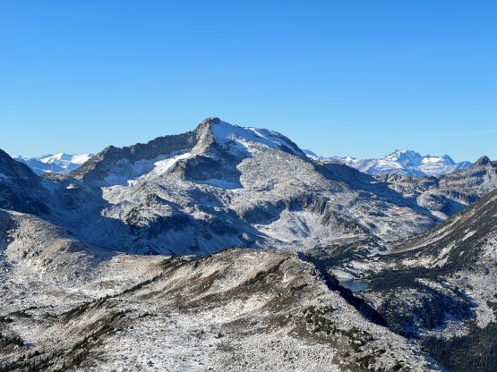
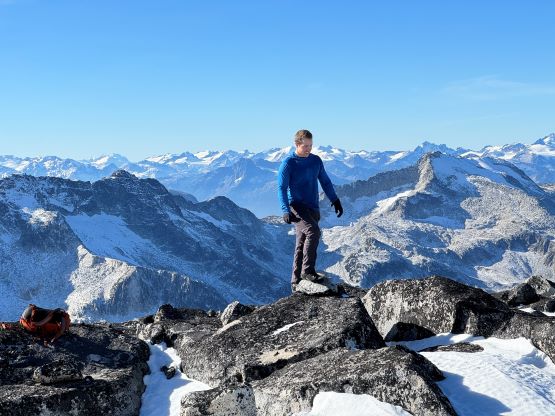
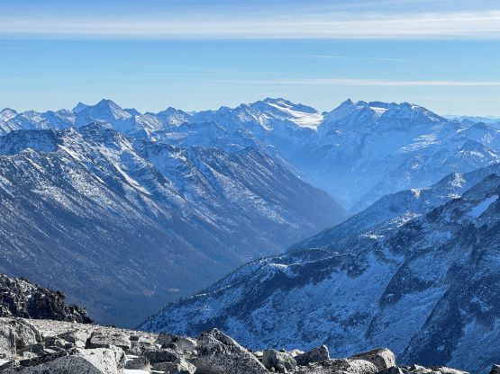
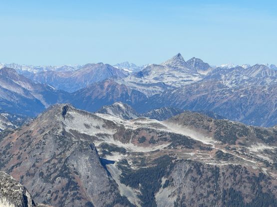
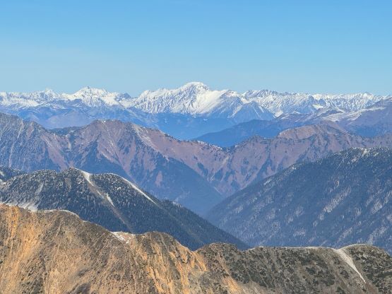
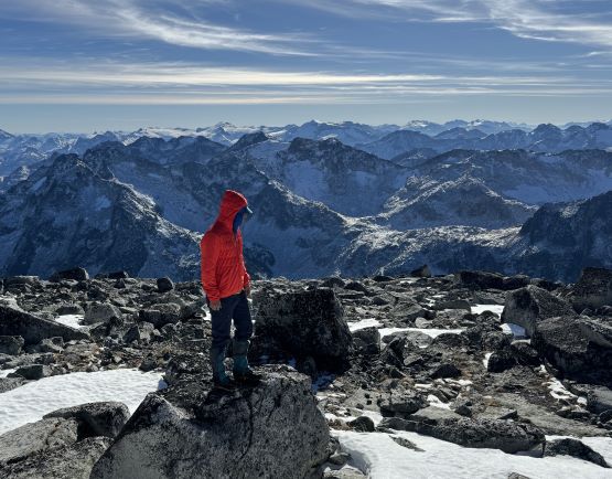
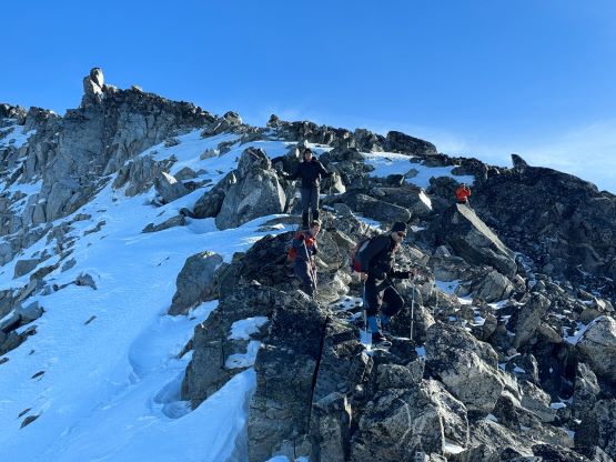
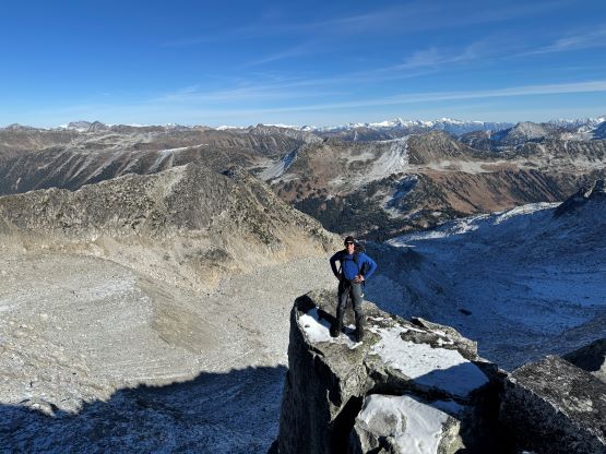
The SW Ridge scramble was basically as expected. There were some 3rd class moves that might or might not be mandatory. I was ahead with Chris and we on purposely stuck closer to the ridge crest for some 3rd class fun. I could not comment on the possibility to bypass those scrambling steps as I was not particularly looking for a bypass anyway. To keep up with Chris also required me to be 100% in my elements so I didn’t even take many photos. Before realizing we had gained the summit plateau with the true summit not far ahead. The views were magnificent towards all directions thank to the crystal clear skies in the late fall. We could see from the very tip of Mt. Judge Howay all the way to the giants in the southern Chilcotins. I wished I did not have to work so I could take more advantage of this incredible high pressure system. The temperature was balmy enough that I could stay on the summit in just t-shirt.
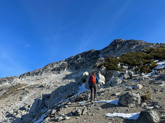


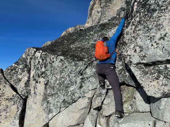


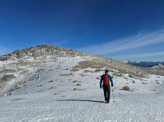
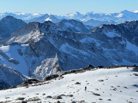
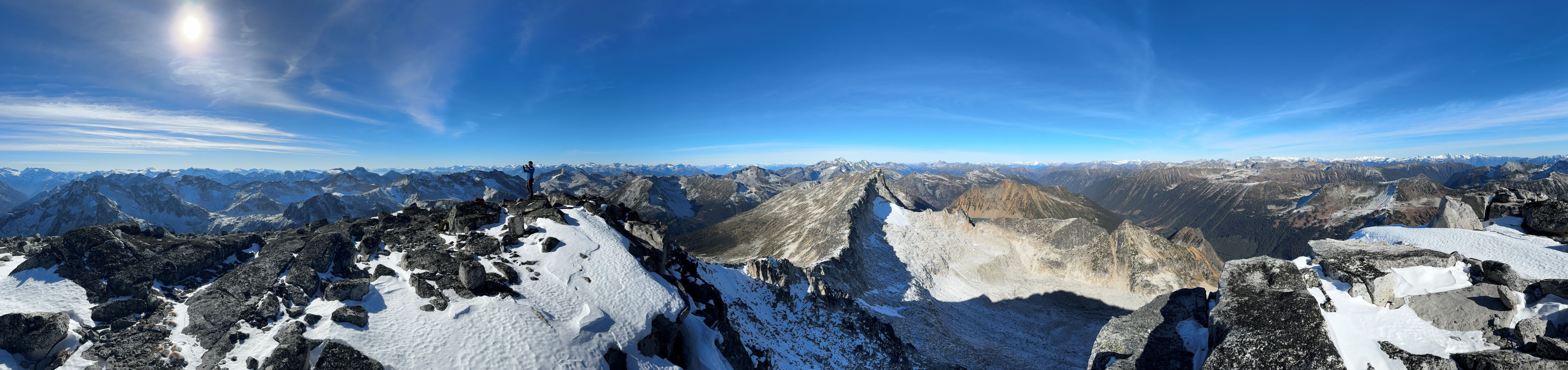


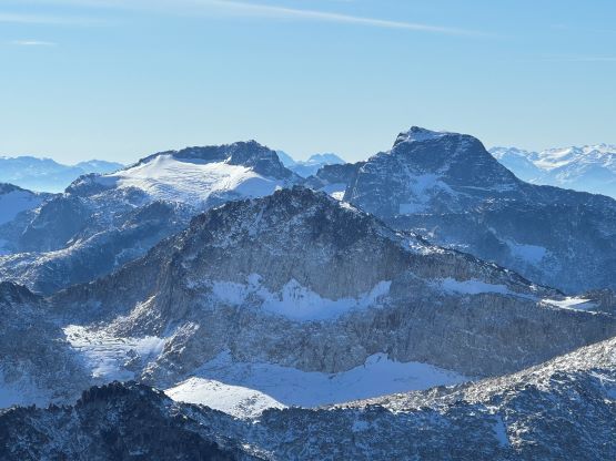


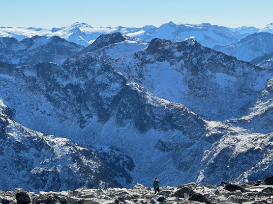
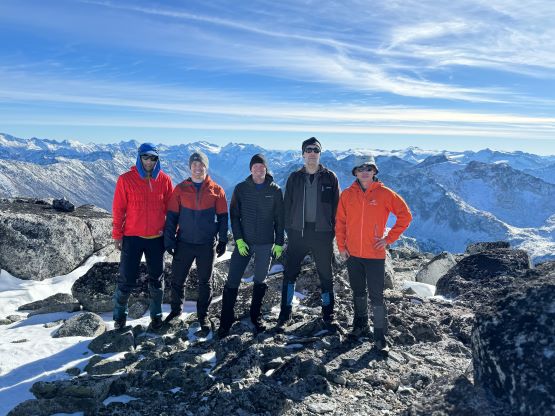
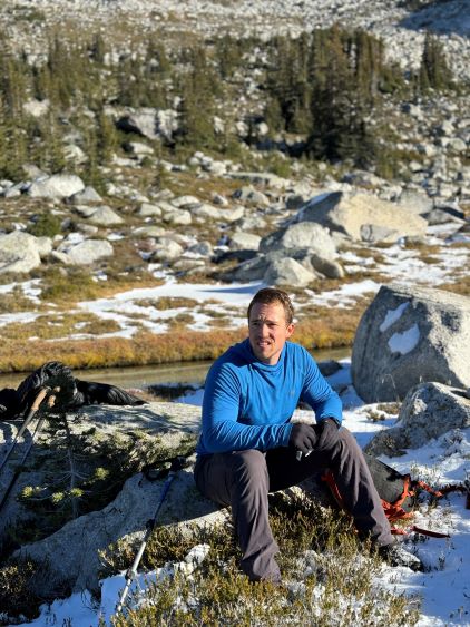
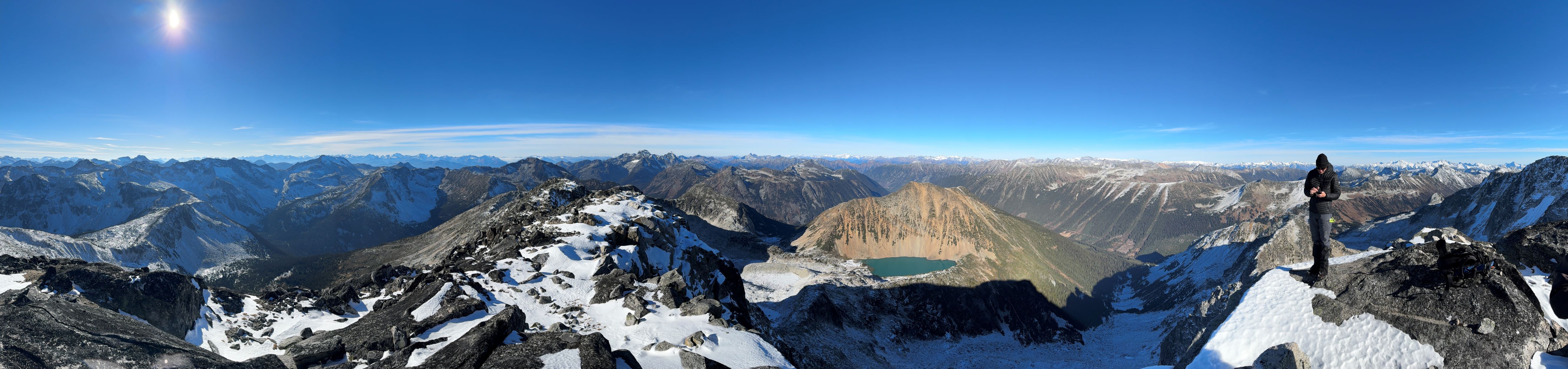
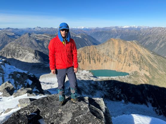
We stayed on the summit for almost an hour soaking in the views and socializing but eventually it’s time to move on. The amount of snow was less than expected especially on the south-facing slopes, so the final decision was made to attempt the direct ridge traverse over to “St. Jacobs Mountain”. The ridge appeared bluffy but we were in for the exploration. Descending the NW Ridge of “Gideon Peak” involved one somewhat interesting 3rd class step but Vlad and Rex in the back of the line found a bypass on skier’s left. Rex decided to skip the secondary objective in order to focus more on the descent and the bushwhacking so we would eventually regroup at the truck. The four of us then continued onward onto the SE Ridge of St. Jacobs Mountain. The scrambling would be 3rd class at the maximum but a few of us were keen on bouldering. We found as many 5th class steps as possible to challenge each other and in total we did at least 5-10 difficult steps. I skipped the last few steps as those were longer and more exposed and I was getting tired from the lack of sleep. I showed up in a Halloween party until midnight in the previous day and I got at most 2 hours of sleep. In any case we attained the summit and this peak offered better views of Midian Lake to the north.

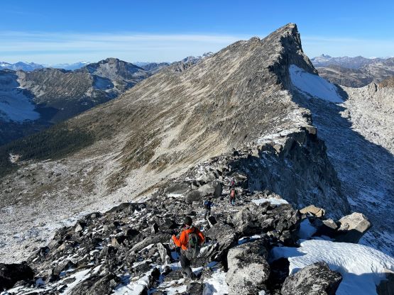


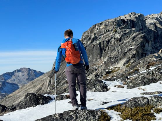


Not doing a ton of lingering we continued traversing to the west ridge to access a loose gully that was visible from earlier in the day. We had already decided to descend this gully to get back into the alpine bowl between the two peaks, and the gully was even easier than expected. There are infinitely many lines that could work after exiting the scrambling terrain and we picked our way entirely based on what we saw in field. The initial plan was to stay high on skier’s right to avoid the green zone but the side-hilling was more tiresome than expected. We then located a creek/chute and descended into the bowl, but staying above our route in the morning. There were plenty of water sources so we took another break loading up the water bottles. Eventually we entered the thrashy zone and rejoined our own route. The rest of the descent was not very pleasant, but not too bad as thrashing down with the underbrush was not that big of a deal. I bushwhacked with my hat and sunglasses so I had less concerns of poking my eyes. At roughly 50 m above the cut-block we caught up to Rex and our round trip time was just over 7 hours. The drive home was long and exhausting, but I somehow managed to stay awake and alert and drove us all the way back to Vancouver with one stop in Whistler for food.