Mount Saskatchewan
August 11-13, 2015
3350m
Icefield Parkway (North), AB
The mighty Mt. Saskatchewan is a giant just to the south of the immense Columbia Icefield. At marginally under the magic number of 11,000-feet this peak isn’t nearly as high as some of its neighbours (Mt. Columbia, Mt. Bryce, The Lyells to name a few), but it’s a truly recognizable peak from almost every vantage point in its vicinity. Over the past 3 years or so I’ve ascended pretty much all the major ones surrounding Mt. Saskatchewan (with the exception of Amery group), so needless to say I’d like to eventually stand on top of this giant sooner than later. With some perfect weather and conditions shaping up towards the Wednesday of this week I just had to ascend something “big”. Unfortunately I couldn’t have a full day on Tuesday to approach some of the bigger objectives and friends were either going for 11,000ers or having to work, leaving myself figuring something else to do solo.
The inspiration for an ascent of Mt. Saskatchewan mostly came from Eric’s trip report. It took him 3 attempts via various routes to solve the problem and the conclusion I got was to use his “Valley to the North” to approach rather than the traditional Terrace Creek or the Saskatchewan Glacier. Though with some unavoidable elevation loss and regain, this is the shortest (half day) and avoids glacier travel all together. Having 2.5 days meant I’d also have opportunities to ascend some of the nearby peaks including Saskatchewan North Towers and/or Terrace Mountain. The ascent would be up the SW Ridge which has two short stretches of 5.4 climbing. To avoid down-climbing them I brought a 30-meter rope, a few pieces of pros and a bunch of slings and webbing.
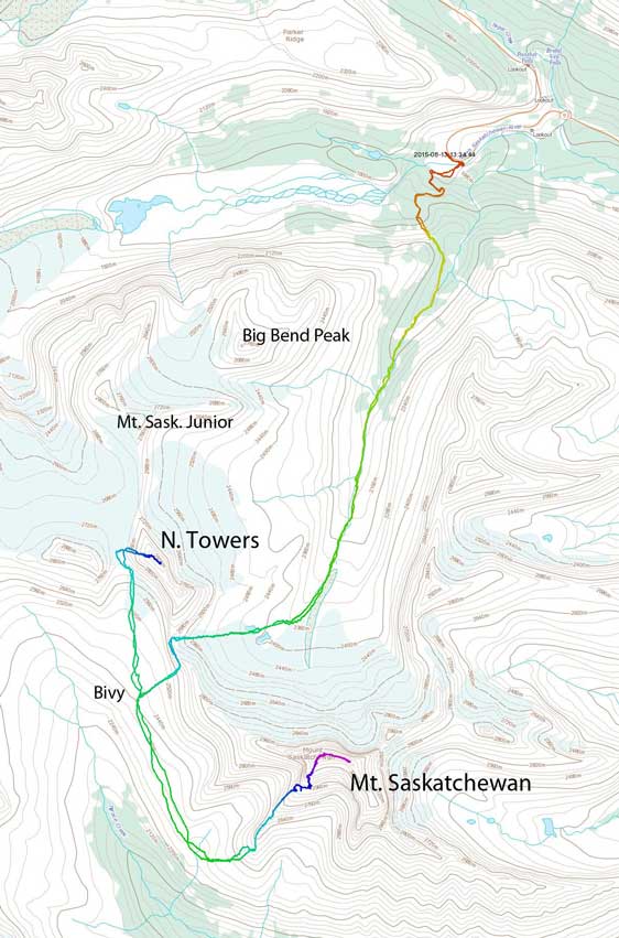
Ascent route of Mt. Saskatchewan and its North Towers. GPX DL
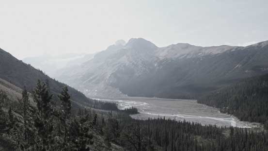
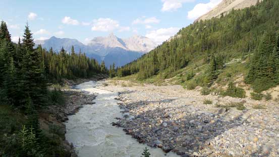
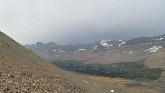
I arrived at the Big Bend parking lot by late afternoon and started the trek shortly after 5 pm. For the initial section I challenged Eric’s route and went for my experimental choice. The first major variation was to avoid the 1 km (one-way) hike on an old abandoned road by fording the N. Saskatchewan River (a major river crossing). It’s flowing fast and high but by crossing at a braided section it’s only slightly higher than knee deep – definitely not any easier than the road-walk but did save me time. The second variation was to follow Big Bend Peak’s scramble route to crest a treed shoulder before descending ~50 vertical meters in open forest, rather than bushwhacking from the start. The open scree slope by Big Bend Peak gave me a bush-free line to go up high so despite the extra height loss I figured this might be able to shave more some time off my approach. And once down to the unnamed creek/river my route merged to Eric’s, following the “valley to the north of Saskatchewan” upwards and onwards.

The N. Saskatchewan River from Big Bend.

Ascending open slope towards Big Bend Peak’s shoulder
Looking back I could see the broad Saskatchewan Glacier’s valley
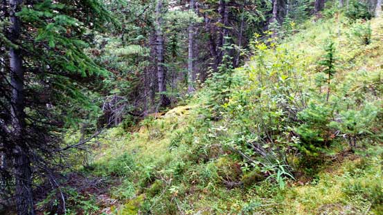
Light bushwhacking is unavoidable no matter how you approach this
Down to the unnamed creek/river by “Valley to the North” now.
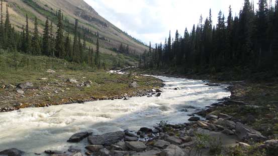
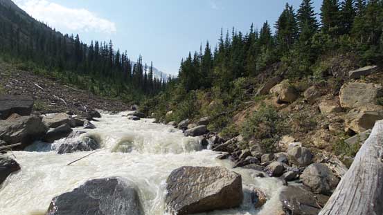
Following Eric’s advice I stayed just to the climber’s right of this unnamed creek/river to avoid bushwhacking. The bush beside the creek did not look very friendly with lots of underbrushes, some alders and tight timbers. Unfortunately there were still a few places that I had to bail into the forest thank to either tight spots or canyon-like features. There were at least 4 or 5 canyons I passed by. Taking pictures of them was cool but I didn’t want to risk slipping into the canyons by going too close. The edges were generally down-sloping and wet and a slip into the canyon would for sure be fatal (even with friends nearby to help). To bypass the tight spots the bushwhacking was as expected, pretty ugly but thankfully they were short-lived. For the most parts I managed to stay directly beside the creek (with a place or two traversing on ledges of no wider than half a meter)…

The same river/creek.
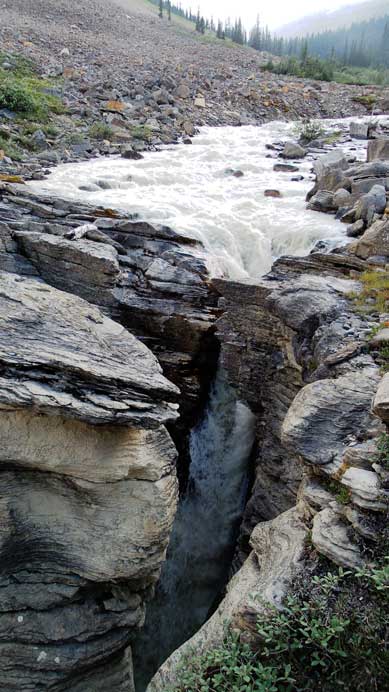
Lots of cool canyons like this
The water was too muddy to drink but there’re clear streams coming down from the sides
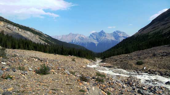
Exiting the trees. My objective looming behind
Looking back from just above treeline
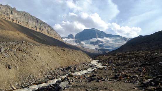
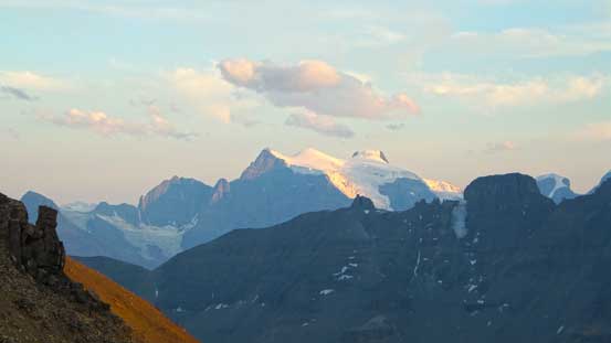
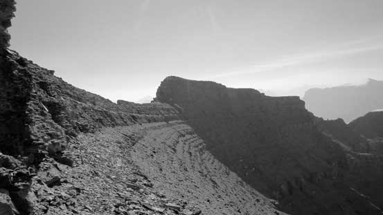
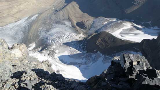
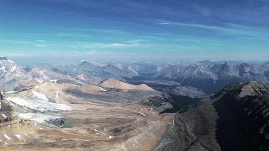
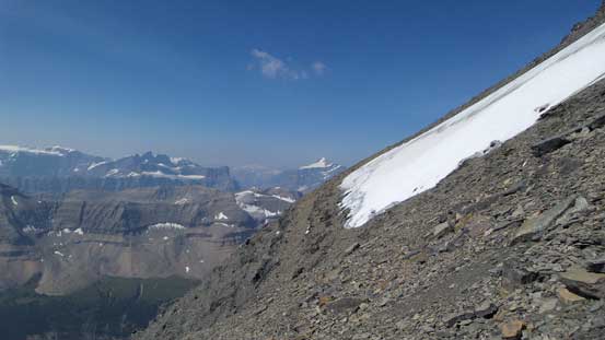
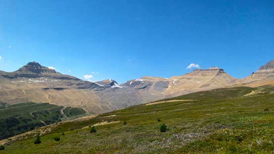
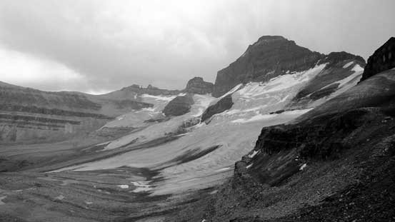
It took me quite a while to reach treeline and it’s here that Eric’s group ascended a scree slope up climber’s right side towards the glacier below North Towers. I challenged Eric’s route again and by studying the topo maps it’s obvious that I could keep following the main creek until pretty much close to the glacier below Mt. Saskatchewan before taking a rising traverse line towards climber’s right. This route looked more gradual so I opted for it – pretty much as expected, generally easy travel with some side-hilling and rubble slog, but nothing terrible. The N. Face of Saskatchewan was directly on sight for this section with the striking Cleopatra’s Needle stealing the show looking leftward. There’s also fresh water sources coming down from climber’s right side along pretty much this entire section saving me from carrying unnecessary weight. Up the slope aforementioned I arrived at two beautiful tarns and ahead would be the long flat rubble bench leading towards the final slog to SK/NT col.

Higher up in this valley

Looking up the sides. Cleopatra’s Needle in the distance
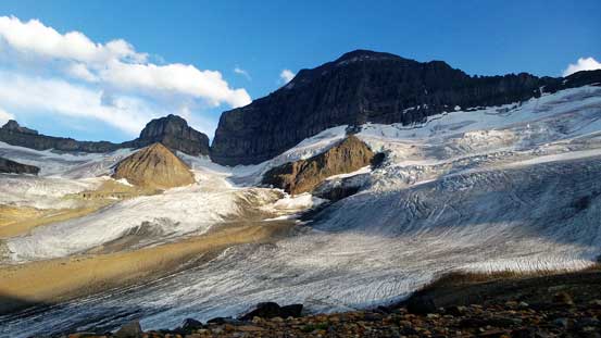
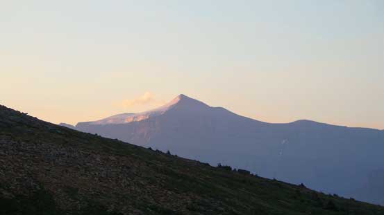
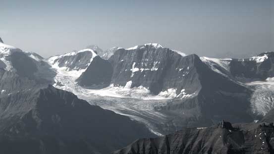
Mt. Saskatchewan and its north glacier
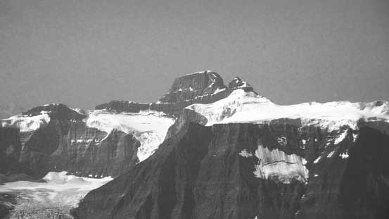
The peak at center is known as “Spine Peak” according to Andrew Nugara’s snowshoe book

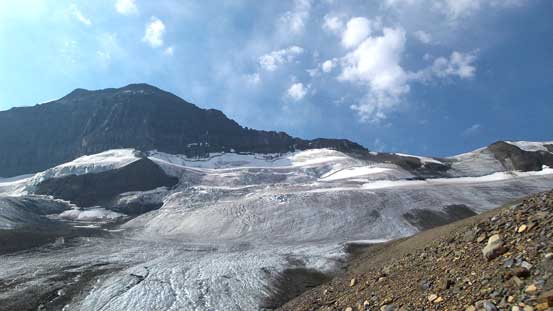
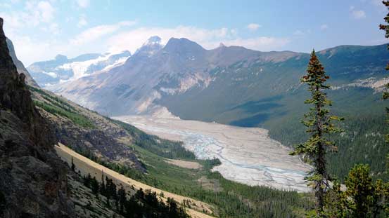
Very fractured glacier by Saskatchewan’s N. Face
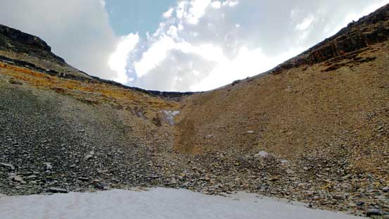
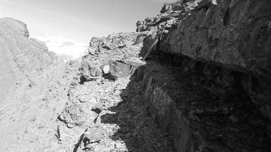
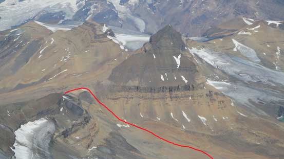
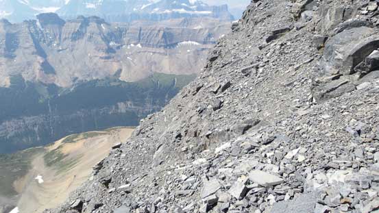
The slog to SK/NT col was not so much fun though – foreshortening and mostly on very loose ground. The terrain was actually a rock covered glacier so that explained why it’s so loose. The other side of this high col was a shear drop-off but the terrain far to the skier’s left (south) looked easy. The way to descend was by continuing uphill along the ridge crest (towards Mt. Saskatchewan) followed by an exposed scree ledge traverse. This dumped me at the big pile of loose rubble with the bivy site visible at somewhere 300 vertical meters down the slope. Descending this pile of rubble was not fun though as it’s mixed with sections of moraine-like concrete-hard dirt, but the reward of finding a 5-star bivy site was waiting for me ahead. This site was quite unique with a stream of water leaking from the ground and a nice, grassy flat bench for tent or bivy sack. It took me 4.5 hours to get here from the parking lot.
The tedious slog to SK/NT col

Another look at Mt. Saskatchewan from the slog up to SK/NT col

Spine Peak and a higher, but unnamed peak
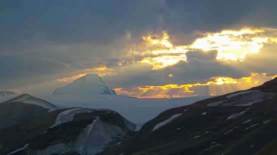
Cresting the col, I got treated with some great lightings!

Castleguard Mountain in evening light
Lyell I, II and III on evening glow
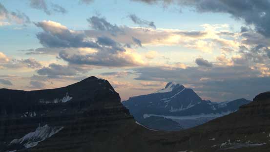
Rising behind the shoulder of Terrace Mountain is the mighty Mt. Bryce
A short and (sort of) exposed scree ledge traverse
Then, frustrating 300 vertical meters of elevation loss on rubble pile….
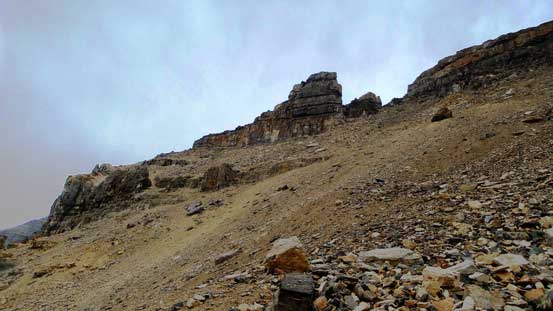
On the second day I woke up by 5:30, had a quick breakfast and off by 6 am. The initial business was to descend (yes, descend) another 100 vertical meters or so down a grassy ledge to the SW Ridge. There’s a false ascent ridge before the SW Ridge proper that could be confusing for folks not doing research or without a GPS unit. Thankfully I didn’t make that mistake so dropped into the bowl between the two ridges and up the far side. I ditched ice axe and crampons as the route appeared to be bone dry and continued onwards. The lower ridge had a loose section to bash up that felt tedious. I chose to ascend more to the climber’s right that had relatively solid(ish) rocks and opted for a rock band rather than the treadmill scree. Then the next section was pretty much an easy plod along the ridge crest with occasional detours on the right (south) side. A long while later I reached the 1st cliff band.

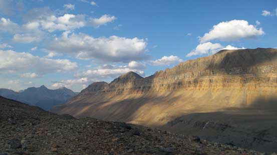
The summit of Terrace Mountain catching the first bit of sunlight
Mt. Amery on alpenglow
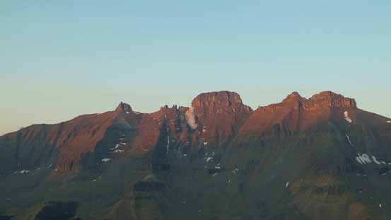
Alpenglow on The Castlelets – an interesting looking summit

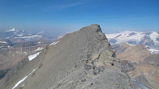
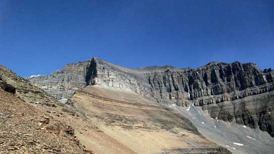
Looking ahead to the SW Ridge route
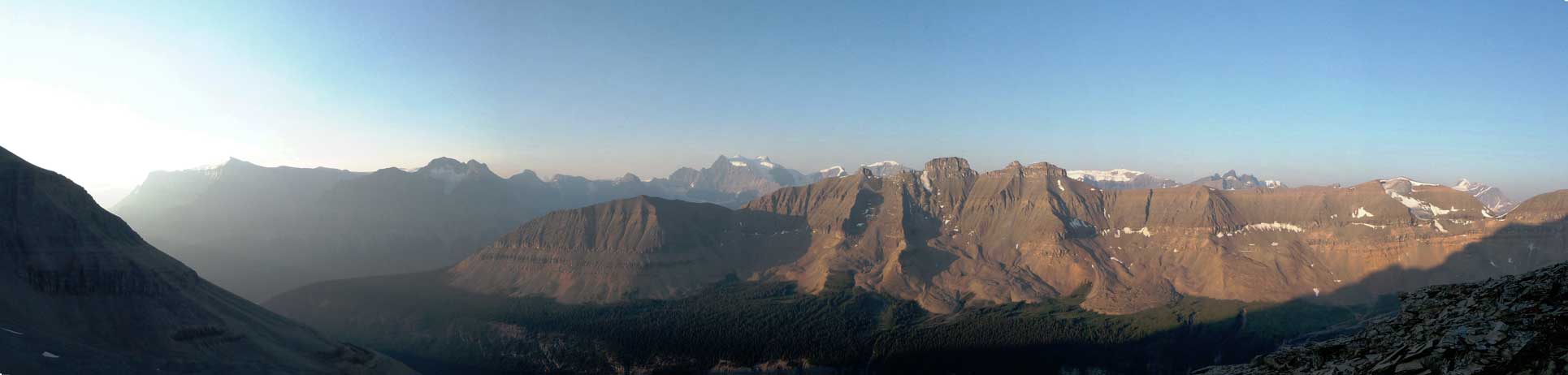
A panorama from partway up the easy section of the ridge. Click to view large size.

The three peaks on Mt. Lyell
This is Mt. Spring-Rice.

Oppy Mountain (a near-11,000er) with Farbus Mountain to its left

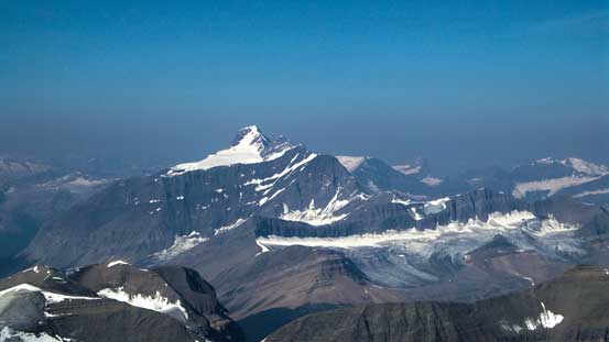
Mt. Columbia looms behind Castleguard Mountain
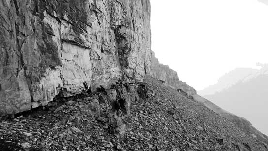
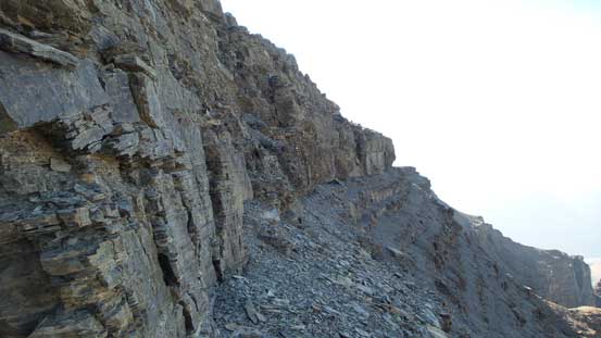
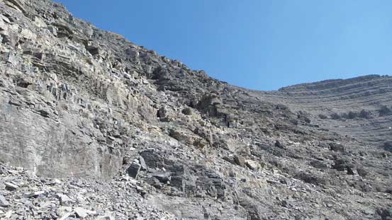
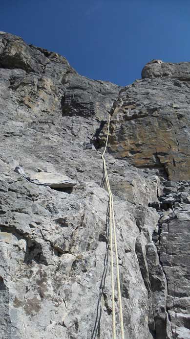
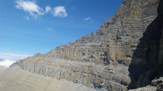
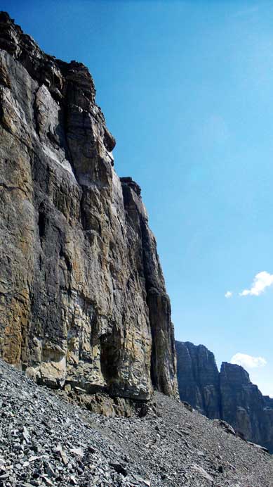
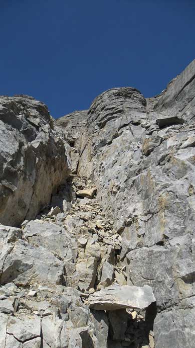
The break through the first cliff band was fairly obvious at roughly 20 meters to the climber’s right. It’s an obvious gully system that “didn’t look bad” from up-close. The rocks were loose but the terrain never exceeded “difficult scrambling” as I made my way slowly upwards. I exited the band on climber’s left and found rappelling cords (on a big boulder) indicating previous parties not comfortable down-climbing this section. The hard stuffs were yet to come! Here came the second cliff band. The break was roughly 50 meters to the right of the ridge proper as I traversed underneath the band. It’s easy to spot but the terrain was looking considerably harder this time. By carefully picking my way up there’s still two cruxes – the first one was a tight chimney with the climber’s right side being overhanging and the second crux was around a corner, an exposed vertical wall with not-so-good holds. Both sections were only 5 meters high but felt awkward, and in between there’s an exposed ledge traverse with a few awkward moves involved.
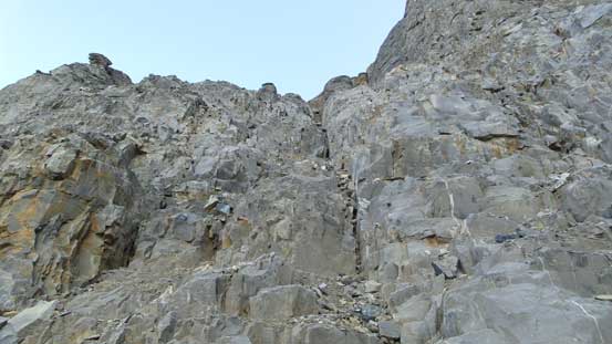
Ascending the first cliff band up a gully system
Traversing beneath the second cliff band
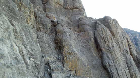
Here’s the second cliff band

Looking down from just above the crux…
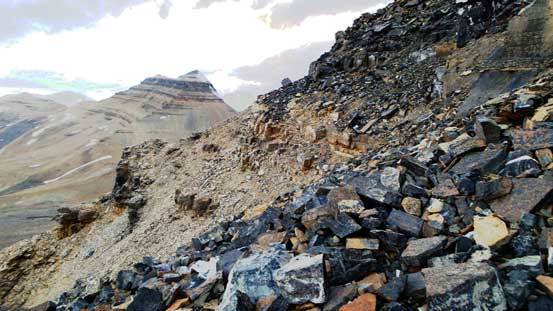
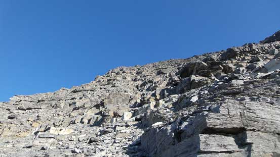
Above the second cliff band I ditched my technical gears as the terrain above was supposed to be scrambling only. The section immediately ahead was a long series of short rock bands separated by nothing but Rockies’ choss. All of those rock bands were easily ascended with route-finding but did require a bit of zig-zagging and quite a bit of route-finding. Upon getting close to the summit ridge the terrain started to level out and the ground slowly transitioned to treadmill scree. I bypassed the false summit by side-hilling on a scree ledge and gained the final summit ridge at false/true col.
The terrain immediately above the crux – very loose

Higher up on the slope, looking towards Mt. Bryce
I bypassed the false summit by side-hilling on a scree bench
The ascent of true summit appeared intimidating from afar but the breaks started to appear once getting closer. Attacking directly would not be possible so I started traversing on an obvious scree ledge while looking for “scrambling terrain”. The key was to be patient here as the easiest way existed roughly halfway down the traverse as I discovered on the descent. I went up too early and had to deal with a few interesting moves.
Route-finding through the difficult rock band on the summit block

Summit Panorama. Click to view large size.
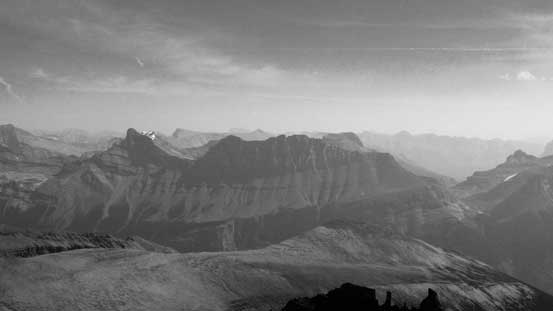
Mt. Bryce

The Twins rise behind Columbia Icefield
Mt. Andromeda and Mt. Athabasca

Nigel Peak right or center; Brazeau Icefield behind; Hilda Peak on lower left

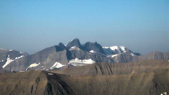
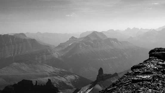
One of these is unofficially named “Rick’s Stick” and might be unclimbed

A slightly more well-known pinnacle – Cleopatra’s Needle
The impressive Alexandra Glacier that rises 2000 m from valley floor to Lyell II/III col

Terrace Mountain looks very small from here!
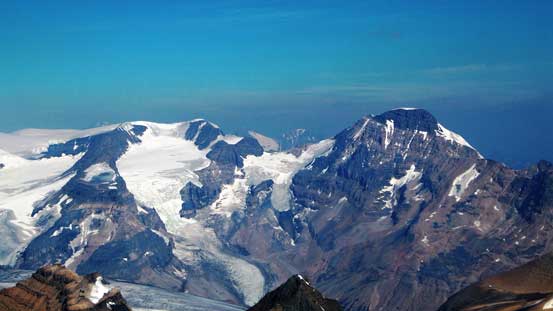
The 11,000er Mt. Alexandra and its adjacent Queens Peak
Lyell I, Lyell II, Lyell III – 3 of the easiest 11,000ers
The broad pass on lower left is Nigel Pass by South Boundary Trail

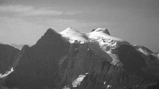
Neat looking glacier
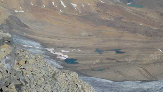
Here’re the few tarns that I passed by

Mt. Forbes appears like a white tooth sticking out
Looking down the super-steep N. Face

Me on the summit of Mt. Saskatchewan

Register placed by Rick Collier

Not many entries but all names are familiar. This is from the Selkirks legend David P. Jones

Someone needs to build a tall cairn to make this an 11,000er

Another panorama from the summit. Click to view large size.
On the descent I decided to check out the false summit as well. It turned out be a better viewpoint (in my mind) with non-obstructed views looking towards the Columbia Icefield. Too bad the sky was quite smoky thank to the forest fire but oh well… I resumed the descent, carefully picking my way down that series of short rock bands. It’s impossible to retreat exactly where I went up but all routes would go by following basic sense. At the 2nd cliff I decided to make 2 rappels rather than risking to down-climb the 5th class stuffs. I would if I had no choice but given the rappelling slings it made sense to use them. I’d already studied where to rappel during the ascent and I managed to pick the line and avoid that awkward ledge traverse.
Carefully picking my way down the summit block
Traversing to the false summit to check out the views

Looking back at the summit block
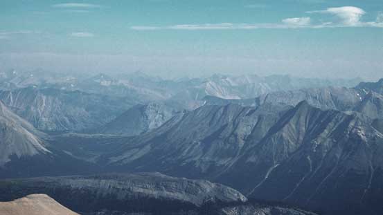
Impressive views towards the front ranges
Cirrus Mountain now looks small!
Mt. Coleman is a popular Kane’s scramble by the Parkway

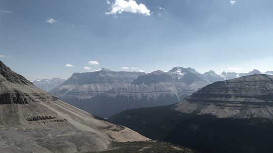
Another look at the area by Bryce and Columbia
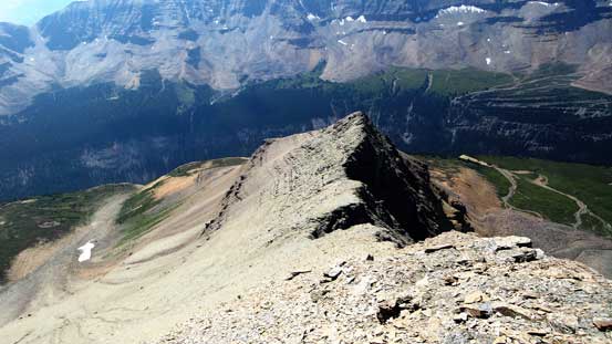
Looking down at the North Towers and the approach route

Lots of fractured glacier by this peak

The white whale sticking out from afar – Mt. Columbia

The stretch of Columbia Icefield

Panorama from the false summit. Click to view large size.

Another panorama from the false summit. Click to view large size.
Time to descend
Lots of Rockies’ choss!
Down the series of rock bands

Rappel #1
Rappel #2

A review shot of the crux with my route shown. Click to view large size.
Between the two cliff bands I nearly made a route-finding mistake by going down a “wrong rib”. I realized it not far down so didn’t waste too much energy/time. Descending the first cliff band required caution but nothing terribly hard. It’s probably only 3rd class terrain so no need to use that rappel anchor (even though it looked fairly solid). The lower ridge consisted of a lot of loose dinner plate rocks and treadmill scree that’s tedious to ascend, but fast and fun on the descent. Back to the grassy bowl I took a long break soaking in the views. At this point I already decided against Terrace Mountain so that meant I had the entire afternoon ahead of schedule. I felt completely lack of energy for the lack of food and sleep in the past few days so once getting back to camp I took a 3-hour nap. I woke up around dinner time and figured might as well wondering around to NT/TAV col making as ascent of the nearby North Towers. The timing would be at sunset so given the smoky sky it’d offer some incredible views. (The ascent of the North Towers of Mt. Saskatchewan is written in a separate trip report as it’s a separate peak).
This is the very broken W. Ridge. If you venture up the wrong rib then you’d have to climb that.
The second rock band

One last look at the immense Columbia Icefield
Descending the first cliff band

Looking over the shoulder of this peak
Typical terrain on the first cliff band

The nose of the first band
Continuing descending on this loose ridge.
Looking back at my objective
Mt. Amery – I’d like to ascend that one too…

Terrace Mountain
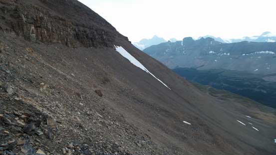
The beautiful grassy ledge traverse back to camp (with 100+ meters of height gain)
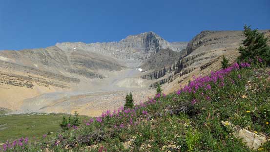
Flowers, grass and Mt. Saskatchewan

A review shot of the lower ridge and the route I took
More about this grassy ledge traverse
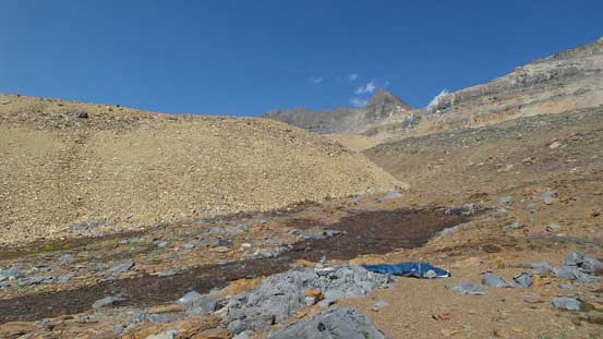
Back to the 5-star bivy site. This stream leaks out from the ground

Very pretty area.
After a well-deserved rest I slept in on the 3rd day, waking up around 9 am. I rarely cook hot breakfast but did so on this day since I was not in a rush at all (I decided against making any other ascent on this day so all I had to do was to hike out). Too bad I started seeing a band of dark clouds approach from the west indicating the weather might collapse. Indeed I slowly worked my up back up to SK/NT col (very tedious) the wind started to pick up. I thought I’d be hiking out in the rain but thankfully the weather magically cleared up once this band of clouds dissipated. Down the other side I carefully retraced my steps following closely to my GPS track. I took a lot of breaks on the hike-out, partially because I was tired and partially because this would be my last time visiting this area…
Tedious slog back up to SK/NT col. The scree ramp traverse is obvious
At this point I thought the weather collapsed…
Mt. Saskatchewan from SK/NT col
But the weather cleared up eventually. Looking at SK again
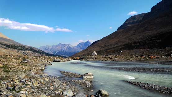
Down to the river now
Almost into the trees
Back into the trees I followed even closer to the creek this time but still had to do a few sections of short, but dense bushwhacking. Lower down I had the option to continue down this valley following Eric’s route out for completeness but decided against it. I didn’t feel like venturing into unknown bushwhacking terrain so followed my GPS out up and around the lower Big Bend Peak’s shoulder. The 50-meter elevation regain was frustrating but didn’t take too long. Descending the open scree slope was fast and in short time I was back to the abandoned old road by Saskatchewan Glacier’s approach. I followed this road back to Big Bend and forded the river (thigh deep this time).
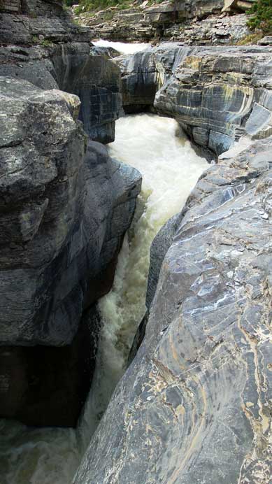
One of the many canyons
Water cascading down smaller steps

The entrance of another canyon

Open forest traverse
Back to Big Bend Peak’s shoulder, looking at Saskatchewan Glacier’s valley

Down to the old road now
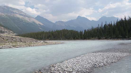
Time to ford N. Saskatchewan River at the end
I did not find the views on Mt. Saskatchewan or its surroundings to be as awesome as people make it sound even though I had good weather, but that could due to the fact I did too many trips in this area in just 2 years and everytime (except for Mt. Alexandra) I had perfect weather. I also did not find the ascent to be that enjoyable neither as the majority of it was nothing but slog on Rockies’ choss. It’s indeed better than peaks like Murchison but there’s no comparison to the classic climbs like Sir Donald or Edith Cavell. I did find this area to be enjoyable though – remote, beautiful and pristine, so overall I’d still recommend Mt. Saskatchewan to compatible parties looking for a relatively straightforward, but big and rarely ascended objective.

Something drives me to this mountain only just hearing about this
Awesome report. Love the photos of technical sections! Thanks for sharing.
Wonderful Report, and great photos. This is my favourite area in the Rockies.