Jeffrey Peak
September 25, 2021
2055m
Hope / Silver-Skagit Road, BC
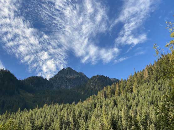
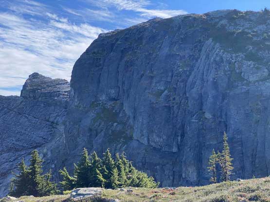
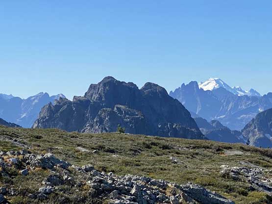
Jeffrey Peak is a very obscured summit in Silver-Skagit Valley guarded by dense forest and steep bluffs on all sides such that only the desperate peak-baggers would ever contemplate an ascent and there had been very few who actually went out to test out their bushwhacking and route-finding skills on this objective. Most seasoned scramblers probably do not even have a clue where this peak is. There are a few trip reports on ClubTread forum but what actually caught my attention was the massive north-facing slopes offering a winter route potentially free of bushwhacking. Alex and I had talked about Jeffrey Peak as a winter ascent for over two years but it wasn’t easy to get that “perfect window” as the slopes are very prone to avalanche. In addition to the tricky timing we would also need to walk about 7 km up Cantelon Creek FSR whereas in summer we could have driven this portion.
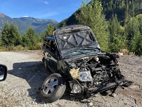
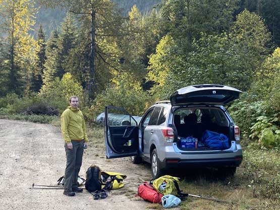
Eventually Alan B. and Ashkan R. made an ascent of Jeffrey Peak via a variation of the north face route a few weeks ago in late-summer conditions. Of course their trip report did not make this sound like a fun outing but they did confirm that the bushwhacking was not thick enough to become a “show stopper” even without any snow coverage. They did mention the boulder-hopping in the valley was never-ending. I interpreted this as a proper “Type 2 fun” kind out trip but with some determination it should be “very doable”. Alex and I eventually decided on the last Saturday of this September and Dean joined the team at the last minute. All three of us are very into obscured peaks and I was honestly pretty stoked about it. Alex volunteered to drive his Subaru Forester this time because we had beta from the other group that his vehicle should be good enough for the task. Compared to a couple months ago when I drove in for Mt. Grant the main Silver-Skagit Road was a lot more pot-holed making a slow show. The spur road off Cantelon Creek valley, though free of deep water bars, was also rough and steep at places. We grouped in Abbotsford at 6 am and did not manage to park the vehicle under Jeffrey Peak’s north slopes until almost two hours later.
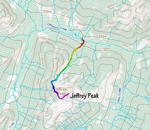
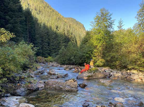
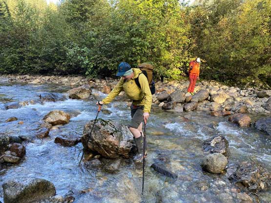
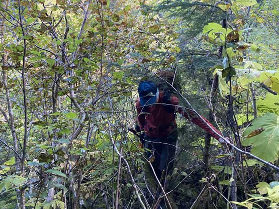
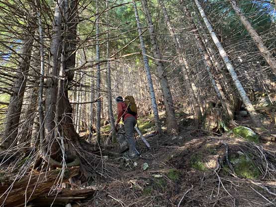
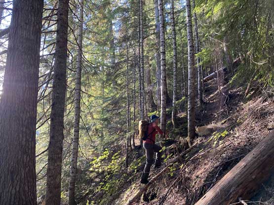
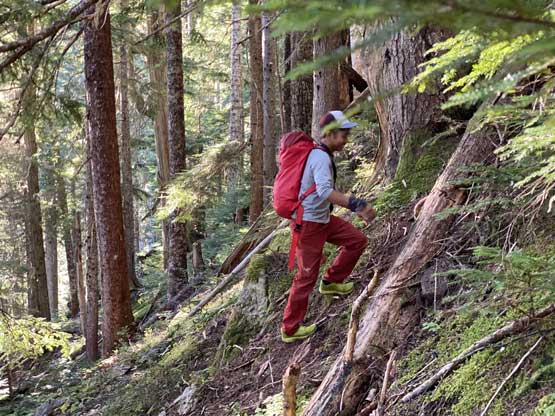
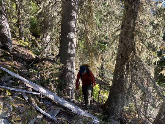
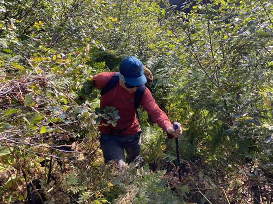
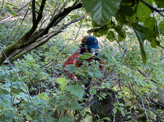
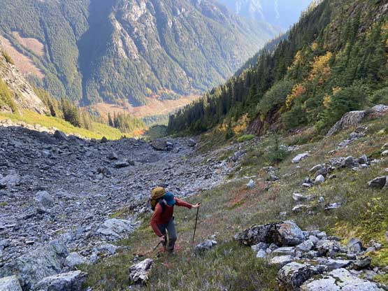
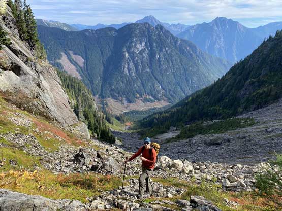
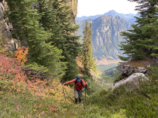
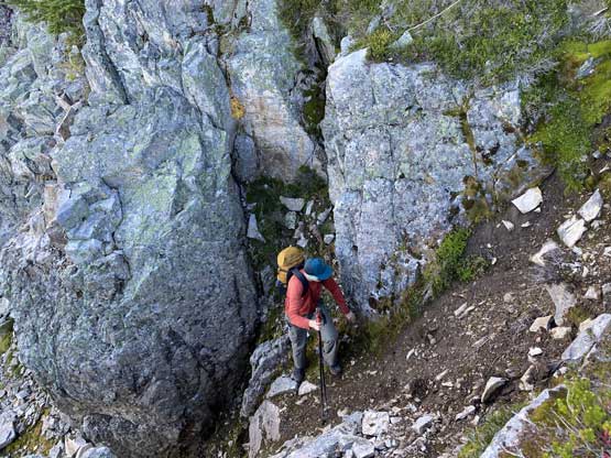
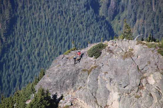
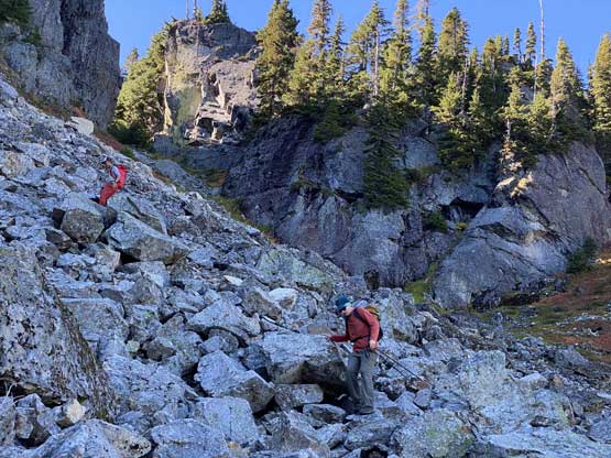
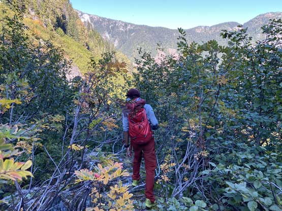
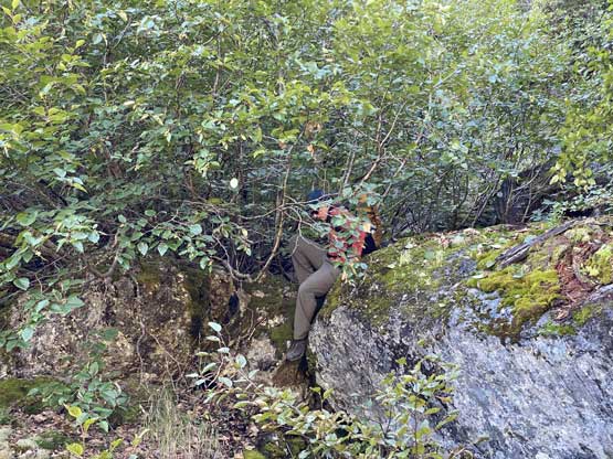
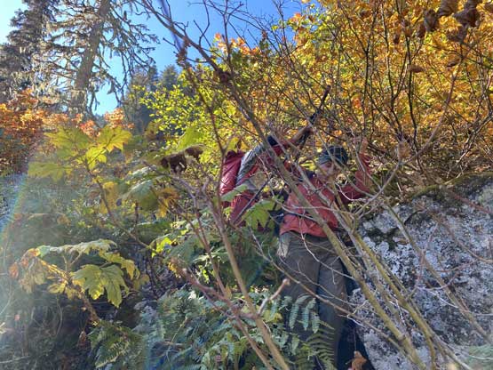
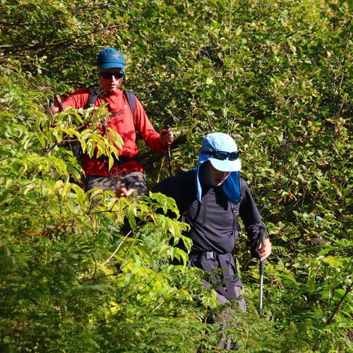
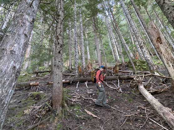
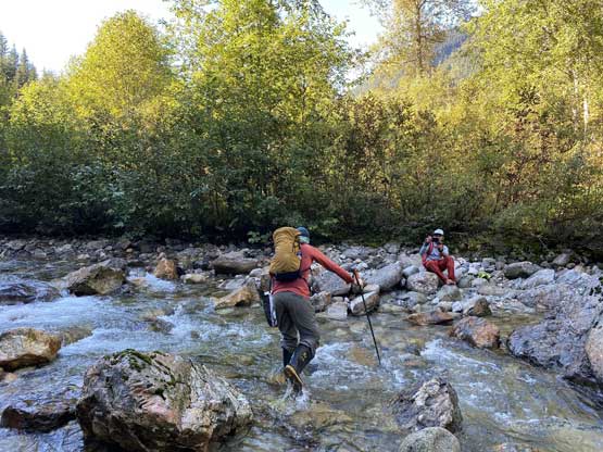
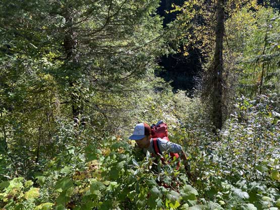
The first business of this route was to cross Cantelon Creek. We backtracked for a short distance from where we parked and bashed down to the creek following Al and Ashkan’s GPS track. This short descent had some intense bushwhacking in thorny plants. The other group had rock-hopped across the creek a few weeks ago but with the recent rainy weather that was no longer an option for us. Thankfully we had come prepared with secondary pairs of footwear such that we all easily waded across. The water level was below knee deep and the crossing was very straightforward. On the south side of the creek we had to bash through another band of intense vegetation including a healthy deal of Devil’s Clubs to get into the mature forest. Thankfully the mature forest was mostly open. We again, followed the previous group’s GPS track trending slightly towards climber’s right at the start, crossed an old logging road and ascended straight up. The grade of the terrain had become insanely steep for a few hundred meters’ of gain. At one point we saw some bluffs ahead and the terrain kind of forced us to traverse leftwards and the direction was again, confirmed by the GPS track. From here onwards we would maintain a diagonal traversing beeline to access the “hanging valley of boulders”. In my opinion I felt this traversing section was the worst. In addition to (short) sections of “level-4” bushwhacking and fields of slippery boulders covered in moss we also had to constantly pay attention to route-finding and that definitely consumed some brain energy out of us. There were a lot of thorny plants including our friends, the Devil’s Clubs.

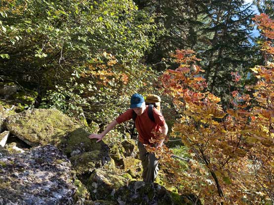
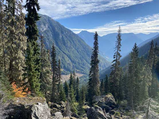
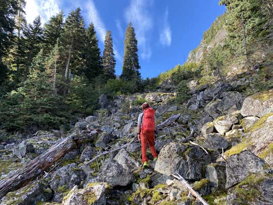
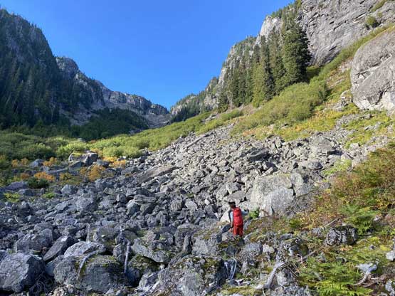
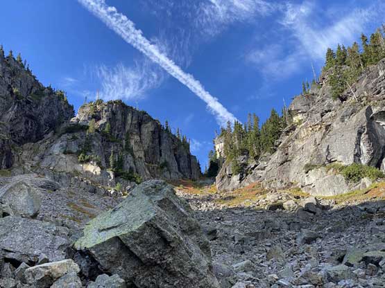
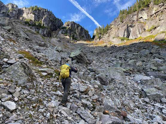
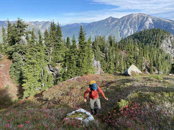
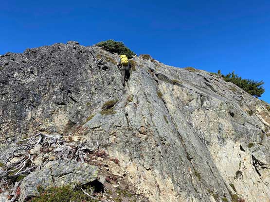
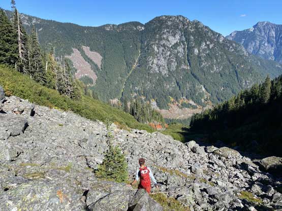
We all came here expecting the worst and the longest boulder-hopping show but it wasn’t actually that bad. I actually felt the boulders on Dickson Peak, especially in the lower approach gully was worse because here on Jeffrey Peak most of them were stable. There were a lot of moss and wet surfaces making some of them slippery, but at least most of them did not roll upon touching. The lower half of the valley had larger sized boulders and we also had to bash through a band of thick bush somewhere a quarter up the valley to link up two open slopes. The upper valley was actually quite pleasant to ascend by sticking on climber’s left side. We found a path with smaller sized rocks and some compact type of choss to give us a break from the boulders. Near the top we traversed climber’s right into that steep gully leading into the notch on Jeffrey Peak’s NW Ridge and this gully was a bit wet and slippery.
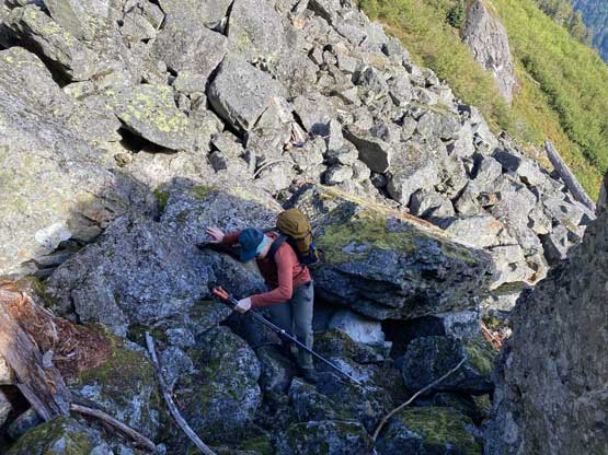
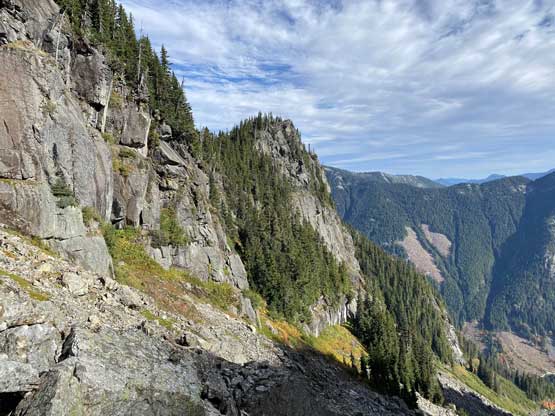
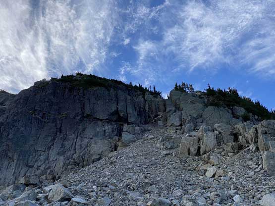
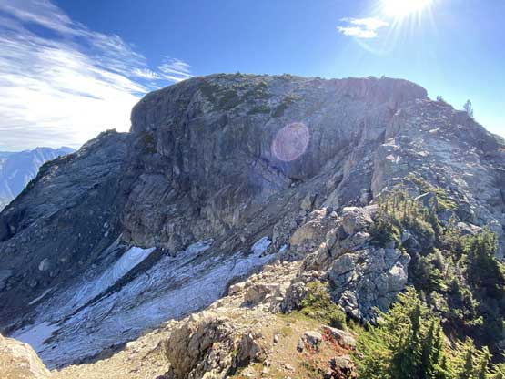
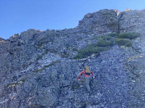
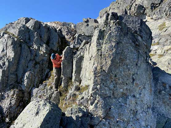
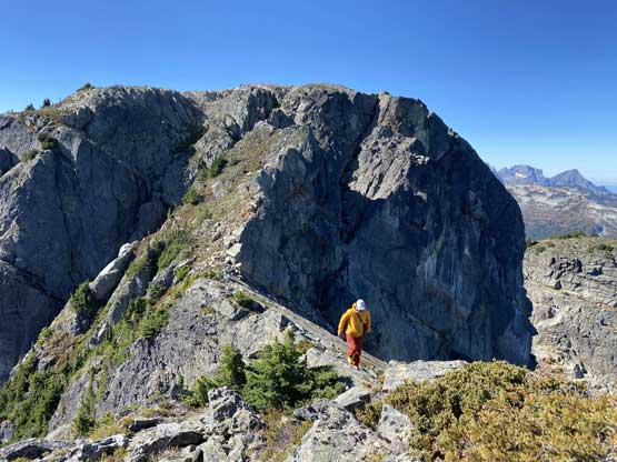
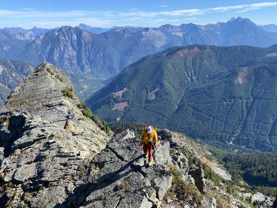
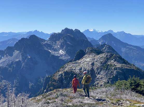
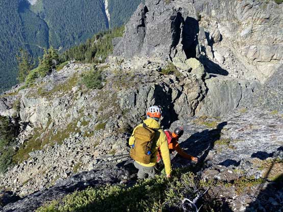
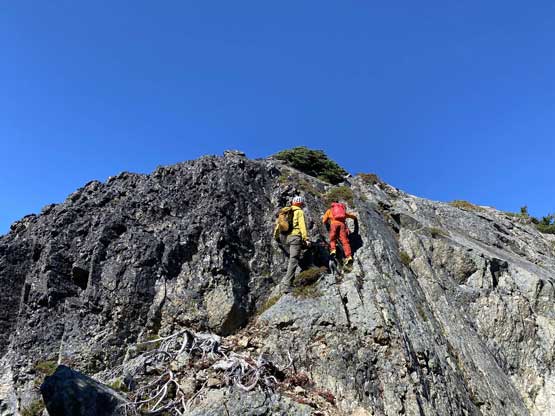
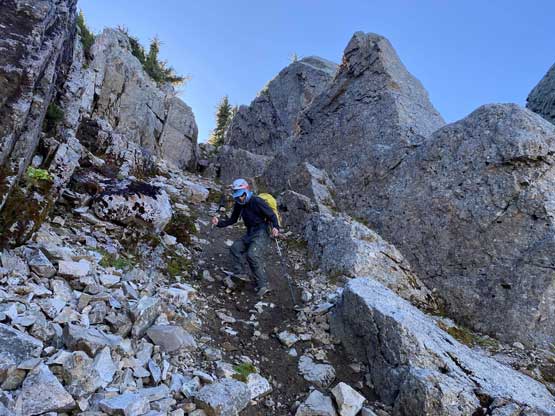
Dean had went far ahead and there’s no way Alex and I could catch up to him so we took our time taking a long energy break somewhere after gaining 100 m up the ridge. The ridge was generally pleasant to ascend except for a few spots. The first “interesting” section was a steep gully to break a rock band. The scrambling had one step of 3rd class and the rocks were very loose by the Coastal standard. Higher up we also had to scramble one or two short rock bands but nothing’s really worth noting.
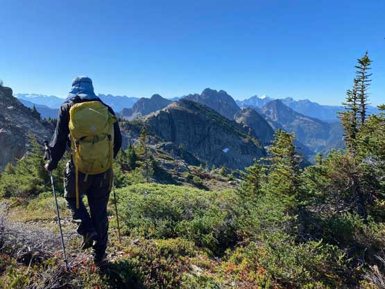
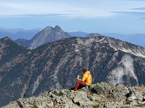
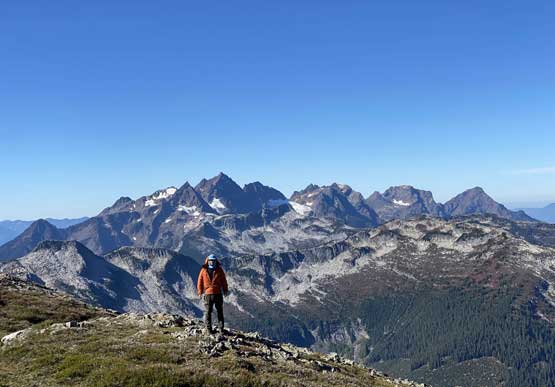
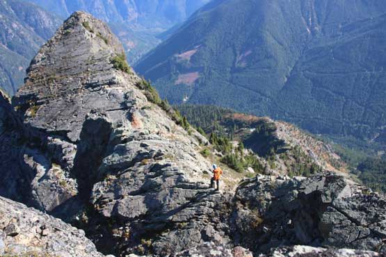
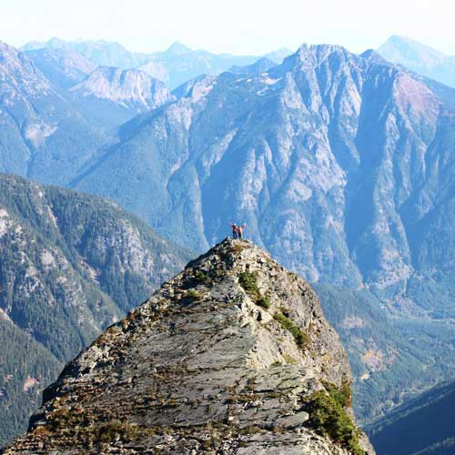
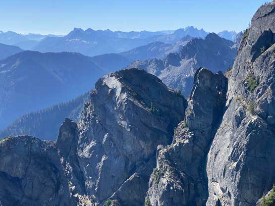
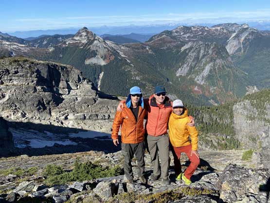
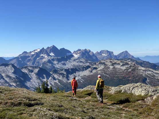
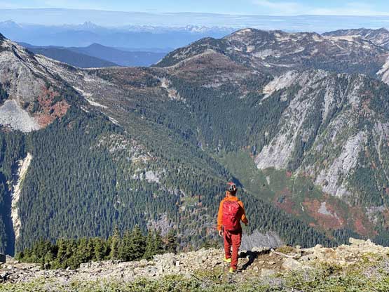
At about 1950-meter elevation we came to a flat-ish plateau feature on the ridge and immediately after that we had to down-climb into another notch. This down-climb had one awkward spot that required either a technical move or vege-belay on stiff/brambly type of plants. I did not like the touch of that bush so only put a small portion of my weight on that to reduce the pain. The final scramble to the summit again, had some sections with loose rocks as well another short band of 3rd class. The summit itself was very flat and broad. After a while of lingering we spontaneously decided to check out an outlier on the NE Ridge extension and to get there we had to descend 50 m on mostly 3rd class terrain. That NE Ridge outlier was a lot more pointy so offered better views.

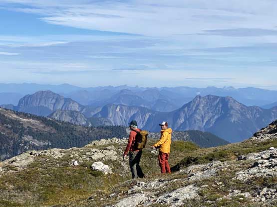


Including this short diversion to check out the outlier we must have spent close to 1.5 hours on the summit so eventually it’s time to descend. We lingered so long because we simply had too much time to kill, but once committing to the descent we zoomed down in one shot. Both Alex and Dean are fast on the descent so I really didn’t get much of a break. From the summit we pretty much followed the exact same route we took and finished the entire descent without taking even a single break. All three of us led different sections so that to give each other some break from the route-finding. At the river crossing I thought about to just wade in my boots but then I didn’t know if I’d need that pair of boots in the next few days, so took my time donning the river shoes to keep the boots dry. I wore the river shoes to bash up that thick band of bush to get back to the vehicle because I was too lazy to do another switch of footwear.


The drive-out was a slow show and we also discovered this Cantelon FSR was actually a very busy place. I thought this road was nearing the end of its life but given the traffic I probably don’t need to worry about the status of this road anytime soon. The rest of the drive was uneventful and I eventually got back to White Rock at 5:30 pm.