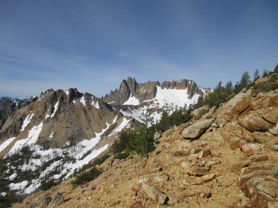
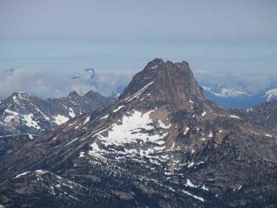
Big Snagtooth
June 27, 2018
2539m
North Cascades Highway, WA
The unofficial name “Big Snagtooth” refers to the highest peak along Snagtooth Ridge immediately south of Silver Star Mountain not far from Washington Pass. This is a member of the famous Bulger Top 100 list so despite the obscured status this peak does see climbers from time to time. It seems like spring is the best time when snow covers much of the upper basin. In summer the pleasant snow ascent is then replaced by bushwhacking and scree bashing, but nothing’s too outrageous. This is overall one of the shortest Bulger ascents. The summit block has two short, but interesting pitches with the crux slab moves rated at 5.7 and is often aided by standing on a partner’s shoulder or pulling on the rope. Big Snagtooth shares the same parking pull-out as Silver Star Mountain’s Burgundy Col route but unlike its popular neighbour, the approach of Big Snagtooth is nothing but cross-country travel in woods and underbrush.
After coming back from a successful ascent of Mt. Fairweather last week Eric G. and I immediately started planning our next Cascadian adventures. The midweek of this week saw a brief weather window forming. Eric was keen on a harder Bulger but I was still tired from the previous trips plus the weather didn’t seem 100% stable so I threw out Big Snagtooth as a “Plan B”. Thank to that interesting summit slab move this is one that you probably want to have a partner anyway and the slabby nature means it’s probably a good idea to not do it in questionable weather.

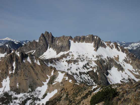
Big Snagtooth standard route. GPX DL
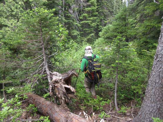
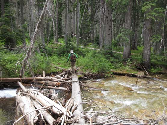
To make the most use of Wednesday morning’s brief window we decided to drive out on Tuesday night and car camp. We both simply slept in our respective cars at that small pull-out. The next morning our alarms went off at 6 am and in half an hour we started the ascent. The first section was dropping 50 vertical meters down to and across Early Winters Creek. The creek crossing was not a big deal on a couple fallen logs. And then the bushwhacking began. At first we had to deal with annoying dead-falls but soon we entered some open forest. Except for some underbrush we didn’t really have to deal with any ugly factor of the usual bushwhacking game. The general bearing was to roughly follow Willow Creek high above its bank on east side and there’s a couple small streams to cross.

Eric crossing Early Winters Creek

This is as bushy as it gets but only for five meters.
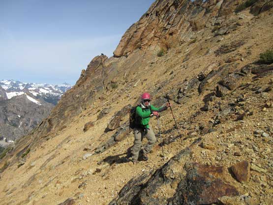
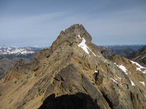
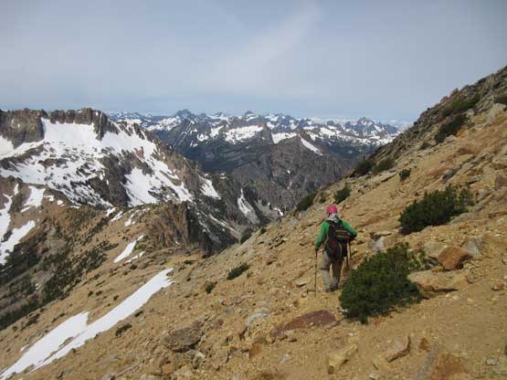
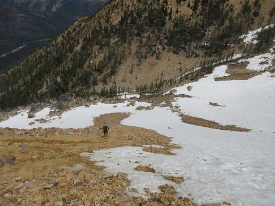
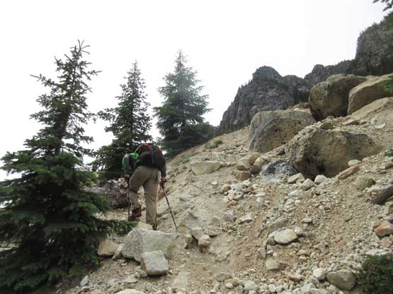
This is one trip that I simply jumped in without doing much of homework. Eric did all of the leading in the woods so the going was very easy for me. I’ve also switched my handheld GPS unit into the Gaia GPS on iPhone and this is a good trip to test it out. It worked exceptionally well and didn’t seem to consume too much of battery power. After a while we arrived at the upper basin, happy to see there’s still a bit of snow to assist the otherwise, hideous scree bashing. The snow was frozen solid so we spent a couple minutes donning crampons. Despite the inconvenience of gear transition this was still faster than the treadmill scree. The upper part of the bowl was choss as I was scrambling in the Rockies, but not nearly the worst I’ve done. Upon cresting the SW Ridge we immediately turned left towards the peak and the next couple hundred feet’s ascent was on relatively solid ground to the small col right below the summit block.
Into the upper basin now. We utilized snow for as much as possible
Tower Mountain does look like a tower…
We strapped our crampons on for the snow ascent
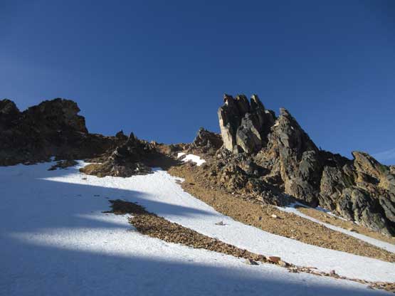
Just a picture to show the typical scenery and terrain here

Merging onto the rocks (choss) now
Big Kangaroo in the distance. I love the brown colours here
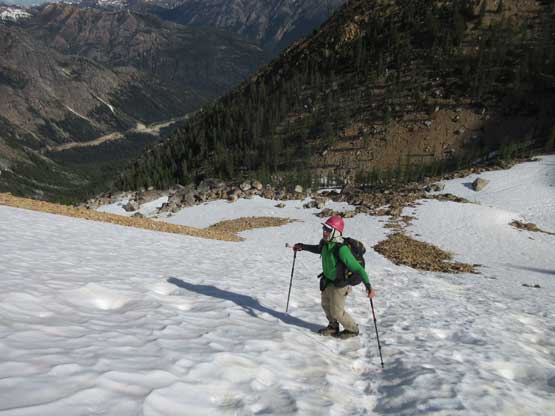
Me slogging up towards the distant col. Photo by Eric G.

There are so many towers around here that I would like to climb at some point
Another shot of Kangaroo Ridge with Big Kangaroo the tallest
There’s still fair amount of scree slog to do
This is Willow Tooth although the labelling on peakbagger.com is confusing
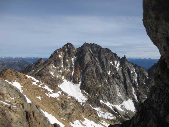
Silver Star Mountain which I bagged in June 2017
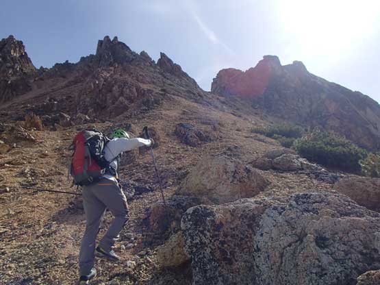
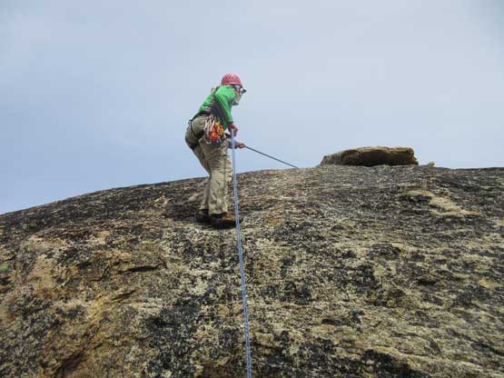
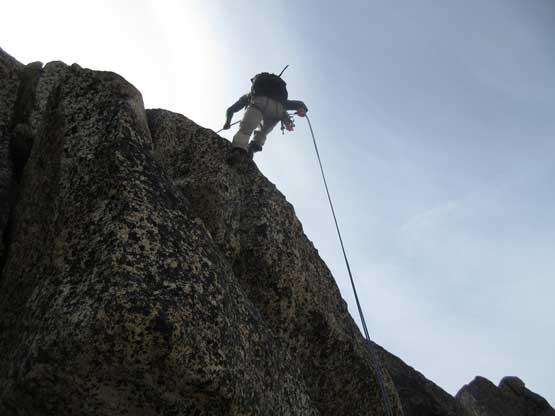
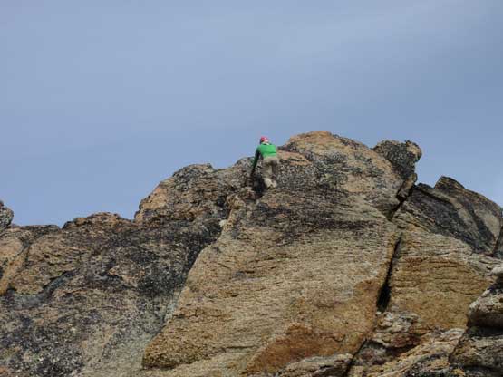
The beta we had was to climb up the “rappel route” on the lower pitch instead of traversing farther out to the south. This involved a short chimney climb that’s probably stiff 4th class for a move or two. We all took our time donning rock shoes and putting the harness on and then Eric confidently led it. The only protection he put in was a .5 sized cam. I had no problem following up. The route then goes over a small notch onto another short stretch of scree and then there’s the summit block slab. The slab didn’t look nearly as hard as we were expecting. We briefly talked about the possible strategies and then Eric just went for it and soloed no problem. For the sake of this slab pitch I even brought an ascender but it turned out to be only a single move of 5.7 at the start. No problem whatsoever and soon enough we were on the summit soaking in the views. It had only taken us 3 hours to get here so no need to rush.

Me at the base of the climb. Photo by Eric G.
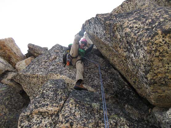
Eric leading the first chimney pitch. 4th or low 5th depends on who you are

Eric soloing the 5.7 move on the summit slab

Eric climbing up the slab.

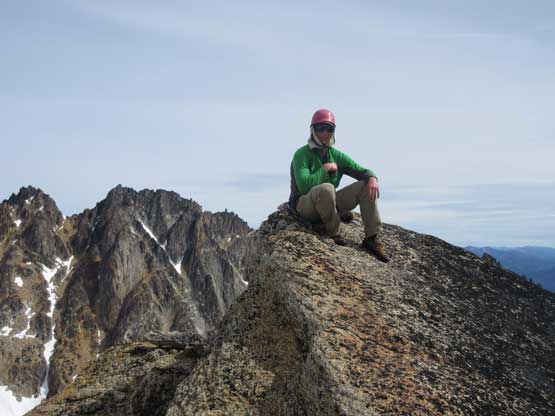
Summit of Big Snagtooth now.
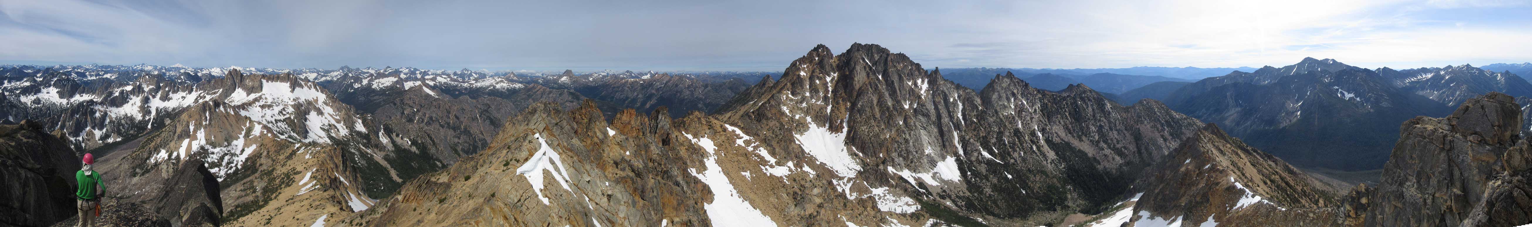
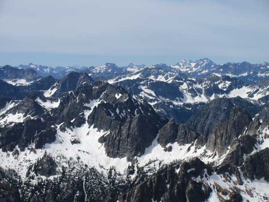
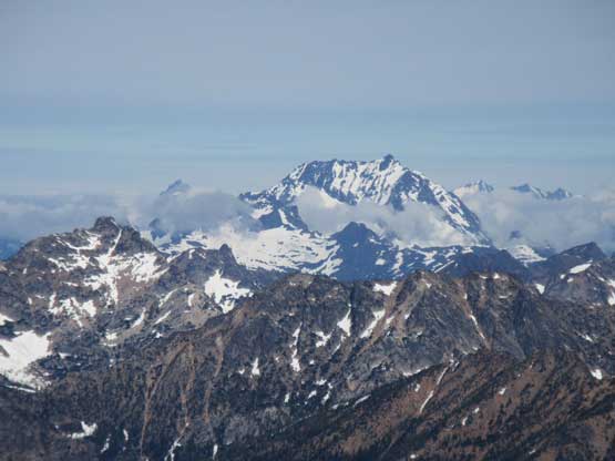
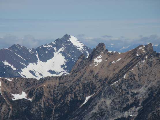
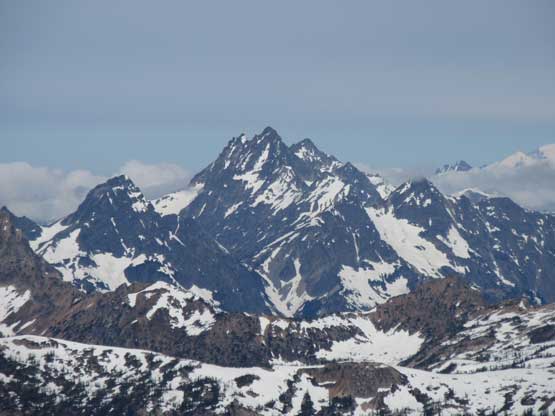
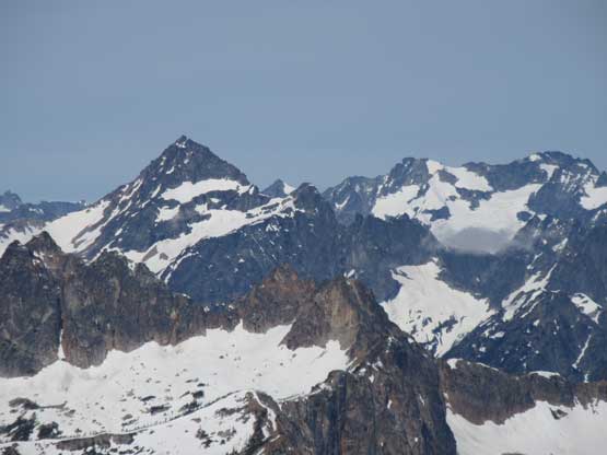
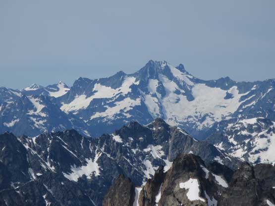
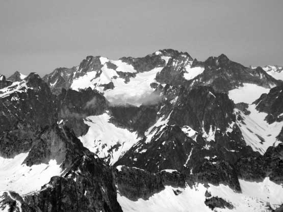
Summit Panorama from Big Snagtooth. Click to view large size.
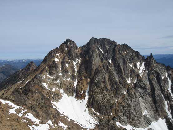
The south face of Silver Star Mountain
This is just a sub-summit of Silver Star Mountain
The Gardners to the east – that’s two Bulgers…
Abernathy Peak is another Bulger. As “exciting” as it looks…
Not too familiar but it’s Flora – Spectacle Buttes – Maude/Fernow on the skyline

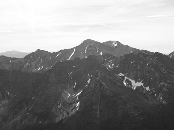
Bonanza Peak and the volcanic Glacier Peak on the skyline
Jack Mountain partially engulfed in clouds already
I believe that’s Mt. Ballard in the distance.
Mesahchie Peak on Ragged Ridge – another Bulger
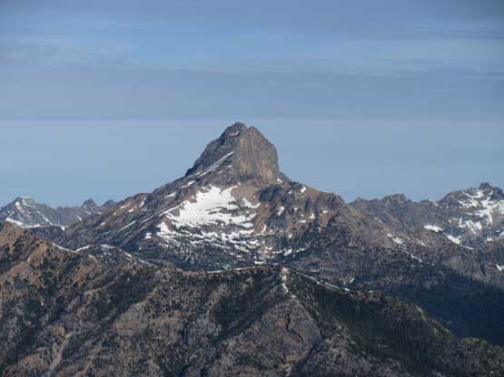
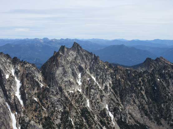
Of course this is Tower Mountain and of course it’s a Bulger
Black Peak (L) and Mt. Logan (R) – that’s two Bulgers…

Behind Big Kangaroo is Dome Peak with Sinister/Gunsight to the left
A closer look at Bonanza Peak – tallest non-volcanic peak in Washington

Goode Mountain with the classic NE Buttress route clearly visible
Mt. Logan close-up, but not to be confused with Mt. Logan in Canada…..

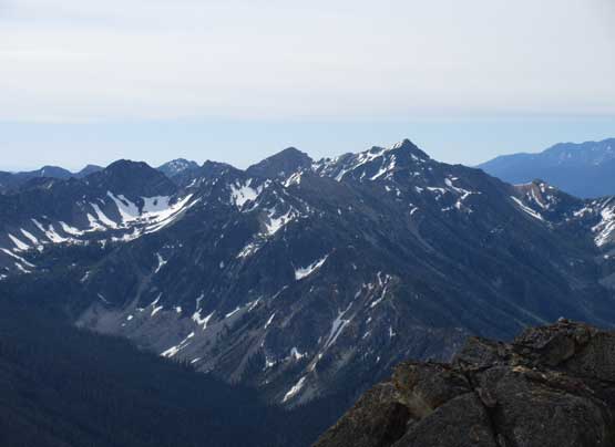
Just another shot to show Kangaroo Ridge in foreground.
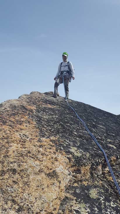
Eric on the summit of Big Snagtooth
Me on the summit. Photo by Eric G.
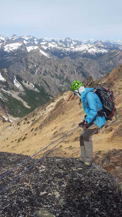
The summit block rappel anchor seemed to have some interesting physics behind so we backed it up with a cam with me heading down first. The anchor held somehow so Eric took down the cam and went down. The lower rappel was a vertical one and went without event. And then we opted to scramble up a nearby highpoint called “Willow Tower” mostly to kill time.. There’s a few 3rd class moves near the top which was kinda fun.
Eric rappelling off the summit slab pitch
Me ready to rappel the chimney. Photo by Eric G.
Eric rappelling the lower chimney pitch
Scrambling up “Willow Tooth” for fun.

The summit block of Big Snagtooth from “Willow Tooth”
We took another long stay on the top of “Willow Tower” but eventually it’s time to head home. Skiing down the scree was fast and fun and descending that choss bowl wasn’t too bad neither with my experience in Rockies. Lower down we picked up the ditched crampons and the snow was just soft enough to (sort of) boot ski. Into the bush we maintained a fast pace throughout. We did quite a few GPS checks just to make sure we stayed on route but overall the return was a fluent process. We crossed the creek at a different place and then failed to find the trail on the other side so just went straight up. Eventually we came across that trail at the boulder field and another 10 minutes later we were back at the parking lot. Our round trip time was just over 6 hours including some long breaks.
Heading down now. It’s fast and easy

Heading down into the basin. The next 10 minutes would be no fun.
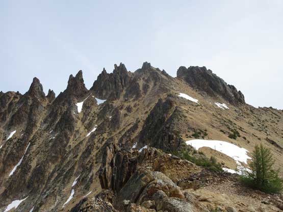
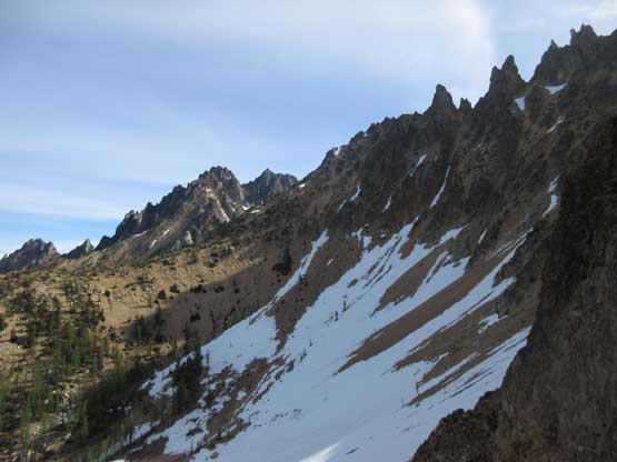
Looking back at the rugged ridge on Snagtooth Ridge
Into the basin. Eric opted to use scree while I stayed on snow

A bit of boot skiing here and there. Photo by Eric G.

Into the bush. We had to regularly check GPS to stay on route
As bushy as it gets. Not fun, but not too bad neither.
We found a different log to cross the creek

Me balancing on the log. Photo by Eric G.
Annoying re-ascending to get back to the highway. Done.
The day was still young but my right knee’s aching up again. The IT band was not doing good so despite the shortness of this trip I decided to just head home. Eric had more ambitious plan to scramble Big Craggy and West Craggy. I wanted to join but just didn’t want to push too hard on the knees to risk ruining the following big trips in July. The drive back home was pretty fun except for that hour-long border delay. To avoid the rush hour traffics on Highway 91 I took King George exit and then 120th street back home which’s proved to be a good call.
