Rolley Peak (Mission)
February 23, 2022
728m
Mission, BC
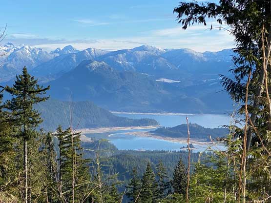
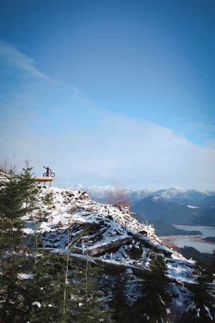
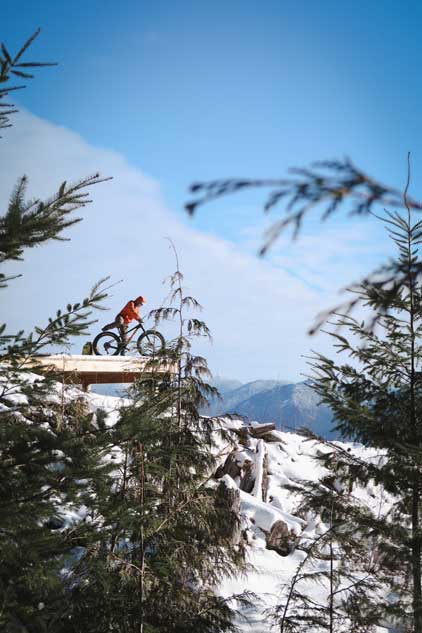
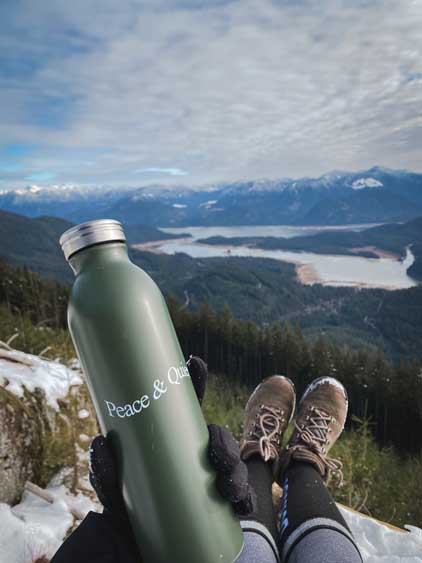
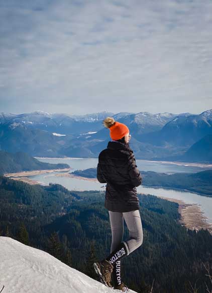
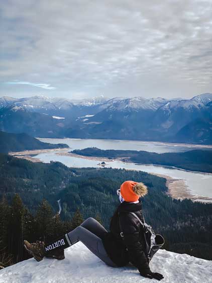
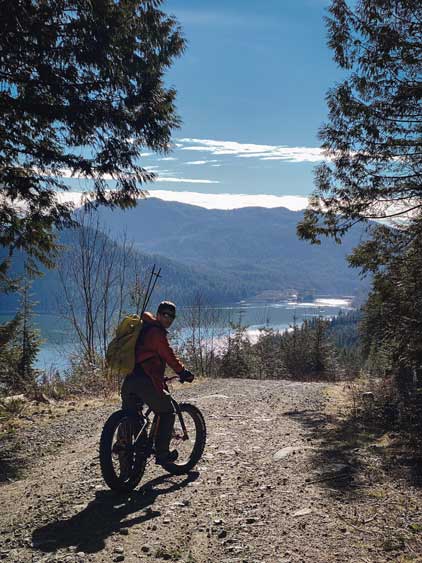
“Rolley Peak” is the unofficial name of the high point immediately to the north of Rolley Lake Provincial Park with just under 200 m prominence on the lower slopes of Mt. Crickmer. This “peak” was mostly unknown to the public until the winter of 2021/22 season when several trip reports blew out the spot. The viewpoint just under the summit offers 180-degree panorama of Stave Lake and the vicinity while the ascent is an easy plod up a gated logging road. The access does require some driving on gravel roads but is doable in any passenger car. In many aspects this hike is similar to another Mission’s social media hotspot Hunter Trail, but doubles the elevation and distance. For those looking for a more demanding hike than Hunter Trail but with equally rewarding views then an ascent to Rolley Peak’s lookout should be an ideal choice. The true summit is however, bushy and forested and is only for the peak-baggers. Thankfully the detour to check out the true summit is a short one.
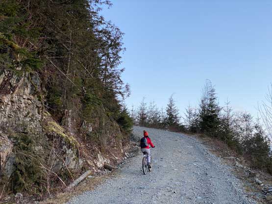
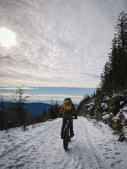
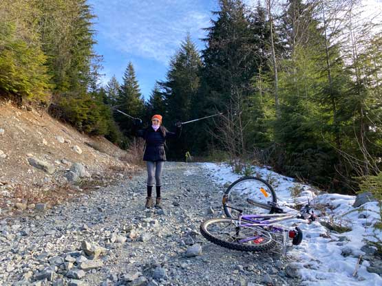
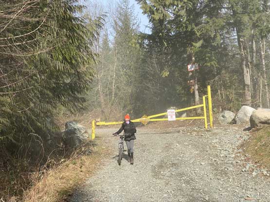
Wendy M. happened to have the morning of Wednesday available for a hike and I naturally suggested “Rolley Peak” even though the elevation (600 m gain) and distance (12 km round trip) wasn’t quite that easy for a morning before-work exercise. This peak had absolutely gone viral in the last few months but I had not seen a biking report yet, which was surprising as biking was definitely the best way to do this peak. The uphill grade was actually not that crazy for those with a proper mountain bike and some riding experience and the downhill would be an absolute blast. Wendy only owns a city bike but I suggested her to take it nonetheless because no matter how crappy the bike is, the trip would still be more enjoyable than walking the full length. The two of us left White Rock at 5:30 am and made to the gate on Florence Lake FSR right at the time when head-lamps weren’t required. The gate was right at the start of the spur road so we parked the truck on a pull-out that could fit 3 vehicles and started the ride.

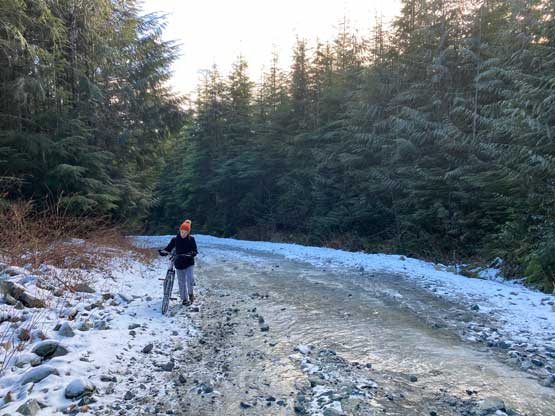
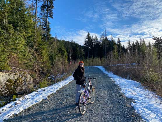
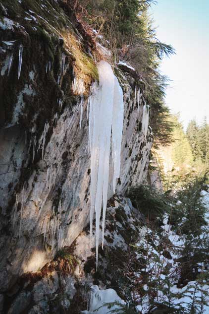
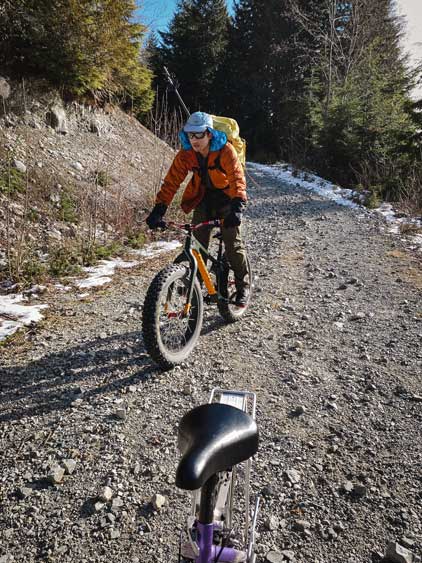
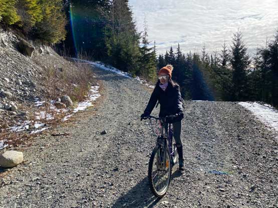
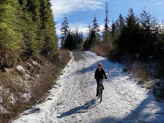
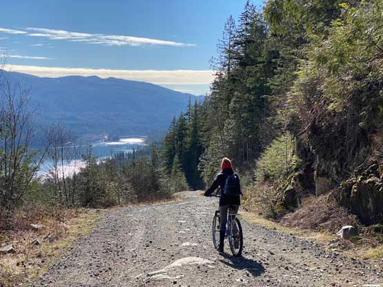
The road was quite steep especially on the lower slopes up to around 500 m elevation so we mostly just pushed the bike up. I could actually ride probably half of these lower stretches on my fatbike, but Wendy’s city bike wasn’t suitable for the job. Even pushing that crappy city bike up the steep hill was a tiring work out. To make sure we definitely could get back home by lunch time I offered to help pushing her bike to speed things up. I developed a strategy to push both bikes (one on each hand). The effort to push Wendy’s bike was probably two times more than mine, so a while later I gave the bike back to Wendy. We just took our time, slowly and steadily with lots of breaks and eventually made to that junction at 500 m. From there we had about 2 km of flat-ish FSR that we both could easily ride on. We started to encounter snow and ice on the road but such did not impose any problem to the riding.
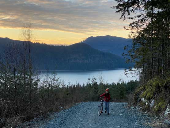
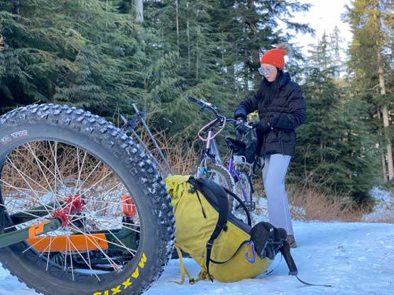
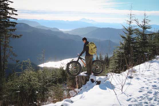
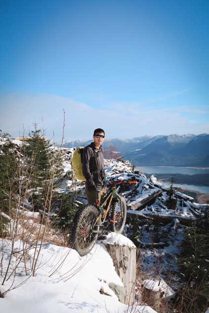
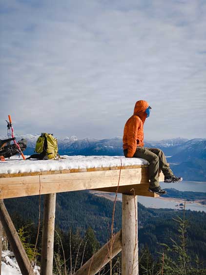
There was a secondary gate when we were supposed to take the left (rougher) branch towards the summit and Wendy ditched her bike here. This spur road was proper mountain biking terrain. I decided to push/ride the fat bike to at least the lookout at 700 m since my bike was designed for riding these rough and steep stuffs. The snow had become deep but the abundant foot traffic in the past several days had packed down the entire road such that post-holing was never a problem. We took another few breaks but eventually made to the viewpoint. Wendy opted to rest and play with more photography while I carried on to tag the true summit. I did a short loop bushwhacking in the forest tagging three separate “high points” to make sure that I absolutely had tagged the summit. The short-cut descent back to the road was very steep, slippery and bushy. I then easily descended back to that viewpoint. Wendy was already hiking towards me because sitting at that viewpoint was quite cold in this Arctic Outflow event. The wind was actually not bad, but the temperature was well below freezing.


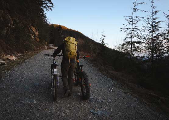
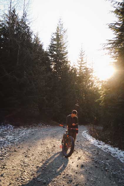
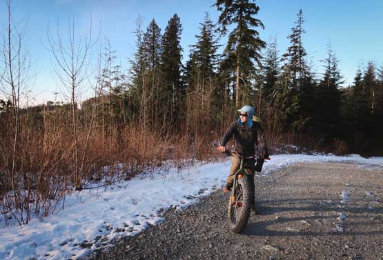
The ride back to where Wendy ditched her bike was fast and furious. I took the oppourtunity to practice biking as slow as I could humanly do, and learnt that on some very steep and loose hills I just could not bike too slow. The horizontal ride back across that 500-550 m stretch was fun for both of us. Lower down Wendy had to be extremely careful but did manage to ride most of the way, except for some really steep and loose stretches where she just walked the bike. I thought about to swap bike with her but decided against that idea, as I still wanted to enjoy the ride. I certainly would not have enjoyed this trip if I had her bike instead of my trust fat bike from North Shore Bike Shop…

Our round trip time was 4.5 hours on a leisure pace and we eventually got back to White Rock at 12:30 pm. Wendy had to go straight to work but I earned myself a proper lunch in restaurant, a shower and about 2 hours of napping time as my work would not start until 4:30 pm on this day.
