West Mountain Peak
March 26, 2022
2341m
St. George, UT
West Mountain Peak is a weird name of a mountain but whatever. This peak locates in the SW corner of Utah in Mojave Desert and boasts over 1100 m prominence. The ascent is nothing fancier than a road-walk. In some years the road can be driven all the way to the summit but it seems like the road condition changes from year to year drastically. In some other years one has to walk a few hours each way. When Doug, Arthur and I decided to drive back to Colorado from Las Vegas area I threw out this add-on objective. We did not have much daylight time left, but I was bidding on being able to drive most of the way up. Earlier in the day we had ascended Grapevine Peak in Nevada and now in late afternoon we were stuck in traffics on I-15 northbound. Thankfully the Google map knew the detours so we only wasted about half an hour’s precious time.
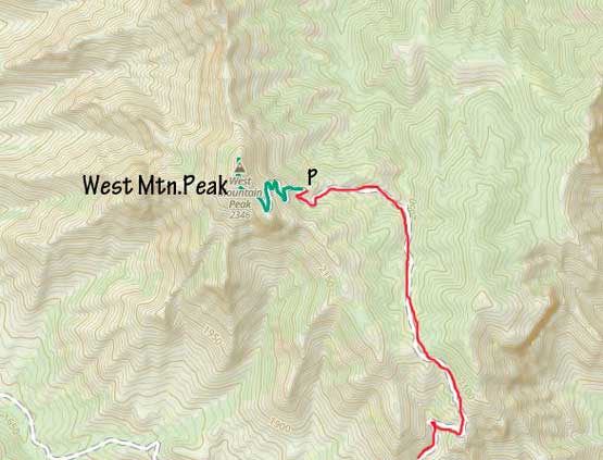
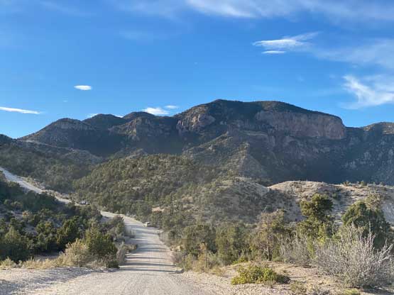
By the time we turned onto the dirt roads we knew we were going to make the summit even if we had to walk more than an hour each way. The lower half of the road was rather a “highway” on which we could cruise at about 50 km/h but near Hell Hole Pass the grade had become increasingly steep. We passed a group of slow Jeepers and continued on. The next kilometer had some steep switchbacks with loose surface but I drove the Subaru up with ease. A recent report indicated someone had stopped at one of the switchbacks here, but I had no clue what kind of vehicle that guy had. The road crested another broad pass and made an 100-m descent to the north side. The final ascent towards the summit was extremely steep and daunting. Once things started to become crazy I turned around the parked. I was glad to be behind the wheel on this drive as this was a great experience for me to test Subaru Forester’s limit. Overall I was not very satisfied about its power and traction. The Subaru was actually overheated by the time we parked.
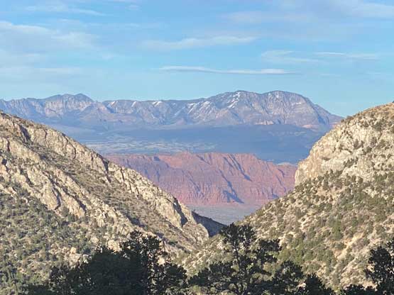
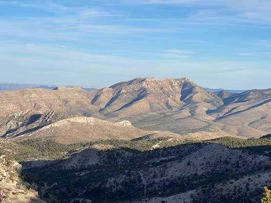

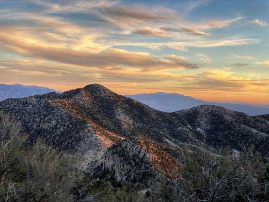
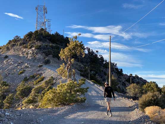
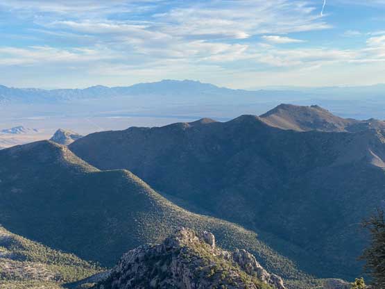
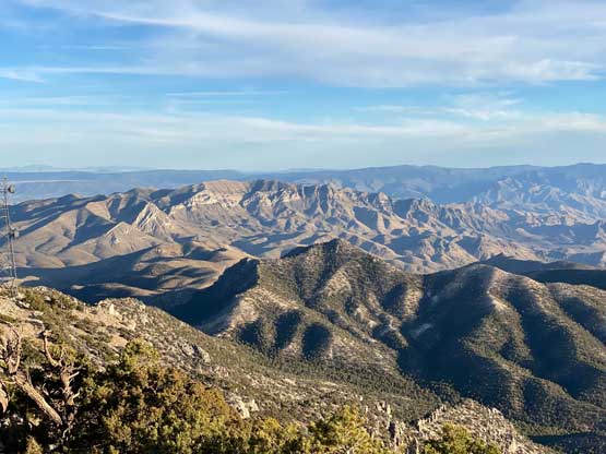
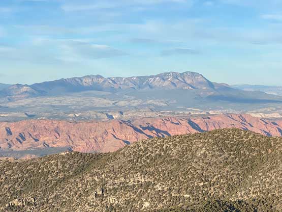
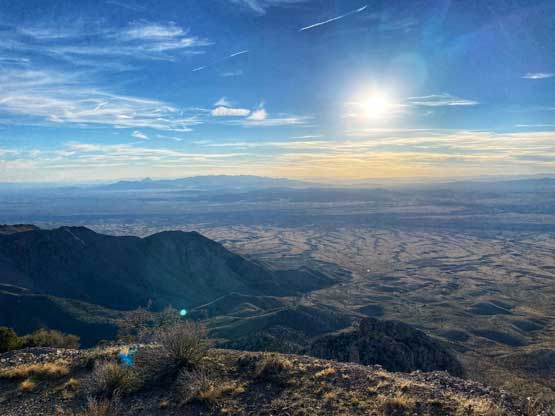
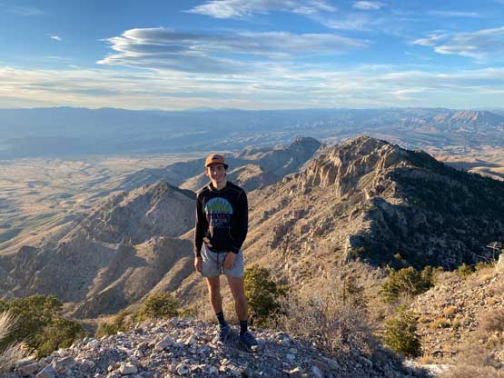
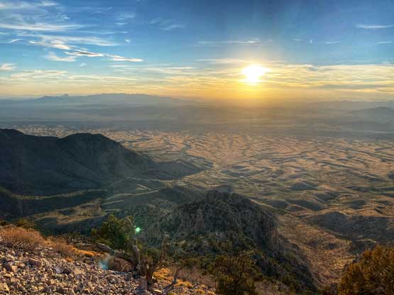
We had about 200 m elevation and 1 km distance to walk to the summit so we were doing great on time. The walk was incredibly scenic, which none of us was expecting. The summit itself was rather ugly with all kinds of towers and structures blocking the views. Arthur and I ended up staying half an hour longer on the summit to explore various viewpoints while Doug made a head-start to descend to make sure the Subaru was doing fine.


The descent was uneventful and the vehicle had no notable damage from the overheating. Doug opted to drive us down and then into the city of St. George. Arthur and Doug had previously ordered some pizza in a restaurant that they were familiar with. I have to say the dinner was great. We then pushed northwards on I-15 all the way to I-70 turn-off, and found a quite spot to set up the tents. Again I just slept inside the vehicle as always. This camping area was at an elevation of over 2000 m and I was grateful for that. In the next two days I would be hiking some taller peaks in Colorado so I needed some kind of acclimatization.