Trappers Peak
November 1, 2019
1818m
North Cascades Highway, WA
Trappers Peak is rather a small summit but offers some of the highest view-to-effort ratio in the North Cascades. It rises more than one vertical mile above the deep Skagit River valley and the village of Newhalem, but good logging roads access dispatches about 600 m elevation gain. The ascent is mostly a hike on a maintained trail with only a few mile 3rd class moves on the upper south ridge. On a clear day this summit offers finest views of the east face of Mt. Triumph and the spires in southern Picket Range. Adventurous folks can easily extend the hike by tagging the northern summit that shares about the same elevation, unofficially known as “X Mountain”, and the round trip from Trappers Peak to “X” and back to Trappers Peak shouldn’t cost much more than 1 extra hour. I had analyzed the maps of this area and decided to save Trappers Peak for a sunrise hike. The plan was to tag the summit in the early AM and rush back home for work in the PM and evening. The length of this outing suggested that “half a day” should be plenty enough, and if time’s on my side then I would bag “X Mtn.” but if not, I wasn’t going to fuss about it.
The decision was made spontaneously for this past Friday when a rare high pressure system dominated over Pacific NW but I couldn’t manage to find volunteer(s) to suffer together. I drove down south across the border at around 11 pm and made to the trail-head after 1 am. My truck was the only vehicle parked there but I noticed shattered glasses indicating previous theft activities. This meant that the thefts must have owned some sorts of 4×4 vehicles because the drive to this trail-head does involve a few stretch of steep and loose spots. I probably could, but wouldn’t want to drive a passenger car up there. Nonetheless, I turned in and slept a couple hours in my truck. The alarm went off at 4:30 am and then I took my time cooking spicy ramen for breakfast before starting the plod.
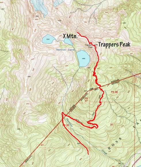
Trappers Peak and X Mountain hiking route. GPX DL
The first portion of Thornton Lake trail was rather just the extension of the logging roads except that this portion of the roads was deactivated and long gone. I had to hop across at least two creeks on slippery, iced-up rocks and thankfully the main Thornton Creek crossing was bridged. The actual trail was well marked, not too steep and easy to navigate. I made some slow, but steady progress on the endless switchbacks and didn’t encounter snow until 1300 m elevation. The snow was icy and compact but no traction needed, and I made to the junction where Trappers Peak’s south ridge route branched off from the main Thornton Lake trail in just trail-runners. It appeared that hikers had gone towards Trappers Peak in this past week judging by the foot prints but the tracks did involve fair amount of post-holes so I took the first, and the only long break swapping footwear for mountaineering boots and gaitors. The hike onto the south ridge of Trappers Peak became steep in one spot that I probably would classify as “class 3-” and was pretty easy.
After gaining the proper south ridge the sky had brightened up enough that I no longer needed my headlamp. I followed the previous footsteps over a dip and then some steep, but easy ground. There’s one narrow spot with mild exposure but nothing particularly worth noting, until the summit block. The ascent was done on the east side of the block on steep snow. The snow was icy but utilizing the holes made by previous parties I didn’t have to use neither ice axe nor crampons. I arrived at the summit at least half an hour before sunrise. I wasn’t sure how long the traverse to “X” would take, so decided to wait patiently on the summit of Trappers Peak for sunrise to come, in wind and frigid temperatures. My figures were literally frozen while taking photos but the views were definitely worth the cold fest.

The upper south ridge at daybreak

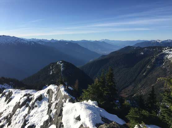
Morning horizon and the Skagit Valley

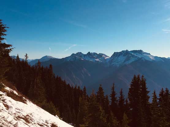
Thornton Peak and Mt. Triumph from the summit

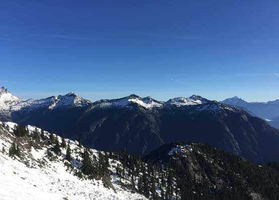
Big Devil Peak across the Skagit Valley on the southern horizon

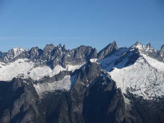
The summit of Trappers Peak and the Pickets behind

Partial Panorama from the summit of Trappers Peak. Click to view large size.

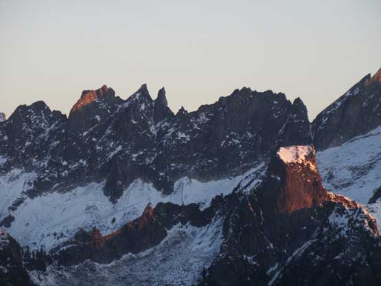
The southern Picket Range at dawn before alpenglow

Jack Mountain dominates the eastern horizon

The southern Pickets on alpenglow. What a show!

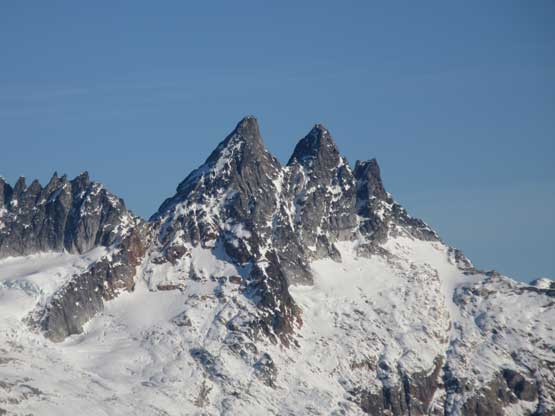
Mt. Degenhardt, “The Pyramid” and Inspiration Peak from L to R

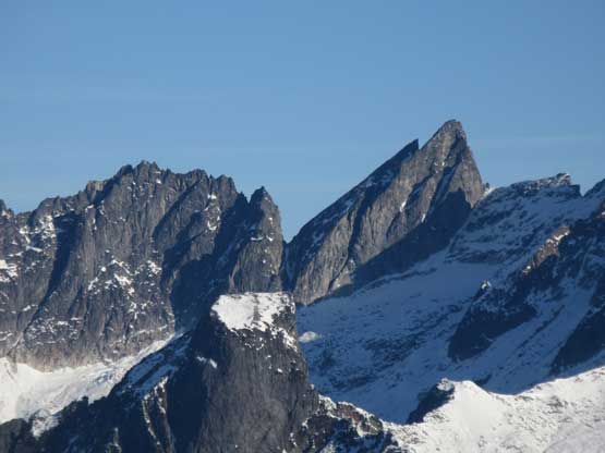
West McMillan Spire (L) and East McMillan Spire (R)

Mt. Despair on alpenglow

And finally, the tip of Mt. Triumph catching the first beams of sunlight
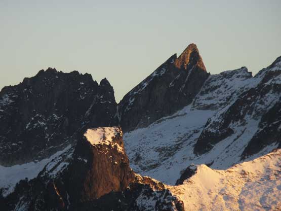
The Twin Needles behind the tiny Pinnacle Peak in foreground
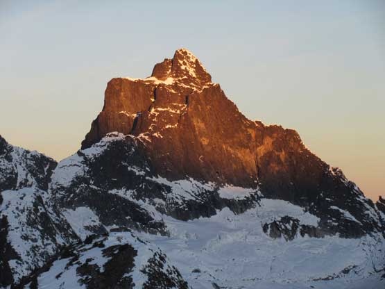
Mt. Triumph
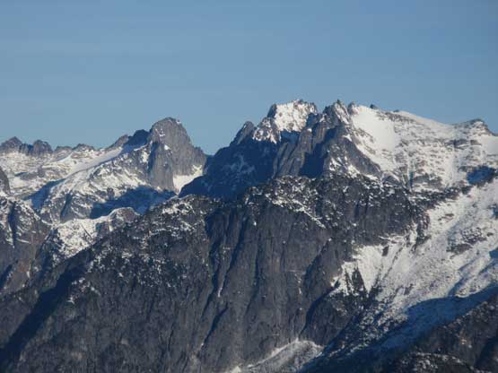
Mt. Terror the highest in southern pickets, behind Pinnacle Peak

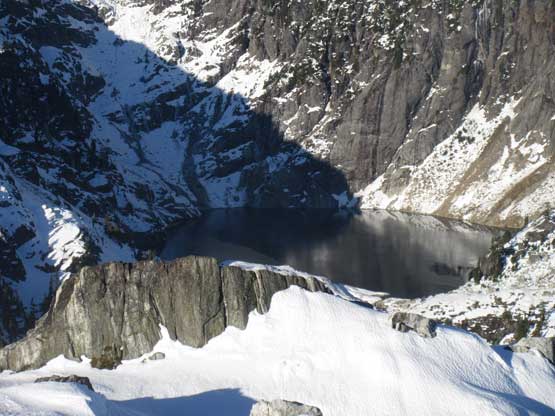
Upper Thornton Lake
After having enough of the views I went down the north to explore the route towards “X”. The steep spot was found to be actually snow-free so I decided to bag “X Mountain” as well, for the sake reason of why not.
The hike to and back from “X Mountain” had taken me longer than expected, that by the time I was back on the summit of Trappers Peak I reliazed that I probably should start picking up some speeds on the descent. I still didn’t bother with any traction device descending the steep slopes below the summit and the easily followed the tracks back across that narrow spot on the south ridge. The rest of the descent was rather boring and tedious. I somehow managed to miss the spot where I ditched the shoes and had to backtrack a little bit to retrieve them. The last few kilometers on the abandoned logging road was done by a mix of walking and jogging. My round trip time was under 7 hours and that included some long waiting around on the summit.

Partial Summit Panorama from Trappers Peak. Click to view large size.

Me on the summit of Trappers Peak with the Pickets behind

Me on the summit of Trappers Peak

Thornton Peak

Mt. Triumph
Mt. Fury, Ottohorn, Himmelhorn, Twin Needles, The Rake, Mt. Terror and Mt. Degenhardt
The twin spires of McMillan Spires

Mt. Degenhardt, The Pyramid and Inspiration Peak
Mt. Terror with “The Rake” to its left. Pinnacle Peak in foreground

Ottohorn, Himmelhorn, Twin Needles from L to R
Phantom Peak et al. looking towards the northern Pickets

Jack Mountain and Crater Mountain to the east
Another photo of the upper Thornton Lake
Ahead is the narrow spot on the south ridge of Trappers Peak
Glee Peak, The Roost, Davis Peak on the horizon
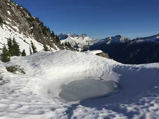
Passing this frozen pond, with again, the Pickets behind

One last look at the southern Pickets before dropping into the woods
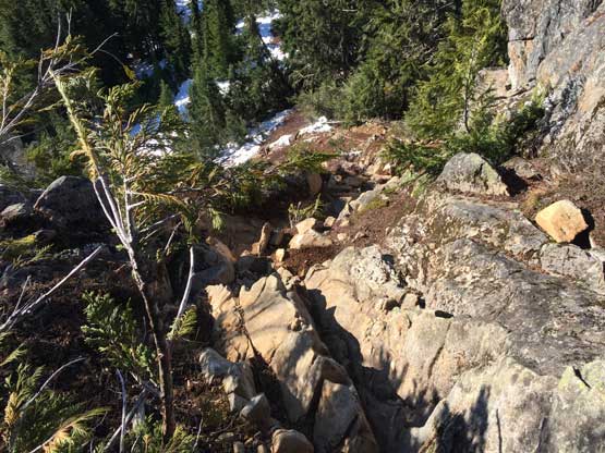
This is that stretch of scrambling.
The Colonel and Snowfield Peak group from the descent
I wasn’t doing particularly bad on time, but knowing that nobody’s around to help me on the driving I had to plan at least half an hour’s contingency for taking a nap. Indeed, I had to pull over in between Concrete and Sedro-Woolley to sleep. I woke up after about 20 minutes, had lunch in a nearby Subway and then sped north up I-5 faster than my normal driving speed. The border crossing was thankfully without too much of a delay. At that point I had about 20 minutes left. The drive to work from the border would be around 15 minutes, so I decided to go home for a quick shower, which resulted in about 5 minutes late for work. Not too bad..
