Mount Fairweather
June 19-23, 2018
4671m
Haines / Glacier Bay National Park, AK/BC
At the far NW corner of British Columbia in the St. Elias Mountains sits a massif fang of ice and snow – Mt. Fairweather, the highest peak in British Columbia despite the majority part of this mountain is actually in Alaska. The summit itself is on the border between AK and BC. The peak is only 20 km away from the Pacific Ocean and features one of the shear vertical rises that any mountain has on this planet. This peak also has close to 4000 m of prominence and that puts it well into the group of “50 finest” (Top 50 in the world by prominence) and hence it’s also an “ultra”. These are just some random facts. The name of Mt. Fairweather is quite funny. It’s apparently named in 1778 by Captain James Cook during a unusual stretch of good weather, but as all climbers know, “fair weather on Mt. Fairweather” is a rare thing. This mountains positions itself in arguably one of the rainiest/snowiest corners on Earth and I’ve heard stories about parties having to spend weeks shoving snow and never able to leave basecamp. Most attempts end up in failures mostly due to the weather. In some years Mt. Fairweather simply doesn’t open her door to any climber…
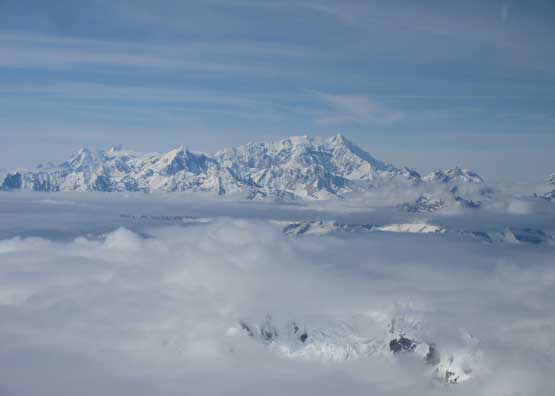
For me the interest in making an ascent of Mt. Fairweather arose from a flight I took in this past spring break from Vancouver to Beijing. I was sitting on the right hand side window seat and it was a rare bluebird day as we flew over the stretch of Alaskan Panhandle into Logan/Denali areas and then into Russia. I spent the entire course of time taking pictures and identifying the peaks. There’s a huge snowy peak coming in view not far from the coast line and my guesstimate was Mt. Fairweather despite I had never seen this peak in person, and sure enough my guess was correct. I did do some research after coming back home and the conclusion – complication with logistics combining with a high rate of failures despite being technically straightforward if, and only if the timing is correct…
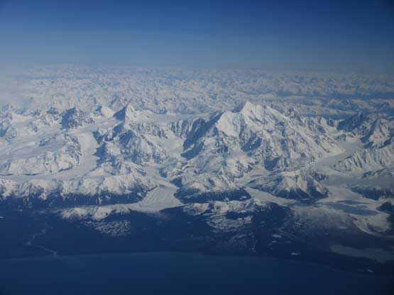
Mt. Fairweather from the plane ride Vancouver -> Beijing
I had not considered making it happen right away in the spring of this year but who knows. In these days I have lots of buddies wishing to do cool peaks with me in various areas of North America. I had to turn down a lot of invites and I’m usually very struggling in making these kinds of decisions. The reason is simple – I simply want to do them all, big or small, but I do not have more than 24 hours per day or 7 days per week… In the beginning of this month I got an invite from Eric Gilbertson to join as a 3rd person to climb Mt. Fairweather with him and Greg Slayden. I had never climbed with any of them before but I knew these big names. Eric (and his brother Matthew) is working on to climb all of the world’s country highpoints and is the current leader of this project. Greg is the webmaster of peakbagger.com. Both of them have extensive resume in travelling and high altitude expeditions and I knew if I ever had a chance to climb Mt. Fairweather then this is the right team to join. Our strategy was to have a flexible schedule and as soon as a window formed we would book the flights. At first we were excited about a short window in June 12-14 period but the forecast changed to the worse at the last minute. We decided to postpone but the condition seemed right in Mt. Robson area so I made a spontaneous decision to climb The Helmet with Ben. This was a risky move as who knows what the forecast would do, especially since The Helmet is a serious climb easily eating 5 days return from Vancouver.
In the end I was darn glad I made the right call because for one, I got The Helmet as my 46th 11,000er and the quality of that trip is good enough to qualify one of my favourate of all time, and two, the weather was shit on Mt. Fairweather the whole period. On the 3rd day of my Helmet’s trip I got text messages from both Eric and Greg through inReach, saying I should push to hike out a day earlier and be ready to fly by Tuesday morning. This meant I would aim to finish The Helmet + Rearguard Mountain in three uber burly days and then drive all the way back to Vancouver (and then to Seattle) with minimal resting in between. On the last day of our Helmet’s trip (Monday, June 18th) Ben and I woke up at 2 am in Whitehorn’s campground and hiked the remaining 11 km back to the trail-head by headlamps then went to Jasper to recollect. After having breakfast in the A&W I pushed all the way back to Kamloops in a single shot and then all the way back to Langley in another shot. I made several quick stops in the gear shops and then went back home, struggling a few hours to pack gears. We had to have enough food and supplies to survive two full weeks on the glacier in case the weather moves in and we cannot fly out. I eventually turned in at around 1 am on Tuesday and sure enough, five hours later my alarm went off and then I drove all the way down south to Seattle, half asleep, picked Eric up from his home and then grouped with Greg in Sea-Tac Intl. Airport. I was mentally and physically exhausted… After getting onto the first plane I almost fell asleep right away. Two hours later we arrived in Juneau, AK and then jumped into the smaller Alaskan seaplane and then went to Haines. The weather was sunny but our pilot Drake (FlyDrake.com) denied a flight onto the glacier that evening because of high wind, so we settled in a motel that night.

A view from Captain’s Choice motel in Haines
On Wednesday morning we heard from Drake that the wind had died down. Twenty minutes later we were back to Haines’ airport thank to our motel’s free shuttle supply. As a group of three we needed two flights each way to ferry all the gears onto the glacier so Greg went first with the majority of our gears. Greg has attempted Mt. Fairweather twice in the past (2008 and 2014) and turned around both times due to impassible crevasses and/or deep trail-breaking. He was with Drake on both trips. About 1.5 hours later Eric and I saw Drake’s plane combing back and quickly put our ski boots on, but then we saw Greg’s also in the plane… What the heck’s going on?? Apparently we got shut down by the record-breaking high temperatures. There’s no freeze whatsoever even at high altitude and the snow was heavy, wet meshed potato that Drake determined it’s too risky to land after making at least half a dozen circles. We trusted Drake’s decision since he’s been flying around there for over 30 years and is certainly the most experienced pilot out there. The weather was still fair and it seemed foolish to waste a bluebird day in Alaska. The spontaneous decision was then to hike up Mt. Ripinsky and the view down into the fjords and inlets from up there is definitely worth the effort.
Attempt to fly onto the glacier but Drake couldn’t land
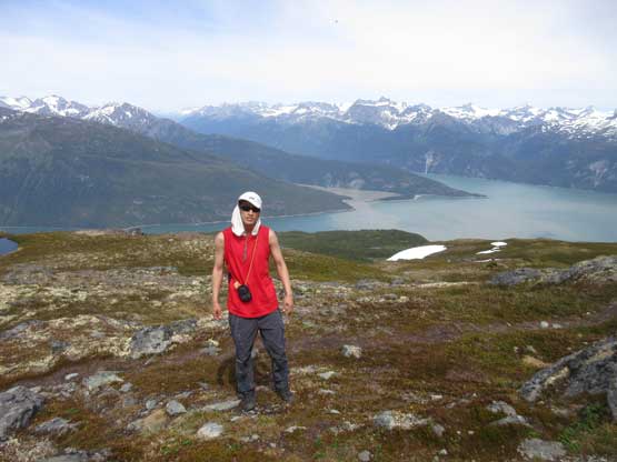
Summit of Mt. Ripinsky on the Haines’ skyline.
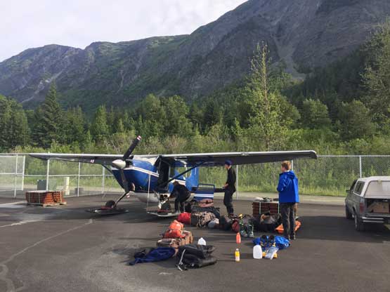
Thursday (June 21st) still saw some high freezing levels so after confirming with Drake in the morning that a flight onto the glacier was definitely impossible we were stuck in Haines for at least another day. Eric had some consulting type of work to do so he opted to spend much of the day in the library. Greg went around the town on a rented bike and managed to bag a small forested summit nearby. I had zero interest in either so just stayed in the room eating and watching out our gears mostly because I needed that extra bits of resting. I was still tired from The Helmet’s trip combined with all of the logistics complications and travelling, and hiking Mt. Ripinsky under 30 degree hot sun wasn’t the smartest thing neither… The forecast was looking hopelessly but it magically improved on Thursday afternoon. Our stoke level was high as we got a text message from Drake on Friday morning that we should make another attempt. We immediately got ourselves into the fire drill mode and made back to Haines’ airport in under 20 minutes. This time Eric went in first and 1.5 hours later Drake returned with Eric no longer in the plane. Greg and I put our boots on and were ready to fly but there’s a mechanical issue with the place that costed an hour’s delay. Greg and I went to look for some “wires”. Drake repaired it somehow but then there came a malfunction in the old gas pump… Another 20 minutes were wasted… And then halfway into the flight Drake noticed some engine’s problem and turned around… After a while it went back to normal so we turned around again and this time he finally got Greg and I onto the glacier. As complicated as it seems getting onto Grand Plateau Glacier is by any measure the crux of this trip.
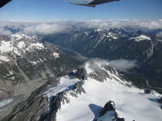
Flying high above Haines due west now. It’s an amazing journey
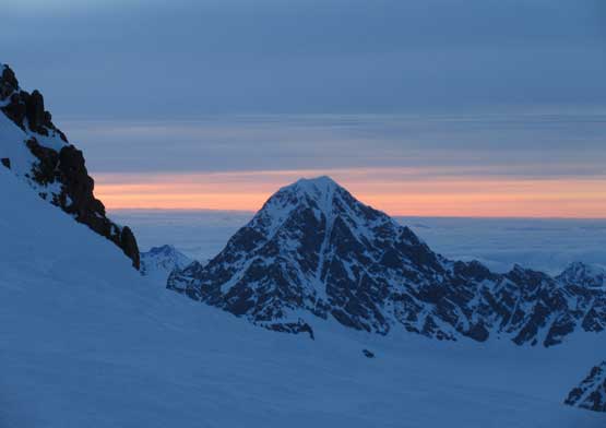
Mt. Crillon on the horizon – big peak in Fairweather Range
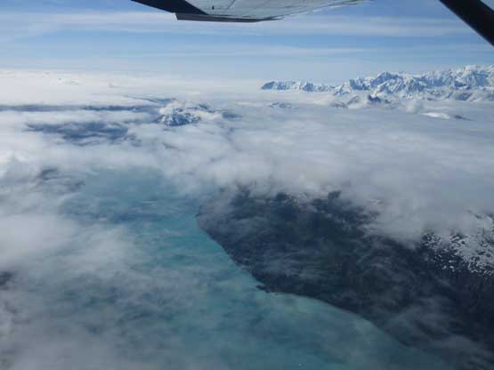
This is the only brief moment that we could look down into the Ocean
Mt. Orville and Mt. Wilbur on the skyline

Mt. Tlingit looks like a Himalayan giant…

Mt. Salisbury is trying her best to compete
Now getting into the climbing section I should talk about our strategy – fast & light single push with no acclimation. At 4600+ meters Mt. Fairweather seems to need some form of acclimation but it’s hard to say. I had previously never hiked to this altitude but I did manage to grab Mt. Rainier (sea level up with zero sleep), Mt. Shasta (fast solo) and then Mt. Whitney (fast hike in sneakers) in single shots without doing any acclimation. From these three trips I knew I could push hard to 4300-4400 m elevation and back without having any issue with the altitude and Mt. Fairweather is only 300 extra meters taller. Obviously there’s a risk of one, or several of us running out of gas but we took that. It’s better to grab the summit whenever the first weather window comes. We’ve heard enough stories of how miserable those expeditions turned into. Thank to Greg and I’s extra delays with Drake’s plane Eric had earned several extra hours to build snow walls around our tent. By the time we all landed on the glacier we were pretty much ready to go. We dumped all of the unnecessary food and equipment in the big tent and carried minimal emergency gears just in case of a forced bivouac. We carried one shovel and a tarp, and up we went with me volunteering to lead first.
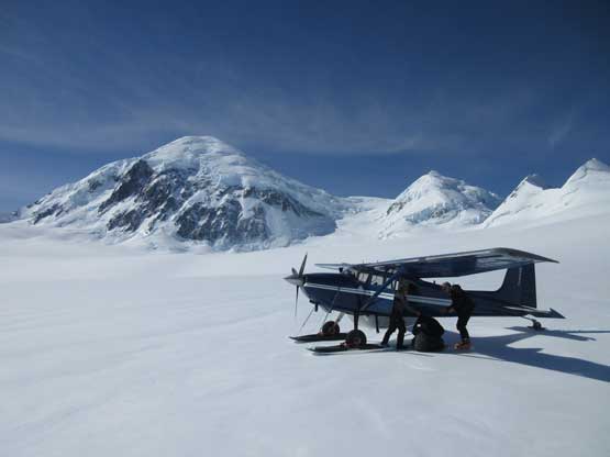
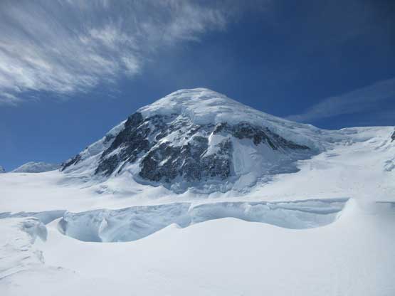
Landing on Grand Plateau Glacier now. Mt. Fairweather behind
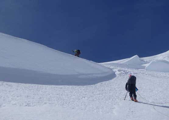
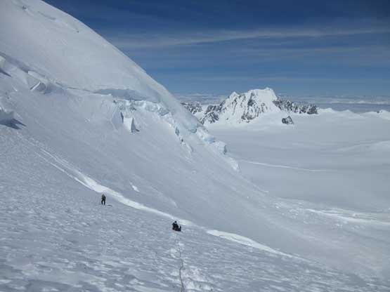
It’s been almost two years since I touched the skis so everything seemed weird at the start but I quickly got the rhythm going. My pace was slow but steady. After a couple gentle rolls I got ourselves into a maze of crevasses. I should have gone either far to climber’s left or climber’s right but I somehow chose a middle path. The crevasses were mostly well bridged except for one giant 30-feet wide chasm which required a detour to the right. In the end my bad choice of route didn’t cost any delay but did add a bit of scenery into the otherwise, mundane plod across the lower glacier. Once entering the “west valley” we skinned to as far as we felt comfortable and then ditched the skis at the seracs’ debris zone. The condition was icy enough that we wouldn’t leave any penetration even on boots so any slope steeper than 25 degrees was impossible to skin up. We debated about carrying the skis but opted for not. The #1 priority was getting to the summit in the fastest way possible and in this case, ditching the skis and donning crampons.
Skinning towards our objective with massive slots to work around
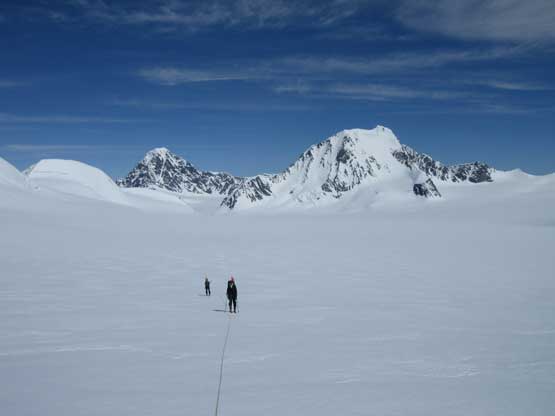
Looking back at Greg and Eric skinning up Grand Plateau Glacier
Me working my way up. Photo by Eric G.
Me and Greg passing a huge crevasse. Photo by Eric G.
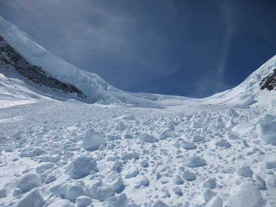
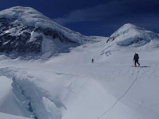
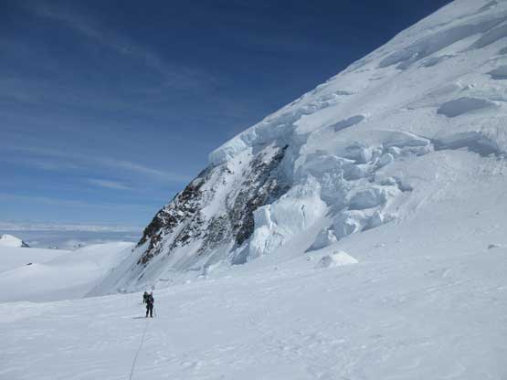
Entering the seracs debris zone. Move quick!
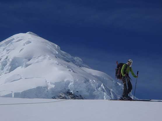
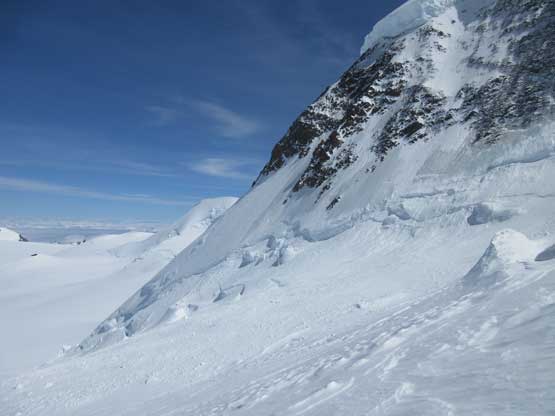
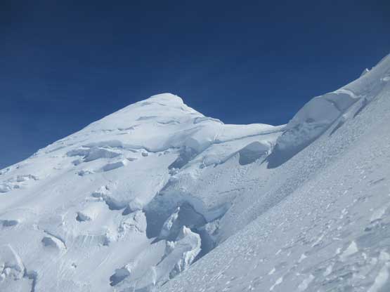
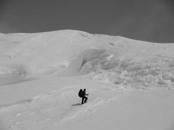
“Skis off then I’m fast”. I was definitely the happiest person when we ditched skis as travelling on crampons was much more comfortable for me. After the debris zone we entered the narrow part of the “west valley” and between us and the “Balcony Camp” there were several giant crevasses. In the past years people had proved that getting around these crevasses could be a problem and Greg knew that from first hand experience. The crevasses could span the entire valley stopping any upward progress but this is a lucky year. We knew a guided group of 10 had succeeded via this standard route in May so the condition must have been good. There’s probably not that much of melting with the sustained snow and cold temperatures neither, and sure we were right. I poked at the lips of those crevasses and saw bomber snow bridges every time not too far from our positions.. Higher up I led a line up climber’s right side of the “headwall” while bypassing several crevasses and the next stop, we were on the notch of the west ridge.
Past the debris zone now. The skis were ditched

Upwards and onward
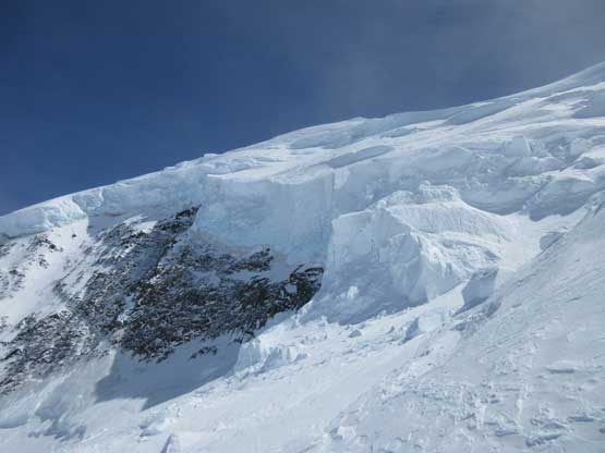
Huge chucks of ice are ready to fall off at any time. The terrain’s huge…
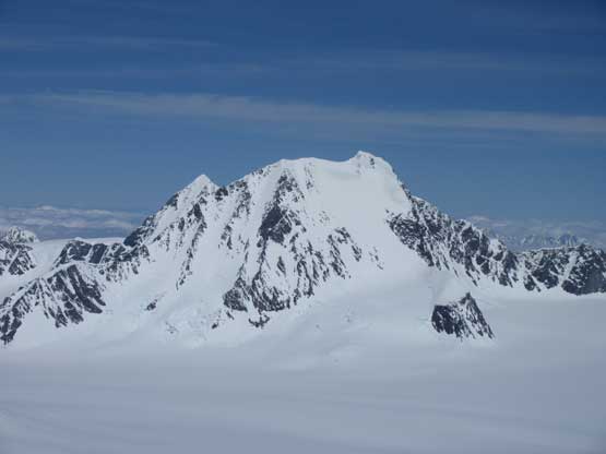
Mt. Root looks nice
Greg’s looking small comparing to the terrain

Me picking a way weaving around the crevasses. Photo by Eric G.
Me and Greg ascending steeply towards the col. Photo by Eric G.
Greg and Eric taking a break.
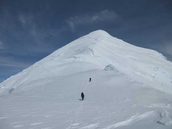
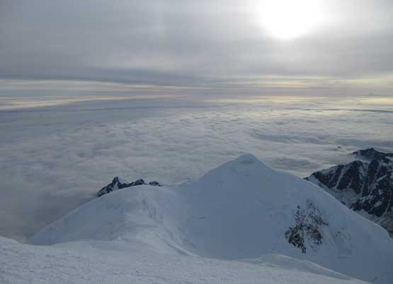
Almost at the col now. Looking towards the summit (very foreshortening)
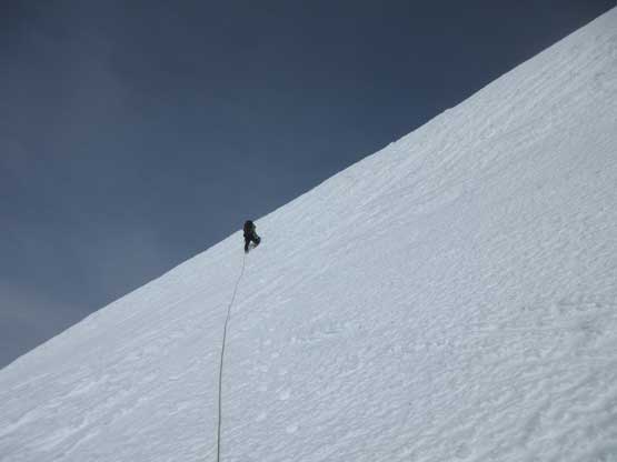
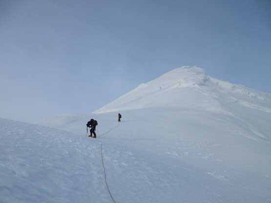
After a long meal break Eric took over the lead and I took over the responsibility in placing wands at the tailing end of our rope team. This was my first time ever using wands and I have to say it’s a bit odd to stop and planting them in, but we all knew the weather here could change without giving any warning. Both Eric and Greg were recording GPS tracks as a back-up though. The ascent of the west ridge appeared straightforward but there were crevasses everywhere. There were also a couple ice buldges/steps that we had to either bypass or attack head-on. One of them proved to be fairly involved with a short section of vertical climbing. Eric led up with just poles while Greg and I had no problem following using just a single ice axe. At this point some high clouds rolled in and we had some concerns. Being the faster persons in the group Eric and I took off as a rope-team-of-two, breaking trail up the last 500 vertical meters while Greg would follow slowly behind using our tracks. Eric is a beast and broke trail all the way to the top. I was barely able to keep up and had to call for a couple breaks. Doing pressure breathing helped a big time as none of us developed any altitude symptom. Ironically the weather on the summit was really nice without much of wind. After what seemed like a while Greg showed up. It’s past 8 pm so the summit celebration was short as we still had a long ways to go…
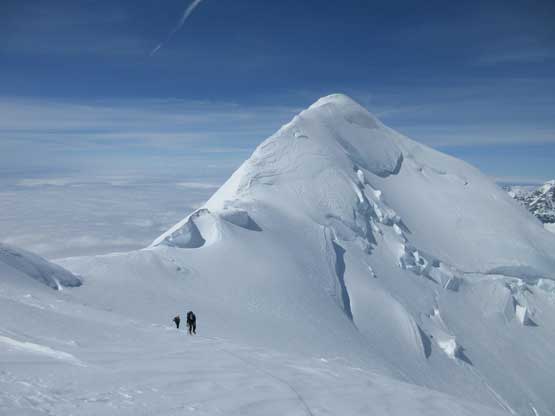
Ascending above the col now, looking back towards the west peak
Eric took over the lead on the ridge.

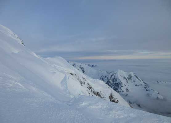
Great views looking south. Just one picture break from the slog.
Eric picking his way up.
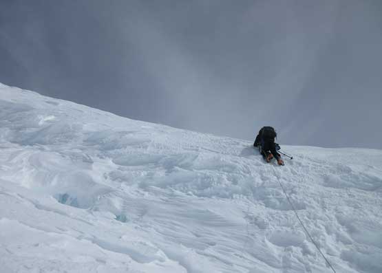
Greg climbing up the short vertical step. It’s a filled in crevasse
The upper ridge was pretty steep at places.

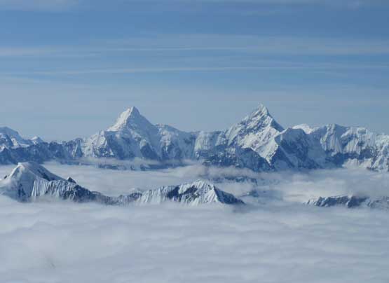
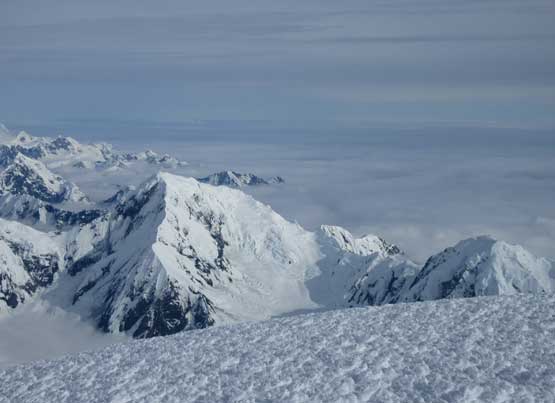
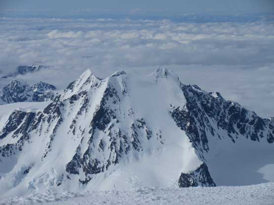
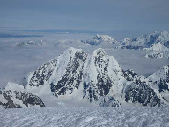
Summit Panorama from Mt. Fairweather. Click to view large size.
Lituya Mountain to the south
The steep south face of Mt. Root
Mt. Salisbury
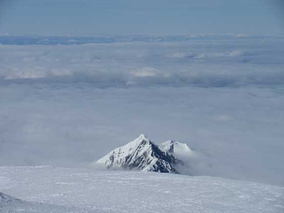
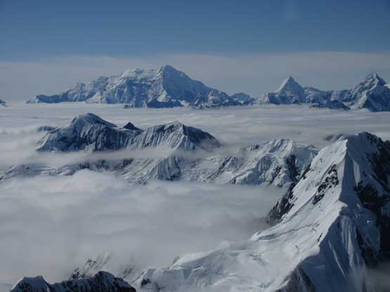
More of the sea-of-clouds photos with peaks poking through
This is just another lower summit of Mt. Fairweather massif

Mt. Crillon is that big peak to the south
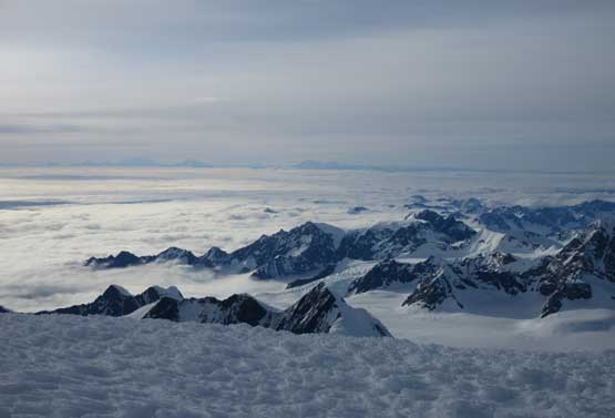
This is a NW horizon with St. Elias, Logan, Vancouver on the skyline

Eric Gilbertson on the summit of Mt. Fairweather
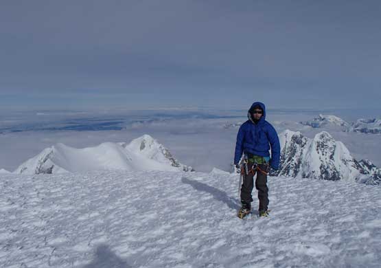
Me on the summit of Mt. Fairweather

Greg Slayden approaching the summit of Mt. Fairweather

Our group shot on the summit of Mt. Fairweather. Highest peak in B.C.
Descending by plunging steps was easy but still required caution especially around a couple steeper rolls. Down-climbing that vertical section was quite interesting. I did pack an ice tool up the peak but was too lazy to take it out. We all really took our time there to not slip and fall (even though without much in terms of exposure). Removing the wands was annoying but we had to do so. Eventually at the col we took the only long break, melting some snow for water. The col was windy and cold and I was shivering even when wrapped in the giant parka so we had to get going. I led the group down using our faint sets of tracks as well as the wands and we had no problem reaching the skis. At this point it’s already past sunset time but the sky was still bright enough to not require headlamps. I did my usual fast gear transition at the skis and somehow managed to ski sideways across the field of seracs debris and then enjoyed a long, gentle run down the icy slopes onto Grand Plateau Glacier. The other guys played more cautiously at the debris section but soon caught up. For the last section we opted to explore a route far to skier’s left (west) side and did manage to avoid the lower crevasses. Eventually we got back to camp after 11 pm and still not needed headlamps.

Cannot stop taking pictures towards north.
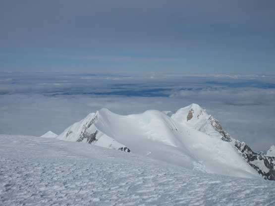
The west summit with a sea of clouds behind. Too bad we couldn’t see the ocean
Just another view from the long descent.
Plodding down. Step by Step…
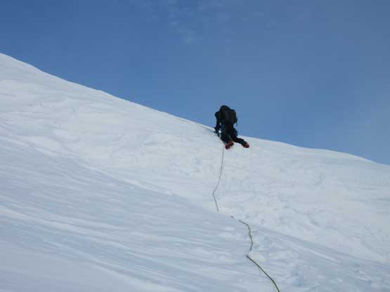
Carefully down-climbing that vertical step.
It’s Alaskan sunset now. Mt. Watson looks big
In this part of the world the night really isn’t closing in. The horizon was always bright even at midnight which was quite cool to watch. Eric and Greg got their white gas stoves going (that I had absolutely no idea how to operate) and soon enough the meals were ready. We turned in after 1 am in the morning and had a couple hours’ sleep. The brightness woke us up and soon it’s getting too warm in the -18 degree sleeping bags so we were out. Greg managed to reach Drake via his satellite phone and a couple hours later Drake was here. Eric and I went in first and I have to say I loved this plane ride even for just the views. It’s a magical journey flying off the Fairweather Group, above the low ceiling and then dipping into a hole in the clouds and back to Haines. In less than 2 hours Greg was back to Haines too and that concluded our success on Mt. Fairweather.
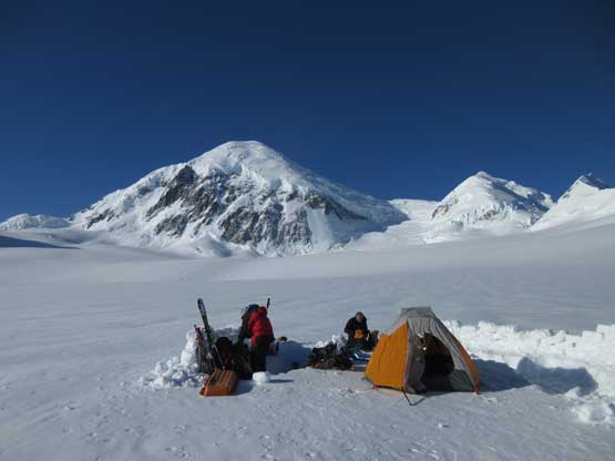
Our camp and Mt. Fairweather on Saturday morning
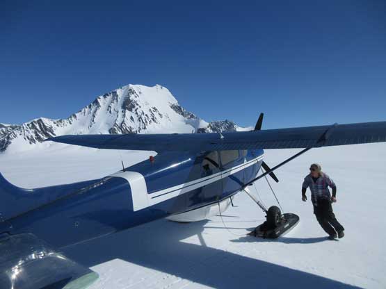
Fly Drake’s picking us up.
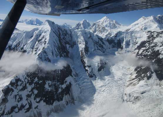
Massive scenery in Fairweather Range
Mt. Crillon and other giants from the fly out.
We all kept our eyes on the time and the decision was to immediately catch the 1:30 pm plane ride from Haines to Juneau. Initially they didn’t allow us to get on but since nobody else booked that plane we got a private ride with all of our gears. The plane was just big enough to fit everything in. After arriving in Juneau we immediately talked to the Alaska Airlines and managed to jump onto the 3:30 pm ride back to Seattle. It was a tight fight but we did manage to squeeze 10 minutes of spare time buying a lunch package in Juneau’s Intl. Airport. Once back to Seattle we decided to all squeeze into my small Corolla. I had no idea how that’s going to work but Greg and Eric had more experience in packing things so let’s figure it out. And we did manage to squeeze everything including ourselves in. The traffics on I-5 was surprisingly clear. After dropping Eric and then Greg off at their places I went to a nearby Olive Garden for a delayed dinner (at 8 pm) and then eventually made back to Vancouver before midnight. Not bad, not bad…
As much as the weather goes in this part of the world we got five consecutive days out there with no single drop of rain. For the two days up on Mt. Fairweather we had mostly bluebird conditions sans some high clouds but nothing’s really moving in. It might be tempting to say the weather wasn’t as bad as I thought but I think it’s just our luckiness. Most groups would have to wait out of the storms for many days in camp, and some never actually managed to fly in. Just because we managed to pull off Mt. Fairweather in 24 hours return from Haines that doesn’t mean it’s the standard. The trip reports below show the typical itinerary – weeks of expeditions with more failures than success.
- Trip Report 1: From Petter
- Trip Report 2 (Rick Collier et al., bivoua.com)
- Trip Report 3: Smileys Project
- Trip Report 4: Greg’s first attempt (2008)
- Trip Report 5: Greg’s second attempt (2014)
Also make sure to check out the trip reports by my partners, Eric Gilbertson and Greg Slayden. Those who are interested in the cost of this trip I think it’s over 2000 US dollars for each person. It’s not a cheap trip and certainly not for the true dirt bags but that’s about Alaskan expeditions. I’m happy that after a few years since graduation I can finally afford trips like this. In the end I have to thank my partners for doing all of the trip planning and logistics, and of course their invite. Without their experience and determination this would simply not happen.
