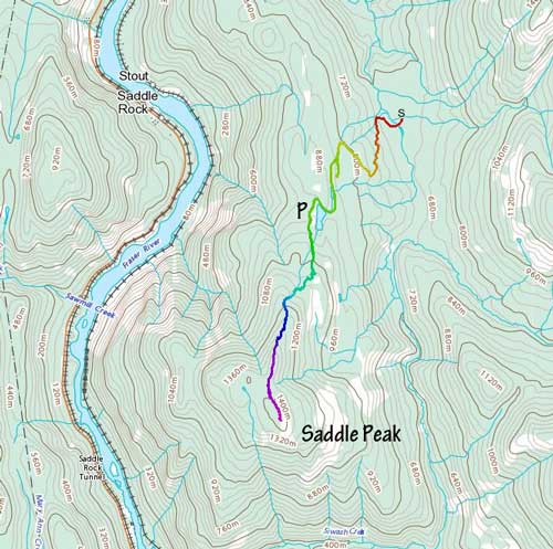
Saddle Peak (Fraser Canyon)
May 17, 2022
1430m
Yale / Fraser Canyon, BC
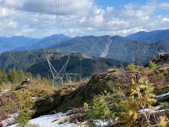
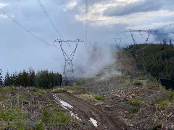
“Saddle Peak” is the unofficial name of a dull-looking, forested but decently prominent (prominence ~800 m) summit in Fraser Canyon not far from the little village of Yale. This peak locates on the east side of the river and the access requires a long drive southwards down Anderson River FSR system from Alexandra Bridge. The logging roads in this area had been significantly mangled by the apocalypse in November 2021 but there are power lines high up on the flanks of “Saddle Peak” meaning BC Hydro must find a way to maintain these roads. Indeed, Matt J. took a gamble in April and the result was that he drove all the way to the driveable end high up on Saddle Peak’s north ridge, leaving only 2-3 hours of work to get this peak done. It took me almost a month to find that ideal window to pull the trigger. Matt was saying that I should get on this peak as soon as possible, raining or sunny, but I’m by no mean a “bad weather hiker” and I needed guaranteed chance of views to do a trip. Eventually everything lined up nicely on this Tuesday. The weather forecast wasn’t the greatest, but good enough to grant some views. And then knowing the shortness of the hike it made perfect sense to practice that “before-work” thing despite the longer drive.
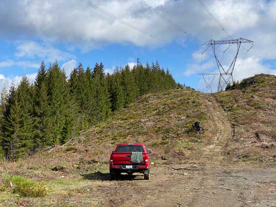
I did not finish work until 10:30 pm on Monday, got home to get things packed, and did not leave home until almost 11:30 pm and subsequently did not arrive at the start of Anderson Main FSR at almost 2 am. I was already exhausted but other than pressing on I had nothing else to do. The condition on the logging roads was worse than expected with pot-holes, temporarily repaired stretches and two creek crossings that required high clearance but nothing problematic for the trusty Taco. The direction could be confusing but I had come prepared with pre-downloaded topo map, satellite images and Backroad Mapbook layers all in the Gaia app. The navigation these days had become extremely straightforward thank to the increasingly more convenient GPS technology. My “plan A” was actually to challenge Matt’s route by taking a different spur that shoots a long ways down south a couple switchbacks lower than Matt’s starting point. The reason was then to hike/snowshoe the broader eastern flank that hopefully had less micro-terrain than the north ridge’s standard route. However, the plan fell apart immediately as it’s very obvious this road was not maintained. I backtracked and drove onto the north ridge just above a sizeable tarn. I wanted this trip to be as short as possible, so continued driving higher since the power line road was still free of snow, but soon realized this would be a dumb idea. The ground was extremely muddy and the road’s becoming worse and worse, so I made a sketchy turn-around, drove back to that broad saddle about the tarn and parked at the same spot where Matt started his trip. It was 2:30 am when I finally turned in and I set the alarm at 5:45 am. To make things more “enjoyable” I only managed at most 1 hour of sleep.
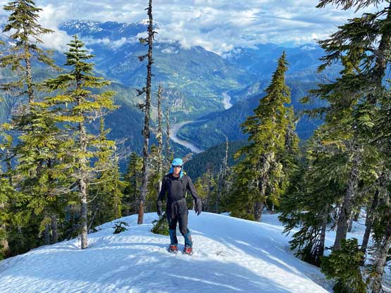
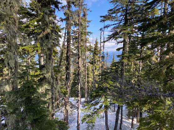
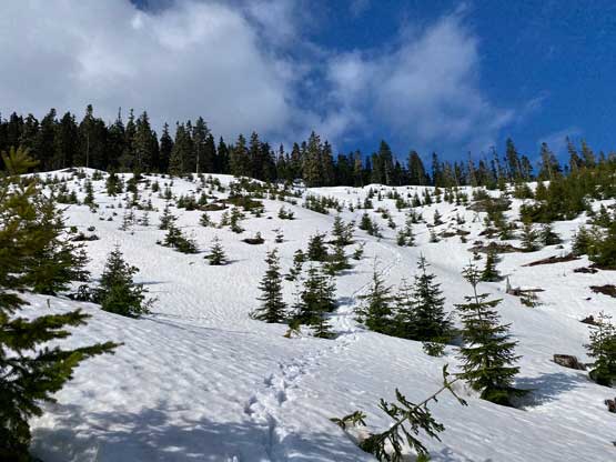
I eventually crawled out of the truck at around 6:30 am after eating some cold breakfast while still in the sleeping bag. I then started the plod in no time under some moody skies. The weather seemed worse than forecasted with intermittent flurries, but I kept my spirit high hoping the “clearing trend” would eventually arrive. The first stage was simply plodding up the power line road and I was damn glad I did not try to drive up this road, as the grade soon became insanely steep and the ground was slippery as fuck such that I was post-holing in the mud at times. At just under 1050 m elevation I encountered snow and it’s here that I left the road following Matt’s track to aim for another road that seemed to come up from the south side. Once getting on that upper road the snow had become continuous so I donned the snowshoes. The snow condition was nowhere as supportive as I was hoping for, such that the snowshoes were definitely mandatory. I then ascended the clear-cut deviating from the track by aiming more on climber’s right. My plan was to get on the north ridge as early as possible and stick to the west side of the ridge crest. The micro-terrain on the ridge kept directing me to traverse east (left) without noticing and the punishment for that was to ascend some extremely steep rolls to get back onto the ridge followed by endless up-and-downs. I kept reminding myself to traverse west (right) and I think I nailed the route-finding pretty well with only 2 steep rolls to ascend in addition to 1-2 short descents.


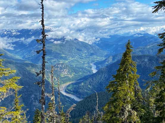
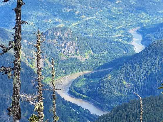
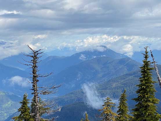
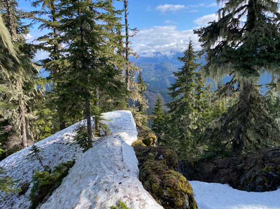
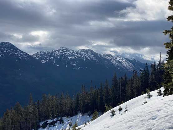
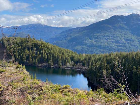
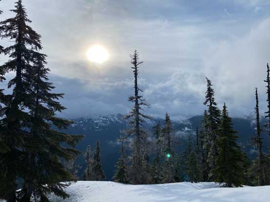
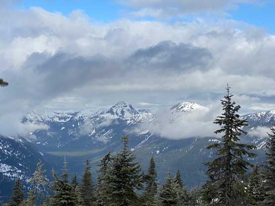
It didn’t take me long to arrive at that bump/ridge crest before the final summit push. The weather was slowly improving so the motivation was high. There’s about 30 m of unavoidable descent followed by more micro-terrain and up-and-downs to reach the true summit. The satellite images showed the summit was mostly “open” but it was not quite that open to grant panoramic views. I did get glimpses of views towards all directions but I had to walk around to find the views through different openings in the trees.


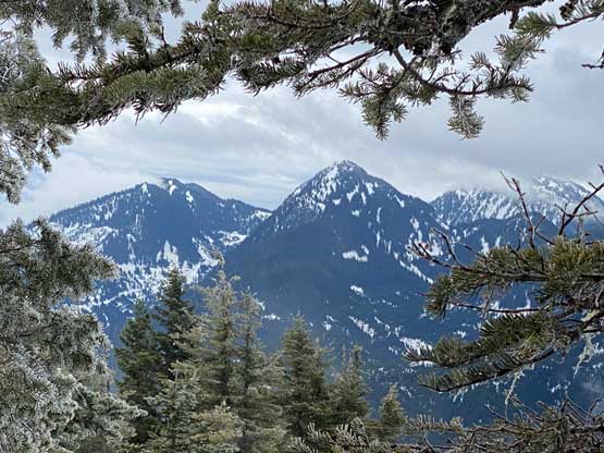
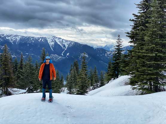
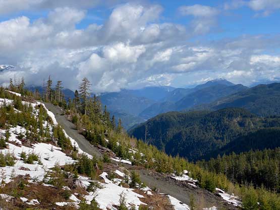
After taking in enough of the views I finally turned on the mission mode to dash down following my own snowshoe tracks. The views further improved as I descended onto the clear-cut so I slowed down again to take more pictures. The rest of the descent was rather uneventful and my round trip time was just over 3 hours. Without doing much lingering I turned on the engine and drove out of this Anderson River FSR system. The creek crossing was not as deep as it seemed in the dark on the way in, such that I actually think a Subaru can manage this drive if the driver is skilled and confident. I had to take a nap somewhere between Hope and Chilliwack. I eventually got back home at 12:30 pm after having lunch in Abbotsford, and earned myself about 2 hours of napping time before the afternoon/evening work routine.