Mount Agassiz
June 9, 2019
962m
Agassiz / Harrison Hot Springs, BC
Mt. Agassiz is the highest of the wooded “island” bounded by Harrison Lake/River to the north and west, Fraser River to the south, and the low-elevation Agassiz-Harrison Hot Springs road to the east, and hence the topographical prominence is almost exactly the same as the actual elevation making it a “P3K” even though it’s technically nothing fancier than a forested hill. The northeast side of this peak boasts Campbell Lake Trail aka. the “Harrison Grind” which is much more famous than the peak itself. No one would bother to venture beyond Campbell Lake other than the stubborn peak-baggers. The trail has a few nice viewpoints of the southern half of Harrison Lake.
I had gone partway up Campbell Lake trail about 10 years ago in high school time but didn’t make to Campbell Lake. I did get to see the beautiful Harrison Lake but turned around shortly after the first viewpoint. I had always wanted to come back to finish the hike as well as the summit of Mt. Agassiz but it’s nowhere on my priority list. I had on purposely saved it for a bluebird day in winter that I could easily do it as a “before-work exercise” on snowshoes. This time the plan didn’t go my way. After finishing Mt. McRae with Adam and Connor we still had at least 6 hours of daylight time to kill. I was not particularly keen on Mt. Agassiz because I didn’t want to just simply bag it from high on Mt. Woodside FSR in summer time, but it was the most prominent option and the unknown FSR would be better to explore with my Tacoma, so I voted for Mt. Agassiz and Mt. Woodside.
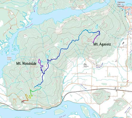
Mt. Agassiz and Mt. Woodside from Woodside FSR. GPX DL
I followed the GPS map to the start of Mt. Woodside FSR and turned onto it. The switchbacks weren’t too bad by west coast standard but were very steep at places, but steepness isn’t something that scares my Tacoma away. In short time we passed the active traffics and were onto the wooded ridge connecting Mt. Woodside and Mt. Agassiz. A couple old brief reports indicated a few gates on various stages on this road but we found none. From the low saddle between Mt. Woodside and Mt. Agassiz the road descended to the northwest side of Mt. Agassiz before ascending steeply back onto the broad NE Ridge. Easy peasy for the Taco. I’m sure a Subaru could make all the way to the end but not without some careful driving. We parked at the highest point on the road and quickly geared up.
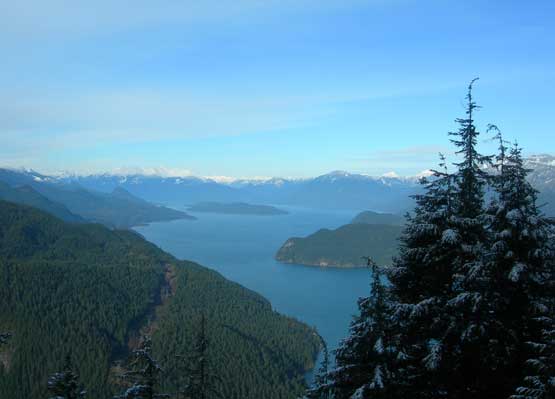
Harrison Lake from lower Campbell Lake trail in December 2009

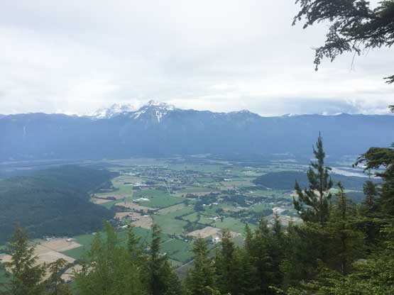
A view into Fraser Valley from the lower Mt. Woodside FSR
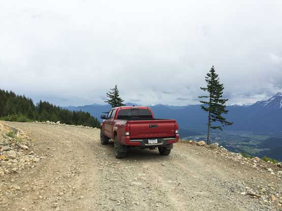
Taco climbing high….

As much as the Mt. Woodside FSR goes. Smooth sailing
The ascent would be nothing fancier than an easy bushwhack up the NE Ridge. The elevation gain was under 200 m and the distance would be just over 2 km round trip. The forest was secondary growth but the travelling was easy without tight timbers nor a ton of dead-falls. We made quick time to the highest point that had a minor viewpoint looking towards the town of Agassiz and Cheam Peak. We went further south to explore another highpoint according to the topographic maps but the conclusion was that the first summit (with a viewpoint) was much higher despite the confusion in contour lines. There’s another summit at over 1 km farther to the west that appeared to be at the same height (either on map or by eyeballing) but we decided against spending two hours bushwhacking there… We then easily descended to the truck following the exact same route we took and then went for the nearby Mt. Woodside.

Adam bushwhacking on the broad NE Ridge.
Fraser Valley from the summit of Mt. Agassiz

A zoomed-in view of Cheam Peak

The town of Agassiz and the agricultural land in this general area

We went beyond the summit to explore another highpoint

Our group shot on Mt. Agassiz. A classic dumpster diving summit…
