Cowap Peak (Canyon Ridge East)
September 19, 2019
1725m
Canyon Creek / Mt. Baker Highway, WA
Cowap Peak is a small summit north of Damfino Lake at the headwaters of Canyon Creek north of Mt. Baker Highway close to the Canadian border. This peak sits on the east/southeast edge of Canyon Ridge higher than all other bumps on the ridge, and offers a bit of scrambling oppourtunity on the summit ridge. A trail that extends from Damfino Lakes Trail brings hikers to the NE shoulder and after that, an unmaintained trail runs all the way to the very summit. The Damfino Lakes and Canyon Ridge trail system is apparently a popular destination but the access road, Canyon Creek FSR had been closed for a couple years due to wash-outs. The road was fixed earlier in this year and that’s the main reason why I picked this objective. I learnt that this access was on-and-off and I wanted to bag this peak while I could still drive the road. The drive requires over 25 km on this gravel road and that’s certainly not within walking range..
From Damfino Lakes trail-head one can easily ascend Cowap Peak in about 2 hours round-trip and the trail-head is reasonably close to home making me believe that it’s an ideal “before-work morning exercise” objective. I made this spontaneous decision because Thursday was likely the only day in the week without rain. I checked with a couple friends and Adam agreed to join. I had to be back to White Rock before 3 pm to prepare for my afternoon/evening work so the decision was meeting in Bellingham at 5:30 am. The drive from there to the trail-head took about 1.5 hours. The logging road was in a decent shape, but the numerous pot-holes kept my speed down.
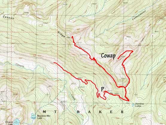
Cowap Peak and Canyon Ridge east side hiking routes. GPX DL
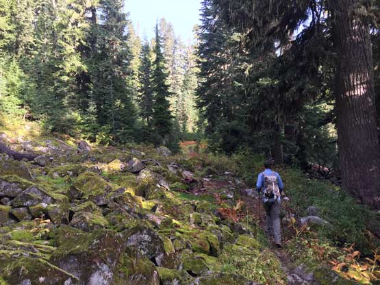
There were already a few vehicles parked at this remote spot including a horse trailer. After a quick canned food breakfast Adam set a blistering pace up the trail and we made to Damfino Lakes junction in no time. It’s been about 2 weeks since my last hike that I had to work really hard to keep up the pace. The trail was extremely wet and muddy from the recent rain events, but thankfully the trail was wide enough that wet brushes weren’t a concern. The views didn’t open up until a rising traverse across a grassy slope on the SE Face of Cowap Peak and shortly after that we arrived at the broad NE Ridge’s shoulder. There wasn’t a trail marked on any map beyond this point, but Adam had done his homework saying there’s an unofficial trail on the ridge running all the way to the summit. I wasn’t fully convinced but the trail was pretty damn obvious.
Adam setting the pace hiking up the Damfino Lakes trail

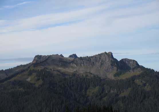
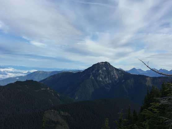
After a while we could finally see our objective looming ahead

A zoomed-in view of the south face of Cowap Peak

Adam starting this scenic rising traverse across the grass slope

This the typical terrain and view around here
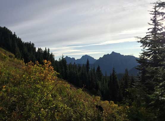
Border Peaks and Tomyhoi Peak to the east

Another look at Cowap Peak. This one is from the grassy slopes traverse
It was here that the view finally opened completely especially looking north into the Chilliwack area. There was one narrow stretch along the summit ridge that required brief scrambling but nothing really worth noting.

On the broad NE Ridge now, looking east towards Border Peaks and Tomyhoi Peak
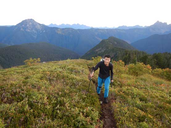
Me hiking up the broad NE Arm of Cowap Peak. Photo by Adam W.
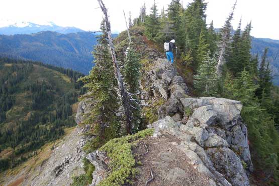
Me negotiating the narrow spot along the summit ridge. Photo by Adam W.

Adam approaching the summit
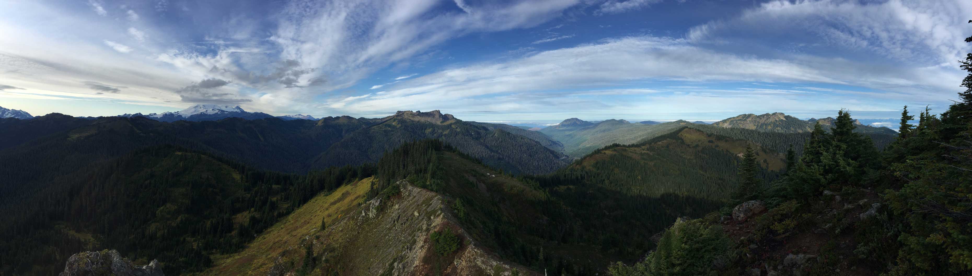
Partial Summit Panorama from Cowap Peak. Click to view large size.
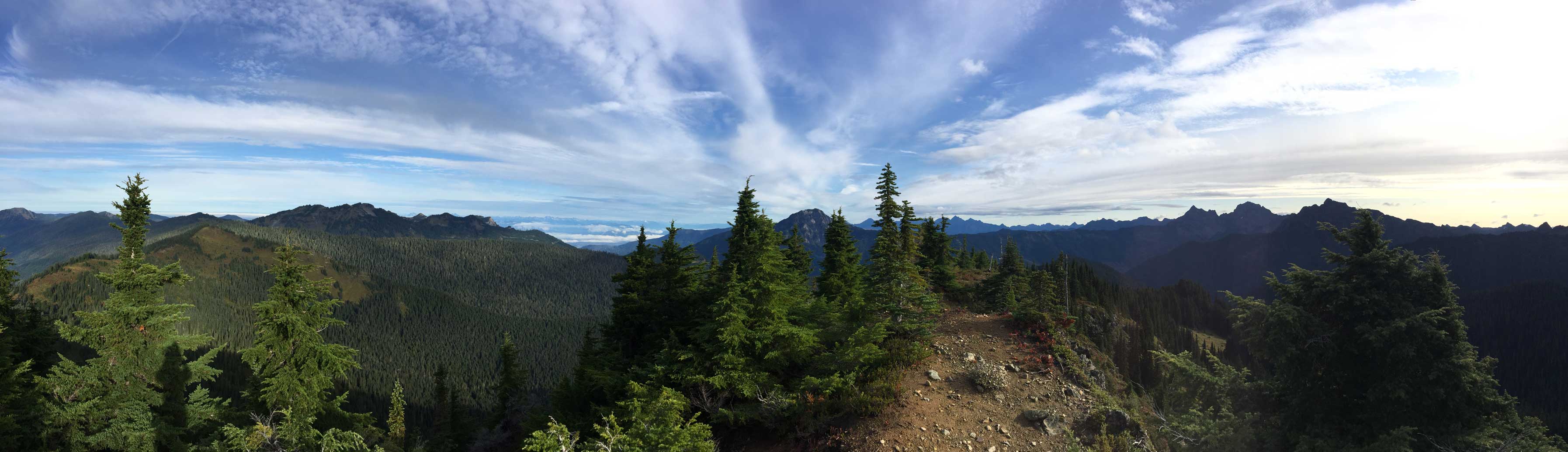
Partial Summit Panorama from Cowap Peak. Click to view large size.

A zoomed-in view of Mt. Baker

This is looking north across Fraser Valley towards Mt. Clarke in the Chehalis Area

Welch Peak et al. in Cheam Range
South Twin, North Twin et al. in Twin Sisters Range
This is looking towards Bearpaw Mountain with Church Mtn. poking behind
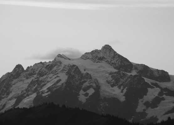
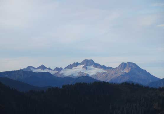
A zoomed-in view of Mt. Shuksan’s north face

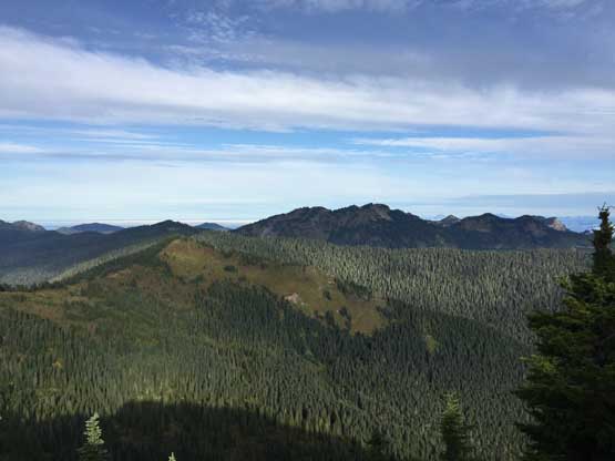
A wider view towards Bearpaw Mountain, another short objective nearby
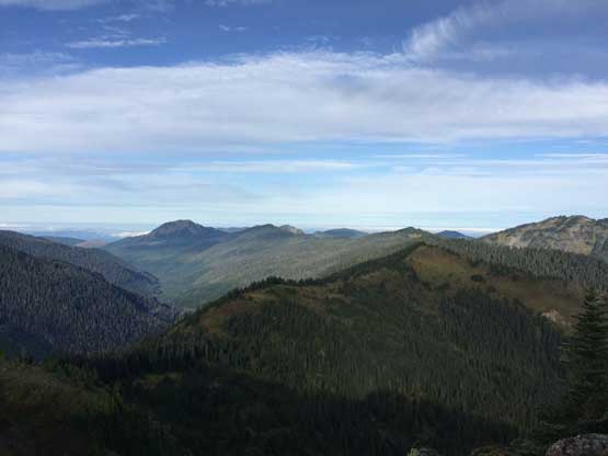
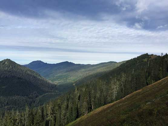
This is looking down Canyon Creek towards Bald Mountain in the distance

The morning sun and Mt. Shuksan on the horizon
Looking across the stretch of Canyon Ridge towards Liumchen Mtn. in BC

Clouds rolling in obscuring Mt. Baker already
This is the south face of Mt. McGuire in Chilliwack area
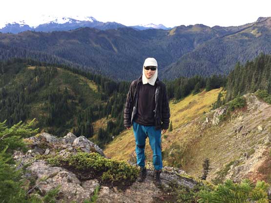
Me on the summit of Cowap Peak
We stayed on the summit for about half an hour. Adam suggested we should go tag the nearby east end highpoint on Canyon Ridge. I wasn’t very keen because a quick calculation yielded the conclusion that any additional hiking meant I probably wouldn’t have much time to sleep after getting back home, but reluctantly agreed. I figured that with Cowap Peak in the bag I would not come back to this exact spot again, so it’s my one and only shot at exploring Canyon Ridge. The hike to the highpoint was easy, but seemed never-ending. Adam led a blistering pace and I pushed as hard as I could to keep up. The view was pretty averaged so not quite worth the detour.

Adam hiking back across that narrow stretch

Mt. McGuire and the Fraser Valley on left skyline
Canyon Creek from the trail towards Canyon Ridge

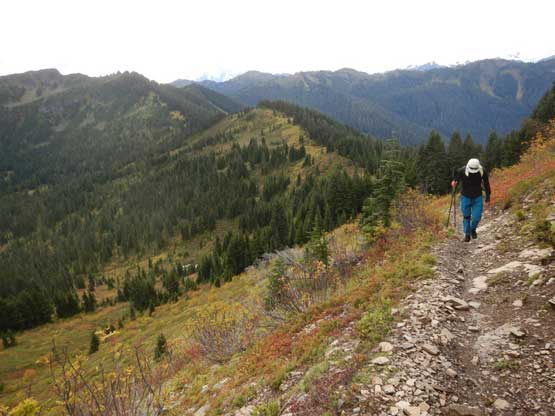
Adam with the east end bump on Canyon Ridge ahead

Slesse, CBP, ABP, Tomyhoi on the skyline
Me hiking up Canyon Ridge’s east end bump. Photo by Adam W.
On the return hike we passed at least three or four large groups including some collage students on their field trip to study vegetation on some north-facing slopes, and more hikers gearing up at the trail-head. Considering this was a Thursday I was really surprised. Once down to the parking lot we immediately hit the road. I was very sleepy on the drive back towards Bellingham but somehow managed to kill the tiredness without having to stop to rest. I eventually made back home at 2:30 pm with barely enough time for lunch and shower, before showing up for work till 9 pm – a typical exhausting, but satisfying day of mine.
