Mount Tantalus
July 21-23, 2018
2603m
Squamish / Squamish Valley, BC
Rising a whooping 2600-meter elevation above Squamish Valley the impressive massif of Mt. Tantalus doesn’t need a lot of introduction. It catches everybody’s attention while driving up and down the Sea to Sky Highway no matter if you climb or not, and has been teasing me for a few years. I wouldn’t just jump into the game blindly until I could perfectly line up the weather, condition, partners and route beta and in my opinion the preparing stage of this trip is just as difficult as the execution. Timing is everything and I couldn’t emphasize enough on this. This peak boasts about half a dozen routes historically but thank to the global warming it’s pretty much only ascended via the south ridge and the north ridge nowadays. The former is shorter while the latter is the least technical (4th class and steep snow).
What makes Mt. Tantalus exceptionally famous in the climbing community is the access. One needs to find a way to cross Squamish River and there are only three ways to do it sans air support. The three crossing points correspond to the three approach options. The traditional approach does a Tyrolean traverse on a cable car and there’s a trail that goes up to Lake Lovely Water and from there one can scramble up to Haberl Hut. This is for the south ridge side. For those interested in climbing the north ridge the shortest option is canoeing across Squamish River followed by a sea-level-up bushwhack to Zenith Lake. This option has the least amount of up-and-downs but is probably the least pleasant. There’s a third way that avoids the complication with Squamish River all together but has massive stats – on the far northern end of Tantalus Range starting from Sigurd Creek trail and ascending up and over Pelion Mountain’s NE shoulder. To me the third option is the way to go – just a burly slog with no complication with logistics and no real 5th class climbing neither. And of course there’s a 4th way. Black Tusk Helicopters serve flights up to the start of North Ridge that costs only 170$ per person for a group of four. This is as cheap as a helicopter service can ever get, so why not…
The best time to do the north ridge route is mid July. You want the bulk part of the north ridge proper to be dry but enough snow to bridge the bergschrunds and moats. Alex and I had been discussing this peak for at least two years but it never panned out. In July 2017 I focused too much on the Rockies 11,000ers and missed the window. There’s no way would I miss out this year’s oppourtunity. I pulled myself out of a supposed 11,000ers trip and committed to Mt. Tantalus. The weather was questionable in Rockies but superb in the Coast so it’s easy decision for me. The main problem was that we could only manage three days instead of four. Our hope was to bag all peaks on the northern end of Tantalus Range – Tantalus, Zenith, Pelion and Ossa but three days aren’t simply enough for that. The solution? Just pay the cash for a helicopter ride to shave the first day off. I called the Black Tusk Helicopters on Thursday and booked our flight for the first thing on Saturday morning, and then found two more volunteers to come along. Ben S. and Matthew B. were very keen as they too had been waiting for many years for this shot. After sorting out all of the logistics complication we grouped in West Vancouver at 4:30 am and drove two cars out to Sigurd Creek trail-head. My Tacoma was left there for the return hike while all four of us piled into Alex’s Forester. We made to Squamish Airport a few minutes before our pilot showed up, and within an hour we were pretty much ready to take off.
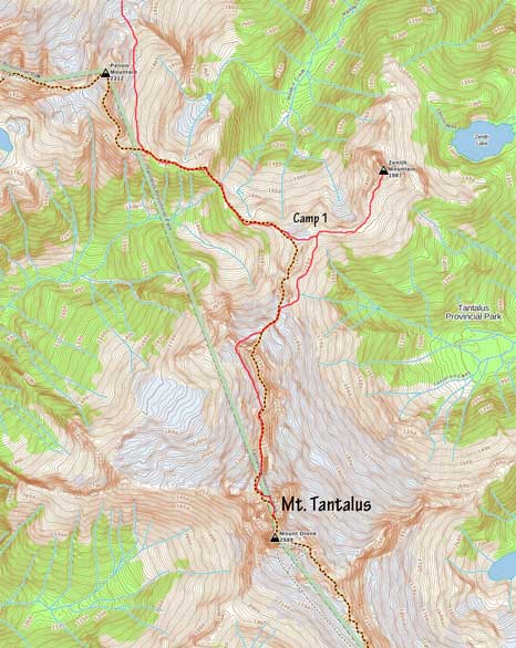
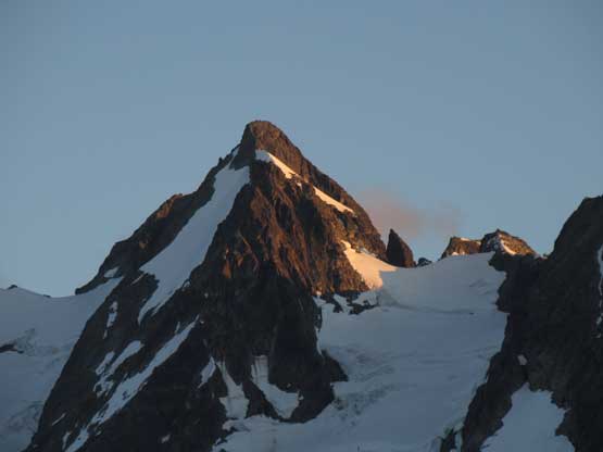
Mt. Tantalus via North Ridge.
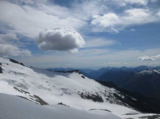
This was my second time using air support to approach a climb and I have to say I really like it. The flight itself can be just as cool and can be considered as a sight-seeing tour. Instead of taking a direct path our pilot flew us over Lake Lovely Water, Haberl Hut and then the stretch of Rambling Glacier before dropping us off on the start of north ridge. We got to see some very impressive scenery from some unusual perspectives.
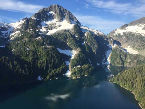
Flying over Lake Lovely Water
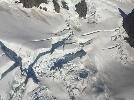
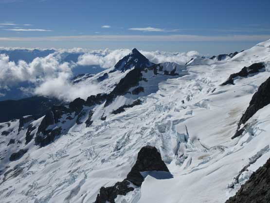
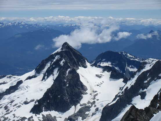
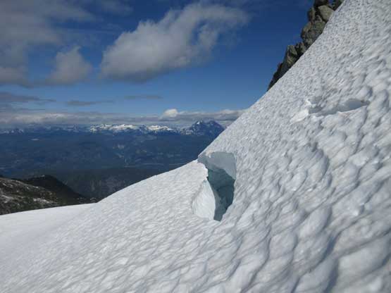
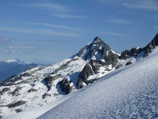
Giant ice cliffs on the east face of Mt. Tantalus (Rambling Glacier)
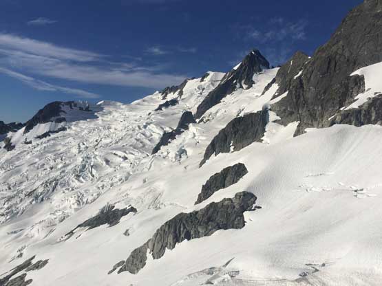
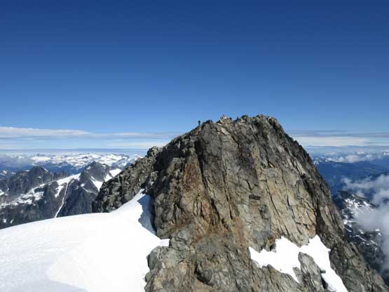
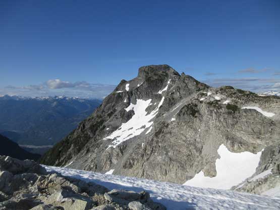
Mt. Tantalus with its broken Rambling Glacier
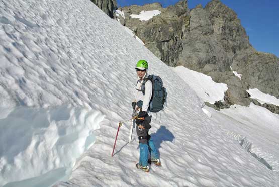
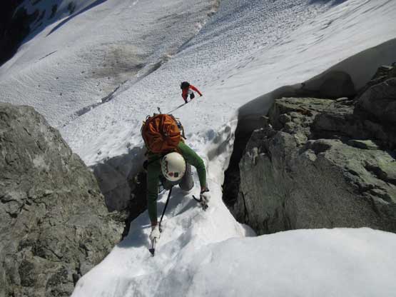
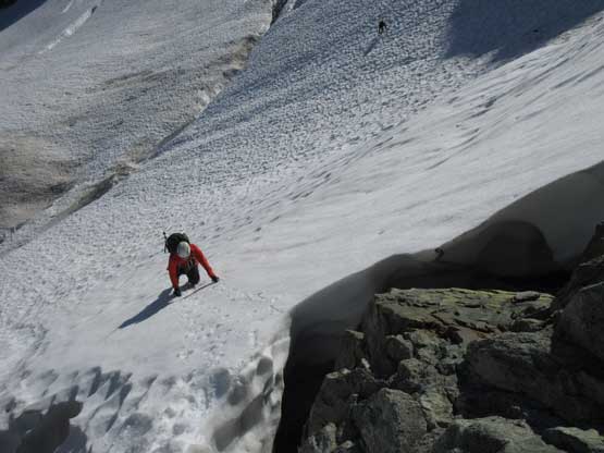
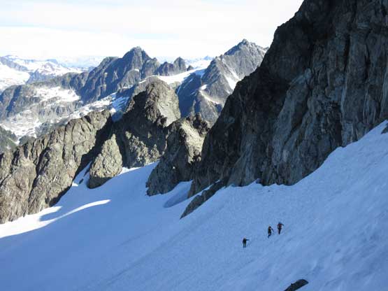
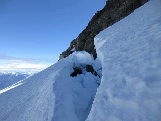
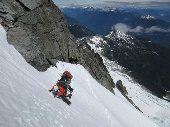
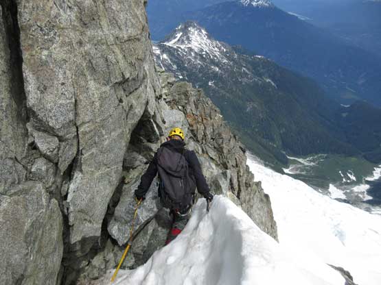
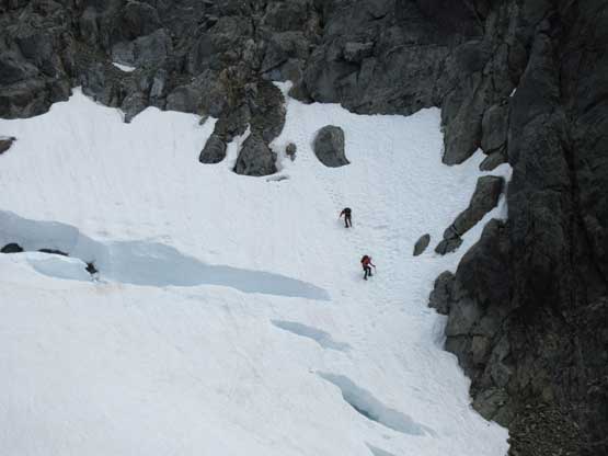
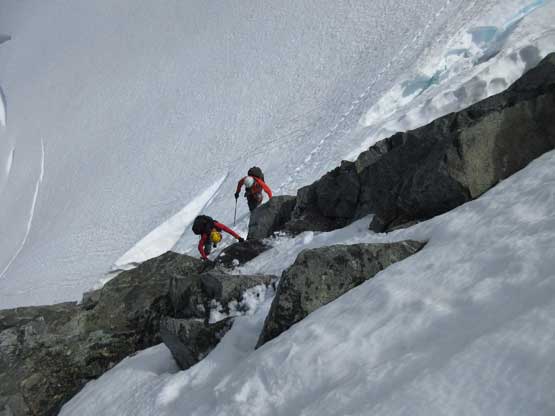
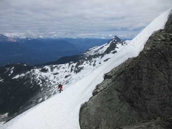
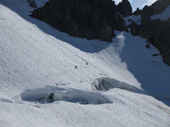
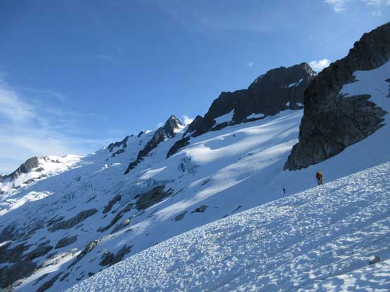
The landing site was entirely on snow and not protected from wind but we did find some sheltered spots on the edge with rocks. There’s no need to set up tents right now so we ditched all unnecessary gears in the “moat” feature and buried them with rocks. Twenty minutes later we started the ascent. Right off the bat we were facing a gigantic bergschrund spanning most of the way across the slope that forced us to make a long traverse above it. The snow was quite icy and the slope angle averaged at 35-40 degrees. Ascending towards the first col we had to climb some 45+ degree snow mixed with a few loose rock steps that certainly spiced things up. Over the first col we traversed a mellow but icy slope for a long ways on the west side of the ridge crest to rejoin the north ridge proper.
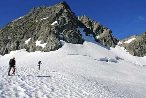
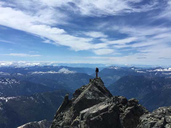
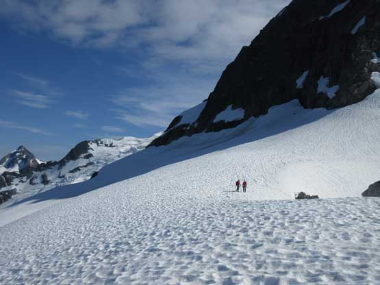
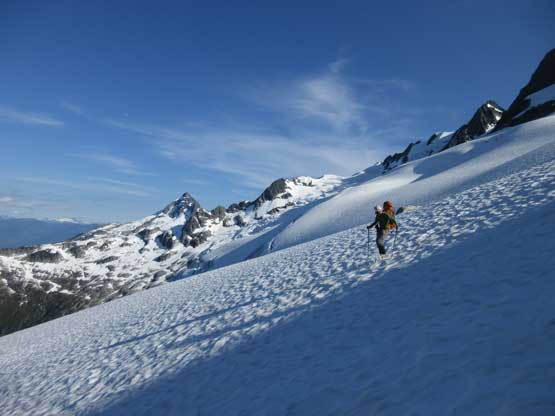
Starting the ascent aiming for the col on far right. Photo by Alex R.
Checking out the first bergschrund…
Me posing on the snow bridge. Photo by Alex R.
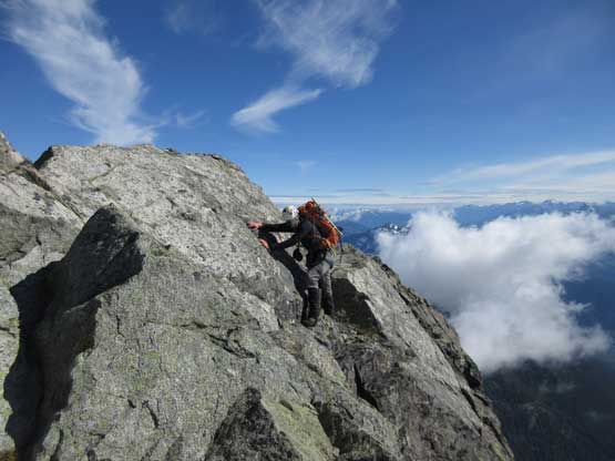
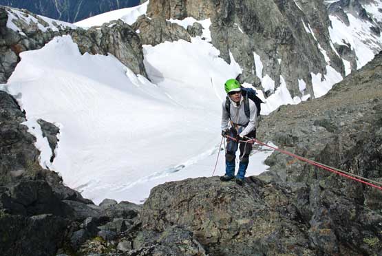
Me leading across the exposed traverse above the schrund. Photo by Alex R.
Alex climbing up a thin and narrow section on 45+ degree snow.
Ben climbing up the steep face above the schrund.
Matthew traversing the sketchy slope. Note the size of the schrund..

Continuing up, Alex charging on the increasingly icy slope
Over to the other side of this col we had to down-climb 3rd class rock with crampons
The long long traverse on the west side glacier was very icy as well
Above and beyond we still had a steep slope before getting onto rocks
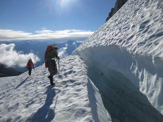
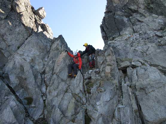
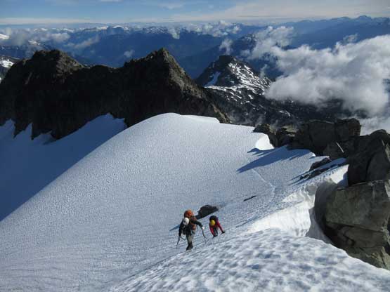
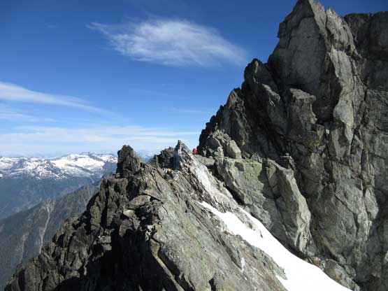
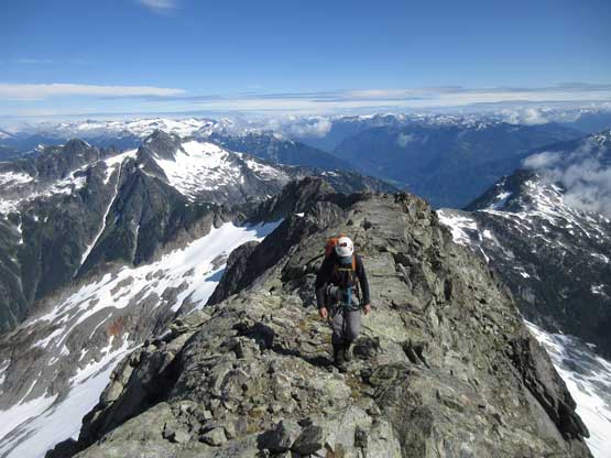
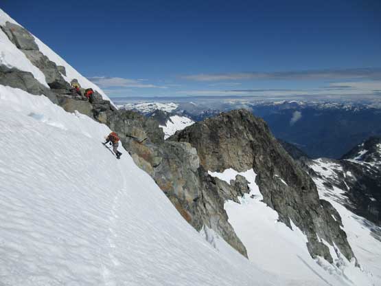
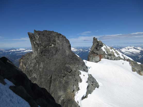
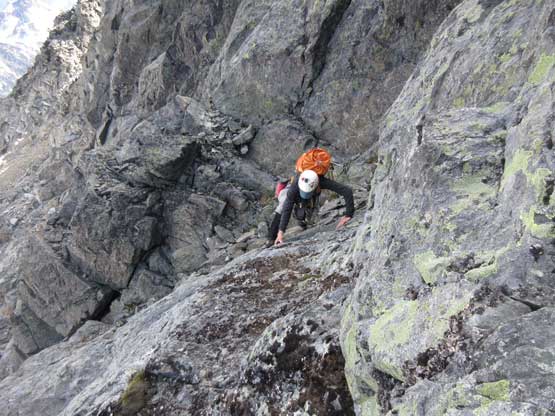
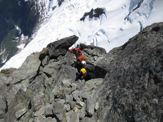
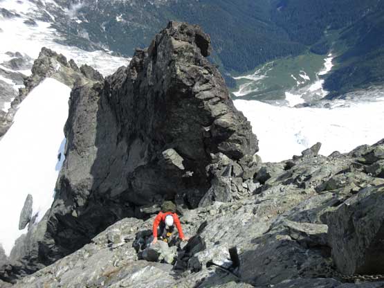
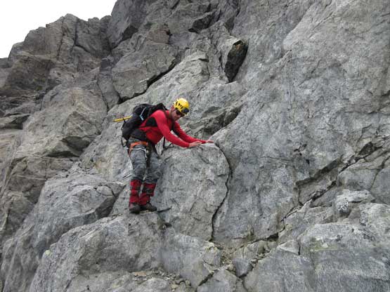
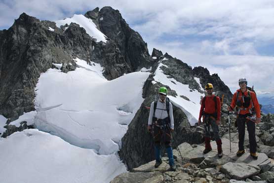
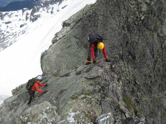
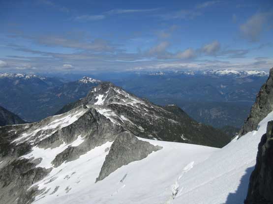
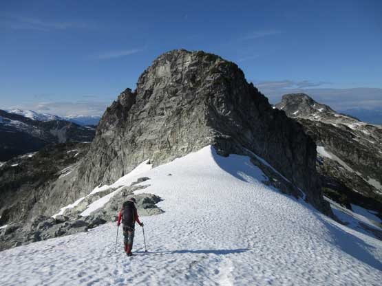
The next stage was more-or-less following the crest of north ridge on mostly 3rd-4th class terrain intermittent by some snow traverses. The position is superb and the exposure is real, but the climbing never gets too difficult. What made it annoying was the amount of transitions needed because of the deep overnight freeze we got. The snow sections were still rock hard even by mid-morning that we had no choice but to strap the crampons on for several times. Otherwise, this is an incredibly enjoyable stretch and we made progress quickly. Before long we spotted a line traversing underneath a small moat and dropped onto the very top part of Rambling Glacier.
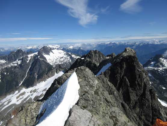
Onto the north ridge proper, looking ahead. This peak is big…
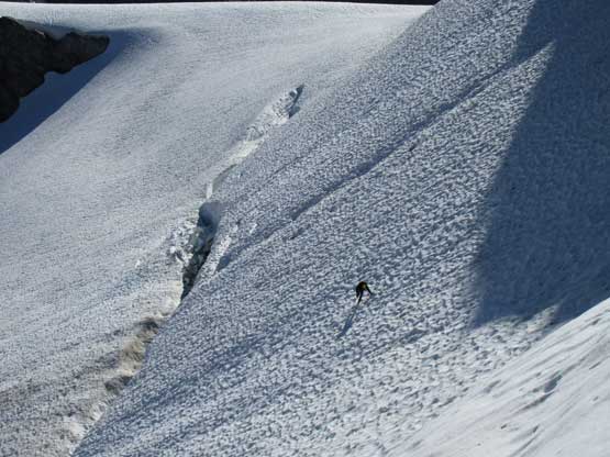
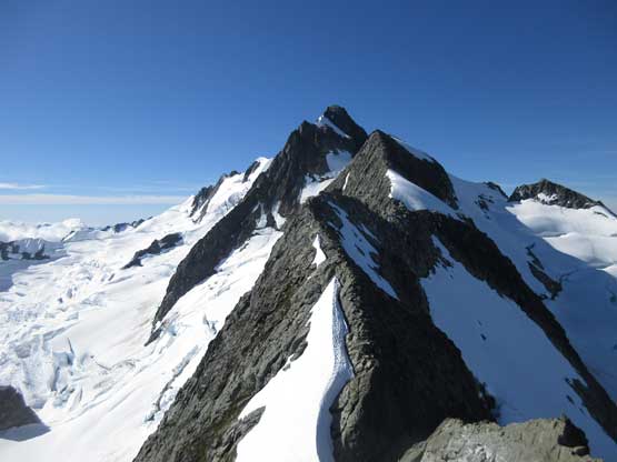
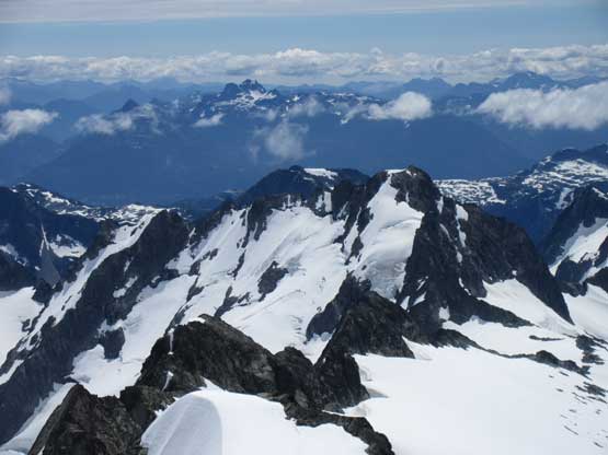
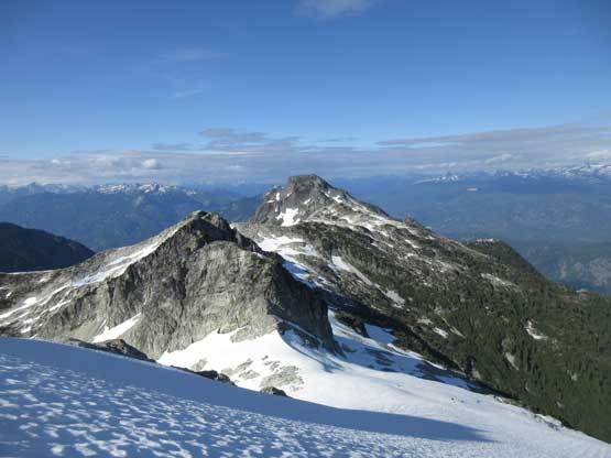
Rambling Glacier with Alpha Mountain behind
A bit of down-climb followed by a knife-edge section to warm things up
Ben down-climbing 4th class rock to get onto a “sickle” feature
We had to don crampons here and guys charging up the “sickle”
A closer look at the “sickle” fun

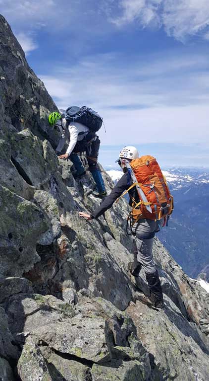
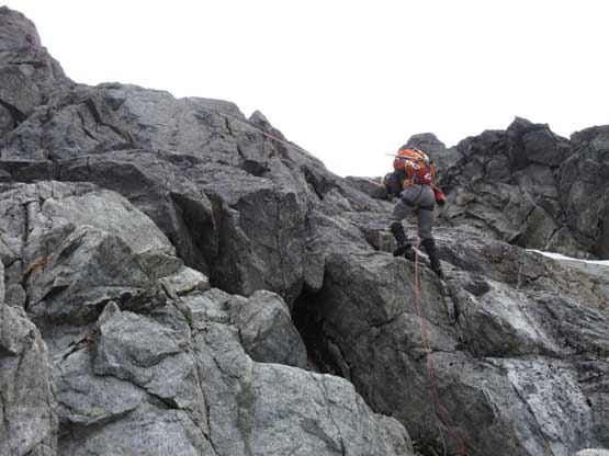
Upwards and onward. This is the typical terrain
Alex negotiating an exposed move
As typical as the position on the north ridge. We cruised this stretch easily
Me traversing 3rd class terrain underneath some vertical snow wall.
Alex traversing onto the ledge bypass. Too lazy to do another gear transition
Higher up the terrain flats out
Me walking towards the crux face. Photo by Alex R.
Alex down-climbing the first bulk of choss to get onto a snow field.
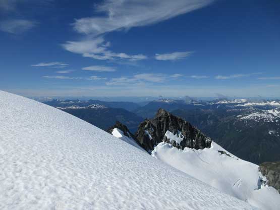
View SW from this snowfield into Sunshine Coast areas
Looking back at the bump we just traversed over
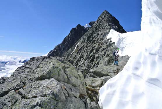
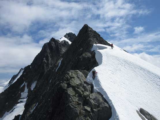
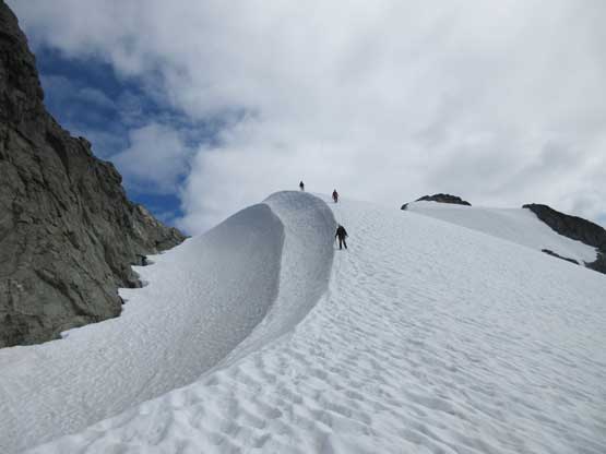
Me crossing onto the top of Rambling Glacier. Photo by Alex R.
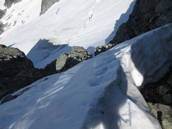
Alex traversing onto Rambling Glacier. Note the moat opening up.
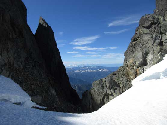
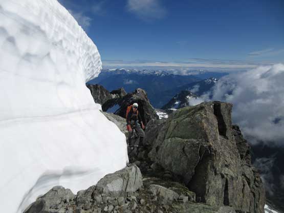
This is the gap on the top of Rambling Glacier. Not many have seen this view.
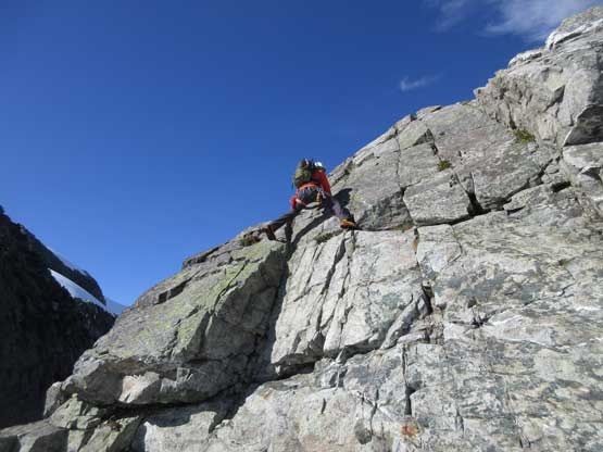
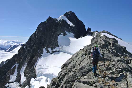
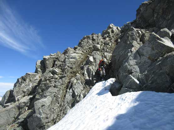
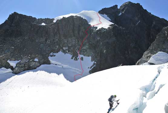
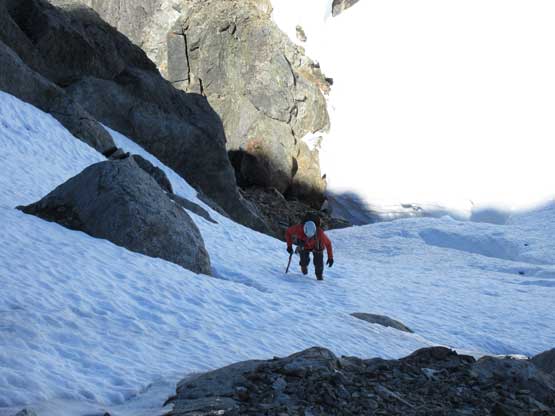
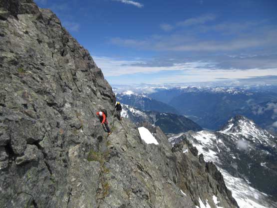
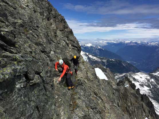
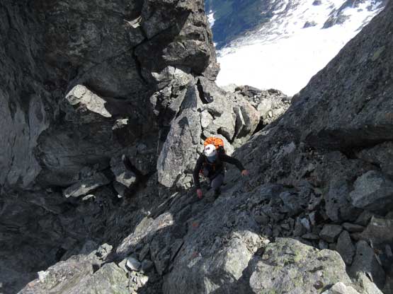
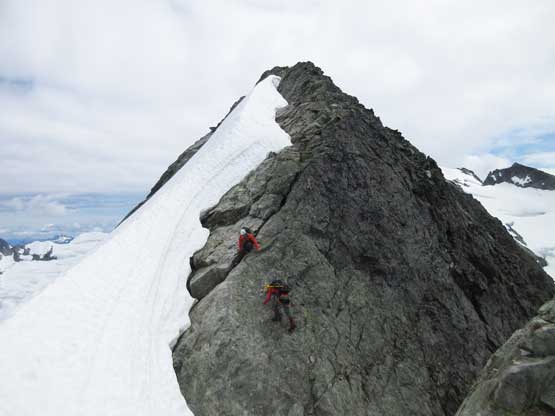
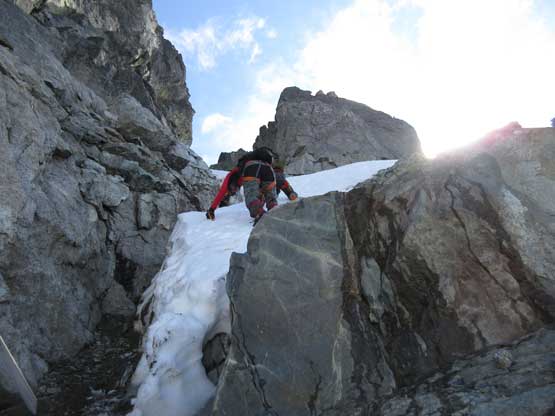
From the top of Rambling Glacier to the exposed traverse underneath the false summit would be the crux. In early season (June) one can climb the triangular face on continuous snow but such was no longer possible for us. The snow had melted back enough that we had to climb some wet but solid 4th class (direct assault) or what seemed like chossy 3rd class terrain on the far climber’s left. Our plan was the climber’s left option but after crossing the bergschrund we decided to just go straight up. And of course the terrain got harder than appeared once we were 3/4 of the way up. We stayed entirely on the left side of fall line that quickly turned into slabby terrain covered by some moss. Picking a line to stay within “class 4” was not easy and required a bit of zig-zagging and back-tracking. Ben had more problem than the rest of us because of the rigidity of Nepal Cubes footwear but there’s an existing rappelling station so setting up a top-rope belay was straightforward. Beyond that we did again, another gear transition and then Alex led us climbing a long section of steep and exposed snow on mostly icy conditions to the base of false summit.
The bergschrund under the crux face was easily crossed. It can be problematic later
Looking back at the traverse onto Rambling Glacier
Me climbing up the steep snow. Photo by Alex R.
Ben climbing up above the bergschrund
Route-finding was tricky. Here’s Alex soloing the 4th class wet slab corner.
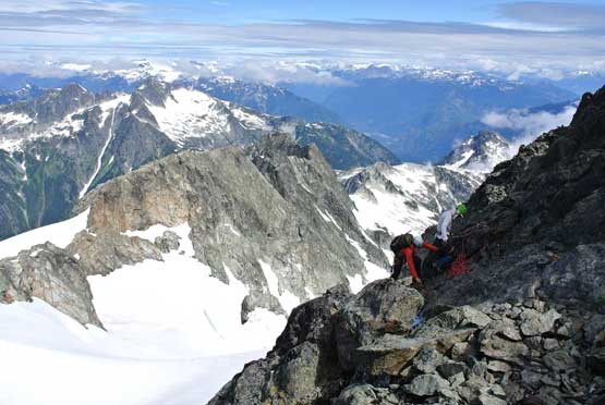
Me belaying Ben up the 4th class pitch. Photo by Alex R.

Climbing onto the upper snowfield with death exposure that you can’t see.
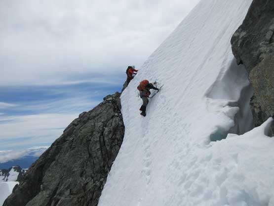
Getting onto rock involved an awkward step-down. We made a mistake for ditching snow gears at the base of false summit because we thought the rest of the route would be bone dry. Wrong.. After making our way across the uber exposed ledge traverse we had to turn around. Another steep snow couloir separated the false with the main summit and the slope’s approaching 55 degrees by estimate. We all went back to grab the gears, and did another awkward transition to strap the crampons on. The snow couloir was as steep as expected but thank to the east-facing orientation the snow was already soft enough to kick firm steps in. Now with the true summit visible we finally could ditch the crampons and ice tools. The scrambling was tricky at places but never exceeded “4th class”. There’s some tremendous sense of accomplishment to stand on the summit of Mt. Tantalus. All four of us had been waiting for this moment for quite a while and glad it worked out perfectly with all major route-finding nailed in one shot.
We found that exposed ledge traverse to bypass the false summit
Ben and Matthew on the airy ledge traverse
And then we had to climb/traverse a uber airy snow couloir
Onto the rocks finally. Exposed 3rd class terrain to the base of the summit tower
Me and Alex climbing up. Photo by Matthew B.
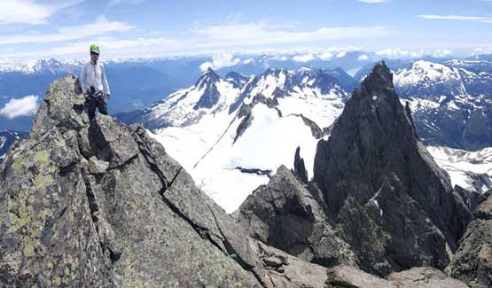
Alex at the col between false and true summits
Ben climbing up the 4th class terrain to the true summit
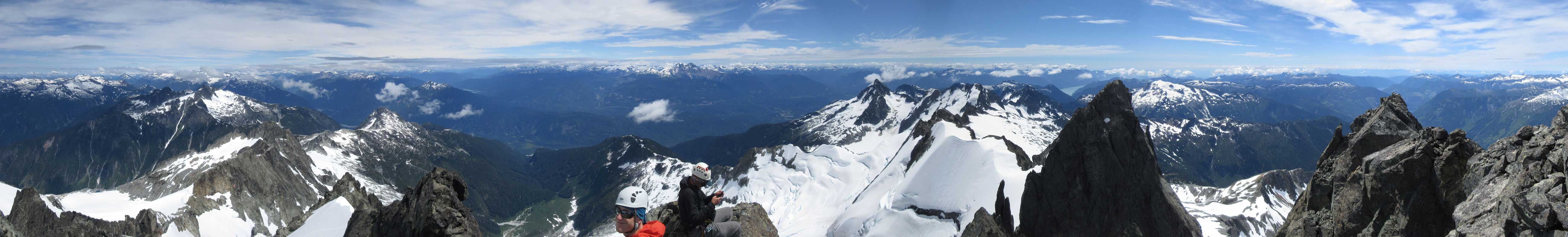
Summit Panorama from Mt. Tantalus. Click to view large size.
Looking north over Pelion and Ossa. Both peaks would be bagged in this trip
Mt. Sedgewick looking south. It’s another tough one to access
Alpha Mountain looks pretty small from here. It looks big from elsewhere
This is the north face of Serratus Mountain
Matthew Baldwin on the summit of Mt. Tantalus
Me on the summit of Mt. Tantalus with Mt. Dione behind. Photo by Matthew B.
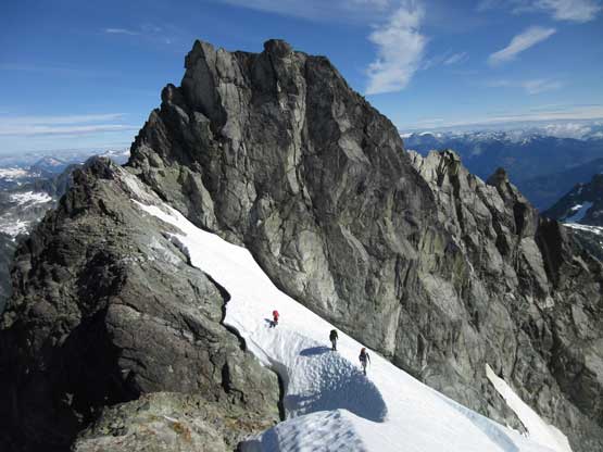
The summit is a nice place to linger but it’s not smart to stay up there forever. We ignored the chained rappel station and opted to down-climb 4th class rock back to that patch of snow. The crampons and ice tools were out again for that short but exposed traverse and then it’s time to reverse that uber airy ledge traverse. Down-climbing the next patch of steep snow was both mentally and physically tiring because the NW aspect was still icy as fuck. We had to down-climb the entire stretch facing into the slope. Back to the crux triangular face we opted to tie the two 30-m ropes together and one rappel got us off the worst of it. More down-climbing and traversing on steep snow along with two bergschrund/moat crossings later we were back onto the north ridge proper. The next hour or so was a fun ridge walk on mostly 3rd class terrain with incredible views and position, although those gear transitions still sucked…

Down-climbing the summit block. Photo by Matthew B.
Matthew squeezing into the moat.
Alex and Ben down-climbing the uber airy upper snow traverse
Me and Matthew starting to downclimb the next patch of steep snow. Photo by Alex R.
Guys down-climbing. It’s a long section of facing-in
Me leading down the rappel over 4th class pitch
Matthew down-climbing
Alex rappelling
Ben and Matthew down-climbing steep snow above the schrund.
And after a steep traverse we had to do a tough transition back onto rock
Me, Matthew and Ben with the crux section behind. Photo by Alex R.
From rock to snow to rock and back onto snow…
Onto rock again, slabby 4th class for fun.
And yes we had to get onto snow. This sickle traverse was sick.
Onto rock again. Fun 3rd-4th class with exposure
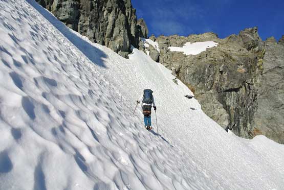
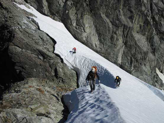
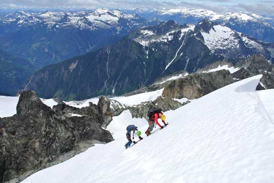
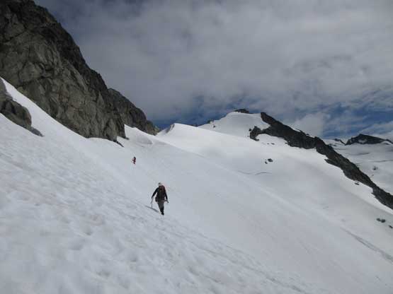
The snow on the lower reaches of our route was still hard enough to warrant the use of crampons and ice axes so we had no choice but making another annoying transition. The main snowpack never got soft. Careful footwork was still required on most of the stage but at times we did manage to plunge some far-reaching steps down. Up and over the first col we had to deal with more steeps and exposure. Down-climbing to, and over the short mixed step was tricky enough and traversing back across the face with a huge schrund below us didn’t boost much confidence neither. The snow was a little bit sloopy on the surfaces but not soft enough to just walk across. Much of the stage was done by step-by-step shuffling while facing into the slope. It’s painfully slow, but as safe as it could get.
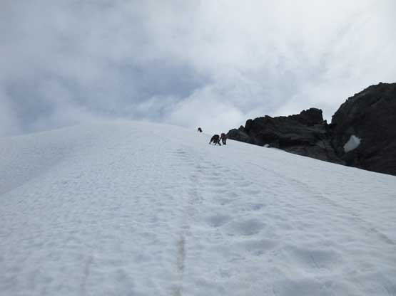
Descending easy terrain now. Easy plunging with crampons
This is that long traverse on the west side of the ridge crest
The view’s really good from anywhere on this climb, literally…
Up and over the chossy col we got to see our next aim
We had to down-climb steep snow. Yes..
Ben down-climbing into the constraint.
Back to the bergschrund after a long and sketchy traverse
Ben and Matthew carefully making their way across the traverse
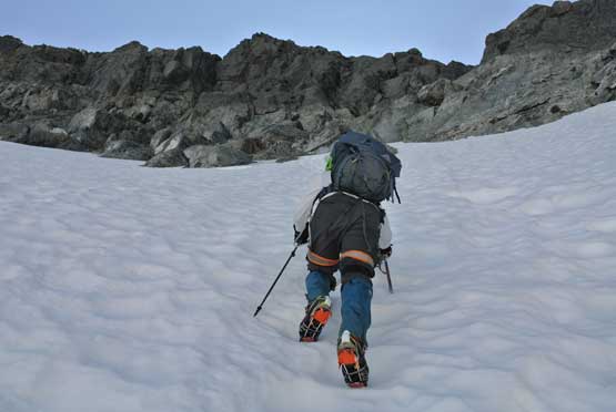
Back to where we were landed. Too early to call a day so let’s move on
We still had a couple hours to kill before sunset so instead of setting up camp at this windy spot we decided to carry on closer to Zenith Mountain. We debated about where to go next and the conclusion was taking the snow route on skier’s right (east) side of the two bumps rather than following the GPS tracks given by some local legends. This would position us closer to our next objective and the snow was soft enough that we no longer had to be super careful, but crampons were still needed. Re-ascending onto the broad SW Ridge of Zenith Mountain definitely sucked a lot of energy out of us, that once the tents were erected we opted to save Zenith Mountain for the following day.
Zenith Mountain would be our next objective. We went to right of the bumps
Alpha Mountain
Descending. The bump is apparently not doable from head-on.
Alex plunging down into the east side
More about the plunging onto the east side slopes
After a while of slogging we were back onto the ridge. Zenith Mountain
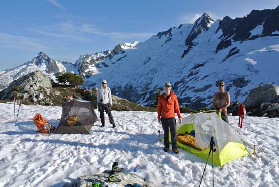
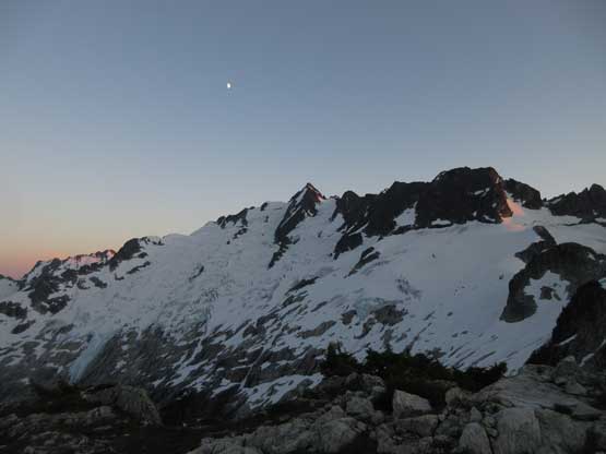
Our camp site for the first night. Photo by Alex R.
This is Ben and Matthew’s tent
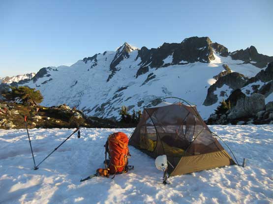
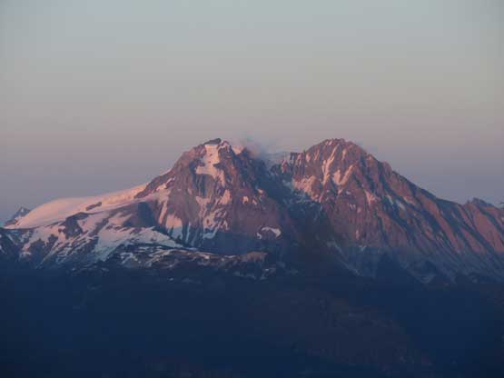
Alex and I’s tent with Mt. Tantalus behind
A zoomed-in view of the summit block of Mt. Tantalus
Evening alpenglow on Mt. Garibaldi and Atwell Peak
Evening horizon looking south over Alpha Mountain
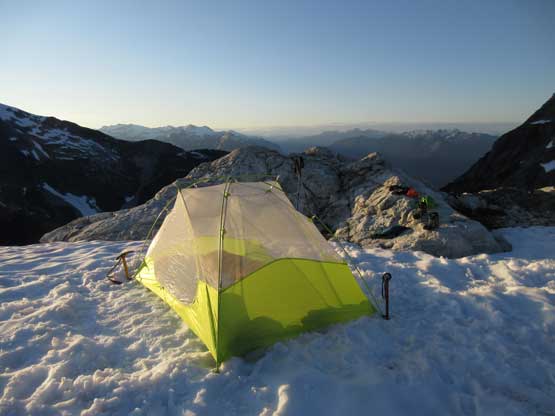
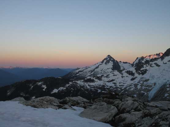
The last bit of sunlight on Mt. Tantalus.
The trip continues with ascents of Zenith Mountain, Pelion Mountain and Ossa Mountain. The second half of this trip was exploratory in mission and involves terrain that’s harder than anything we did on Mt. Tantalus so definitely check those trip reports out. And in case anyone interested in how to get to the base of north ridge without the air support then check out the Pelion and Ossa’s trip reports because we hiked out. A fit party should be able to that approach in 12 hours and there’s no need to cross Squamish River and that’s all I want to tell right here.
Mt. Tantalus is as big and serious as its reputation suggests but what it lacks is the “technical difficulty”. One does not need to be a rock climber to climb Mt. Tantalus but one does want to be a competent all-around mountaineer to even consider it. It’s hard to classify how difficult this peak is, but assuming no air support is involved then an ascent of Mt. Tantalus via Sigurd Creek and North Ridge resembles a upper mid-level 11,000er mission for those familiar with the Canadian Rockies background.
The following trip reports are all worth to check out and especially thank to Leigh McClurg and Spring McClurg for providing us important route beta. Without their support this trip would not flow as fluent as it was.
