Mount Urquhart
September 25, 2022
2098m
Harrison Lake East, BC
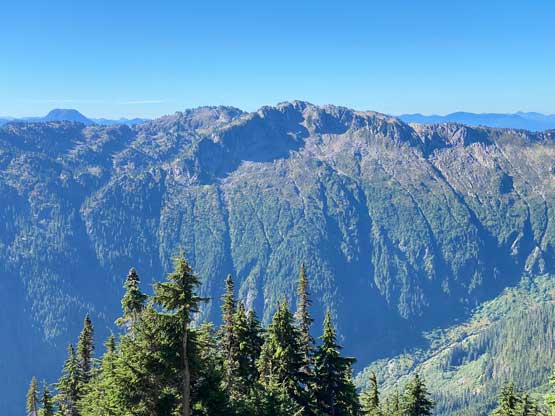
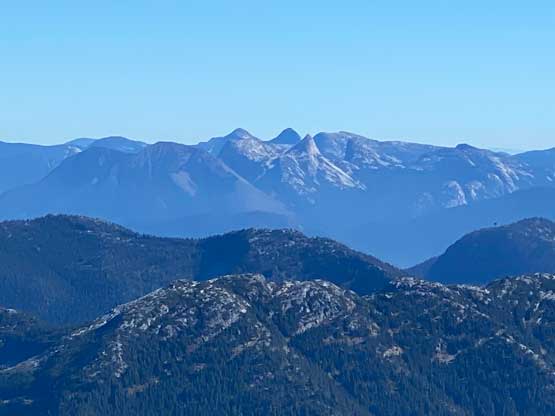
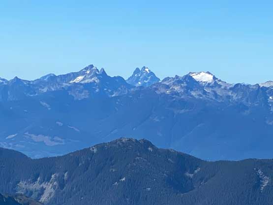
Mt. Urquhart is one of the most significant summits in the “East Harrison” area with its striking profile recognizable from many places in SW BC. This peak was used to be a “classic” with multiple established rock routes but the access had downgraded in the early 2000s. Nowadays even the standard route of Mt. Urquhart is rarely ascended since the access is a pain the ass. There are a few methods/routes that parties had been trying in the recent era, and some were successful but most were not. The sole method I was keen on was to bike the entire Cogburg and Charles Creek FSR systems from the locked gate at the bottom. This meant a sea-level-up ascent with over 2000 m elevation gain and round trip distance close to 50 km, but majority of the distance would be dispatched on a bike. The recent satellite images showed the overgrown spur roads in Charles Creek drainage had been cleared, so I was eager to pull the trigger. Little did I know that they were still actively logging the area. I had been seeing this road’s improvement in the past two years through satellite data but no ascent of Mt. Urquhart had been reported and there had to have some legit reasons.
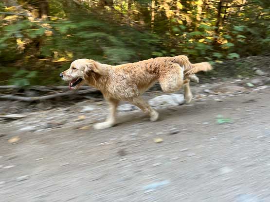
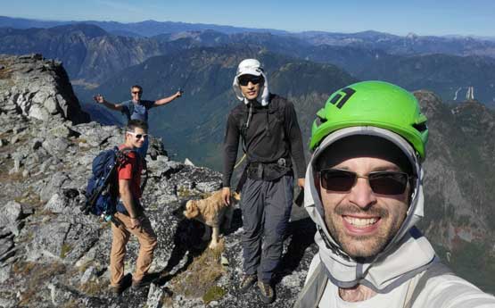
Matt J. and I had been discussing this objective for at least a year. Matt had some ideas that he wanted to try in the winter, but I wanted to have no snow on the class 3 scrambling section to secure a guaranteed chance of success, so I insisted to bike up Cogburn FSR in late-summer conditions. In retrospect I’m not sure which of the plans would actually give a higher chance of success… When a window lined up Adam Walker and Ben Butca also showed their respective interest but we did not commit until the last minute as we needed all stars to line up perfectly, including weather and smoke situation. Matt’s truck was capable to ferry all four of us plus Twig, as well as four bikes so we made the decision to leave Vancouver at 3 am in the morning for a home-to-home type of push. We really should have camped there the night before and if we did so we would be aware of the active logging and made adjustments to the plan. We arrived at the start of Cogburn FSR at 6 am. The gate was locked as expected, but there’s also a sign with words like “Active heli logging, no public entry”. As usual we decided to ignore the signs, hop the bikes over the gate and proceed onwards. We had never run into problems doing so in the past and we hoped the trend could continue.
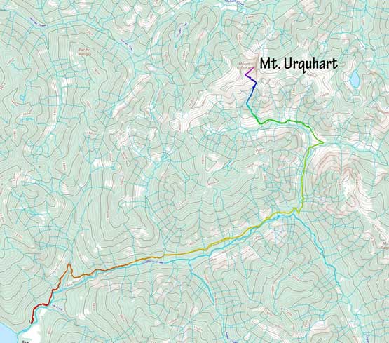
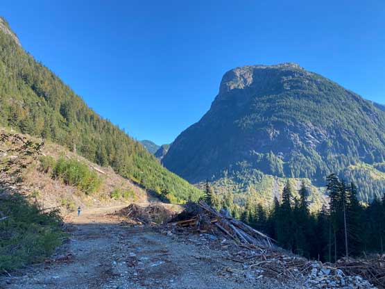
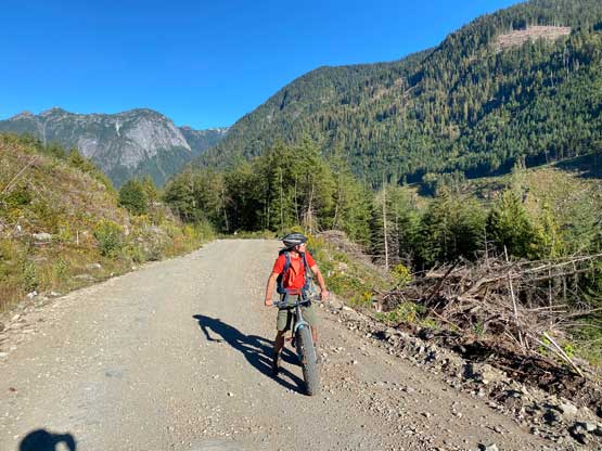
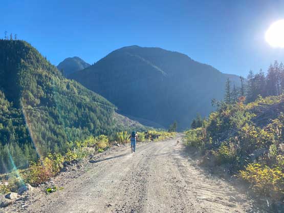
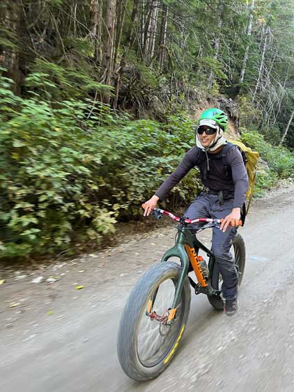
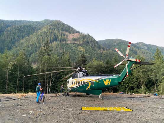
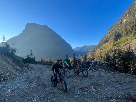
The 16 km ride up Cogburn FSR was mostly on a gentle uphill incline with a few steeper rises, a few kilometers of flats and two descends that would become annoying at the end of the day. Biking down those two downhill sections with head-lamps on was a little bit interesting as I didn’t feel comfortable to zip too fast. About 5 km into the ride a couple trucks came from behind and warned us that they would indeed be heli-logging the area even on Sunday. This was right around the time that head-lamps were no longer needed. We then biked into a helicopter staging area. The security guard was yelling but but we continued nonetheless. Another kilometer later the pilot drove by and passed on more details about their plan. The logging zone would be on the south side of Cogburn Creek and had we biked another 2-3 km further we would exit their work zone, so we immediately started the race and made sure that we would be on the far side of the zone before the next encounter. Not to our surprise the next person that caught us was the manager and she was extremely pissed, but after about half an hour of negotiating she decided to give us permission to proceed, as to turn around here meant we would be biking back through the work zone when the helicopters were already flying. The deal was that we would have to carry one of her radios to inform them when we’d go back through the work zone later in the day. I’m 100% sure this permission was the one and only that she would pass on to hikers so make sure you do this peak when they aren’t logging the area. I don’t know their contact information nor do I even know which company this was, so do your own research. I do think that they are working 7 days a week even on long weekends.

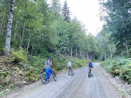
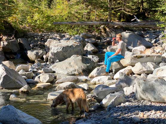
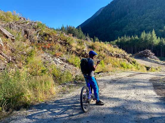
The next few kilometers were mostly flat so we cruised to Cogburn/Charles Creek junction where the old overgrown FSR had been cleared. In circa 2017 parties had to thrash through 5 km of dense alders on the overgrown Charles Creek FSR but in 2022 all we needed was a bike. The riding wasn’t nearly as smooth as on the mainline as they hadn’t been logging this zone for a while. There were a lot of rocky stretches and also some steep hills. Adam and Ben pushed their bikes most of the way on this spur road. I was able to pedal probably 2/3 of the road while Matt biked the entire way to the end. Matt checked his GPS and the distance clocked to just over 20 km and that was definitely the longest biking approach that Adam, Ben and I have ever done. My ass was already hurting and I was not looking forward to the return ride. We made a mistake by not stopping at one of the two bridge crossings to load up water bottles. Prior to the trip we all made the decision to carry minimal water (mine being two 500ml bottles of Gatorade) due to some river crossings reported by other parties. Apparently the bridges were reconstructed but we didn’t know that the bridges were the only sources of water in this late-summer condition. After missing out the only oppourtunities we had to push through with minimal water. I knew I could do that based on the past experience, but this would not be enjoyable.
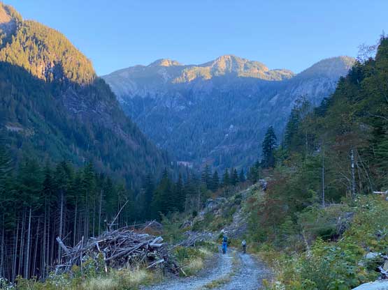
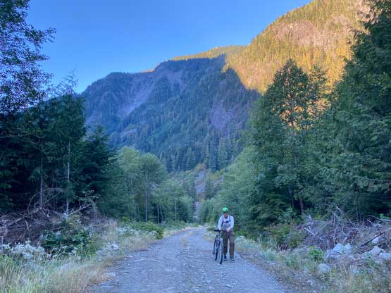
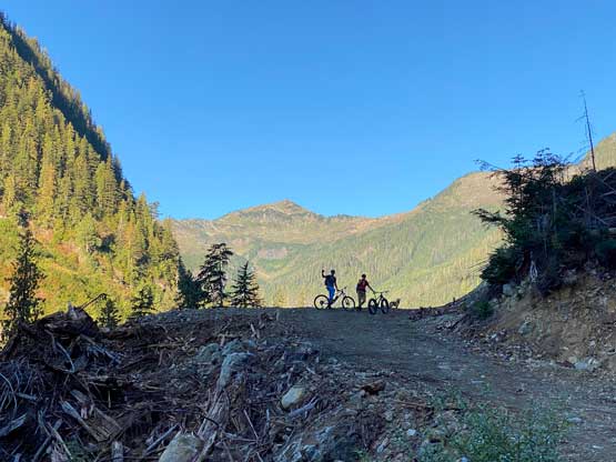
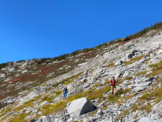
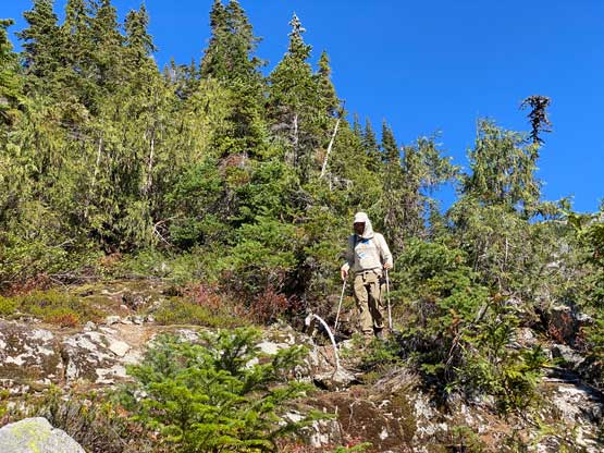
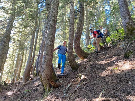
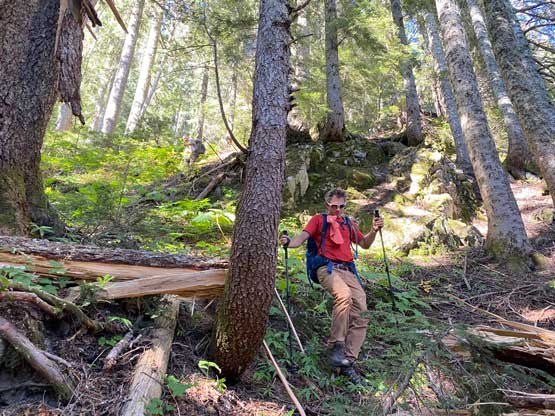
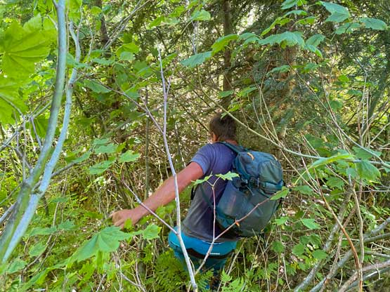
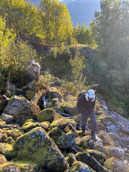
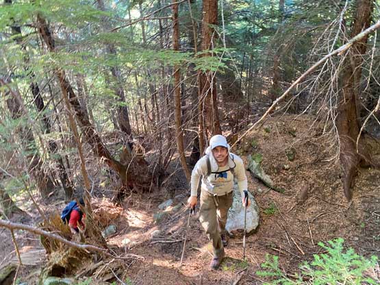
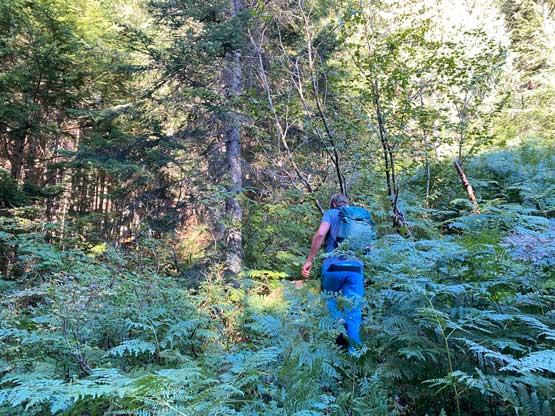
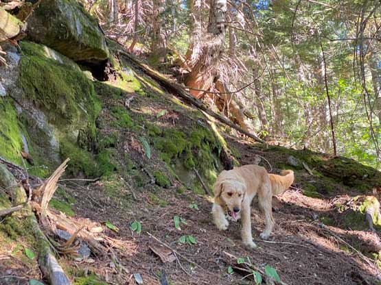
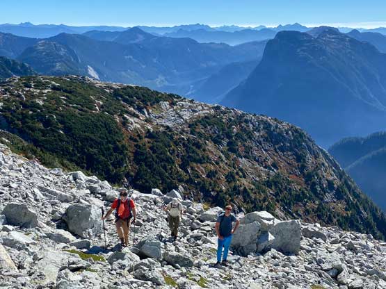
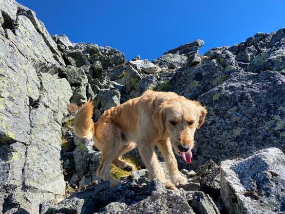
The road had not been reconstructed to the historical road’s end so we still had about 500 horizontal meters of thrashing on the old, overgrown road to the base of the peak. I was determined to stick to the known and follow Jeff Han’s GPS track like it’s God’s sake but the bushwhacking was horrendous. We made probably 100 m of progress in 10 minutes and we couldn’t even know where the road’s bed was. Matt then immediately pointed that we actually didn’t have to use that track as the mature forest immediately above us would grant an easier passage. I checked the map and agreed, so we bailed the “road” into the forest. About 5 minutes later we merged into the mature forest and that officially marked the end of the bad bushwhacking. We now would ascend the forested flank significantly climber’s right of the known track but the satellite images suggested this forest would be rather consistent, so we should be fine. We did encounter some steep stretches with very slippery ground but never had to do significant amount of route-finding through bluffs. We merged back onto Jeff’s GPS track an hour later after the rib doing a turn to the right (east). The bushwhacking became worse near treeline but wasn’t annoying enough to be worth noting. We were desperate to find water in some of the deep gullies but to no avail, so now we were committed to finish the ascent and the descent with whatever we still had, mine being one 500mL of Gatorate and that’s it. I was fine but we were worrying about Twig.


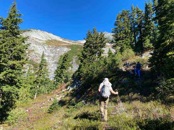
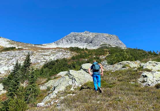
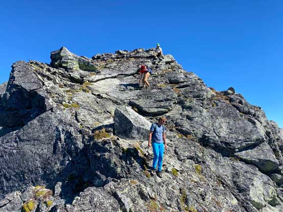
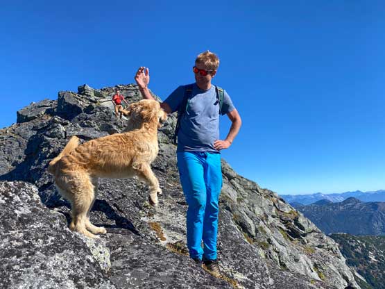
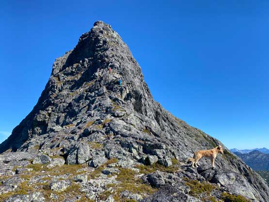
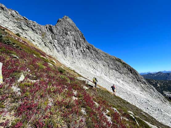
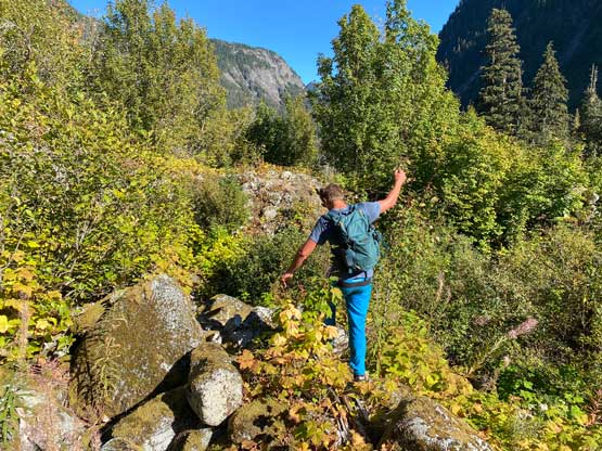
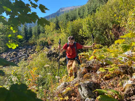
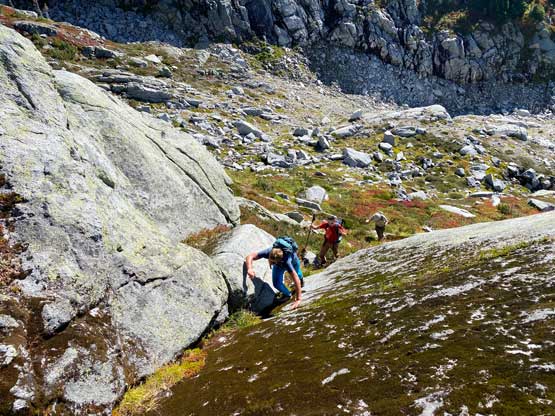
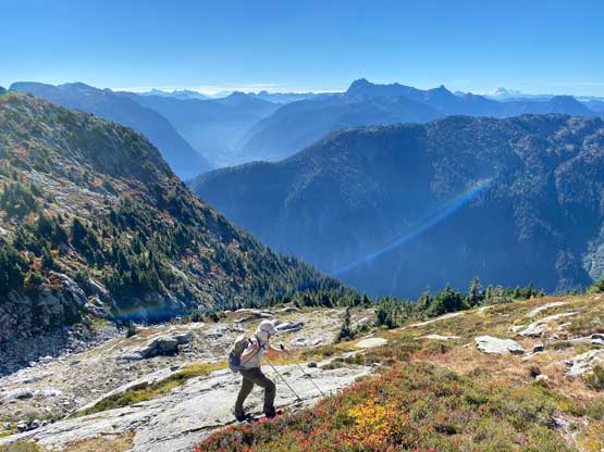
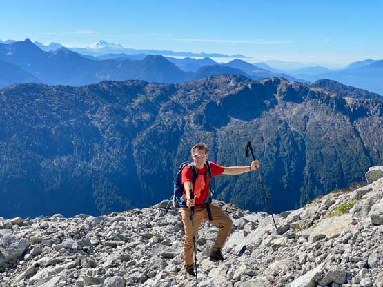
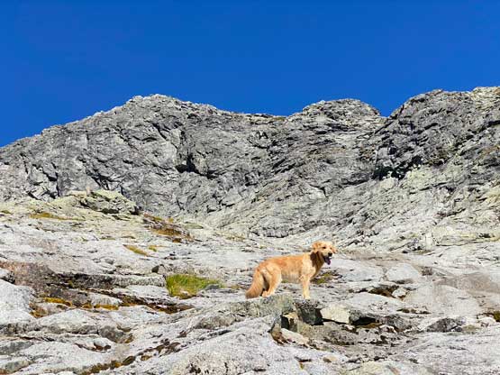
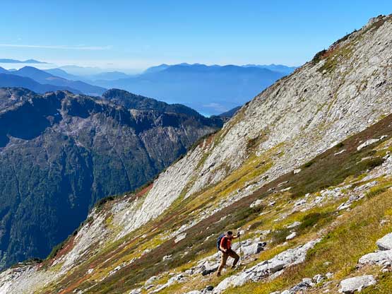
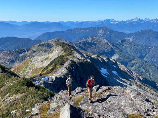
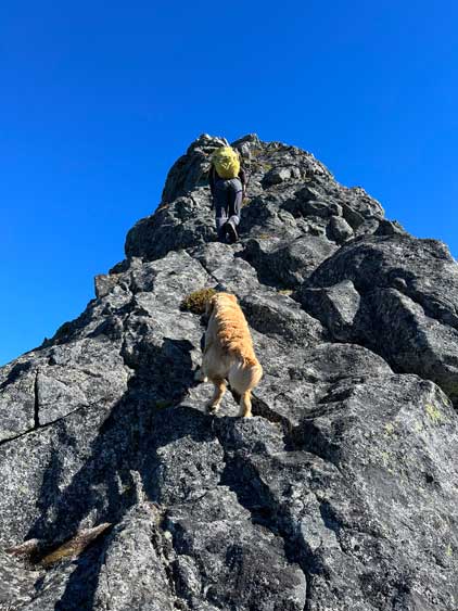
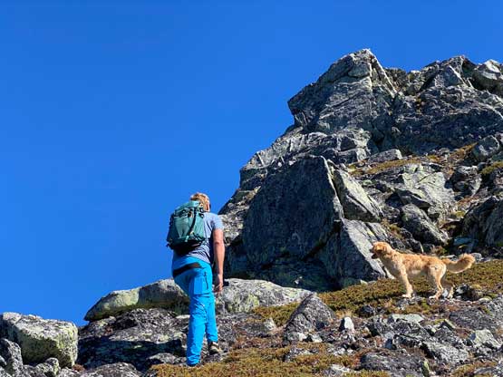
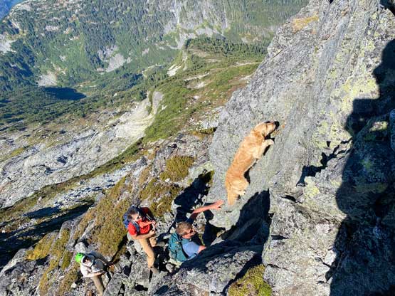
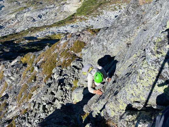
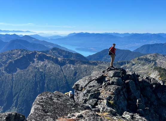
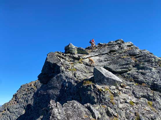
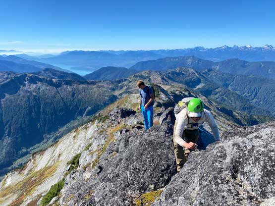
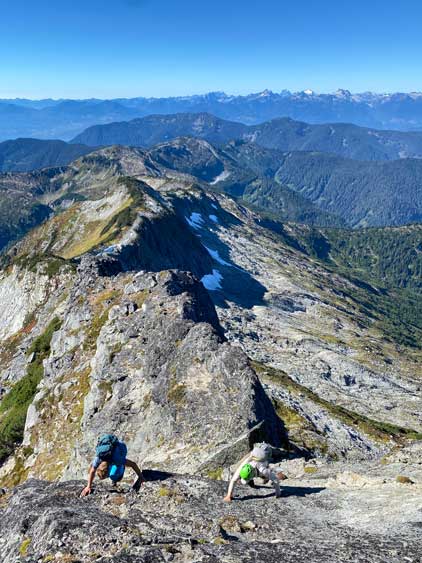
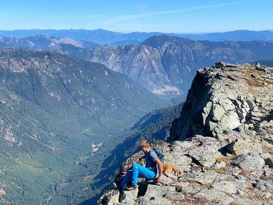
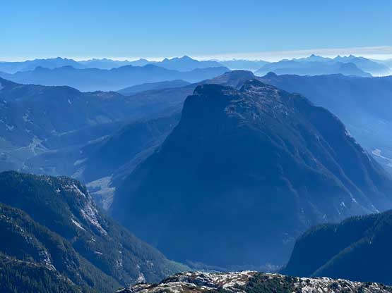
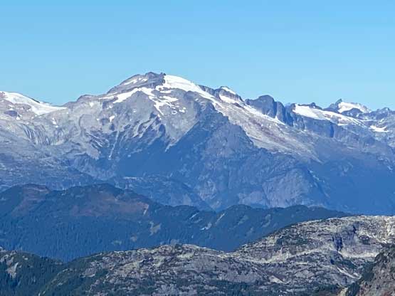
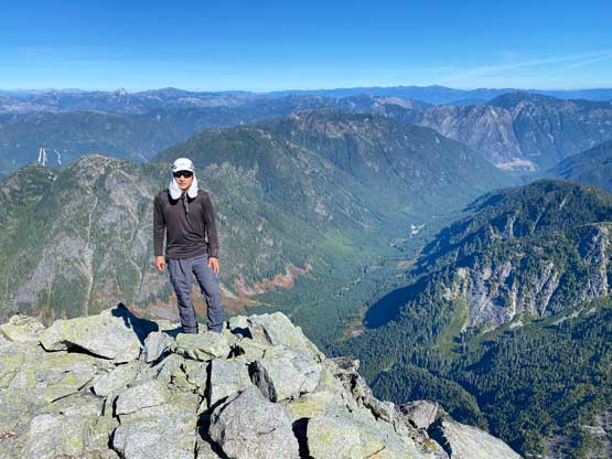
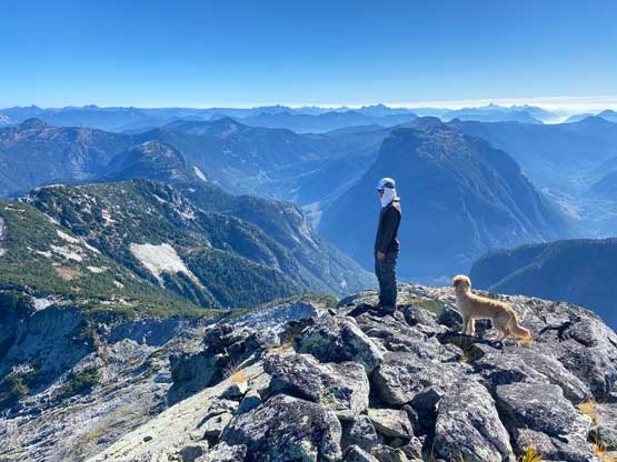
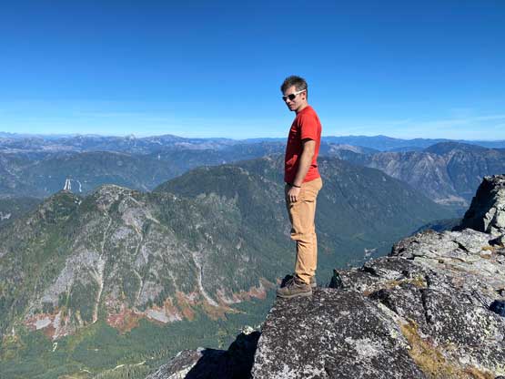
The next stage was a long diagonal leftwards traverse/ascent across some slabs and heather slopes to the base of Mt. Urquhart’s west ridge. The start of this stretch was rather steep with some class 3 scrambling but we might not have picked the easiest line. We then ascended closer to the rock face and magically found two puddles of stagnant water. Those two puddles were big enough to solve Twig’s problem, but not enough for us humans to replenish so we continued. The west ridge was aesthetic but not as difficult as expected with only a few spots of class 3 and minimal exposure. The crux was a steep wall with a few solid moves. I led a line more-or-less straight up the wall but the others found an easier variation on the descent. There’s one more piece of slabs higher up that involved some exposure but the rest of the route to the summit was mostly just walking. Matt and I even walked passed the summit to the edge of the east face cliffs for better photos. The GPS devices had clocked to 25 km at this point. We caught some weak cell services, made some updates on our socials and now we had to plod all the way out.


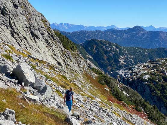

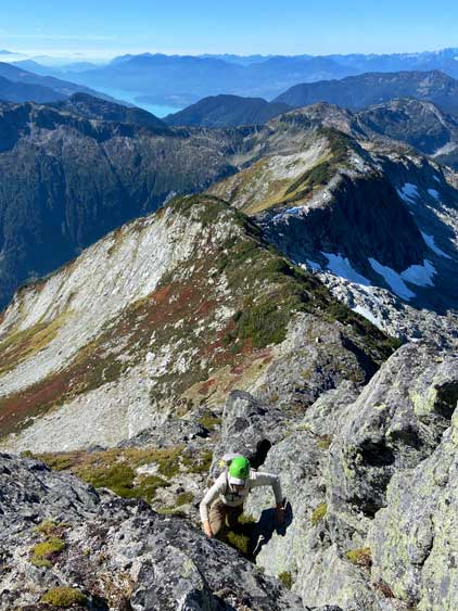


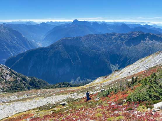
After carefully making our way down the west ridge I led us back across the traverse sticking as close to the track as possible. My hope was that two puddles of water would be refilled and I was actually correct. Twig drank one puddle and us humans shared the other puddle. I got about 200 ml of fluid, drank them all immediately and committed to the 1000 m descent with not a single drop of water in the bottles. I would not be able to get any water until riding down to the Charles Creek bridges. The forested descent was actually not too bad and we took turn leading to give each other some mental breaks. Lower down Matt led us through the bushy section by staying far to the left. We still had to thrash through some nasty stuffs but that was under 5 minutes long. Wasting no time at the bike I took off ahead for the bridges. Matt and Ben caught up to me a few minutes later and Adam caught up to us almost half an hour later at the bridge. We all took a very long break at the water source before committing to the rest of the ride. We informed the lady at km-12 mark and she granted us permission to ride back through the work zone. We then dropped off the radio to the security guard. The two major uphill sections near the end were killing my legs but I managed to power it through using whatever energy I still had. Our round trip time was under 12 hours and that was pretty much as expected. We then drove back into Harrison Hot Springs for dinner and then got back home at a reasonable time.