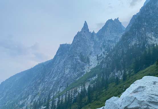
Prusik Peak
September 11, 2022
2438m
Leavenworth / Enchantments Area, WA
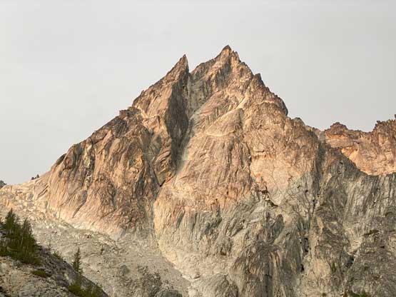
Prusik Peak is a small but iconic summit in the core zone of Enchantments that despite the sub-50m prominence this peak attracts all climbers from the Pacific NW or even abroad. The west ridge of Prusik Peak is rated 5.7 but involves mostly “low class 5” climbing on solid granite with the exception of a slab corner and a finger crack. The south face offers a few harder routes including “Stanley Burgner” rated at 5.10-. For the real climbers that’s the dream route of this peak, but to me the West Ridge is more than good enough. No matter what route to choose the approach involves either a monotonous trek through Snow Lakes or by plodding up and over Aasgard Pass from Colchuck Lake. It takes about 4-6 hours of hiking from either side. It might sound fantastic to camp up there but this is a restricted area such that to obtain a camping permit requires winning a lottery. That level of bureaucracy is a hard nope for me so the only method is to do it in a single, car to car push.
Prusik Peak is the first “goal” objective that Winnie and I talked to each other about when we firstly met in 2020 and at that time to lead 5.7 in the alpine still sounded like a serious fair to any of us. The border closure due to Covid meant we couldn’t get down there until two summers later, but two years could change a lot. These days Winnie had progressed to become a much better rock climber. The west ridge of Prusik Peak would still offer the right amount of challenge for me but is now too “easy” for Winnie. Still, she agreed to give it a go and we set the day to be the Sunday after the Labour Day long weekend. I was very glad the weather worked out as otherwise I probably wouldn’t be able to see her in this summer after all due to lack of mutually interested objectives.
The smoke situation was bad and a new fire had induced a closure of US-2 and even stranded some hikers but those wouldn’t be the deterring factor for me. The closure of US-2 would mean a longer detour down through Snoqualmie and Blewett Passes making the long drive even longer. I didn’t tell Winnie about all these news that happened within the past 12 hours but she did find out the road closure when she took the bus down to White Rock. I immediately said that we would take I-90 anyway and we’d be fine. We were able to leave White Rock at 4:40 pm as planned and the border delay was rather minimal. We did a few stops for gas and food and made to Leavenworth by 10 pm where we found an enormously large grocery store. There’s another road closure on Icicle Road but a detour was available, thankfully. I decided to take the Tacoma for the drive up to Colchuck Lake trail-head and that was the correct call. At least 50 other cars were parked and some were car-camping like us, and we anticipated a busy day ahead after setting up the alarms at 3:15 am. In term of gears we decided to carry my 60m 7.5mm twin rope, a small rack of cams, rock shoes and lightweight harnesses. The plan was for Winnie to lead all pitches but we knew we would just end up soloing the route until I no longer felt comfortable to do so. As usual the climb turned out much easier than I thought.

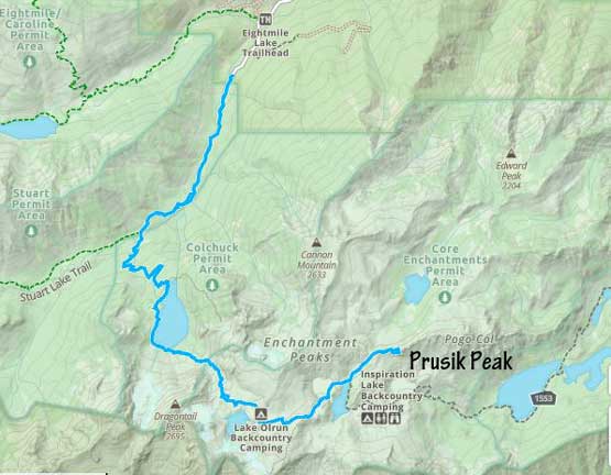
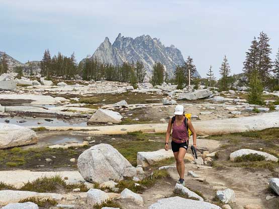
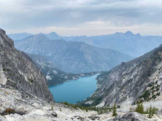
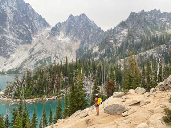
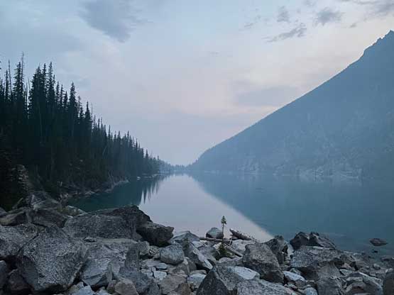
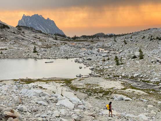
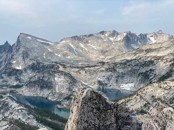
This was my second time hiking the Aasgard Pass approach and this time was much easier as the ground wasn’t covered by a thin layer or snow and ice. The entire approach to Colchuck Lake was done with head-lamps on. The contouring around that lake in the dark was definitely confusing that at one point we missed some turns and ended up doing circles. Thankfully I checked GPS very often and soon corrected the mistake. The boulder field on the far side of Colchuck Lake was memorable on my first visit. This time we timed ourselves to be there when there’s enough daylight and we succeeded on that. On the far side of Colchuck Lake we were able to turn off the head-lamps. This was shaping up to become a smoky and cloudy day, but with the iPhone 11 Pro camera these days I no longer worried about those that much. We then took a break filtering some water before starting the monotonous slog onto Aasgard Pass. This 700-m grunt had lots of trail branches but the general bearing was straightforward. We got up there in an hour after leaving the lake and that was right in time for some sick morning lightings.


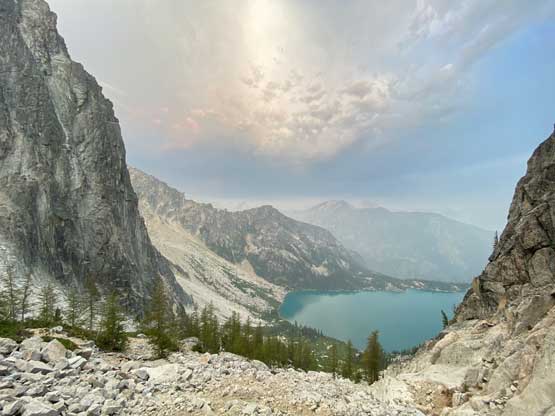


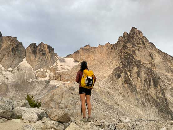

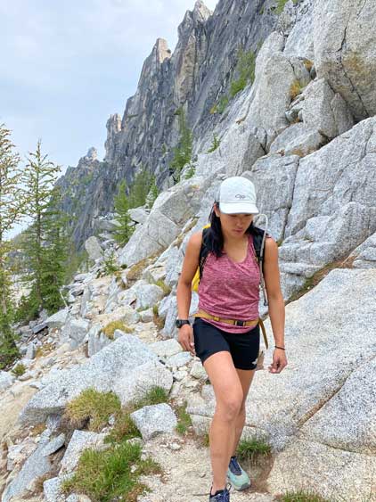
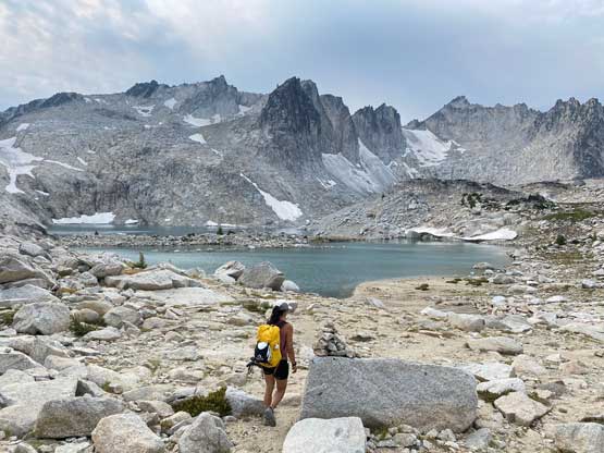
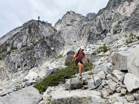
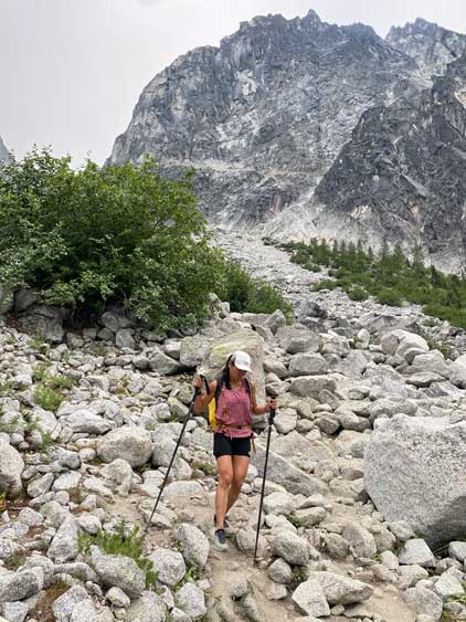
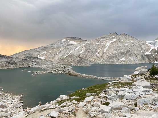
One of the downside of taking this approach is the 200 m elevation loss from Aasgard Pass to Perfection Lake but the trail is reasonably well marked and the scenery is good enough that one doesn’t really notice the frustration that much. While descending above Isolation Lake we got hit by a few intermittent showers that were not in the forecast at all. I did not even bring a rain jacket. The temperature was also not as hot as forecasted but that’s a good thing. We took one lengthy break at Inspiration Lake to filter some water as that and Perfection Lake were the last two sources of water. We then plodded up to Prusik Pass and traversed around a subsidiary bump on the north side. The path leading to the base of the climb was still visible but less defined and the general direction was to traverse on the north side of the ridge.

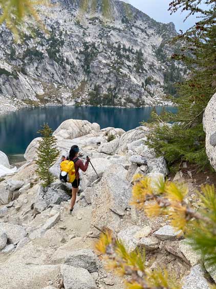


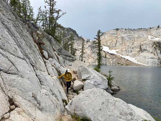


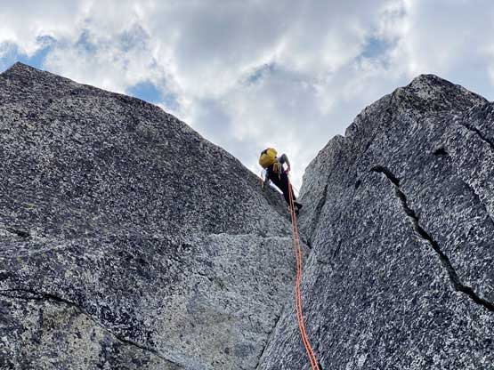
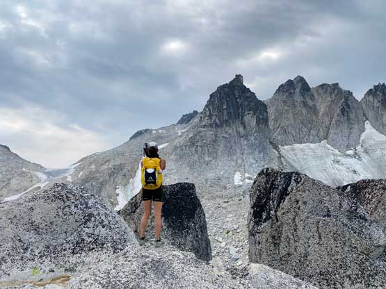
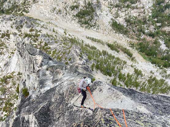
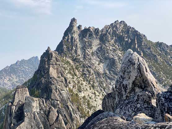
At the start of the route we took another long break to ditch a whole bunch of unnecessary gears including one backpack, and swapped footwear to rock shoes. The route appeared simple enough to scramble and sure it was. While Winnie ascended straight up onto the ridge crest I stayed mostly on climber’s left side and our lines converged above that initial 5.6 “white crack”. My route bypassed that crack but still involved at least a few stiff moves and with higher exposure. We then continued soloing the first two pitches with mostly 4th and low 5th class climbing. There were a few notable spots including one roof-ish feature that’s definitely harder than “low 5th”, but there were abundant possibilities in picking the routes so we might or might not have stayed on the easiest path. Nobody had done extensive research about the climbing details so we more or less just picked a path that worked for us. We continued soloing partway up the 3rd pitch until directly underneath the 5.7 slab. It didn’t appear dauntingly difficult, but the lethal exposure made me wanting to have a belay. Winnie then went up the pitch placing only one draw onto the fixed piton and belayed me up from immediately above the slab.


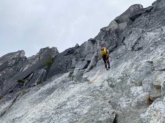
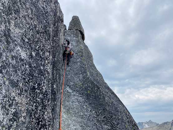
The terrain ahead appeared to be “scrambling” again so we coiled and stored the rope. A few more steps later we arrived at the infamous knife edge traverse which looked harder than it actually was. There’s some au-cheval techniques to be used and there’s one down-climb on blank slabs that felt mid 5th class. Beyond this exciting stretch we easily soloed partway up the final pitch to the base of the finger crack. I briefly contented about to keep soloing but I’m not someone with a ton of experience on this type of climbing. The crack was technical but not exposed so Winnie dragged the rope up and didn’t even need a belay. Winnie again, built an anchor immediately above the step and belayed me up.


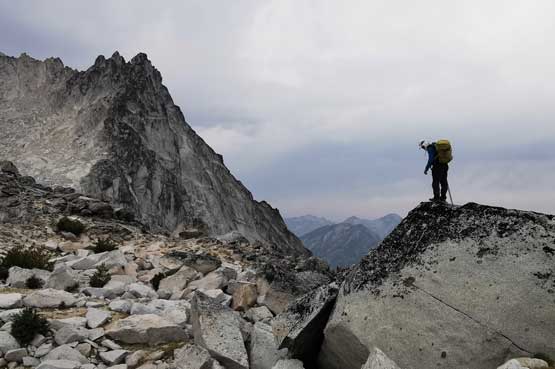
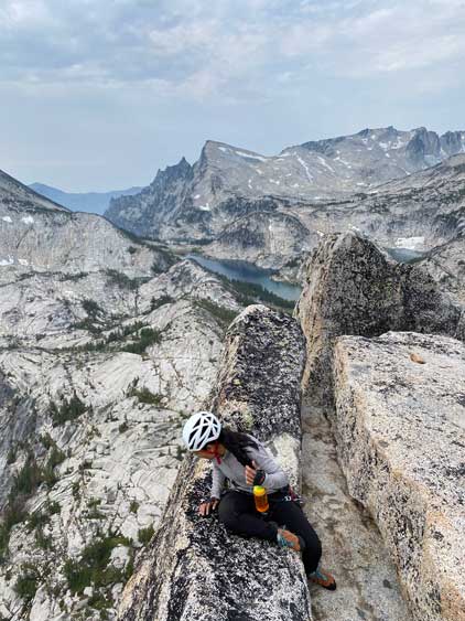
The terrain above the finger crack appeared easy again but I was too lazy to coil the rope this time. I simply started soloing/scrambling while dragging the rope up behind me. A few moves later I climbed to the south (climber’s right) side of a corner and the final challenge was a short, but vertical off-width chimney that took me a while to figure out a sequence. Meanwhile Winnie radioed me that she wanted to be belayed up a direct face variation for more fun climbing and to do that I had to belay her from the actual summit, so I committed to that off-width chimney and got to the top. I used a pinch point to build a simple anchor. I don’t know how difficult that route is, but she surely seemed to have a lot of fun climbing. The west ridge of Prusik Peak turned out much shorter and simpler than expected. While relaxing on the summit Winnie kept looking down the shear south face and telling me beta about the Stanley Burgner route and I spontaneously said that we should just rappel off from the summit and climb the uppermost pitch of that route, rated 5.9+ or 5.10-. We did that, and that was definitely the best climbing of this day. I surprisingly did this pitch relatively fluently without needing to sit on the rope.


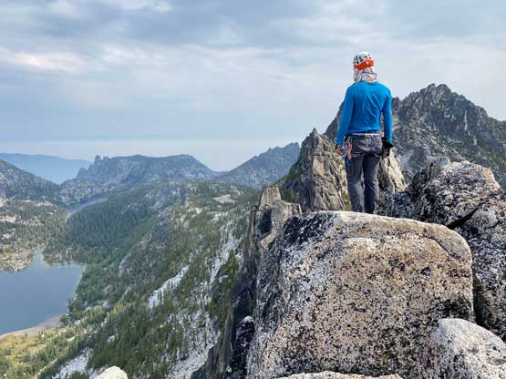


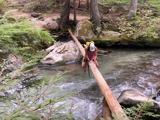
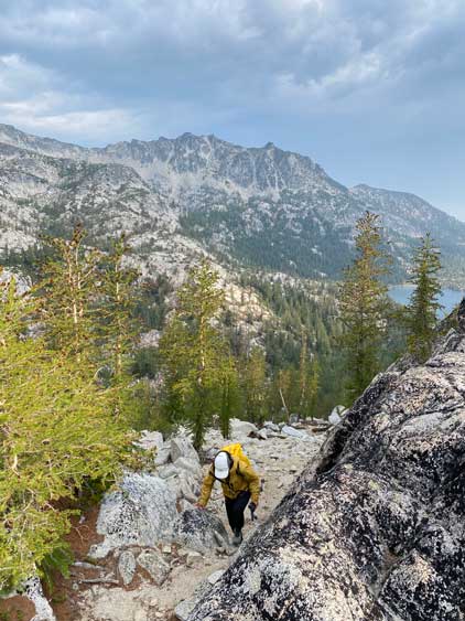
After taking another long break on the summit we did the standard descent, rappelling 5 times from station to station down the north face back onto hiking terrain. The rappels were easy, but confusing at times and the biggest challenge was to actually locate the stations. The first rappel was a shorter one but the other 4 were all 30 m stretchers or close to. We were originally planning to run up Little Annapurna but the two extra pitches of climbing definitely consumed at least an hour of time. We were looking at the time and decided that it’s better to not linger too much anymore as even on our current pace we wouldn’t get back home until midnight. We did stop regularly for photos and water breaks as we just had to in this beautiful setting. There weren’t much worth to document about the hike-out from Aasgard Pass other than a mistake nearing the end that resulted in an awkward au-cheval across the main creek. Judging by the GPS track I downloaded from peakbagger.com, we were definitely not the only group there, but most other parties backtracked and found the hiker’s foot bridge. I determined the creek crossing looked doable on a thin log so refused to backtrack, as usual. I ended up dipping both of my feet into the water while doing the au-cheval and hiked the final 3 km back to the truck in water-logged shoes. Our round trip time was 14.5 hours including all stops, detours and extra climbing. The drive home was an exhausting game though but I pulled it through with only one stop for napping.