Gunung Sumbing
August 9, 2023
3371m
Java, Indonesia
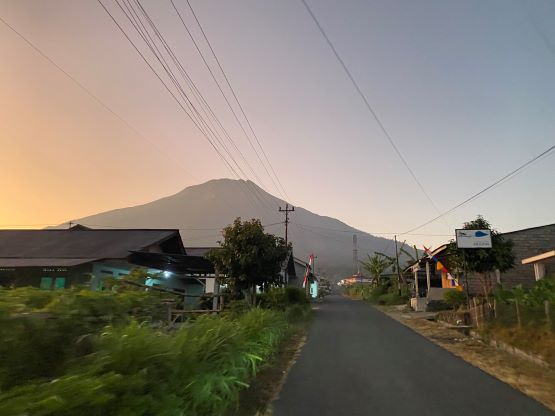
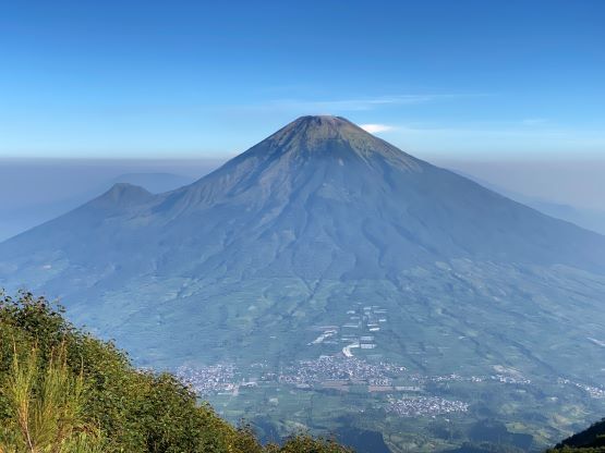
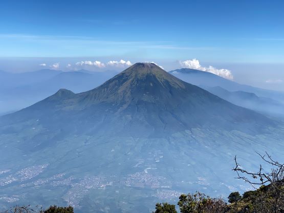
Gunung Sumbing is the 3rd highest peak in Java and the 2nd highest in Central Java. This peak and the nearby Gunung Sindoro are very visible from almost everywhere. As a result these peaks are often climbed, but not as popular as Gn. Merbabu that is also in the vicinity of the area. The most popular route goes up from the north side where an ojek can drive up to 1900 m elevation. The trail is the typical steep and dusty type that one can expect from this area, and to attain the true summit one must be able to scramble some 3rd class terrain with exposure, aided by fixed lines. Rob Woodall’s trip report and GPX along with the excellent article on Gunung Bagging website were all we needed to get this job done rather efficiently. Adam had booked the hotel (Dieng Kledung Pass) right at the base of the route and the hotel secured two ojeks for us at 5:30 am in the morning. The breakfast was supposed to be served at 5:00 am but was late by 15 minutes. As a result I had already finished my “back-up” bread with chocolate and I was no longer able to eat the actual breakfast. That’s a bummer.
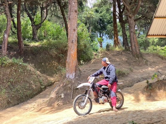
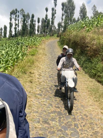
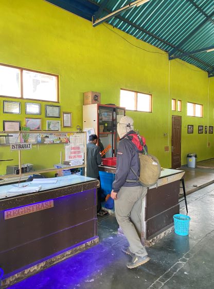
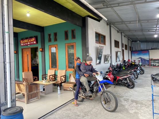
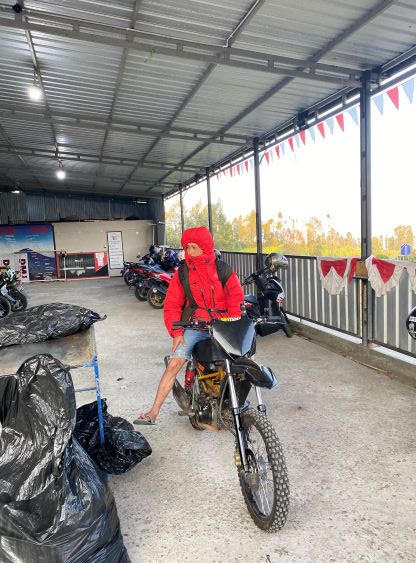
The ojeks did come in time but were only able to take us to the “basecamp” and that was not to be expected. I guess we did not address to the hotel that we needed a ride to “Pos 1”, the actual starting point. There was about 400 m elevation gain from the “basecamp” to “Pos 1” so there’s no way we would “just walk it”. The ojek drivers did wake up that basecamp and they replied the registration would not open until 7 am, and the ride to Pos 1 would not happen unless we did the registration. That was frustrating, but after explaining that we would not be camping on the mountain they gave in. One of them got up so we could get the registration process done. I think the red tape is rather serious on this mountain probably because of the difficulties in reaching the true summit, and at least one hiker had died on this route. They took Adam’s driver license so they basically forced us to come back after the hike. Our hotel’s ojek drivers then went back and we were left there waiting for the actual dirt bike drivers. About half an hour later we were finally able to leave. The road to “Pos 1” was on steep and rough cobblestone pavement, but the drivers drove extremely fast and aggressively, that a fall would likely be fatal. They also put us on the front seat so the ride was actually quite awkward. I had done only one ride ducking in front of the driver and that was on a snowmobile, so this one felt like new-ish. They blasted us up the 400 m elevation gain in probably only 5 minutes. A few hours later on the descent I talked to a Singaporean hiker and she decided to walk all the way up from the basecamp to avoid this dangerous ride. It was indeed very dangerous (no helmet so unlikely able to survive a crash), but I somehow enjoyed it.


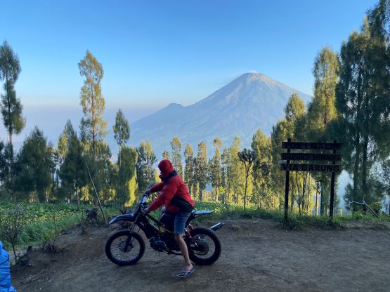

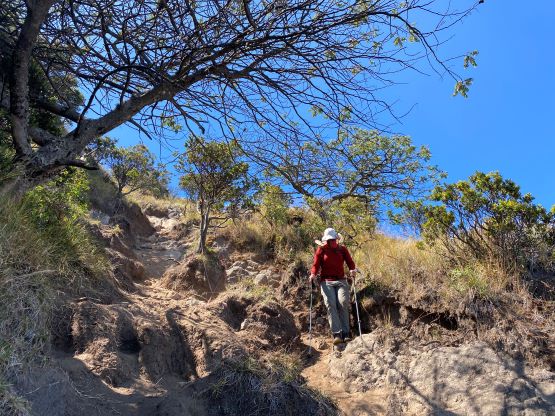
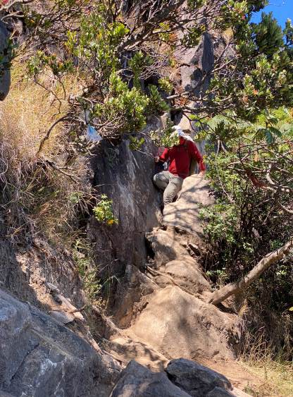
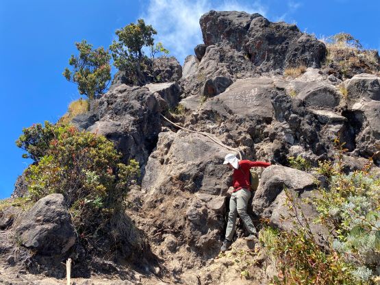
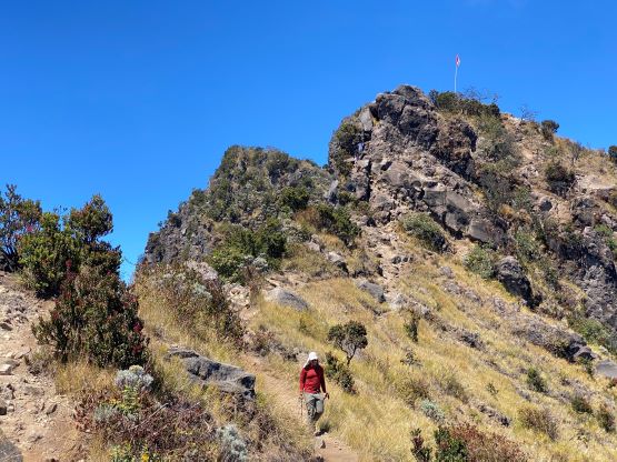
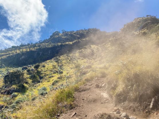
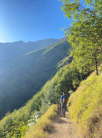
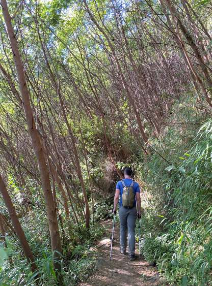
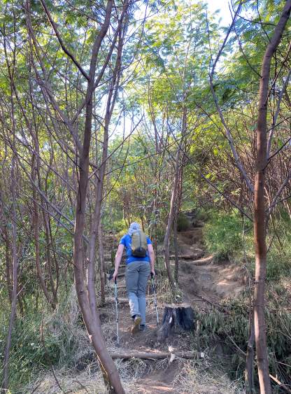
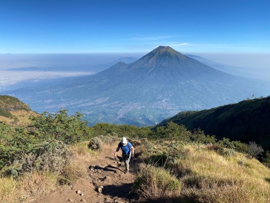
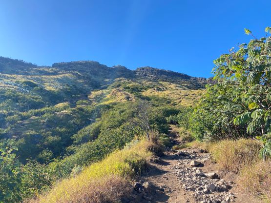
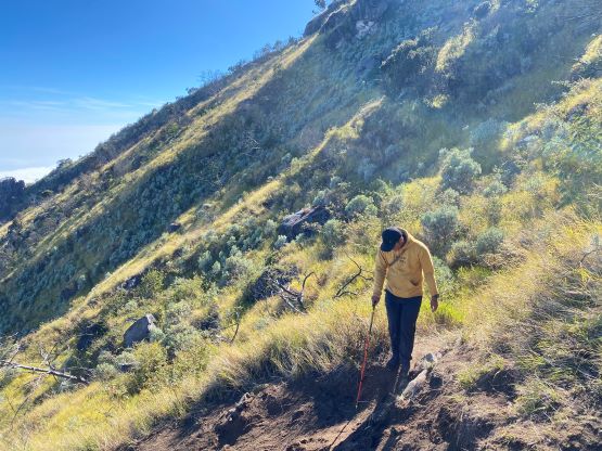
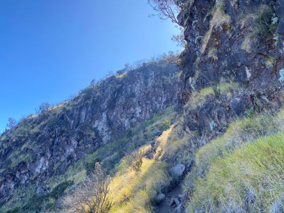
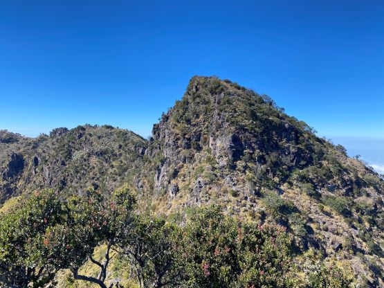
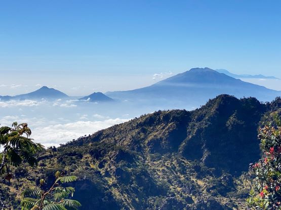
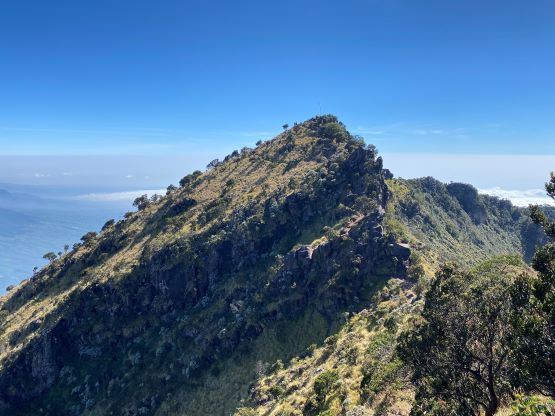
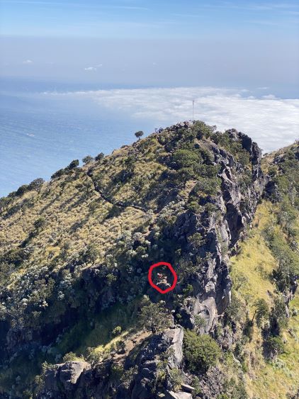
With the ojek rides the ascent to the crater rim wouldn’t be that much of a deal. There are two trails, both labelled correctly on my Gaia app and the maps in their basecamp. I simply decided to follow Rob Woodall’s GPX track taking the more western of the two trails, but I later learnt that this was the “new” trail and the purpose to build this trail was to mitigate the erosion problems. This trail is slightly longer than the direct, old one with a few gully-crossings and some minor elevation losses. Up until 3000 m the trail was in an excellent shape with hardly any dust but the final 300 m grunt onto the crater rim was very steep, loose and dusty. Adam and I had to space ourselves out so the follower wouldn’t be breathing in the dusts as much. And whenever there came a descending group we would have no choice but to embrace the dusts. We both brought a buff this time and Adam actually used it. I did not bother probably because I had never used a buff and I don’t like to restrict my breathing. Even in the dusty zones in Khumbu I opted to just tough it out. I had no idea how far back Adam was, so instead of waiting on the crater rim I decided to scramble to the first (false) summit known as Puncak Kawah. There was one 3rd class section aided by some fixed ropes, and the route-finding wasn’t that obvious at the first glance. A few minutes after making this false summit I could finally see Adam showing up on the crater rim, so I waited for his arrival.
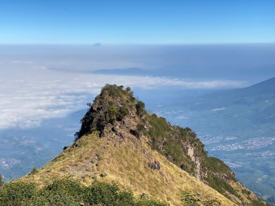
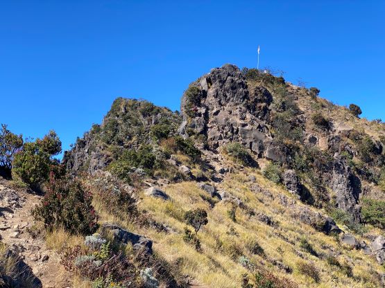
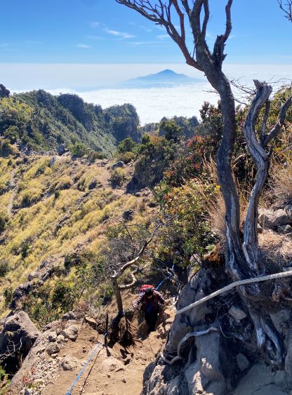

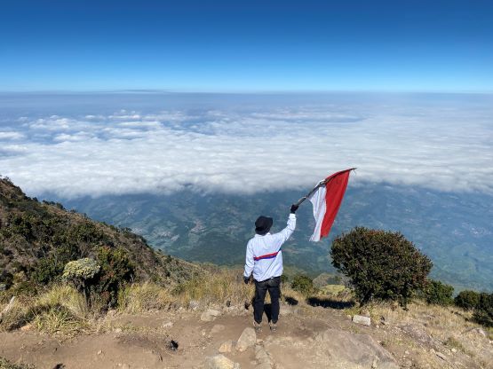
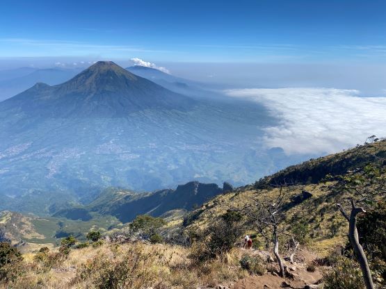
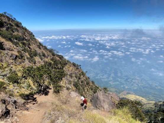
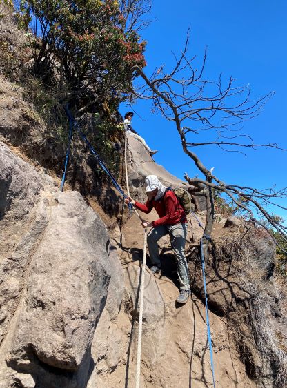
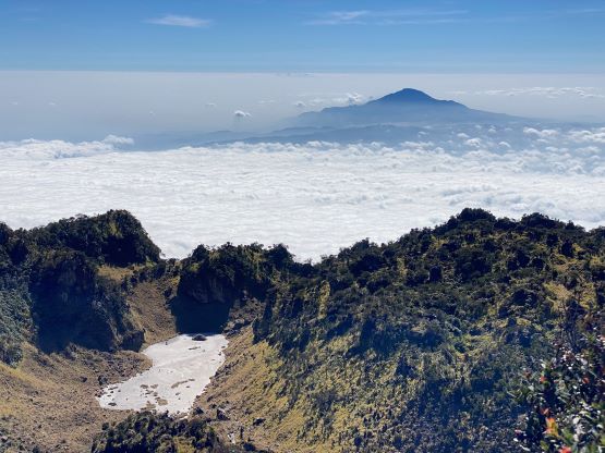
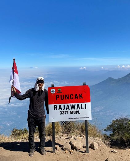
Adam needed a break on this false summit but I had already taken a lengthy break, so I decided to carry on to the true summit – Puncak Rajawali. The traverse to the true summit was more involved than I thought due to the difficult descent into the Kawah/Rajawali saddle. This section was not visible from the false summit (Kawah) as otherwise I would prefer to stay together. Based on the various paths I knew there must be an easier but contrived way slightly north of the rim but I opted to just deal with the scrambling on the direct route. There were several fixed ropes to support the few 4th class steps. I mostly avoided using them as the ropes looked to be old and dangerous. There were a few stiff moves that made me to pause for a few seconds, so I wasn’t sure if Adam would be happy to go down this way. The scramble onto the true summit from the saddle was actually quite straightforward, so I found a spot with sights back towards the false summit so that I could watch Adam’s progress. Indeed Adam was able to find an easier bypass to avoid any 4th class terrain. The view from the true summit was not as good as I was hoping for, so we didn’t linger up there for too long. I did explore past the highest point and found a sneaky spot to look into the gigantic crater.
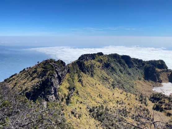
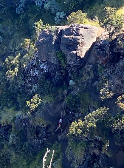


The scrambling back towards the false summit required some caution, and from the saddle we each picked our own way. I again, stuck closer to the rim (4th class) for the fun factor whereas Adam used his contrived way, slower but easier. We did not actually have to go all the way back up to the false summit as there’s one traversing path that helped us to avoid the unnecessary elevation gain. We had one more 3rd class section to descend and I could totally see why most hikers would call it “peak enough” by just topping out the crater rim. The ascent of Rajawali or even just Kawah requires scrambling skills that not everyone has. To avoid breathing in the dusts we again decided to descend at our own pace, with me leading about 10 minutes in front. I jogged down most of the dusty sections as my strategy to deal with the dusts was to simply outrun them. I did take a massive spill and covered my whole body with dusts. I was thankfully able to hold my breath for a few seconds so I did not breathe any of them in. The rest of the descent was boring and uneventful. There were plenty of ojeks waiting at the “Pos 1” and their rates were significantly cheaper than what we had paid earlier in the morning. The downhill ride was again, fun but exhilarating. We did remember to stop at the basecamp to recollect Adam’s driver license and made back to the hotel at 12:10 pm, earning ourselves just enough time to take a much-needed shower before resuming the westwards drive towards our next objective.