Tomyhoi Peak
August 14, 2022
2266m
Mt. Baker Highway, WA
Tomyhoi Peak is a classic scramble that is well known in both SW BC and Washington’s communities. The scramble is included in Matt Gunn’s Scrambles in SW British Columbia even though it’s not in the region. This is considered as a classic for good reasons: easy access, no bushwhack, fun scramble and awesome views. This peak can be day-tripped from either Vancouver or Seattle but those who prefer to camp can spend a night at the 5-star tarns under Yellow Aster Butte as well. This peak was however, not super high on my “list” as it’s too obvious and straightforward but I knew at some point I would end up doing it. This Sunday seemed like a right time. I was tired from the recent climbs of Sherpa Peak and Argonaut Peak and Holly happened to have the day available. I suggested that we should do something “type 1 fun” and Tomyhoi Peak was an easy sell. Holly was worrying that I would end up suggesting that add-on summit Yellow Aster Butte hence to rush the hike, but that wouldn’t be the case as few years ago I had already hiked up Yellow Aster Butte in November (on snow and in the dark) and got back home in time for work.
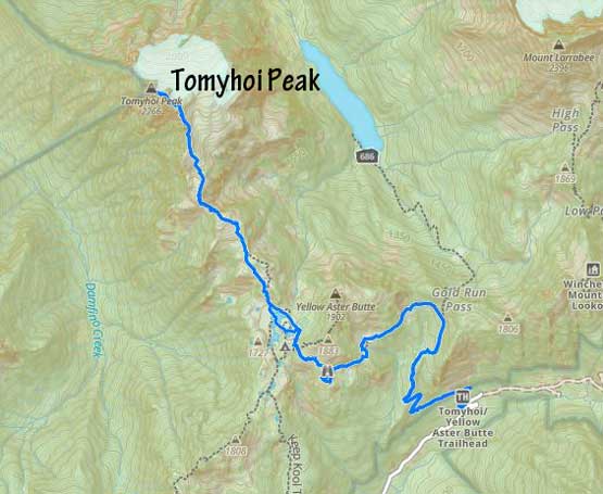
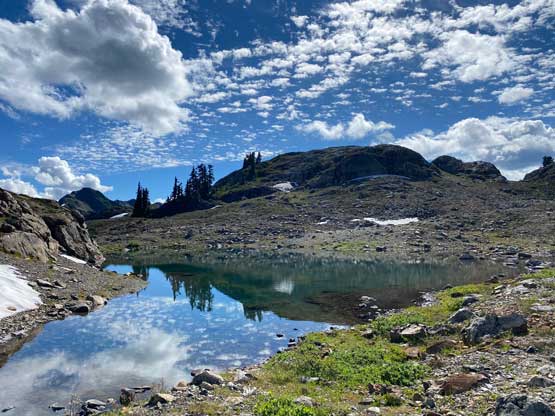
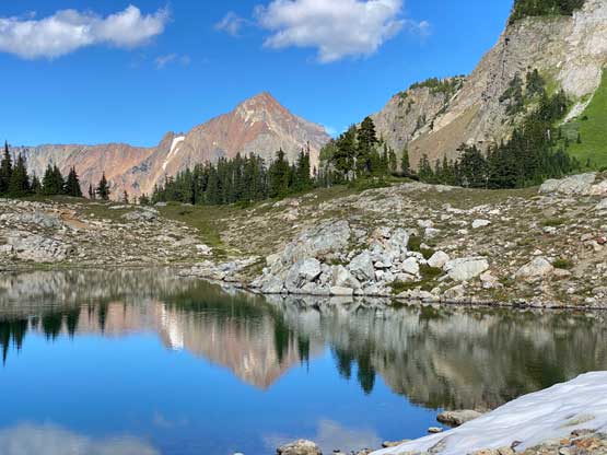
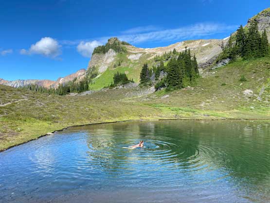
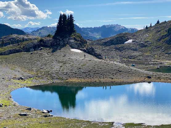
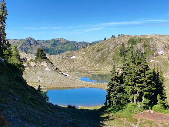
The most logical meet-up place for Holly and I would be Abbotsford and we decided to meet there at 5:30 am and the plan was to thoroughly enjoy this hike without rushing the pace. We got to the trail-head in Holly’s SUV about an hour and half later and started at around 7:20 am. The first few kilometers were quite boring without much to see, but the views opened up drastically as we wrapped around Yellow Aster Butte on its south slopes. The descent from the trail junction to the tarns wasn’t super obvious and we just randomly picked up a path. I was sure that we didn’t pick the most travelled path but whatever. The lakes were inviting for a swim, but we would worry about that later on the return.


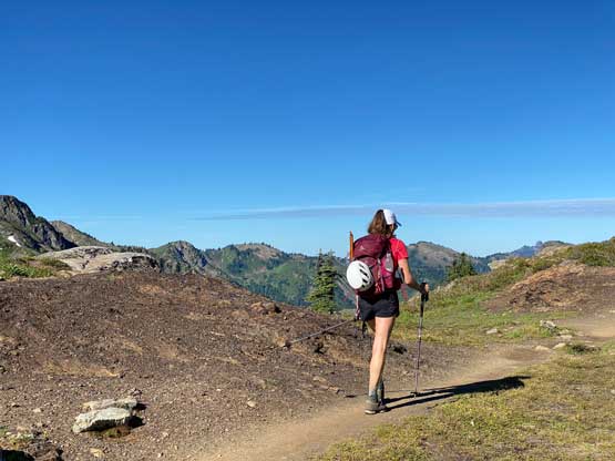
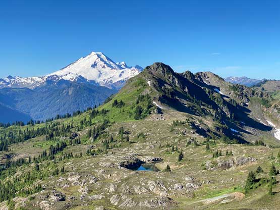
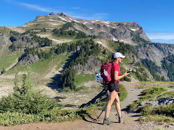

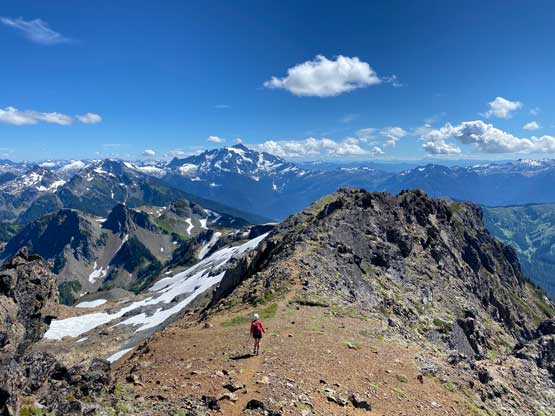
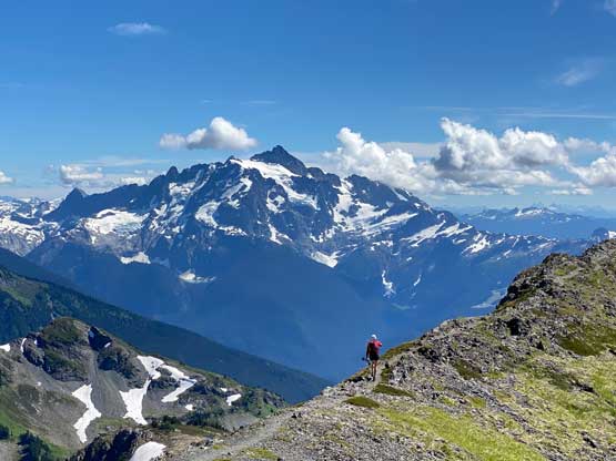
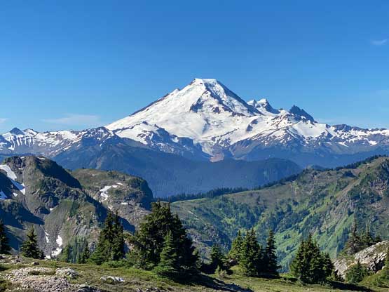
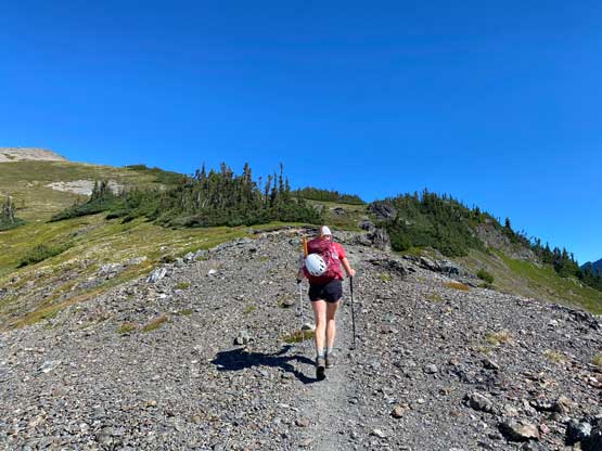
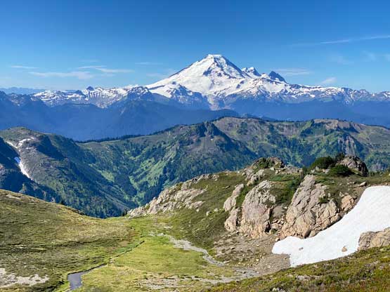
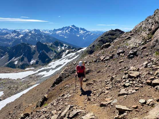
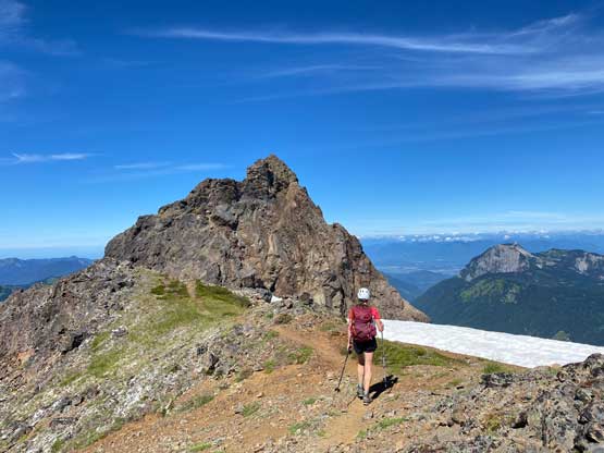
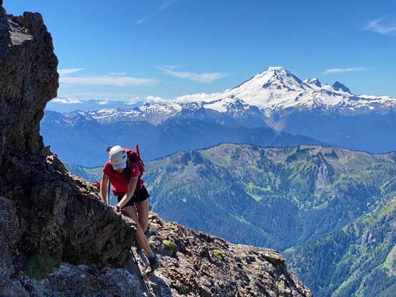
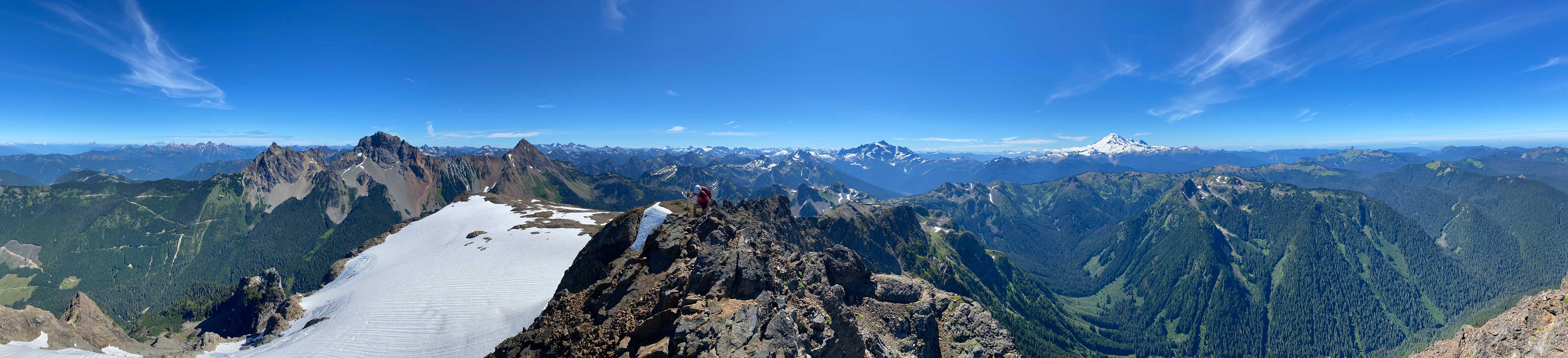
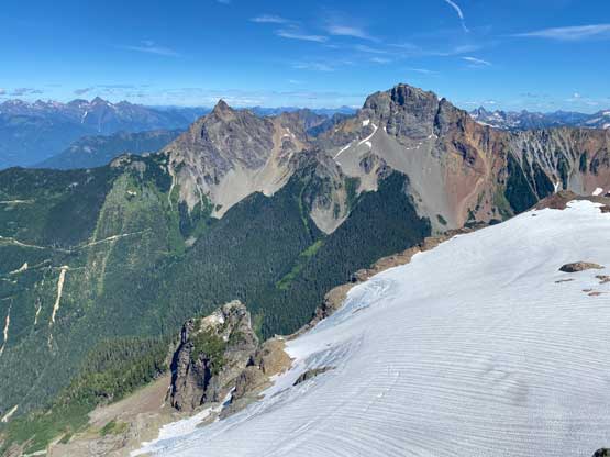
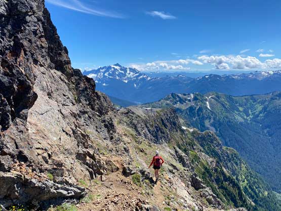
Upwards onto Tomyhoi Peak’s lower slopes we were still following a trail, albeit unmaintained. The trail was easy to follow except for only a few places and the views were expansive for the whole way up. There were still tarns with running water even halfway up the slopes but fearing there wouldn’t be water sources higher up we stopped to refuel our water bottles. The area was extremely busy with people and dogs, so we opted to treat the water for extra safety measures. There’s one major dip with about 50 m elevation loss somewhere around 1950 m elevation zone. We then easily plodded to 2100 m where we crested a ridge and saw the summit towers up-close.


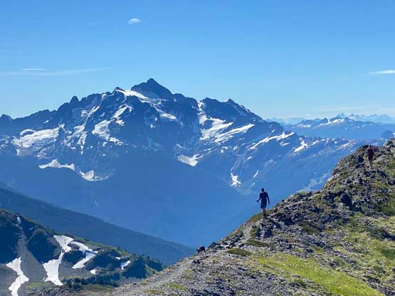
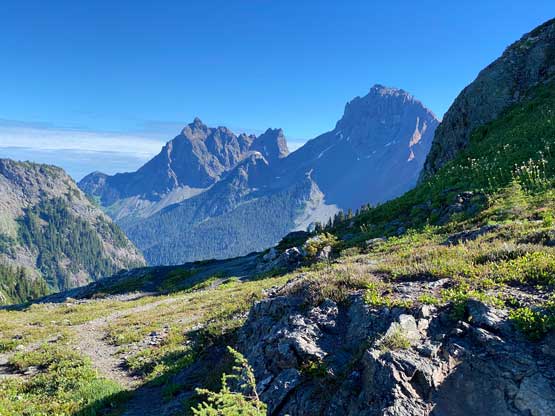
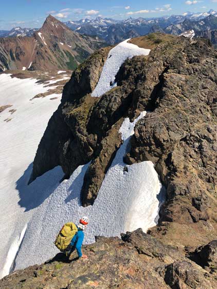
We followed a well-trodden path traversing the east side of some towers on scree and then ascended back up onto the ridge. The next traverse brought us to a patch of snow with very obvious tracks on it. The snow slope appeared rather trivial but turned out harder than expected. We had brought ice axe, crampons and mountaineering boots but didn’t bother to don any of them. Instead, we just walked across the snow slope in trail runners using only poles to balance. We then crested a notch and followed the path dropping down to the west side of the ridge and that path brought us to the false summit. The scrambling was very minimal here.
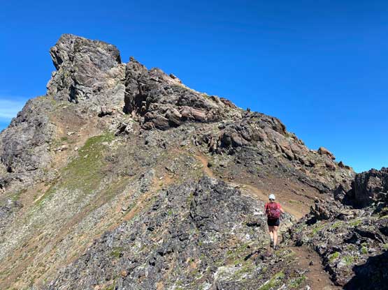

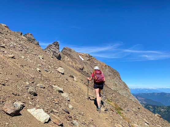


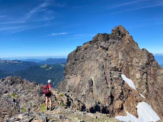
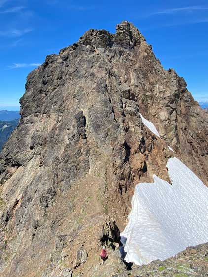
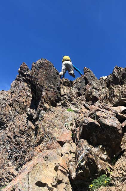
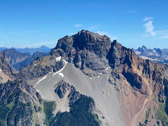
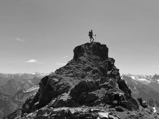
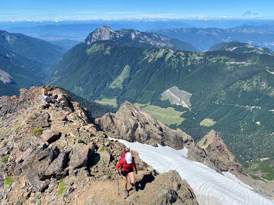
The true summit appeared daunting so I ditched one pole and swapped footwear to mountaineering boots. I do not like to scramble rough terrain in trail-runners. Meanwhile Holly had started the descent into the deep saddle and I caught up to her at the bottom. I did not come here with any “beta” about how to attack the true summit, so just did the route-finding onsight. We ascended more-or-less straight up from the saddle linking up ledges and gullies and the scrambling never exceeded “3rd class” although the exposure was real at places. The steep scramble brought us to near the summit and we still had to work around some features to get to the very top. The summit was very pointy without room for 2 people, so we continued past the highest point and settled to rest about 10 m beyond the top. The summit stay was almost 2 hours but that’s usual for Holly’s trip.
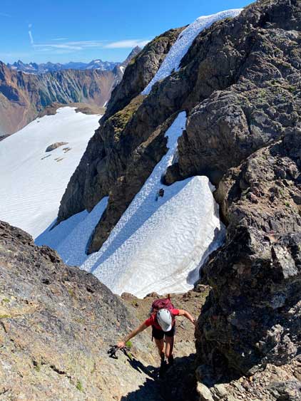


Eventually we had to get going. We retraced our route back to the false summit and then there came a decision point. Holly suggested to scramble over or around those pinnacles to avoid the snow. Initially I was rejecting the idea as I’m never a fan of dealing with the unknowns, but once seeing the terrain on the west side of the ridge I was sold. Holly however, decided that the terrain looked too chossy and complicated and went back to descend the snow traverse. I insisted to check out the rock variation and it turned out to be mostly just 3rd class but loose and exposed. I ended up being the faster one.


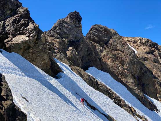
After watching Holly gingerly down-climbing and traversing the snow using her ice axe I was glad I did the rock variation but due to the looseness of that route I’m not sure if I would recommend. We then easily plodded down to the lakes and Holly went for a swim as usual. I decided against swimming due to the mosquitoes and the rest of the descent was rather uneventful. Our round trip time was under 10.5 hours and that included all the breaks we made. We then drove down to the town of Glacier and went for some pizza dinner, but ended up waiting for almost an hour to get our order. The border delay at Sumas was also crazy (1+ hour) so eventually I did not get back home until almost 11 pm.