Stonerabbit Peak (SE Face)
October 3, 2020
1856m
Chehalis Area / Harrison West, BC
The group of peaks in the “Chehalis area” is remote and guarded by steep bluffs and dense South Coast rainforest, but offers some of the finest mountaineering on granite in our immediate local areas. Stonerabbit Peak is one of the more sought after objectives in this group. The north and SW Faces both offer multi-pitch technical climbing, while the SE Face offers a mostly 4th class, introductory level and yet aesthetic slab route. For those not capable of technical climbing, the west ridge is the easiest option and with careful route-finding it should not exceed “3rd class” albeit with some bush thrashing. For a few years I thought the only route that interested me was the scrambler’s west ridge but I changed my mind this year when Winnie wanted to squeeze one last alpine climb before snowfall. Technically I wouldn’t call the SE Face of Stonerabbit Peak an “alpine climb” but I also wouldn’t call it a “scramble” neither. It’s more like a borderline scramble for those familiar with rock climbing on granite slabs.
Winnie and I had spent quite a few days cragging in Squamish including making an ascent of the multi-pitch route “Frontside 180” and I started to become a little bit comfortable on granite and slabs. The SE Face of Stonerabbit Peak seemed like a perfect objective to further improve our slab skills. Once the plan’s confirmed I made some last-minute changes of work schedule to take advantage of the incredible weather on Saturday. Winnie was not able to leave home in the previous evening so I woke up early and picked her up at around 5 am in Vancouver. The drive down east on Lougheed Highway was fluent, but then up Chehalis FSR was a slow show thank to the zillions of pot-holes. I think the 30 whatever kilometers up the Chehalis FSR took us almost an hour. The spur road in Skwellepil Creek drainage was not as bad as expected. It was still rough with a ton of water bars, but none of the water bars was troublesome. We had no problem making to the driveable end in my Tacoma and I honestly didn’t even feel like pushing the truck. It was just a slow crawl that took forever. I was already exhausted by the time we parked…
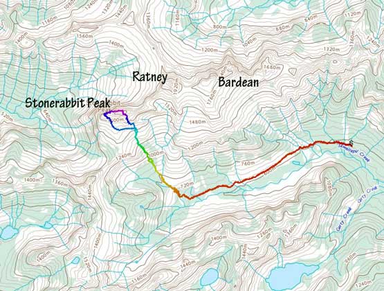
Stonerabbit Peak via SE Face. GPX DL
The first stage of this trip was plodding up the decommissioned portion of Skwellepil Creek FSR for about 4 km to pretty much the end of it. The major washout that stopped vehicular access (100 m beyond where I parked) was probably doable for experienced ATV enthusiasts or dirtbikes but even for them I wasn’t sure. It’s a massive washout with a shit ton of boulders to walk through. The road beyond that was in a surprisingly good shape without much of alder thrashing, until the very end where we did have to touch the (wet) brushes here and there. There were also a number of annoying dead falls towards the end of this road section. At around 680 m elevation we came to the base of the huge drainage system that came down from high up on Stonerabbit Peak and here’s where we should start ascending.
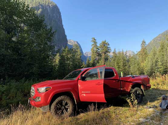
Taco parked at the driveable end

Winnie walking across the slide path/washout that stopped vehicle access
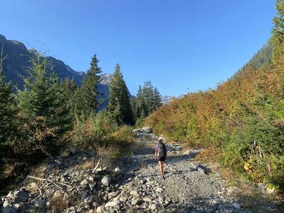
The typical condition on the final 4 km (walking portion) of the road.
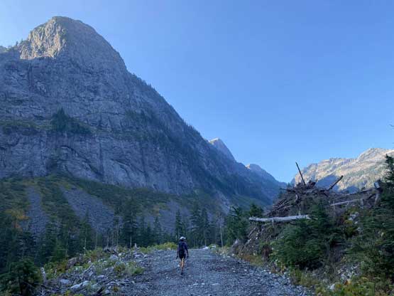
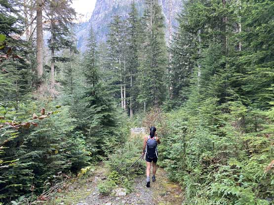
Winnie walking under some impressive Chehalis walls
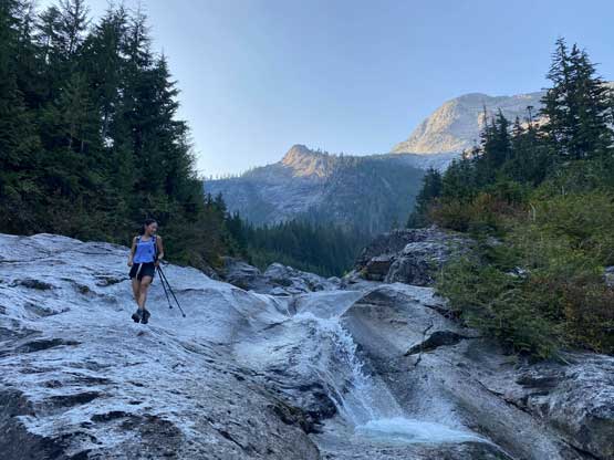
The first obstacle came at around just under 750 m where we had to bypass a large waterfall slab. The beta wasn’t very clear but we picked the climber’s right side that involved a short, but intense bushwhack followed by some 3rd class scrambling on wet slabs with moderate exposure. On the descent we took the opposite side which involved a similar deal. Once the terrain levelled out we hopped on boulders to the opposite (west) side of the creek. The scrambling on the west side of the creek soon narrowed down forcing us to bushwhack in some devil’s clubs on slanted ground. We made some mental notes to avoid this section on the return. After the bushwhack “fun” we had a long section of cruise-sail, and upon hitting a major “intersection” we took the left branch aiming for the upper reach of Stonerabbit Peak.

Starting the gully system. Note the waterfall to bypass
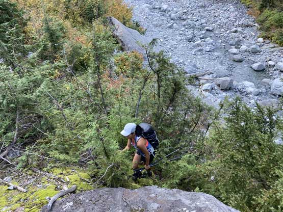
We went climber’s right. Some bushwhacking was needed
Class 3 scrambling started right off the bat

Above the waterfall step we hopped across the water course to the left side
Winnie scrambling on the left side of the gully.

The chosen gully that leads to the upper part of the face

The right hand side (wrong) gully goes towards Mt. Ratney instead
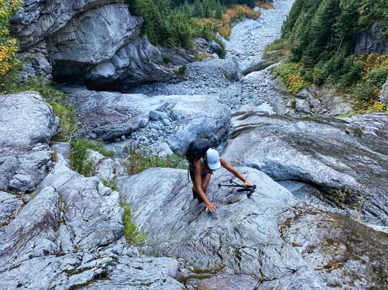
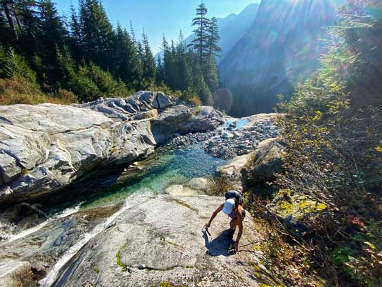
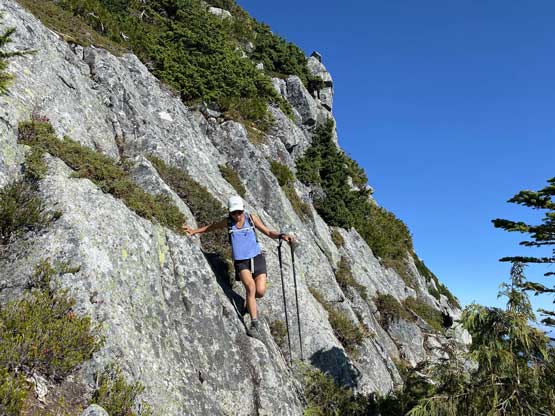
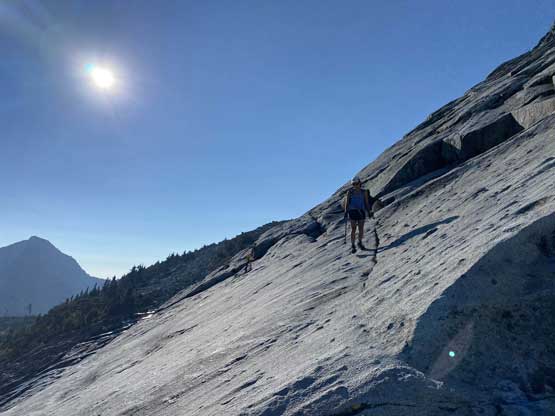
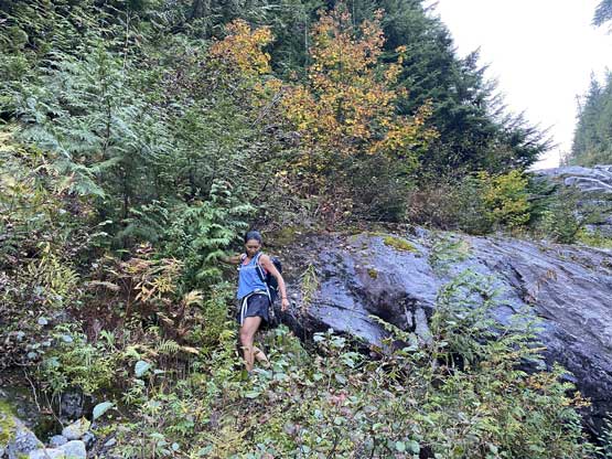
The next stage involved a few hundred vertical meters of class 3-4 scrambling on the dry slabs with occasional bushwhacking and route-finding. There were a few spots that we ended up taking a different line on the descent but generally speaking we didn’t discover the easier options by picking a different line, so “pick your poison” is probably my only advice. It’s pointless to describe the very details of this stretch as there usually aren’t many route options anyway and all we needed was some common route-finding sense. The heat of the day really started to kick in and we were pretty exhausted, but we insisted on pushing to the base of Stonerabbit’s SE Face before taking a much-needed long break. There’s a trickle of running water and we made sure that we drank for at much as we could.

Winnie walking into Stonerabbit’s access gully

As you can see, some degree of bushwhacking is unavoidable

Let the slab scrambling start

Winnie found a cool rock roof to play with…

Short bits of 4th class scrambling here and there

A wider angle of Winnie scrambling the access gully

We took a very long break at this platform
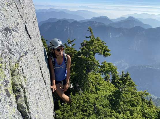
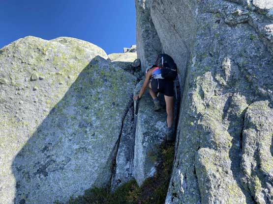
From this spot to the start of Stonerabbit Peak’s SE Face still involved a short section of boulder hopping and scrambling and then we were officially onto the slabs. We stayed on the climber’s right side of the face at the start as the slabs were pretty mellow there. And then we followed an obvious ramp system aiming left onto more sustained 3rd class terrain and the exposure also started to kick in. Once the terrain started to look 4th class we made the decision to put rock shoes on, but the rope stayed in the pack. We generally followed Richard So and Drew Brayshaw’s descriptions in their respective trip reports but we probably didn’t find the easiest line at the area just under the crux section. The crux spot came fairly obviously as it started from a rightward traverse on an exposed and awkward ramp and finished on a section of blank slabs that definitely felt like low class 5 and with considerable exposure. Without the few rock climbing trips in the past few weeks I probably would end up needing a rope there. Once above the crux we veered climber’s left briefly onto easier ground, but eventually still had to face the rightward traverse onto the upper face, which involved a few more sketchy and committing moves.
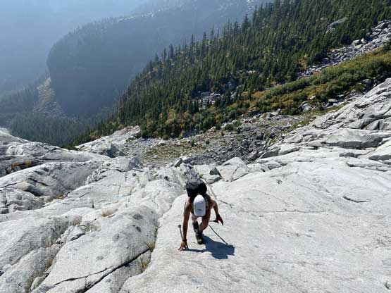
Winnie starting the SE Face climb
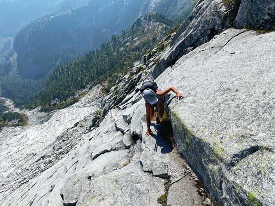
This was the starting move of the crux zone
Winnie tackling the crux moves.

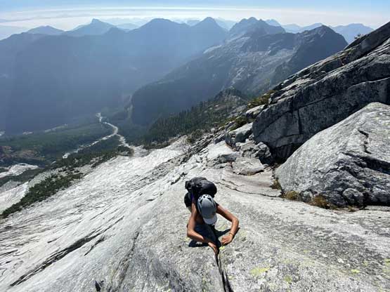
Taking a short mental break from the slabs and exposure

Winnie leading another set of harder moves
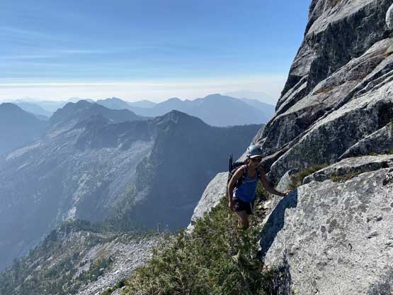
We found a bushy ledge to traverse climber’s right onto the upper face
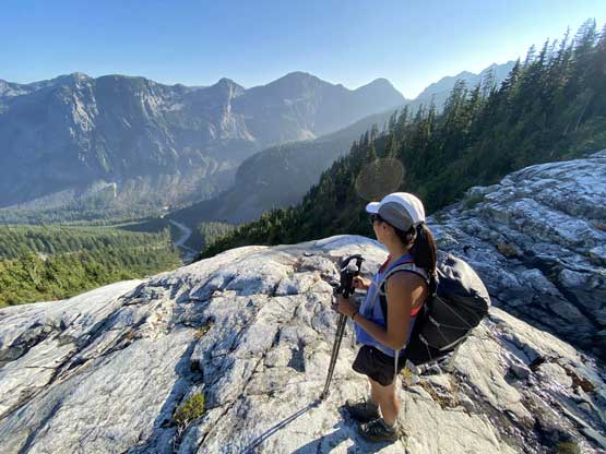
The upper face was mostly just 3rd class and the route-finding wasn’t particularly challenging. We on purposely picked some harder moves because we were wearing rock shoes and wanted some extra challenges. Towards the top of this zone we had to do some brief bushwhacking to get onto the summit ridge, and then the summit was reached shortly after. The views from Chehalis area never disappoints and the temperature and time were all on our side, so we spent at least an hour up on the summit soaking in the experience.
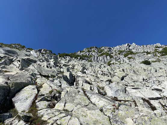
The typical blocky terrain on the upper face
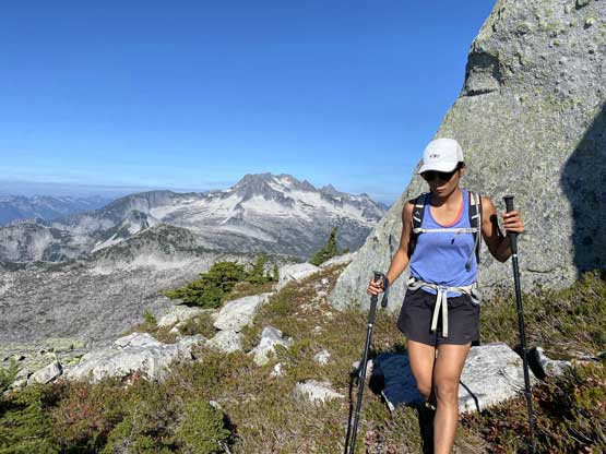
Winnie scrambling on the upper face
The immense granite slabs and faces on Mt. Ratney massif
Winnie scrambling through a bushy section to gain the summit ridge

Gaining the summit ridge
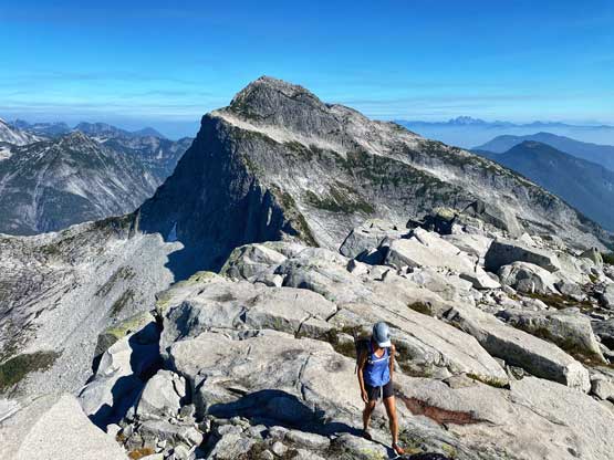
Winnie traversing towards the summit of Stonerabbit Peak
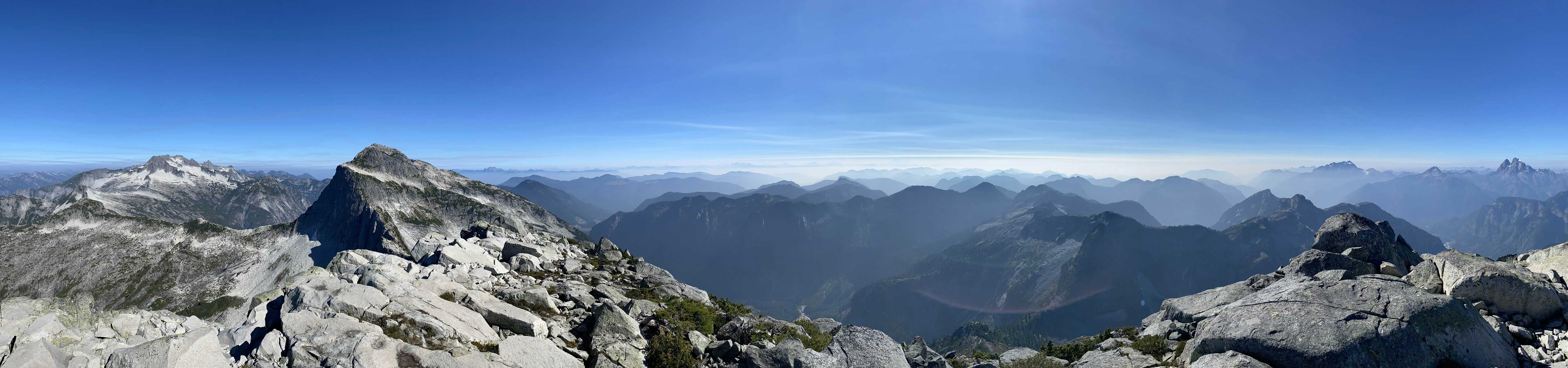
Partial Summit Panorama from Stonerabbit Peak. Click to view large size.

Partial Summit Panorama from Stonerabbit Peak. Click to view large size.
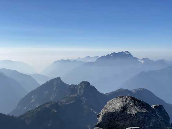
Mt. Robie Reid and the smoky Lower Mainland skyline

Mt. Judge Howay and the “Hourglass Gully” displaced in front

A wider view of the Chehalis “VRC Group”
Mt. Ratney close-up shot

The Old Settler on the eastern skyline

Mt. Clarke with Recourse Peak and Viennese Peak on the right

A wider view of Mt. Judge Howay behind Winslow Creek valley

Robertson Peak to the north has seen only 4 ascents to date
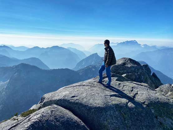
Me on the summit of Stonerabbit Peak
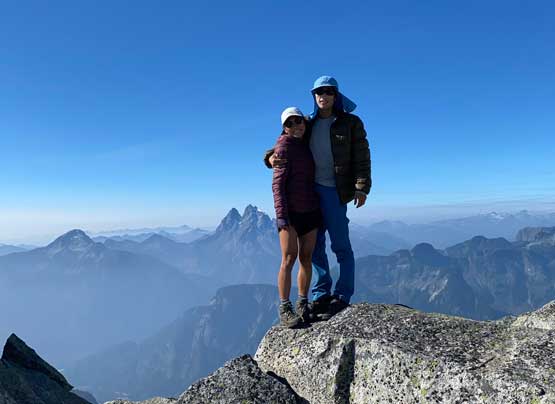
Winnie and I on the summit of Stonerabbit Peak
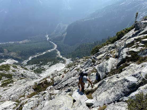
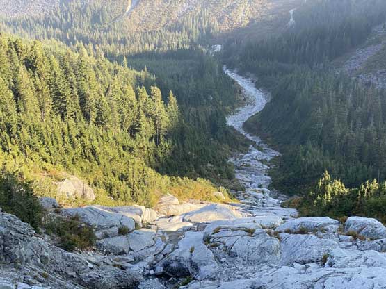
I was not particularly looking forward to the west ridge descent mostly because we didn’t have a GPS track for that and we didn’t come up from that side. The ridge started easily but soon turned into a mix of 3rd class steps and bushwhacking. We weren’t very sure where exactly to bail the ridge to descend the south side and ended up wonder around for quite a bit. I almost made the commitment to just do several rappels using trees as natural anchors but felt too lazy to dig the rope out. To descend this route without rappelling we had to backtrack and carefully pick a line through bush and bluffs, which certainly felt frustrating at times. Lower down we had to traverse a long stretch of boulder fields and then slabs to rejoin our ascent route at the base of the SE Face. The 500 vertical meters of loss down in the slabby gully wasn’t very fun and required careful route-finding as well as concentration, but we both handled it pretty well. The final 4 km of road walking back to the truck wasn’t too bad with chatting.
Starting the west ridge descent
Winnie on the west ridge with Mt. Clarke behind
The route-finding wasn’t straightforward

Vege belays and 3rd class bluffs and steps were the key

A lone tree with some Chehalis backdrop
Traversing a long ways across slabs

Winnie descending the lower SE Face slabs

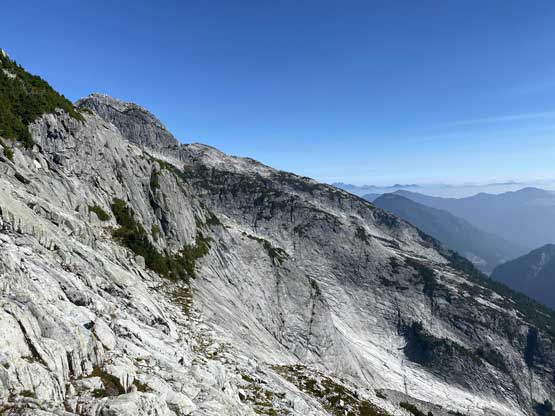
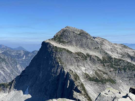
A review shot of Stonerabbit Peak’s SE Face
About to commit to the gully descent

Winnie somewhere down the upper part of the gully

Down-climbing a tricky step
Still a long way to go…

We remembered this stretch on the ascent
Winnie still having fun.

The typical Chehalis terrain and views
No matter what line we picked we had to deal with a bit of bushwhack
Back to the logging road.
The crux of this trip was the drive back home. I’m not someone who speeds on the logging roads even though I had a trusty Taco with all terrain tires, so the drive out of the Chehalis took me well over an hour. We also wanted to have a proper dinner instead of fast food so went for a short diversion to Abbotsford for some Italian food. While driving Winnie back to Vancouver I had to constantly fight fatigue and sleepiness. I thought I could push all the way to Vancouver but had to call for a nap break in Burnaby as I was simply too impaired too keep driving. I eventually got back to my home in White Rock past midnight and the conclusion was that we needed at least one night of car-camp next time when heading back into that area.
