Reconnaissance Ridge
August 8, 2019
2793m
Clemenceau Icefield, BC
Reconnaissance Ridge is the smallest (officially) named summit on Clemenceau Icefield in arguably the most remote corner of central Canadian Rockies. This is a long ridge that splits Cummis Glacier to the west and Tusk Glacier to the east, and both glaciers are part of the icefield. The position is superb and the ascent is mostly a walk except for the last 100 m where some exposed 3rd class scrambling is unavoidable. Because the name of this summit is a “ridge” there’s confusion as where exactly the summit is. The ridge extends north all the way to Mt. Morrison/Mt. Sharp with no obvious “key saddle” to separate the peaks. I only did the southernmost peak along the ridge while I could see a few peaks to the north are slightly higher. This was part of the Mt. Clemenceau and Tusk Peak expedition so to read the full story you should read the other two main trip reports.
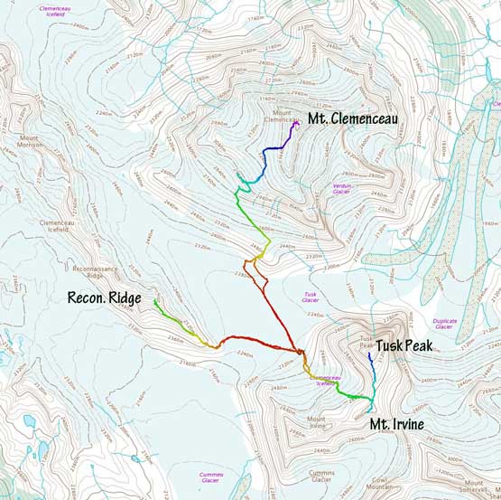
Ascent routes for Clemenceau, Tusk, Irvine and Reconnaissance Ridge. GPX DL
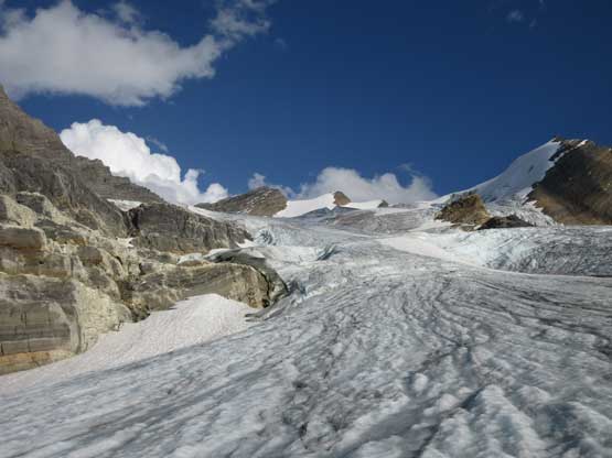
From the basecamp underneath Tusk Peak’s NW Ridge the first business was losing some elevation down to the flat Tusk Glacier in the middle of Mt. Clemenceau, Tusk Peak and Reconnaissance Ridge. The descent started by a bit of elevation gain over a ridge and then some slabby 4th class albeit on solid rocks. When we climbed Mt. Clemenceau a few days ago this down-climb felt sketchy but now with a very light pack I felt it quite easy. The snow bridge to hop onto the glacier had thinned considerably but I decided to trust it nonetheless and in short time I was down to the glacier. The plod across the glacier was monotonous but at least very scenic.
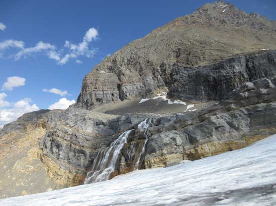
Descending passing the set of waterfalls that drain the water pool we camped at

About at the midpoint among Clemenceau, Tusk and Reconnaissance Ridge

Following a strip of moraine towards the base of Reconnaissance Ridge
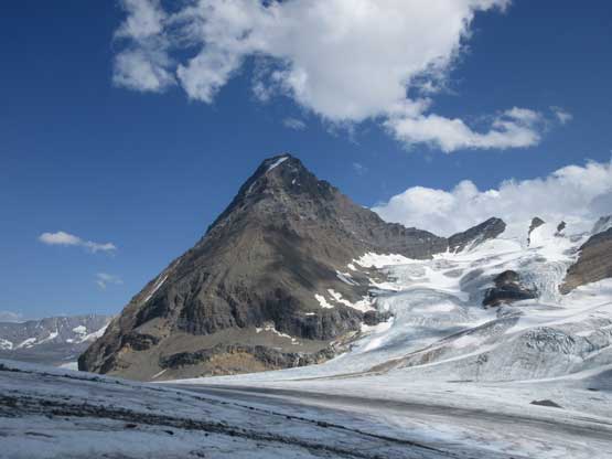
Looking back at Tusk Peak
The start of the south ridge looked shitty but turned out not too bad. I thought there’s some rock-covered ice to deal with but the shit zone was very short-lived. The ascent onto the ridge proper was mostly on stable rock and the lower ridge also involved very little treadmill scree. Near the first bump/shoulder was where I started encountering isolated spots of “class 2” aka. “moderate scrambling”. Past the first bump the ridge narrowed down considerably and became 3rd class at spots with considerable exposure.

Typical terrain on the lower south ridge

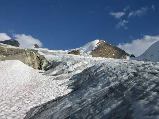
The meet-up point of Tusk Glacier and Cummins Glacier

Near the summit the terrain became more scrambly
I ditched one trekking pole and continued onward with hope that I could make the summit by mean of “scrambling” because I was there alone with no rope. The uppermost ridge looked questionable but the ledges on climber’s left side might provide some bypasses. I traversed left on a narrow ledge and turned right whenever I could. I ended up climbing some exposed 4th class slabs, on mountaineering boots that required 100% concentration. I had to find a different route to get down as down-climbing slabs on boots would be awfully sketchy, but at this point I just had to tag the summit first and get the views. The views weren’t disappointing as expected.

Traversing on ledges to bypass the difficulties on the ridge

The ridge extends north all the way to Mt. Morrison/Mt. Sharp over a few higher bumps

A very zoomed-in shot of Mt. Bruce

Apex Mountain

A wider view of part of Clemenceau Icefield

The base of Tusk Peak. Three glaciers are also in this shot
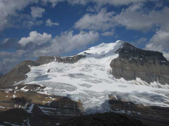
A full view of the SW Face of Mt. Clemenceau that we just climbed

Me on the summit of Reconnaissance Ridge

Tusk Peak and Tusk Glacier
Mt. Shackleton pokes behind Mt. Irvine

Pic Tordu behind Mt. Shipton

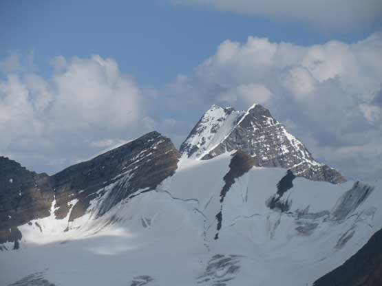
A closer look at Tusk Peak
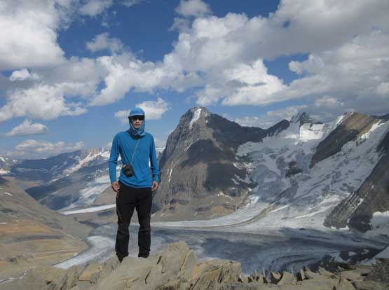
Another shot of me on the summit of Reconnaissance Ridge

Partial Summit Panorama from Reconnaissance Ridge. Click to view large size.
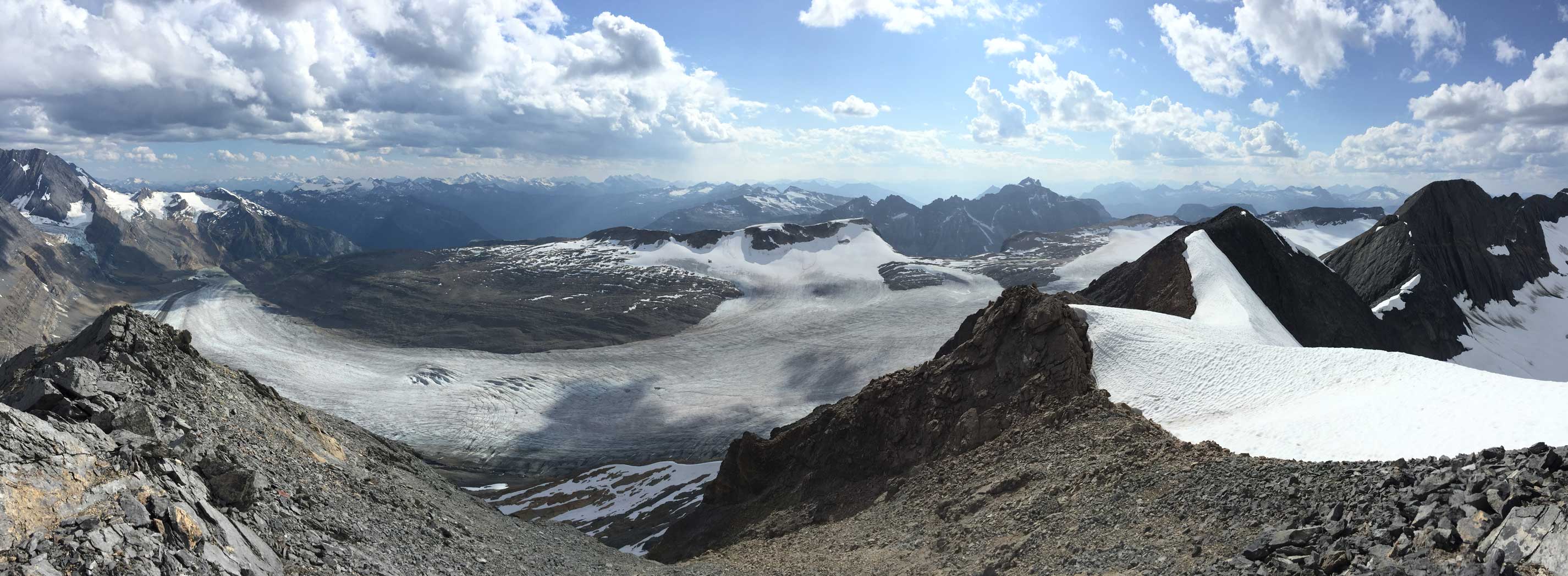
Partial Summit Panorama from Reconnaissance Ridge. Click to view large size.

Partial Summit Panorama from Reconnaissance Ridge. Click to view large size.
After about half an hour I decided to go find a different line down the summit block. I went farther out down-climber’s right and tried two very loose gullies and decided on the one farther out to the right. It was no more than 3rd class but the terrain was loose and down-sloping and exposure was real. The “fun” part was over in no time though, and I was back on easier ground. The rest of the descent, and the hike back across Tusk Glacier was uneventful. The last piece of snow bridge bridging the moat held my weight and I got back to camp at dinner time. The round trip time was about 4.5 hours on a leisure pace. Overall I’d definitely recommend this side trip.

This is the loose ledges that I had to find a way down. 3rd class choss with exposure

The difficulties were over now. Lots of ridge walking ahead

Panorama of Cummins Glacier west of the ridge. Click to view large size.
Down to the glacier now. This lobe drains onto the lower Cummins Glacier

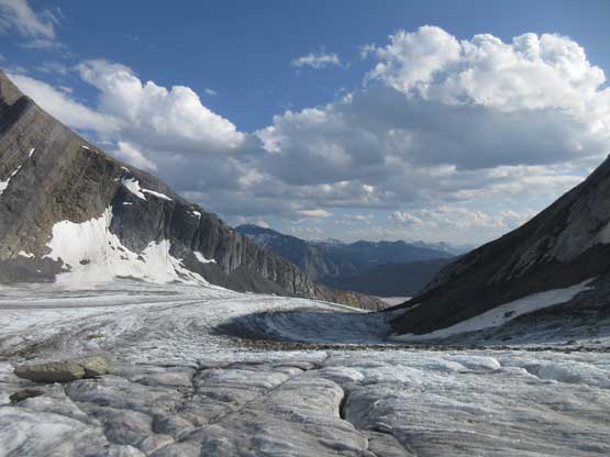
More scenery on the dry Tusk Glacier.

Mt. Chettan and Mt. Shipton and their glaciated faces

Icefalls on Mt. Chettan

A panorama from the center of Tusk Glacier towards Tusk Peak. Click to view large size.

Tusk Peak

Almost back to the set of waterfalls now
Looking up the glacier we just climbed a day ago on Tusk Peak’s ascent
Very cool glacier scenery here
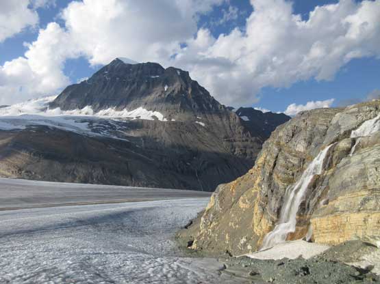
Mt. Clemenceau and the set of waterfalls

I ascended this patch of snow to get back to our basecamp
