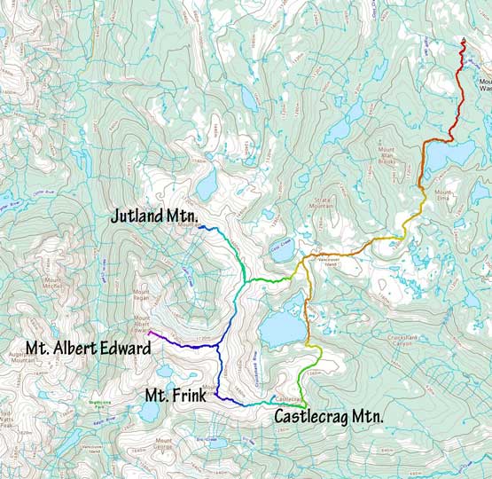
Mount Albert Edward
July 31-August 1, 2021
2093m
Vancouver Island, BC
Mt. Albert Edward is the 6th highest on Vancouver Island and also the easiest of the greater peaks on the island. The ascent is entirely a “walk-up” albeit a long one from parking lot near Mt. Washington ski resort. The fit parties usually do this peak in a single day while most opt to camp at Circlet Lake. This entire area on Forbidden Plateau is in the Strathcona Provincial Park and is very busy such that booking a camping permit at Circlet Lake is usually not an easy task. I had thought about to make this a single-day ascent but I also wanted to grab the nearby summits such as Jutland Mtn., Mt. Frink and Castlecrag Mtn. and to do all 4 in a single day would be impractical for me. I also thought about to make Mt. Albert Edward a snowshoe ascent as this is very doable in the winter conditions but weather is fickle in winter and I did not end up getting that perfect window. In the end Alex and Vlad joined me to make the 4 peaks into a loop traverse (43 km) with a overnight stay up high on the ridge.
The decision to hop onto the island was a last minute one due to the weather and the smoke. We knew it’s August long weekend and we should avoid the ferry traffics but we also had to aim for the area with the best weather and the least amount of smoke, and that happened to be the northern section of Vancouver Island. I made the call to wake up at 2:30 am, grabbed Alex and then Vlad and eventually made to the Horseshoe Bay terminal at 4 am. We thought this would be more than enough to get onto the 6:15 am ride but we were wrong. We ended up getting onto the second ride at 8:40 am and eventually made to the trail-head at 1:30 pm. I was already exhausted from the waiting and the driving and the weather was clear, but exceptionally hot thank to a mini heat wave.
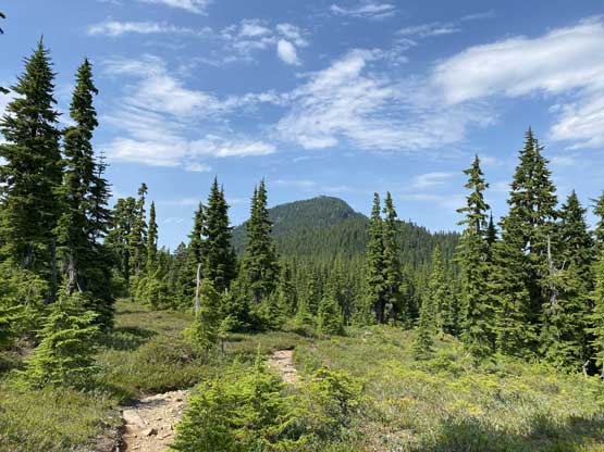
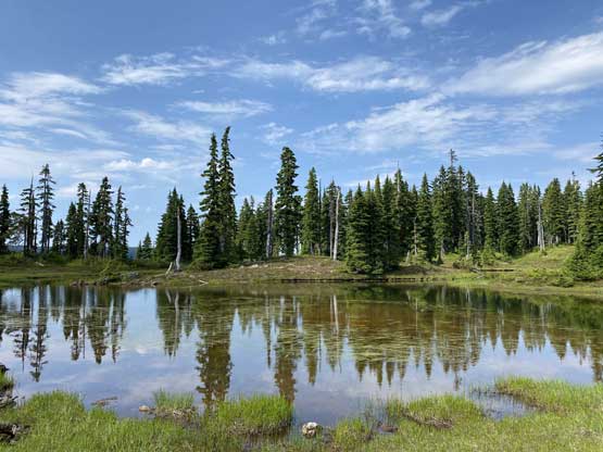
There’s a maze of trails near Mt. Washington ski resort and the most logical one starts from Paradise Meadows trail-head. We followed the most trodden path (mostly on wooden boards) and a few kilometers later we made to the shore of Lake Helen Mackenzie. From there we contoured around the lake on the west side with deteriorating trail quality (more roots and muddy sections) and marched up and over the broad pass between Mt. Allen Brooks and Mt. Elma. The next few kilometers of the plod towards Circlet Lake under Jutland Mtn. was decently scenic but very boring with some major up-and-downs. The heat had definitely taken a toll on us. We nailed finding the perfect source of water to load up the water bottles as there wasn’t a lot of options.


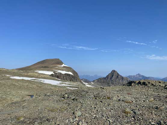
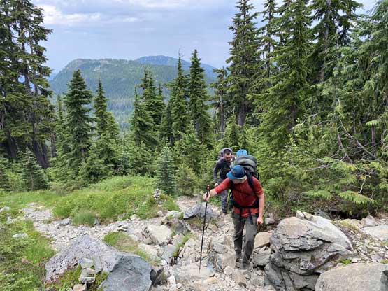
We did not bother to check into the campground at Circlet Lake and instead, kept plodding up towards the ridgeline about 500 vertical meters above. The trail became insanely steep at one spot but the steep stretch only lasted for 150 m vertical and then it was a steady ascent onto the ridge. The weather was deteriorating with more and more clouds and the mosquitoes had become insane that as soon as we stopped for a break I had to put on the rain coat as a bug shield. Upon reaching the ridge crest we ditched the backpacks and made a dash to ascent Jutland Mountain, which was much longer than anticipated. We even got hit by a brief thundershower on the summit.
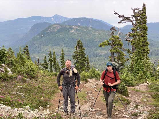


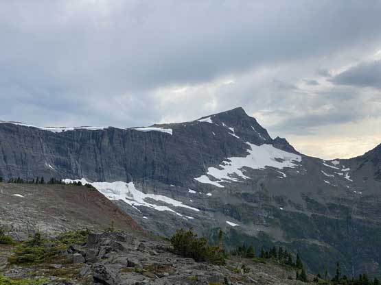

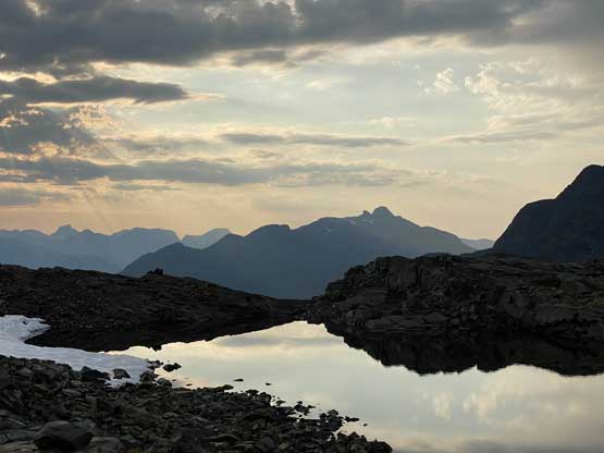
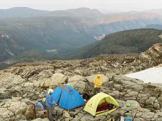
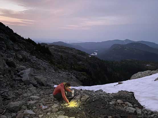
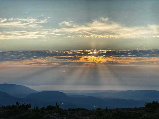
We debated about where exactly to camp as we did not come here with a precise plan and it wasn’t very obvious where would be the best spot. We still had a few hours of daylight to kill so the decision was to carry onward towards Mt. Albert Edward and decide spontaneously. I was more interested in just camping at the col but reluctantly agreed to push further. In the end we did not find that “perfect spot” but the site we found wasn’t bad. We were able to pitch out both tents on a massive rock slab (albeit a little slanted), and found a tiny stream of running water under a large patch of snow, albeit with about 5 minutes of walking. The sunset scenery we got from this campsite was insanely good, partially thank to the lightly hazed horizon.


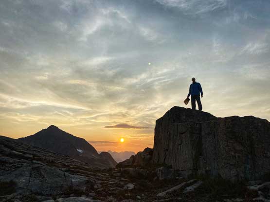
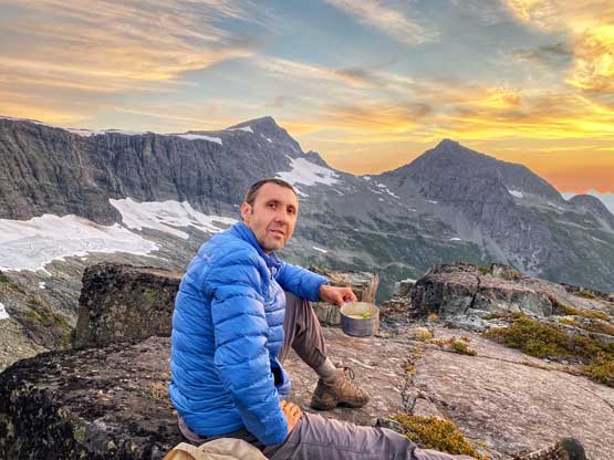


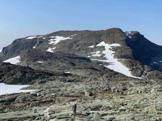
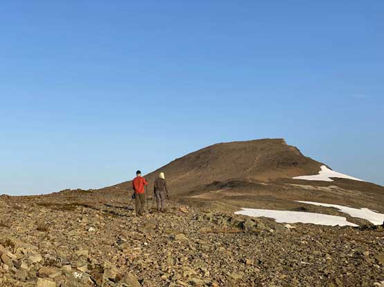
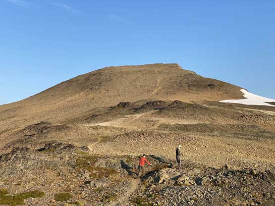
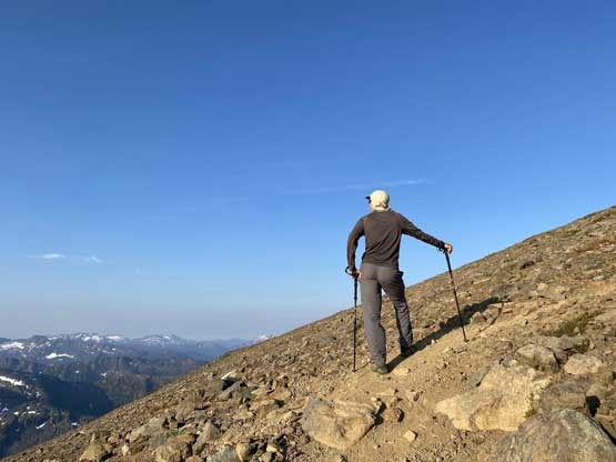
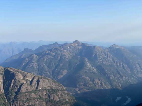
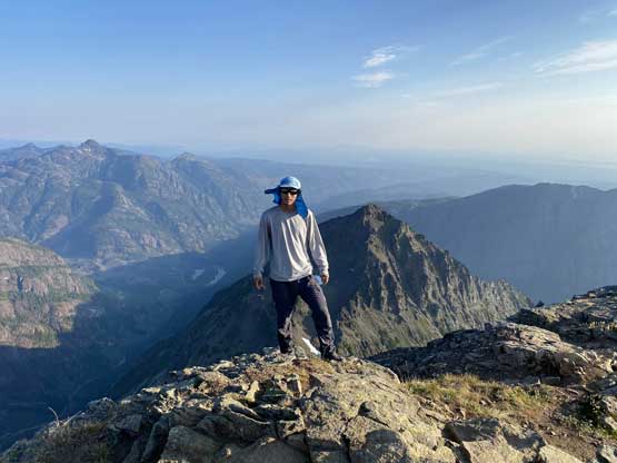
The morning of Day 2 we woke up at sunrise and finished the morning routine in under an hour. Once hitting that broad east ridge of Mt. Albert Edward we found a sheltered spot to ditch the packs and carried onward carrying nothing. I was surprised that the trail continued all the way to the very top of this peak. There were a few less defined stretches but for the most parts we were able to stay on the path. The ascent was as expected, just a massive plod with endless amount of putting one foot in front of another but the views were not disappointing.


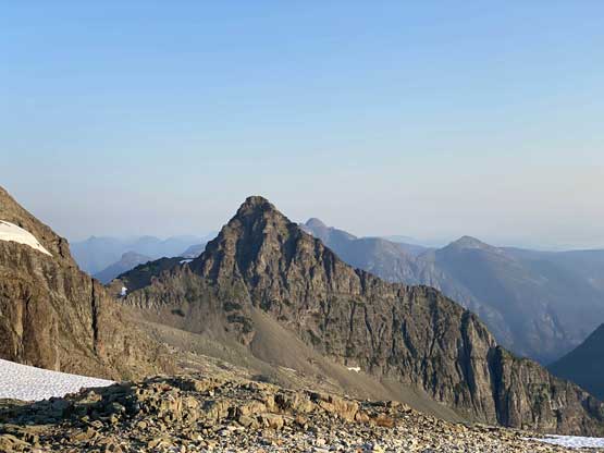


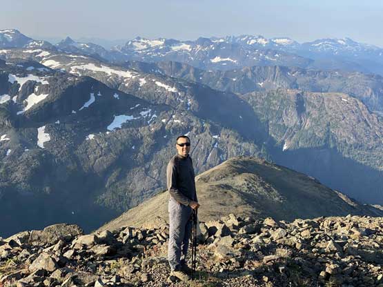
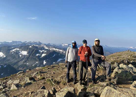
We still had a long day ahead so didn’t linger as long as I had hoped for. In under half an hour we started the descent and another half an hour later we were at the backpacks. We continued dropping south on some easy but undulating terrain into the broad saddle between Mt. Albert Edward and Mt. Frink and continued the loop traverse with ascents of Mt. Frink and Castlecrag Mountain. I was feeling unreasonably tired but pushed on nonetheless.