Volcán Pili (Acamarachi)
February 3-4, 2020
6046m
San Pedro / Puna de Atacama, Chile
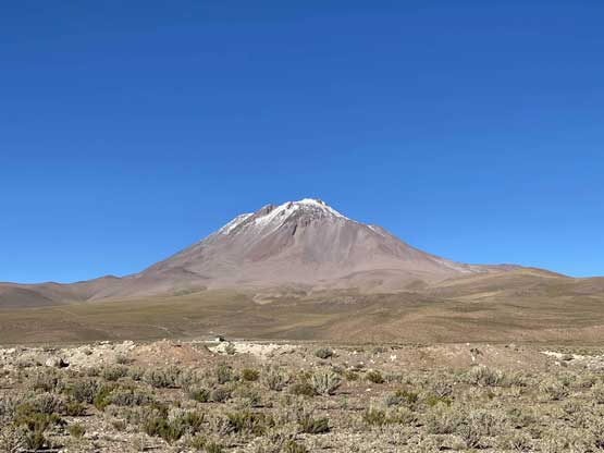
Volcán Pili aka. Acamarachi is a 6000-m “ultra” in Puna de Atacama region of northern Chile, about two hours drive east of the small town of San Pedro de Atacama, and is the highest in its close vicinity. This peak is relatively unheard in the climbing world of the English-speaking countries despite the elevation. There are much bigger peaks further south in the Andes, and the standard route on Volcán Pili is mostly an off-trail plod that does not boast much mountaineering interest. A rough road goes to the base of the peak at 4900 m elevation and providing one’s acclimated, the ascent can be done in a single day. However, the drive to the end of the access road can be more challenging than the climb itself.
Connor and I made the spontaneous decision to give this peak a try after completing an ascent of Volcán Llullaillaco a couple hundred kilometers to the south. We finished the ascent of the taller volcano one day ahead of schedule leaving us a few more days to kill till the end of our trip. We were exhausted but the weather was too good to not climb more 6000m peaks. The condition was very out in Puna de Atacama region with at least two feet of snow fallen in the last several weeks, but we figured the elevation of Volcán Pili is 700 m lower than that of Volcán Llullaillaco and the condition might actually be acceptable. Of course this was just our hope. The worst of the post-holing we just encountered started at around 5800 m which meant to reach the summit of Volcán Pili we only needed to endure 200 vertical meters of post-holing, which sounded manageable, even though we were still coughing moderately.
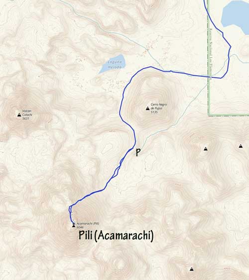
Volcán Pili (Acamarachi) standard route. GPX DL
We decided to drive from the refugio at Llullaillaco to the trail-head of Volcán Pili in a single day and this meant we had to get up early. There is a short-cut route through the desert but we had not done much research on it and we also weren’t sure if we had enough diesel for that. The only alternative was to drive all the way back to near Antofagasta, then up north-east past Calama into San Pedro de Atacama. We got to Calama at around 1 pm and made a couple quick stops for fuel and lunch, and then hit the road again, over a 3500-m pass to the small town of San Pedro de Atacama. This small town had a lot of tourism activities and an elevation of 2500 m. This could serve as an ideal starting point for acclimating process. However, since we were already acclimated we didn’t even bother to stop in the town. The drive up towards the Bolivian border involved a long, gradual ascent to 4800 m before descending to around 4600 m. My Gaia map had a road drawn to the base of Volcán Pili so we knew where exactly to leave the main road.
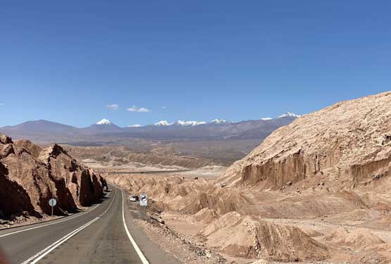
Driving down into San Pedro de Atacama
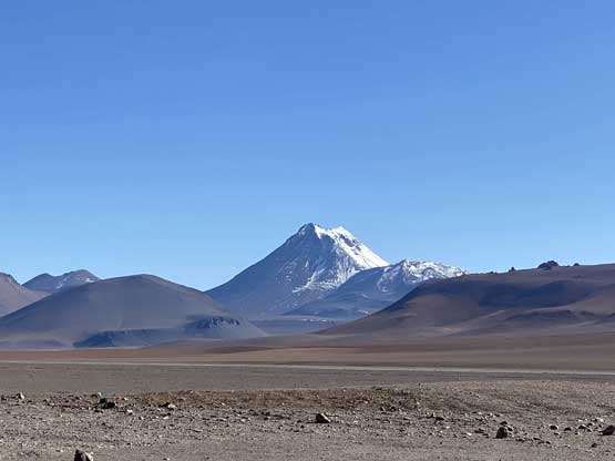
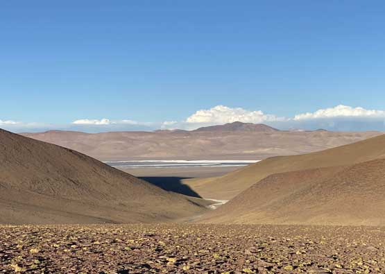
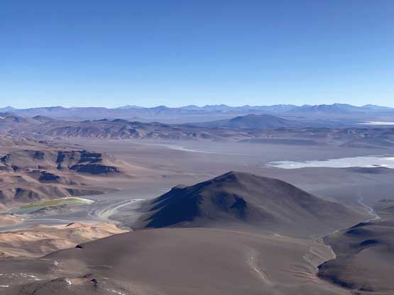
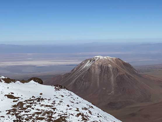
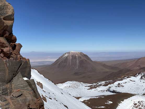
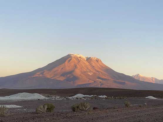
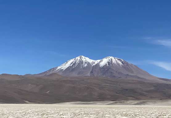
Volcán Pili from distance
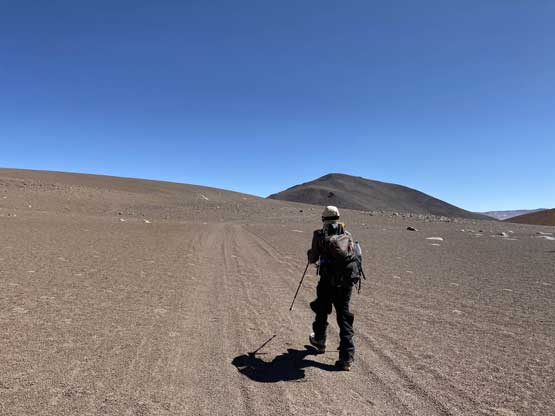
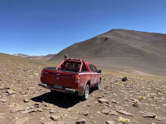
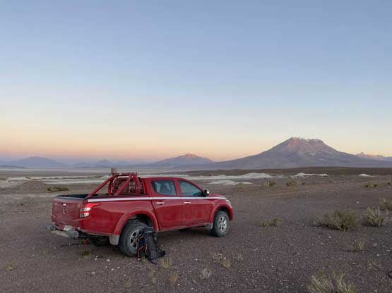
At the entrance of the dirt road a truck came out saying the area “was closed until May”. This was not to our surprise as February is actually the rainy season here. We waited for a while to let them disappear and then entered the park nonetheless. There was no defined road and we just followed a “highway” of tire tracks across the desert floor. The navigation was done purely by GPS as otherwise we would be totally confused by the side tracks. The tracks converged at the base of Cerro Negro de Pujsa but the road also degraded in no time. The steep climb onto the pass south of Cerro Negro de Pujsa was a slow crawl over rocks that required Connor to switch gear into 4Low. Beyond that, the road literally disappeared into a maze of rocks guided only by occasional cairns. We opted to park a kilometer later, at around 4750 m. This meant we would have an additional 3 km of cross-country travel to cover in the morning, but the risk of getting our truck stuck here was too much for our level of tolerance. The wind was also howling that even opening the truck’s door was difficult, contradicted by what the Mountain Forecast predicted. There’s nothing we could do at this point other than hoping the wind could die down in the morning. We determined it was too windy to comfortably set up the tent so just slept inside the truck. Needless to say, it wasn’t pleasant at all…
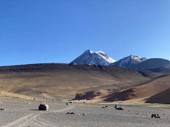
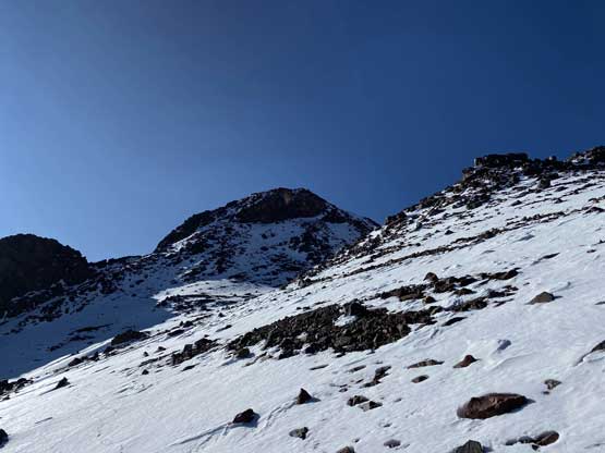
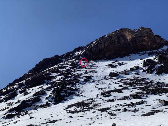
Partway up the access road, looking towards our objective
Looking back down to the 4500-m desert plateau from where we parked
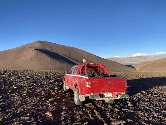
Our truck parked at 4750 m. Too rough to go further…
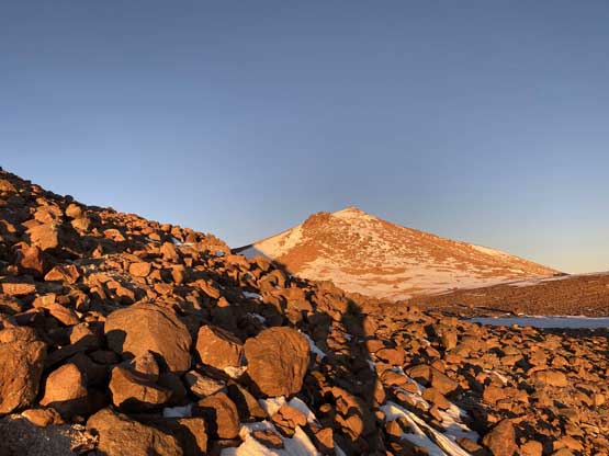
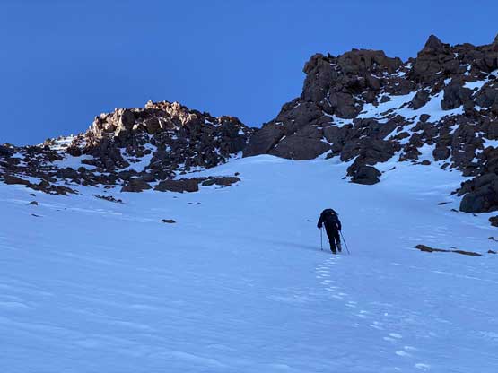
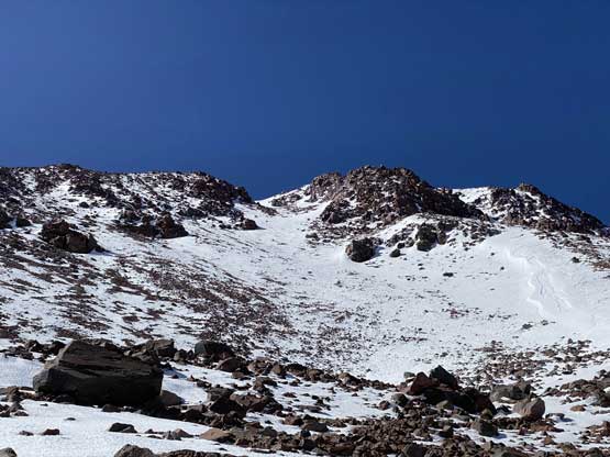
I got out of the truck at around 3 am and the wind did die down and the sky was totally clear so it would be our summit day. By 4 am we started the plod. In the dark it wasn’t easy to follow the cairns so completely missed the road as the terrain descended a bit into a broad basin, but with GPS the navigation wasn’t a problem. Half an hour later we rejoined the (much better) road and easily plodded it to the end, at around 4900 m. My Gaia map showed that a trail goes all the way to the summit but given the quality of the access road we were really skeptical about that, and we were correct. The trail was next to non-existence even in daylight time, let along in the pitch dark. The lower half of the grunt towards the “north saddle” wasn’t difficult, but tedious due to the amount of boulders. The middle stretch wasn’t particularly bad as we had no choice but to hop on unstable boulders for over half an hour. At this point we were actually looking forward to hit snow and once there, we were pleased to find out the snow was firm enough to walk on, but not icy to need crampons. We then had an easy cruise to the saddle, where by coincidence we watched an amazing sunrise.
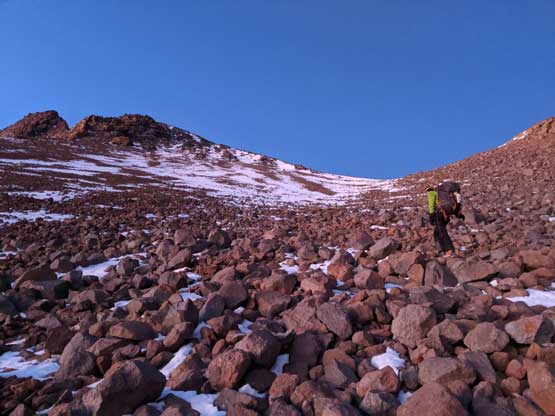
Me hopping on the painful boulder field. Photo by Connor M.
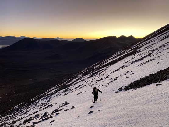
Connor ascending easy snow in the dawn hour
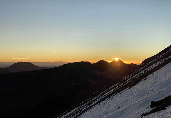
It’s sunrise time! From 5400 m elevation
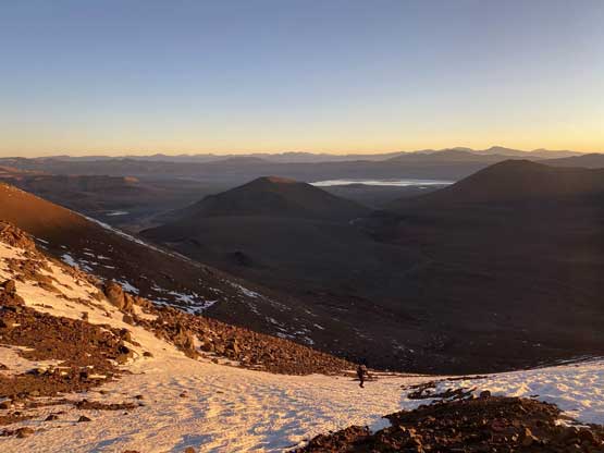
Looking back from near the “north saddle” at sunrise
Enjoying the first beams of sun ray
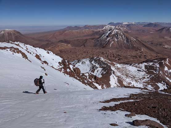
Connor picking his snow line. No post-holing, thankfully…
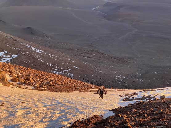
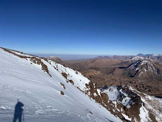
Around the corner we soon entered the shaddy and windy side of the peak and the parka was out in no time. We also had to make a unpleasant transition to don crampons as the terrain steepened up considerably. With crampons we confirmed our decision to stay on snow for as much as possible and for the most part we had zero post-holing to deal with. Connor went ahead and broke trail for the only parts that required. I managed to maintain a fast pace to around 5800 m, in the middle of a 35-degree gully that leads up onto the summit area, but had to take an energy break there. We had been cruising up until this point but for some reasons I started to feel very shitty. I forced in a frozen donut and some water-ice mixture but couldn’t start to feel any better. I figured I better kept going so just embraced the misery and to my surprise, the ill feeling went away soon. I on purposely slowed my pace down just to be safer. From below I could see the top of the gully leading to a plateau but once there I learnt the summit was still a ways away. The ascent onto the summit required some scrambling and post-holing but thankfully Connor had already made the tracks. I joined Connor at the summit and stayed for another half an hour soaking in the views.
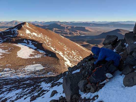
Me donning parka and crampons. Photo by Connor M.
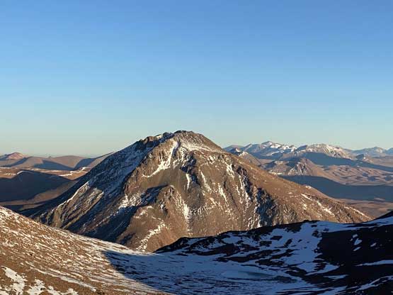
Looking back over the top of Cerro Negro de Pujsa
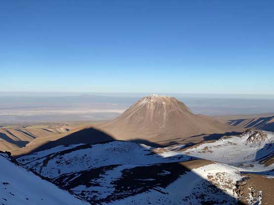
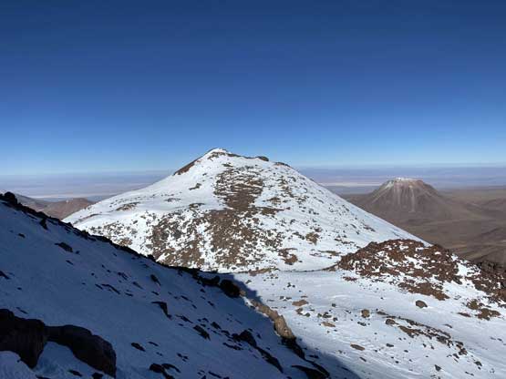
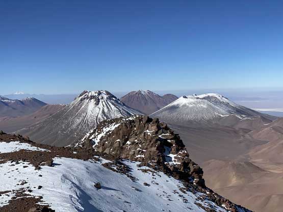
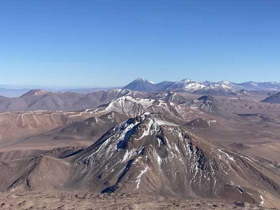
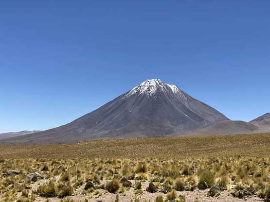
Volcán Colachi (5631m) to the north
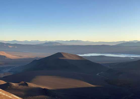
Volcán Laguna Verde (5430m) is very cool-looking
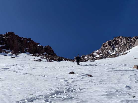
Connor ascending the snow highway
Above the gully now at 5900 m
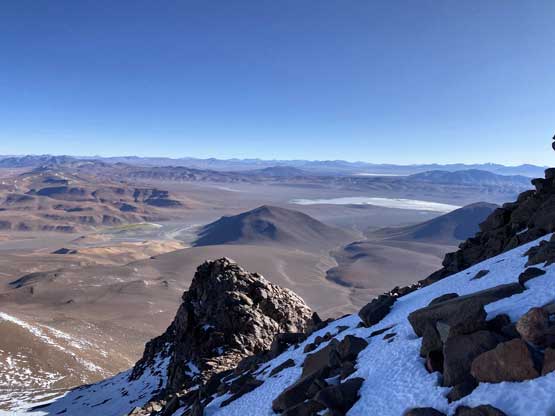
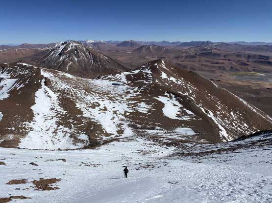
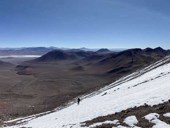
Looking back down to the vast desert landscape
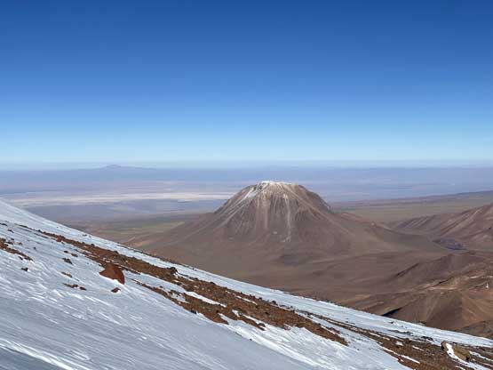
Volcán Laguna Verde
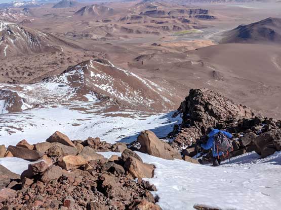
The summit block still required fair amount of energy
Partway up the summit block, looking down
The sub-summit is getting smaller
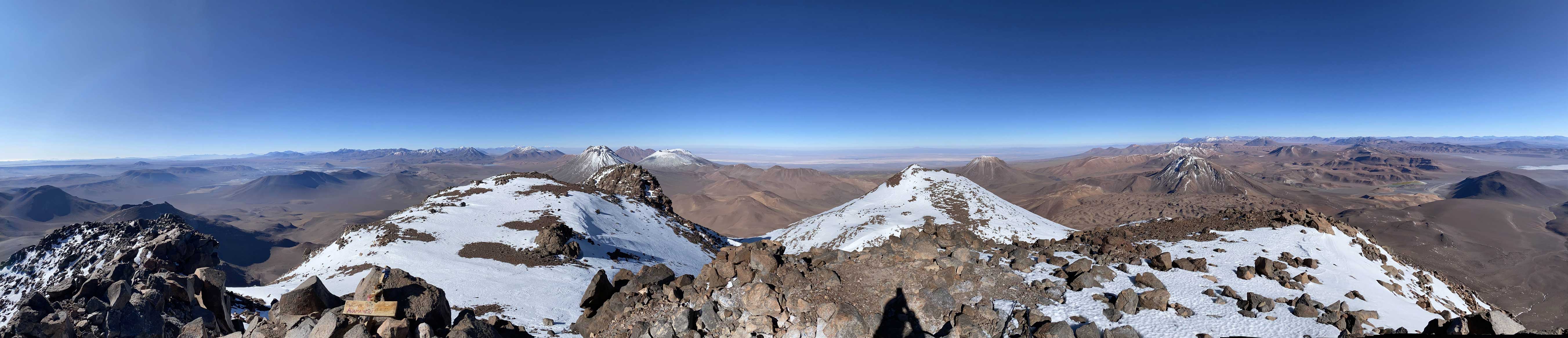
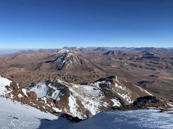
Partial Summit Panorama from Volcán Pili (Acamarachi). Click to view large size.
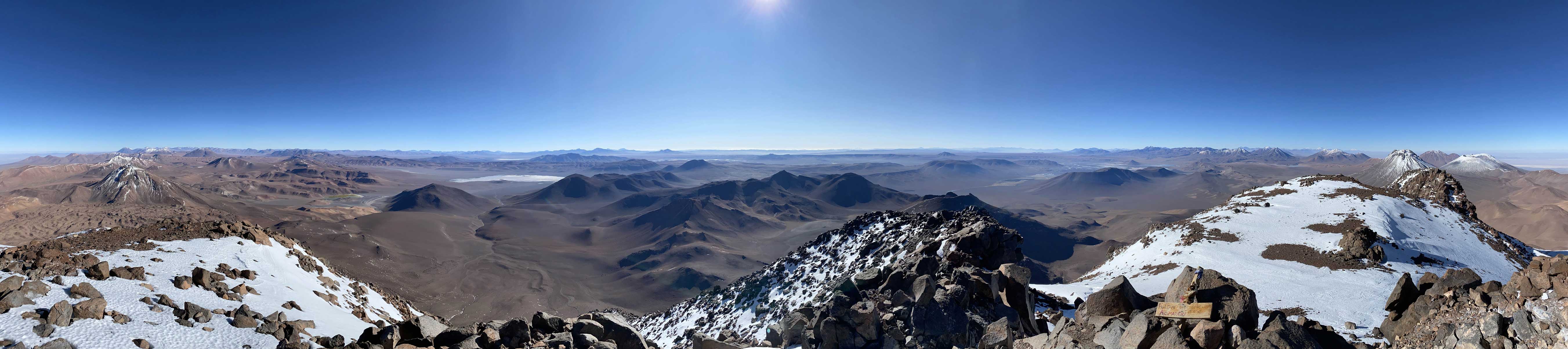
Partial Summit Panorama from Volcán Pili (Acamarachi). Click to view large size.
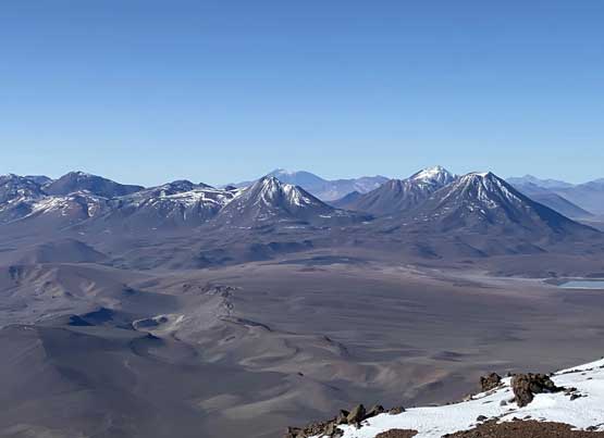
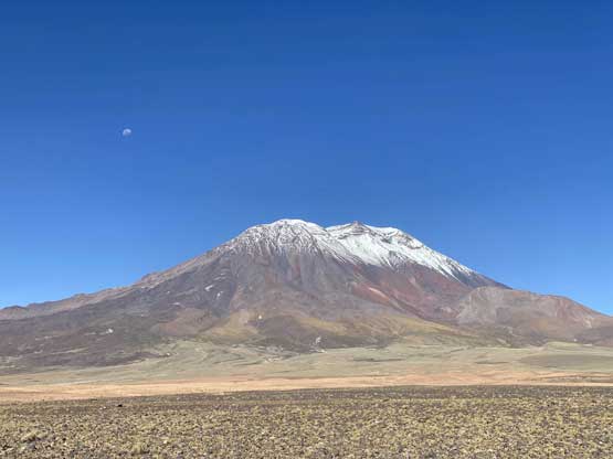
Aguas Calientes (5924m), Cerro Tumisa (5658m) and Lascar (5592m)
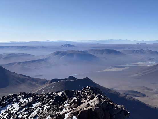
The typical desert scenery looking south-east
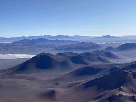
The vast landscape of Puna de Atacama
One more photo of the Puna de Atacama scenery
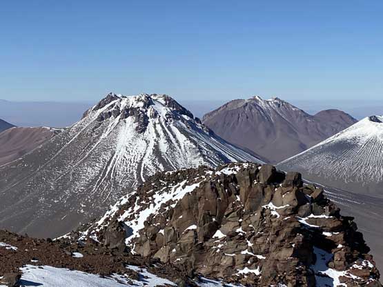
Volcán Licancabur (5920m) dominates the skyline far to the north
Cerro Chiliques et al. another group of volcanoes to the south
A closer look at Aguas Calientes with Cerro Tumisa behind
Volcán Laguna Verde is far below us now
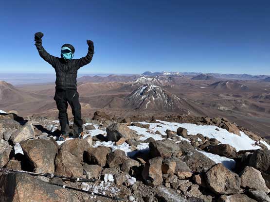
Me on the summit of Volcán Pili (Acamarachi)
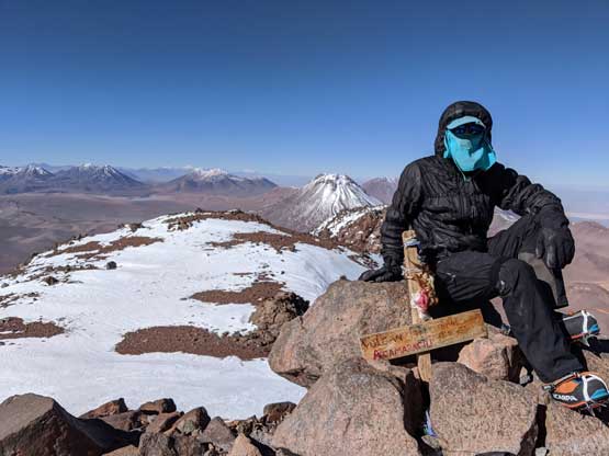
Another photo of me on the summit of Volcán Pili (Acamarachi)
The descent off the summit block was fairly effortless and in no time we were back into the gully, where concentration was required. The snow was still firm enough that a slip would not be acceptable, because we both opted to not bring an ice axe in this ascent. A while later the grade eased off to around 30 degrees and we enjoyed a fast plunge down to the “north saddle”. Twenty minutes later we took off the crampons and after enduring the misery of boulder-hopping we had a relatively fluent descent back to the roads. Instead of retracing our cross-country trek we opted to follow the road back to our truck, which involved more elevation loss and regain but less mental work.
Me starting the descent. Photo by Connor M.
Connor descending the summit block.
Me ready to drop into the gully. Photo by Connor M.
Connor plunging down the gully
Almost down to the “north saddle” now
One last look at Volcán Laguna Verde
A review shot of the broad gully that we ascended and descended
Descending the last bits of snow down from the “north saddle”
Back to the road now
A frustrating 3 km of road plodding…
Driving down the shitty road.
It was only around 11 am when we got back. After a quick trail-head transition we were soon on the road. Connor did an excellent job driving us down the rough stretches. We had some concern that we might get caught on the way out but such concern proved to be unnecessary. The fact we had both Volcán Llullaillaco and Volcán Pili to ourselves was largely due to the closure of the national parks. However, these rules don’t seem to be enforced in Chile as much as in US, so we had no problem sneaking in these climbs. We decided to drive down to San Pedro de Atacama to find a restaurant with wifi. We still had 3 days to the end of our trip and the last 1.5 days had to be spent in the city of Antofagasta, which meant we had 1.5 days to climb another big mountain, ideally over 6000 m. We indeed found a nice restaurant with wifi so that I could also pull out the phone for some internet. We debated about a few options but in the end, opted for Volcán Aucanquilcha about 5 hours away to the north, as the trail-head was the highest and the ascent would be mostly plodding up a road. Connor was still highly motivated and did the 5-hour drive northwards while I slept for at least half of the period. The drive from Calama to the border town of Ollagüe was very scenic with views of a handful 6000 m volcanoes and at least a dozen 5000 m volcanoes. At the town of Ollagüe we followed my Gaia map’s direction but half an hour later we learnt the access road was completely washed out. With our finally objective out we reluctantly drove back down the road and found a deserted mining factory to crash for the night.
Volcán Licancabur is the iconic peak at San Pedro de Atacama
North of Calama now, this is Volcán San Pedro (6120m)
Volcán Ollagüe (5868m) at sunset on the Chile/Bolivia border
Time to prepare for the night.
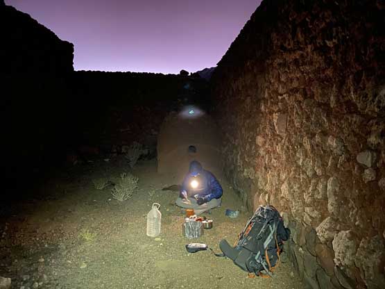
Camping inside a deserted mining factory
The next morning we woke up, had a leisure breakfast and drove back down to the town of Ollagüe for wifi access. We reasoned there’s no more worthy summit to climb so opted to drive back to Antofagasta. Along the way I saw a cool-looking cinder cone with official name Volcán Poruña. I decided to bag it while Connor opted to stay in the truck to watch our gears and to catch up with emails. We booked Hotel Antofagasta in the middle of the downtown. The quality of this hotel was superb at the cost of 80 USD per night. We spent the rest of the day exploring the city and making plans for the following day. Earlier in the trip we agreed to use our last day to ascend Cerro Moreno a “P3K” objective along the coastline so that’s where we went next.

Llamas walking by in the morning that woke us up
Volcán Aucanquilcha (6174m) from our camp. True summit not visible
Another photo of the massif of Volcán Aucanquilcha on the drive back
