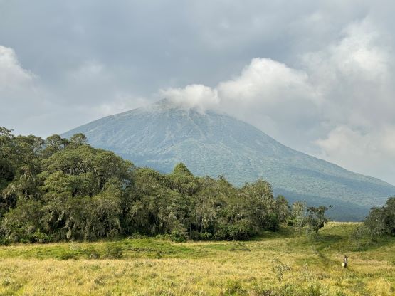
Mount Karisimbi
January 11-12, 2024
4507m
Volcanoes National Park, Rwanda/Congo DRC
Karisimbi Volcano is the highest peak in Rwanda and borders with the Democratic Republic of Congo. Volcan Karisimbi is the French version of the name. The area is more known for its gorilla treks but these volcanoes do get done from time to time. Mt. Karisimbi boasts over 3000 m prominence and is subsequently one of the world’s top 100 by prominence. This was the primary objective of this East African trip among Rob, Alastair and myself. A guide is required by law to hike anywhere in the national park and Rob made the arrangements through Amahoro Tours. We would also be joined by three other peakbaggers, Deividas, Richard and Denise so 4 of the top 7 ultra-prominence baggers in the world would join force here. I felt privileged to be invited to tag along.
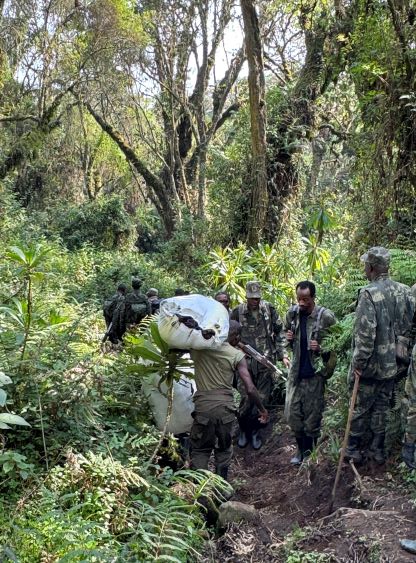
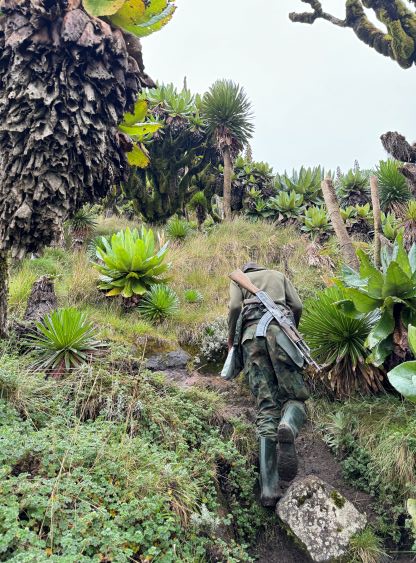
This part of Rwanda is touristy but not very safe due to the close proximity to Congo. In the recent decade at least one group of British tourists were kidnapped near the border while doing the gorilla treks so the park is now taking safety very seriously. We would be accompanied by 11 soldiers on majority of the hike. The said reason was to protect us from the buffalos, gorillas and other wildlife but they were also there to protect us from the bad people. In addition to these soldiers we also hired one ranger who’s basically the lead guide, one cook, and 9 additional porters. Some of these porters carried our personal gears but most were there to carry the food, water, propane tanks and the camping equipment. Our gang of almost 30 people all needed to spend one night at 3600 m altitude so doing this peak over 2 days also gave us some adequate acclimatization. Most of us were already acclimatized by doing other peaks in Uganda, Kenya and Tanzania and the company did offer us the option to day-trip Mt. Karisimbi, but we decided to keep the original plan. I liked the two-day plan as this essentially gave us two chances of summitting. If the weather was bad in the afternoon (as forecasted) then we would wait for the next morning to make the summit bid.
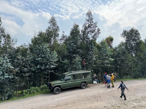
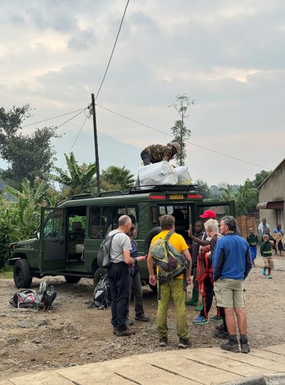
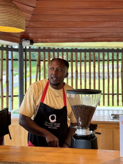
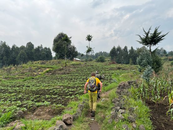
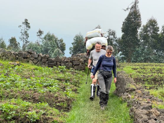
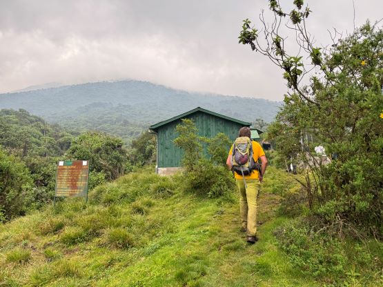
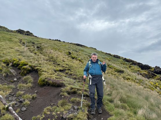
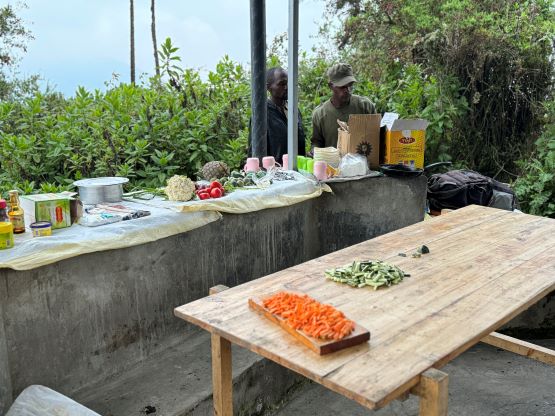
We would be based in Musanze and the hotel was decently nice with wifi, electric outlets and hot showers. The cell reception was also much better here than in Kenya and Uganda. For some reasons I actually felt Rwanda to be the most modern country among the three we visited. We got here quite late in the evening so after a quick briefing we all went to bed. The final decision was made to start early to aim for the summit in the afternoon of Day 1, whereas the morning of Day 2 would give us a second chance. I was not particularly looking forward to the first window as the forecasts were calling for 15-20 mm of rain and thunderstorms mostly in the afternoon. I do know that this is basically on the equator and the weather forecasts are mostly useless in the tropical regions, so we would see. We had a few more things to do in the morning such as buying water, photocopying our passports, collecting our guides at the park’s headquarter, and arranging our porters but did eventually start trekking by around 9 am. The six of us together decided to hire 3 additional porters to carry our personal gears at the cost of 20 USD round trip per porter. The cost was literally “nothing” for us and we wanted the trip to be rather enjoyable.


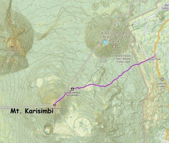
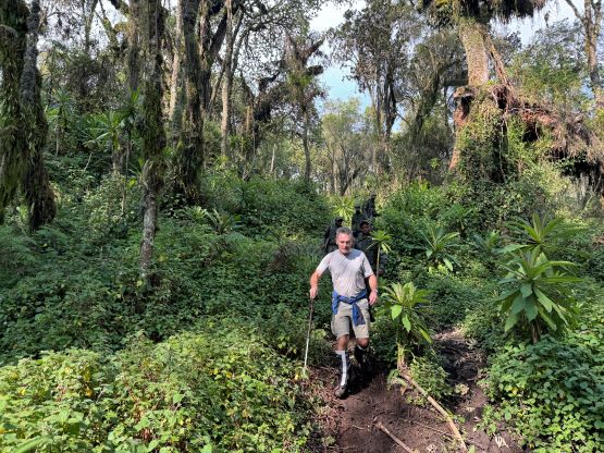
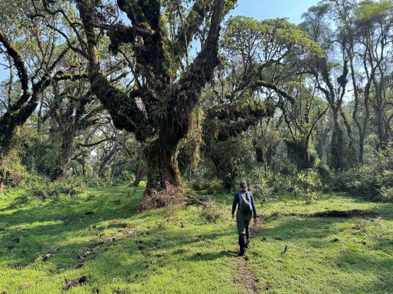
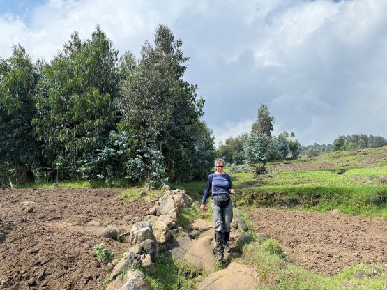
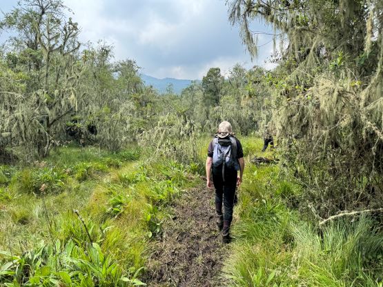
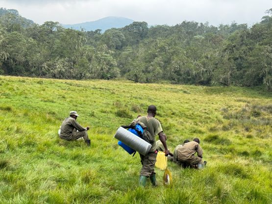
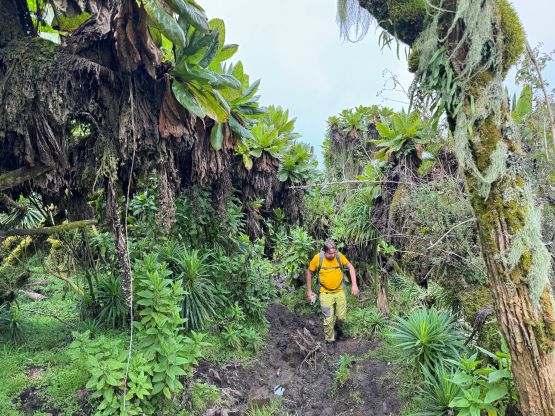
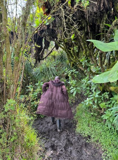
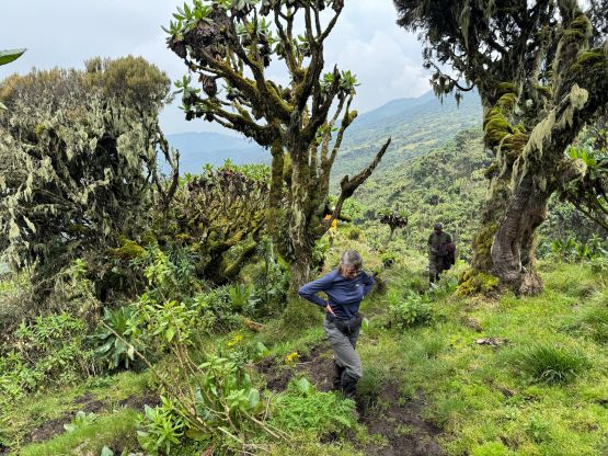
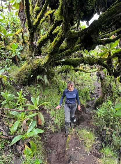
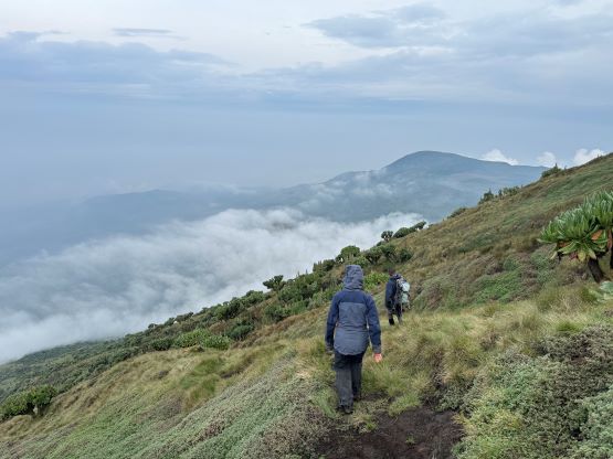
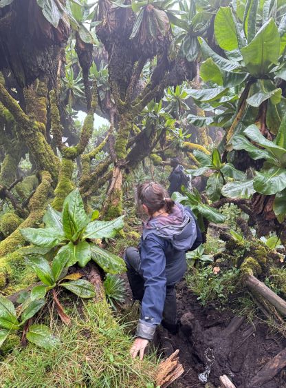
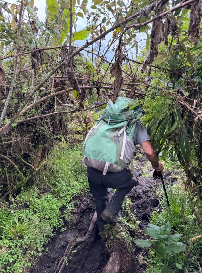
Right away I noticed that we were taking a different route than Rockinstraw’s GPX track. I pointed out my concern and the guide explained that the road to the other route had been destroyed. This new route would eventually join the old route near the campsite. We firstly hiked through some farmlands, then collected the 11 armed soldiers before entering the forest. The trek up through the forest was a nice one from the scenery perspective, but was quite muddy and unpleasant. The mud was however not as bad as some of the ascents that we just did in Kenya. I opted to only wear trail-runners on this hike and I managed to keep my feet dry throughout. We took one lengthy break on a large grassy meadow and then pushed to the 3600-m camp in another shot. This camp could be “too high” for those coming directly from sea level, but thankfully we all had done some taller peaks in the past couple weeks. The weather was still looking fine, so after about half an hour of resting we decided to make the summit bid.


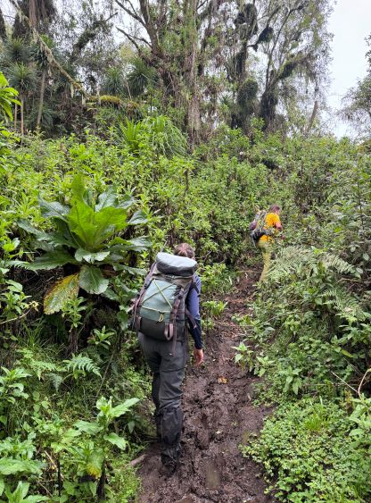


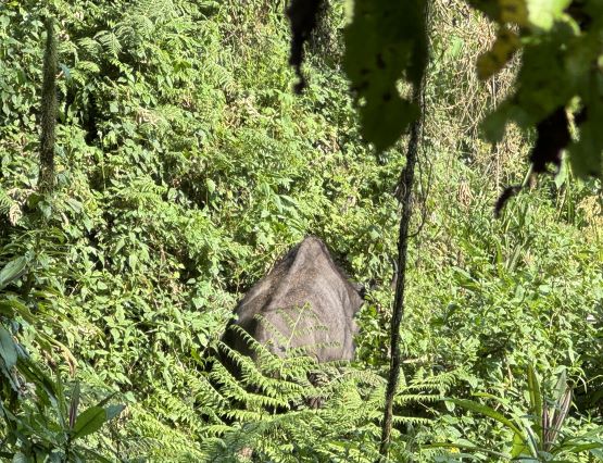
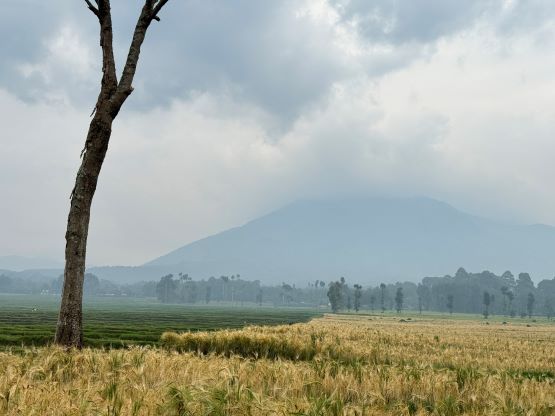
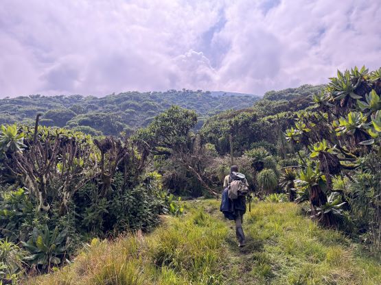
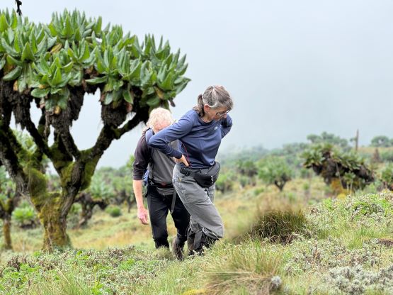
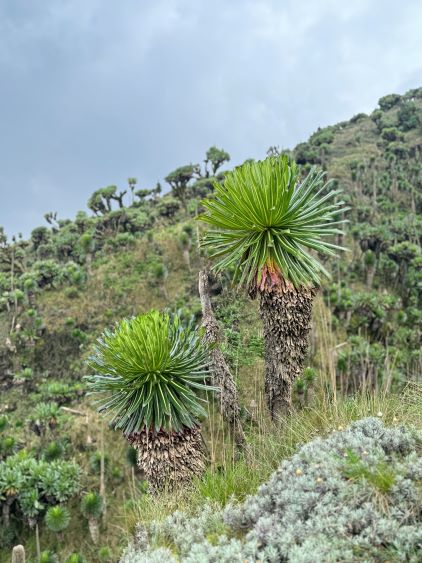
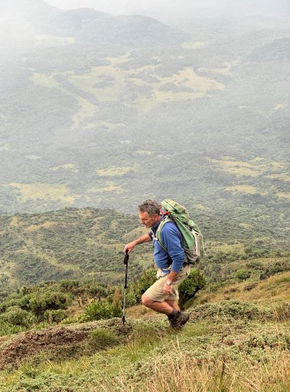
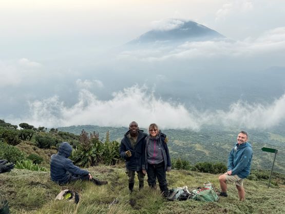
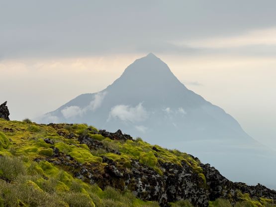
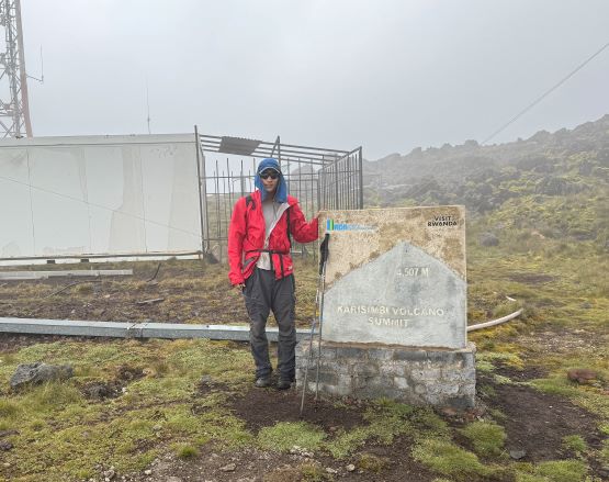
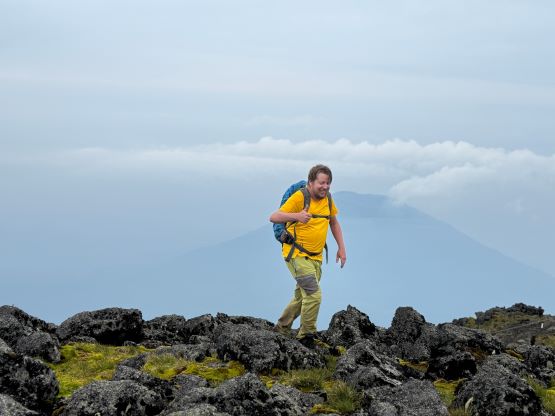
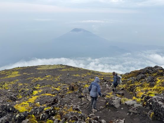
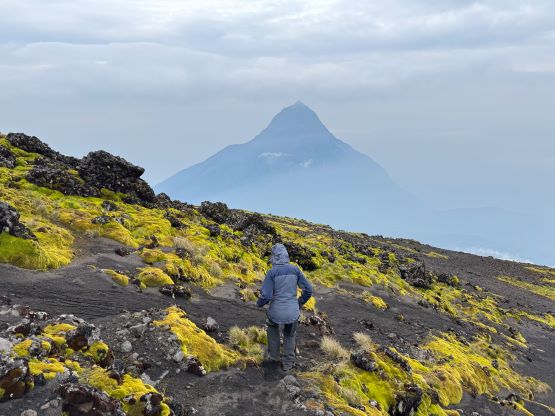
The ascent to the summit was a steep one, gaining 900 m in just a couple kilometers. The terrain was the typical tropical jungle with more mud in the lower sections, but open grasslands on the upper slopes. We took a few long breaks along the way. A few rain showers passed and we were all expecting to get soaked, but the downpour had never come. By the time we ascended to the upper grassland the weather actually improved with more and more views showing up. The most impressive view was looking at Mt. Mikeno, a nearby P1000m objective entirely in DRC Congo. For obvious reasons that volcano is not doable. There is a large communication facility on the summit and the entire construction was made by porters’ carrying. The true summit was slightly to the north, and we waited for another half an hour until everyone showed up. It was actually quite warm up there so I felt okay to be waiting without donning too many layers.


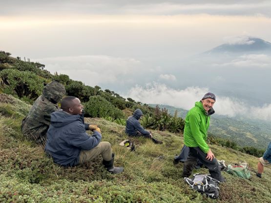


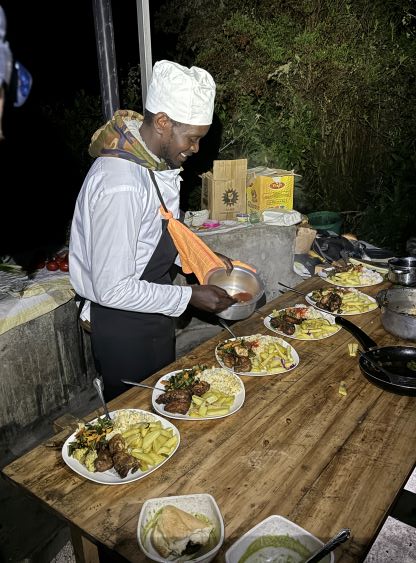
We then mostly descended in two groups with me, Alastair and Denise going in front with a few armed soldiers. Denise was quite quick at descending so we made good time down the hill. I sped up near the end as I had given my headlamp to Deividas and it was now getting dark. I was the only one without a headlamp so I needed to make sure to get back to camp before dark. I ran with a soldier and it was nearly impossible to keep up with his speed. Thankfully I was not too far from the camp by this point. The rest of the evening was spent organizing the camping area and waiting for our dinner to be served. The six of us had to share the same hut. They had installed two tents inside the hut and we felt those to be rather redundant. I volunteered to sleep open and so were most of us. I had also given the porter my own sleeping bag and mattress to carry. The bag turned out to be not needed but the air mattress was useful. The dinner was eventually served and was excellent. It seems like the norm in Africa that things tend to be served slowly but with quality. I told the group that the food was as good as in Everest base camp so we definitely should tip this cook later.

The next morning we all woke up sometime between 6 and 7 am and the breakfast was ready by 7 am. It was not a bluebird morning but it was also not raining. We were in the short dry season, after all. The mountain was still engulfed in clouds but that was to be expected on any given day regardless the season. The hike-out seemed much longer than what I remembered and took us about 2.5 hours. We again, took exactly one break at that same spot. Due to the size of the gang (30 people) it took us a while to figure out a tipping plan. I did not engage in the conversation as I’m generally not a tipping kind of person and definitely not experienced in this kind of calculation and I would simply follow the group decision. I think we ended up tipping a few dollars to each of the them regardless their occupation. Our round trip time was about 10.5 hours sans camping time so yeah, it’s definitely doable in one day had we pushed for it. We then spent the rest of the day in Musanze. Rob, Deividas and I went out for lunch and a few of us also hiked up a nearly hill. That hill lacked 100 m prominence so I played the laziness game and opted to work on the trip reports in the hotel.