Mount Bonnycastle
September 22, 2016
1741m
Hixon Creek / Stawamus-Indian FSR, BC
The bulk of Mt. Bonnycastle forms a large granite plateau buried deeply in the woods behind Indian Arm and our local North Shore Mountains. What makes this peak interesting isn’t its height or prominence and in fact, there’s even vegetation on the summit, but rather the unique shapes created by its ridges wrapping around Barnes Lake like an amphitheatre. Another thing that interested me was its remoteness and the access difficulties. One has to drive from Squamish via Stawamus Indian FSR and then the Hixon Creek Branch and that involves a close-to-40 km drive on rough roads (one-way). And on top of that, this access road had been on-and-off for numerous times in the past several years and once it’s off, the bridge at kilometer-10 was pulled and folks had to bike 30 km just to get there…
There’s one recent updates on ClubTread from someone who just went there 2 weeks ago and the road was reported to be good. I bothered him with a bit more details and the message I got was that it’s no worse than the Mamquam Main FSR (which I just drove a week ago) so my vehicle should have no problem making it. And then the weather was calling for “golden” conditions so I knew I had to give this one a shot. The objective was dead set with no flexibility whatsoever. There’s no way to predict the access status for the following year and 30-km is a bit too far for my like as a hiking approach, as I’m not really a mountain-biker by any mean.

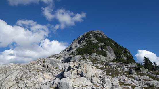
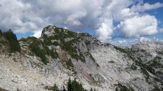
Mt. Bonnycastle traverse route, up S/SE Ridge and down SW Ridge. GPX DL
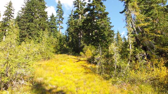
I set my alarm at 4 am Thursday morning and in about 1.5 hours I had made to the district of Squamish. Turning onto the now-familiar Mamquam Main and 3 km later I branched off up the narrower Stawamus-Indian Road. I had to comment that the road was fairly smooth-sailing by the west coast standard, but don’t expect to drive 40 km/h… As someone coming from Alberta I’d still call it rough given the amount of rocks and pot-holes. The road climbed steeply to a pass at elevation just under 800 m before making its gradual descent towards Indian Arm which was a still long ways away. I had to drive to pretty much within 5 km from the Arm and in this section a few wash-outs along with numerous water bars were encountered, with some of those fairly deep so a high-clearance vehicle was definitely needed. I correctly located the Hixon FSR and the start of it was actually smoother than the main road (newly graded), but the section beyond Norton Lake Branch was narrow and very rocky. I drove to within 1.5 km from the end and figured it’s good enough and even that, the entire logging road adventure had taken me about 2 hours…
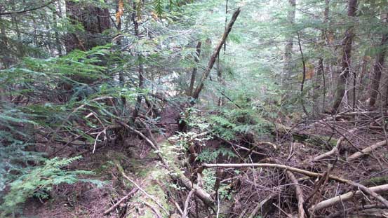
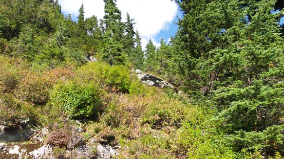
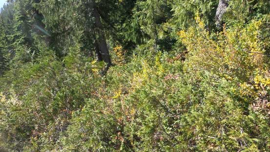
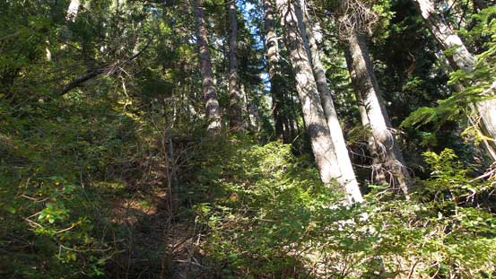
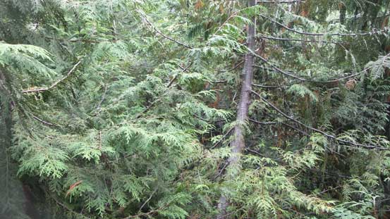
All geared up I hiked the remaining 1.5 km to the end of this road, with an aggressive fence marking the entrance of the Coquitlam Watershed. This was the place where I should head into the forest. The bush didn’t look friendly but I was mentally prepared for that so up I went.. The initial stretch up the secondary-growth forest was really bad with lots of tight timbers, one steep bluff, chucks of dead-falls mixed with brambles type of plants… The bushwhacking was horrendous but knowing there’s mature forest not far up I kept my attitude positive and soon enough, it was over and I could pick up my speed again. The goods didn’t last long though. Arriving at one flat bench I had to a diagonal traverse aiming at the main creek/fall line and that part involved more dense vegetation. Thankfully once this part was over the ascent paralleling the climber’s right (east) side of the main creek wasn’t that terribly bad…

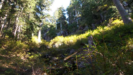
The initial stretch of logging road plod. Should have driven a little bit further.

Into the bush I went..
To be honest this wasn’t too terribly bad. Just the initial 100 m or so was really bad.

Devil’s Clubs…
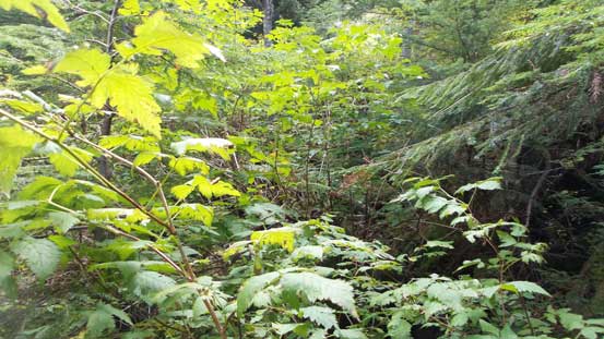
Not very pleasant….

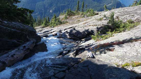
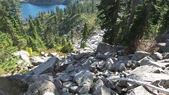
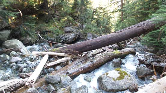
Finally reached the creek now. Time to ascend parallel on the right side bank.
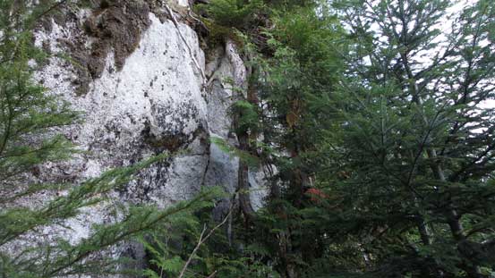
At elevation under 900 m I located a good spot to rock-hop over the creek to its left (west) side. This place gave some neat views of an impressive waterfall above which appeared to show up on every trip report I’ve read, so I knew I was doing good on the route. Ascending steeply up the west side bank I had to deal with more bush. Lots of vege belays were still required to fight my way up the steep forest but overall the “bushwhacking grade” had eased a bit comparing to what I just encountered lower down. The grade further eased higher up and I followed a gully feature up towards climber’s left side since the bush appeared to be good that way, but then I had to find a way through the steep bluffs above. After some searching around I committed to one path. It was quite short, but involved some “3rd class vegetation scrambling” and then the terrain was back to “average” (with dense brushes and so on).

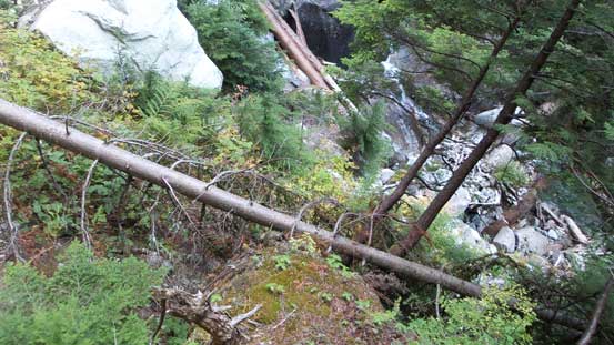
Finding a way to cross the creek at just below the waterfall
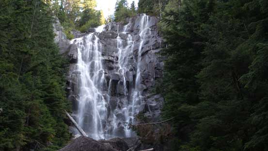
This is that signature waterfall
Ascending steeply up the opposite bank.

It’s steep…..
Now the terrain tapered off a bit. I was following this gully feature up towards climber’s left.
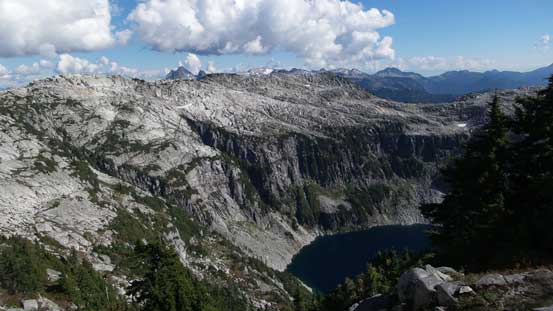
I kept my bearing back at a diagonal path towards climber’s right aiming at the outflow on Barnes Lake which appeared to get closer and closer on my GPS screen. And sure enough I broke out of the forest and the beautiful lake displaced in front. The problem was, I topped out on it’s climber’s left side and the terrain was so bushy that I couldn’t even find a flat spot to take a break, so I bashed my way down to the outflow. Those flat rock platforms provided a pleasant change after that lengthy bushy approach, but soon enough, I had to get going again. I was debating about the two ridge options and eventually opted for the longer, but more scenic S/SE Ridge which looped around the right-hand-side skyline. This option was reported to have some more enjoyable scrambling too.
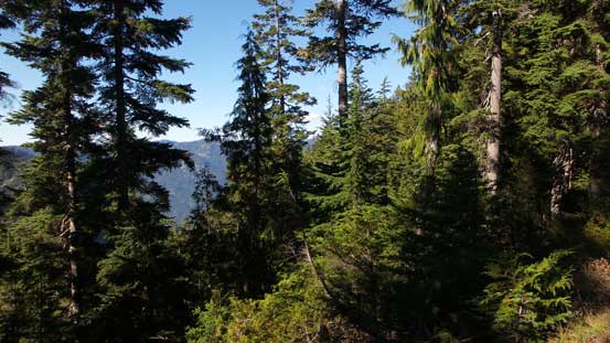
Higher up in the forest now.
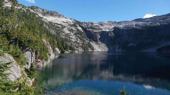
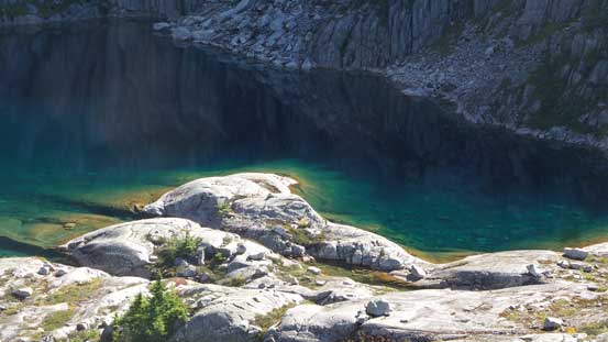
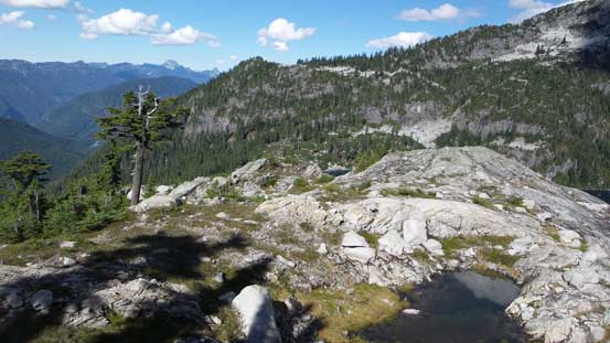
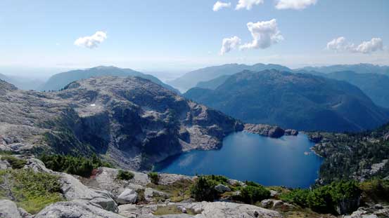
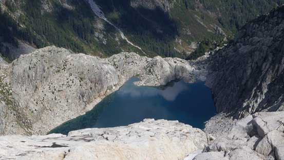
A pleasant change topping out on the lip… Barnes Lake displaced in front.

Very neat colours in Barnes Lake
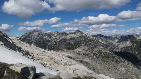
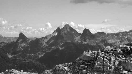
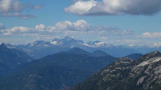
Looking back towards the unofficially named “Hixon Peak” and beyond

A zoomed-in view of Cathedral Mountain

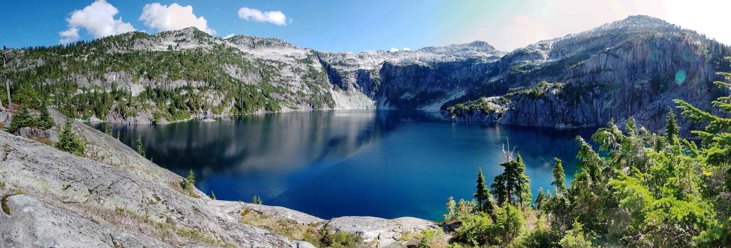
A panorama of Barnes Lake. The summit of Mt. Bonnycastle is on the left side.
Right off the bat I faced the first challenge as the initial 20 m or so was insanely bushy and steep… Examining it up close I almost decided to turn around and go for the shorter SW Ridge but I really wanted to explore the other ridge especially since I had the entire day ahead. Into the bush I had to scramble on all fours and at times my feet couldn’t even touch the ground (nor could I see the ground). I basically just pulled myself up using vege belays and for a few moves I had to put my entire body weight on the vegetation which was quite interesting… Thankfully this part was short but then traversing to the start of the S/SE Ridge was more involved than I thought with lots of micro-terrain and up-and-downs. The upside was that the scenery was great and I got some different perspectives of the lake.
Crossing the lake’s outflow
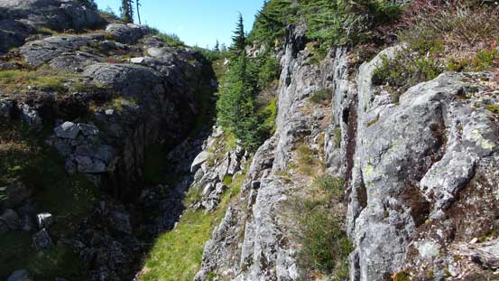
Lots of micro-terrain to negotiate

Slabby..
Cool colours
Another panorama of Barnes Lake. Click to view large size.
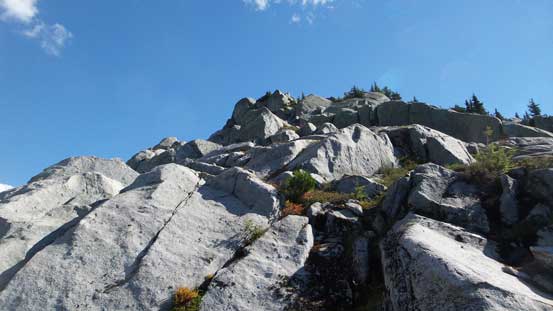
Finally at the start of the S/SE Ridge now the terrain ahead was again, bushy and steep at places. It wasn’t too bad though but still, I had to fight through tight brushes but at other times I could find some solid rocks which was very nice. It took me a good while to top out on the ridge crest, awarded by some awesome views especially looking back down at Barnes Lake. I also found cell phone signals and did some quick Facebook thing before resuming the traverse. I went up and over the first highpoint but then the pointy peak ahead appeared a bit bushy, but easily bypass-able on climber’s left side by some ledges and that’s exactly what I’d do. The ledges also involved some scrambling and route-finding. Once around that sub-peak I made my way diagonally up and intersected the ridge again.
Gaining height rapidly now. The bush was behind
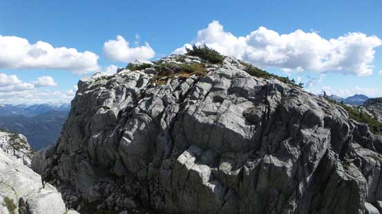
Grippy rocks.

Looking back down at Barnes Lake
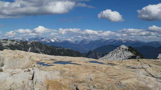
A panorama shot from the crest of the ridge. Click to view large size.

The tip of Meslilloet Mountain showed up behind the SW Ridge of Mt. Bonnycastle

Following the ridge onwards there’s one impressive bump in front
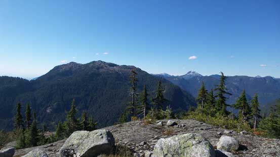
Looking south into the North Shore’s.
Below that bump, I decided to skirt around on the left side

Barnes Lake

The ledge was easy to traverse

More about the ledge traverse..
Looking back from halfway across. Some up-and-downs required during the traverse
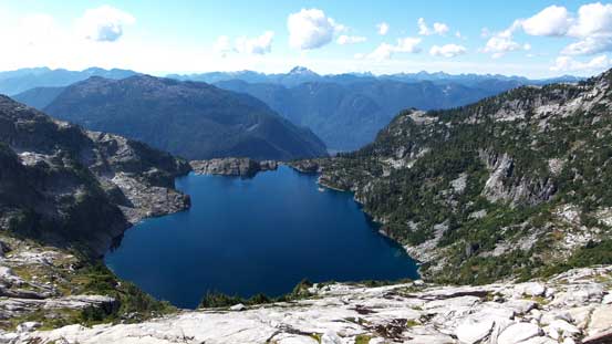
Another look at Barnes Lake
Back to the SE Ridge now.

Lots of different colours on the rocks

The summit ahead.
Can’t stop taking pictures !
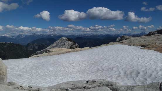
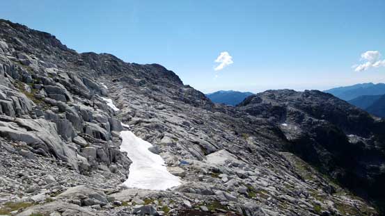
A cool snowfield.
Another shot looking down at Barnes Lake. This traverse gives all perspectives of it.
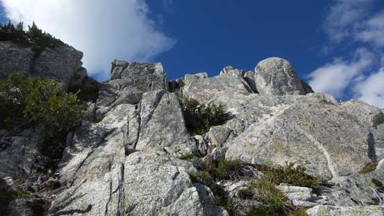
Gaining the next highpoint involved some “low 3rd class” scrambling on solid rock but then I faced a deep notch with some shear drop-offs. Examining it closely I did find a reasonable route to get down on slightly to the down-climber’s right side. Committing to it I had to do a few longer reaches but then the problem did get solved fairly smoothly, and then it’s the final plod to the summit which was foreshortening. There were two points appeared equally high and I traversed to the far one before calling it a summit and thus, taking a well-deserved break.
Ahead is that 3rd class bump
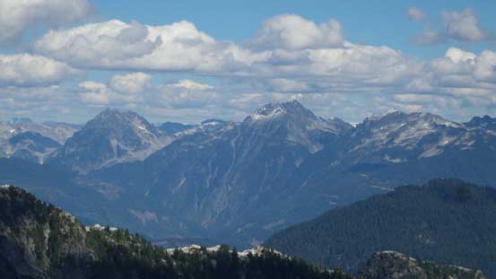
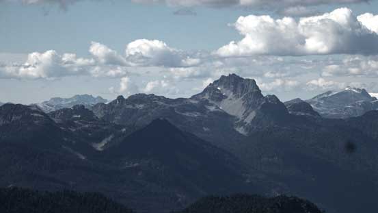
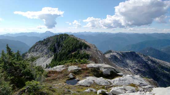
Meslilloet Mountain
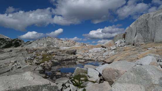
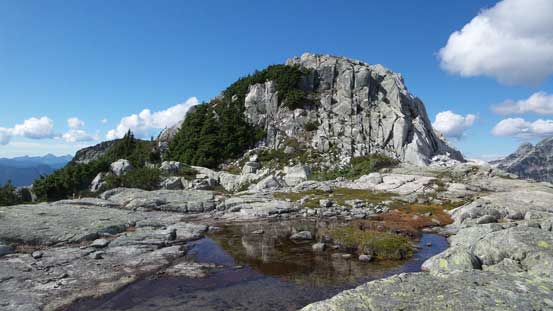
This is another tarn, unnamed of course, on the NE side
Scrambling up the bump

Another (wider) shot looking towards the NE side
The summit push ahead
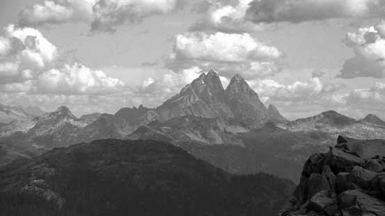
The Five Fingers group – Middle Finger at center, Little Finger on left and The Forefinger on right
Looking back at that bump and the notch.

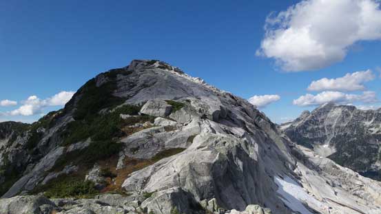
The next highpoint looks a little bit higher

The south face of Meslilloet Mountain

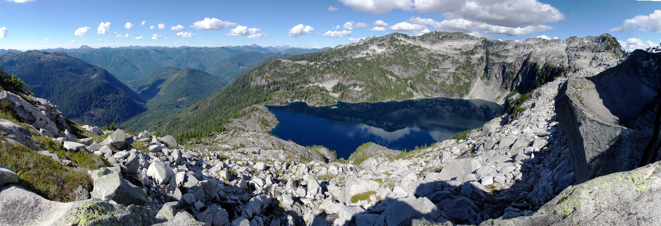
Summit Panorama from Mt. Bonnycastle. Click to view large size.

Katzie Mountain massif with Nimbus left of it and Nebula to its right.
Old Pierre Mountain with Pukulkul Peak to its left.

The very properly named Remote Peak left of center

This is another remote one right of center – Robertson Peak
The iconic Mt. Judge Howay is equally remote…

Another shot of the Five Fingers.

Peaks south of the Fingers – Consolation Dome and Obelisk Peak with Mt. Lou in front
The Tantalus Range looms behind
Sky Pilot Mountain
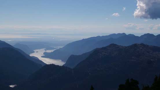
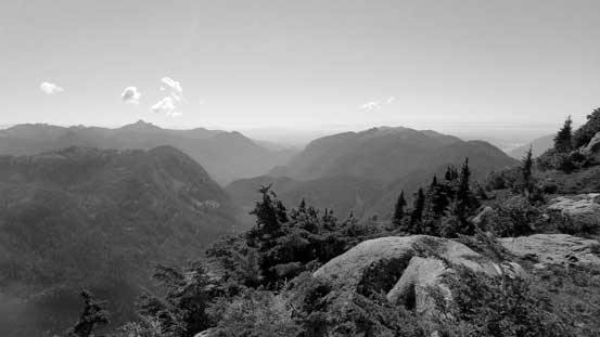
Indian Arm and the Greater Vancouver looking south
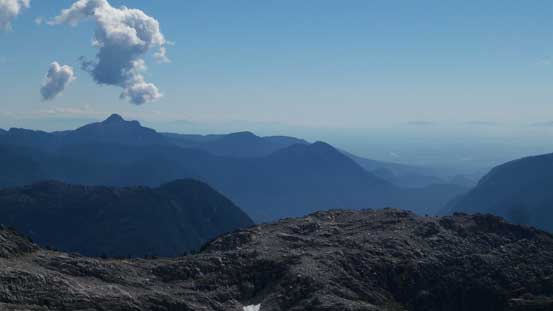
Coquitlam Mountain is that pointy peak on the far left.
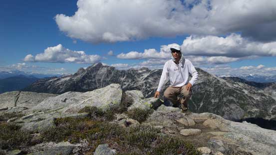
Me on the summit of Mt. Bonnycastle
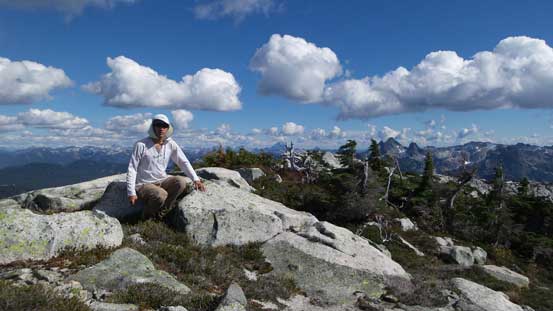
Another picture of me on the summit of Mt. Bonnycastle

Another panorama from the summit. Click to view large size.
I stayed for more than half an hour up there but the time was getting on and I had to get going. Descending the SW Ridge without ascending it would be interesting as I wouldn’t know the exact terrain I had to deal with. I didn’t do much research neither but based on my earlier observations I did have a rough idea. Down initially I stayed on or close to the spine of the ridge and things went fairly smoothly, but then a few steep steps were encountered. Looking for solutions left or right I did get myself down to the first saddle without too much of an issue. And then I made a mistake trying to side-hill around the bump ahead. Once around a corner I realized there’s no easy way to keep traversing so I had to go back up that bump which sucked. Once up there I followed the spine of the ridge again for a good while until dropping onto a wide bench (as per earlier observation). Shooting more-or-less straight down the bench I correctly located a gully feature and that led me down towards the lake. This gully wasn’t very pleasant to descend with lots of slippery grasses and big chunks of boulders lower down.
Heading down the SW Ridge

Had to overcome bluffs here and there…
Looking back
Further down the ridge, it’s time to bail down the face
Very cool cirque created by Barnes Lake
Found a way down..
Lots of slippery ground though

And, huge size of boulders lower down…
Not even bothering to reach the lake shore I followed my GPS aiming directly towards my up-tracks in the bush. The key was to check my GPS for every 2 minutes or so just to make sure I stayed on my ascent route. Lower down I had no problem locating that key spot to down-climb the bluff and then it’s the gully time. For downhill travel I opted for the forest on skier’s right which was nice and soft (easier for my knees). The bush was overall fairly easy on the descent until the grade steepened near that waterfall. It was a bit slippery at places and vege belays had to be regularly applied. My GPS helped a big time again on locating that spot where I had to drop into the steep bank to cross the main creek, and then I followed my up-tracks again down the east side before crossing that bushy bench. It didn’t felt as hard as in the morning and in short time I was on the last part of the forest. This time I went straight down the old growth (still had to do about 50 m of very bad bush but that’s much shorter than on the way up), but then this added one final obstacle for the day and I had to get very creative about it…
Down the forest I went..
Into the bush…

Typical, typical…
It’s getting steep…

That waterfall
Crossing the creek now
Interesting route-finding and class-3 bush scrambling required…
Power it through…. . .
The final 1.5 km plod back to my vehicle was uneventful and my round trip time was about 10.5 hours. It’s apparent that I had to drive a good portion of this logging road in dark but that’s fine and I just had to be a bit more patient. It took me about 2 hours again to get out of the logging roads. One final food break in Squamish and then I drove home, tired but very satisfied. All in all I’m glad to have Mt. Bonnycastle in the bag but not sure how much I’d recommend it. It’s a classic Type II fun and for folks like me it’s all worth the spent but if you don’t like lengthy logging roads or bushwhacking then you should consider something else to do…
