“Ure Peak”
May 10, 2020
2562m
Whistler / Garibaldi Provincial Park, BC
“Ure Peak” is the unofficial name of a remote summit in the northern Garibaldi Provincial Park halfway between Mt. Currie and Wedge Mountain, at the headwaters of Ure Creek (probably how it’s named), and boasts Mystery Glacier on its north slopes. The access of this peak is contrived and requires one full day by any mean. This area is not unheard in the ski mountaineering community as the classic Currie-to-Blackcomb Traverse goes right by Mystery Glacier. However, I doubt any skier would bother to ascend the summit of Ure Peak, as such requires lots of boot-packing and scrambling over a tricky notch. For the summit routes I’ve only seen one or two trip reports on bivouac.com.
Alex and I planned to slam the peaks in this area on snowshoes in spring time. Earlier in the trip we had ascended Mt. Neal, Eureka Mountain, Peggy Peak, Oasis Mountain and Mt. Moe, slowly working our way northwards. We camped at Weart/Moe col and the objective of the last day of this trip was Ure Peak. It looked farther away than anticipated, and seemed to have at least one tricky notch on the summit ridge. We had zero beta about the notch and had been talking about it for the last few days, but there’s only one way to figure it out.

Mt. Neal to Ure Peak peak-bagging slam.
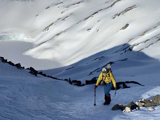
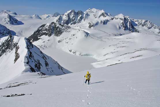
In the morning we again, woke up at 4:30 am, cooked breakfast at dawn and watched sunrise while breaking camp. It was a very cold morning so the going was slow. Once ready we traversed to the shoulder on Mt. Moe’s east ridge and dropped onto the steep glacier on the north side of Mt. Moe. I had remembered seeing crevasses on this glacier from my first trip to Mt. Moe a few years ago, but at this time of a year we observed nothing that indicated we were actually on a glacier. The glacier was pretty steep though, like 35 degrees for a long while, but the snow held off nicely all the way to the low point. From there we ascended up and over a bump to a lake basin south of Ure Peak’s multiple summits. The lake was completely frozen but appeared to have a ton of unnecessary elevation drop, so we opted to contour around which sucked big time with non-stopping side-hilling on snowshoes, and on firm snow.
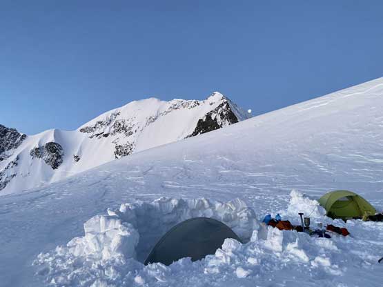
Our camp at Weart/Moe col at dawn
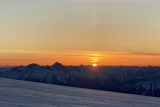
Sunrise behind Joffre Group

The north face of The Owls on alpenglow

Alex taking in the views
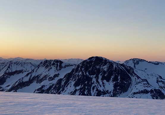
The dark peak in foreground is Oasis Mountain
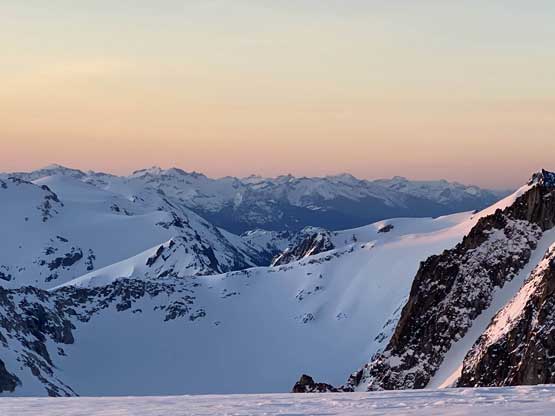
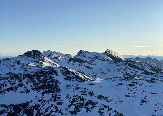
Gowan Peak to Mt. Breakenridge on the skyline..

Moonset behind the NW Ridge of Mt. Weart

Another photo of The Owls and our camp
This is Mt. Cook

The north face of Mt. Weart
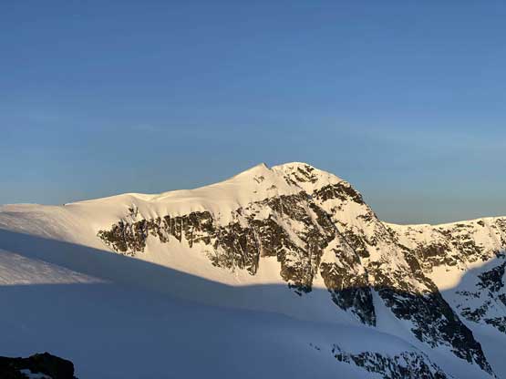
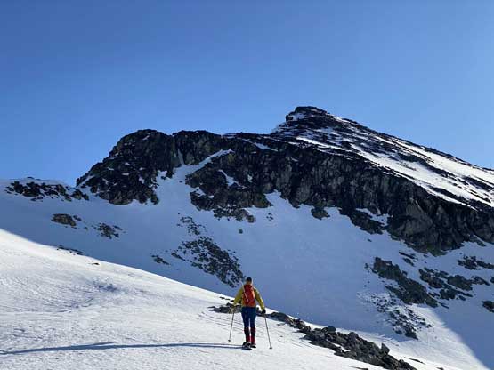
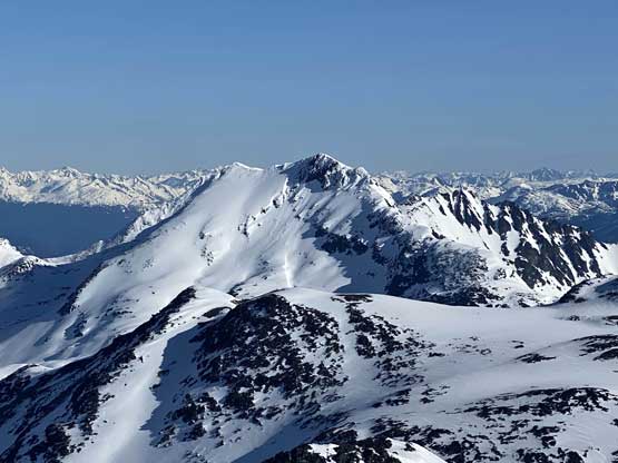
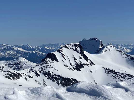
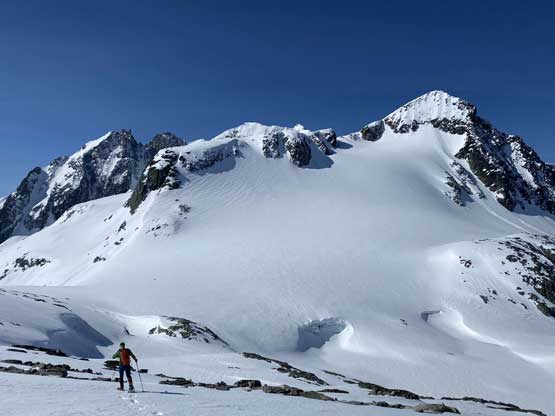
Ure Peak is the rightmost summit
Me heading down the north glacier of Mt. Moe. Photo by Alex R.

Alex plunging down the glacier on snowshoes

Alex continuing down the glacier to the low point
Me coming down to the low point underneath Mt. Moe

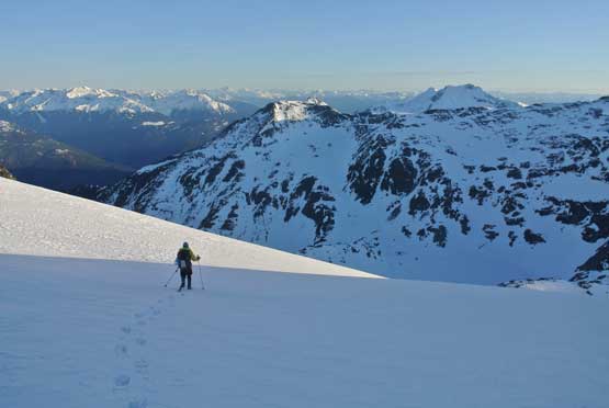
Ascending the next bump now, looking back
Alex leading across the never-ending side-hill traversing
Oasis Mountain behind an unnamed lake

Me posing in front of this gorgeous (frozen) lake. Photo by Alex R.
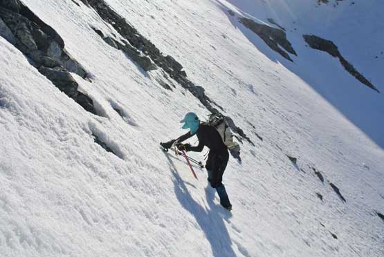
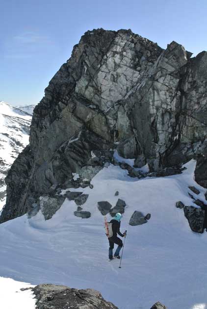
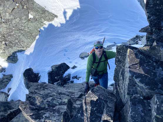
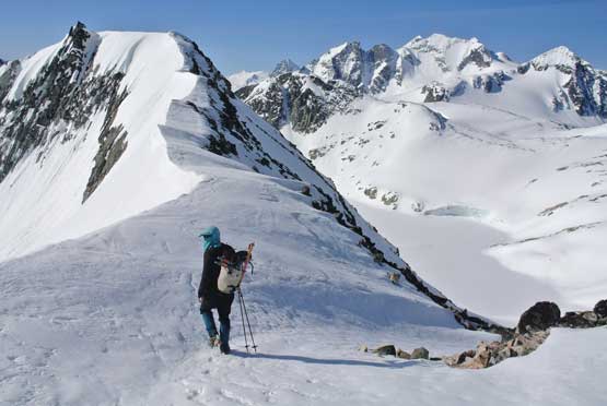
We found nice flat spot underneath a rock wall on the north side of the lake to take snowshoes off. The traverse to the col south of Ure Peak appeared to require ice axe and crampons. The snow was shitty at places but averagely speaking the condition was firm. After the steep grunt to the south side col we found finally see the few potential summit routes ahead. To avoid that unknown notch we would have to down-climb a steep east-facing slope backed under the sun for a couple hours already, and then re-ascend another steep south-facing gully. We said no to that and opted to embrace the unknown. We ditched snowshoes and easily boot-packed to the west ridge and traversed across some loose rocks to that notch. It was not bad at all with only a couple 3rd class moves. After that we ditched crampons and easily plodded to the summit, which was farther than we thought.
Me starting the boot-packing traverse. Photo by Alex R.

Alex boot-packing. This short step was shitty

Now back onto firm snow.

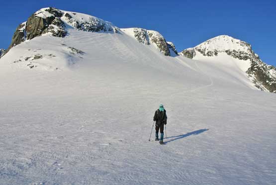
Alex ascending to the col south of Ure Peak
A closer look at Alex cramponing up
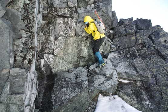
Me at the notch. Photo by Alex R.
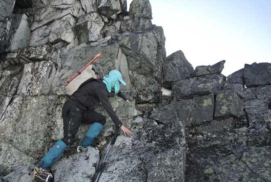
Me scrambling 3rd class notch on west ridge of Ure Peak
Alex scrambling up the notch.
Alex on the summit ridge of Ure Peak
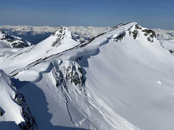
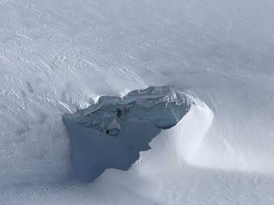
A cornice fail stepped down to weak layers on Mystery Glacier
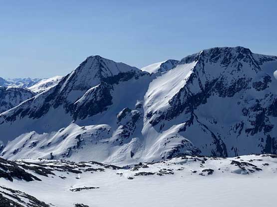
The south face of Mt. Currie

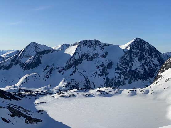
The north face of Mt. Weart
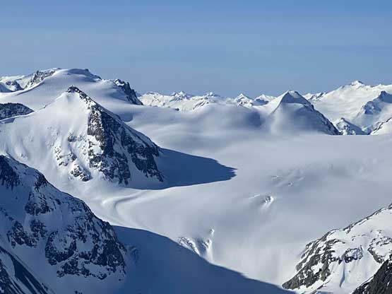
Weart Glacier in its glory

This is looking down Ure Creek towards Joffre Group on the skyline
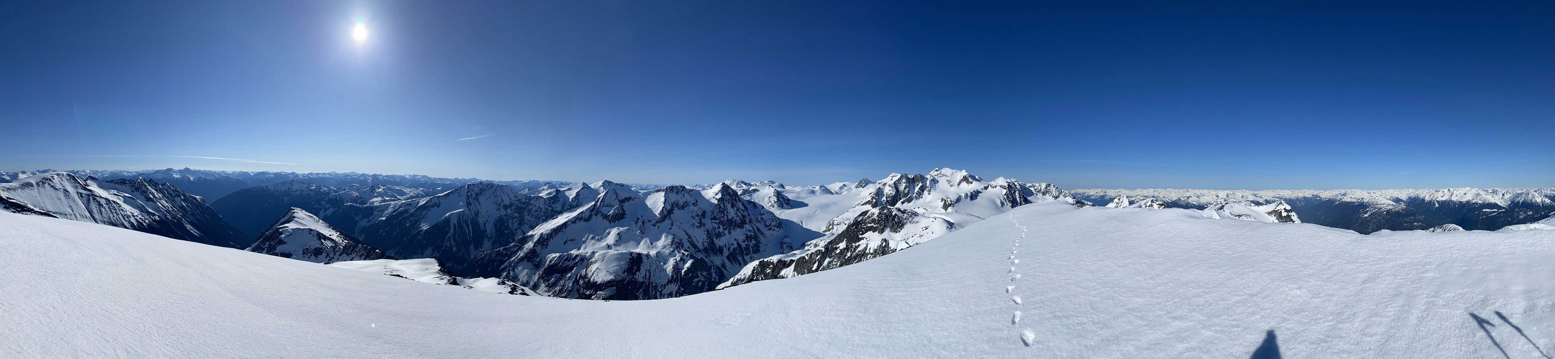
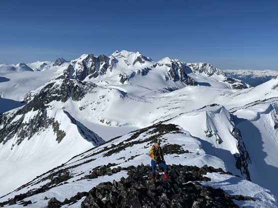
Summit Panorama from Ure Peak. Click to view large size.
Hibachi Ridge to the north. I still need to do that one

Gunsight Peak (In-SHUCK-ch Mtn.) in front of Livingston Peak and Traverse Peak

A closer look at the massif of Mt. Neal

Lesser Wedge Mountain and Shudder/Quiver Peak behind
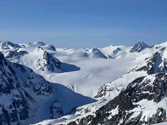
Yet another photo of Weart Glacier
Me on the summit of Ure Peak
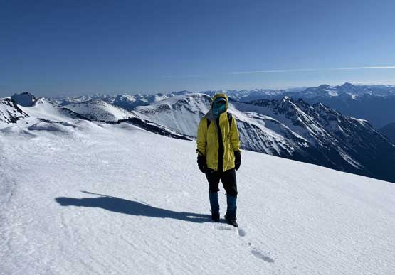
Another photo of me on the summit of Ure Peak
The view especially looking back at Weart Glacier was unbelievable so despite the cold wind we still took a long break on the summit. After having enough fun we easily retraced our steps back across the summit ridge and plunged back to our snowshoes. We had an option to descend all the way to the lake and then re-ascend but opted to retrace the tracks across the never-ending side-hilling. Thankfully the snow had softened up now meaning the snowshoeing wasn’t as painful as in the morning.

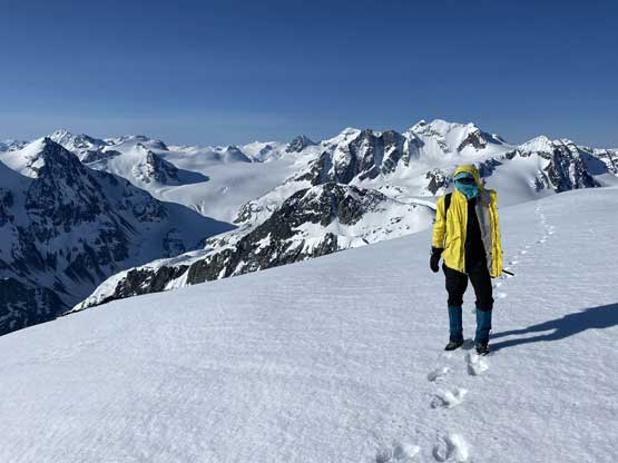
Me heading back across the summit ridge. Photo by Alex R.

A wider view of that slide on Mystery Glacier

Looking north from Ure Peak’s west ridge. Mt. Currie dominates

Alex down-climbing the notch
Me down-climbing the notch. Photo by Alex R.
Me plunging down the south slopes of Ure Peak. Photo by Alex R.
Me back at the south side col. Photo by Alex R.
If you look closely you can see a slide on the north side of Oasis Mountain
Almost back to the low point north of Mt. Moe
Probably the only indication we were actually on a glacier…
