Talon Peak
July 2, 2017
2375m
Lillooet River / Garibaldi Provincial Park, BC
Talon Peak is one of the satellite peaks of the much-bigger Nivalis Mountain on the far eastern reach of McBride Range. Despite the fact it’s actually within the boundary Garibaldi Park, this is a remote area and an ascent of any peak in this group is a rare thing. While the bigger Nivalis Mountain and Mt. Sir Richard do see some traffic from skiers doing the week-long McBride Traverse, very few except for the hardcore peak-baggers would consider Talon Peak. I had never thought about accessing this place via a system of logging roads starting from Lillooet River if not because of Alex’s suggestion, but once actually studying the maps I was instantly game. Talon Peak came down on the second day of this trip while on the first day we had already made ascents of Gauguin Peak and then Flood Peak.

Ascent routes for peaks around Nivalis Mountain
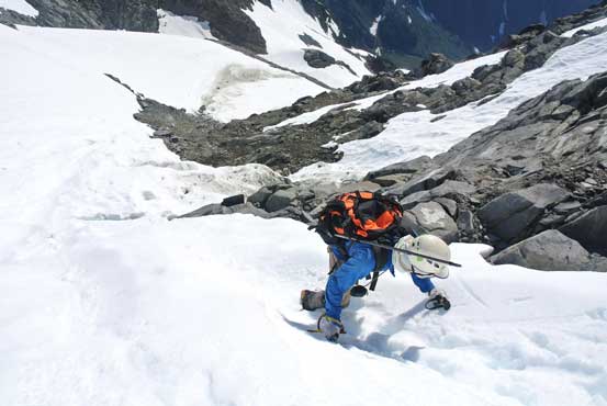
From our high camp on a “rocky island” surrounded by the “East Nivalis Glacier” our initial goal was to access Talon/Nivalis col. This stretch of the glacier looked exceptionally fractured on Google Earth images but as of early July it appeared tame and easy. From near the col we had to make a route-finding decision. The only beta that Alex had was to go up the north ridge although it did look troublesome at least for some parts. We had our fate on the old beta so up we went. Daniel led a good pace kicking step up to a saddle on the north ridge and then the fun began.
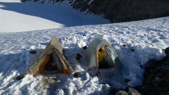
Not a bad morning to wake up!

Plodding the glacier towards Talon/Nivalis col

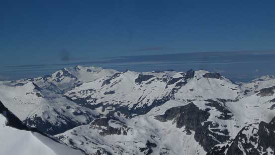
Looking back at the “East Nivalis Glacier” and The Orphans behind
Gaining the north ridge now, looking ahead
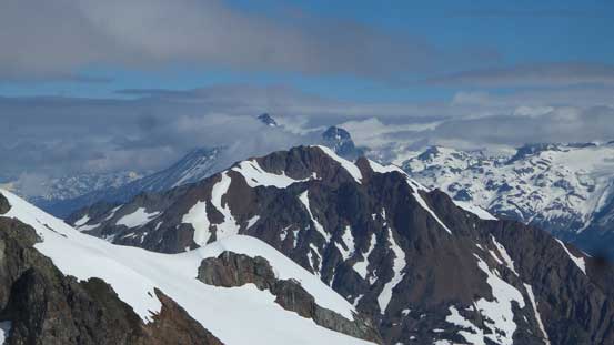
Looking down from where we gained the north ridge. Flood Peak behind

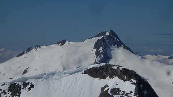
This is the majesty – Nivalis Mountain.
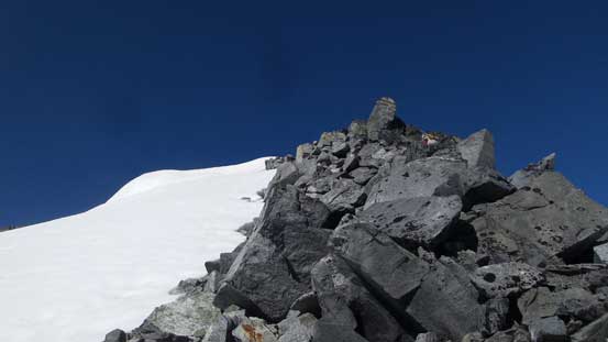
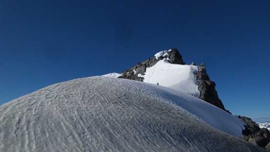
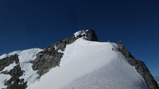
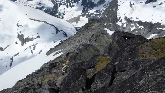
The start wasn’t too bad but the rocks were loose making slow progress in a group of 4. At places I just jumped onto snow and kicked albeit the snow line was a bit exposed. The angle eased off upon arriving at a snowy plateau but then steepened up considerably as we approaching the summit block. The last 20 meters was what we had worry about and we were right. Daniel was on the lead and after watching him struggling to make some 5th class moves the rest of us decided to bypass the technical climbing entirely on snow. This was not trivial neither as we must face into the slope and shuffle across a good stretch of the north face with slope angle increasing to about 50 degrees.
Arriving at this snowy plateau on the north ridge
Continuing upwards towards the summit block. Daniel leading the way
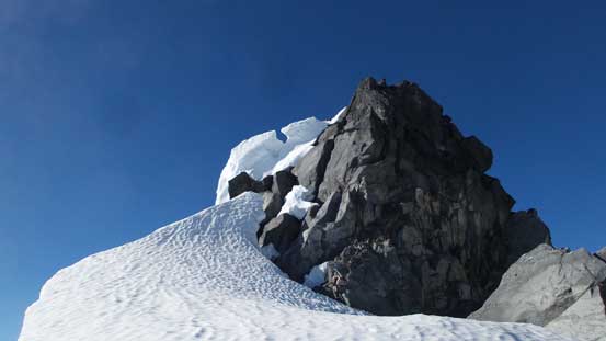
The summit block was over our comfortable level…
Me leading the way traversing a stretch of steep snow. Photo by Alex

Ben and Daniel following the steep snow traverse. It’s very sketchy…
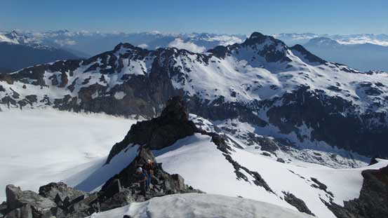
Nobody liked this snow route neither so once everyone got across safely we agreed to search for an alternative descent route, likely from Talon/Adieu col. This traverse dumped up on the uppermost of the east ridge and the scrambling to the summit was easy from there. The views were awesome with no smoke obscuring the peaks.
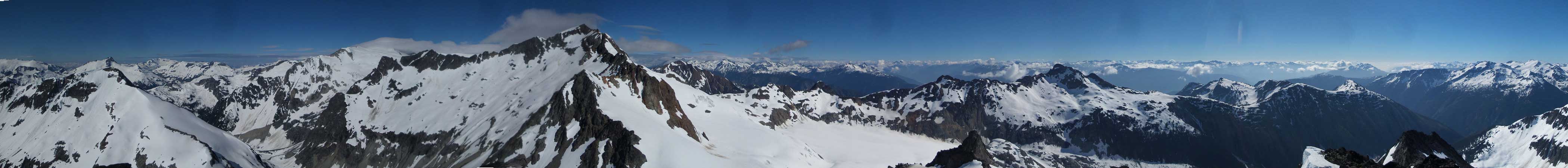
Summit Panorama from Talon Peak. Click to view large size.

Looking over the summit of Adieu Mountain towards Mt. Pitt
That distant giant is Mamquam Mountain, from an unusual angle of course

Looking deeply down Lillooet River towards Fire Mountain

Flood Peak is now below us

Gunsight Peak always catches one’s attention
This is looking over the summit of Outlier Peak towards Wedge Mountain
A closer look at Mt. Pitt
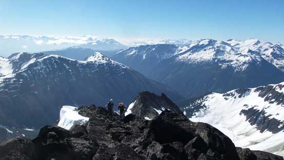
Ben and Daniel gaining the east ridge.
We spent at least half an hour on the summit soaking in the views and drying out the very soaked boots, but eventually it’s time to get going again. The north ridge of Adieu Mountain did not look easy at all but again, we had fate on the old beta. The first business now was to find a way down to Talon/Adieu col and even this was not trivial. Staying entirely on the rocky ridge was not too bad until a couple jagged towers forced to detour onto snow, down-climber’s left. A couple tricky moves to get into a steep couloir and then some longish down-climbing later we could finally start traversing back towards the col. This part was mostly side-hilling on soft snow so not too bad.
Descending on rock initially

Soon enough we had to merge onto a snow route

Looking back at the snow passage we just came down

Arriving at Talon/Adieu col
At Talon/Adieu col we took another longish break before resuming the ascent of Adieu Mountain.
