Mount Sloan
September 3, 2022
2720m
Gold Bridge, BC
Not to be confused with Sloan Peak in Washington which I did in August 2017 this one is near Gold Bridge of SW BC. Both of them are some of the most iconic summits in their respective regions and both are worthy objectives. Mt. Sloan in BC boasts two popular routes – the NE Ridge (3rd to low 5th class) in Alpine Select and the SE Gully documented in Matt Gunn’s Scrambles in SW British Columbia. My original plan was to do the scramble route but more and more beta about the NE Ridge had come out in the recent years. The route does not sound nearly as daunting as appeared so I changed my mind. Most NE Ridge parties opted to descend the scramble route to make a loop, but I liked the idea to down-climb the ridge for more fun scrambling. Most of the route is 3rd class scrambling with odd bits of unavoidable 4th class steps. Of course there exists indefinite potential to make it a proper 5th class climb if one tries to stick to the ridge crest. Lots of the difficulties can be bypassed on climber’s left side.
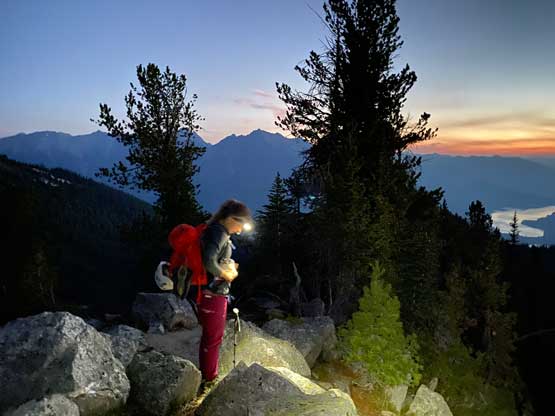
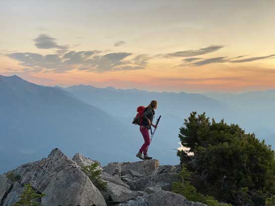
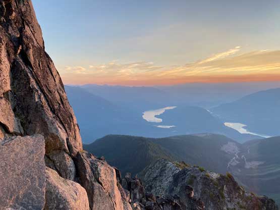
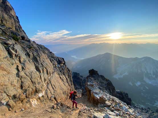
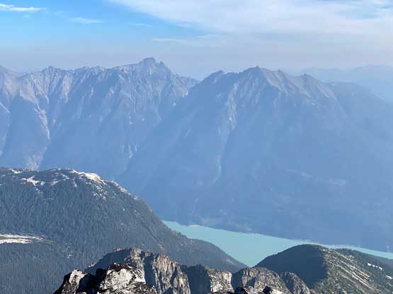
Over the past few years I had discussed this objective with at least 10 people and in the end I did it with Elise. We had planned a 5-day road trip to Wyoming but the trip had to be cancelled as Elise’s cat needed an emergency surgery. Elise was still able to get out for a day so we immediately settled on Mt. Sloan as we had been talking about this objective for months. The drive would be a long one so realistically speaking we had to do a car camp the night before. Both of us were scrambling to get things packed but by 8 pm I did manage to pick her up from Burnaby and three hours later we made to Pemberton. The drive up and over the Hurley Road was not too terrible, but definitely not pleasant with lots of washboards and rocky stretches on the first half. The second half was a cruise-sail. The spur roads heading to the base of Mt. Sloan were a completely different story. Those who did this peak in 2021 were lucky as they were logging the area. The logging must have finished so they dug out at least 100 ditches from the start to the end. None proved to be troublesome to the Tacoma but none was straightforward. A Subaru or Rav4 would have to be parked very much at the beginning adding at least 2 hours of walking each way. I had to use 4Low a few times and also scraped the bottom a few times but I was stubborn enough to get us to the driveable end. We got there at almost 1 am, and set the alarm at 4 am. Elise suggested to watch sunrise on the ridge and that turned out to be a brilliant idea.

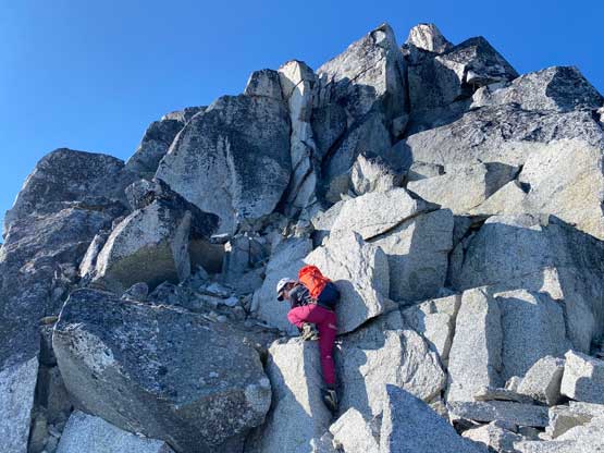
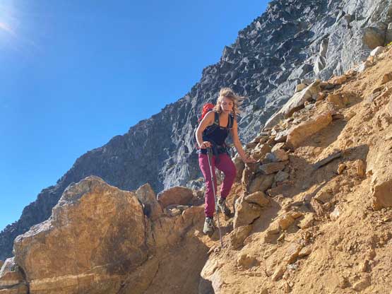
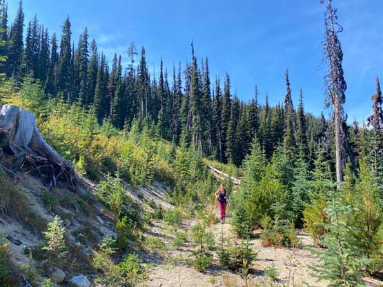
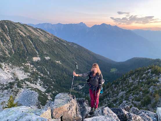
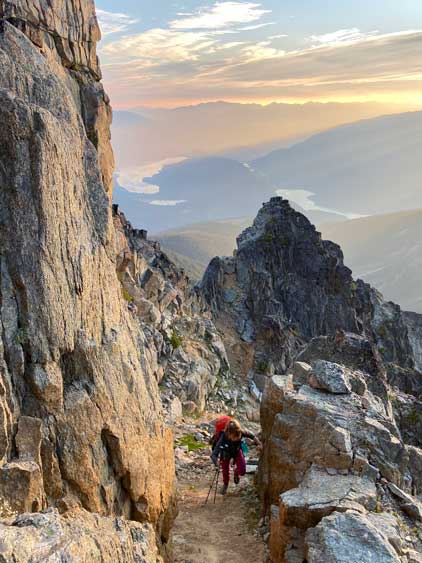
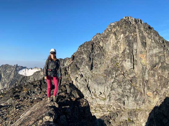
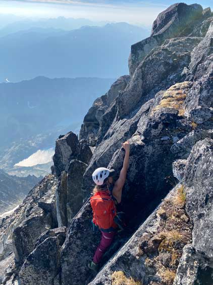
I had downloaded a set of GPS track from peakbagger.com and the plan was to stick to that track as we’d be bushwhacking in the dark. I also knew there’s a climber’s trail somewhere but by sticking to the GPS track we failed to find that trail. In fact, we were thrashing up sustained level-3 underbrush. The going wasn’t slow, but very frustrating. We basically bushwhacked onto the NE Ridge where we came across the climber’s trail. The next stage was a long section of wooded ridge. There was still a “trail” here and there but we did often lose it and end up doing some unnecessary bushwhacking. There’s some minor up-and-downs and scrambling and the sky had become bright enough for us to turn off the head-lamps. Upon reaching the first scrambling section we went for climber’s left and did some 3rd class bushy belays. The correct route that we learnt later in the day (on return) was to stick to the ridge crest. Beyond this step we had a long section of easy scrambling terrain before things steepened again.

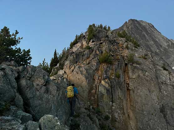
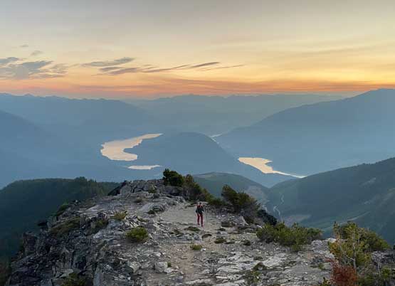
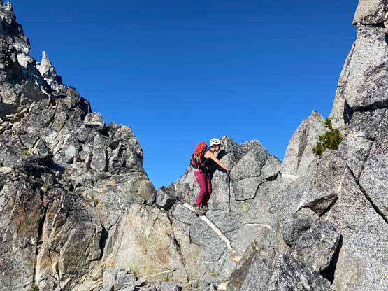
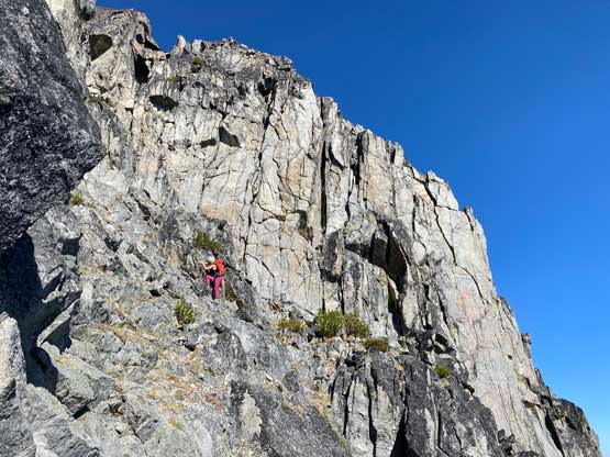
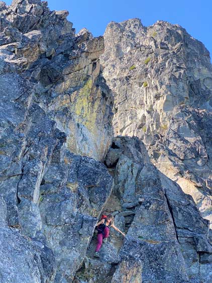
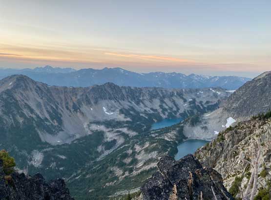
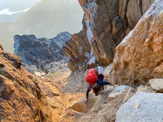
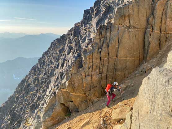
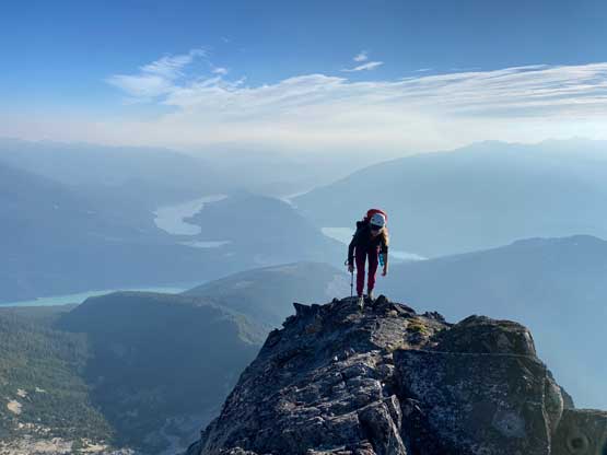
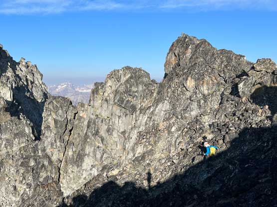
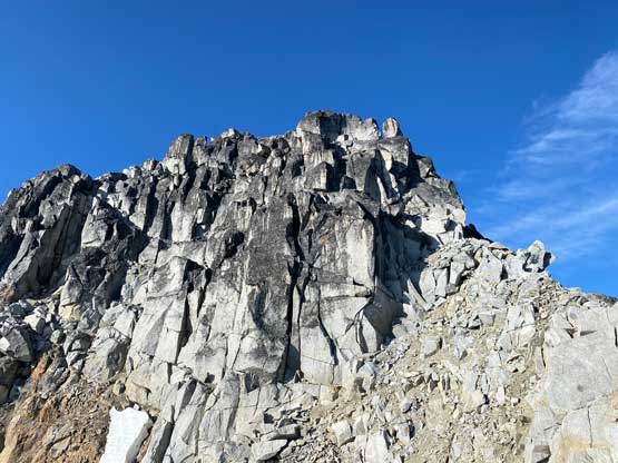
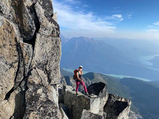
It’s pointless to describe the route in depth as the scrambling and route-finding was never-ending but not difficult. We bypassed some major chunks by ascending climber’s left side of the ridge but most of the time we stuck closer to the ridge. At one point we traversed left into a characteristic “red gully”. The scrambling was easy but it led us into another red gully higher up that involved 3rd class scrambling on choss. We did not enter the 3rd leg of this gully but rather exited to climber’s right onto the ridge. This was a correct call. Once topping out the “high point” immediately above us we faced that “twin towers” section mentioned in some other trip reports. We knew the difficulty ahead could be bypassed by losing some elevation on again, the south side of the ridge, but we decided to scramble up head-on for more fun. This day started to become too easy so we wanted some extra challenges. We did some exposed 5th class free soloing including two airy notches to down-climb into. The difficulty exceeded my anticipation but we managed without a problem. We had brought rope, harness, rack and rock shoes but didn’t end up using any.


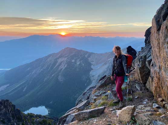


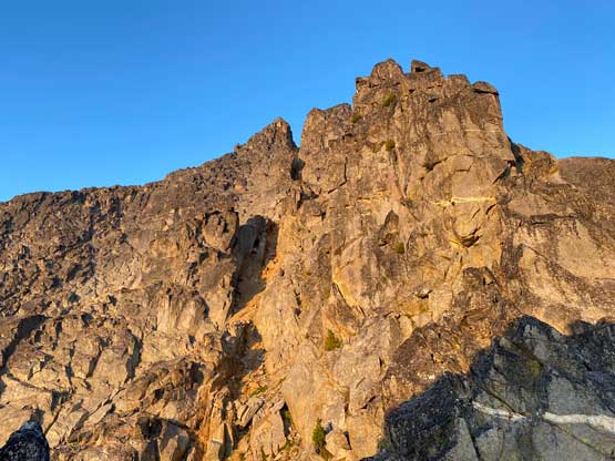


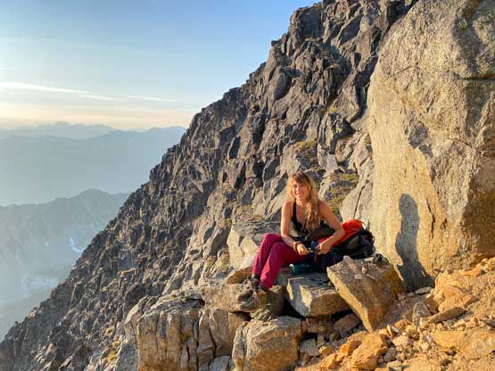


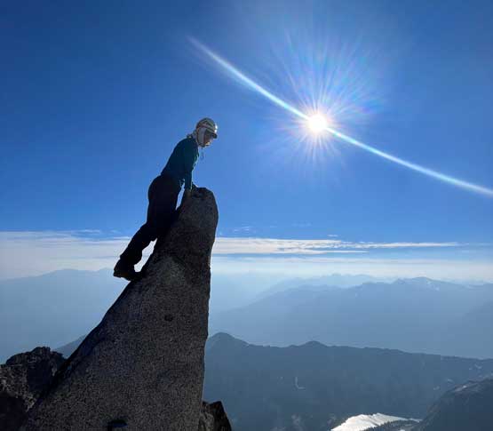
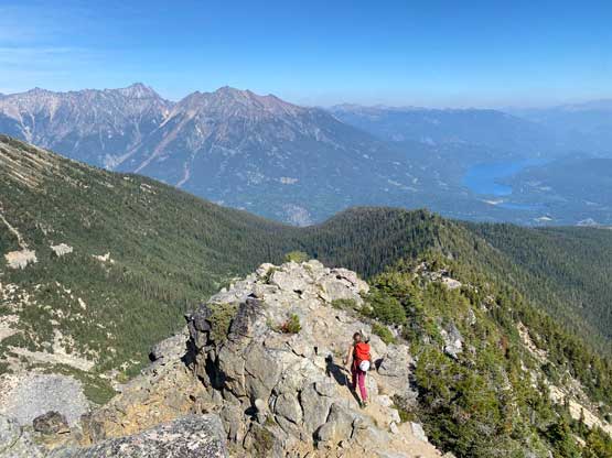
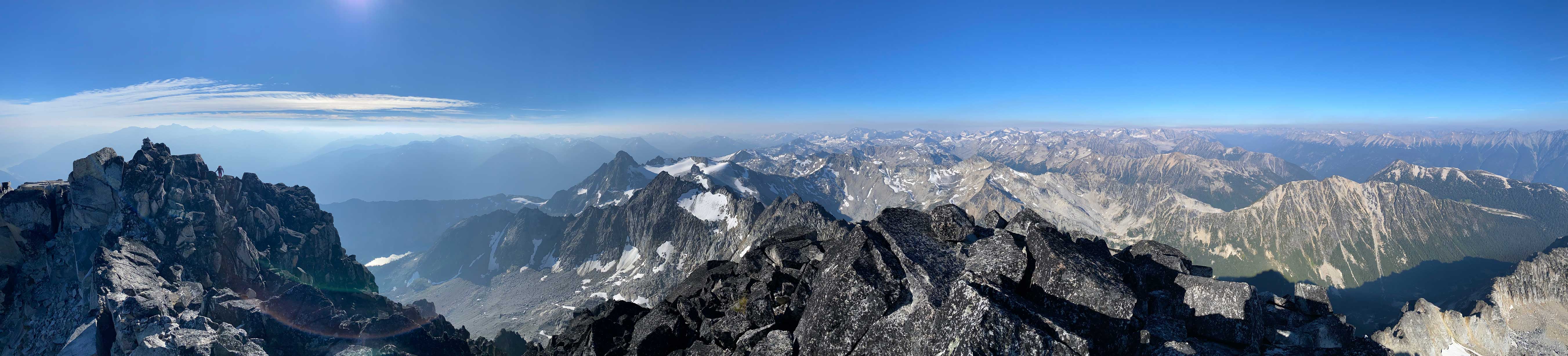
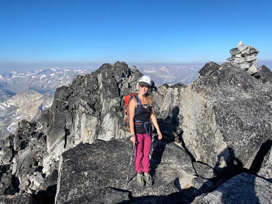
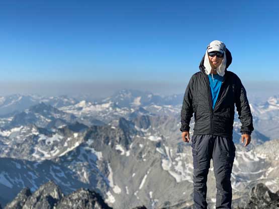
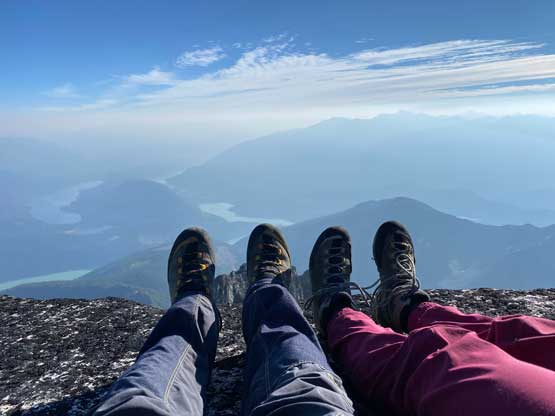
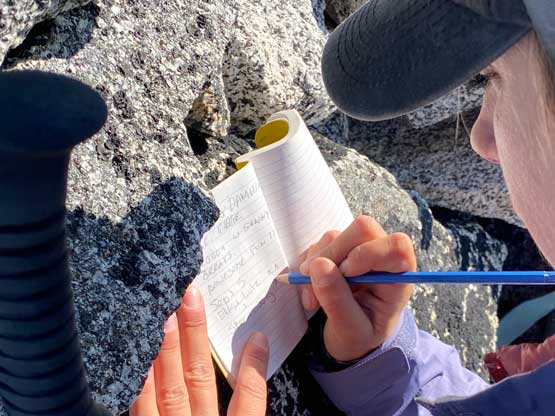
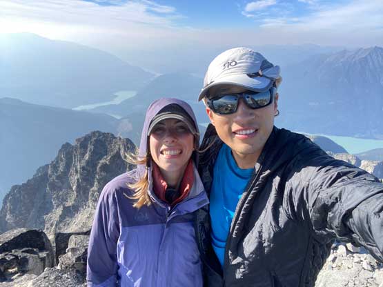
Above this “twin towers” zone we were looking at the final summit push. This time we followed the path of the least resistance dropping down and traversing around a few more towers. We then ascended a 3rd class face back onto the ridge crest. The final head-wall had some unavoidable 4th class steps but none was exposed. There were even cairns to guide the way. Beyond that, we were on the summit. The register was placed on the first summit but a secondary high point about 50 m further appeared equally high, so I went there to check that out as well. Elise and I stayed on the summit for at least half an hour but the cold wind forced us to retreat.


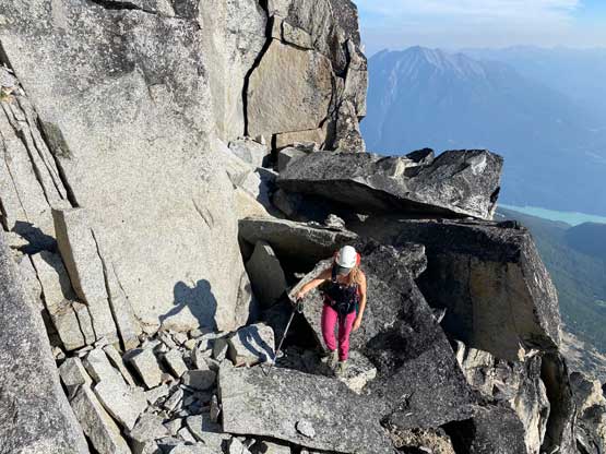


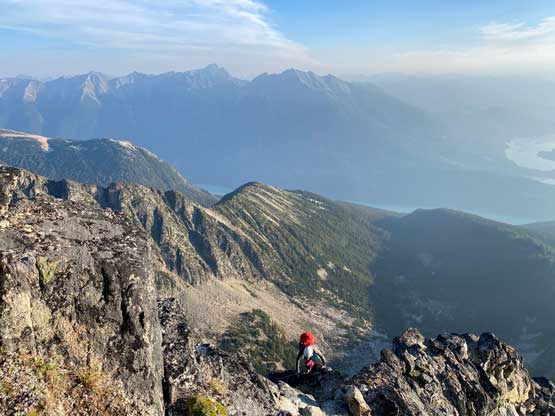
Down-climbing always felt easier than ascending to me for some reasons, likely because on the descent I already knew what exactly to expect. We took our time descending the 4th class terrain under the summit and then followed the path of the least resistance around several towers. That included some annoying elevation regain. We bypassed that 5th class tower challenge and the bypass was only 3rd class. Lower down we stuck more or less on the ridge. There’s one more stiff step near the beginning of the scramble. I knew that could be bypassed as well, but decided to tackle the challenge. It’s more fun to just down-climb that step. Once back into the trees we tried really hard to stick to the “trail” and we somewhat succeeded. That path led us down a different line in the lower forest and we avoided at least 70% of the bushwhacking. Our round trip time was 8.5 hours with lots of breaks and a non-rushing pace. The drive-home was tiring of course, but we got back in time for dinner.