Liumchen Mountain
October 12, 2016
1830m
Chilliwack / Cultus Lake Area, BC
With some decent weather forecast Vlad and I were hoping to take advantage of the last nice day of this hiking season before a big storm blowing in, but the problem was, we both had to get back by the late afternoon. My issue was a prearranged evening work schedule while Vlad was facing with some last-minute family commitments. We both tried our best to shift things around but still, 6 pm was the deadline and no later than that. Vlad suggested us to try Liumchen Mountain and Church Mountain nearby Chilliwack and after some searching I agreed with him. There are two unofficially named summits – “Windy Knob” and “Old Baldy” to tag along as well.
This group of peaks do not boast too much of mountaineering interest but are worthwhile objectives for hiking nonetheless given the expansive vistas they offer. Over the past few years the access had become an issue as the deactivation of the logging roads had left to folks a long walking approach. The situation had greatly improved last year thank to a dude who regraded the Liumchen East FSR and now with a good 4×4 HC vehicle one can drive to 1450 m elevation. Also worth noting that the summit of Liumchen Mountain lies probably only 50 m north of the international border on the BC side and that makes it an interesting destination as well.

Ascent route for Liumchen, Church, Old Baldy and Windy Knob. GPX DL
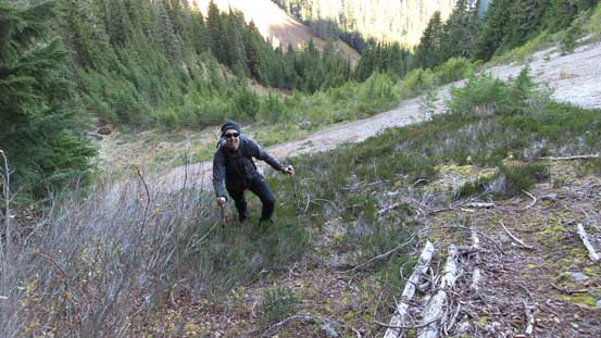
To make sure we could bag all 4 of our objectives in this trip I pushed hard on an “alpine start”, and in the dark if necessary. We met at the North Surrey Park n’ Ride by 4:45 am and then cruised eastwards down Highway 1 in my Jeep. Turning onto the No. 3 Road towards Cultus Lake we made quick progress to the start of Vance Road. The next hour could potentially be the crux as I had to be very careful negotiating the narrow 4×4 road in dark. The initial few clicks went by fairly smoothly and only involved some pot-holes but once turning onto the Liumchen East FSR things got interesting in no time. This spur road (for a total of 8 km) was pretty much entirely a single-lane track with very limited turn-around point. It’s steep, narrow and had lots of deep ruts but my Jeep handled very well. There were a few confusing side branches but with a pre-drawn GPS track those were easily distinguished.
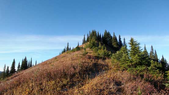
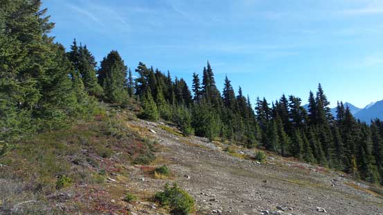
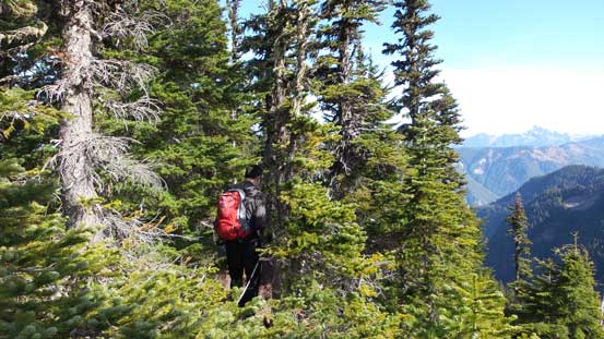
The entire logging road section took us over 1 hour but overall wasn’t too terribly bad. I’d compare it to the nearby Chipmunk FSR (Cheam Peak’s access) only to be narrower and more “remote”. We made to the high parking lot when it’s just bright enough to not need head-lamps and then we started the plod not wasting any time. The ground was frozen solid but then there were already some decent views only 5 minutes away from the parking lot. The trail stayed on the ATV road for a while before branching off into the forest. It was very easy to follow and led us bypassing the first bump – “Windy Knob”. The summit was only 10 minutes away but we decided to tag it on the way back instead. Due south we paid attention to not follow the main trail down towards Liumchen Lake and instead took the “high road”. The led us easily to the summit of “Old Baldy” where we watched a nice sunrise.
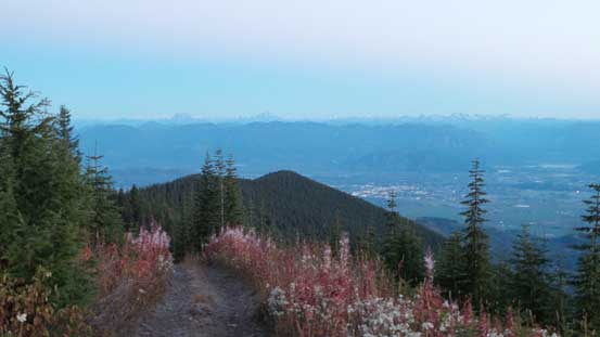
Pre-dawn view from the start of this trip.

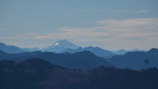
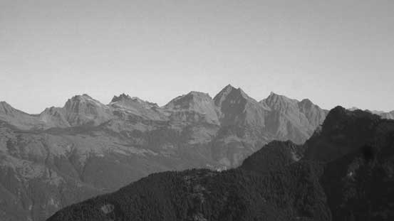
Morning colours over the southern horizon. This is Mt. Shuksan
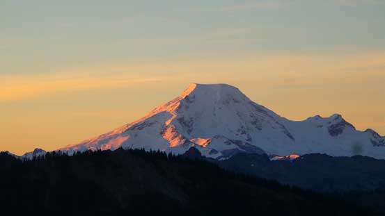
Alpenglow on the iconic volcano – Mt. Baker
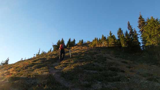
Vlad marching up towards the summit of “Old Baldy”

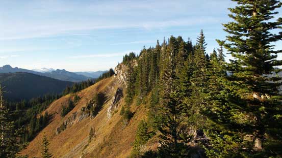
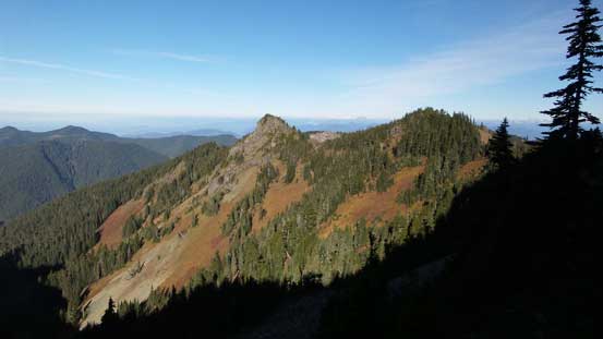
From the summit of “Old Baldy”, looking back towards “Windy Knob”

More views from “Old Baldy”. It was a gorgeous morning.

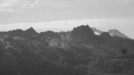
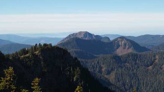
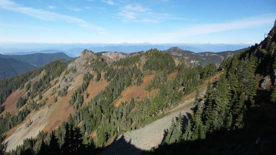
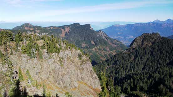
Looking over Church Mountain (the dark peak in foreground) towards Cheam Range
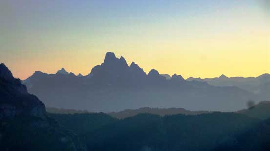
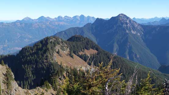
Slesse Mountain looms impressively behind
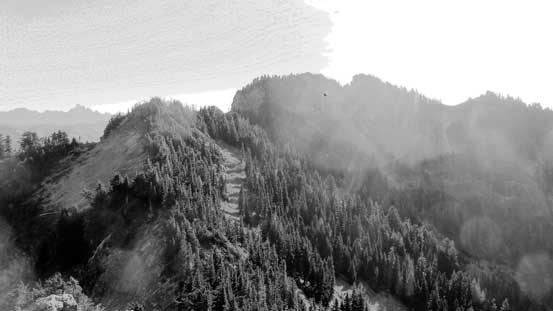
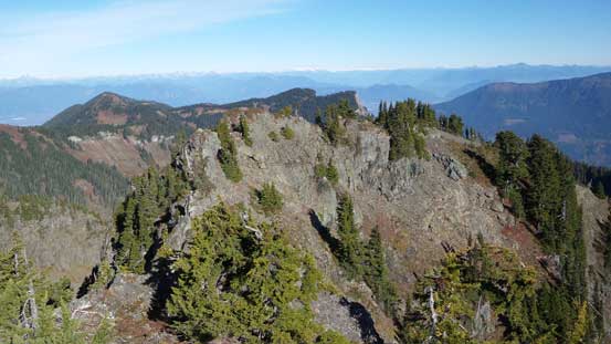
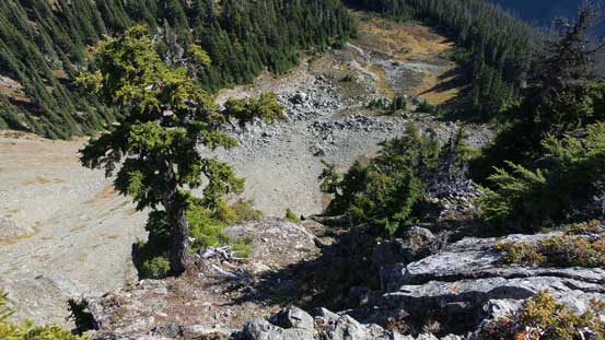
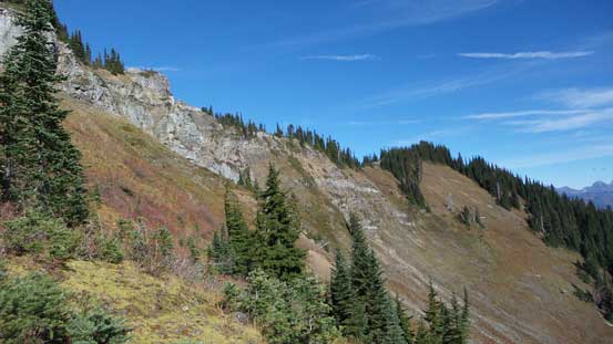
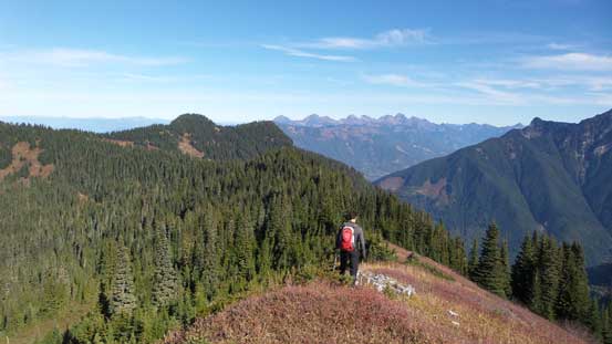
From the summit of “Old Baldy” we dropped down the south side on some open slopes but soon entered the forest again. The trail had become a bit indistinct at sections but essentially it just followed the ridge crest so there’s no reason to get lost. And in fact, we were even surprised by the quality of this path especially given the status of that access road. This section of the ridge was undulating but nothing in terms of “major dips” and in short time we were going up again. A few spots were tight and bushy but nothing terribly ugly and we wasted no time reaching the unnamed high point about 2 km north-west of Liumchen Mountain.

Neat fall colours on the slopes of “Old Baldy”
Plodding up towards the next highpoint
The next highpoint ahead. This one is unnamed..

The typical forested travel along the ridge

Vlad balancing over a scrambling section

A look towards Fraser Valley
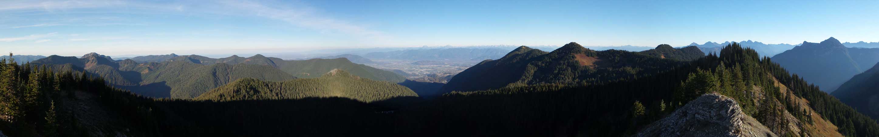
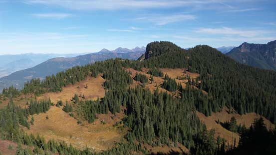
Panorama from the unnamed highpoint. Click to view large size.
The next stage would involve the most significant elevation loss. The steep descent was done in two stages with one slight uphill section in between. Once down to the saddle we picked up a gully feature and made good time up the opposite side. Near the top of that gully I led the way traversing climber’s left in search for more open terrain, but what’s waiting for us was those frozen and slippery grassy slopes again. We soon bailed into the forest and the bushwhacking wasn’t as bad as I thought. The trail was non-existent now but nonetheless we didn’t need a trail anymore as we just had to follow the spine of the ridge up to the next highpoint.
Ascending steep and frozen ground
Looking back. We were higher than the previous bumps now.
The summit was still fair a bit of ways away…
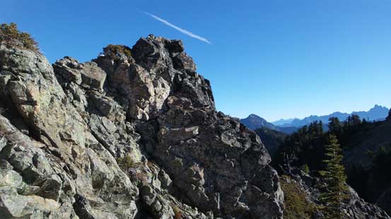
The summit of Liumchen Mountain was getting closer and closer but it’s apparent that we still had to overcome one or two more subsidiary bumps along the way. Traversing the connecting ridge we immediately had to face the first hands-on scrambling section of this day. The “nose” of the first bump appeared very steep from above so we down-climbed the right (south) side before making a side-hill traverse to rejoin the ridge. Following the ridge spine we had no further problem going up and over the next highpoint and now we finally made to the base of our objective. According to various sources the easiest route was by a rocky gully on the climber’s right (south) side, so not doing any unnecessary elevation gain we did a long side-hill traverse on a mix of grass, talus and scree to hit the base of that aforementioned gully. We were happy to discover the nature of this gully being more rocky than grassy so despite the north-facing aspect it wasn’t that frozen and slippery. It was also not as steep as appeared from afar. Once exiting this gully the route joined the broad south ridge and then it’s a mere plod to reach the highest point.
Bypassing a rugged section on the ridge

Pretty straight route-finding in general

Almost rejoined the ridge crest. We had to go up and over the next highpoint too.

The summit was at least getting closer and closer now…

Traversing this slope towards the ascending gully
Looking back towards the two bumps we just traversed over

Ascending the gully.
Onto the broad south ridge now, looking ahead.

The broad saddle. I believe we were less than 30 m from the international border now.

Summit Panorama from Liumchen Mountain. Click to view large size.
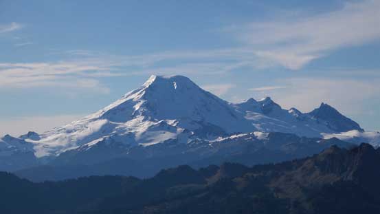
Mt. Baker

Mt. Shuksan
Glacier Peak

Mt. Sefrit with some rugged peaks in the infamous Picket Range behind
The dark peak right of center is the Washington state’s Church Mountain.
The peak in the distance is Bald Mountain. Yep it’s another Bald Mountain…

Fraser Valley
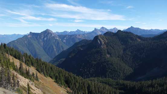
Looking over an unnamed highpoint towards Cheam Range and Mt. McGuire
Looking over the lower north summit
The highpoint in the foreground is already in Washington state. Bald Mountain behind
A zoomed-in view of peaks in Cheam Range. Welch Peak is the highest out there.
The east side of the summit block was a shear drop-off…

Vlad and myself on the summit of Liumchen Mountain.
I really wished we had more time to relax but that wasn’t the case on this day, so after spending roughly half an hour on the summit we had to start the descent. Reversing our route down and around the summit block went by uneventfully and then it’s that undulating ridge traverse. The hands-on section imposed no problem on the return and then we made some quick progress down to the low saddle. Plodding up the opposite side wasn’t very appealing but easy going and our next break was on that highpoint 2 km NW of Liumchen Mountain.

Time to go down, looking back.
Looking ahead to the long undulating ridge traverse we had to do.
Plodding up one of the many subsidiary bumps

Looking back towards the summit.
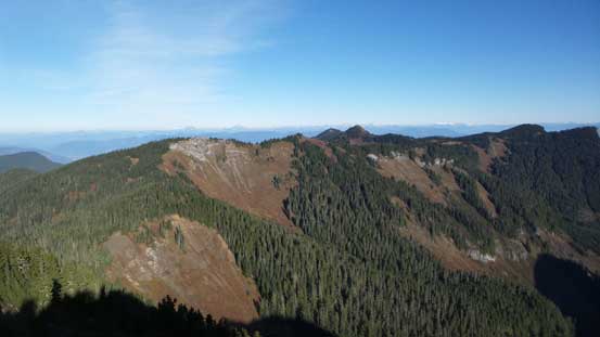
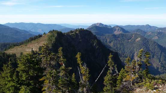
The views were great though. Church Mountain is that forested bump at center.
Re-ascending the unnamed peak NW of Liumchen Mountain.
Nice views from this unnamed peak. Mt. McGuire on the far left
A zoomed-in view of Slesse Mountain. The easiest route – SW Buttress 5.6 is on this face…
The next stage was following the spine of the ridge back to “Old Baldy” and according to our earlier observations we already made the call to not hit the summit again. Instead we had spotted a “short-cut” route that could potentially shave off some time and elevation regain.
More about the forested ridge traverse
On and on and on…

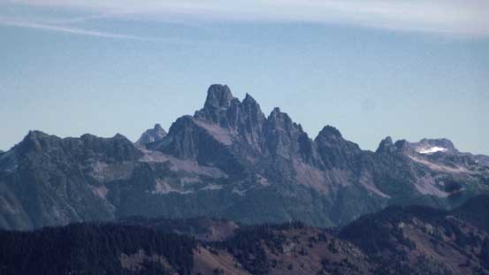
From L to R: Canadian Border Peak, American Border Peak and Mt. Larabee
Church Mountain will be our next objective.
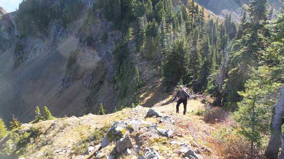
The intermittent trail led us traversing up and over some undulating terrain, down to another saddle before plodding upwards towards “Old Baldy”. We paid close attention to our previously spotted line and once there we made the call to traverse straight towards our next objective – Church Mountain.
