Mount Windsor
January 4, 2017
1689m
North Shore Mountains, BC
Mt. Windsor is one of the northernmost peaks along the Howe Sound Crest Trail (HSCT). While thousands of hikers attempt the various portions of the HSCT, not many people venture up this peak despite the fact there’s actually a smaller trail leading that way. To tag Mt. Windsor itself the most logistic way is by Deeks Lake Trail from Porteau Cove and the majority of the ascent is nothing more than just a forested plod. The tame nature of this peak also suggests a straightforward winter ascent and the various trip reports on ClubTread help to confirm this.
Towards the tailing end of this Arctic high pressure system Al and I decided to combine Mt. Windsor with the nearby Deeks Peak to make a loop traverse. A few sections of the route would be steep but given the recently broken set of tracks there’s little to worry about. However, it’s still a big day with around 1800 m cumulative elevation gain so we had to make an alpine start. It was a bit of slow going in the morning considering this was the 3rd day in a roll of peak-bagging for me, but we did manage to start the plod by around 5:30 am from Porteau Cove.

Mt. Windsor and Deeks Peak loop traverse route. GPX DL
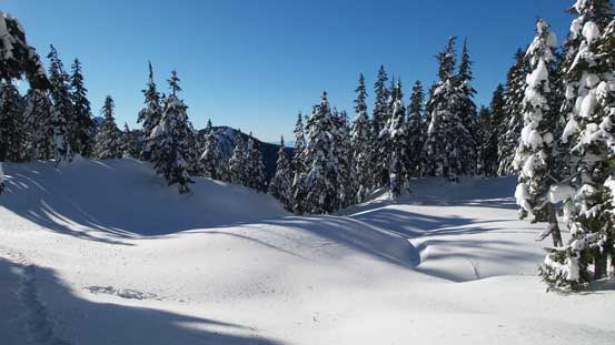
There’s not much to document about the initial 3.8 km walk up Porteau Road other than putting one foot in front of another for about an hour. Snowshoes were strapped about halfway down the road but then were taken off once the road ended and the Deeks Lake Trail started. There’s a dry stretch along the lower portion of this trail with lots of roots and rocks and I didn’t feel like wrecking my ‘shoes. After what seemed like quite a while the post-holing took over again so we once again, donned the ‘shoes, and then the sky had become bright enough to not require head-lamps. More mind-numbing plod were followed, then the trail had become increasingly steep and started to make some large switchbacks, and the next thing we had arrived at Deeks Lake. Following the previous set of tracks we walked around the left edge of this lake and soon enough it’s time to enter the forest again.

The steep creek that’s the outflow of Deeks Lake.
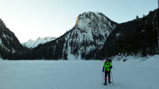
Snowshoeing across Deeks Lake
Thank to the previous group breaking the set of snowshoe tracks there’s not much work left for us to do other than again, putting one foot in front of another. The section from Deeks Lake to Deeks/Windsor col was much longer than what appears on topographic maps and seemed to drag on forever. A food break was taken somewhere along the way but then it’s getting cold so we had to keep moving. Near Deeks/Windsor col the terrain finally opened up a bit. Leaving the set of tracks we soon started the Mt. Windsor’s NW Ridge and that had a few steep rolls.
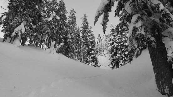
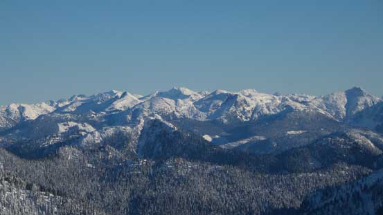
As much as we could see from the forest…
Al climbing up the first steep roll out from Deeks/Windsor col

Me climbing the same roll. Photo by Alan Blair
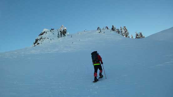
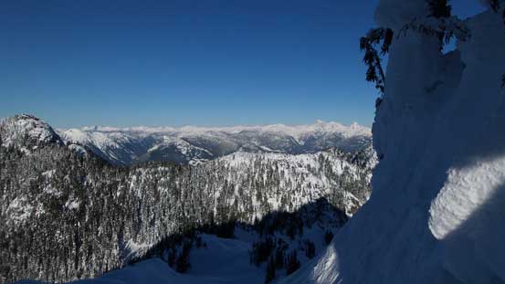
Now the views finally opened up! Capilano Mountain on right in foreground
Biting firmly on the surface utilizing our Lightning Ascents the 35-degree slopes were easily attacked head-on. The terrain levelled a bit and a flat bench dumped us below another steep rise and looking ahead we made the call to aim for a lower break. The snowshoes once again, bit firmly on the hard surface and were worn right to the ridge and then we turned left. I led the way cutting a few hard switchbacks up a short, but steep forested stretch and then Al took over the lead and broke trail straight up the final push. I had to say it’s a wee bit steeper than I was expecting before this trip. We were glad to have stable conditions and then it’s time to take a well deserved summit break.
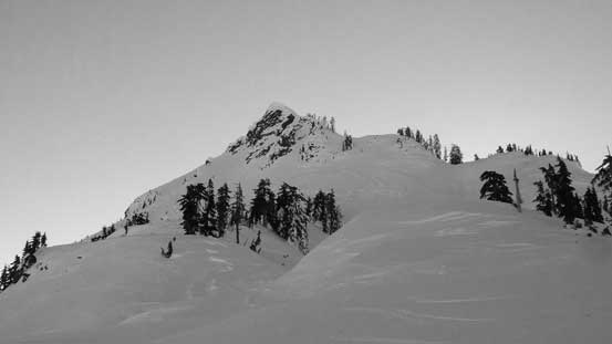
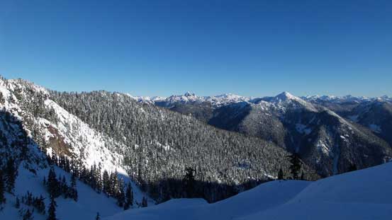
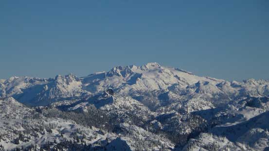
Our objective and the route ahead
Al approaching the upper ridge. Note the firm conditions here.

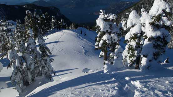
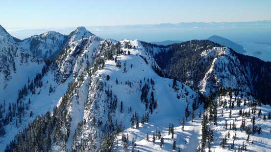
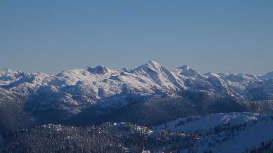
Looking back at Deeks Peak which’d be our next objective
Not a bad view at al!
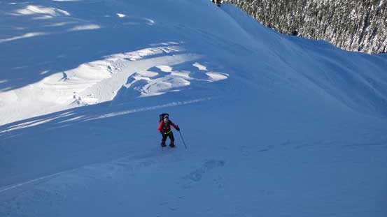
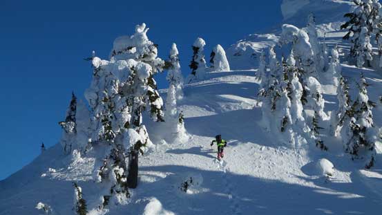
Going up another steep roll
Looking sideways across the steep forested stretch.

Topping out on another plateau now.
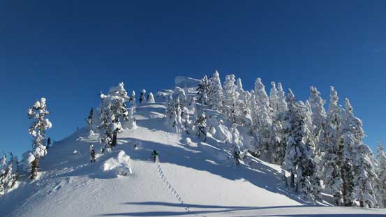
Al leading the way up the final push.
A closer look at Al breaking trail. It’s steep…
Looking down from halfway up the final push.

Summit Panorama from Mt. Windsor. Click to view large size.
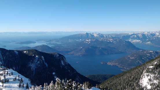
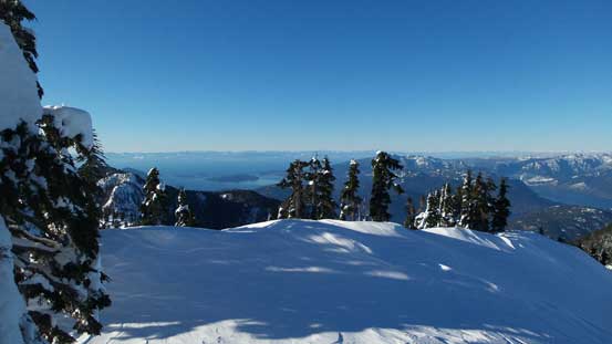
Looking down at Howe Sound
Looking down at Gotha Peak in the foreground with Hat Mountain behind
The N. Face of Brunswick Mountain

The N. Face of Mt. Hanover
Hat Mountain looks fairly interesting from this angle actually…
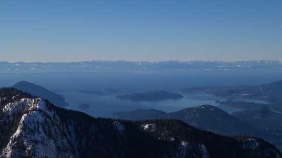
Looking across Straight of Georgia and the peaks on Vancouver Island were clearly seen.
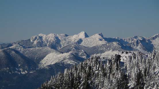
Tetrahedron Peak is one of the taller peaks along Sunshine Coast
Looking over the summit of Mt. Wrottesley towards the remote Tzoonie area
Looking northeastwards and Capilano Mountain in the foreground
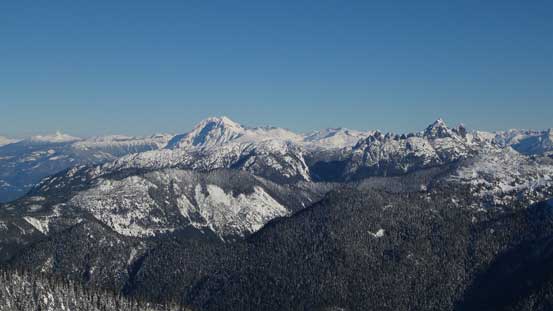
The bulky Mt. Garibaldi massif and the rugged Sky Pilot Group are always eye-catching
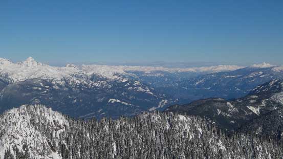
Looking up the Squamish Valley

A panorama of Tantalus Range
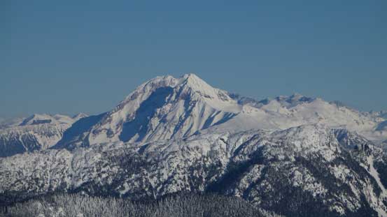
A zoomed-in view of Atwell Peak/Mt. Garibaldi massif

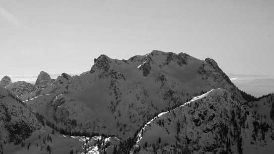
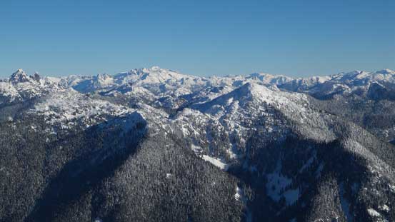
Cathedral Mountain the grand slog of the North Shore.

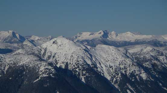
Mt. Sedgwick is now an interesting peak to access…
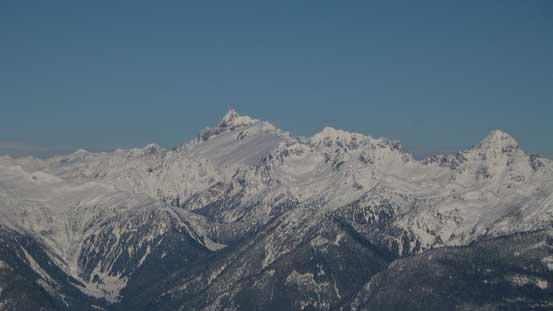
A closer look at Mt. Dione/Mt. Tantalus massif with Serratus and Alpha to its right

The Copilot, Sky Pilot Mtn. and Ledge Mtn. on the rugged Sky Pilot Group
Mamquam Mountain
Looking way towards Katzie Mountain massif by Stave Glacier
Meslilloet Mountain

Al and I on the summit

Another photo of our group shot on the summit of Mt. Windsor
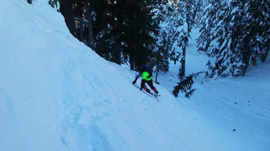
To our great surprise there’s actually very minimal wind on the summit so we spent at least a good half an hour soaking in the views, but eventually it’s time to move on as we still had a long ways to go. Plunging down the upper NW Ridge was fast and furious and once dropping into the shaded lower section it’s a different game. I decided to just take the snowshoes off and walk/post-hole down to the col as otherwise the hard surface would be too hard on the knees. At least without the ‘shoes I could just plunge.

Time to descend. Plunging down was fast and fun.
Back to Deeks/Windsor col now.
Now back to Deeks/Windsor col it’s time to take another break before preparing for an ascent of Deeks Peak via the connecting ridge. Regarding Mt. Windsor itself I’d definitely recommend as a winter ascent for the views but thank to the forested slog I don’t think many will come visit this thing twice.
