July Mountain
September 28, 2020
2124m
Coquihalla Pass, BC
July Mountain is a broad summit that locates immediately to the northeast of the “core group” Coquihalla Pass. The elevation is marginally lower than Vicuna Peak and Guanaco Peak but unlike the spires to the south, the standard route of July Mountain is just a hike. And with a 4×4, high clearance vehicle one can drive to within a couple hours from the summit making it one of the easiest hikes out there. The same route can also be done in winter on skis or snowshoes but one must plod 6 km on the road just to access the trail-head, as the logging roads aren’t plowed in winter.
It made perfect sense for me to tag July Mountain as a before-work exercise in the fall season when the logging roads were still snow free. Winnie agreed to join me despite the lack of technical challenge, as I assured her that we would have some good views of the Coquihalla spires. To make my work day less tiring we agreed to car-camp at the trail-head so that I could catch a few extra hours of sleep. In the previous day (Sunday) I had just hiked Gate Mountain with Alex. We made back to my home in White Rock at around 5 pm. All I did at home was taking a shower and repacking, which took about half an hour. I then drove my Tacoma to Vancouver to pick up Winnie, and then out eastwards we went. The drive to Coquihalla Pass took about 2.5 hours and the logging roads took about 40 minutes. We let the Gaia map to do the navigation for us. The roads were a bit rougher than expected with a few scary-looking water bars. One of them required me to get out to inspect, but turned out to be not a problem for my Tacoma.

July Mountain hiking route. GPX DL
The parking lot was unfortunately small and slanted that I had no choice but to pitch the tent on a slopy ground. But unlike on H’kusam Mountain we opted to orient the tent in the direction that our feet would face the downhill side. This orientation felt better, but still uncomfortable. I brought enough sushi and T&T food such that I didn’t need to cook the spicy ramen, but Winnie still needed her hot coffee. Packing the wet tents and sleeping bags took a while too, that we didn’t manage to start the hike until 8 am. The first part of the trail was on the deactivated extension of the logging road. After reaching the road’s end we followed the trail up through a few basins and across a few boulder fields to Drum Lake under the north face of our peak.

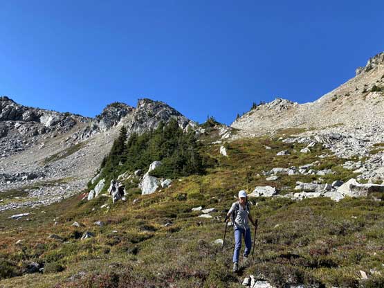
Winnie seemed very happy in this morning
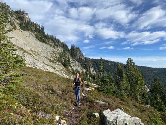
Upon arriving at the next basin. The views didn’t change much
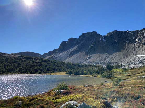
Near the shore of Drum Lake. We had to hop across some boulder fields
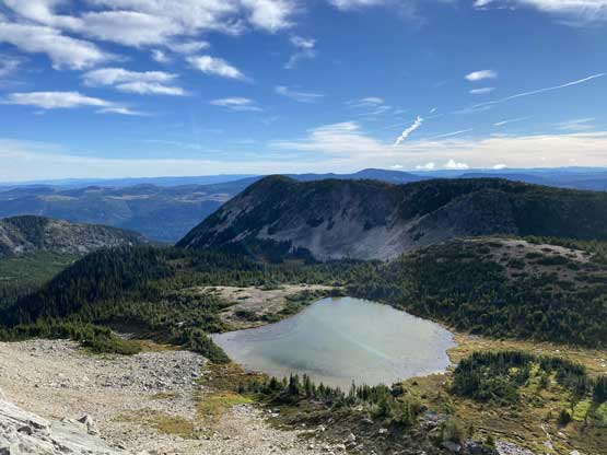
This is Drum Lake viewing from above
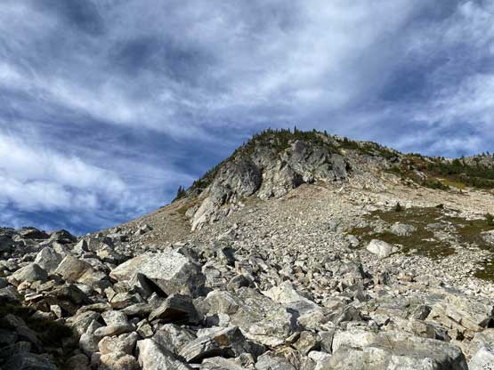
The section from Drum Lake to a col on the north ridge of July Mountain had some scree and talus but didn’t take us too long. Traversing the north ridge towards the summit had some confusing spots with micro-terrain, as well as some fresh snow. The summit was a little farther away than I thought, but the views were as good. The ascent had been ridiculously short so we earned ourselves an hour of stay on the top.
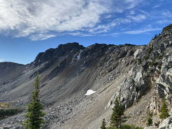
The north face of July Mountain
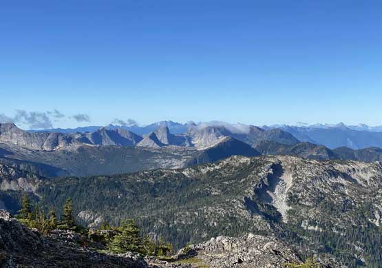
Upon hitting the north ridge we got our first view of Anderson River Group

“Juliet Peak” in the foreground

The first snowfall of the season!
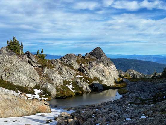
A cool little tarn on the summit ridge
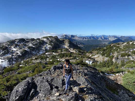
Winnie approaching the summit of July Mountain
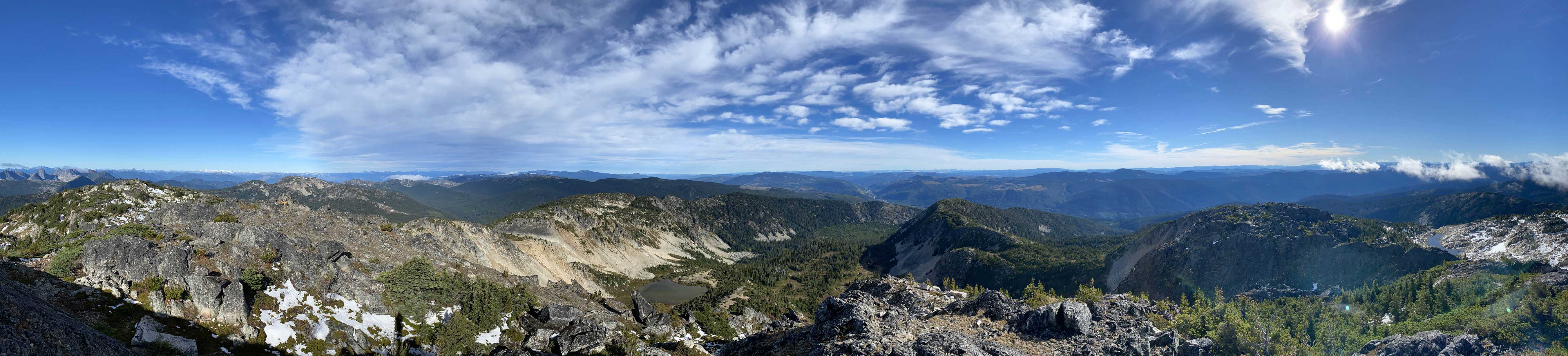
Partial Summit Panorama from July Mountain. Click to view large size.

Partial Summit Panorama from July Mountain. Click to view large size.
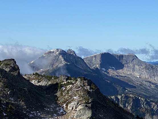
Guanaco Peak, Vicuna Peak (poking behind) and Alpaca Peak
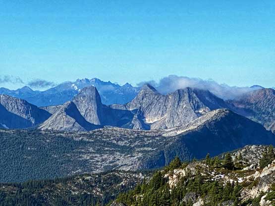
Anderson River Group – Steinbok, Ibex and Chamois from L to R

Mt. Breakenridge and Traverse Peak dominate the western skyline

Me on the summit of July Mountain
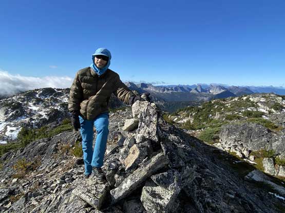
Another photo of me on the summit of July Mountain
There’s not much worth noting about the descent. We pretty much got down in a single push. We lost the trail briefly several times but with the GPS technology we soon regain track. The drive back home was long and exhausting. I had to take a short nap after finishing the logging roads portion thank to the lack of sleep.

Time to head down.. This is just one of the tarns on the summit ridge

Drum Lake looks better in the late-morning sun
Winnie descending from the north ridge down towards Drum Lake
The north face of July Mountain behind Drum Lake
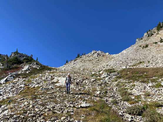
Winnie descending the typical terrain

This meadows would be beautiful in fall colours

It’s Taco time…
