Mount Merritt
August 27, 2019
3049m
Glacier National Park, MT
Mt. Merritt is the shortest of the six 10,000ers in Glacier National Park of Montana. It pokes above the 10,000 feet elevation by only 4 feet, but the view from the summit is supposed to be one of the finest in the entire park according to some fabled mountaineers in the area. This is one peak to be saved for absolutely clear weather. The standard route goes up the NE Ridge from Glenns Lake with technical difficulties not exceeding “class 3”, although taggin’ the highest point of the central summit requires an exposed 4th class notch. The only approach that makes sense is via Belly River from the Canadian Customs far to the north-east. It’s over 21 km of trail hiking to the basecamp at Mokowanis Junction and most parties would prefer to have at least 3 days for a summit bid. The same approach can also be used to ascend Mt. Cleveland, the highest in the park, and for folks aiming to finish the six 10,000ers it might make the most sense to combine Mt. Merritt and Mt. Cleveland in the same trip.
Adam, Connor and I hiked in from Belly River with primary objective being Mt. Cleveland but the weather was too good to not push harder on the first day. We had 4 days of food and the plan was to ascend Mt. Cleveland on Day 2 and then Mt. Merritt on Day 3, but we didn’t want to put too much fate on the weather forecast that far in advance. The first day had bomber weather and Connor and I wanted to bag Mt. Merritt right away. This meant 21 km of backpacking followed by 1600 m elevation gain on unpleasant terrain on Day 1, which is further followed by a 30 km, 2000 m elevation gain on the next day. This was very crazy even by my standard, but I figured if Mt. Merritt can come down in this trip then I’m pretty much set to finish the six 10,000ers, so let’s push hard. Adam didn’t want to do Mt. Merritt in favour of saving energy for Mt. Cleveland, so it was only Connor and myself going up in the afternoon. We didn’t manage to leave Mokowanis Junction campground until 1:30 pm, later than expected.
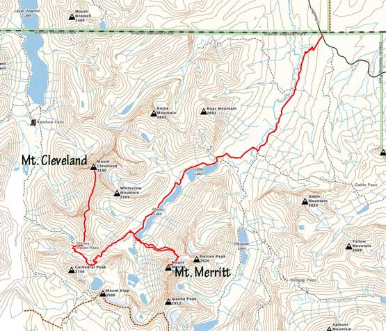
Mt. Merritt and Mt. Cleveland via Belly River. GPX DL
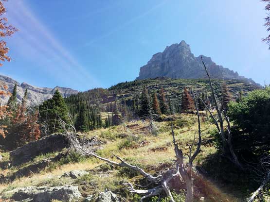
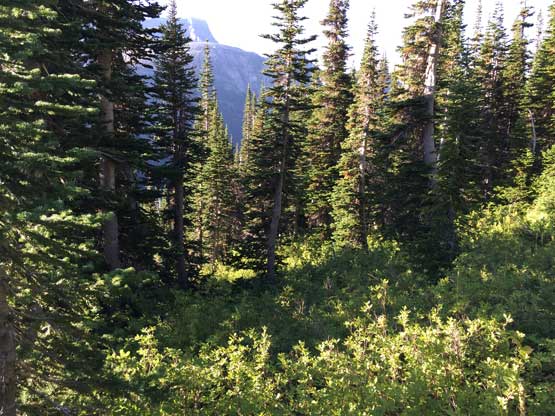
The traditional route starts from Mokowanis Lake but we had Steve Sheriff’s GPX track loaded from peakbagger.com. I don’t know Steve Sheriff in person, but based on his resume we would assume he’s a local peak-bagging legend, so we trusted his beta more than the guidebook’s. We followed the GPX track leaving the trail right next to Glenns Lake into what’s supposed to be “open forest”, aiming up and diagonally to the left. The objective was to reach a treeline basin, 600 m higher on the north side of Mt. Merritt. The bushwhacking wasn’t bad by Glacier National Park’s standard with lots of open terrain and only occasional dense brushes. We unintentionally veered off Steve Sheriff’s GPX track farther to the climber’s right. We assumed that he must have scrambled up some open, 3rd class mossy cliffs but after finishing the scrambling we realized the track actually traversed a long ways due left. This was perfectly fine as we just had to figure things out on our own now. The route we took actually involved less bushwhacking, but dumped us higher than expected. Not wanting to lose too much elevation we opted for a long ass side-hill traverse above the bowl on either treadmill or compact scree. This was a frustrating mistake that costed us lots of energy.
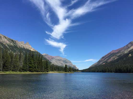
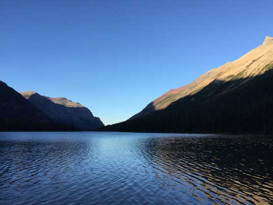
Glenns Lake at the start of the route
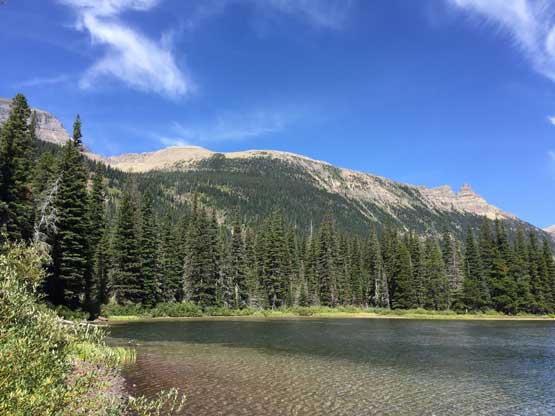
Another photo of Glenns Lake
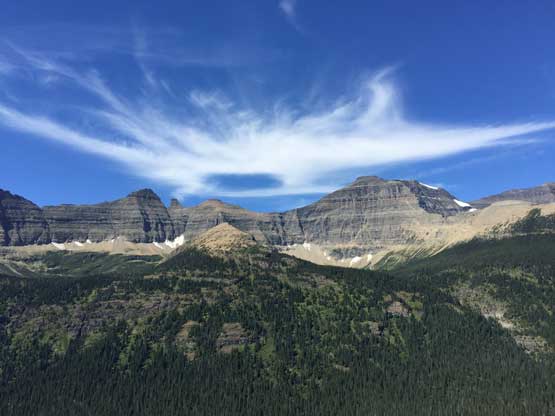
Looking at Mt. Cleveland and Stoney Indian Peaks as we gained elevation
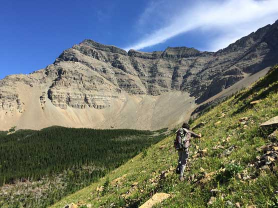
As you can see, the bushwhacking wasn’t too bad at most places
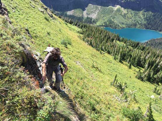
Connor scrambling up an open slope of steep grass
Me scrambling with Mokowanis Lake and Pyramid Peak behind.
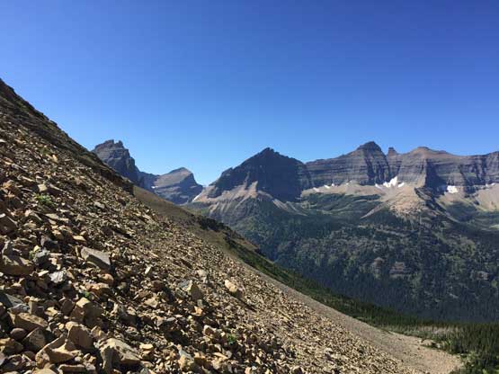
Looking back down Mokowanis Valley with Kaina Mtn. and Bear Mtn. behind
Connor traversing steep grass to side-hill into the bowl
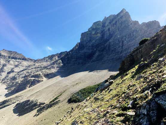
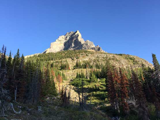
A long ass stretch of side-hilling ahead… Mt. Merritt looming above
Traversing Rockies treadmill scree…
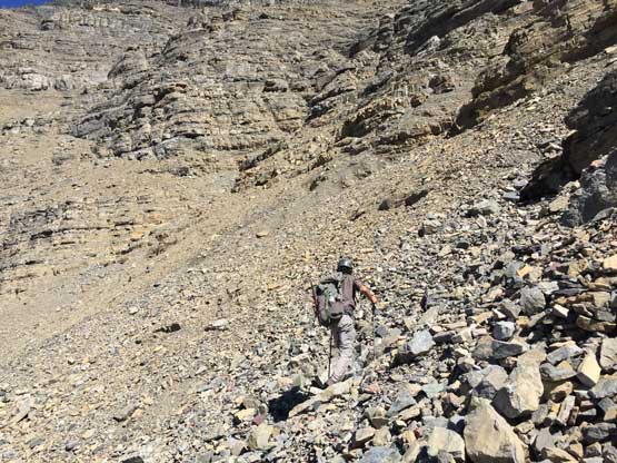
At last we finished the unpleasant scree traverse and now we had to gain 600 vertical meters to a high col under the NE Ridge of our objective. Much of this stage looked downright shitty and it sure didn’t disappoint us. The terrain was the typical Canadian Rockies choss but with route-finding we managed to stay within “class 3-” terrain the whole way up. There were multiple ways and we just picked what appeared to make the most sense. What surprised us was fresh grizzly tracks and poops. We knew from other trip reports that grizzlies frequent the higher ground in this part but what the heck are they doing up there… In any case, Connor led the pace and I pushed as hard as I had ever forced myself, and we crushed the 600 m of scree in under 50 minutes.
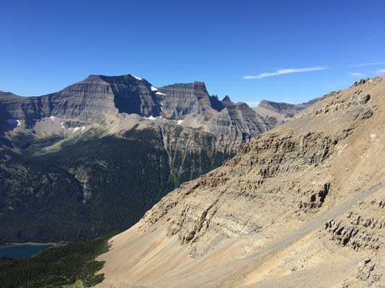
Partway up the scree slog, looking back at Mt. Cleveland
A microscopic section of the scree…
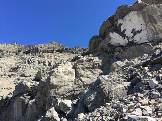
This is the typical terrain on the 600m scramble to the col…
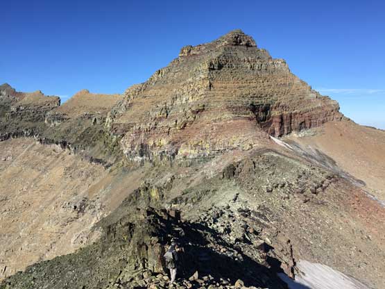
At the notch we took a short food break, ditched some food and water and resumed the ascent. The wind picked up and we were cold from the sweating, so better moving. The ridge started out pretty easily with great views across Old Sun Glacier to the east. After 100 or so vertical meters the ridge became more scrambly and we had to always detour to the climber’s left side on narrow ledges in search for a scramble route. The scrambling again, never exceeded “3rd class” but we did have to pay close attention to route-finding. Much of the upper ridge was ascended on the climber’s left side above Old Sun Glacier.
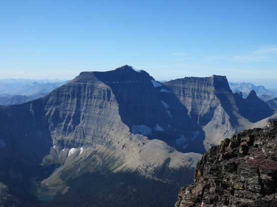
The east side view from the ridge towards Apikuni Mtn. et al.
This is looking over Old Sun Glacier towards east
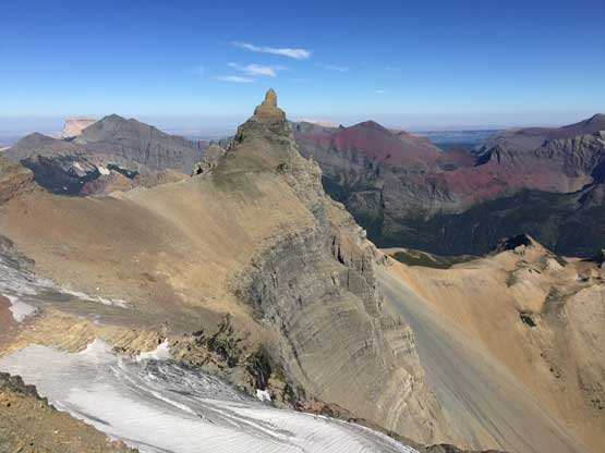
Natoas Peak is such a striking sub-summit of Mt. Merritt massif
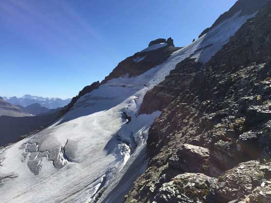
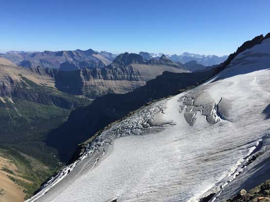
Another photo of Old Sun Glacier
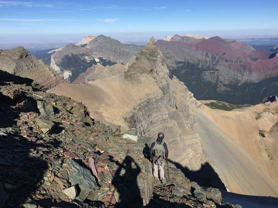
Once the ridge petered out we decided to check out the central summit first. The central summit is reported to have the same elevation as the north summit so in order to safely claim this peak we had to bag both. Getting to the central summit required more side-hilling on scree ledges followed by a stretch of “class 3” scrambling. We made to the summit cairn, but noticed the southern ridge extension was clearly higher, but was separated by a troublesome notch. It appeared that we couldn’t detour around to bypass the notch, but the notch itself also didn’t look impossible. Once “in it” the notch was a “go” – exposed and very loose 4th class. Down-climbing the opposite wall on the way back required lots of care about loose holds but didn’t impose much of a problem. We then went to the north summit for completion, and from visual inspection we both agreed that the central summit “appeared” higher.
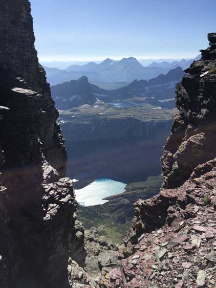
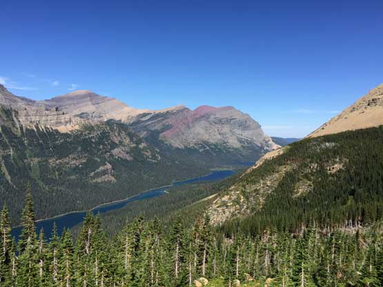
This is a view at Margaret Lake from a notch on the ridge
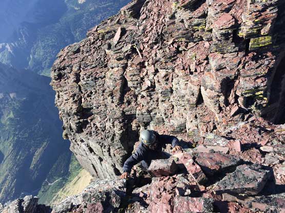
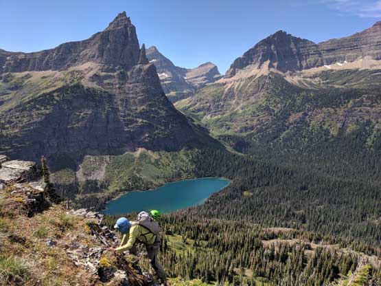
Connor coming out of the 4th class notch to the true summit
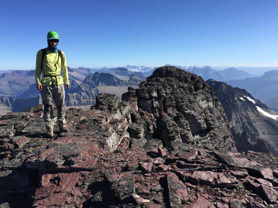
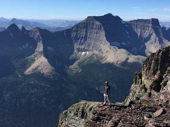
Me on the summit of Mt. Merritt
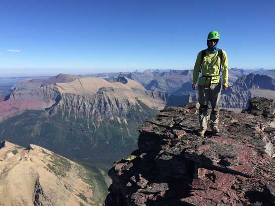
Another photo of me on the summit of Mt. Merritt
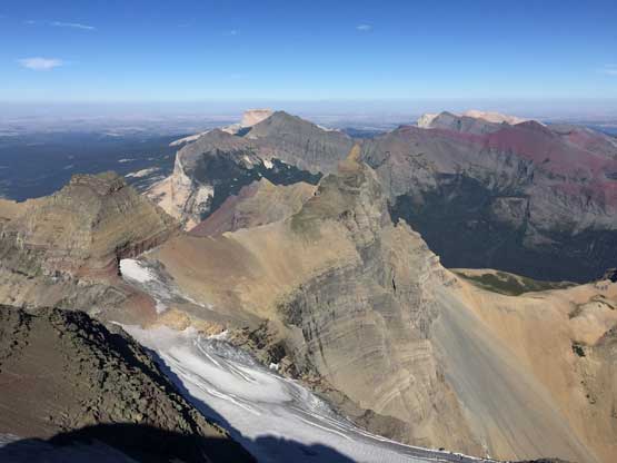
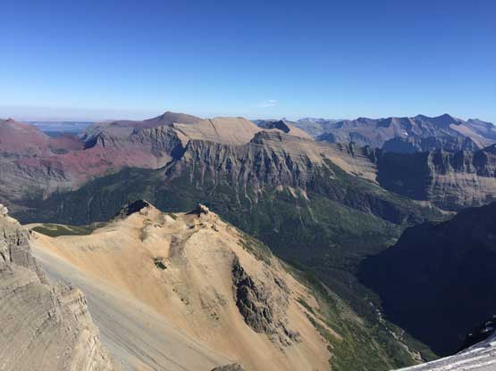
Looking back down over Old Sun Glacier, Cosley Ridge and Natoas Peak
Mt. Kipp and Cathedral Peak in the foreground; Vulture, Rainbow and Kintla behind
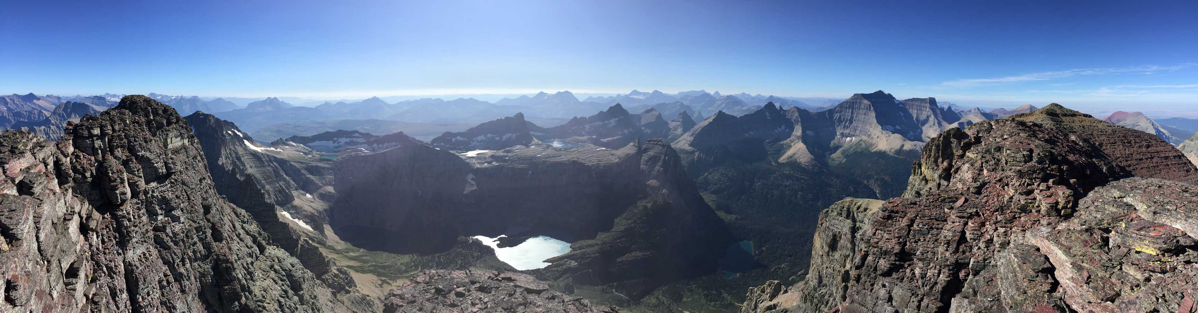
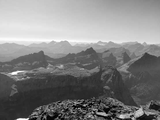
Partial Summit Panorama from Mt. Merritt. Click to view large size.

Partial Summit Panorama from Mt. Merritt. Click to view large size.
Connor posing in front of Mt. Cleveland

Me down-climbing the 4th class notch. Photo by Connor M.
Connor scrambling up to gain the north summit
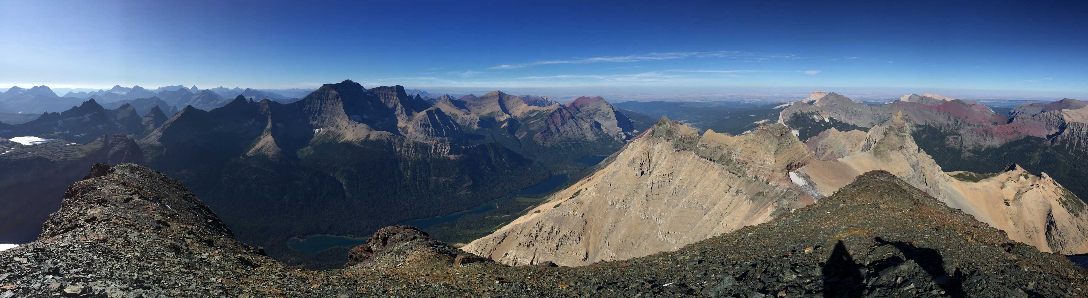
Summit Panorama from the north summit of Mt. Merritt. Click to view large size.
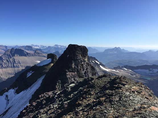
Looking back towards the central summit, which we believed to be higher
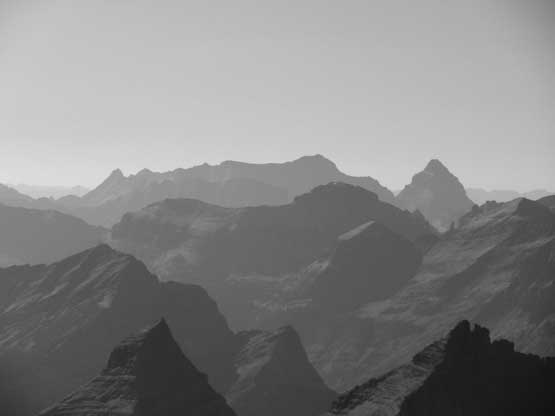
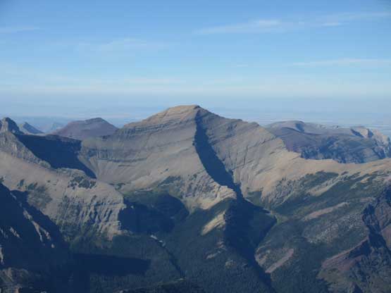
A southern view towards Mt. Siyeh
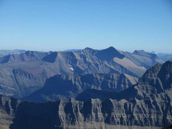
Mt. Stimson far to the south, second highest in the park
Kintla Peak and Kinnerly Peak far to the west
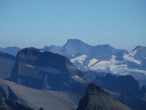
A closer look at Mt. Cleveland the grand prize of this park

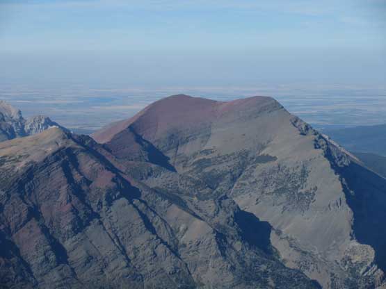
Chief Mountain to the east. That was my first ever summit in the US
Bear Mountain
Kaina Mountain
Our new goal now was to get back to camp as fast as we could, so down we went. We agreed that Connor would lead the choss while I would take over the lead in the bush. Descending Rockies choss was the only type of terrain that I could marginally keep up with Connor but I had to work as hard as I could, running easy scree ledges and jumping some short steps. While pushing for speed we did have to pay close attention in route-finding as none of us paid much attention about “looking back” on the ascent. We had to consult with GPS multiple times, but in short time we were back to the col, where we took another (longer) food break mostly because I needed some energy. The 600 m descent into the bowl wasn’t entirely on scree so we couldn’t just run it, but still, we were off the choss in half an hour. Into the bush we agreed to explore Steve Sheriff’s GPX track in order to avoid down-climbing that mossy scrambling section. The track’s route definitely had more bushwhacking, but given the downward direction we didn’t really care. The forested descent did seem to drag on and on and on with at least 100 checks of my GPS, but eventually we made back to Glenns Lake and another 15 minutes later we were back to camp.
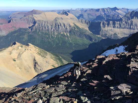
Connor descending the NE Ridge
Almost back to the col between Mt. Merritt and Cosley Ridge

Descending the typical terrain for 600 m down from the notch

We were glad to have this stream of water
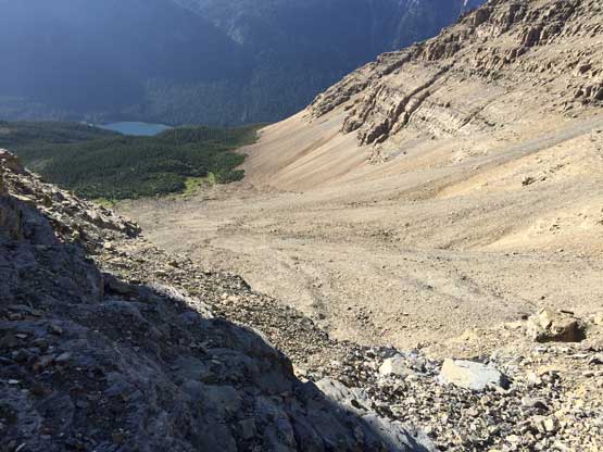
Lots and lots of (compact) scree… It was awful…
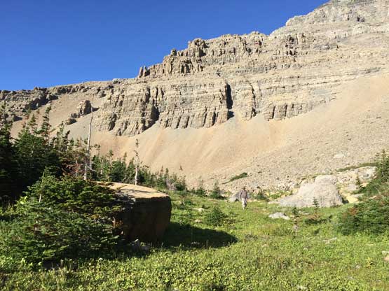
Finally back to the green zone.
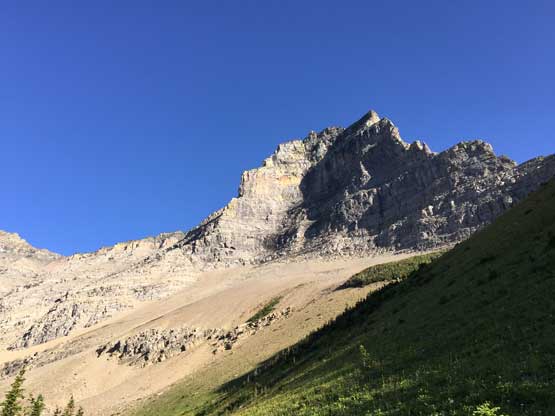
Looking back at Mt. Merritt
Into the bush we went… It was much better than the south side of the park
Another photo of looking back from the woods
Down to Glenns Lake now.
Our round trip time was about 6 hours that Adam was surprised we were back by just dinner time. The prize I paid was a complete exhaustion but given my stubborn mind I knew I would make Mt. Cleveland one way or another, on the following day. Mt. Merritt turned out to be a typical Rockies scramble with great views, and lots of choss.
