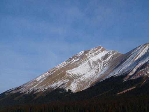
Mount Drummond
October 4-5, 2013
3149m
Eastern Banff Park – Drummond Icefield, AB
Early October is a tricky time of the year to pick suitable climbing objectives and this year isn’t an exception given how much snow we’d already got at higher elevation. But knowing ahead that the next peak would be my 250th summit, and given the superb weather forecast for Friday, I was keen on a bigger objective. After throwing out my thoughts to a couple friends, it was eventually Eric and I planning an aggressive 2-day ascent of Mount Drummond, a peak buried deeply in the front country of Banff N. Park. This area sees some visitors in winter as the nearby Drummond Icefield offers some interesting ski touring but in general, few people come here for alpine ascents. Given the fact it’s a big and prominent mountain visible from many peaks in Skoki, I’d expect more visitors, but in fact, only 4 parties had signed the register since Rick Collier placed it in 1994.

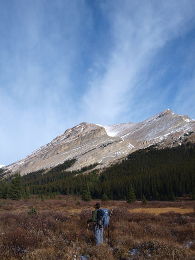
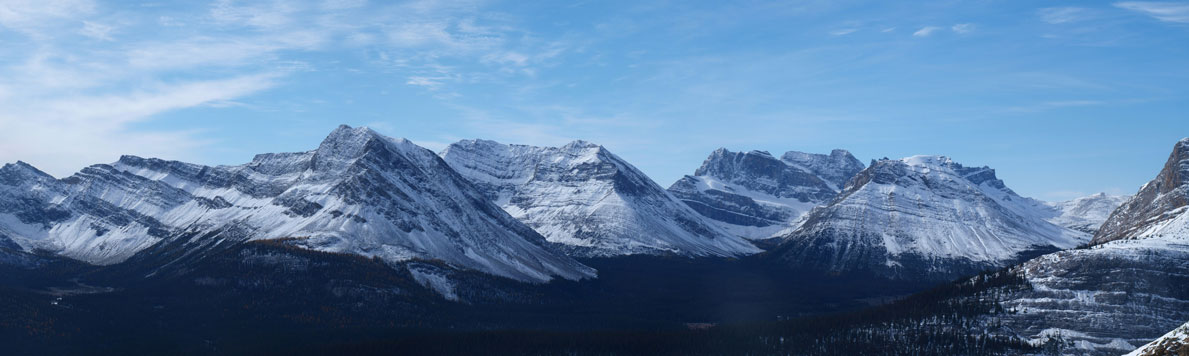
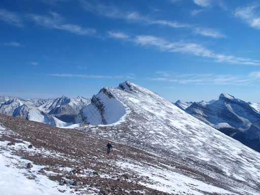
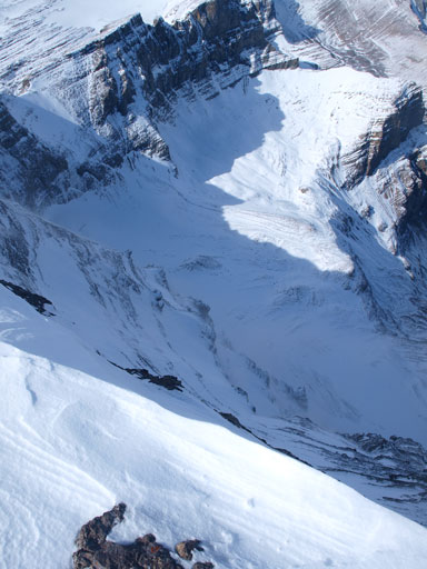
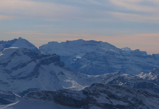
Mt. Drummond ascent route via south gully
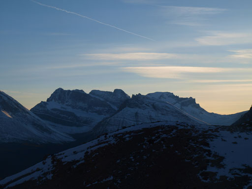
I took a good photo of this peak from the ascent of Oyster Peak last year and it appears to be “right-there” and straightforward. But it’s farther than it appears and getting there is a near-30km trek through the Skoki wonderland. Despite 99% of the approach being on well-maintained trails, it’s a bloody long way in. Ideally this would be a perfect 3-day objective, but combing everyone’s working schedule and the weather forecast, we were “forced” to push it into 2 days. Given the superb forecast for Friday but questionable for Saturday’s, we’d like to fully use the good-weather day (summitting on Friday). We were not able to leave Edmonton until 7:30pm at Thursday evening, and that meant we could not start our day till midnight. Oh well.
Utilizing the same technique as our Victoria Cross Traverse, we’d start right away once getting to the trail-head. It’s 12:10 at midnight with millions of stars above, and off we went. For obvious reason I didn’t take any photo on our way in and the sequence of our first 5 hours went like this:
- Hike up Temple Lodge Road
- Hike pass Hidden Lake turn-off, and up and over Boulder Pass
- Up and over Deception Pass
- Down towards Skoki Lodge and missed the hiker’s turn-off and ended up on a horse trail
- Back-track to find Jones Pass turn-off
As expected there were already plenty of snow but it’s not too deep to slow our progress down. And judging by the amount of human and horse traffics, it’s not winter in Skoki Lodge yet so we had little problem following the trail and tracks. We did miss a branch and ended up doing a couple sketchy creek crossings on a horse trail. And by following this horse trail we ended up at Skoki Lodge so we backtracked a couple hundred meters to find the correct turn-off. It was almost 5am and we were very sleepy so we decided to catch up a couple hours’ sleep first. It was a super cold night though.
We woke up at 7:30am. It was so cold that I didn’t want to eat/drink any (cold) food/water and I just wanted to warm up quickly. After packing up we were soon over Jones Pass and down towards Red Deer Lakes. At Red Deer Lakes Campground (SK19), we decided to ditch our overnight gears since it appeared obviously that we could get back here after summitting Mount Drummond before dark. Well, never trust foreshortened view though… The trail led us crossing the flats and during which we got great view towards Hector and Andromache. I believe not many people have seen Andromache from this side.

Wall of Jericho
Cyclone Mountain

Mount Andromache
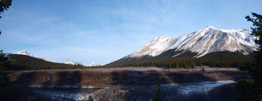
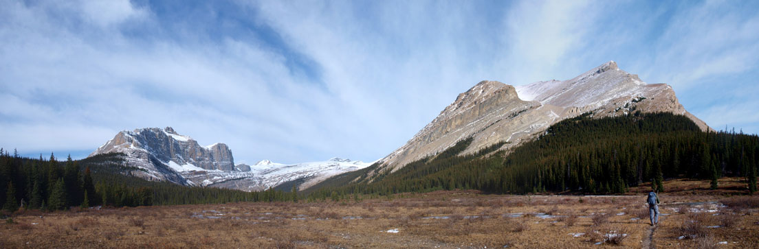
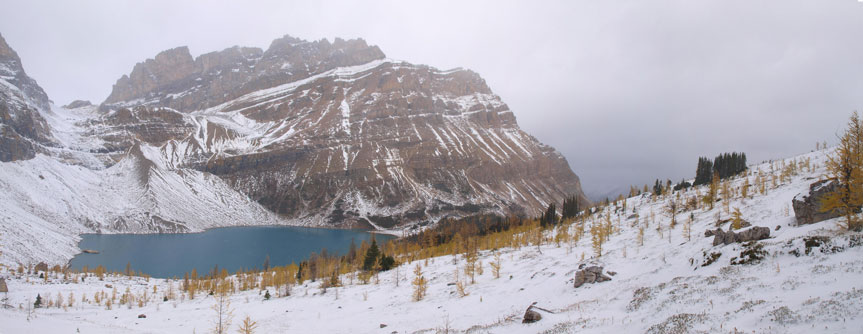
Panorama of the Red Deer Lakes flats
Another panorama from the flats, showing Fossil Mountain and Skoki Mountain
After 1km leaving the campground we joined the Red Deer River Trail which was in a much better shape than expected. Judging by the popularity of this area I was expecting a very bushy and overgrown trail, but apparently I forgot the horse traffic in this area. We passed through a horses’ yard and a cabin, and then the next 5km or so down Red Deer River Trail was as boring as one could expect. There was pretty much no view at all until Shingle Flats and that’s where we gonna leave the trail. It also kept going downhill forever and though we were not complaining now we knew we’d gain all of them back later in the day… Shingle Flats is where the Drummond Icefield’s outlet stream drains Red Deer River. We followed the Drummond Stream up and crossed it at a braided section without wetting our boots.
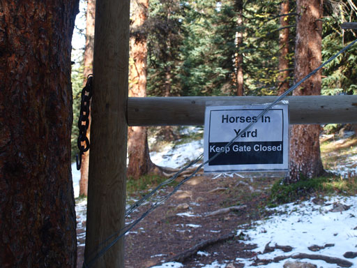
We went through a horse yard

Typical hiking on Red Deer River Trail
Finally arrived at Drummond’s base

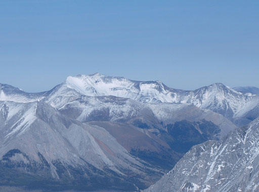
The impressive East face of Pipestone Mountain
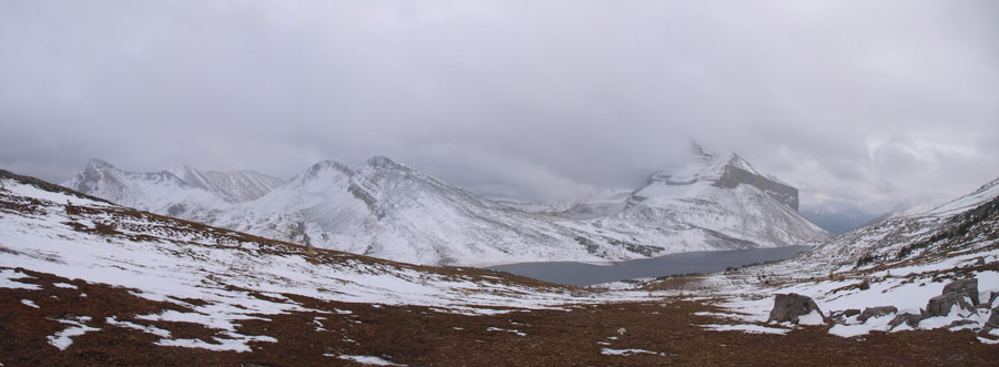
Panorama view from Shingle Flats
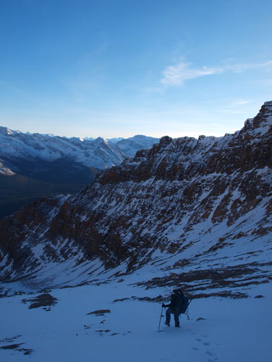
There’s a broad avalanche gully farther up the stream but we weren’t patient enough so started bushwhacking earlier than needed. Some moderate bush (willows and alders) punished us but thankfully it was relatively shortly lived. We went towards climber’s left and existed the bush into a small gully and followed it up towards a high alpine basin, and that’s where the real grind started.
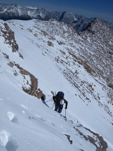
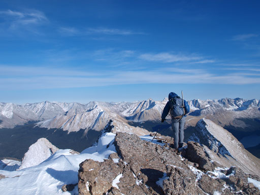
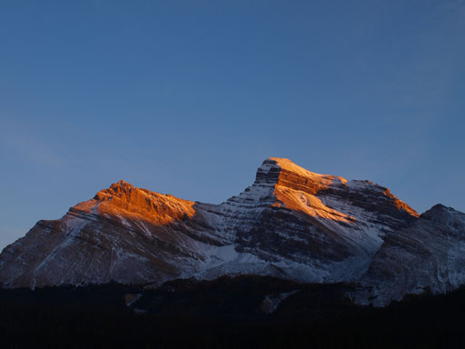
The next part was grinding up a gigantic (foreshortened) avalanche gully to the false summit, at 700 vertical meters above. It’s a true test for our mental endurance. There was boot to knee deep post-holing at sections but overall the snow wasn’t too bad. Higher up we ventured to climber’s right hoping to avoid more post-holing but then we had to deal with snow covered boulders. It was almost “there” so we just sucked it up. Soon we were out of the boulders and staring at the false summit. A short snow traverse brought us to its top where were treated by mind-blowing views towards each direction, and also, the brutal wind that forced us to take out all layers. I was very glad I bought a huge parka for this trip.
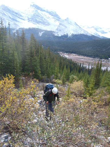
Grinding up the lower gully. Just came out of the bush
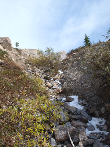
The lower gully

Pipestone Mountain

There was some post-holing in this gully

Arrived at the basin. Upper gully ahead. It’s very foreshortened…
Panorama view of Oyster Peak, Fossil Mountain, and Skoki Mountain

After a long time of slog, it came the snow covered boulders
Negotiating a steep step
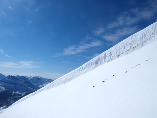
A cornice is forming on the false summit
Eric coming up the false summit
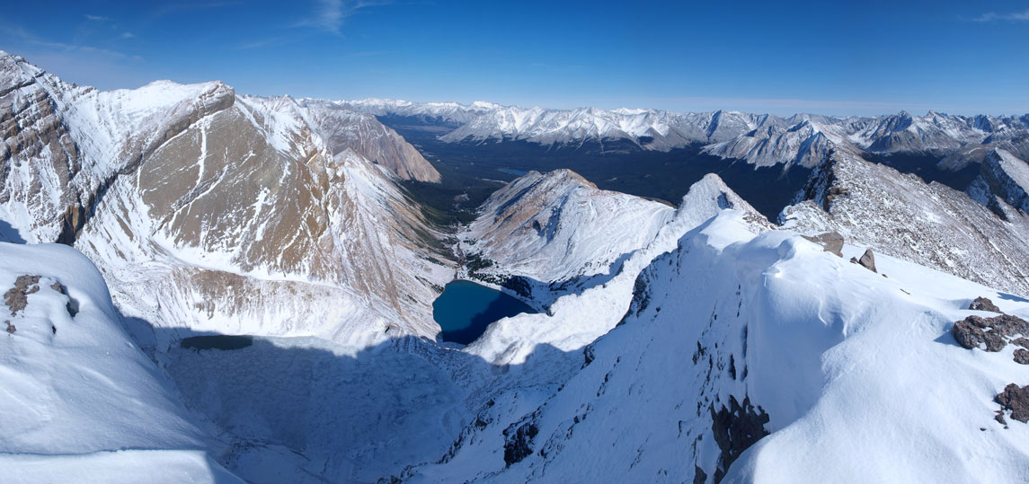
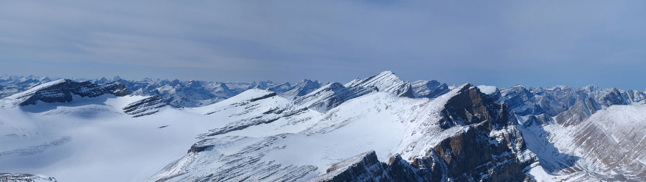
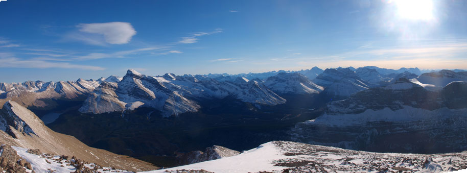
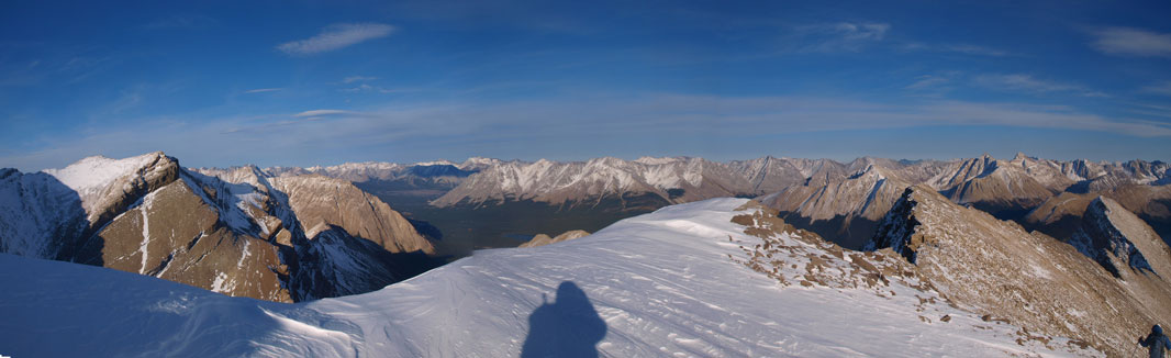
Panorama view from the false summit.
Another panorama from the false summit, showing the Drummond Icefield

Panorama of Drummond Icefield

Mount Hector
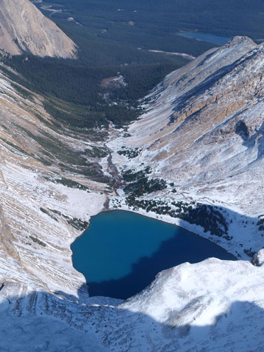
Drummond Lake

Still a long way to the true summit
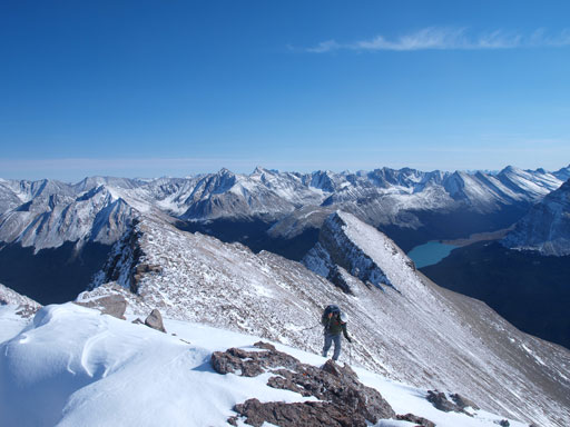
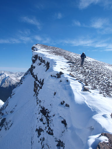
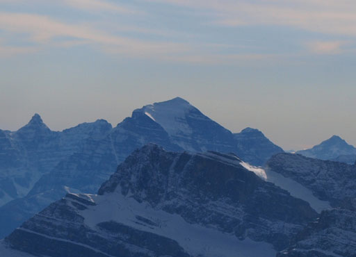
The traverse to true summit looked easy and straightforward, but it’s a long way there.. Firstly we had to lose elevation along the summit ridge while battling against the wind. Up the other side, we traversed climber’s left to avoid a steep section, and then, it’s simply a matter of putting one foot in front of the other, but, it’s a bloody long way up. The slope would never come to an end… By the time we finally reached the top we were already higher than all other peaks on the Icefield. The views were again, breathe-taking. We also got some photos of rarely seen peaks like McConnell and Wapiti. Due to the brutal wind we couldn’t stay long on the top, so after signing the register we were hurrying down. It was also getting late and we wanted to be off scrambling section before dark.
Descending from the false summit
Leaving the false summit behind

Summit Panorama. Click to view large size.

Eric coming up the true summit
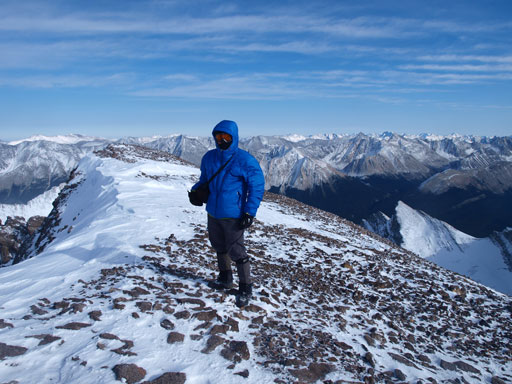
Me on the summit of Mount Drummond

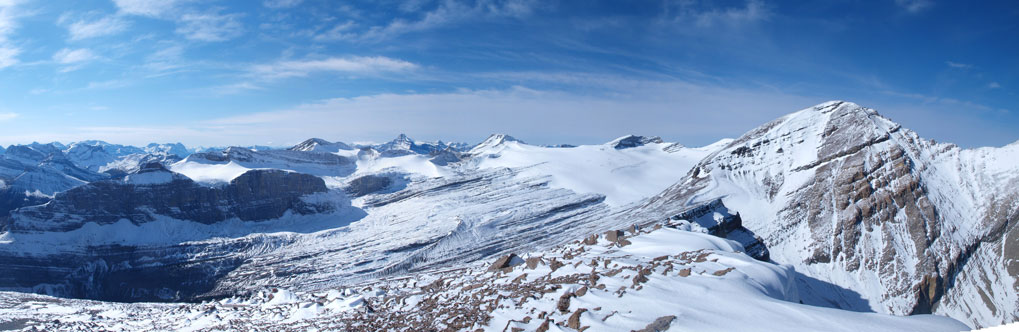
Panorama of Drummond Icefield, with Mount Hector behind
Panorama of Drummond Icefield, with Cataract Peak behind

Panorama view of Mount McConnell

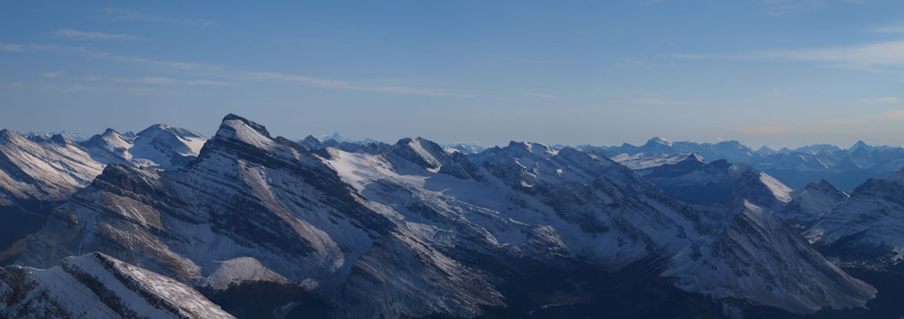
And, panorama of the NE side. Prow Mountain at center in the foreground

A range of unnamed peaks East of Valley of The Hidden Lakes

Panorama of the familiar giants in Lake Louise, with the Skoki scrambles in front
Panorama looking south. Mt. Douglas on left

Impressive cliffs
The East side is a straight drop-off!
Hector

Cataract
Wapiti
Gable and Barrier
Victoria
Temple
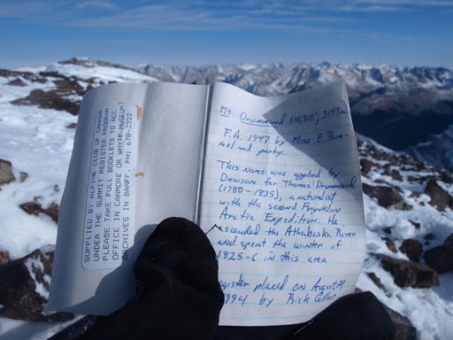
Rick Collier placed this register in 1994

Two separate parties went up here in 2006 and 2007

And then, it’s Liam’s group in 2011, and that’s it!

Panorama from the summit again. Click to view large size.
As the sun went lower we got better and better view of Mount Douglas. It was in front of us for pretty much the entire descent! Once in the big avalanche gully we utilized snow for as much as we could as it offered easy plunging-step. Back into the wood, we stayed in the major drainage and avoided most of the bush except for the last 20 meters where we had to wack through willows. This line was much better than our ascent line. We made back to Shingle Flats just at the last evening glow on Douglas. The slog up Red Deer River Trail went on forever. It was eventually too dark to see so we took our head lamps out. And then another few kilometers’ marching brought us back to the campground. It was already 9pm and after having a well-deserved dinner we went to bed. It was not as cold as the night before and we got a much better sleep.

Drummond Icefield from the false summit
Panorama from false summit before starting the descent
Eric on the false summit
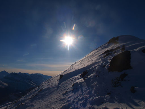
The sun glare

Leaving the false summit behind
One last panorama before leaving these views behind..

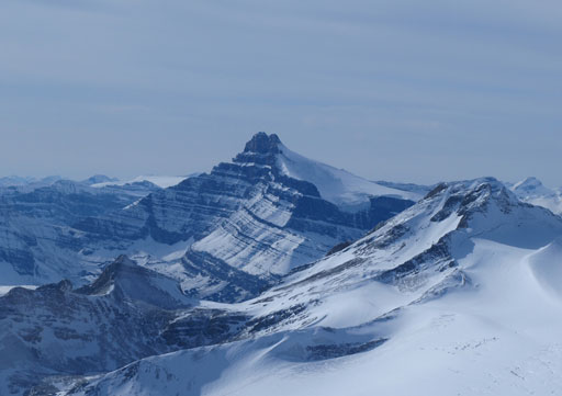
Mount Douglas
Plunging-step down the gigantic gully

Interesting view from the gully
The Skoki’s Trio – Ptarmigan, Pika, and Richardson

Mount Douglas

Evening glow on unnamed peaks
Evening glow on Mount Douglas
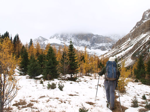
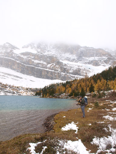
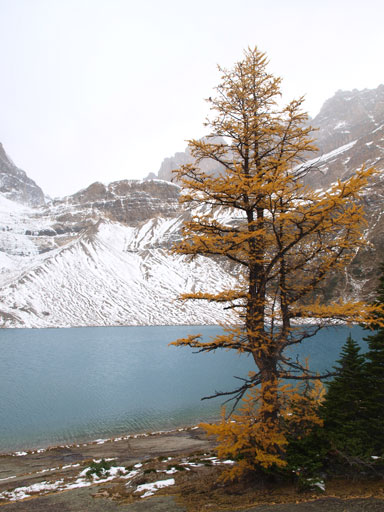
At 8am Saturday morning we woke up under grey sky. Oh well, our job for this day was simply hiking back to the parking lot so there was little to worry about. Looking back we could see Drummond area being soaked in already.. Up and over Jones Pass, we decided to check out Skoki Lodge. It wasn’t open to public in the morning but the stuffs were kind enough to let us in and we had some nice and warm tea and coffee. We also spent some time checking the books and journal entries. We did find something interesting – the highpoint on the NE end of Merlin Ridge is named as Silver Tip Peak. Back to the winder wonderland, we decided to take Packer’s Pass out instead of Deception Pass in order to see the two Skoki Lakes, Myosotis and Zigadenus. The larches were on their full force (to our surprise) and this variation proved to be a much better choice. The two lakes were simply amazing even with bad weather. There was also a short scrambling section through a chimney to get to Myosotis Lake. That’s the only (on-route) hands-on section for our entire trip and was pretty fun. At Zigadenus Lake we found a lovely spot and took a lunch break. It’s so beautiful that I’d wish to spend some times soaking in the sun at this area, definitely.

We gave Skoki Lodge a visit
Then we picked the unofficial trail towards Packer’s Pass

The larches were out on full force!

Larches and snow!

Scrambling up a chimney to get to Myosotis Lake

Interesting view from the chimney

Panorama of Skoki Valley

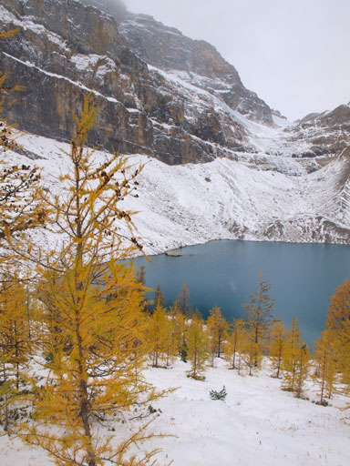
Myosotis Lake
Hiking on Myosotis Lake’s right hand side

Some fun scrambling (not necessary if staying high)

Fun scrambling
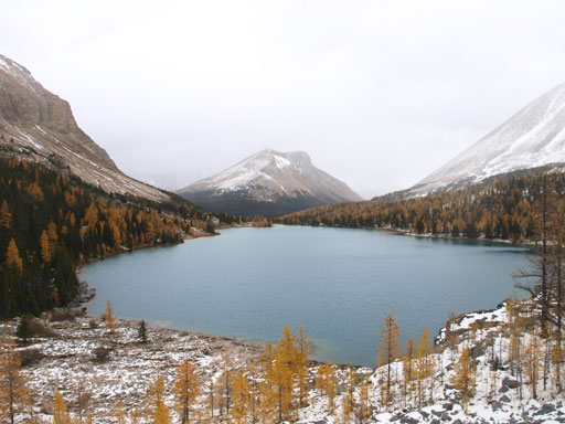
Looking back towards Myosotis Lake
A lone larch and Zigadenus Lake
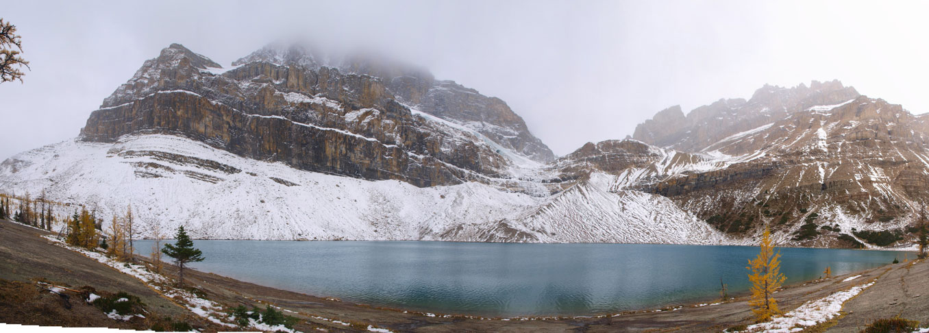
Panorama of Zigadenus Lake from our lunch spot
We picked a set of fresh tracks up and over the windy Packer’s Pass. The two guys setting the tracks went up the little peak between Packer’s Pass and Deception Pass. Given the weather we didn’t have any desire to go up there so went down the other side immediately. Back to the main Skoki’s trail we followed it leisurely back to Temple Lodge Road. A party of three caught up from behind and informed me there would be a pick-up at 3pm. It’s 2:50 so we decided to wait for this free-ride. This service is for the folks in Skoki Lodge but they also allow others to take the ride. What a gift!
Looking back towards Zigadenus Lake

Snow covered trail towards Packer’s Pass
Panorama looking back.
At the windy Packer’s Pass, panorama view of the other side

Redoubt Mountain and Ptarmigan Lake
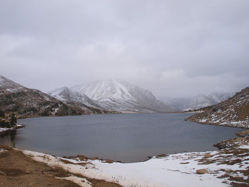
Ptarmigan Lake

Up and over Boulder Pass, panorama view of the other side.
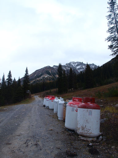
Back to Temple Lodge Road. How many bombs here?!
Thankfully the Skoki Lodge’s bus gave us a ride down!
Overall, it was an awesome trip again. It’s already the shoulder season and I’m very glad that we still can do big trips like this. Mount Drummond is a long grind, both the approach and the ascent itself. But on a clear day, the views are amazing and it definitely worth the effort.

[…] peak there is pretty good beta available for Mount Drummond. Rick Collier, Graeme Pole and Steven Song all have reports that are useful despite the fact that we were only the 8th signees in the […]