Adder Mountain
August 2, 2021
1507m
Vancouver Island, BC
Adder Mountain is one of the easier-to-access summits directly off Highway 4 that connects Port Alberni to Tofino but the trick is that one must own a reliable 4×4, high clearance vehicle with good tires. The logging roads above Sutton Pass are deactivated with tens of water bars and sections of very rough conditions. When Alex, Vlad and I decided to hop onto the island in this August long weekend this was not part of the original plan, but after completing the group of peaks near Mt. Albert Edward we were too tired and burnt out to do anything major. I recalled a post from Francis Bailey on the “SWBC Peak Baggers” Facebook page as well as his site that he did Adder Mountain as a simple add-on scramble while travelling from Vancouver to Tofino so after some researching we all thought this would be a decent objective. We could not download his GPS track because none of us uses AllTrails, but with some additional research we were confident to be able to figure it out ourselves in the field.

From Courtenay to Sutton Pass would take us over 1.5 hours so we immediately hit the road after dinner. I was already tired from the two days’ of deach-marching but did manage to pull off this drive without having to call for a break. At the pass we correctly located the logging road and the road condition sure reflected Francis’ words. We came here expecting a bad road and it was bad, so upon seeing a real bad section about three quarters of the way up I just switched to 4Low and crawled it up, even in dark. I eventually managed to drive to the very end of the road and there was enough of flat ground to pitch out both tents. We were able to sleep by 10 pm and that was not too bad.


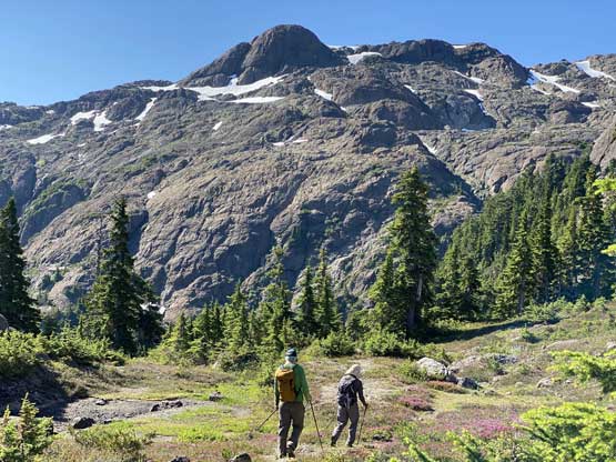
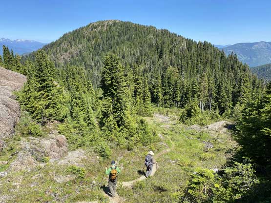
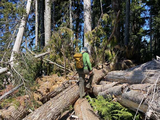
The next morning we slept in until someone else showed up. It was a long weekend Monday so we expected some traffic on this hike. We eventually started right after the other group and right off the bat we got confused. Apparently there were some recent dead-falls to obscure the section of the trail that made a steep descent into the creek. We missed that spot and followed some flags and (less defined) paths ascending too high on the left (east) side of the creek. Thankfully I had a habit to check GPS often such that we were able to correct the mistake without significant detouring. Once rejoining the main trail we had no further problem following towards a saddle feature a couple km north of the summit. The terrain was still “below treeline” but we started to encounter patches of open areas as well as some optional scrambling on bluffs, which is typical on Vancouver Island.


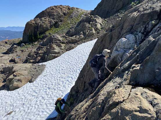
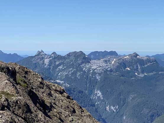
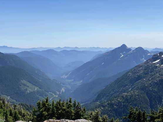
We were not too far away from the open alpine at this point and once there we had lots of different route options to choose. We made our own variations here and there but generally speaking we stuck to the beaten path all the way to within 200 m vertical from the summit.


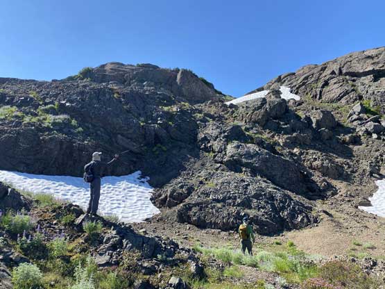
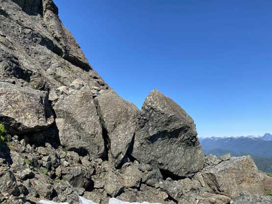


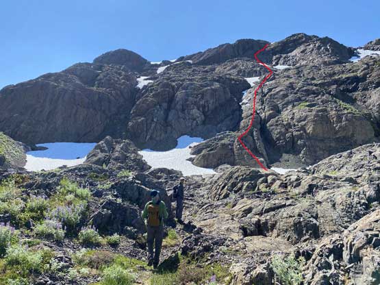
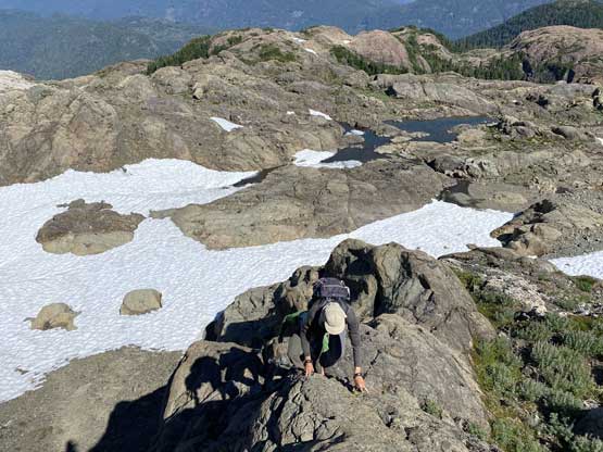
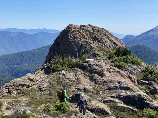
At the base of the summit push we looked around and Vlad pointed out the option to “scramble straight up the north flanks”. I thought his idea had the potential to be fun so agreed. While at the base of it I said if we really wanted to make this a challenging scramble then I had to stick to the nose of the prominent rib, which had a short section of low 5th class climbing at the bottom. I free climbed it while the others scrambled up some 3rd to 4th class rock not too far from my line. After that we enjoyed a long stretch of 3rd class scrambling to a small snowfield under the final summit push. I tried pretty hard to maintain a “straight up” line which deposited us onto a short but not-too-bad wet slab corner and beyond that we popped out onto the summit ridge not far from the west summit. The true summit was the eastern of the two so unfortunately we must traverse over to truly claim this success.


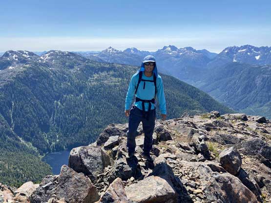

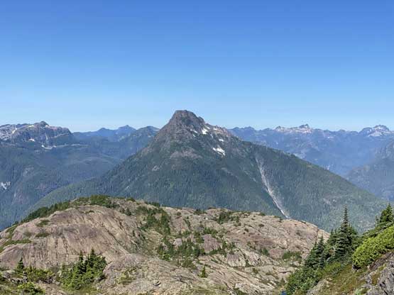
We lingered on the summit for a long time and eventually decided to take the “standard route” down, which would be about 100 m to the west of our ascent route. The part immediately below the summit ridge still involved a section of 3rd class scrambling and/or steep snow but anything further down was easy. We eventually rejoined the beaten path and followed it leisurely back into the forest. On the descent we decided to take the trail out and by the end of it we realized how we actually missed it in the morning. It’s difficult to explain but in short words, those new blowdowns had messed things up. My advice is to just download and follow our descent GPS track..


Without doing too much lingering I immediately started the engine and committed to this sketchy drive-out, which was actually not too bad. Vlad wanted to take a dip in some lakes but I remembered a summit called Mt. Underwood near Port Alberni that had a road to the top. I was more interested in bagging a dumpster summit and Alex agreed with my idea. We spent over an hour driving on dirt roads including three separate entrance points but all were gated for one or another reasons. Walking the road would be too much for an add-on summit so we reluctantly drove back into Port Alberni and killed several hours in the A&W. By around 7 pm we got out, and drove to Mt. Joan‘s trail-head which was another 1.5 hours away.

