Hungabee Mountain
August 3-4, 2017
3492m
Lake O’Hara / Yoho National Park, AB/BC
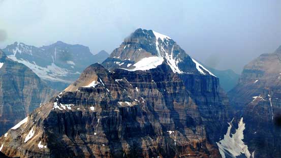
Apart from being a somewhat frightening 11,000er, the infamous Hungabee Mountain is also known as the highest peak straddling the continental divide in the heart of Lake Louise – Lake O’Hara group. About 6 years ago I hiked up Mt. Temple and the grand NE Face of Hungabee Mtn. was by no doubt the most formidable sight. The ascent, however, is more characterized by nothing but the “Rockies choss fest” at least according to most sources I’ve read. For that reason this is not a particular 11,000er that I was looking forward to but eventually I had to face it and there came this past week when another stellar, dry stretch of forecast lined up nicely with Ben and I’s schedule.
It seemed like in recent years a “west ridge direct” option pioneered by the ACMG Larry Stanier has gained enough popularity that few people would go for the traditional route anymore. The reason is simple as the Stanier’s variation avoids the worst part of the face (rock fall hazard) all together by a couple aesthetic 5th class pitches on generally reasonable rocks. It does upgrade the technical difficulty into a multi-pitch alpine climb, but those intending to finish the 11,000ers list should be able to handle challenges at this grade without much of a problem. Putting it this way, if you find the Stanier’s variation over your head then might as well forget about Deltaform Mountain.
Accessing peaks from Lake O’Hara involves some complication with logistics but if you do have the patience to work with the park’s regulation the payoff is a luxurious bus ride approach (for about 11 km and over 400 m elevation gain) making Hungabee Mtn. one of the least physically strenuous 11,000ers out there. It turned out that between the two of us Ben is the one having the required “patience” so I let him handle the booking process. He sure did a perfect job and shortly after locking our objective the bus rides were booked and the bivy permit was obtained. And then pretty much like a week ago the whole day of Wednesday was spent driving. There’s no need to rush this time so I leisurely started at around mid-morning, made to Revelstoke by late afternoon, took a nap, had a dinner in the A&W before driving to Lake O’Hara trail-head for the usual car-camping. The next morning Ben showed up at around 7:45 am and after briefly sorting the gears out we got onto the 8:30 am bus (the first ride in) for the lazy approach.
Hungabee Mountain via west ridge. GPX DL
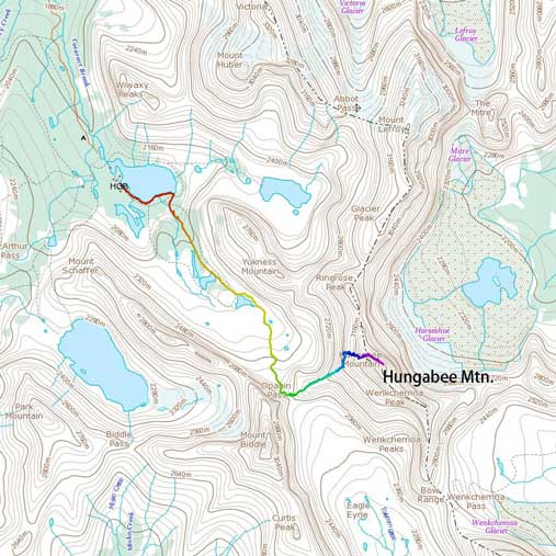
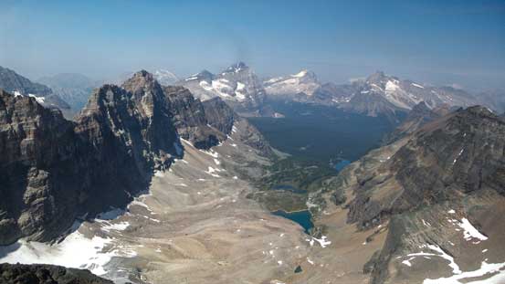
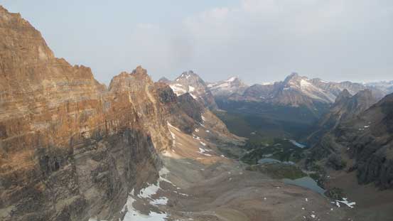
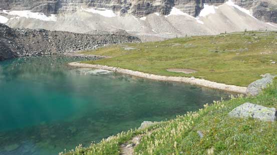
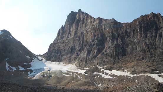
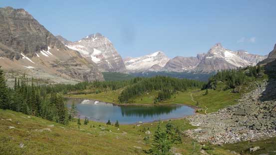
Half an hour later we were dropped at the lake. It’s already 9 am and our plan was to make the summit push on Day 1 so from this point onwards every single minute counted as a race with the daylight time. There are two trails heading up Opabin Plateau and the shorter, albeit less scenic option is by the “East Opabin” trail. This brought us a straight beeline to the shore of Hungabee Lake and then 10 minutes later we arrived at the higher Opabin Lake, a mere hour after leaving the bus. After briefly admiring the views we took the climber’s trail contouring the east side of Opabin Lake which eventually disappears into a pile of boulders and glacial moraine. There were still cairns and occasional paths and we had no issue making to the toe of Opabin Glacier where we filled up our water bottles.

The scenic Lake O’Hara

Reflections of Wiwaxy Peaks in Lake O’Hara

Mt. Stephen and Cathedral Mountain and their reflections
Arriving at Hungabee Lake
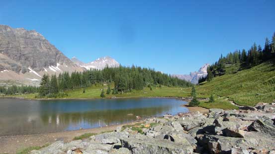
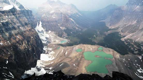
And then, this is the famed Opabin Lake
We picked up a set of climber’s trail around the lake

Opabin Lake

Another shot of Opabin Lake with Odaray Mtn. behind

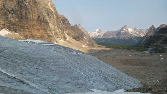
The toe of Opabin Glacier
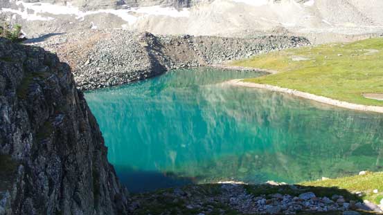
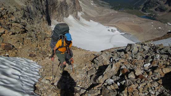
For some reasons I made a mistake packing the crampons down at the bottom of my backpack. Digging them out would require re-packing the whole thing so I went up the scree instead hoping the snow higher up was soft enough to kick-in. Meanwhile Ben strapped his crampons on and took the scenic ice-walk option. The scree/moraine sucked but to my great relief the snow was indeed soft enough to just walk on and then our next top was Opabin Pass or more precisely, the Biddle/Hungabee col. This is not the most ideal bivy spot as there isn’t even one flat place to pitch a tent out, so we carried onwards for another 200 vertical meters of gain to the top of a large plateau feature on the lower west ridge of Hungabee. This is referred as “Opabin Peak” on some source although with hardly any prominence I do not want to claim it as a “peak” myself.. We spent about half an hour setting up camp but we had to keep moving.

Ben cramponing up the dry glacier
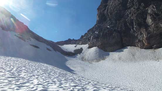
Merging onto the snow now looking towards the col
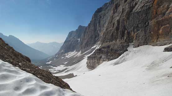
From the col looking down into Prospector Valley
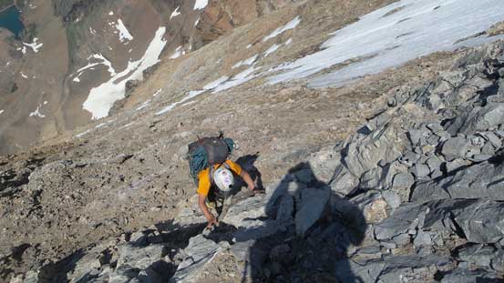
Ascending upwards from the col. Heavy pack made things not fun.
Looking back down the glacier and the valley we approached from

Ben scrambling up a tricky, 3rd class step.
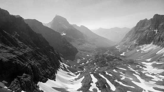
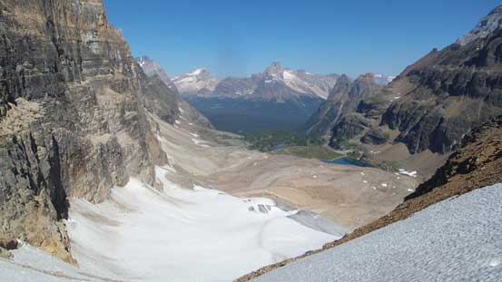
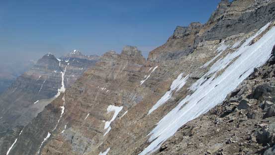
Another shot looking down into Prospector Valley.
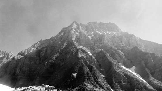
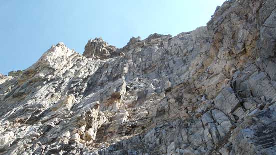
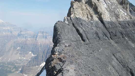
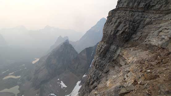
The west face of Hungabee Mtn. looming impressively above
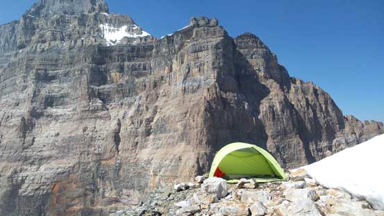
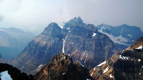
Our campsite and the east face of Mt. Biddle
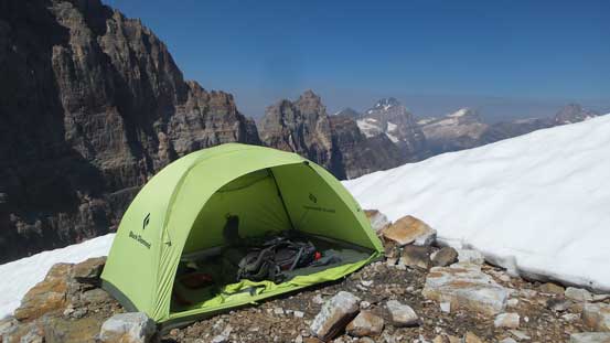
Another shot at our campsite. Ben stayed in this tent while I open-bivy
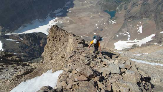
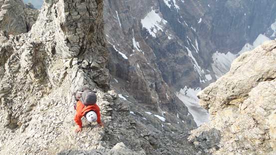
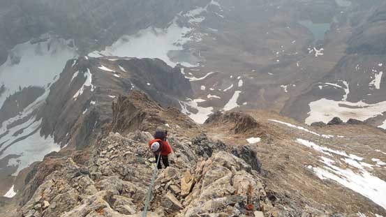
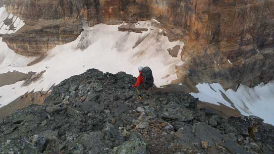
The ascent from this point onwards can be broken into 4 different stages. The first stage was a long, sustained 3rd class scramble up the lower quartzite ridge. Much of the terrain was attacked head-on although there’s one place we detoured into a shallow gully on climber’s left. Higher up we encountered a tough spot but the steppy nature of a quartzite ridge meant there’s not much hesitation needed. We climbed straight up the nose and it went as an exposed “4th class” by BC standard. It’s very much similar to the first crux on Edith Cavell’s east ridge but without the 500 m exposure on both sides.. Shorter after we picked up a set of cairns and paths which led a rising traverse cutting a long ways due climber’s left. This is a key traverse that links the 1st and 2nd stages and also goes at “3rd class”.
Partway up the lower quartzite ridge, looking down

This is the typical terrain on this lower quartzite ridge
Great views looking back towards Opabin Plateau
A section of stiff 4th class that we opted to rappel on the way down

Somewhere here you have to start working your way across
The typical terrain along this rising traverse

It doesn’t get more typical than this… Lots of cairns making the path though.
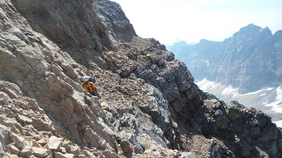
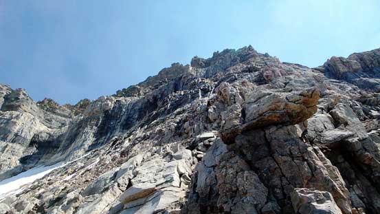
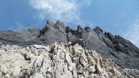
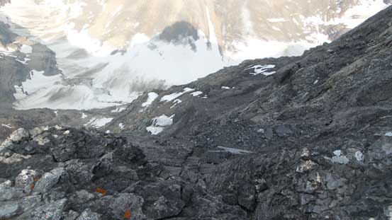
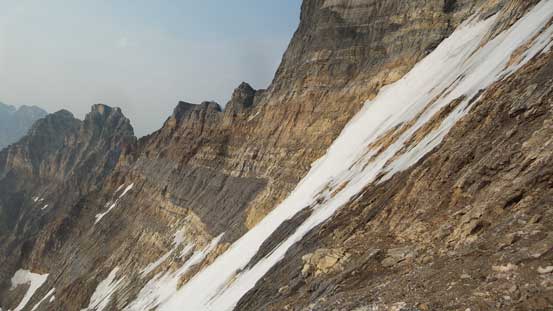
The traverse ended at the edge of the massive NW Face which has some permanent snow fields. It’s very apparent when we had to ascend straight up the slopes again. Much of this stage was on shattered limestone and the terrain felt more “face” than a “ridge”. The rocks were generally better on climber’s right although the further right we went, the steeper the scramble became. In the end we zig-zagged a lot in search of easier ground and by the time we reached the top of this NW Face snowfield we hadn’t really encountered any particular cruxy step. In other words, the 2nd stage also goes at a mere “difficult scramble”. A couple big cairns on ledges (climber’s right) marked the point where this Stanier’s variation separates from the standard route. We ignored all the traversing ledges and instead, picked up a shallow gully/chimney on climber’s left. This loose, 4th class step marks the start of the climbing section although we opted to continue soloing another 2 rope lengths until the terrain really starts steepening up.
Working our way efficiently up the shattered limestone rib
Looking up
This field of snow/ice is where we would ascend parallel to
As typical as it goes for the “stage 2”
This is already after the junction with the traditional route. Things gets steep quickly
Continuing scrambling for a while
Roughly where we decided to pitch out
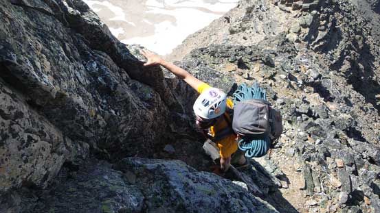
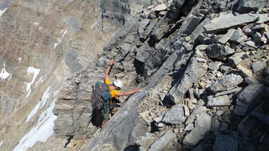
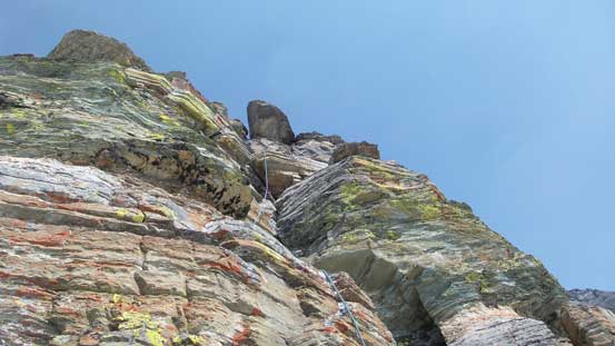
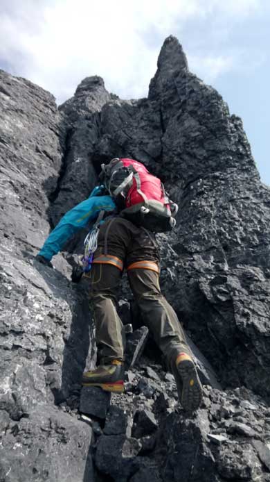
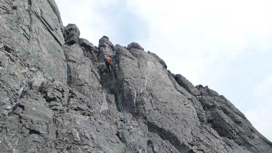
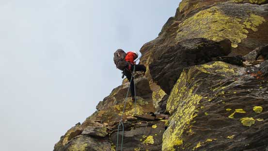
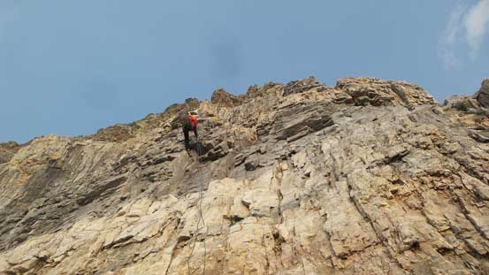
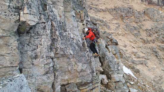
Pretty sure we could have continued soloing the ridge but with the “mid-5th class” description by Larry Stanier we opted to break the rope out. The rappelling station was a bit out of the way to use as a belay station so Ben spent some time building a trad anchor. Meanwhile I did my job sorting the rope out and then I got to lead the first pitch. There’s a couple awkward moves but nothing really “crazy” and I only put in 3 pieces of pros. This pitch ended at a section of low-angled Class 2 so we packed the rope again. Traversing a bit towards climber’s left on an obvious scree ledge we decided to solo the next pitch which involved some chimney climbing on broken quartzite. It ran harder than expected so by the time we reached a good belay/rappel station we decided to pitch out again. Ben volunteered to lead this pitch which had a few mid-5th class moves right of ridge crest but otherwise it’s not sustained at all. To our surprise this was the last pitch on the “west ridge direct” and after topping out we’d already hit the NW Ridge..

Looking down at the first pitch I led

Looking ahead
After working our way around we opted to solo the second pitch
The third pitch that Ben offered a lead
Topping out on the ridge now

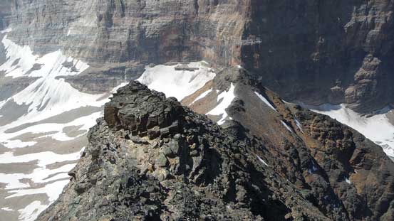
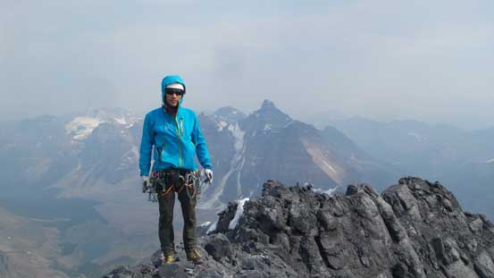
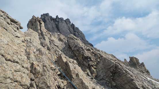
The majestic summit block along NW Ridge
Ben and Mt. Biddle
Mt. Lefroy and Mt. Victoria rises behind the tiny Ringrose Peak
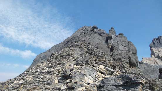
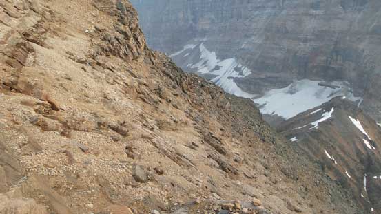
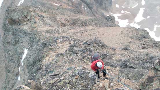
Soon enough the rope went into our packs again as the start of this “knife-edge” NW ridge appeared nothing harder than a “difficult scramble”. We also managed to avoid the so-called “knife-edge” section by traversing a scree path about 30 meters towards climber’s right. There’s a route traversing all the way across but once making sense we picked a line ascending some shitty black rocks transitioning onto the yellow band. This 3rd-4th class section terminated at an obvious gendarme which was bypassed easily and then up a shaded gully left of the ridge crest.

It’s nice to finally look down at Horseshoe Lake at the head of Paradise Valley

Mt. Temple – not sure how many tourists are looking at us at the same time….
Talking about knife-edge. Of course we bypassed this section…

Scrambling back up to regain the ridge

Spectacular position
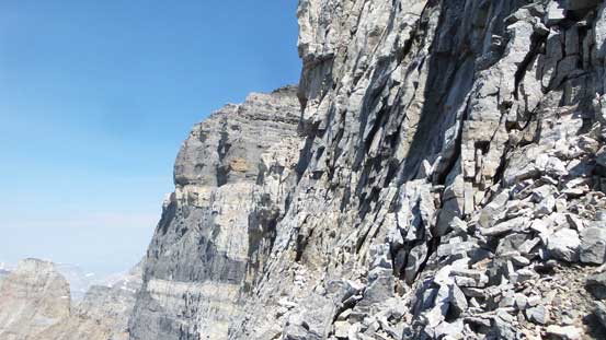
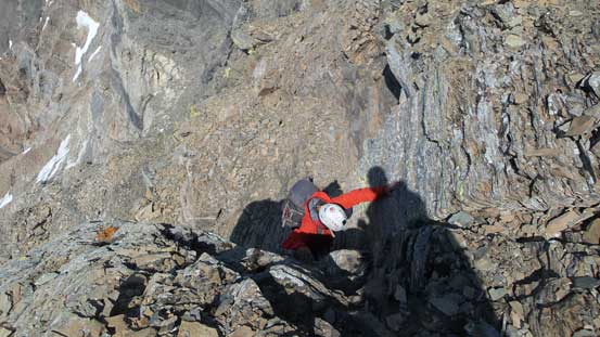
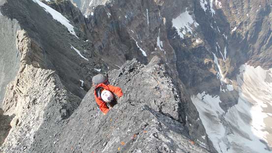
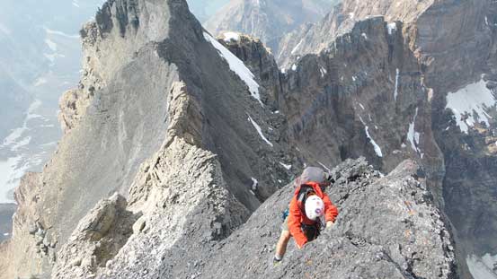
The yellow band was successfully (and easily) passed and now we were back onto the chossy black rocks. The terrain ahead appeared a bit complicated but once sticking our nose into it we managed to pick a line close to the ridge crest. It’s exposed and super loose but with great care we all managed to solo no problem, but then there came that “big sporty step-across”. Inspecting it up-close none of us felt comfortable soloing but there was a good rock boulder to sling around as a belay station. The rope was out again and a leader fall would not be pleasant but at least it wouldn’t be straight to death so with that added bit of security Ben managed to gingerly lead across and then I followed. It sure was the mental crux but once over, the rest was an easy plod to the summit of my 43rd 11,000er.
The sharp contrast between the yellow and black bands
Me attacking the black band.
Talking about exposure…
Very careful work to solo this pitch of 5th class black rock.
The exposure down NE Face is unreal..

The big sporty step-across was very tricky and mentally taxing

Me after the step-across. Photo by Ben
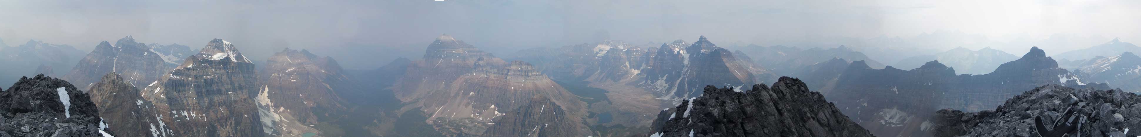
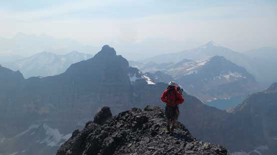
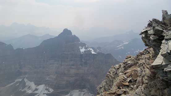
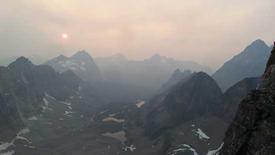
A very smoky summit panorama from Hungabee Mtn. Click to view large size.
Horseshoe Lake and Paradise Valley
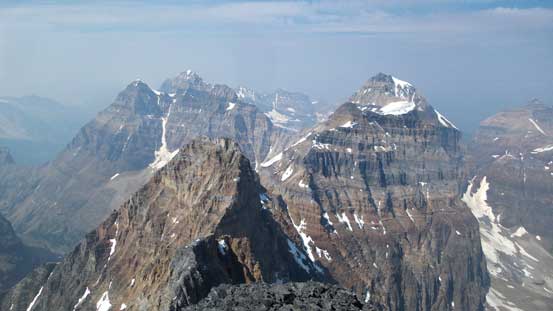
The mighty Mt. Lefroy – bagged 3 years ago
Mt. Huber and Mt. Victoria – bagged together in a 19-hour day

The beautiful Deltaform Mountain – bagged last week

Familiar names in the register entry
Me on the summit of Hungabee Mountain. #43 /58
The summit celebration was short-lived but I did enjoy flipping the (soaked) summit register and seeing all the familiar names. By far we were doing excellent in time (a bit over 2 hours to camp, and 4.5 hours camp to summit), but the descent would take just as long if not longer due to the numerous rappels. Thankfully there’s no need to reverse that sporty step and instead, we took 2 rappels with bit of down-climbing in between and then traversed back over to the west ridge. There’s no need to down-climb any of those black choss which was really nice. 4 rappels in a sequence got us down the “west ridge direct” section and I have to comment here that having a 70-m rope was a great asset. Rappel #2 down the west ridge was short by about a meter to the scree ledge and #4 also just barely reached the bottom. Had we used two 30-meter ropes we would have to down-climb some of the stuffs.
The first rappel off the summit block
A bit of down-climbing
Descending onto the yellow band now

The 2nd rappel off the summit block avoids the lower section of black rocks
Mt. Biddle

One of the first couple rappels off the west ridge direct
This rappel got us off the upper quartzite rock.
The 3rd rappel off west ridge direct.
After the 4th rappel we were dumped briefly onto the traditional route and had to traverse about 30 m on a shitty scree ledge to get back onto the west ridge. This part sucked and that explained why we had no interest in doing the other route. After getting back on track we opted to do two additional short rappels on low-angled, but very loose terrain just so the anchors were great and had fresh tats on it. None of us was in the mood of down-climbing 4th class choss at this stage due to our tired mind and body. Down-scrambling the lower 3rd class terrain was actually quite fun and the fact we each brought a pole to this point paid off nicely. And then back onto the key traverse over to the initial lower quartzite ridge. We did another full-length rappel down that 4th class part and then easily descended back to camp with about an hour of extra daylight time to kill. And then there came the (very relaxed) evening routine.
Back to scrambling terrain now. Note the remnant glacier on NW Face
An additional rappel since we didn’t want to down-climb…

The typical terrain on the scrambling part. Pebbles covering ledges.
More choss covered ledges…

Down-climb and traverse back towards the initial quartzite ridge
Great views.
We went off-route but decided to down-climb nonetheless.
Smoky sunset!
Last rappel of the day.
Theoretically with the peak already bagged there’s no reason to not sleep well but I did wake up constantly. It was a bit too warm in my -7 bag but I think it’s the ashes from the smoke that affected me. Ben had his green tent as a shelter while I had nothing (open-bivying) so completely exposed to the smoke issue. Oh well. When the daylight arrived we both got up and then the goal was set on catching the 11:30 am bus so there’s no that much to waste. Descending to Opabin Pass sucked with a heavy pack but then down the snow was a nice change. Back onto the scree/moraine was painful but at least this section was short. Once rejoining the trail it’s an easy stoll back to Lake O’Hara and then we bumped into the legendary Larry Stanier in person which was very surprising but sweet.
The next morning all we needed was a 2-hour hike out
Time to head home..
Back to the glacier

Back to Opabin Lake
Another shot of Opabin Lake
Looking back towards Opabin Glacier and Opabin Pass
Hungabee Lake ahead

Joining the East Opabin trail. Wiwaxy Peaks ahead
Back to Lake O’Hara

Done!
And then there came the luxurious bus ride back to the parking lot and that concluded another efficient and successful 11,000er trip. I sure haven’t heard much about people climbing Hungabee on Day 1 given the super non-alpine start of the bus services, and our round trip time was 27 hours car-to-car. Finishing the trip at noon meant I had the entire day ahead to drive back home but I got exhausted in no time. I had to stop in Golden, Revelstoke and then Salmon Arm for rests and by the time I got going again it was already late in the evening. I pushed all the way back to Abbotsford but had absolutely no further strength to continue so slept a couple hours in car at a gas station.. Then I made back home at around 4 am so I did manage to pull Hungabee off as a 3-day return from Vancouver.. Not bad.
Overall I was pleasantly surprised by the quality of this “west direct variation”. There’s minimal hazard from natural rock falls and most of the climbing parts sans the black bands on summit ridge was more “solid” than the reputation of this mountain suggests. To me it’s more of a “classic climb” than a “horror show”. But that could due to the fact we just climbed Deltaform and had lots of experience with the Rockies choss. I’m sure a random climber coming from BC coast will be terrified by the rock quality on this route so.. Make your own choice.
