North Mountain
March 15, 2017
641m
Phoenix, AZ
North Mountain is one of those low elevation “urban summits” surrounded by the city of Phoenix on all sides, but it’s also one of the landmark peaks out there. The area is very well developed and there are more than a few routes leading to the summit with the most popular one being a paved road. With less than 300 m of elevation gain many locals choose to hike it on a weekly or even daily basis. As a visitor I figured the summit of this mountain would give me a nice perspective of the surrounding landscape so with a couple hours to kill it didn’t take me long to make the decision. The downside was that 33 degree temperature but I was in Phoenix, right?!
North Mountain hiking route. GPX DL
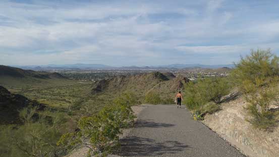
I had no particular interest in exploring a less travelled route so would join the gang up that aforementioned paved road (closed to vehicle access). Right off the bat I got a good taste of that Phoenix sun. It was brutal and my pace was painfully slow. Thankfully there’s nothing to rush for so I just took my time enjoying the scenery. One good thing for hiking in a desert is that the views were always accompanying so it actually felt incredibly scenic despite actually being in an urban area. The road took a couple turns and then I was getting close to the top.
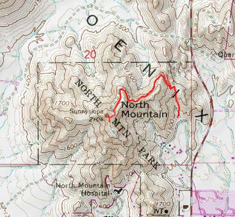
The start of the hike.
Looking back at the start.
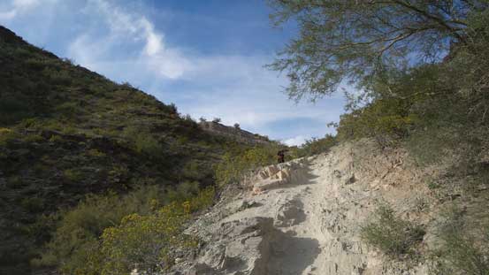
The first switchback. As you can see, the views were constantly accompanying

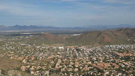
Another hiker taking a short break. Squaw Peak and the city of Phoenix behind.

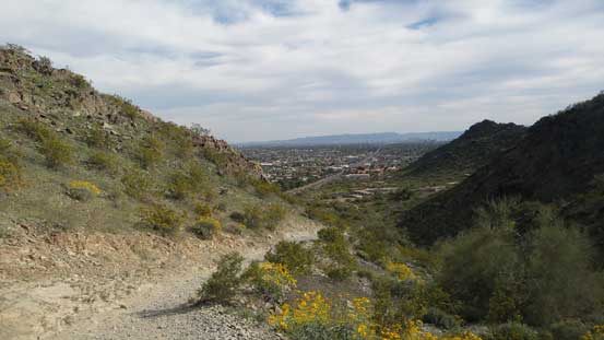
Merging onto the paved road
The typical plod up this road.

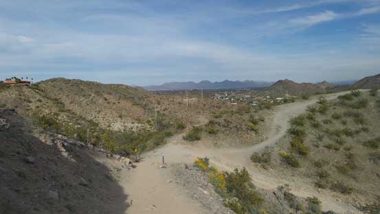
Bypassing a minor highpoint along the way.
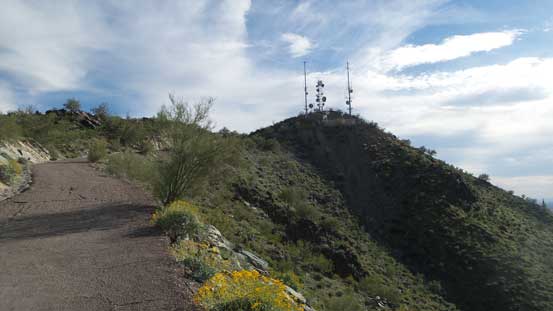
The summit was actually obscured by a huge station with wired fence so I had to walk around a bit to soak in the views. After taking enough pictures I settled on the south side of the fence and spent the next hour or so sitting around. I thought about waiting for another hour till sunset but figured I probably should move on.

Upwards and onwards.
The summit ahead.
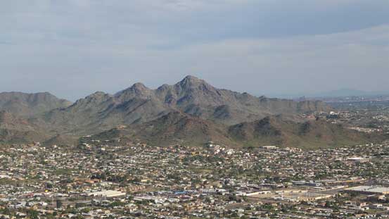
Squaw Peak is such an eye-catching peak here.

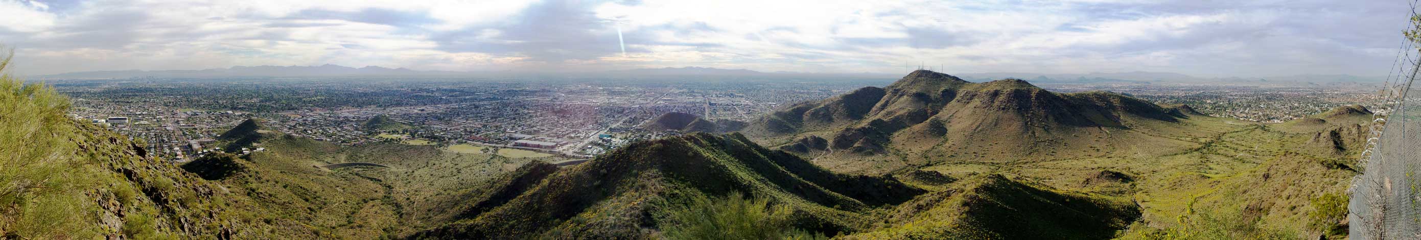
Summit Panorama from North Mountain. Click to view large size.
Another panorama. Click to view large size.
A eastern view.

This is looking a bit towards north-east
Lookout Mountain in the foreground – another popular hike

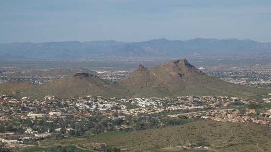
A zoomed-in view of Squaw Peak – second highest peak in Phoenix urban area.
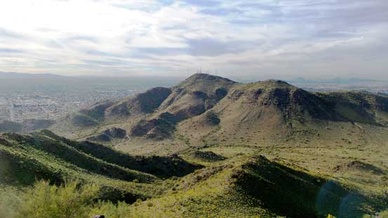
Shaw Butte nearby
This is looking north. The urban area is really expansive.

Me on the summit of North Mountain
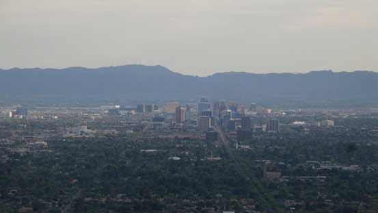
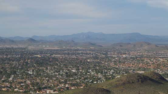
A zoomed-in view towards downtown Phoenix, with South Mountain behind.

Started to see the evening horizon, but I had to move on.
There’s not much to document about the descent except it’s much easier than going up. There’s a layer of high clouds rolling in obscuring the Sun so it was actually quite enjoyable.

Another photo of the evening horizon. This is from partway down.
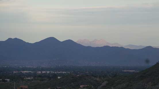
In the distance I could see Four Peaks (Brown’s Peak) on glow.
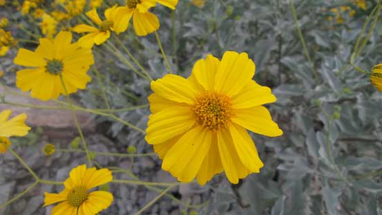
Some random shots of the flowers. It’s the blossom season in the desert.

Almost back to the parking lot.
There were a lot of things to get done in the evening. First of all I had to resume the drive down south and that involved going through the entire stretch of Phoenix urban gong show. The traffic pattern was confusing so I just followed the instructions on my iPhone without actually knowing where I was going. I exited the highway at Casa Grande south of Phoenix for food (Safeway) and then dinner (Olive Garden). At this point I was still debating about the “car vs. motel” but in the end I opted for the latter as I really didn’t think I could sleep well, if at all in car given the temperature. This is not the Coconino Plateau in northern Arizona and instead I was in the Sonoran Desert.
