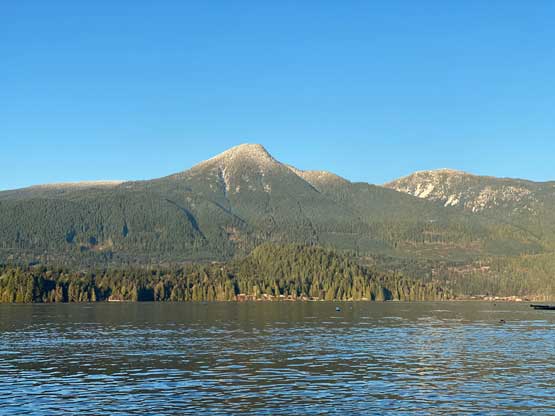
Mount Liddell/Gambier Peak
February 1, 2022
922m
Gambier Island, BC
Mt. Liddell and “Gambier Peak” are basically two high points of one mountain. The latter is the slightly higher one and because of that, “Gambier Peak” boasts over 900 m prominence and is also the island’s high point. Mt. Liddell on the other hand, has very minimal (<50 m) prominence but Mt. Liddell is the officially-named summit. The name “Gambier Peak” was unofficially assigned to the highest point on the island and is rather just a peak-baggers’ name. In my opinion these two should be considered as a single peak with “Gambier Peak” being the true summit of Mt. Liddell but these years, thank to the Bagger Challenge list most people consider these as two distinct summits. In my personal count I would follow the trend to claim two peaks out of this trip, but the trip reports would be written together.
The transportation to Gambier Island had always been a deterring factor as I’m never a fan of researching logistics and the last thing I want is to follow rigid timelines. One option is to take a private water taxi ($$$) but the cheaper and better way is by connecting ferries from Langdale, Sunshine Coast. The tickets for the Horseshoe Bay-Langdale and Langdale-Gambier Island ferries are not sold together so one really has to layout the schedule and plan the logistics ahead. Thankfully I got some recent updates from a post on “SWBC Peak Baggers” Facebook group. Raphael Smith had day-hiked Mt. Killam on Gambier Island from Vancouver in a fairly cheap fashion and showed us his entire transportation schedule. I decided to just simply take his “beta” and do the same way for at least getting there. The link-up that made the most sense to get back was the 4:30 pm ferry departing Gambier Island transferring to 5:25 pm ferry departing Langdale. With almost 8 hours on the island I figured I should aim for the farther/taller peaks than Mt. Killam.

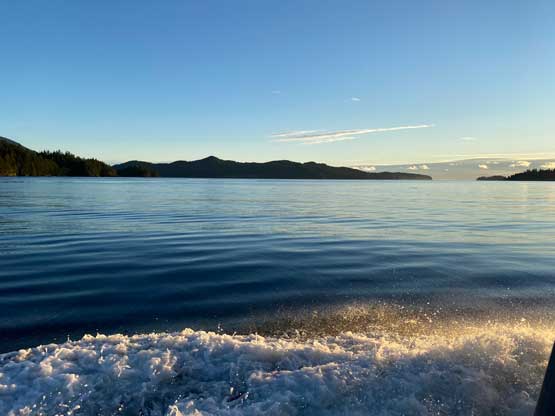
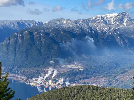
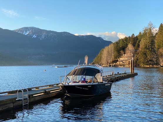
Instead of parking at Horseshoe Bay terminal (20$ per day) I took some old beta that I had heard about over 5 years ago and parked at one of the trail heads about 1 km away, which was free. This was only my second time boarding a ferry on foot so I had never practices that secret, cheap bypass before, but decided to try it out as one purpose of this trip was to get familiar with the passenger travel logistics. The walking from that trail-head to the terminal took 10-15 minutes and wasn’t very obvious. I had to consult with the Gaia’s map several times to make sure I took the correct trail as it wasn’t just to walk on the streets. Some parts of the connector trails were dark enough that I even wished to have a head-lamp, but mine was buried deeply in the backpack such that I didn’t want to dig it out. I made to the Horseshoe Bay terminal about 20 minutes before the scheduled ride and that timing was perfect. There was still fair amount of walking inside the terminal from where I bought the ticket to the waiting room. I bought a big breakfast on the ferry to Langdale and immediately after getting off this ride I followed the signed “Keats/Gambier” to the next one. The 8:20 am ride from Langdale to Gambier was scheduled to wait for us coming off the main ferry. This smaller ferry looked more like a water taxi with only maybe 8-10 people’s capacity, and that explained why Gambier Island’s travel is only for foot passengers. The ride to Gambier was much more scenic but I didn’t get the best seat for pictures.

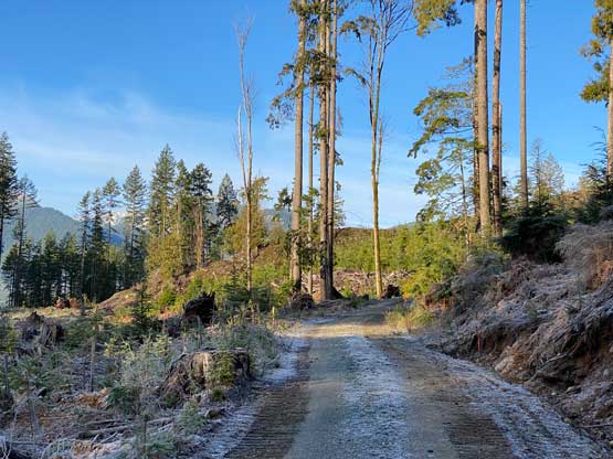
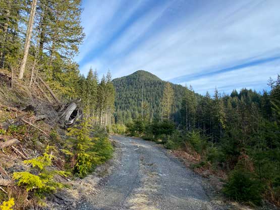
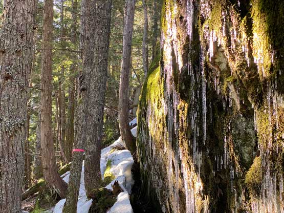
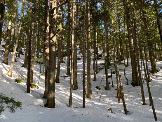
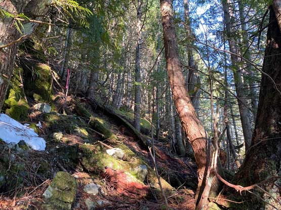
I had done zero research about the hiking portion asides downloading the Gaia’s map which had most of the “trails” correctly shown. There appeared to have only one trail heading up “Gambier Peak”/Mt. Liddell but several ways to get there. I decided to follow the most obvious line which was basically a system of logging roads that connect New Brighton towards the broad valley/pass between Mt. Killam and Mt. Liddell. The walking on these roads was much longer than I thought with several downhill stretches that sure would feel frustrating on the return. There was only one spot with active logging but they didn’t seem to mind people walking by. The road-walk totalled over 5 km each way and when I thought I would finally hit the trail I realized that trail was basically still a deactivated logging road… This deactivated road ascended the broad valley between Mt. Killam and Mt. Liddell and around 450 m elevation I started to encounter snow. The snow was mostly supportive but the occasional post-holes still made me decide to swap footwear from trail runners to mountaineering boots with gaitors. Instead of ditching the trail runners I opted to carry them in the pack as I hadn’t made the exact return plan. The trail along this flatter section just before the junction with Gambier Lake was definitely not in a great shape with bushes, post-holing and a creek that were basically running on the trail.

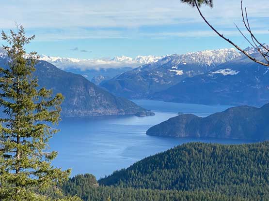
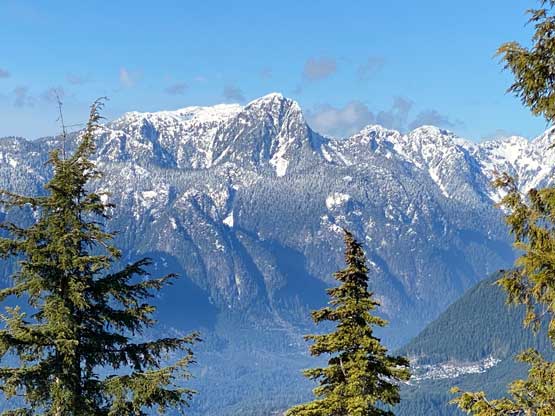
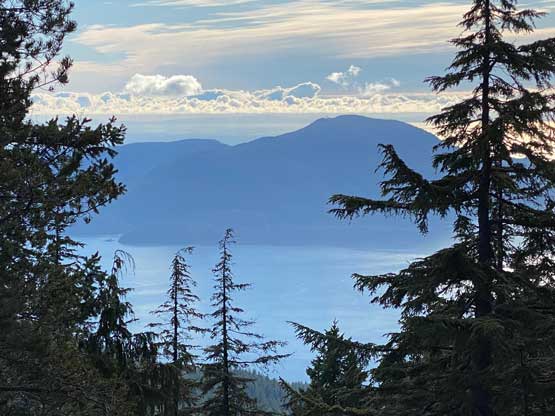
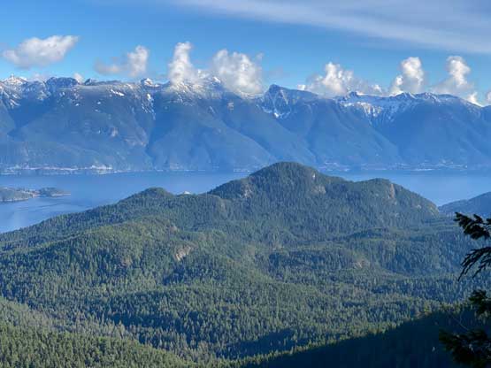
The wetness had decreased drastically after leaving the main trail onto that smaller “trail” heading up towards Mt. Liddell but I personally would rather call this a “route”, but a very well-flagged route. The abundant flags meant getting lost would be next to impossible even without a GPS device but the foot bed of this trail was either entirely destroyed by last year’s floods, or had not developed yet. A few hundred meters’ of ascending later I came to another junction and opted for a short detour first to check out a viewpoint. I knew nothing about what to expect other than a “viewpoint icon” on Gaia’s map. It turned out that I got some great views looking down onto the frozen Gambier Lake.


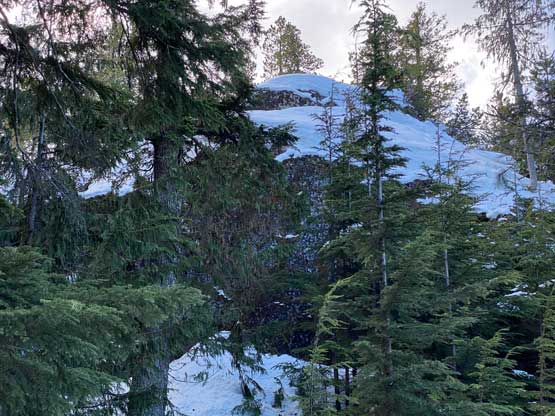
The section immediately after that viewpoint had some of the steepest grades with one step of “class 3 tree roots” and then I followed the flags traversing a long ways due north under some cliffs. After getting on top of that cliff the route traversed a long ways back due south to basically directly under the summit of “Gambier Peak”. I finally encountered continuous snow without any intermittent dry patch along this section. The snow was steep and icy but I was able to manage it (barely) without the use of crampons. I also brought snowshoes but they seemed to have become training weight again. The summit of “Gambier Peak” had some slight openings but not enough to provide any notable view.


I soon started the traverse towards that officially-named Mt. Liddell summit and this traverse was again, longer than expected. I had to lose almost 100 m elevation down from “Gambier Peak” summit on again, steep and hard-packed snow before picking up the undulating north ridge of Mt. Liddell. The entire traverse was still well-flagged but I didn’t pay enough attention and got off-route several times with some bushwhacking through tight timbers. It didn’t really matter as I just needed to follow the ridge up. Nearing the summit there were several bluffs to scramble over. The summit offered slightly better views than “Gambier Peak”, but still, nothing noteworthy.
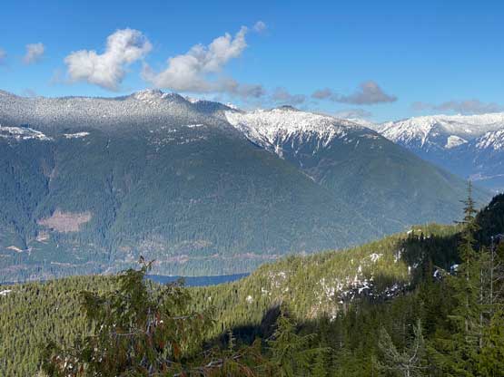

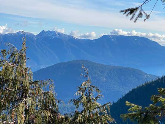
I thought about to bushwhack down the south ridge of Mt. Liddell but even if I got off the mountain 1 hour earlier I still had to take those ferries home, so I might as well take my time on the hike. After a long break I leisurely plodded back to “Gambier Peak”, paying a closer attention to the flags to avoid bushwhacking. I did also manage the steep descent/traverse off “Gambier Peak” without having to don any traction device and soon I was back to that junction with the viewpoint. Since I had time to kill I went up to check out that viewpoint again, as that had the best views on this entire hike. The rest of the descent was rather uneventful and I eventually got back to the ferry terminal at 4 pm, half an hour before the scheduled ride. The round trip distance was almost 22 km and my time was 7.5 hours.


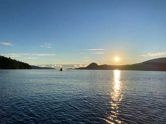
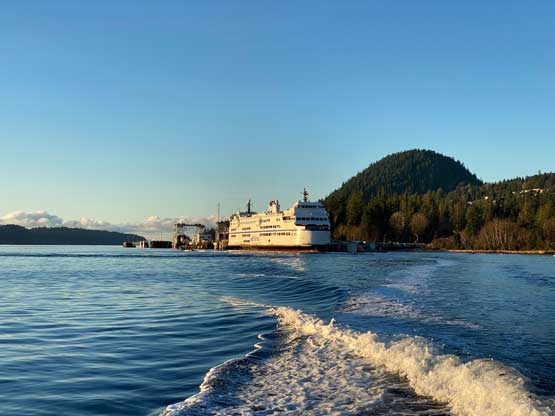
I was lucky to have the ride from Gambier Island to Langdale to myself so I stood up the whole way and took a bunch of photos and videos. This was surely a scenic ride and only costs 6.5 dollars each way. The ferry terminal at Langdale was cold as fuck as soon as the sun went down, so I spent most of the next hour inside the waiting room. The rest of the journey back home was basically as planned. I did plan ahead this time to have the head-lamp ready for that 10-m uphill walk from Horseshoe Bay terminal to where I parked the truck for free. I debated about to go to Richmond for dinner since I was really hungry, but I didn’t seem too stoked about the driving detour and the city traffics. Instead, I drove straight to White Rock but I did opt for a fancy dinner in a local restaurant (40$) before going home.