Mount Robertson
September 7, 2022
3194m
Kananaskis Country, AB/BC
Not to be confused with Robertson Peak in SW BC, this is the one that locates in Kananaskis Country of the Canadian Rockies. Both Robertson’s are some of the most elusive objectives in their respective areas but for different reasons. The former is because of the access difficulties and the latter is known to be one of, if not the hardest scramble in the 3rd edition of Alan Kane’s book. I did SW BC’s Robertson Peak as a possible 5th recorded ascent in April 2021 and this time I came to the Rockies for the other one. This peak had not caught much attention until Alan Kane published his 3rd edition but since then there had gathered enough hype on the internet that I just had to come and check it out myself. Two notable groups of scramblers had together solved the problems. Elizabeth Imhof’s party was the first to face the unknown and ended up doing a harder variation. Later, Doug Lutz’s group successfully resolved the mystery by locating the key ledge traverse mentioned in the Kane’s book. A few smaller parties had come in the last couple years as well, some were successful and some were not but all were extremely sketched out. I believe the entire scrambling community is eyeing on Mt. Robertson but few dares to even think about an attempt as some said it’s “harder than Chancellor”, “scarier than South Goodsir” and others had made it sound like a nearly suicidal mission. Even I started to question my sanity when I committed to this trip but there’s only one way to know. Part of me was sure that it couldn’t be that bad as I’ve scrambled with two Robertson’s summitters (Doug/Grant) and I knew my capability compared to theirs, and party of me was really curious what Alan Kane had recently put into his “scrambles” book.
The trip actually started from trying to find partner(s) for Mt. Vaux but most had already done it. Instead, I got an invite from Andy B. to join him together with Alma and Lito for Mt. Robertson. All three of them had done most of the hardest scrambles together earlier in this year including the other grand daddy of beast in Kane’s book, Chancellor Peak so even though I had never met any of them I was instantly game. I had just scrambled Chancellor Peak a few weeks ago and being able to pull that one off in a timely manner (not a 24-hour epic) meant we were all on the same page here. The day had to be Wednesday, the last day before a snow storm came in but I didn’t want this trip to be just Mt. Robertson so I drove out a couple days earlier. I ended up doing Redoubt Mountain with JP on Monday, and then Mt. Wintour with Devan on Tuesday. These two trips were reasonably short enough that I was still decently fresh for Mt. Robertson’s mission. I found the secret parking spot in Canmore again and slept a few hours in my car and then next morning we all gathered in Andy’s home at 3 am. There were some strong winds (gusts over 70 km/h) in the forecast starting at noon and rain by 3 pm so we wanted to get the job done as early as possible.

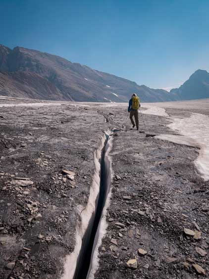
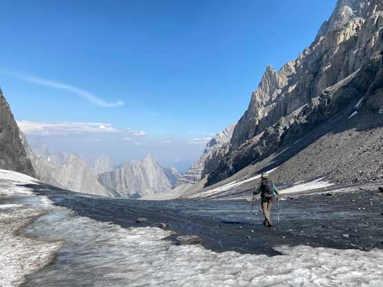
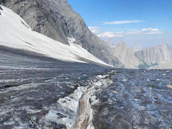
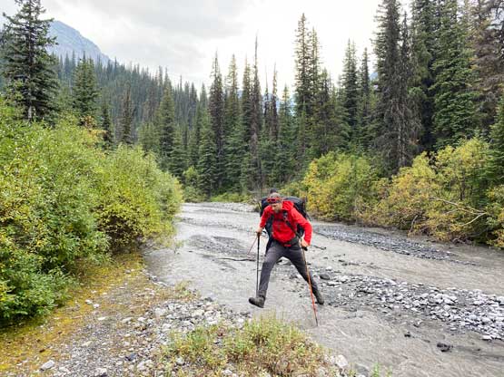
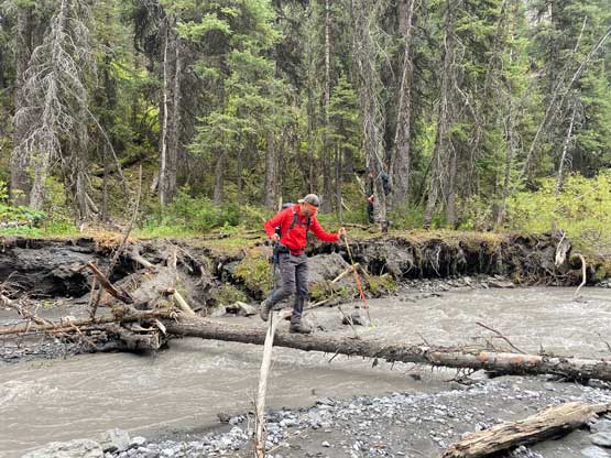
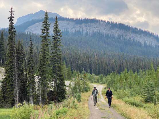
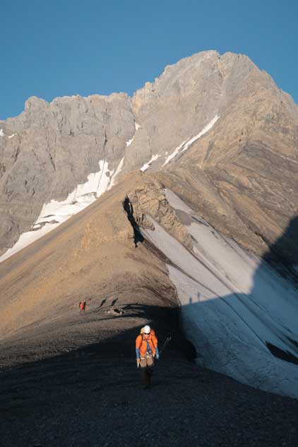
This was my first time riding the portion of Smith-Dorrien Road along the Spray Lakes area in at least 7 years and it was just as bumpy as I remembered. I guess in the past 7 years there wasn’t any improvement in the road’s quality. Lito had done the approach recently for Mt. French so he volunteered to lead us through the initial confusing sections. Lito’s beta was to use Doug Lutz’s ascent track (original route also the one we took for French/Jellicoe in 2014) even though Doug wanted me to take his descent track. The only downside of the original route was a possible creek crossing, but we successfully located a log to walk across. We then picked up the trail on the east side of French Creek. The trail was meandering with some up-and-downs and washed-out sections but was easy to follow in the broader scope of sense. The trickle of water coming out of “Prairie Lookout” at treeline was the most reliable water source. We were still in the pitch dark when we started the scree slog above treeline. After slogging up one horrible section I spent a few minutes to ditch trail-runners and don mountaineering boots. I then caught up with the team and we together did another horrible stretch, this time side-hilling on a rock-covered glacier to access the bare ice on French Glacier. We no longer needed the head-lamps here and the horizon started to show some morning colours, but it’s shaping up to be a smoky day ahead. The plod onto French/Robertson col was uneventful but foreshortened.


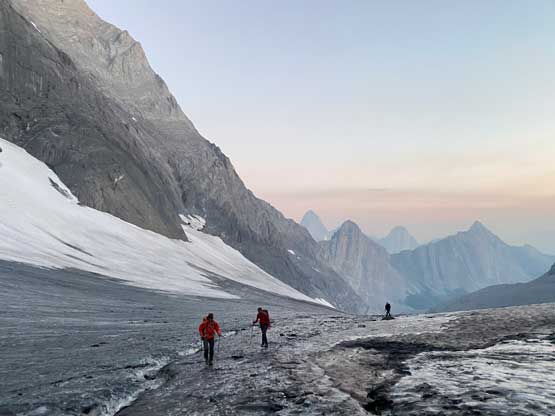


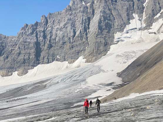
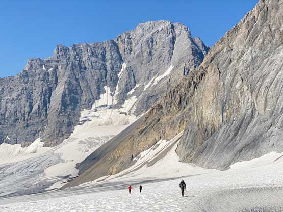
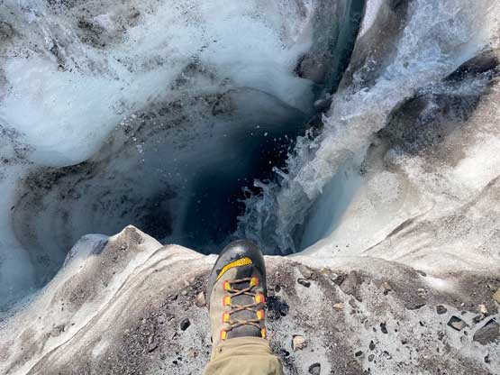
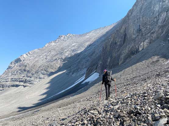
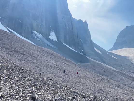
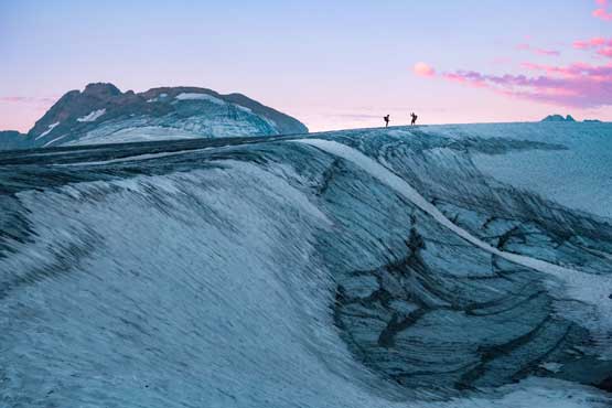
We then plodded up a wind scoop onto Haig Icefield and donned harness the crampons. The portion of Haig Icefield ahead was still covered in snow and a few large crevasses near or on the wind scoop had to be crossed by stepping onto some snow bridges. The snow bridge seemed very solid and we never bothered to take the rope out. Halfway across the Haig Icefield traverse we were back onto bare ice and then easily plodded to underneath Robertson/Sir Douglas col. The most horrible section was about to come. The choss slope leading towards Robertson/Sir Douglas col was steep and compact. We were able to utilize a gully made purely by water running but that gully was still loose and shitty with a ton of rockfall hazard. I was looking hard to find a better option for the descent but there wasn’t anything obvious. Nonetheless we plodded onto the col. The sun beams hit us there briefly but so was the cold wind.


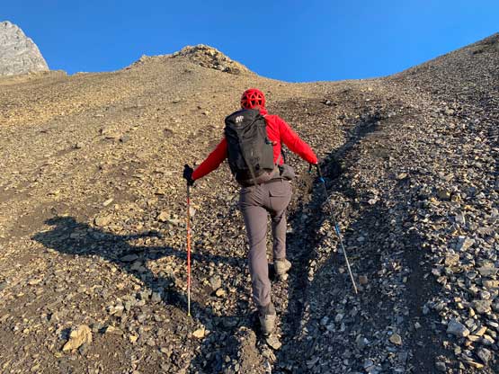

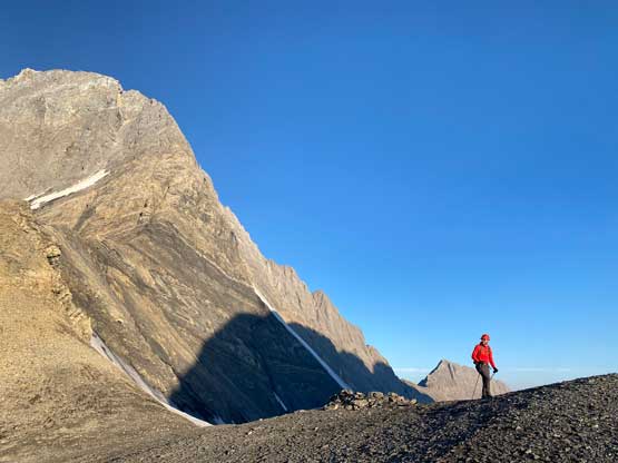
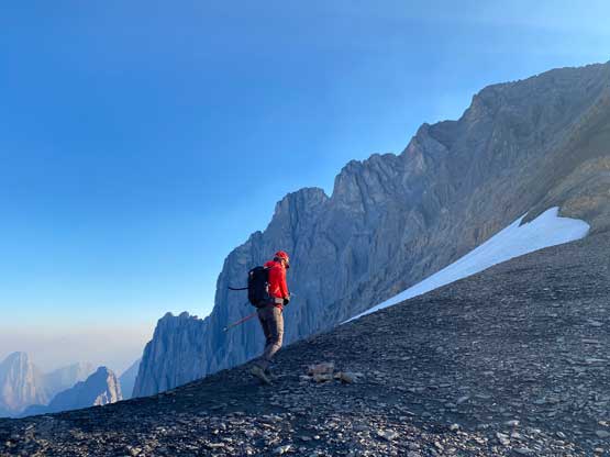
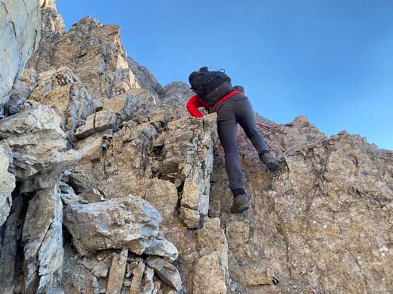
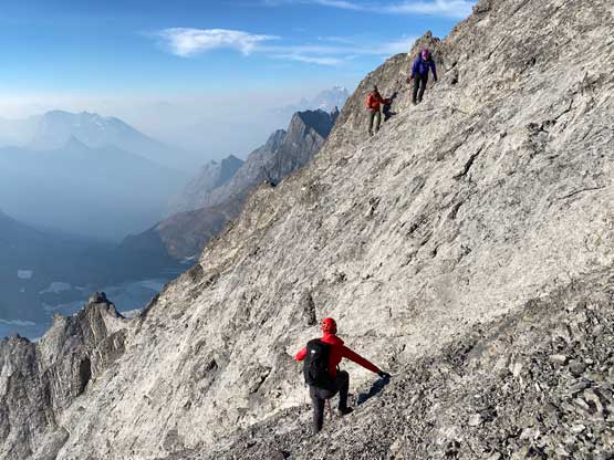
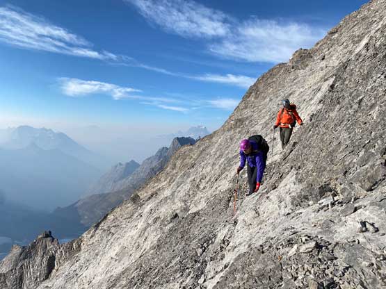
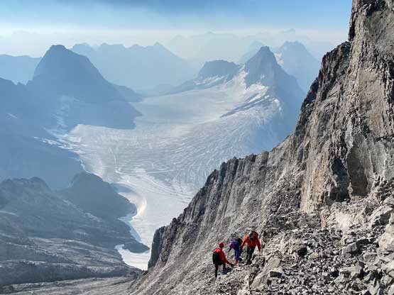
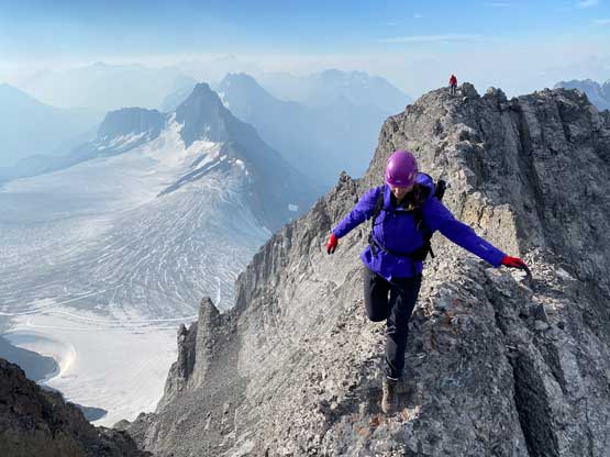
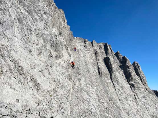
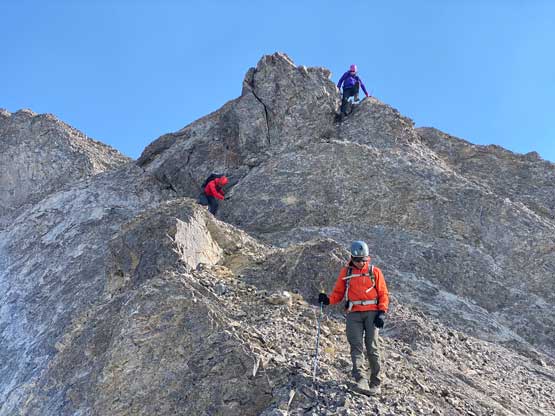
The wind definitely did not help my mood when we started the lower SW Ridge and immediately got onto some compacted choss type of terrain with exposure. Very few people had mentioned the difficulty on the lower ridge but I actually felt some parts of the lower ridge were actually trickier or more dangerous than the upper route. Andy was leading ahead the entire way and picked some nice lines through one obstacle after another. There’s one chimney-ish step coming up and after that we were finally into the sunshine. The warm sun definitely made things easier at least for me. The rocks were very loose and the ridge was exposed. The scrambling was mostly class 3-4 but we must be extremely careful as the terrain was definitely consequential. It didn’t take us long to top out onto the upper south ridge where we instantly located the cairn built by Doug Lutz which I would call the “Doug’s Cairn”…


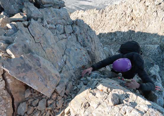


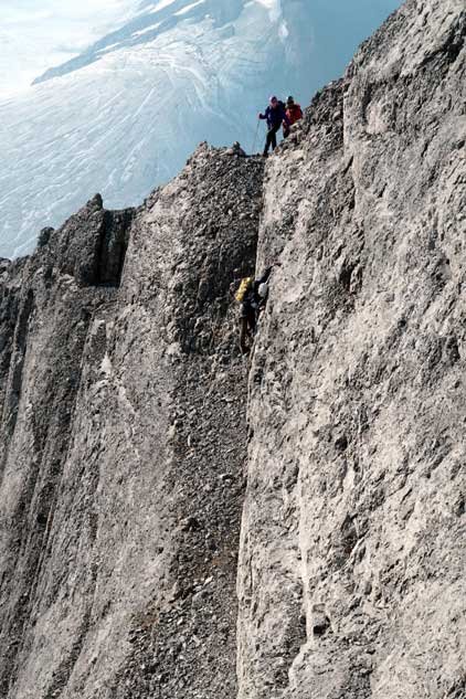
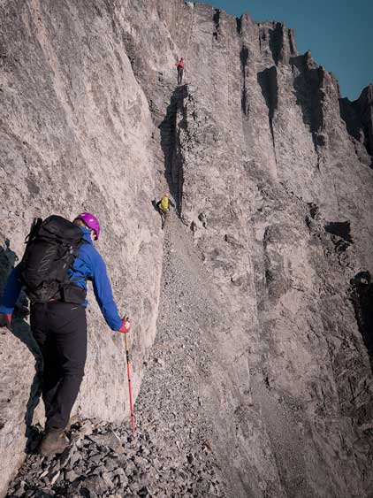
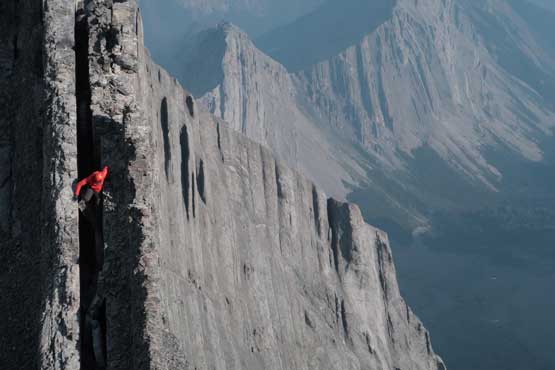
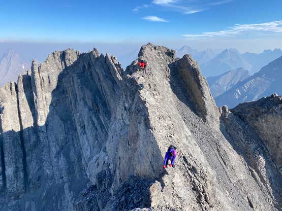
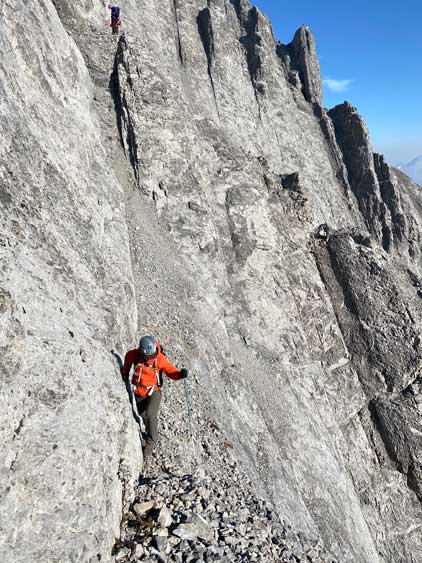
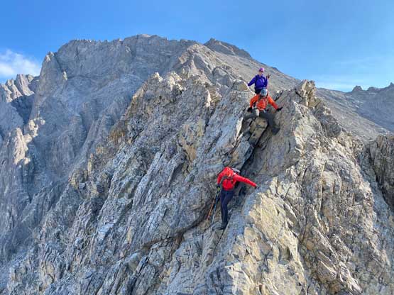
That cairn indicated the start of the key ledge traverse and it wouldn’t be obvious if Doug didn’t build the cairn. Getting to the cairn involved some tricky scrambling on slabby terrain. Andy found a line with some zig-zags and kept the difficulty to within class 4 but some parts of this zig-zag line were on choss-covered down-sloping ground. Looking back I decided to just climb a direct variation on the return, more technical but on better rocks. By the time Alma and Lito finished this downwards traverse Andy was already halfway across the ledge. The ledge was not nearly as bad as anticipated. It wasn’t that narrow, and the wall and the drop-off wasn’t that vertical. The hardest section for me was the first couple downwards moves but a few steps down later I reached out to a few positive hand holds on the left side wall. It was then not too bad. Towards the upper section of the second leg of this ledge traverse we got onto some very loose and down-sloping terrain. The scrambling was only 3rd class but extreme care must be taken.


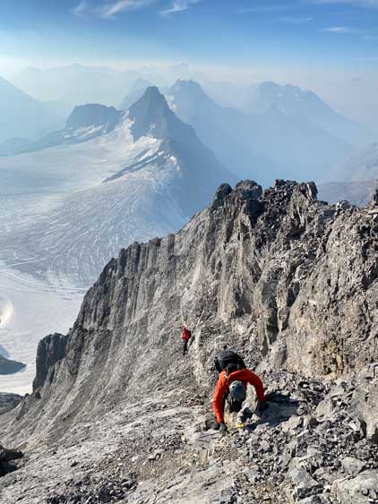

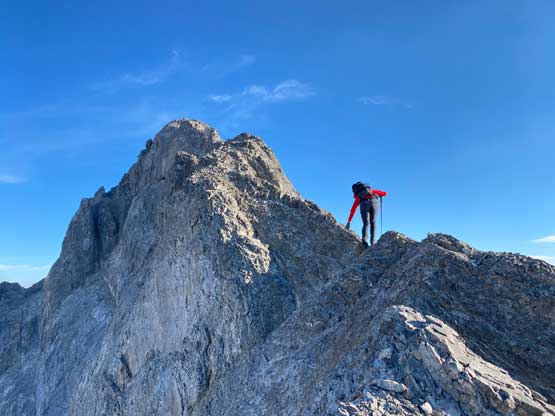
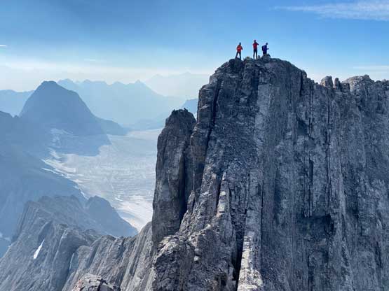
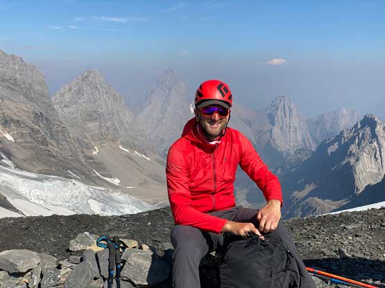
Immediately after the ledge traverse we would have to face the summit ridge which was actually the crux for a few previous parties. The ridge again, didn’t look to be that bad. The first half of the traverse was rather trivial but the two boulder problems near the summit did live up to their reputation. I wouldn’t say the moves were hard (class 4 only), but the blocks seemed rather detached. I had to bear-hug the blocks while trying to step down onto some thin foot-holds and those few moves did not boast confidence. Had the blocks break apart I would almost certainly die, so I tried really hard to balance without putting too much weight while hugging. The way back an hour later felt exponentially easier as we already knew the blocks and the moves. It took the four of us at most 10 minutes to all successfully and safely cross the ridge onto the summit and that was it. I would not say this was an “easy” ascent by any measure but it was definitely not nearly as challenging as I was expecting.
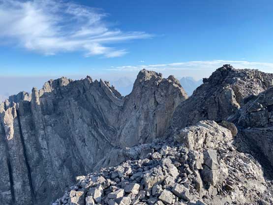


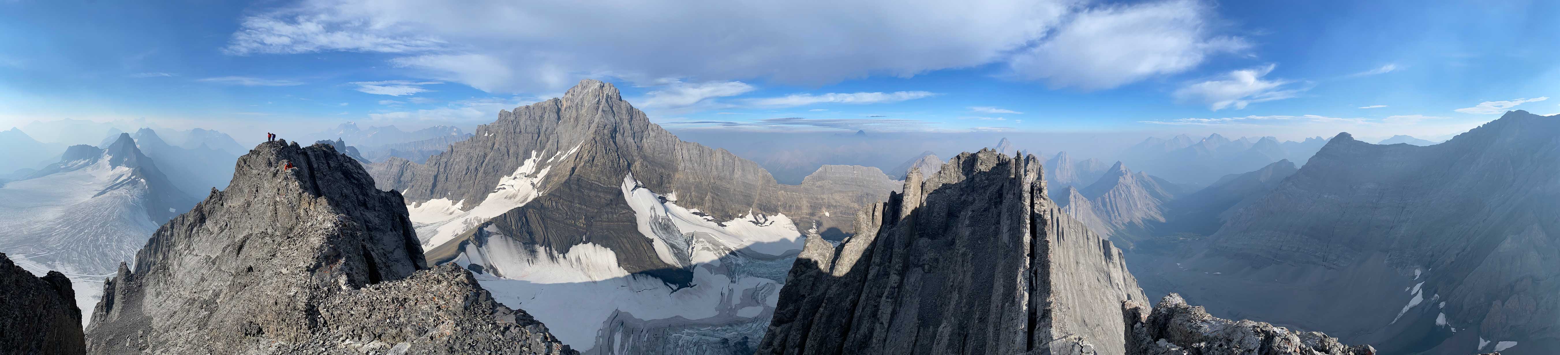

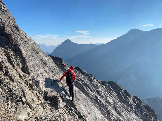
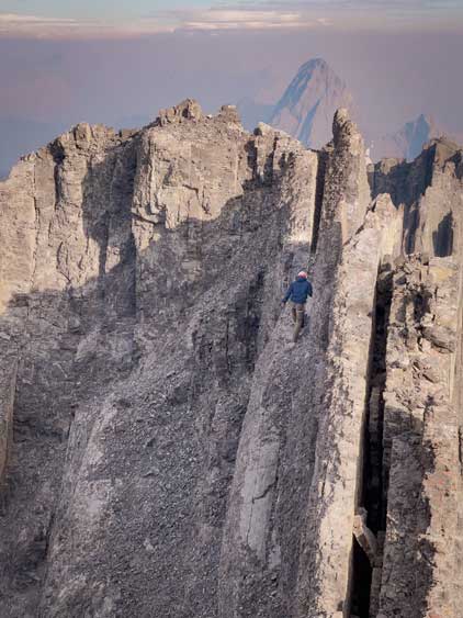
While celebrating the success I made the spontaneous decision to check out that north summit which seemed lower, but marginally. I remembered reading the reports that Elizabeth’s group thought that was the actual summit, tried a few different ways but couldn’t get there. Grant in Doug’s party also tried to traverse there but didn’t make all the way. I didn’t expect to make all the way across but I would decide one step at a time. The first portion was to balance across a knife-edge flake and from the top of that flake I made a few committing moves to get down into the small notch. The terrain on the west side was the only possibility but there’s a vertical wall underneath. However, this wall wasn’t that tall actually. I lowered myself using bomber hand-holds but no foot hold (class 5) onto a thin ledge, traversed this ledge and climbed onto the next flake (wider but looser). After that I was surprised the difficulty was already over and minutes later I was on the north summit. There’s a cairn but no register. I continued past the north summit to get more views before coming back. The return to the true summit felt much easier as I already knew what exactly to expect.


After spending another half an hour on the summit (finally ate some food) we decided to go homewards. The traverse back across the summit ridge wasn’t bad and neither was the descent of that ledge. Any downwards move on that ledge required more caution than the upwards ones. After the ledge I climbed a direct variation to get back onto the SW Ridge as I planned easier. This line involved a few 5.2 ish moves but those weren’t problematic for me. Originally I was thinking the descent of the SW Ridge could be tricky but it turned out not bad as well. With the warm sun I felt all the hard steps on that lower ridge were exponentially easier than a few hours earlier. The worst was still the choss slopes under Robertson/Sir Douglas col. We tried to not take that gully but it became impossible towards the bottom. Traversing and descending the moraine type of compact choss was literally my least favourate type of terrain and there sure had a lot of that. Eventually we had to merge back into the gully and gingerly descended onto the glacier. The conclusion? I brought rope and rock shoes but didn’t bother to use any, including the traverse to the lower north summit.


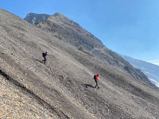


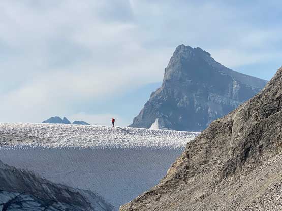
I didn’t even bother to don crampons for the Haig Icefield crossing as I expected the snow and ice to be much softer now. I was correct. There was actually some post-holing on slurpee kind of ice. The least enjoyable part of the return was to get off French Glacier back onto the trail. The unavoidable kilometer-long side-hill bashing on loose rocks was mind crushing. I hated every minute of that part. Lower down I successfully located my ditched trail runners but carried them down to treeline before swapping footwear. The rest of the return was long but uneventful. Our round trip time was under 11 hours. The sky had turned overcast from the moment we stepped off French Glacier and we actually did receive a few drops of rain while driving back to Canmore. That evening I drove all the way back to Revelstoke and the next morning I drove back home, and that concluded another successful mission in the Rockies.