Baring Mountain
September 28, 2017
1867m
US-2 Corridor / Wild Sky Wilderness, WA
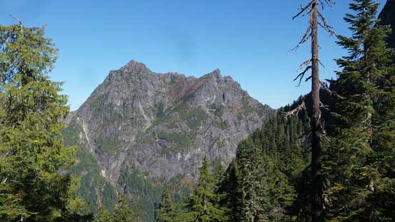
Baring Mountain has a very distinct double-summit profile along with a massive north face that sticks out of the western Highway 2 corridor liking a towering gendarme. This peak is super recognizable from almost everywhere within its vicinity. In the peak-bagging community it’s also known as one of the “steepest” in Washington state. The “steepness” isn’t just the visual impression, but rather some numerical values after a set of formulated calculations. I personally don’t really care how this is calculated so I wouldn’t bother to go in depth, but this fact does indicate something. In a state with countless iconic and rugged peaks Baring Mountain really stands out..
Contrary to its fearsome profile the standard route up Baring Mountain is a mere “class 2” scramble with much being on a trail. To me this puts it lower on my “to-do” list for the sake of reason that reaching the summit of Baring Mountain is nowhere an impressive feat, at least not according to my personal experience. On the other hand, the lack of technical difficulty means this peak is within most scramblers or even hikers’ league such that on a clear day you’re likely going to see someone else, even though the access trail isn’t a maintained or well-advertised one. A hike up Baring Mountain was a complete random decision on the Thursday of this last week of September. I had to be back to Vancouver by 6 pm for work but the weather was too good to not dream about something. I figured had I slept in my truck at the trail-head I could have bagged Baring Mtn. in a timely fashion and still be at work on time…

Baring Mountain standard route. GPX DL
With the challenge set at the last minute I drove down south across the border on Wednesday night and made to the trail-head after midnight. The 5 or 6 miles or dirt road was in an excellent shape such that I could have easily gone by easily with just a LC 2-wheel drive.. I was not happy about this because I drove my Toyota Tacoma down there so wasted a lot of gas money.. But that’s just a minor thing. The next morning it was actually the arrival of another hiker that woke me up as I slept through the alarm.. By the time I finally got going it was already an hour past the first light.. Right off the bat I almost made a mistake for taking the Barclay Lake trail. The unofficial and unsigned “Baring Mtn. trail” starts parallel to the main trail, but on the right (south) side. The point where this trail turns sharply into the forest was fairly obvious and then it’s a 400+ meters of steep grunt. There are small switchbacks here and there and the grade isn’t as steep as I thought it’d be. It’s still a steep hike, but quite an averaged one if in BC Coast.
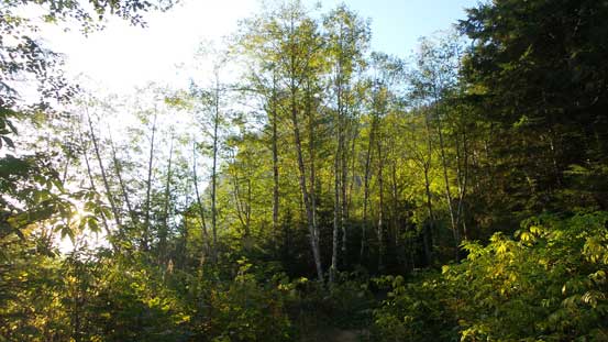
This is the initial flat section following an old road
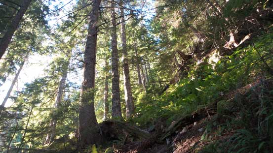
Steep grunt up the forest
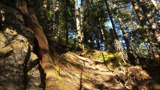
As typical as it goes..

Just another view in the forest. This is looking down
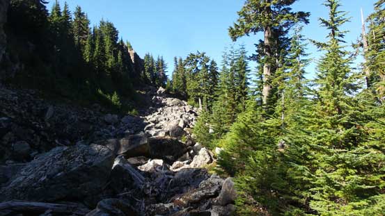
The next stage was following the spine of a (forested) ridge due south-east. I thought this section would have some views but nope. The whole ridge walk was done under a thick canopy although the trail was still in a decent shape. After a long while this trail drops, and then traverses into a forested bowl on the south side before re-ascending steeply back to the ridge crest and then into a “boulder basin”. I finally got some views from the basin although there’s still not a lot of things to see. One feature that caught my attention immediately was the steep gully to the high col between the main and south summits. That part did not look fun to me at all… And then traversing across this “boulder basin” was a bit tedious too as I lost the trail and had to hop over some pretty sizeable rocks. The grunt up the aforementioned gully wasn’t as bad though as the grade was much mellower than appeared from far afar.
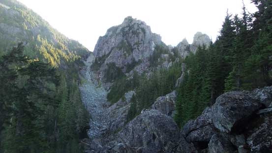
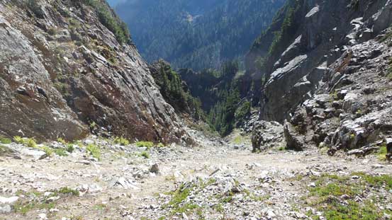
Looking straight towards the gully I had to grunt shortly after….

Lots of talus in this gully

Almost exiting the gully, looking back. Finally some views…
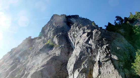
The col between the main and south summits offered a natural place to take the first break of this day but then I got hammered by a strong gust. That was not pleasant at all so I moved on. The ascent out of this high col required a few moves of “scrambling” but otherwise it’s not much harder than a “hike”. There’s a somewhat sheltered spot about 50 m upwards which I used to take a lengthy break. And then upwards onto the upper slopes the only challenge was to stay on the trail/path. There are cairns but not all of them are obvious that I ended up having to wonder back-and-forth a bit to find the path with the least resistance. And then the summit was easily attained.
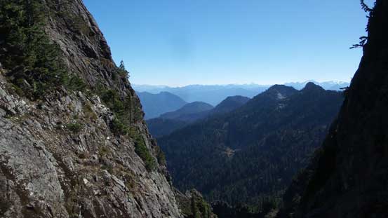
From the Main/South col, looking down the east side
This is the south peak from the col. Looks pretty rocky..

The ascent out of the col is actually the steepest part
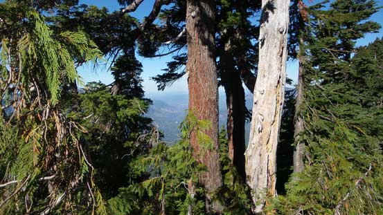
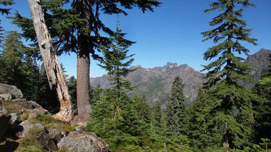
More glimpses through the thinning forest
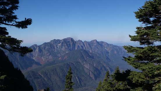
A full view of Mt. Index – another highway 2 icon

The typical terrain on the upper south slopes
This is looking back at the south peak
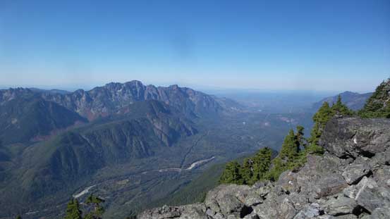
Mt. Index and US-2 Corridor

Almost there..

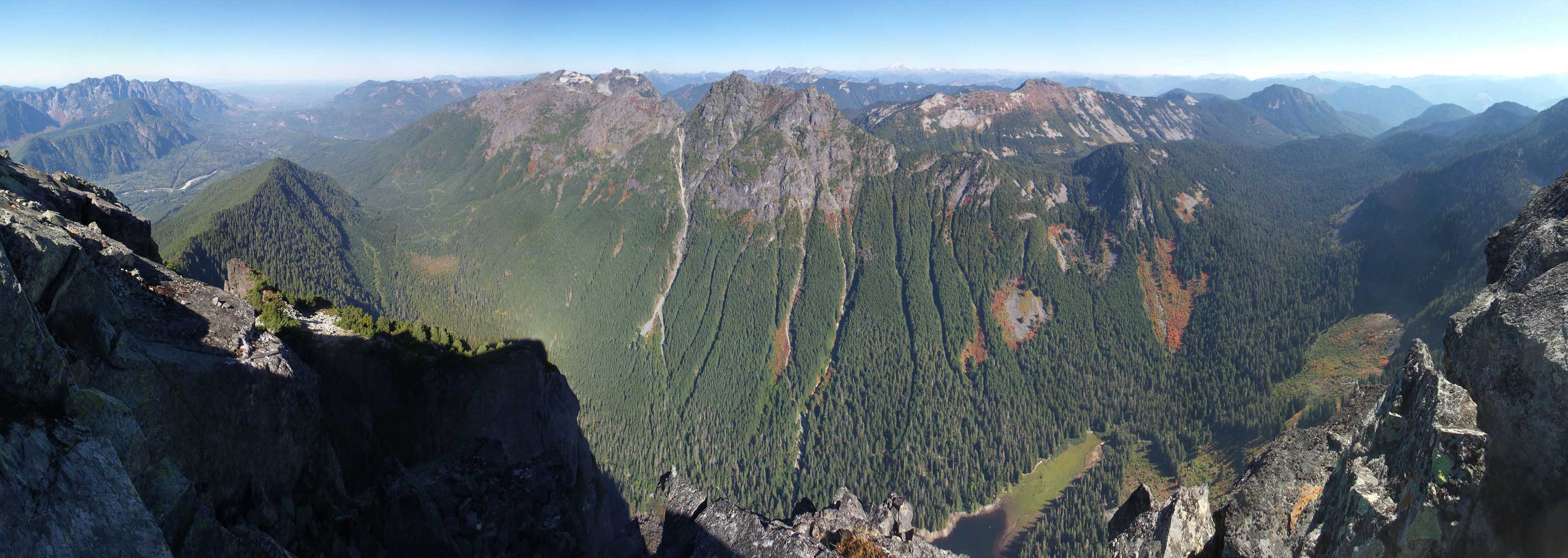
Gunn Peak is the highest in Wild Sky Wilderness
Merchant Peak in the foreground
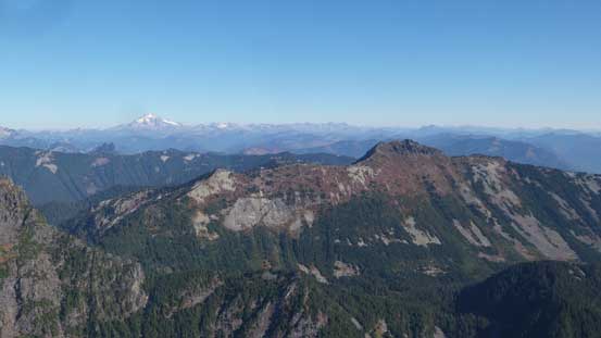
Townsend Mountain in the foreground with Glacier Peak behind on the horizon
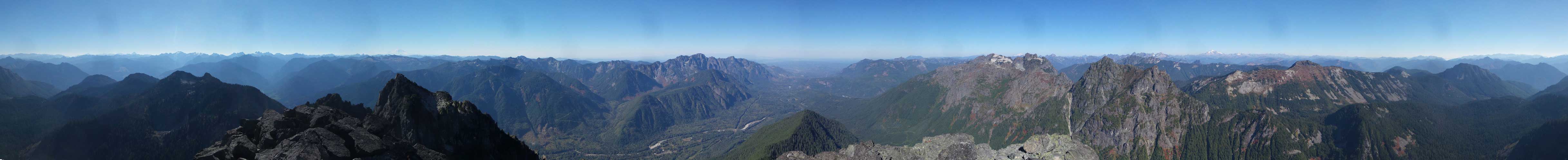
Summit Panorama from Baring Mountain. Click to view large size.
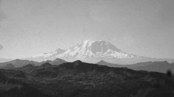
Mt. Rainier dominates the southern skyline
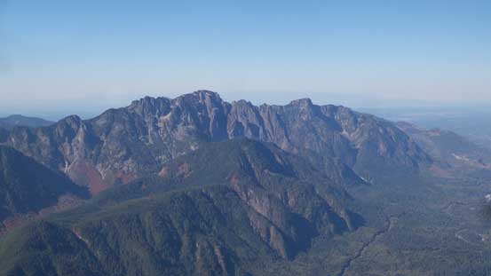
Mt. Index
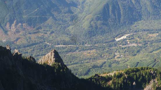
Looking steeply down the south side into the highway

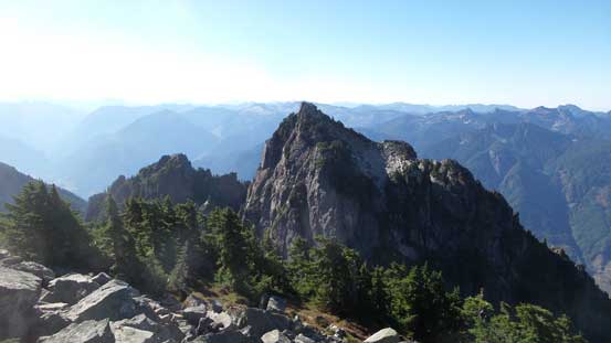
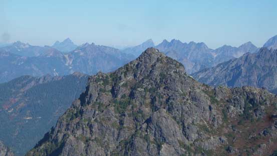
The south peak of Baring Mtn.

This is the north-east horizon with Mt. Pilchuck way far back

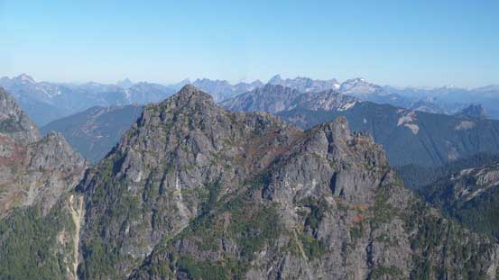
A closer look at the fang of Gunn Peak.
A closer look at Merchant Peak with quite a few rugged peaks behind
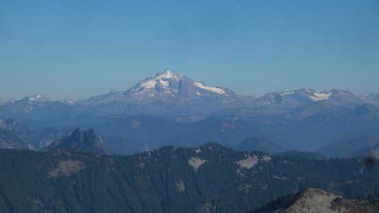
Glacier Peak
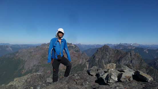
Me on the summit of Baring Mountain
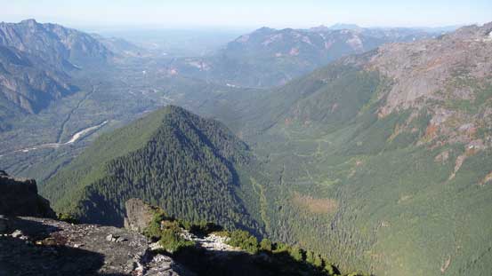
Looking down at the forested ridge approach.
Another panorama from Baring Mountain. Click to view large size.
I stayed for less than half an hour as time was slowly getting on. While reversing the upper slopes I ended up getting lost briefly, firstly too far down skier’s right and then too far skier’s left. Too lazy to back-track I ended up having to down-climb a short, but wet 3rd class crux to rejoin the trail. Descending the gully from the main/south summits col was just as tedious and tiring but at least faster than grunting up. Lower down into the “boulder basin” I stayed on the north side to avoid as much as hopping as possible and I have to say this did work out pretty well. The rest of the game was simply following the trail back to the parking lot with sections pretty steep for descending.

Going down now
Back into the high col. This is looking east

A review shot of the gully
This is the “boulder basin”. Staying on the north edge avoids much of the hopping
Gunn Peak through the trees
Merchant Peak

Looking back at the main summit of Baring Mtn. before dropping into the trees

Steep forest…
Not wasting much of time I soon started up the engine. Driving down this logging road was easy and then I turned onto US-2 towards Everett. The traffic through the urban areas wasn’t too terrible although getting onto I-5 was a pain in the ass as usual. Once I drove northwards out of Everett the rest was a cruise sailing back to the border crossing. The agent didn’t ask me too many questions (thankfully) and I did get back to work on time, but barely…
