The Watchman
May 21, 2017
2442m
Crater Lake National Park, OR
As the deepest lake in the U. S. of America there’s not much need to introduce the famed Crater Lake, a place that everybody should come visit at least for once in a lifetime. There are some small peaks along the crater rim that’s specially appealing to me and The Watchman is the easiest among those. In winter and spring the north, west and east rim roads aren’t plowed so there’s not that much I could do anyway. A snowshoe plod up The Watchman seemed like the perfect idea as an introductory.

The Watchman ascent route. GPX DL
The crews had plowed the west rim road for about 2 miles from Rim Village and that shaved some distance off my trip right off the bat. I slept in my car at the gate, 1 mile down the road and did not bother to wake up until almost 8 am. I debated about watching sunrise vs. having enough sleep for the long day ahead and opted for the latter… I had no idea how far ahead they plowed the road but since it looked dry it made perfect sense to don sneakers and carry boots/snowshoes. This turned out to be a good call as the road was dry all the way to the base of The Watchman and wearing sneakers surely made this slog a lot more pleasant.
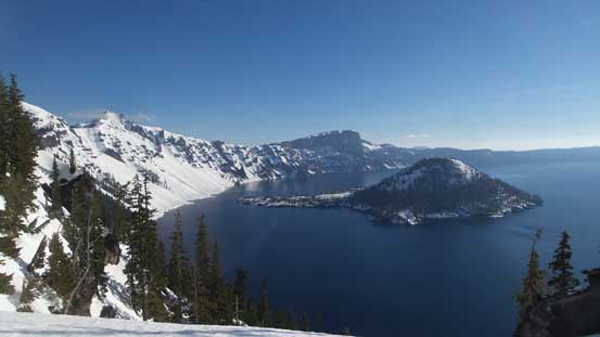
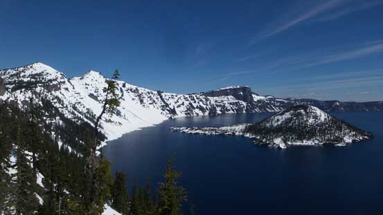
A view into Crater Lake from where I parked

Following the plowed west rim road towards The Watchman
This was as far as they plowed.
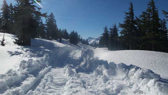
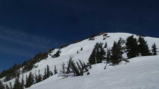
Soon enough it’s time to ditch sneakers and don boots and snowshoes. There were at least 4 big machines working on clearing the road and it’s pretty impressive to watch, but their progress was painfully slow and in no time I passed them and continued on the road on my own. The stretch traversing on the south side of The Watchman was steep and narrow and with the 5+ meters of snow the shape of the road was completely indistinguishable making some unpleasant side-hilling. It’s time to bail the road and ascend straight up.
The steep traverse soon became pain in the ass on snowshoes (side-hill)
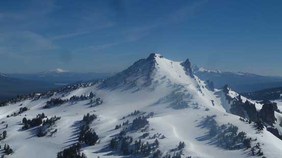
The steepest pitch was right at the start but even so it’s not much steeper than 25 degrees and the snow was firm that the Lightning Ascents bit pretty firmly. In no time I was on the broad W/SW Ridge and after a gentle turn to the right (east) I was staring at the summit lookout. Getting to the lookout proper required a few scrambling moves due to snow-covered steps and I could tell that nobody went here in the last day or two. The views were good but the sun was in the wrong side for photographing Crater Lake..
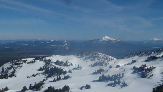
Union Peak to the south

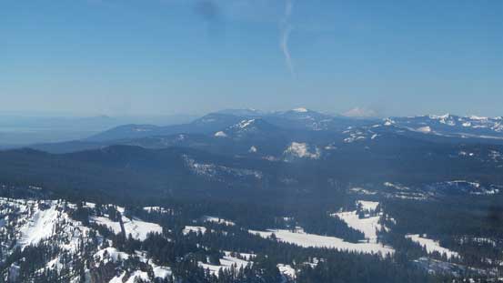
Mt. McLoughlin on the horizon
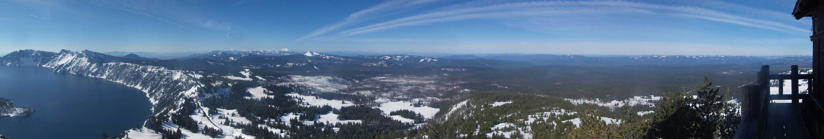
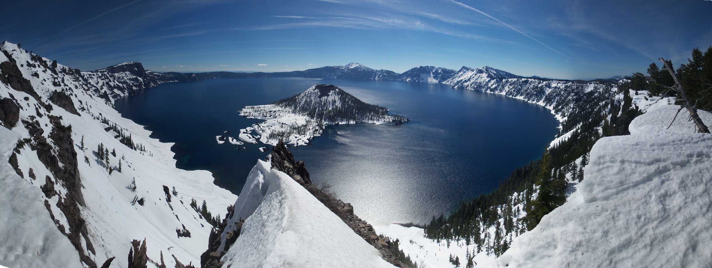
Partial Summit Panorama from The Watchman. Click to view large size.
Partial Summit Panorama from The Watchman. Click to view large size.
The southern horizon with Mt. Shasta visible on the right side.
Mt. Bailey to the north
Hillman Peak
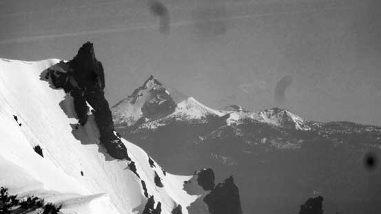
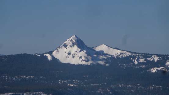
Could see the pointy Mt. Thielsen

Me on the summit of The Watchman
I did try to stay longer but then the cold wind kicked in. I thought I could go inside the lookout but apparently not, so down I went. In order to take in more views I opted to not use the SW Ridge and instead, the steep snow down S/SE Face looked mighty doable. The snow was getting soft already so there’s no need to take ice axe or crampons out which saved a lot of hassle. There were a few spots that’s pretty steep (40+ degrees) that I had to down-climb facing inwards but most of the route was an easy plunge. There’s some route-finding required near the bottom and after getting cliffed out I found a continuous snow line further to the down-climber’s left (east) which worked nonetheless. The rest of the return along the road was boring and mind-numbing but at least not a long one.
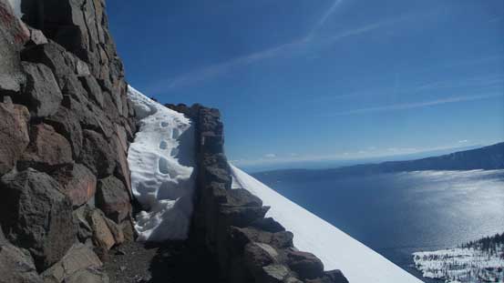
The summit lookout was still very snow covered. Note my steps.
Descending the steep SE Face
Crater Lake from partway down. Garfield and Applegate Peaks left of center
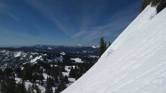
As you can see, this route is steep..
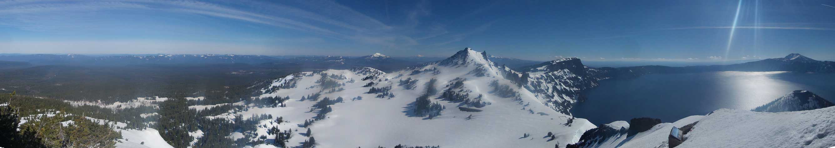
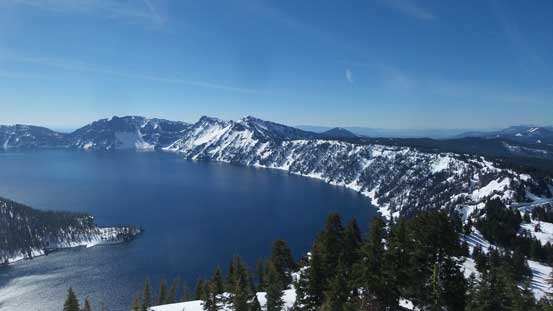
Panorama of Crater Lake. Click to view large size.
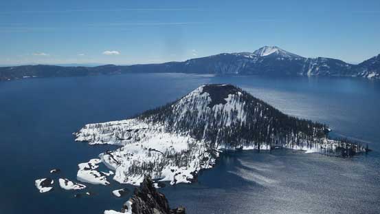
Wizard Island

A closer look into the lake and Skell Channel
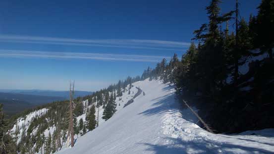
Partway back along the rim walk
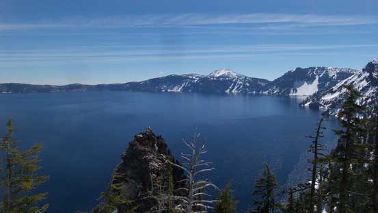
Mt. Scott (highest in the park) on the horizon

Wizard Island with Llao Rock behind
Back to the parking lot I joined the hordes and did some tourism thing including paying a visit to the Rim Village, but I didn’t stay long as I’m just not the type of person who enjoys mass amount of people. The drive down US-62 was peaceful and without much traffic and then I merged onto US-97 north. This road was much more scenic than I-5 with views of most, if not all of the Oregon volcanoes from south to north. After the small city of Madras the road climbed up onto a plateau and then dropped into a deep canyon near Maupin before climbing back up to the plateau. It was a very interesting driving variation which I greatly appreciated. Eventually the SR 197 descended into the Columbia River Gorge and 40 miles later down west along I-84 I got to drive across the “Bridge of the God”. Too bad I had to pay for it but it only costed 2 dollars. And then the next stop would be Beacon Rock.
