Volcán de Agua
March 20, 2024
3761m
Santa María de Jesús, Guatemala
Volcán de Agua is considered by many as the most dangerous volcano in all of Guatemala, not because of the technical difficulties but rather the armed robberies on the standard route. The safety issues had been there for decades and the officials were never able to fully resolve the problem. A simple search on Google about this volcano would reveal a bunch of horror stories including a 77-year-old German guy being shot twice in 2018 (though survived). The robberies were also aiming at larger, guided groups such that hardly any touring agency offers this ascent nowadays. One article mentioned there had been 25 active robbers working in the zone and once you were seen walking past the town or through the lower farmlands they would plan an attack and wait for you on the return, often by jumping out of the bushes with masks, handguns and machetes. Those were former police officers and the poor farmers in the vicinity of Santa María de Jesús. In the case you aren’t starting early enough this could even happen on the way up. I’ve also seen one trip report in which the hikers opted to not carry a camera/phone to minimize the loss, but I could not consider that as an option, as I needed to have proofs of making the top. I was aware of two other routes (both twice as long and involve over 2000 m elevation gain) that do not have these safety issues, and the “Ruta Extrema” from Ciudad Vieja was the original plan, but the situation was further complicated by a large forest fire that took out most of the upper mountain 3 weeks ago. The latest update was about a week ago, that the fire was “currently 90% under control”.
“In control” does not mean the fire had been put off, so I dug out the images from Sentinel Hub Playground to find out where the 10% “out of control” burning was, and that turned out to be on the upper slopes of the north and west aspects. A few days ago I had just hiked through a burned zone on Almolonga and I do not think it’d be a wise idea to repeat that experience had the fire been actually burning, so the two longer and safer routes are no longer in consideration. There is a safer way to do this “standard route”, that is to hire at least two armed police officers in addition to a guide and that has to be arranged at least 3 days prior and can be costly. Again, because of the active fire I’m sure the climbing on this volcano is “closed” at the moment, so hiring a police escort was also no longer a viable option. This peak is one of the six “Ultra prominent peaks” in Guatemala so I must find a way to make do, alone via the standard, unsafe route and it took me a few days of concentrated thinking to formulate a plan. From reading Sam Grant’s trip report I knew there’s a dirt road skirting around the north-west side of Santa María de Jesús, and this road actually extends a few more kilometers all the way to 2650 m elevation, bypassing most, if not all of the lower farmlands. I had no “beta” about this road, but it was clearly seen on the satellite images and I had a private driver with a 4×4 vehicle so why not give that an attempt. By doing the entire driving at night I hoped that nobody could see me, or at least not with a clear indication that a foreign hiker had gone up the trail. Given the current fire situation I would also hope that the work on the communication towers on the summit had stopped (which was not true), and if not, at least I would be the first one going up the peak, away from any sighting until on my way down.
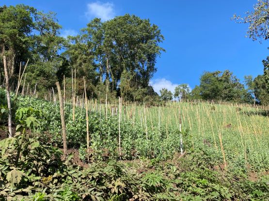
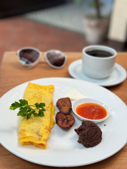
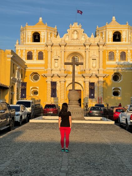
Kate and I arrived in Antigua in the previous afternoon and checked into our hotel. Oswaldo went home as he lives in Antigua, and the plan was to pick me up from the hotel at 4 am in the morning. Kate was sick (Covid or at least a cold/flu), and had been exhausted from the day-after-day peak-bagging in the past 9 days, so I suggested her to take a rest day. The original plan was to do Acatenango and then Agua but I switched the order as per Kate’s needs. It’s okay to skip Volcán de Agua but the other one is supposed to be the best one in this entire trip, so she had to conserve energy for the last day. I was also slightly sick but I had caught a Covid and/or cold/flu in literally every single international trip that I’ve done since the pandemic, so I knew I could push things through without a problem. The hotel was nice enough to offer me a boxed breakfast at 4 am, and the driver showed up on time (as always). The drive to Santa María de Jesús took half an hour, and I directed him onto the aforementioned dirt road (which was not shown on Google Map) using my Gaia app. Somewhere around Sam Grant’s starting spot we had to switch to 4-Low but with that we were able to drive ~5 km all the way to the road’s end at above 2600 m elevation. This was turning out to be the “best case scenario” in all of the possible outcomes so I told Oswaldo to come back and pick me up in 3.5 hours. With only 1100 m elevation gain on a well-travelled trail I could not anticipate a round trip longer than that. Oswaldo would drive back to Antigua for his family breakfast. I suggested him to stay here and wait, but I guess the family breakfast was more important to him than saving the 4×4 distances. On the other hand, this would further reduce the chance for those poor farmers to realize the presence of a foreign hiker (with at least one phone/camera to rob off).


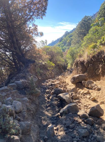
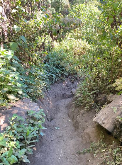
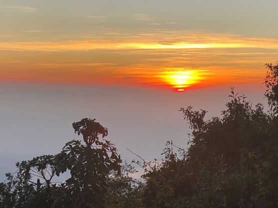
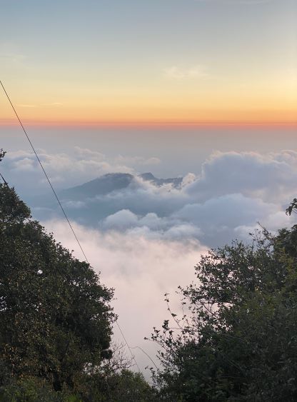
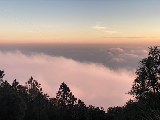
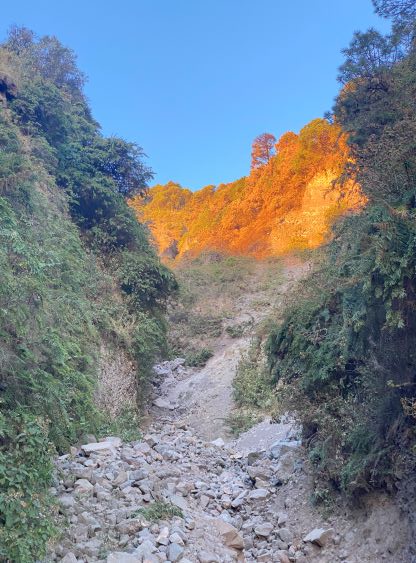
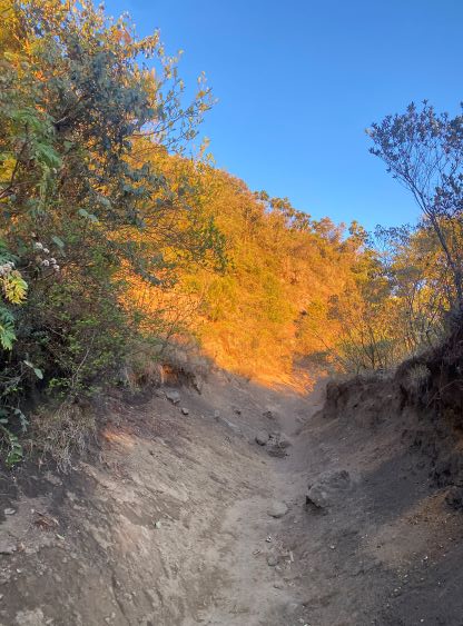
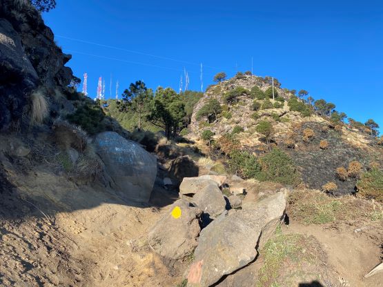
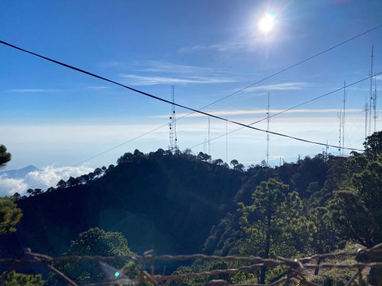
It was 5 am when Oswaldo turned around and drove away. I was left alone, somewhat sick, in the dark, on the unsafe route without a guide nor a police escort and I tried to focus on the immediate tasks ahead without weighing too much on the consequences. Thankfully the hike itself was no-brainer compared to the mental work in formulating this plan. This road actually continued further (but in much rougher shape) for at least one more kilometer, suggesting more farmlands to walk through. Not far from the absolute road’s end I got barked again by one dog. I could not locate this dog, and the barking was not from directly ahead so I sped up and the barking stopped in a minute. This dog did not bother to fuss with me on the return and this suggested that “hiking at night” might not be as ideal as I had been hoping for, at least not in Guatemala. After the road turned into a trail I simply had to put one foot in front of another, and the sunrise came an hour later when I crested a small “viewpoint” next to some cables. I waited for about 10 minutes for the sun to rise above the horizon before proceeding onward, and the next notable landmark was the crossing of a deep ravine. Some engineering had been done on the far side of the trail as otherwise this crossing could be impossible. I did smell some burning about 20 minutes earlier while still using the head-lamps but the smell did not last long. I later realized that this was from a campfire not far from the trail. I had no idea if that guy was awake or not when I walked by.


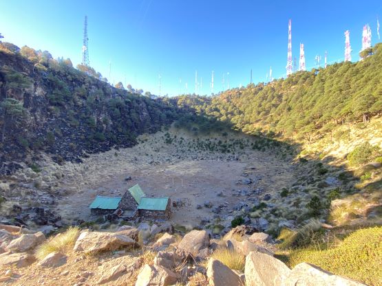
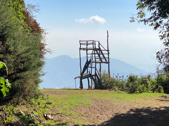
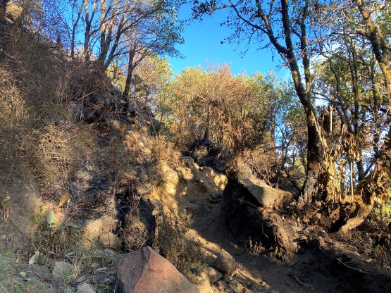
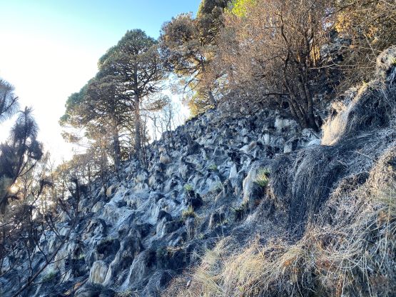
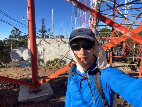
Somewhere around 3400 m elevation I entered the burnt forest and to my surprise I could not smell the burning, suggesting the fire had been completely put off near this trail. This was good, as my Covid masks was down to just one and I did not want to ruin the last one on this day yet. The dusts were insane though, but by hiking fast I was able to escape from the dusts made by myself, but the moment I stopped to take a photo I had to breathe some of them in. The fire damage was honestly not as bad as I thought, as I could still see some green colours on various plants and vegetation. The next stretch was to plod up some seemingly endless switchbacks and then I was looking into the crater. This volcano does not have a crater lake, and instead they had installed a soccer field in the center. I did not bother to go down to check that out but quickly dashed up the final 50 m gain to the crater rim where the hundreds of communication towers were located. The true summit was to the south and was easily attained. I also went to check out a northern sub-summit just to be sure, and I have to say that this was downright one of the ugliest summit by the “Ultras” standard. And thank to the radio or whatever electromagnetic waves they were sending and receiving I did not want to linger too long up there, and the plan was made to have a rest/food stop after descending back through the burnt zone. I had managed to catch some sporadic cell signals so I sent roughly 30 photos to Kate via Messenger, in case my phone got robbed on the descent. The most important for me was not to keep that old iPhone 11 Pro, but rather to send the “proofs” out. That What’s App was not working on this old phone (probably need a new ID for that), so despite having the local SIM card I could not communicate with the driver, but based on the past records in the past 9 days I knew he’d show up at the correct spot on time. He said he could “remember” the roads and I trusted him.


The plan of having a rest/food break fell through as not far below the crater I came across a local dude pushing his horse up. I tried to be friendly and he too seemed friendly, but after passing each other I paused slightly and heard him talking something like “hey” on his phone. It’s most probable that he just communicated with his coworkers (work needed to be done up on the top due to the fire damages), but I must assume the worst case scenario, that he just informed his “colleagues” down in Santa María de Jesús to prepare for robbing a lone foreign hiker. Up to this point I was not seen by anyone so this would be the earliest possible time for them to start preparing, and find the guns/machetes/masks and walking up the initial 500-m gain to where Oswaldo parked would take at least 1 hour even for fast hikers. I was confident that I could dash the entire way down beating that time, so I started jogging. There’d be no food break, unfortunately. I passed two more guys on their way up, with the first one clearly being a worker. The second guy was having a machete and blasting music, but seemed friendly as well. I did eventually get back to the vehicle without being robbed, in just over 3.5 hours round trip, and Oswaldo was indeed waiting for my return. We did no lingering as they could actually rob our entire vehicle, so quickly drove away via that same road system, avoiding going into the middle of Santa María de Jesús. I eventually got back to the hotel in Antigua at 9:30 am and earned myself a free second breakfast. Kate was just awake by the time I got back, and this started to feel deja vu the trip that I did in West Java.