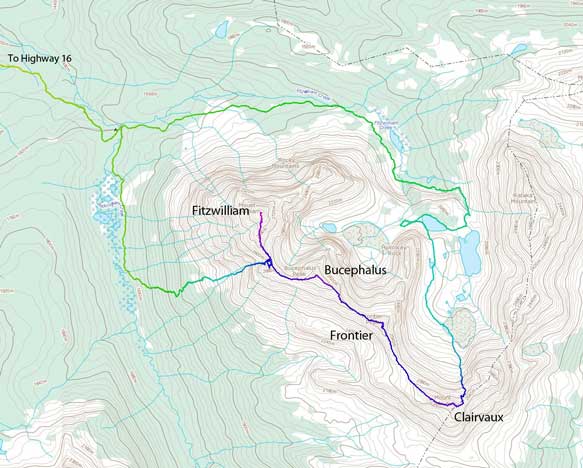
Mount Fitzwilliam
August 23, 2015
2902m
Mt. Robson Provincial Park, BC
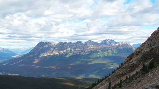
Mt. Fitzwilliam isn’t nearly the highest in its vicinity, but the proximity to road (Highway 16) and the huge vertical relief (1800 m) makes it one of the most impressive peaks visible when driving eastwards from Mt. Robson towards Jasper. Having driven this section for quite a few times I knew I had to get up Mt. Fitzwilliam someday. There wasn’t much useful information from simple Google search, but thankfully my friend, a Jasper local mountaineer Liam Harrap had ascended it more than 10 years ago. With the brief description provided by him and my photos taken from the nearby Ghita Mountain I could clearly picture the route out, that was, via a gigantic gully then the upper S. Ridge from Rockingham Creek to the west, with possible extensions to other peaks nearby.
Maurice (Maury) Perreault and I had been chatting for quite a while on Facebook and I was glad to finally do a trip with him (unfortunately, towards the rear end of my 4-year stay in Alberta)… Maury is a very hardcore climber and has climbed almost all of the Rockies’ 11,000ers as well as a handful of first ascents of some super-technical and obscured alpine mixed and ice climbing routes. Comparing to him I’m pretty much just a beginner in the world of alpine climbing. We had a big objective in mind but unfortunately an August snow storm came in dumping 40+ cm of the white stuffs two days prior to this trip. Not liking to take a chance and waste a couple days we eventually decided on Mt. Fitzwilliam which was oddly enough, in the same broad area as the original objective.
The Fitzwilliam to Clairvaux Traverse route. GPX DL
The strategy was to do an early start, travel light and attack Fitzwilliam, Bucephalus and possibly a few others in one very long day. We started at roughly 5:30 am and with Maury setting up a blistering pace we cruised up the initial 7 km trail in just 1 hour 10 minutes. We made to the campground by Rockingham Creek and other campers were still sleeping… We crossed the creek on a good bridge and then the adventure began. For the next 3 km or so to the base of our ascending gully we were supposed to travel alongside Rockingham Creek but the underbrushes were dense and the ground was wet and boggy forcing us to do some bushwhacking in the forest just to the left. It wasn’t bad though and we made progress fairly quickly.

Maury taking a short break
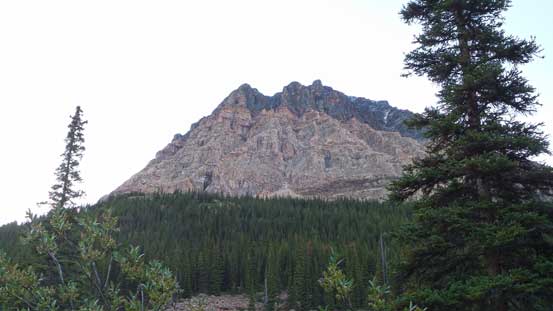
A glimpse of part of Mt. Fitzwilliam from Rockingham Creek

Bushwhacking along Rockingham Creek
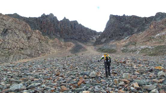
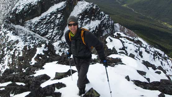
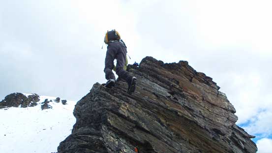
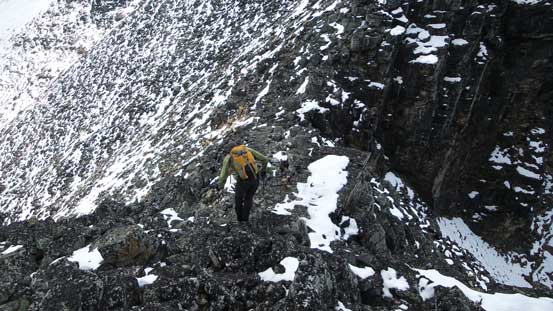
Then for the next 500 vertical meters or so we had to do some bushwhacking to hit the alpine. Given the location and my experience on the nearby Ghita Mountain I was fully expecting hours of horrendous work. The terrain was steep and the bush was still dense but by Jasper’s standard I’d say it’s fairly “easy”, and again, we made pretty good on time. Once exiting the trees we got our first view of the ascending gully. It looked narrow, steep and snow covered but not overly tricky. Oh by the way, this marked the official start of this boulder-hoping fest. If you don’t like a full day of endless quartzite boulders of all sizes then don’t come to visit Fitzwilliam area… The gully was somewhat sheltered from the sun on the NW aspect so higher up we encountered a lot of fresh snow. Adding to the moss those quartzite rocks were super slippery and required some extra cautions. Some of the boulders were horribly loose as well adding to the “fun” factor… But, high on motivation it didn’t take us long to make to the high col.
A view of Waddington Peak (not to be confused with the huge Mt. Waddington)…
Maury approaching our ascending gully
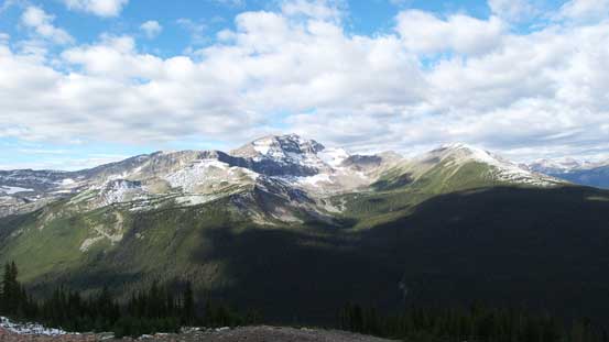
A view of Yellowhead Mountain – another icon along Highway 16
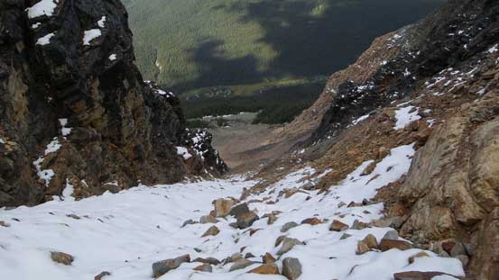
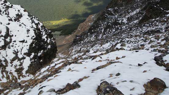
Partway up the gully, looking down
This picture shows the steepness of this gully
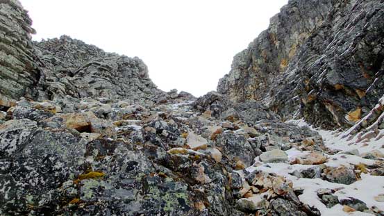
Looking upwards. Endless boulders
Almost at the top
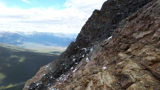
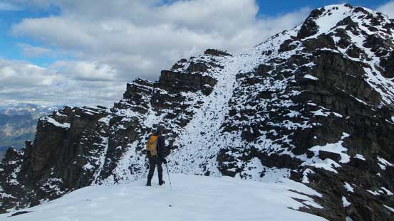
From the top of this gully, looking towards the S. Ridge of Mt. Fitzwilliam
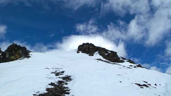
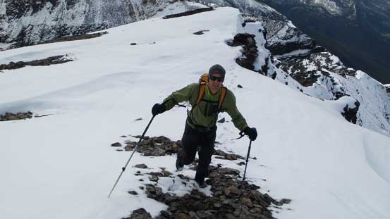
There’s more snow accumulation on the upper south ridge than expected (at sections it was post-holing), but the sky was more overcast than sunny so that might explain why. The cold temperature and chilly wind didn’t help neither. We generally stayed on the ridge crest as long as possible but did do a few short detours to either left or right. With a bit of route-finding the route was nothing harder than Class 3 scrambling and soon enough we stood on the summit – a place I’d been wishing to hang around for a few years already!
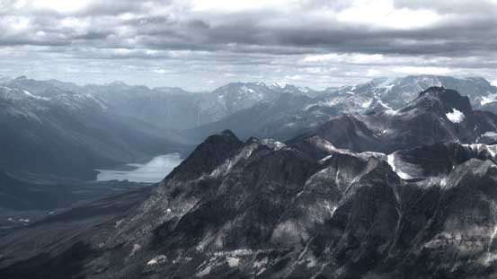
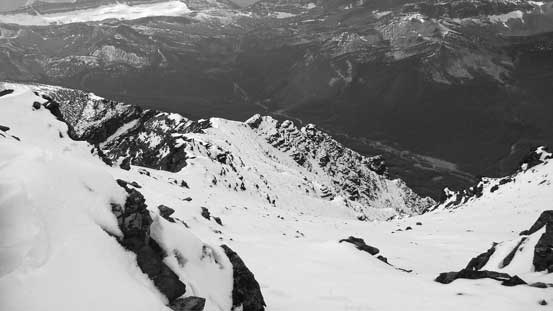
Looking down towards Fitzwilliam Basin which is on the other side

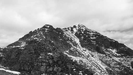
Bucephalus Peak will be our next objective
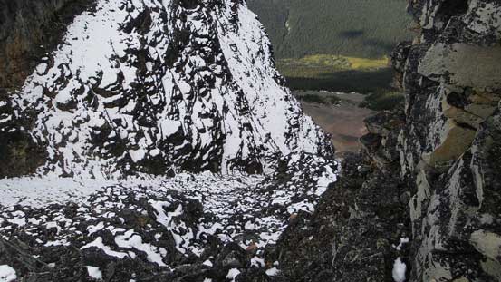
Another look down this steep gully…
Maury having fun on the wet boulders…
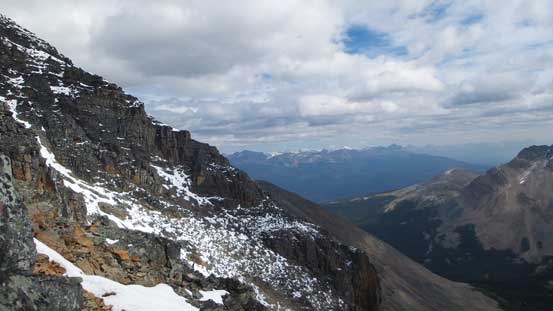
Studying the next section

Surprisingly to see cornices already forming up along the ridge
We picked a more direct line up a rock band
The final slope was pleasant step-kicking on snow
Maury approaching the summit
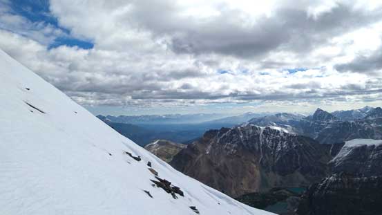
Great views before the smoke rolled in
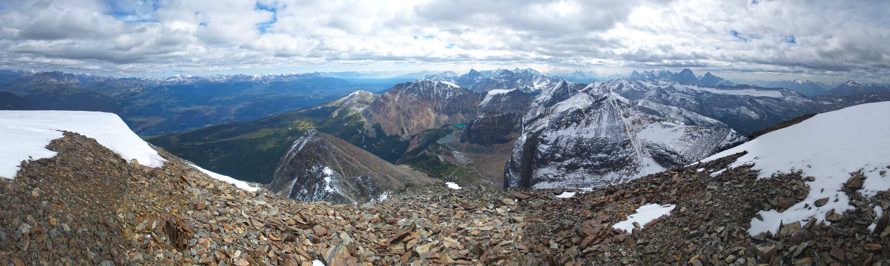
Partial summit panorama. Click to view large size.
Partial summit panorama. Click to view large size.
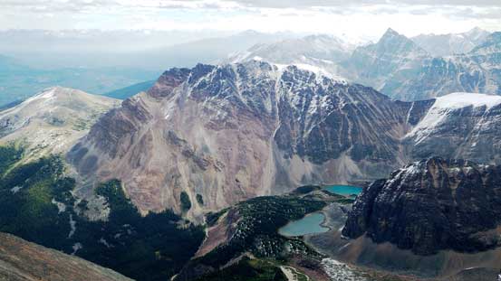
Kataka Mountain just across Fitzwilliam Basin
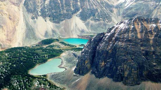
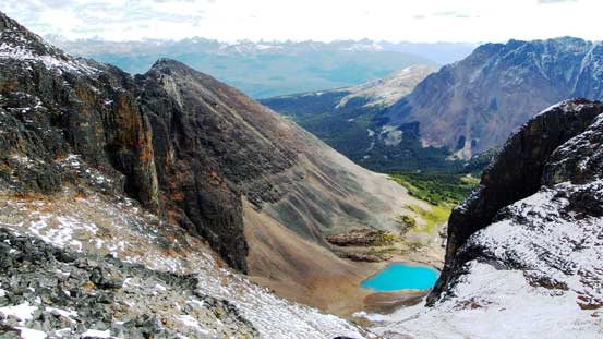
A couple tarns in the basin with Halloway Rock to the right
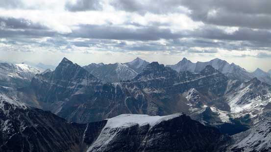
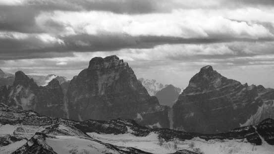
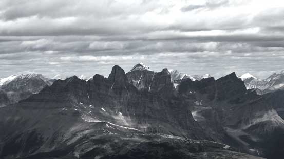
Roche Noire, Basillica and Curia, with high peaks in Trident Range poking behind
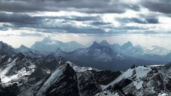
Mt. Edith Cavell and peaks by Tonquin Valley

The Ramparts with Simon Peak (Mt. Fraser) being the highest
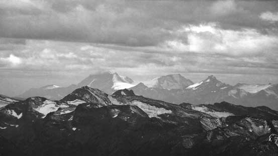
Kuraluk Peak a very obscured one in Selwyn Range
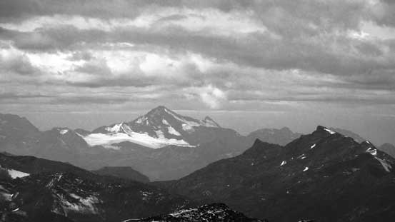
Jeanette Peak is the highest in Selwyn Range
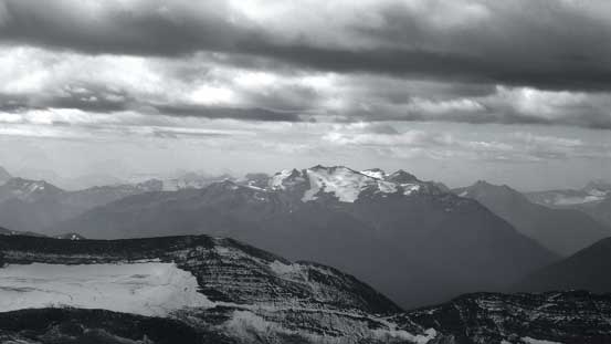
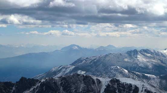
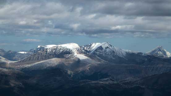
Mt. Albreda way to the west in the Monashees
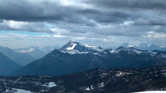
Mt. Monashee is the highest peak in the Monashees
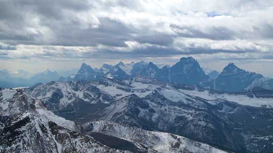
Another picture of the Ramparts
Another picture looking towards Edith Cavell and Tonquin area
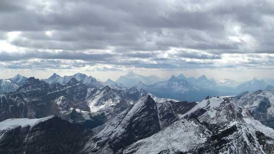
Mt. Geikie and Barbican Peak
In the distance are peaks on Skyline – Excelsior, Tekarra, etc.
Colin Range way to the East towards Jasper’s front country
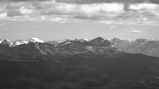
Pyramid Mountain and part of the Victoria Cross Range
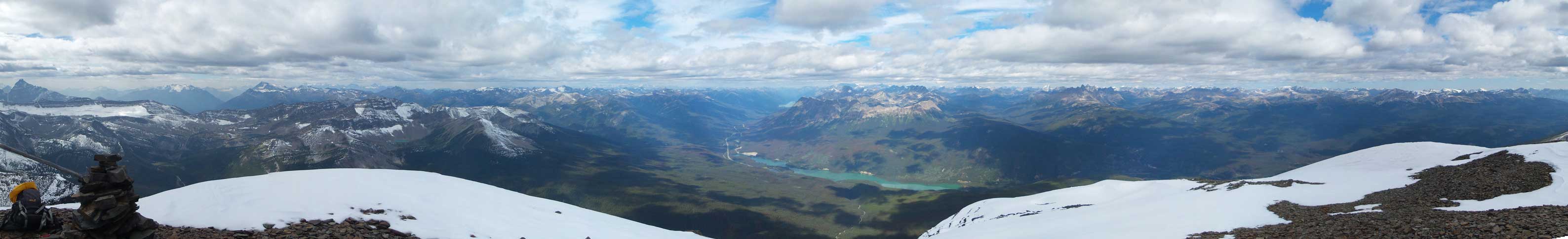
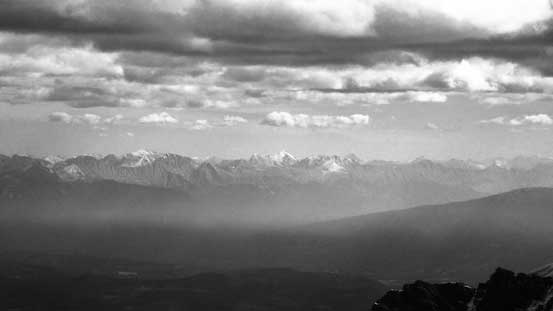
Looking down towards Moose Lake. Note the Robson Group was soaked in
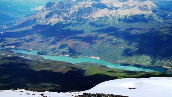
Yellowhead Lake
Mt. Bridgeland is supposed to be very hard…
Mt. Oliver had some fresh coating on
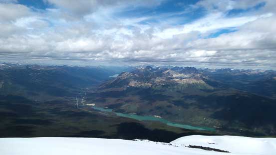
Yellowhead Lake and Yellowhead Mountain
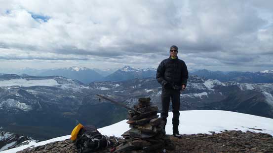
Maury on the summit
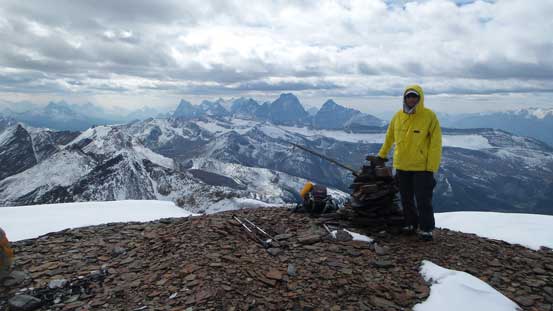
Me on the summit

A full panorama of Victoria Cross Range. Click to view large size.
Maury replaced Liam’s summit register (broken) with his newly bought waterproof one, then we quickly made our way down. Despite the slippery boulders the descent was still much faster than the ascent.
There were a lot of snow on this peak…
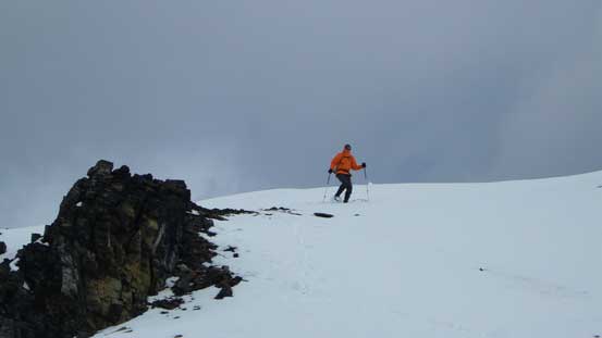
Maury starting the descent

Continuing down with Bucephalus Peak in front

One of the tarns by Fitzwilliam Basin
Another view from the descent
Almost down to Fitzwilliam/Bucephalus col, time to think about the next objective
Looking ahead it’s apparent Bucephalus Peak was only half an hour away. Despite the fresh snow Maury and I were fast and motivated so it made perfect sense to at least bag another peak while we were there anyway…
