Catacombs Mountain
September 12-13, 2013
3290m
Icefield Parkway (North), AB
During my two consecutive visits to the Brazeau Icefields in this past July, a fat glaciated peak on the opposite side of Icefield Parkway attracted my attention particularly. I knew there’s a near 11,000er called Catacombs Mountain situated at about halfway between Woolley and Fryatt, and this gotta be it, and yes, I was right. About a couple weeks ago, Eric threw out the ambitious plan to bag this fatty bastard along with the nearby Fortress Mountain in mid September when Chaba River is likely to be low enough to cross. Vern, Ben, Liam, and I agreed to join so that’s about it. A big lure of this objective is that we’d likely to be the second recorded ascent party after its first ascent in 1927. After examining carefully all of the beta we could gather, we agreed to ascend its south face to a high alpine shoulder where we could access the upper icefield. This is different from the FA party’s west ridge route but “looked” easier from Eric’s photo. The official height of this giant is 3333m and that puts it in the category of near-11000er, but on the summit our GPS readings along with altimeters agreed it’s lower than 3300m.
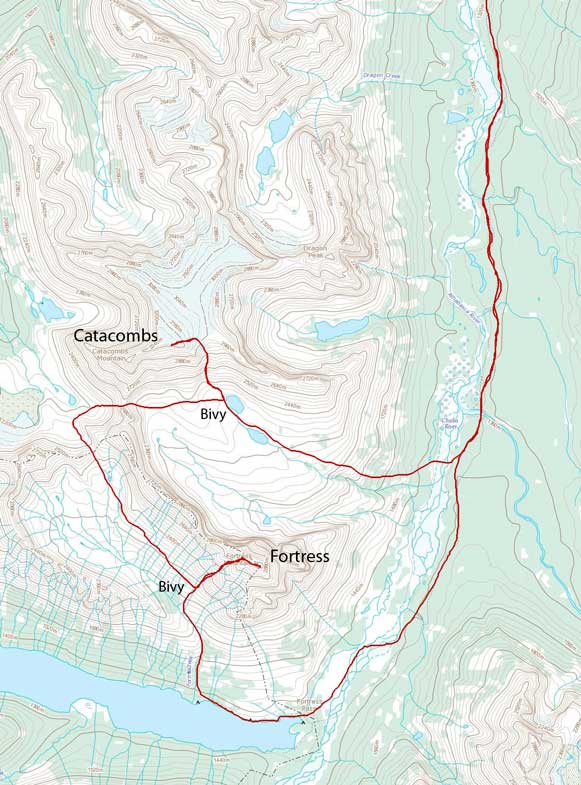
Catacombs Mountain and Fortress Mountain ascent route. GPX DL
Luckily for us, a high pressure system moved in gifting us a whole week’s sunny weather. Time to plan the details! It was apparent that we would need at least 3 days to get both Catacombs and Fortress, and to make it more secure, we’d plan 4 days plus an extra evening. If everything goes smoothly we’d have an extra day so Mount Sadleir was thrown in the plan, and of course, we could also decide to finish the trip earlier. The trip went slightly different than planned. We overestimated Friday but underestimated Sunday. It turned out this way:
- Thursday: approach to Athabasca Crossing Campground. 14.5km one way. (3.5 hours)
- Friday: cross Chaba River, bushwhack up forested slope, and set up camp at the high lake, scramble up the south face, ascend Catacombs’ upper icefield, and back to camp. (12.5 hours)
- Saturday: up and over “Catacombs south high col”, up and over “Fortress col”, down Fortress Creek, ascend Fortress Mountain and back to treeline, and bivy. (13.5 hours)
- Sunday: bushwhack down Fortress Creek, walk around Fortress Lake, cross Chaba River, and slog all the way back to parking lot. (11.5 hours)
It was a full on exploratory mountaineering trip with very limited route beta. In particular, from the first Chaba crossing to “Fortress col” we had zero beta. It was a BIG success to have both objectives bagged and also able to finish the trip 1 day ahead of schedule. That also meant I didn’t need to skip Monday’s classes which was good. I’m in 3rd year engineering program now and I didn’t really want to skip classes unless I “have to”. Back to the trip itself.. All 5 of us gathered at the Sunwapta Falls trail-head at about 9pm on Thursday evening with our big packs. Head-lamps on, and off we went.
The first 6km to Big Bend Campground was slightly down-hill and with lots of chatting it went by quickly. The next 9km to Athabasca Crossing Campground was a pure slog. It was at night so there’s nothing to see. Well, there wasn’t much to see at daylight time neither. All in all, after 3.5 hours’ boring hike we made to the first planned bivy spot. Considering how much traffic it receives, his campground is luxury and we quickly went to bed. It was very warm and the stars were bright.
On Friday morning we woke up at 7 and started at about 7:30. There’s a small lake offering our first view of Dragon Peak. It’s really just a small outlier on Catacombs Mountain massive though, but from this campground it looked very impressive and intimidating. The trail quickly led us to Athabasca River crossing where an old suspension bridge spans over. I didn’t feel very secure while walking on this bridge. It looked like the wood pieces would fall apart at any time. Once on the other side, we followed the trail entering the woods again. The trail deviated from the Chaba River but we kept our eyes closely to the supposed crossing. Vern’s GPS was handy here. After bushwhacking down to the flats it was the time to don running shoes.
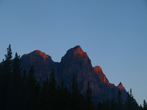
Dragon Peak seen from Athabasca Crossing Campground
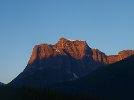
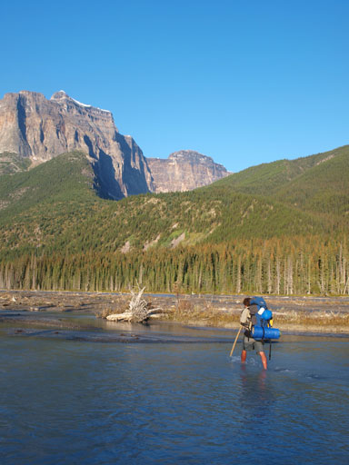
Fortress Mountain. Can’t believe we would be up there!

Crossing the suspension bridge

Fortress Mountain again
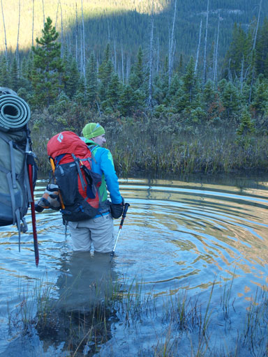
I’ll never forget this painful and cold river. My feet were already numb after crossing the first few channels, and the major one was yet to come. It never exceeded thigh deep but did require some careful route-finding. Liam and I went over a deeper channel that was thigh deep but Eric, Ben and Vern managed to find a slightly shallower place to cross. This major channel was so long that I almost completely lost the feelings on my feet. We were all happy to eventually survive this crossing. Into the bush, time to switch back the footwear.
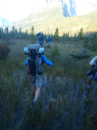
The first part was slushing across a swamp. Looks familiar?!
The first channel was surprisingly deep

Ben enjoying the first crossing
Now comes the real Chaba River
Liam crossing the first big channel. Not a big deal,

This is the last channel. Almost done!
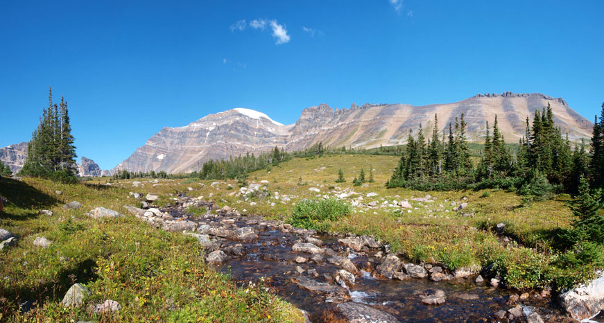
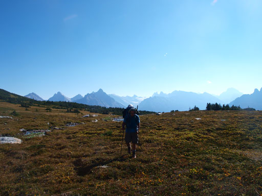
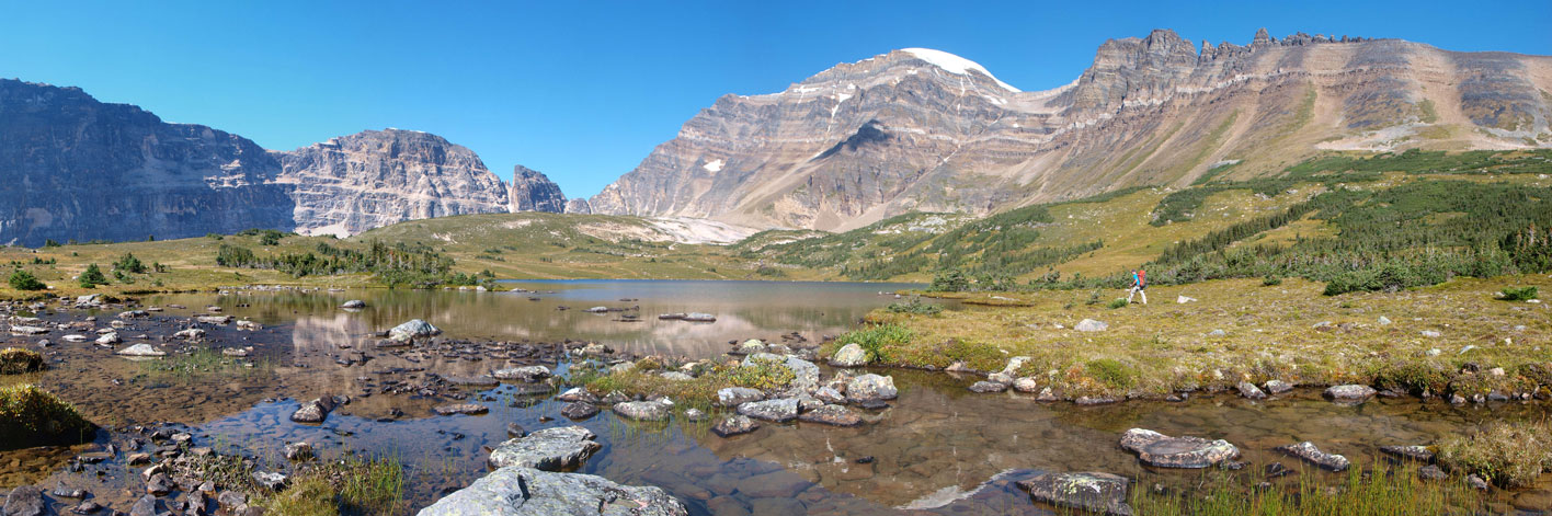
The bush part was 3km in distance but 900m in elevation gain. Initially it went smoothly. “How bad it can be?!” Well, never say that as it was turning on us soon. After gaining about half of the elevation we came across a very dense alder band. This part went painfully slow but we somehow managed to bash a line through. (It was a good warm-up for 2 days after)… After the bush got thinner again we found ourselves being too close to Fortress so we adjusted the bearing and ascended more straight up and also slightly to climber’s right. It was hot and we were all running low on water but thankfully we came across a neat stream. Following it up shortly we arrived at a lovely waterfall. What a change in scenery! Continuing up we would enter the alpine soon. It was still far away from treeline but the terrain levelled out and the trees got thinner with occasional meadows here and there. This terrain soon gave way to a large alpine meadow situated at the south bowl of Catacombs Mountain. Our objective was right in front of us, impressive but not “that” intimidating. After passing the first lovely alpine lake on it’s right side we pressed on to the far end of second lake. Now, it was the time to make an important decision!
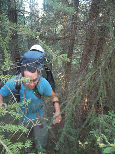
The initial bush wasn’t that bad.

But it soon got rougher
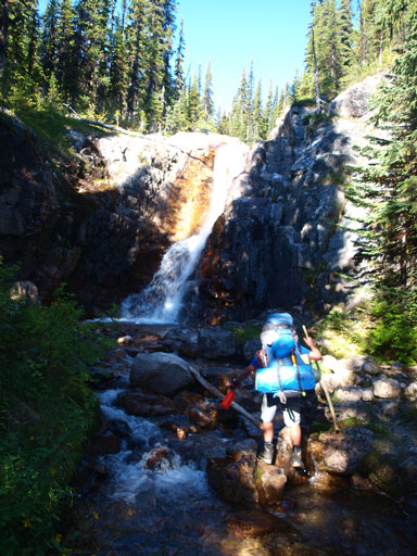
Following a stream up, we arrived at this waterfall
Now we finally made to the alpine meadows
Looking back, it was quite hazy!

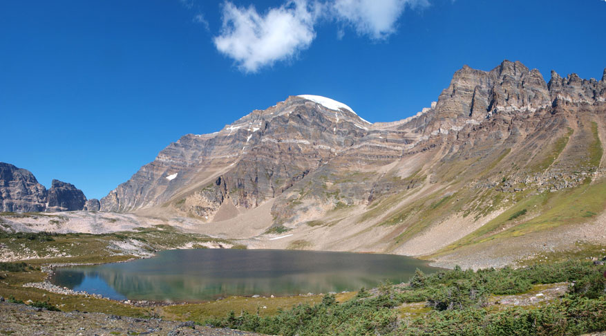
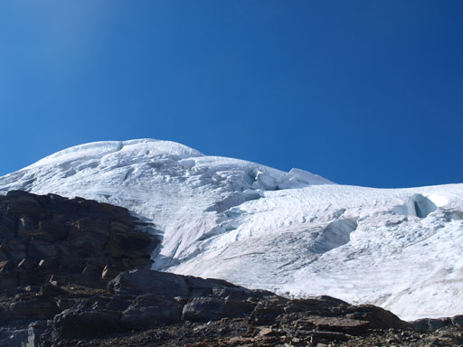
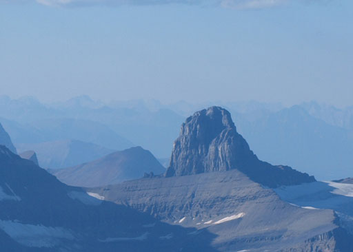
Our objective, Catacombs Mountain
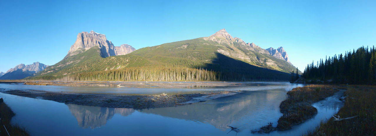
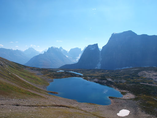
Panorama view of this lovely alpine bowl
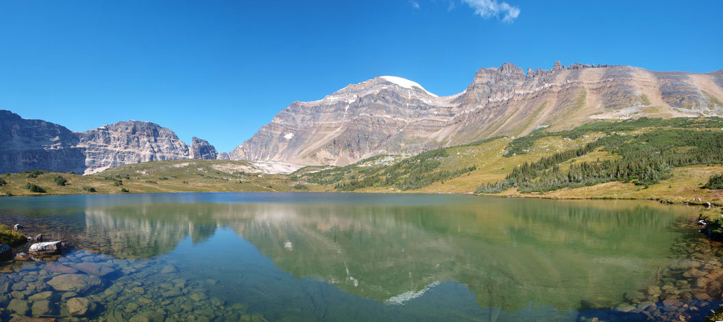
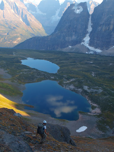
The first (lower) lake
The second (upper) lake

We contoured to its far end
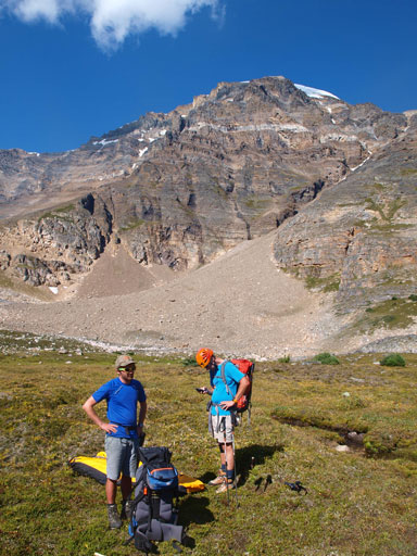
Time to set up the camp.
It was only noon. This camp site was superb but we were not sitting there for the next 8 hours… Eric’s initial plan was pressing on to the high shoulder to bivy. That would involve dragging all of the heavy gears up another 700 vertical meters on loose scrambly terrain and most of us weren’t in that mood. We figured that we’d have enough time to have this peak bagged and back down to this lake before dark. In theory it would work perfectly time wise but we all had the concern with the snow condition. It was extremely sunny and hot and we’d be travelling on an unknown icefield in late afternoon.. Oh well.. Nobody questioned our decision so after ditching bivy gears it was the time to press on.
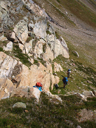
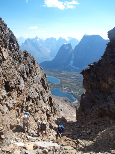
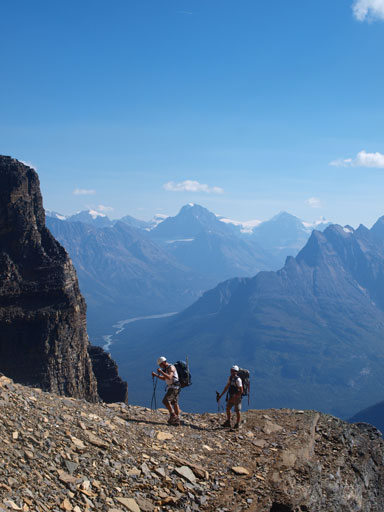
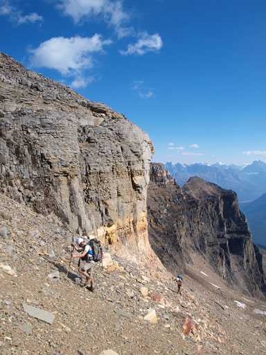
The south face looked to be very doable to us. Indeed, the scrambling never exceeded moderate on this route, though at times it got tedious and loose. We started on right side but worked our way towards left aiming for the long gully on far climber’s left. This gully would work all the way up from bottom to top but since we had five people we wanted to avoid rockfall zone for as much as we could. There’s a light grey band at about midway up and the only way to break through it was by going up this gully, and from there on, we stayed in this gully and automatically broke through the next rock band. At the last rock band guarding the summit ridge, again, the only break existed on far climber’s left. It took us about 2 hours from camp to the high shoulder. The glacier above us looked steep and broken. Our plan was to traverse around it on a big loop hoping to find easier route. We’d be on two rope teams with Liam, Eric, and Vern being the leading team, while Ben and I would stay behind on the 2nd rope.
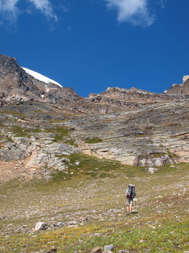
We followed this grassy slope aiming climber’s left
Looking back
A short scrambling section

Looking back again. You can see the two lakes
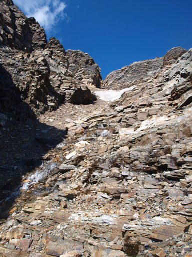
Here we would access the big gully, and we would follow it up
Looking back in this gully
Eric, Ben, and Mount Alberta
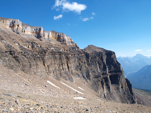
The upper walls that guards the summit ridge
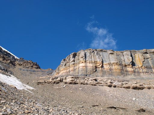
The only break exists on far climber’s left
Breaking this last band
But, the icefield looks steep and broken!

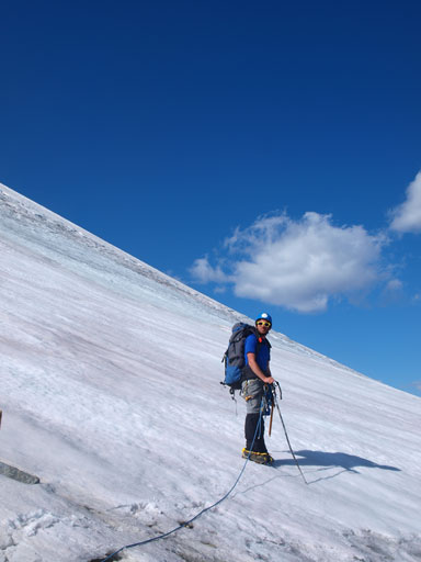
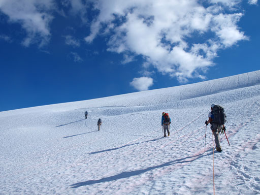
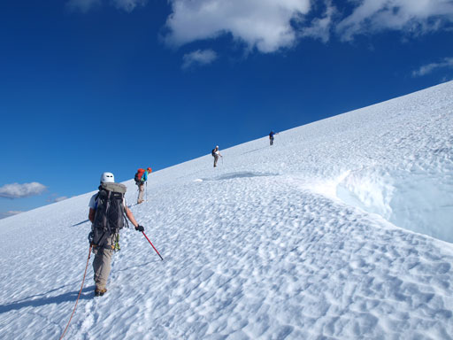
Ready for the glacier travel.
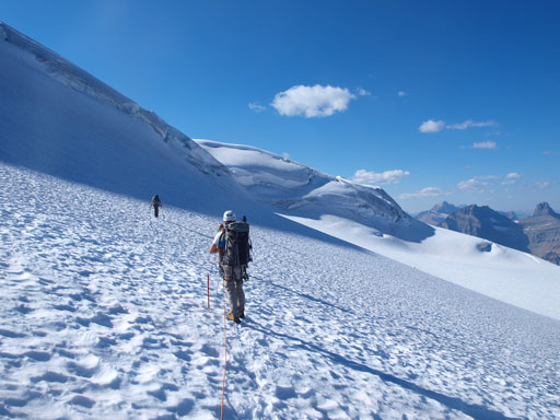
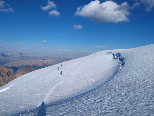
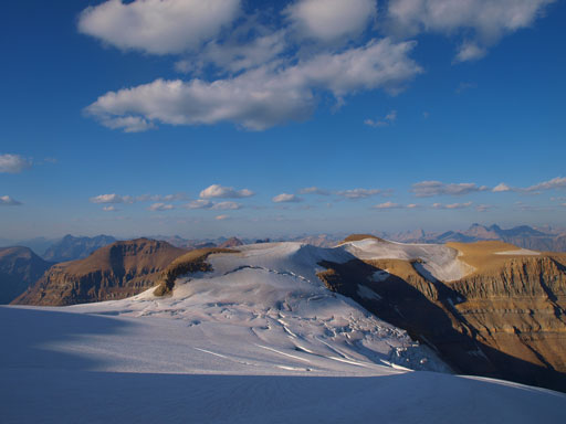
Less than 400 vertical meters to go. Liam led the way crossing a “handsome looking” crevasse before venturing onto the snow. The snow condition was much better than expected with pretty much negligible trail-breaking, but we realized this icefield/glacier was much more broken than we thought. It became pretty hopeless to see a large bergschrund/crevasse spanning most of the way across with the exception of the middle part that we couldn’t see. We contoured around a cool looking serac to the middle section of this glacier, and were very relieved to see easier terrain ahead. There were still numerous crevasses to cross but they were all bridged. Higher up we had to cross a big one that can suck in someone’s house. After that the summit was in sight but near the top we discovered a couple hidden crevasses including one right on the summit. We had to take turn to summit this mountain otherwise we’d be risking having more than 1 person falling into a hole. Despite the haze, the views were awesome. We could see many rarely seen peaks, as well as many familiar 11,000ers. The highest point was on snow and we thought about descending a bit to the rock so we could leave our register there, but doing so would involve another crevasse crossing and probably not really worth it.
Liam leading the way
Now what! Is there an easier way up?!
Well, let’s enjoy the scenery first
This icefield is much more broken than we could imagine!

Contouring around hoping to see easier terrain
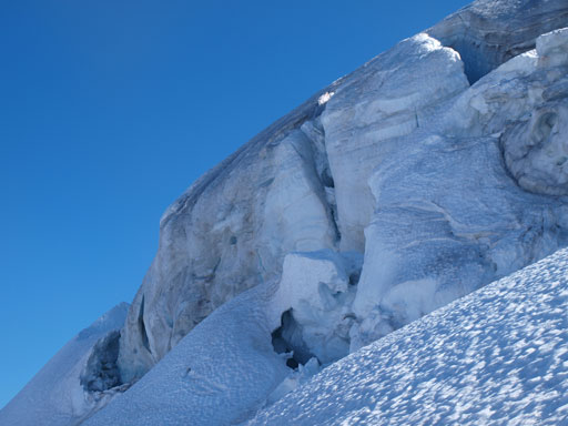
We traversed under this impressive serac

Looking back
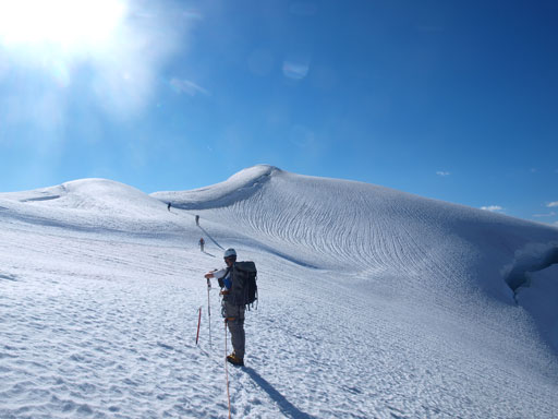
Now uhh, we found easier line up
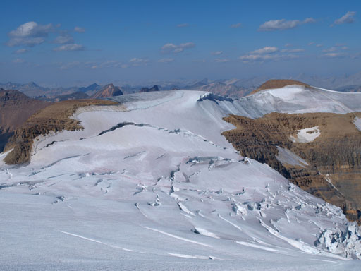
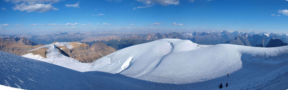
Panorama of Catacombs Icefield

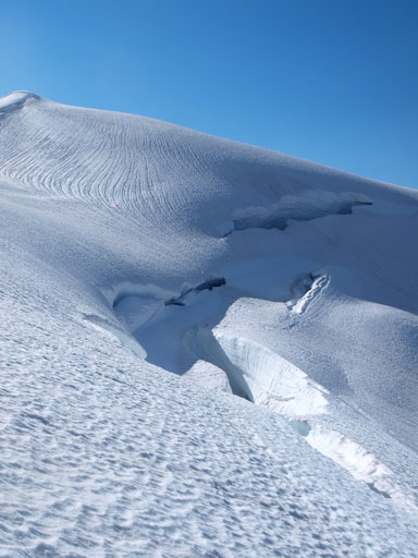
Broken ice everywhere
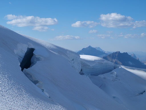
Crossing a big crevasse

This one can suck in your house!
The same crevasse
The summit is finally in sight
Big holes all around the places

Liam, Eric, and Vern ascending the last slope

Looking over the other side, the FA party’s ascent route
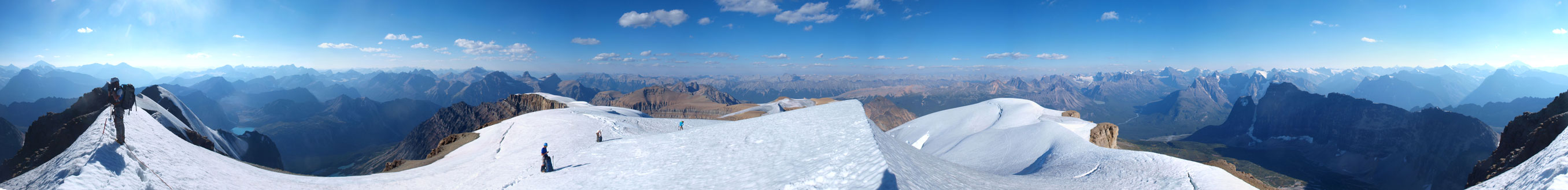
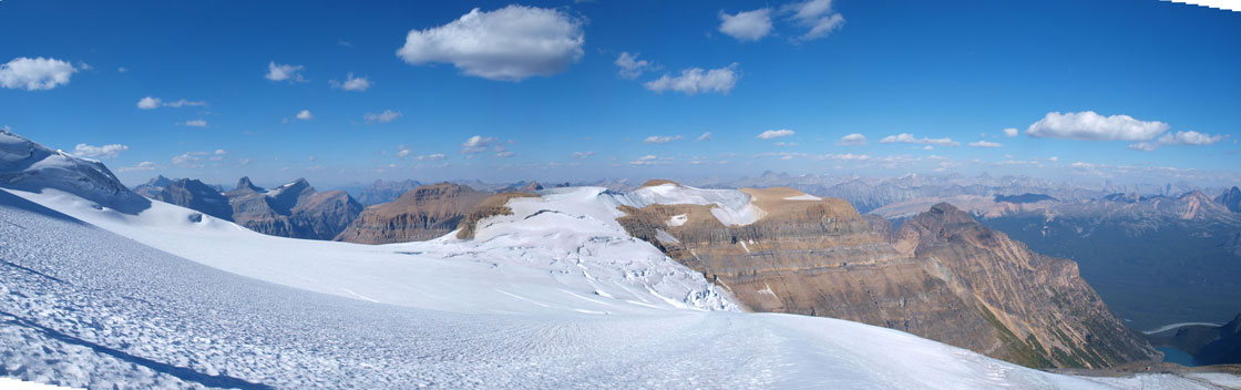
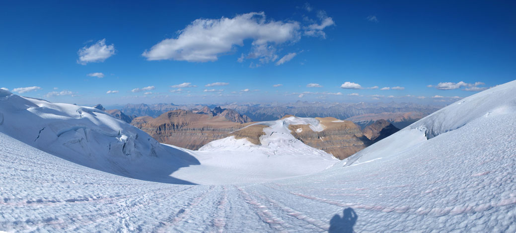
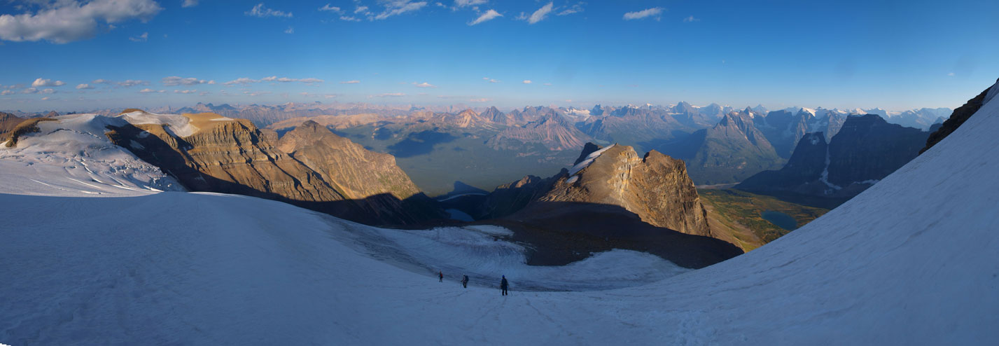
Summit Panorama. Click to view large size.
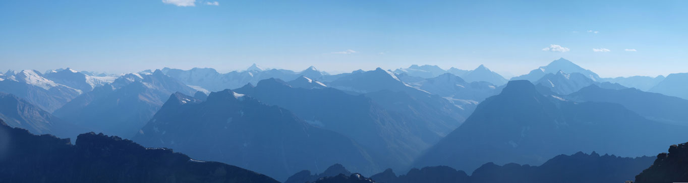
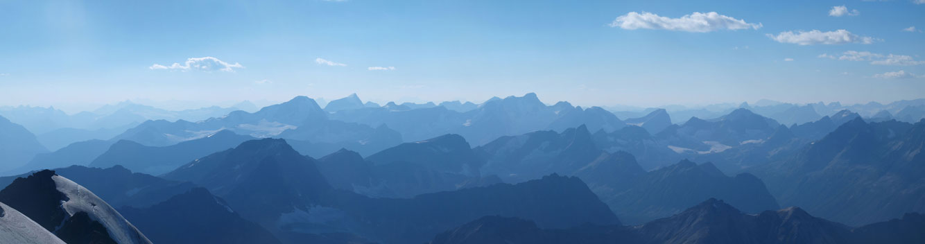
Panorama across Icefield Parkway. You can see Brazeau Icefield’s peaks
Panorama of Sir Winston Churchill Range with many familiar 11,000ers
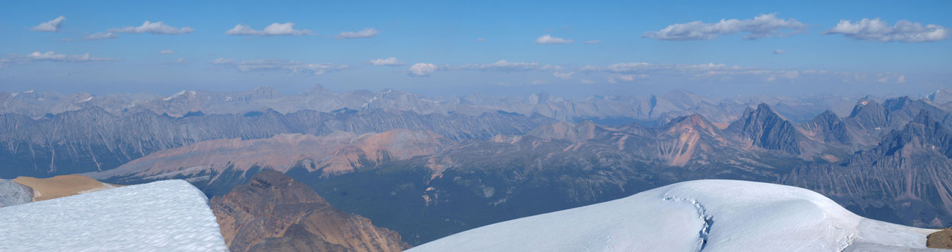
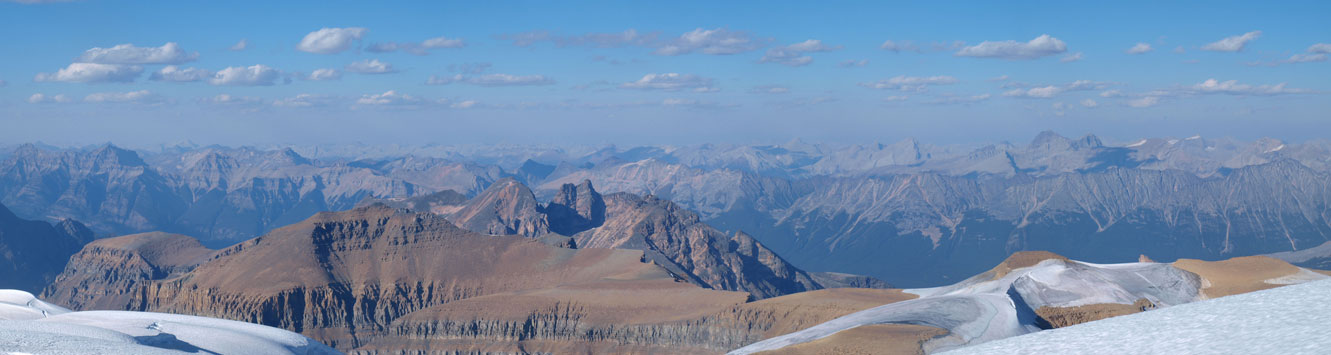
Panorama of the distant Clemenceau Icefield area
And then, the Hooker Icefield area

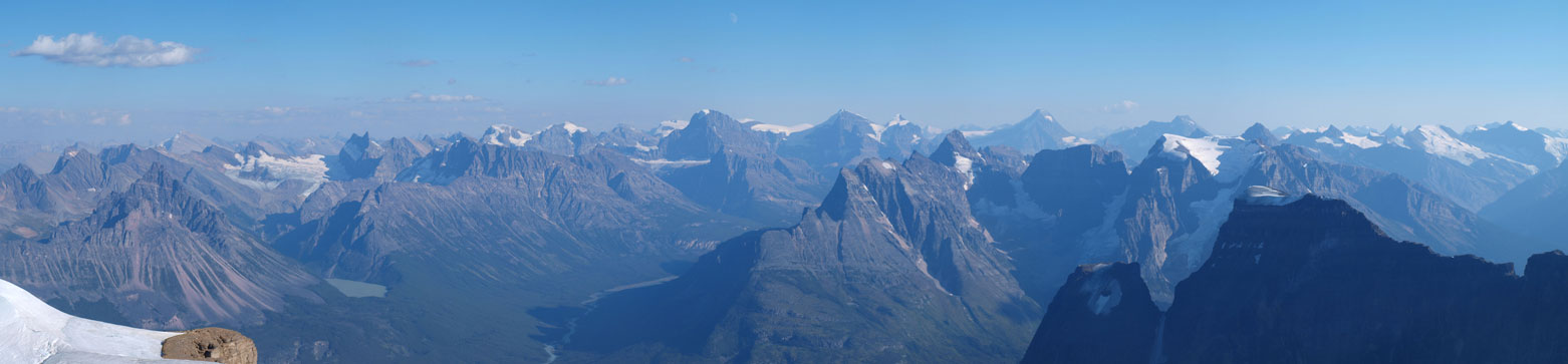
Panorama of the peaks around Fryatt Valley
And finally, looking north. You can see Kerkeslin on the far left, and Unwin on right side skyline

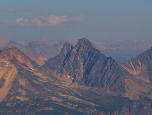
North Twin and South Twin
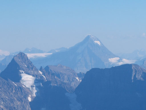
Mt. Alberta
Mt. Columbia

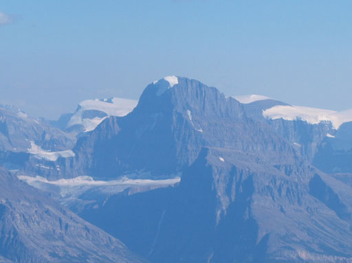
Mt. Clemenceau

Mt. Fryatt
Brussels Peak

Kerkeslin Mountain
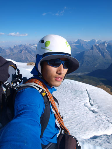
Me on the summit of Catacombs Mountain
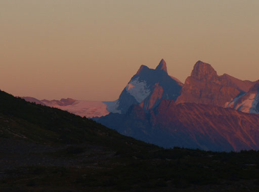
It was late in the day so we had to descend quickly. Nobody fell into a crevasse on the return and we were off the snow/ice quickly. As the sun lowering itself the smoke appeared to be dissipating and we got better and better views especially towards Mount Alberta and Mount Columbia. The descent went smoothly but tedious. Now what, time to enjoy this superb bivy site! We were cooking and eating dinner while watching evening glow on the distant Sir Winston Churchill Range peaks across a lovely alpine tarn!

Getting ready for the descent
Panorama of this icefield
Vern, Eric, and Liam descending the upper icefield
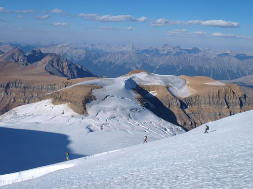
Vern, Eric, and Liam with impressive scenery behind

A closer look

Back to these seracs
Panorama view from the lower part of this icefield. Sun is getting low!
Mt. Morden Long

Mt. Confederation

Mt. Quincy
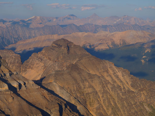
Dragon Peak
One last look at this rarely seen icefield
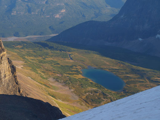
Looking down to our approach valley and the first lake

Descending the south face
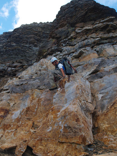
Ben down-climbing a short section
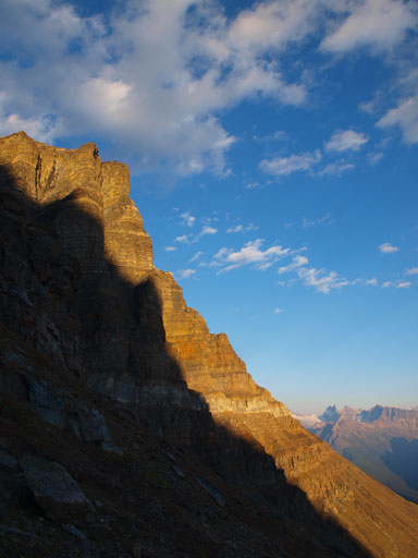
Gorgeous lighting on this face!
Interesting reflection of a few clouds on the upper lake

Panorama of this gorgeous valley

Almost back to the lake

Front-door view from our bivy site!
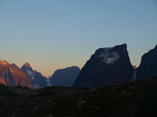
“Little Fortress”
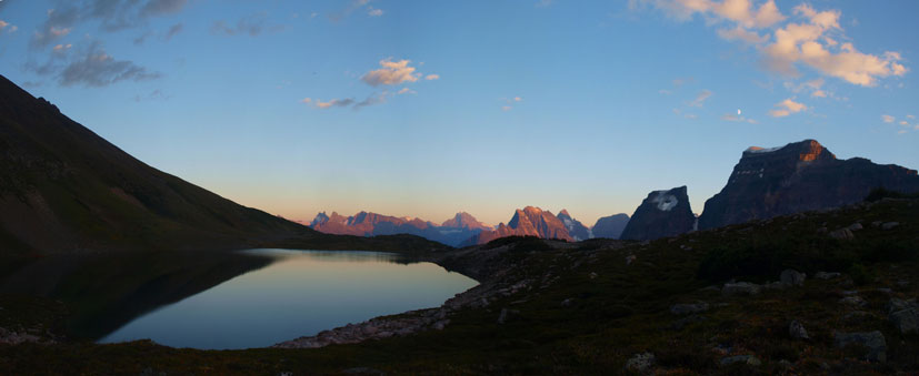
One of my favourite panoramas from this trip!

Fortress Mountain, our objective for the next day.
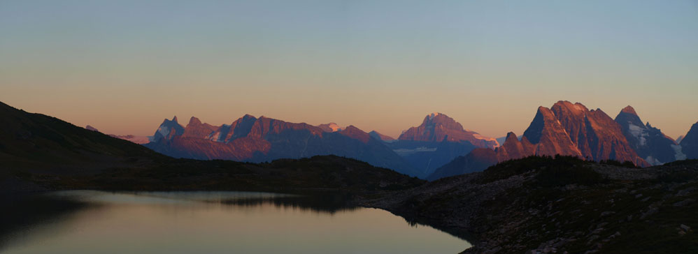
Panorama of Alberta et al., at evening glow
Mount Smythe

Mount Alberta
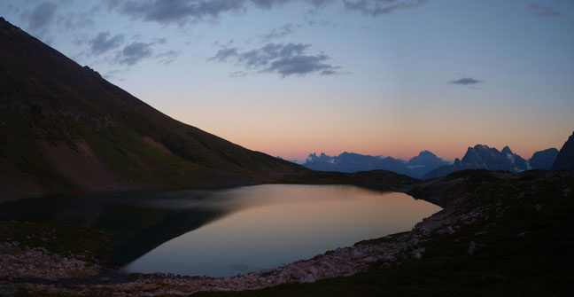
Our front-door view
Now we were actually half a day ahead of schedule, and we were all confident to get Fortress Mountain bagged on the next day!
